


DVOA Event Schedule
We use online preregistration for all of our events; pre-registration costs less than registering on the day of the event. Links to register are listed below. Deadline to register is normally the Thursday before the event.
Event fees (preregistration and day-of) are listed in the DVOA pricing sheet.
Walk in day-of-event registration may be available unless otherwise noted, but map/course selection may be limited.
See below for a note about risks you assume while orienteering, including Covid-19 information.
Course Setter: Mark Frank
Notes: Instructions at Hollidaysburg YMCA starting at 10am. Beginner event starts are from 11:15 to 1PM.3 Email Orienteer7@aol.com for more information and pre-registration.
W Y O Br G R Bl Instruct
 Volunteer to help at this event

Course Setter: Samuel Kolins
Notes: The Gov Dick Event has been postponed. Stay healthy.
Directions: From the PA Turnpike, go South from the Lebanon-Lancaster exit of PA TPK on route 72. Turn West on Cider Press Road then North on Pinch Road. (From Rt 30 in Lancaster go North on Rt 72 through Manheim and another 3+/- miles to Pinch Road.) Follow Pinch Road to the event site. Look for entrance shortly after crossing over the Turnpike.
ED/CS Notes:
The Gov Dick Event has been postponed.
Courses Information:
| Course | Distance | Climb | Ctrls |
|---|---|---|---|
| White | 2.20km | 75.0m | 10 |
| Yellow | 2.50km | 110.0m | 12 |
| Orange | 4.20km | 155.0m | 12 |
| Brown | 4.10km | 120.0m | 10 |
| Green | 5.50km | 160.0m | 12 |
| Green-Y | 5.20km | 235.0m | 15 |
| Red | 6.70km | 265.0m | 19 |
| Blue | 8.50km | 333.0m | 24 |
| Special | 1.20km | 55.0m | 13 |
Course Setter: Glen Tryson
Notes: The Big Woods Event has been postponed. All registered participants will be contacted with further information.
Directions: Follow Rt. 23 to PA Rt. 345, take Rt. 345 north and watch for O'-signs
Course Setter: Ron Wood Co-Setter: Ron Wood
Notes: Event has been cancelled due to the predicted weather. Look for it to be rescheduled next spring.
Directions: From PA Rt 1 take PA Rt 896 south toward Newark, DE and watch for O'-signs, or from I-95 take DE 896 North to park.
ED/CS Notes:
Event has been cancelled due to the predicted weather. Look for it to be rescheduled next spring.
Courses Information:
| Course | Distance | Climb | Ctrls |
|---|---|---|---|
| White | 2.40km | 65.0m | 8 |
| Yellow | 2.60km | 95.0m | 9 |
| Orange | 3.50km | 110.0m | 11 |
| Brown | 3.30km | 100.0m | 8 |
| Green | 4.40km | 135.0m | 10 |
| Red | 5.00km | 175.0m | 18 |
Course Setter:
Directions: From the north, take Northeast Extension of PA Turnpike to I-80 exit. Turn right at light onto PA Rt. 940 and follow west for 3 miles. Go south on PA Rt. 534 and follow O'-signs. From the south, take Northeast Extension of PA Turnpike to Rt 903 exit. Turn right on PA Rt. 903. Turn left at the light onto PA Rt. 534 and follow O'-signs. The entrance to the Sand Spring Lake parking area is along PA Rt. 534 Between I80 and Rt. 903.
Course Setter: Mary Frank
Notes: Beginner program. Watch for Registration Link. Start for Instructions is 10 am. Then you go on a course. Free program. Parking is limited.
Directions: 1200 Skelp Level Road, Downingtown PA, 19335. Entrance is discreet- marked by a wooden post with 1200 and a narrow driveway.
Course Setter:
Directions: Take Northeast Extension of PA Turnpike to I-80 exit. Turn right at light onto PA Rt. 940 and follow west for 3 miles. Go south on PA Rt. 534 and follow O'-signs.
Course Setter:
Directions: From Rt. 320 and Rt. 30 intersection at Villanova follow Rt. 320 south to first light. Right at light then bear left at road fork (Newtown Rd). Follow O'-signs.
Course Setter: Mary Frank
Directions: 1200 Skelp Level Road, Downingtown PA, 19335. Entrance is discreet- marked by a wooden post with 1200 and a narrow driveway.
Course Setter: Nathan Ohrwaschel
Directions: From US Rt. 30 Bypass north of Coatesville, take PA Rt. 82 north. Watch for left turn at top of hill. Follow O'-signs.
Course Setter: Nathan Ohrwaschel
Directions: From US Rt. 30 Bypass north of Coatesville, take PA Rt. 82 north. Watch for left turn at top of hill. Follow O'-signs.
Course Setter:
Notes: Chester County Series. 6 pm introductory course and Sprint series. Maybe we can all go to eat afterwards?
Directions: From US Rt. 30 Bypass north of Coatesville, take PA Rt. 82 north. Watch for left turn at top of hill. Follow O'-signs.
Course Setter:
Notes: Chester County Series, Introductory Course 6 pm
Directions: Follow PA Rt23 to Knauertown and watch for O'-signs
Course Setter: Ron Barron
Notes: Chester County Series Introductory Course and Sprint Series 6 pm
Directions: From the North take Rt 82 south to Rt 282. Follow 282 south and look for O signs at the junction with Springton Road. From the south take Rt 282 north from Downingtown to the intersection with Springton Road and follow the O signs.
Co-Director: Wyatt Riley
Course Setter: zzzzz zzzzzzzz
Notes: Tentative - Seeking permission from park
Directions: From I-95 take DE Rt.896 South. Go to Old Baltimore Pike and take a Right, West on Baltimore Pike. The park entrance and then the church parking will be on your right. Follow the O'-signs.
Course Setter:
Directions: Take Route 422 W to PA Rt23 West exit. Follow Rt23 west through Phoenixville to Rt724. From Rt23 & Rt724 jct, follow Rt724 west 1.1 miles to Zion Lutheran Church on left. From the Rdg-Pottstown area, take the 724 Exit off 422. Continue E on 724 through 3 lights and look for signs. Large white Church on the right.
Course Setter:
Notes: President's Cup. Photo/Score-O Registration:11:30 mass start at 12:00. White starts from 11:00 to 1:00
Directions: From US Rt. 30 Bypass north of Coatesville, take PA Rt. 82 north. Watch for left turn at top of hill. Follow O'-signs.
Course Setter:
Notes: Instructional program at 10AM
Directions: Rt 625 South of Reading, about 2 miles south of the Jct of 625 and 724
Course Setter:
Notes: Misery and Joy, Mass start, Score format, details to follow
Directions: From King of Prussia - Rt. 202 take 422 West and exit at the Valley Forge/Rt. 23 West exit and watch for O'-signs
Course Setter:
Notes: score and sprint courses by Clem & Dasha
Directions: North on I 95 to the intersection with I 295. Follow I 295 East and exit at exit 8 and go west on PA 332. Go straight 4.7 miles, and in that stretch 332 becomes Route 413. Where Rt 413 makes a sharp right turn, you will instead be turning left at that light into the main Park entrance. Watch for O-signs.
Course Setter:
Notes: Lots of route choice and minimal time in the green.
Directions: From US Rt. 30 Bypass north of Coatesville, take PA Rt. 82 north. Watch for left turn at top of hill. Follow O'-signs.
Course Setter:
Directions: Take NJ Turnpike to I-195 exit. Go east on I-195 and take exit 11. Follow O'-signs.
Course Setter:
Directions: Follow PA Rt23 to Knauertown and watch for O'-signs
Course Setter:
Directions: Exit Rt 22 at the Schoenersville/378 south exit. Use the Schoenersville ramp, and then turn left. Pass the Hospital on the right, left on Illicks Mill Rd, or from the south on 378 exit on 8th street North, Left on Schoenersville, Rt on Illicks Mill Road.
Course Setter:
Directions: Follow Rt.23 to PA Rt.345, take Rt.345 north and watch for O'-signs.
Course Setter:
Notes: Courses by S. Fillebrown. A bike-O course will available - great for adventure racers. $2.00 per car parking fee.
Directions: Rt 273 west of Newark Delaware or east on 273 from the crossing of MD Rt 213
Course Setter:
Notes: Earth Day at the Willows
Directions: From Rt. 320 and Rt. 30 intersection at Villanova follow Rt. 320 south to first light. Right at light then bear left at road fork (Newtown Rd). Follow O'-signs.
Course Setter:
Notes: East side of creek, courses by Bob Burg
Directions: East side: turn west on Eden Road near the Wawa on US 202 about a mile south of 92 and follow O signs. West side park office: take 92 West off of US 202 to park entrance. Follow O signs
Course Setter:
Notes: MASOC 18 Scouts Only. Preregistration required. more information
Directions: Follow PA Rt.23 to Rt.345, take Rt.345 north and watch for O'-signs.
Course Setter:
Directions: Follow PA Rt.23 to Rt.345, take Rt.345 north and watch for O'-signs.
Course Setter:
Directions: From I-95 take DE Rt.896 South. Go to Old Baltimore Pike and take a Right, West on Baltimore Pike. The park entrance and then the church parking will be on your right. Follow the O'-signs.
Course Setter:
Notes: An indoor 90 minute introduction to orienteering starting at 10am with an outdoor walk on a simple black and white map to follow afterwards. The event is free to all participants.
Directions: From the PA Turnpike, go South from the Lebanon-Lancaster exit of PA TPK on route 72. Turn West on Cider Press Road then North on Pinch Road. (From Rt 30 in Lancaster go North on Rt 72 through Manheim and another 3+/- miles to Pinch Road.) Follow Pinch Road to the event site. Look for entrance shortly after crossing over the Turnpike.
Course Setter:
Directions: Take Northeast Extension of PA Turnpike to I-80 exit. Turn right at light onto PA Rt. 940 and follow west for 3 miles. Go south on PA Rt. 534 and follow O'-signs.
Course Setter:
Notes: A long white course is also available
Directions: Pawlings Road:From PA Rt. 422 Exit at Oaks and head East on Egypt Road. Make a right onto Pawlings Rd. Watch for O'-signs. Betzwood Bridge: After the right onto Trooper Road, go left at Audubon Road. Follow O Signs.
Course Setter:
Directions: Pawlings Road:From PA Rt. 422 Exit at Oaks and head East on Egypt Road. Make a right onto Pawlings Rd. Watch for O'-signs. Betzwood Bridge: After the right onto Trooper Road, go left at Audubon Road. Follow O Signs.
Course Setter:
Notes: New 2006 version of map. NO DOGS
Directions: From N & W: NJ Turnpike Exit 8 to Rt 33 East for 5 mi. Rt 527Alt North/Iron Ore Rd. From E: Garden St Pkwy Exit 100A to Rt 33 W for 16 mi. to Rt 527Alt/Iron Ore Rd. Then North 1/4 mile on 527Alt to Quail Hill sign, turn right onto Le Valley Rd into camp.
Course Setter:
Directions: From Rt. 202 take Paoli Pike exit west to West Chester, left onto High St. then three blocks to a right on W. Miner St. W. Miner St. becomes Rt. 842. Follow Rt. 842 west for about 6 miles to Brandywine Valley Association Myrick Center.
Course Setter:
Notes: CS = M. Cornish
Directions: Follow Rt. 23 to PA Rt. 345, take Rt. 345 north and watch for O'-signs
Course Setter:
Notes: Mass starts at 9:30 & 11 AM for all advanced runners, Regular starts for white & yellow
Directions: From PA Rt. 422, 8 miles west of Pottstown, go north at Baumstown on Daniel Boone Road. Follow O'-signs from Rt. 422.
Course Setter:
Directions: East from the Allentown exit of the PA Turnpike. US 22 to Airport Road south. Airport Road becomes Irving Road. Turn right (west) at Hanover Road. Right on Albert Road ( just before the bridge over the Lehigh) & follow Signs to Canal Park.
Course Setter:
Directions: South of Reading PA on route 625. Take Rt 724 West from I 176, or East from 222 and turn south on 625. The park is about 2 miles South of that intersection.
Course Setter:
Notes: Courses by Ed Scott
Directions: Follow Rt.23 to PA Rt.345, take Rt.345 north and watch for O'-signs.
Course Setter:
Notes: Second 9/11 Rememberance Challenge
Directions: Pawlings Road:From PA Rt. 422 Exit at Oaks and head East on Egypt Road. Make a right onto Pawlings Rd. Watch for O'-signs. Betzwood Bridge: After the right onto Trooper Road, go left at Audubon Road. Follow O Signs.
Course Setter:
Directions: Take Northeast Extension of PA Turnpike to I-80 exit. Turn right at light onto PA Rt. 940 and follow west for 3 miles. Go south on PA Rt. 534 and follow O'-signs.
Course Setter:
Notes: Night O
Directions: Take Northeast Extension of PA Turnpike to I-80 exit. Turn right at light onto PA Rt. 940 and follow west for 3 miles. Go south on PA Rt. 534 and follow O'-signs.
Course Setter:
Notes: Start times are 10:00 to 12:00
Directions: Take Northeast Extension of PA Turnpike to I-80 exit. Turn right at light onto PA Rt. 940 and follow west for 3 miles. Go south on PA Rt. 534 and follow O'-signs.
Course Setter:
Directions: Take Northeast Extension of PA Turnpike to I-80 exit. Turn right at light onto PA Rt. 940 and follow west for 3 miles. Go south on PA Rt. 534 and follow O'-signs.
Course Setter:
Notes: Delaware Scout event. Parking fees: $3/car for resident, $6/car non-resident. Start on West side near park office. This is a Scouting event only!
Directions: East side: turn west on Eden Road near the Wawa on US 202 about a mile south of 92 and follow O signs. West side park office: take 92 West off of US 202 to park entrance. Follow O signs
Course Setter:
Notes: Parking fees: $3/car for residents, $6/car non-residents. Start on WEST side near park office
Directions: East side: turn west on Eden Road near the Wawa on US 202 about a mile south of 92 and follow O signs. West side park office: take 92 West off of US 202 to park entrance. Follow O signs
Course Setter:
Notes: and the Susquehanna Stumble
Directions: Rt 273 west of Newark Delaware or east on 273 from the crossing of MD Rt 213
Course Setter:
Directions: Follow Rt. 23 to PA Rt. 345, take Rt. 345 north and watch for O'-signs
Course Setter:
Notes: Scout event, open to the general membership and the public. NO dogs allowed. A $1 camp surcharge will be added to the normal DVOA fees.
Directions: From N & W: NJ Turnpike Exit 8 to Rt 33 East for 5 mi. Rt 527Alt North/Iron Ore Rd. From E: Garden St Pkwy Exit 100A to Rt 33 W for 16 mi. to Rt 527Alt/Iron Ore Rd. Then North 1/4 mile on 527Alt to Quail Hill sign, turn right onto Le Valley Rd into camp.
Course Setter:
Directions: From Rt. 320 and Rt. 30 intersection at Villanova follow Rt. 320 south to first light. Right at light then bear left at road fork (Newtown Rd). Follow O'-signs.
Course Setter:
Notes: DVOA Long Course Champs, course setter John Campbell
Directions: Follow Rt.23 to PA Rt.345, take Rt.345 north and watch for O'-signs.
Course Setter:
Notes: Score Night-O, all levels, Reg 7PM, Mass start 8PM, party 9 til ?
Directions: From Rt. 202 take Paoli Pike exit west to West Chester, left onto High St. then three blocks to a right on W. Miner St. W. Miner St. becomes Rt. 842. Follow Rt. 842 west for about 6 miles to Brandywine Valley Association Myrick Center.
Course Setter:
Notes: NJ Scout Champs
Directions: From Interstate 95 north of Trenton take NJ Rt. 29 north along the Delaware River. Turn right after about 2.5 miles on Rt 546. The park is on the left
Course Setter:
Directions: From Interstate 95 north of Trenton take NJ Rt. 29 north along the Delaware River. Turn right after about 2.5 miles on Rt 546. The park is on the left
Course Setter:
Directions: From PA Rt 1 take PA Rt 896 south toward Newark, DE and watch for O'-signs, or from I-95 take DE 896 North to park.
Course Setter:
Directions: From US30 East (White Horse Pike) in Hammonton take SR-542 (Pleasant Mills Rd.) toward Batsto, follow SR-542 north-east for about 7mi and watch for O'-signs.
Course Setter:
Notes: Sanctioning in progress
Directions: From Junction of NJ70 and NJ72 go SE on NJ72 and look for O signs
Course Setter:
Directions: Find Garden State Parkway exit 114. Exit, and from the North go Right on Red Hill Road, and from the South go left. Take a Right on Crawfords Corner Road, then a Left on Roberts Road, then a Right on Longstreet Road, and left into the park.
Course Setter:
Directions: From Rt 422 take Rt 29 north. About 3.5 miles after the junction with Rt 73 look for a left turn onto Deep Creek Road and follow that and O signs to the park. From the North on Rt 29, look for O signs to the right as you approach the town of Green Lane..
W Y O Br G R Sprint-O
Course Setter:
Notes: expanded map
Directions: Take Route 23 West through Valley Forge National Historic Park. Watch for O-signs after the junction with Route 252.
Course Setter:
Notes: Mid Atlantic Championships
Directions: From I-70 West of Baltimore take Marriottsville Road North 4 miles & watch for signs on right.
Course Setter:
Notes: More data soon
Directions: Take Route 422 W to PA Rt23 West exit. Follow Rt23 west through Phoenixville to Rt724. From Rt23 & Rt724 jct, follow Rt724 west 1.1 miles to Zion Lutheran Church on left. From the Rdg-Pottstown area, take the 724 Exit off 422. Continue E on 724 through 3 lights and look for signs. Large white Church on the right.
Course Setter:
Notes: Registration: 11:30, Mass Start: 12:00
Directions: From US Rt. 30 Bypass north of Coatesville, take PA Rt. 82 north. Watch for left turn at top of hill. Follow O'-signs.
Course Setter:
Notes: Program at 10, course afterward.
Directions: Rt 625 South of Reading, about 2 miles south of the Jct of 625 and 724
Course Setter:
Notes: Please pre-register Details
Directions: From King of Prussia - Rt. 202 take 422 West and exit at the Valley Forge/Rt. 23 West exit and watch for O'-signs
Course Setter:
Notes: open to everyone. No pre-registration required More info
Directions: Follow PA Rt23 to Knauertown and watch for O'-signs
Course Setter:
Directions: From PA Rt 1 take PA Rt 896 south toward Newark, DE and watch for O'-signs, or from I-95 take DE 896 North to park.
Course Setter:
Notes: Recreational courses available Event information page
Directions: Rt 273 west of Newark Delaware or east on 273 from the crossing of MD Rt 213
Course Setter:
Directions: Rt 273 west of Newark Delaware or east on 273 from the crossing of MD Rt 213
Course Setter:
Notes: Recreational courses available Event information page
Directions: Rt 273 west of Newark Delaware or east on 273 from the crossing of MD Rt 213
Course Setter:
Directions: From Junction of NJ70 and NJ72 go SE on NJ72 and look for O signs
Course Setter:
Directions: From Rt. 422 take Rt. 29, North to Collegeville, East on Germantown Pike and watch for O'-signs.
Course Setter:
Directions: From Rt. 320 and Rt. 30 intersection at Villanova follow Rt. 320 south to first light. Right at light then bear left at road fork (Newtown Rd). Follow O'-signs.
Course Setter:
Directions: From Newtown Square follow Rt.3 west approximately 2 miles to main park entrance on south side. Follow O'-signs.
Course Setter:
Directions: Follow PA Rt23 to Knauertown and watch for O'-signs
Course Setter:
Notes: East Side
Directions: East side: turn west on Eden Road near the Wawa on US 202 about a mile south of 92 and follow O signs. West side park office: take 92 West off of US 202 to park entrance. Follow O signs
Course Setter:
Notes: MASOC 19 Event for Scouts Only more information at Scoutorienteering.com
Directions: Follow PA Rt.23 to Rt.345, take Rt.345 north and watch for O'-signs.
Course Setter:
Directions: Follow PA Rt.23 to Rt.345, take Rt.345 north and watch for O'-signs.
Course Setter:
Directions: North on I 95 to the intersection with I 295. Follow I 295 East and exit at exit 8 and go west on PA 332. Go straight 4.7 miles, and in that stretch 332 becomes Route 413. Where Rt 413 makes a sharp right turn, you will instead be turning left at that light into the main Park entrance. Watch for O-signs.
Course Setter:
Directions: From US Rt. 30 Bypass north of Coatesville, take PA Rt. 82 north. Watch for left turn at top of hill. Follow O'-signs.
Course Setter:
Directions: From I 80, take US 209 North about 12 miles and watch for signs.
Course Setter:
Notes: Betzwood bridge parking area
Directions: Pawlings Road:From PA Rt. 422 Exit at Oaks and head East on Egypt Road. Make a right onto Pawlings Rd. Watch for O'-signs. Betzwood Bridge: After the right onto Trooper Road, go left at Audubon Road. Follow O Signs.
Course Setter:
Notes: Instruction:10:00am, White course: 12:00
Directions: North on I 95 to the intersection with I 295. Follow I 295 East and exit at exit 8 and go west on PA 332. Go straight 4.7 miles, and in that stretch 332 becomes Route 413. Where Rt 413 makes a sharp right turn, you will instead be turning left at that light into the main Park entrance. Watch for O-signs.
Course Setter:
Notes: Pavillion #2 near the tollgate road entrance. Lots of open fields, be prepared for sun and for the potential of nasty vegetation on Orange.
Directions: From Langhorne, PA follow PA Rt. 413 North toward Newtown and watch for O'-signs.
Course Setter:
Notes: NOTE SPECIAL TIME 12-4PM
Directions: From US Rt. 30 Bypass north of Coatesville, take PA Rt. 82 north. Watch for left turn at top of hill. Follow O'-signs.
Course Setter:
Notes: NJ Scout event, public welcome, Dogs OK
Directions: Find Garden State Parkway exit 114. Exit, and from the North go Right on Red Hill Road, and from the South go left. Take a Right on Crawfords Corner Road, then a Left on Roberts Road, then a Right on Longstreet Road, and left into the park.
Course Setter:
Notes: Shorter courses. DVOA Picnic and Business Meeting after the event.
Directions: Take Northeast Extension of PA Turnpike to I-80 exit. Turn right at light onto PA Rt. 940 and follow west for 3 miles. Go south on PA Rt. 534 and follow O'-signs.
Course Setter:
Directions: Follow Rt.23 to PA Rt.345, take Rt.345 north and watch for O'-signs, or from Rt422 take 82 into Birdsboro and follow 345 to park.
Course Setter:
Directions: From King of Prussia - Rt. 202 take 422 West and exit at the Valley Forge/Rt. 23 West exit and watch for O'-signs
Course Setter:
Notes: Courses by Bob Meyer
Directions: Directions: From the E or S: Business 422 to Mt Penn, Right on Carsonia Ave, Left on Antietam Road, Left on Angora Road, left on Hill Road, right on List road to Rotary Park. From the W or N: Skyline Drive south from Rt 12, left at Bingaman then right to stay on Skyline Drive, left on List Rd., cross Angora and Rotary Park will be the right. Look for O signs.
Course Setter:
Directions: Follow Rt.23 to PA Rt.345, take Rt.345 north and watch for O'-signs.
Course Setter:
Notes: Instruction at 10
Directions: Rt 625 South of Reading, about 2 miles south of the Jct of 625 and 724
Course Setter:
Notes: 2 sprints
Directions: 202 N from K of P (not taking DeKalb St), across Dannehower bridge into Norristown, continuing straight on Markley St for many blocks, about 1/2 mile past Main St, passing a Septa Station on left, then turning L on Harding, L on Sterigere to map.
Course Setter:
Notes: Training weekend
Directions: Take Northeast Extension of PA Turnpike to I-80 exit. Turn right at light onto PA Rt. 940 and follow west for 3 miles. Go south on PA Rt. 534 and follow O'-signs.
Course Setter:
Notes: CS Sandy Fillebrown, Epunch on Advanced
Directions: Take Northeast Extension of PA Turnpike to I-80 exit. Turn right at light onto PA Rt. 940 and follow west for 3 miles. Go south on PA Rt. 534 and follow O'-signs.
Course Setter:
Notes: Epunch Brown and up. Registration is from 10:00 AM to Noon. Registration and starts end at Noon.
Course Setter:
Directions: From Newtown Square follow Rt.3 west approximately 2 miles to main park entrance on south side. Follow O'-signs.
Course Setter:
Directions: Rt 273 west of Newark Delaware or east on 273 from the crossing of MD Rt 213
Course Setter:
Notes: DVOA short course Champs
Directions: From I-95 take DE Rt.896 South. Go to Old Baltimore Pike and take a Right, West on Baltimore Pike. The park entrance and then the church parking will be on your right. Follow the O'-signs.
Course Setter:
Notes: 31st Annual Maryland Scout Orienteering Day SCOUTS ONLY Preregistration required More data go to "Activities"
Directions: Take Route 1 into Maryland. 1.3 miles past the Conowingo dam, make a right on to 623 and follow it through a sharp turn at 2.5 mi and then another 2.3 miles to Susquehanna Hall Road, a gravel road left (W) . Also can be accessed from Md 136 N of Dublin.
Course Setter:
Notes: WYAdvanced + 2 sprints
Directions: Business 422(Perkiomen Avenue from the east, Penn Avenue then Perkiomen from the west) off 422. Watch for signs at the intersections of Perkiomen Avenue and Glen Road, or at 18th Street. (Note: This park is in Reading, PA)
Course Setter:
Directions: From Rt. 320 and Rt. 30 intersection at Villanova follow Rt. 320 south to first light. Right at light then bear left at road fork (Newtown Rd). Follow O'-signs.
Course Setter:
Directions: The camp is approximately 30 miles southwest of Wilmington, DE and 50 miles northeast of Baltimore, MD. Take Exit 100 off I-95, follow Rt. 272 for 10 miles south, through the town of North East and look for signs
Course Setter:
Notes: Registration 7PM, Mass start at 8PM. NIghtO for all levels + halloween party
Directions: From Rt. 202 take Paoli Pike exit west to West Chester, left onto High St. then three blocks to a right on W. Miner St. W. Miner St. becomes Rt. 842. Follow Rt. 842 west for about 6 miles to Brandywine Valley Association Myrick Center.
Course Setter:
Notes: New Jersey Scout Champs. Regular Courses for all open at 11AM.
Directions: From Interstate 95 north of Trenton take NJ Rt. 29 north along the Delaware River. Turn right after about 2.5 miles on Rt 546. The park is on the left
Course Setter:
Directions: From Rt 422 take Rt 29 north. About 3.5 miles after the junction with Rt 73 look for a left turn onto Deep Creek Road and follow that and O signs to the park. From the North on Rt 29, look for O signs to the right as you approach the town of Green Lane..
Course Setter:
Notes: US CHAMPS A Event Day1
Course Setter:
Notes: US CHAMPS A Event Day2
Course Setter:
Notes: Scout event, open to the general membership and the public. NO dogs allowed. A $1 camp surcharge will be added to the normal DVOA fees.
Directions: From N & W: NJ Turnpike Exit 8 to Rt 33 East for 5 mi. Rt 527Alt North/Iron Ore Rd. From E: Garden St Pkwy Exit 100A to Rt 33 W for 16 mi. to Rt 527Alt/Iron Ore Rd. Then North 1/4 mile on 527Alt to Quail Hill sign, turn right onto Le Valley Rd into camp.
Course Setter:
Notes: Tree planting service project - courses after the trees are in to benefit the Jr Team!!!.
Directions: Follow PA Rt.23 to Rt.345, take Rt.345 north and watch for O'-signs.
Course Setter:
Notes: DVOA Long O Champs
Directions: From Newtown Square follow Rt.3 west approximately 2 miles to main park entrance on south side. Follow O'-signs.
Course Setter:
Notes: HVO Dual meet at DVOA, NOte that due to the change to standard time control collection will begin before 3:00 PM. All starts should be before 12:30.
Directions: Take Northeast Extension of PA Turnpike to I-80 exit. Turn right at light onto PA Rt. 940 and follow west for 3 miles. Go south on PA Rt. 534 and follow O'-signs.
Course Setter:
Notes: 2007 Mid Atlantics
Directions: From Lancaster follow Rt. 30 West to Rt. 24 North (Mt. Zion Rd.). Take Rt. 24 north to top of hill and make a right onto Deininger Rd. Watch for O'-signs.
Course Setter:
Directions: From US30 East (White Horse Pike) in Hammonton take SR-542 (Pleasant Mills Rd.) toward Batsto, follow SR-542 north-east for about 7mi and watch for O'-signs.
Course Setter:
Directions: Take Route 23 West through Valley Forge National Historic Park. Watch for O-signs after the junction with Route 252.
Course Setter:
Notes: Extra Long O..Marathon length and half marathon length. Lots of trail running, but not all on trails. No beginners courses. Pre registration only.
Directions: From King of Prussia - Rt. 202 take 422 West and exit at the Valley Forge/Rt. 23 West exit and watch for O'-signs
Course Setter:
Notes: 2 PM Winter progam, pot luck dinner, and meeting. Look for details in a few weeks.
Directions: Take Route 422 W to PA Rt23 West exit. Follow Rt23 west through Phoenixville to Rt724. From Rt23 & Rt724 jct, follow Rt724 west 1.1 miles to Zion Lutheran Church on left. From the Rdg-Pottstown area, take the 724 Exit off 422. Continue E on 724 through 3 lights and look for signs. Large white Church on the right.
Course Setter:
Notes: Special course... details in a week or so. Epunch?? check back later.
Directions: Follow PA Rt23 to Knauertown and watch for O'-signs
Course Setter:
Notes: Special course is a long white trail run. Be alert for date changes if the weather does not cooperate. Note special start times: 12:00pm - 2:00pm Details
Directions: North on I 95 to the intersection with I 295. Follow I 295 East and exit at exit 8 and go west on PA 332. Go straight 4.7 miles, and in that stretch 332 becomes Route 413. Where Rt 413 makes a sharp right turn, you will instead be turning left at that light into the main Park entrance. Watch for O-signs.
Course Setter:
Notes: Instructional event - Indoor program starts at 10AM
Directions: Rt 625 South of Reading, about 2 miles south of the Jct of 625 and 724
Course Setter:
Directions: South of Reading PA on route 625. Take Rt 724 West from I 176, or East from 222 and turn south on 625. The park is about 2 miles South of that intersection.
Course Setter:
Notes: 10AM indoor program course at 11.
Directions: From the PA Turnpike, go South from the Lebanon-Lancaster exit of PA TPK on route 72. Turn West on Cider Press Road then North on Pinch Road. (From Rt 30 in Lancaster go North on Rt 72 through Manheim and another 3+/- miles to Pinch Road.) Follow Pinch Road to the event site. Look for entrance shortly after crossing over the Turnpike.
Course Setter:
Directions: Follow Rt.23 to PA Rt.345, take Rt.345 north and watch for O'-signs.
Course Setter:
Notes: HVO event/Bob Burg map. Exit 17 of I84 in NY. O signs to Holmes Presbyterian Camp & Conf Cntr.
Course Setter:
Notes: Instructional event
Directions: Follow PA Rt23 to Knauertown and watch for O'-signs
Course Setter:
Notes: Courses by Rick Slater
Directions: East of New Egypt on route 528 (New Egypt Township, West of the Town of Lakehurst), look for signs
Course Setter:
Directions: From Rt. 320 and Rt. 30 intersection at Villanova follow Rt. 320 south to first light. Right at light then bear left at road fork (Newtown Rd). Follow O'-signs.
Course Setter:
Directions: From Rt. 422 take Rt. 29, North to Collegeville, East on Germantown Pike and watch for O'-signs.
Course Setter:
Directions: Exit Rt 22 at the Schoenersville/378 south exit. Use the Schoenersville ramp, and then turn left. Pass the Hospital on the right, left on Illicks Mill Rd, or from the south on 378 exit on 8th street North, Left on Schoenersville, Rt on Illicks Mill Road.
Course Setter:
Notes: Could not get permission from park.
Course Setter:
Notes: More data soon: awaiting sanctioning
Course Setter:
Notes: More data soon: awaiting sanctioning
Course Setter:
Directions: Follow PA Rt.23 to Rt.345, take Rt.345 north and watch for O'-signs.
Course Setter:
Notes: No crossing cultivated fields!!!!!
Directions: North on I 95 to the intersection with I 295. Follow I 295 East and exit at exit 8 and go west on PA 332. Go straight 4.7 miles, and in that stretch 332 becomes Route 413. Where Rt 413 makes a sharp right turn, you will instead be turning left at that light into the main Park entrance. Watch for O-signs.
Course Setter:
Directions: 202 N from K of P (not taking DeKalb St), across Dannehower bridge into Norristown, continuing straight on Markley St for many blocks, about 1/2 mile past Main St, passing a Septa Station on left, then turning L on Harding, L on Sterigere to map.
Course Setter:
Notes: National Trails Day event
Directions: Pawlings Road:From PA Rt. 422 Exit at Oaks and head East on Egypt Road. Make a right onto Pawlings Rd. Watch for O'-signs. Betzwood Bridge: After the right onto Trooper Road, go left at Audubon Road. Follow O Signs.
Course Setter:
Notes: Registration is off site at the parking area at the west end of the Pawling's Road bridge over 422. Look for signs. All pets must be leashed at all times.
Directions: Pawlings Road:From PA Rt. 422 Exit at Oaks and head East on Egypt Road. Make a right onto Pawlings Rd. Watch for O'-signs. Betzwood Bridge: After the right onto Trooper Road, go left at Audubon Road. Follow O Signs.
Course Setter:
Notes: Courses by Bob Meyer
Directions: From US Rt. 30 Bypass north of Coatesville, take PA Rt. 82 north. Watch for left turn at top of hill. Follow O'-signs.
Course Setter:
Notes: Picnic and VP relays
Directions: From Rt. 202 take Paoli Pike exit west to West Chester, left onto High St. then three blocks to a right on W. Miner St. W. Miner St. becomes Rt. 842. Follow Rt. 842 west for about 6 miles to Brandywine Valley Association Myrick Center.
Course Setter:
Directions: Take Northeast Extension of PA Turnpike to I-80 exit. Turn right at light onto PA Rt. 940 and follow west for 3 miles. Go south on PA Rt. 534 and follow O'-signs.
Course Setter:
Directions: Rt 273 west of Newark Delaware or east on 273 from the crossing of MD Rt 213
Course Setter:
Notes: Courses by Ron Bortz
Directions: From the E or S: Business 422 into Reading and look for O signs. From the W or N: Skyline Drive south from Rt 12 and look for O signs
Course Setter:
Directions: From I 80, take US 209 North about 12 miles and watch for signs.
Course Setter:
Notes: Program at 10 AM
Directions: Rt 625 South of Reading, about 2 miles south of the Jct of 625 and 724
Course Setter:
Notes: Long Score O. Pre-registration will be required. More details will be posted later.
Directions: West of Newark Delaware on 273, or East from the crossing of 272 and 273. Look for O Signs.
Course Setter:
Notes: A great weekend gathering for Orienteering instruction, and training followed by a regular club event.
Directions: Take Northeast Extension of PA Turnpike to I-80 exit. Turn right at light onto PA Rt. 940 and follow west for 3 miles. Go south on PA Rt. 534 and follow O'-signs.
Course Setter:
Notes: National Orienteering Day Event
Directions: Take Northeast Extension of PA Turnpike to I-80 exit. Turn right at light onto PA Rt. 940 and follow west for 3 miles. Go south on PA Rt. 534 and follow O'-signs.
Course Setter:
Notes: National Orienteering Day Event, Courses by Rob Wilkison. Pre-registration required - see event information page. Starts close at 12:00pm.
Directions: Take Northeast Extension of PA Turnpike to I-80 exit. Turn right at light onto PA Rt. 940 and follow west for 3 miles. Go south on PA Rt. 534 and follow O'-signs.
Course Setter:
Notes: two heat sprints
Course Setter:
Notes: E-Punching to be used on all courses
Directions: From PA, follow US Rt. 1 South into MD. Turn right on Red Pump Rd. Follow for 3/4 mile and turn left on Ridge Road
Course Setter:
Notes: Program at 11 AM
Directions: From the PA Turnpike, go South from the Lebanon-Lancaster exit of PA TPK on route 72. Turn West on Cider Press Road then North on Pinch Road. (From Rt 30 in Lancaster go North on Rt 72 through Manheim and another 3+/- miles to Pinch Road.) Follow Pinch Road to the event site. Look for entrance shortly after crossing over the Turnpike.
Course Setter:
Directions: North on I 95 to the intersection with I 295. Follow I 295 East and exit at exit 8 and go west on PA 332. Go straight 4.7 miles, and in that stretch 332 becomes Route 413. Where Rt 413 makes a sharp right turn, you will instead be turning left at that light into the main Park entrance. Watch for O-signs.
Course Setter:
Directions: From Rt. 320 and Rt. 30 intersection at Villanova follow Rt. 320 south to first light. Right at light then bear left at road fork (Newtown Rd). Follow O'-signs.
Course Setter:
Notes: DVOA Long O Champs
Directions: From Rt 422 take Rt 29 north. About 3.5 miles after the junction with Rt 73 look for a left turn onto Deep Creek Road and follow that and O signs to the park. From the North on Rt 29, look for O signs to the right as you approach the town of Green Lane..
Course Setter:
Notes: New Jersey Scout Champs. Scouts must pre-register. Regular courses (WYOGR and possibly Brown) for all open at 11AM.
Directions: From Interstate 95 north of Trenton take NJ Rt. 29 north along the Delaware River. Turn right after about 2.5 miles on Rt 546. The park is on the left
Course Setter:
Notes: Courses designed by Bob Burg. Scout event, open to the general membership and the public. NO dogs allowed. A $1 camp surcharge will be added to the normal DVOA fees. EPunch on O,Br,G,and R.
Directions: From N & W: NJ Turnpike Exit 8 to Rt 33 East for 5 mi. Rt 527Alt North/Iron Ore Rd. From E: Garden St Pkwy Exit 100A to Rt 33 W for 16 mi. to Rt 527Alt/Iron Ore Rd. Then North 1/4 mile on 527Alt to Quail Hill sign, turn right onto Le Valley Rd into camp.
Course Setter:
Directions: Exit Rt 22 at the Schoenersville/378 south exit. Use the Schoenersville ramp, and then turn left. Pass the Hospital on the right, left on Illicks Mill Rd, or from the south on 378 exit on 8th street North, Left on Schoenersville, Rt on Illicks Mill Road.
Course Setter:
Notes: Night O & Halloween Party
Directions: From Rt. 202 take Paoli Pike exit west to West Chester, left onto High St. then three blocks to a right on W. Miner St. W. Miner St. becomes Rt. 842. Follow Rt. 842 west for about 6 miles to Brandywine Valley Association Myrick Center.
Course Setter:
Directions: Follow Rt.23 to PA Rt.345, take Rt.345 north and watch for O'-signs.
Course Setter:
Directions: The park is approximately 30 miles southwest of Wilmington, DE and 50 miles northeast of Baltimore, MD. Take Exit 100 off I-95, follow Rt. 272 for 11 miles south, through the town of North East and into the park.
Course Setter:
Notes: Mid Atlantic Champs: Courses by S. Fillebrown
Directions: Rt 273 west of Newark Delaware or east on 273 from the crossing of MD Rt 213
Course Setter:
Notes: Use directions for East side. Courses by Ron Wood
Directions: East side: turn west on Eden Road near the Wawa on US 202 about a mile south of 92 and follow O signs. West side park office: take 92 West off of US 202 to park entrance. Follow O signs
Course Setter:
Notes: Dual event at HVO.
Directions: I-280 W (from Garden State Pkwy Exit 145) or E (from I-80 East Exit 47A) to Exit 8B for Prospect Ave / Rte 577 North. After 0.4-0.6 mi, turn R at 3rd traffic light onto Eagle Rock Ave. Go 0.4 mi and turn L into Eagle Rock Reservation. Follow O Signs.
Course Setter:
Notes: White + Sprint-O in Motala format with mass start
Directions: I-280 W (from Garden State Pkwy Exit 145) or E (from I-80 East Exit 47A) to Exit 8B for Prospect Ave / Rte 577 North. After 0.4-0.6 mi, turn R at 3rd traffic light onto Eagle Rock Ave. Go 0.4 mi and turn L into Eagle Rock Reservation. Follow O Signs.
Course Setter:
Directions: From US30 East (White Horse Pike) in Hammonton take SR-542 (Pleasant Mills Rd.) toward Batsto, follow SR-542 north-east for about 7mi and watch for O'-signs.
Course Setter:
Notes: Fire Tower start area. W & Y are on the Pagoda map.
Directions: Directions: From the E or S: Business 422 to Mt Penn, Right on Carsonia Ave, Left on Antietam Road, Left on Angora Road, left on Hill Road, right on List road to Rotary Park. From the W or N: Skyline Drive south from Rt 12, left at Bingaman then right to stay on Skyline Drive, left on List Rd., cross Angora and Rotary Park will be the right. Look for O signs.
Course Setter: Sandy Fillebrown
Directions: From I-476N use exit 18A to Ridge Pike, go southeast. From I-476S exit at 18B and use the U turn at Allanwood. From I-76 use exit 338 Green Lane, follow N to left turn on Ridge Pike. Look for signs at corner of Ridge Pike and Port Royal Ave.
Course Setter:
Notes: Instructional classes, pot-luck dinner, and annual business meeting.
Directions: Take Route 422 W to PA Rt23 West exit. Follow Rt23 west through Phoenixville to Rt724. From Rt23 & Rt724 jct, follow Rt724 west 1.1 miles to Zion Lutheran Church on left. From the Rdg-Pottstown area, take the 724 Exit off 422. Continue E on 724 through 3 lights and look for signs. Large white Church on the right.
Course Setter:
Notes: The Winter Fun Event will be a score-O. Starts will be between 10 AM and noon. I expect that the winner will have found all 25 controls in the hour time limit and that elapsed time will actually determine the winner. The woods are wide open (even the "green" is not very green); the creek low; and with cold temperatures I am anticipating very fast times. So come out and have some fun in the woods.
Directions: From Rt. 320 and Rt. 30 intersection at Villanova follow Rt. 320 south to first light. Right at light then bear left at road fork (Newtown Rd). Follow O'-signs.
Course Setter:
Directions: Rt 625 South of Reading, about 2 miles south of the Jct of 625 and 724
W Y O Br G R Bl Sprint-O
Volunteer to help at this event
Course Setter:
Directions: From Junction of NJ70 and NJ72 go SE on NJ72 and look for O signs
Course Setter:
Directions: From PA Rt 1 take PA Rt 896 south toward Newark, DE and watch for O'-signs, or from I-95 take DE 896 North to park.
Course Setter:
Directions: Follow PA Rt23 to Knauertown and watch for O'-signs
Course Setter: Rob Wilkison
Directions: Take Northeast Extension of PA Turnpike to I-80 exit. Turn right at light onto PA Rt. 940 and follow west for 3 miles. Go south on PA Rt. 534 and follow O'-signs.
Course Setter:
Directions: From Lancaster follow Rt. 30 West to Rt. 24 North (Mt. Zion Rd.). Take Rt. 24 north to top of hill and make a right onto Deininger Rd. Watch for O'-signs.
W Y O Br G R Special
Volunteer to help at this event
Course Setter:
Notes: US Deaf-O team Fundraiser includes an Easter Egg score O.
Directions: The camp is approximately 30 miles southwest of Wilmington, DE and 50 miles northeast of Baltimore, MD. Take Exit 100 off I-95, follow Rt. 272 for 10 miles south, through the town of North East and look for signs
Course Setter:
Directions: From Rt. 320 and Rt. 30 intersection at Villanova follow Rt. 320 south to first light. Right at light then bear left at road fork (Newtown Rd). Follow O'-signs.
Course Setter:
Directions: From Newtown Square follow Rt.3 west approximately 2 miles to main park entrance on south side. Follow O'-signs.
Course Setter:
Directions: From I-95 take DE Rt.896 South. Go to Old Baltimore Pike and take a Right, West on Baltimore Pike. The park entrance and then the church parking will be on your right. Follow the O'-signs.
Course Setter: Tom Overbaugh
Notes: A String-O for the younger set (preschool and early elementary age) will be offered to introduce the basic concepts of orienteering. Easy and fun!
Directions: West of Newark Delaware on 273, or East from the crossing of 272 and 273. Look for O Signs.
W Y O Br Score-O
Volunteer to help at this event
Course Setter: Ed Scott
Notes: Scout event MASOC 21 More information & Registration forms (pdf)
Directions: Follow PA Rt.23 to Rt.345, take Rt.345 north and watch for O'-signs.
W Y O Br G R Bl
Volunteer to help at this event
W Y O Br G R
Volunteer to help at this event
Course Setter:
Notes: Revised map: April 2009; Western half of map and major trails were checked by Bob Rycharski (OCAD by Fred Kruesi) due to NJ-18 highway being constructed in 2005.
Directions: From S on US 1, or exit 9 on the NJTPK , take NJ-18 N to Davidson Road/Metlar's Lane, right on Ave E look for O signs. From N on 287 take Centennial Ave to Hoes Lane, exit at Davidson/Avenue E campus exit, bear left Over Rt-18 and follow O signs.
Course Setter:
Directions: From I 80, take US 209 North about 12 miles and watch for signs.
Course Setter:
Notes: SVO event. Details to follows
Directions: From US30 go West from Gettysburg to Caledonia. Turn Right (North) on Rt.233 and watch for O'-signs.
Course Setter:
Directions: From Exit 26 of the PA Turnpike follow PA Rt. 309 south to Rt. 73. Take a right onto Rt. 73 and follow it north and west and watch for O'-signs.
Course Setter:
Notes: National Trails Day. Starts from 9-1. check NPS website for more details about the day. NPS website
Directions: Pawlings Road:From PA Rt. 422 Exit at Oaks and head East on Egypt Road. Make a right onto Pawlings Rd. Watch for O'-signs. Betzwood Bridge: After the right onto Trooper Road, go left at Audubon Road. Follow O Signs.
W Y O Br G R Sprint-O
Volunteer to help at this event
Course Setter: Vadim Masalkov
Notes: First issue of new map. The sprint course will be fundraiser for the US Team.
Directions: From the Lansdale exit on the Northeast extension of the PA Turnpike, turn right onto Route 63 (West). Follow Route 63 through Mainland and Harleysville. As you near Sumneytown you will go down a large hill. Bear right just beyond the hill onto Geryville
Course Setter: Vadim Masalkov
Notes: DVOA VP Relay with a mass start around 10:00-10:30AM followed by club picnic and summer meeting.
Directions: From Rt 422 take Rt 29 north. About 3.5 miles after the junction with Rt 73 look for a left turn onto Deep Creek Road and follow that and O signs to the park. From the North on Rt 29, look for O signs to the right as you approach the town of Green Lane..
W Y O Br G R Bl
Volunteer to help at this event
Course Setter: Sandy Fillebrown
Directions: From the north, take Northeast Extension of PA Turnpike to I-80 exit. Turn right at light onto PA Rt. 940 and follow west for 3 miles. Go south on PA Rt. 534 and follow O'-signs. From the south, take Northeast Extension of PA Turnpike to Rt 903 exit. Turn right on PA Rt. 903. Turn left at the light onto PA Rt. 534 and follow O'-signs. The entrance to the Sand Spring Lake parking area is along PA Rt. 534 Between I80 and Rt. 903.
Course Setter: Ed Scott
Directions: From the E or S: Business 422 into Reading and look for O signs. From the W or N: Skyline Drive south from Rt 12 and look for O signs
Course Setter:
Notes: Registration is in the Park & Ride on Pawling Road near the 422 overpass.
Directions: Pawlings Road:From PA Rt. 422 Exit at Oaks and head East on Egypt Road. Make a right onto Pawlings Rd. Watch for O'-signs. Betzwood Bridge: After the right onto Trooper Road, go left at Audubon Road. Follow O Signs.
W Y Sprint-O
Volunteer to help at this event
Course Setter: Sandy Fillebrown
Directions: From I-476N use exit 18A to Ridge Pike, go southeast. From I-476S exit at 18B and use the U turn at Allanwood. From I-76 use exit 338 Green Lane, follow N to left turn on Ridge Pike. Look for signs at corner of Ridge Pike and Port Royal Ave.
Course Setter:
Notes: Annual DVOA training weekend
Directions: From the north, take Northeast Extension of PA Turnpike to I-80 exit. Turn right at light onto PA Rt. 940 and follow west for 3 miles. Go south on PA Rt. 534 and follow O'-signs. From the south, take Northeast Extension of PA Turnpike to Rt 903 exit. Turn right on PA Rt. 903. Turn left at the light onto PA Rt. 534 and follow O'-signs. The entrance to the Sand Spring Lake parking area is along PA Rt. 534 Between I80 and Rt. 903.
Course Setter: James McGrath
Directions: From the north, take Northeast Extension of PA Turnpike to I-80 exit. Turn right at light onto PA Rt. 940 and follow west for 3 miles. Go south on PA Rt. 534 and follow O'-signs. From the south, take Northeast Extension of PA Turnpike to Rt 903 exit. Turn right on PA Rt. 903. Turn left at the light onto PA Rt. 534 and follow O'-signs. The entrance to the Sand Spring Lake parking area is along PA Rt. 534 Between I80 and Rt. 903.
Course Setter:
Notes: Pre-register to insure there is a map for you. Start closes at noon.
Directions: From the north, take Northeast Extension of PA Turnpike to I-80 exit. Turn right at light onto PA Rt. 940 and follow west for 3 miles. Go south on PA Rt. 534 and follow O'-signs. From the south, take Northeast Extension of PA Turnpike to Rt 903 exit. Turn right on PA Rt. 903. Turn left at the light onto PA Rt. 534 and follow O'-signs. The entrance to the Sand Spring Lake parking area is along PA Rt. 534 Between I80 and Rt. 903.
Course Setter:
Directions: Rt 625 South of Reading, about 2 miles south of the Jct of 625 and 724
W Sprint-O Int Adv
Volunteer to help at this event
W Y O Br G R Bl
Volunteer to help at this event
Course Setter:
Directions: East side: turn west on Eden Road near the Wawa on US 202 about a mile south of 92 and follow O signs. West side park office: take 92 West off of US 202 to park entrance. Follow O signs
W Y O Br G R Bl
Volunteer to help at this event
Course Setter:
Directions: Follow Rt.23 to PA Rt.345, take Rt.345 north and watch for O'-signs.
Course Setter:
Directions: Follow PA Rt23 to Knauertown and watch for O'-signs
Course Setter:
Directions: From Rt. 320 and Rt. 30 intersection at Villanova follow Rt. 320 south to first light. Right at light then bear left at road fork (Newtown Rd). Follow O'-signs.
Course Setter:
Notes: Open to Scouts and DVOA members. No dogs are allowed in the scout camp.
Directions: From N & W: NJ Turnpike Exit 8 to Rt 33 East for 5 mi. Rt 527Alt North/Iron Ore Rd. From E: Garden St Pkwy Exit 100A to Rt 33 W for 16 mi. to Rt 527Alt/Iron Ore Rd. Then North 1/4 mile on 527Alt to Quail Hill sign, turn right onto Le Valley Rd into camp.
Course Setter:
Directions: From US Rt. 30 Bypass north of Coatesville, take PA Rt. 82 north. Watch for left turn at top of hill. Follow O'-signs.
Course Setter:
Notes: New Jersey Scout Event. There will be regular courses available, but please note that start times for the general public will be 11:00am to 1:00pm.
Directions: From Interstate 95 north of Trenton take NJ Rt. 29 north along the Delaware River. Turn right after about 2.5 miles on Rt 546. The park is on the left
Course Setter:
Notes: An Easy Score and a Stumble format, 1 hour time limit.
Directions: From Rt. 202 take Paoli Pike exit west to West Chester, left onto High St. then three blocks to a right on W. Miner St. W. Miner St. becomes Rt. 842. Follow Rt. 842 west for about 6 miles to Brandywine Valley Association Myrick Center.
W Y O Br G R Sprint-O
Volunteer to help at this event
Course Setter: Vadim Masalkov
Directions: From the Lansdale exit on the Northeast extension of the PA Turnpike, turn right onto Route 63 (West). Follow Route 63 through Mainland and Harleysville. As you near Sumneytown you will go down a large hill. Bear right just beyond the hill onto Geryville
Course Setter:
Notes: Annual Mid Atlantic Champs with QOC, SVO, WPOC & DVOA. Starts 10-1 with relay at 2. Warm shelter available between runs.
Directions: From I95 south to the Baltimore beltway (exit 64B), take I695 west (counterclockwise) to I83 north (exit 24). 6 3/4 miles north (at exit 20B), take Shawan Road west about 3/4 mile to Oregon Ridge Park and follow signs to parking. From the more western parts of our area, take I83 south to exit 20B. Go west on Shawan Road and look for the park entrance on the left.
Course Setter:
Notes: Beginner event primarily for local scout troops with an advanced course or two for leaders and helpers. Meeting spot has been tentatively set for parking lot 101, off Avenue E on the RU Livingston Campus.
Directions: From S on US 1, or exit 9 on the NJTPK , take NJ-18 N to Davidson Road/Metlar's Lane, right on Ave E look for O signs. From N on 287 take Centennial Ave to Hoes Lane, exit at Davidson/Avenue E campus exit, bear left Over Rt-18 and follow O signs.
Course Setter:
Notes: HVO Dual Event. NO DOGS allowed on the property.
Directions: From N & W: NJ Turnpike Exit 8 to Rt 33 East for 5 mi. Rt 527Alt North/Iron Ore Rd. From E: Garden St Pkwy Exit 100A to Rt 33 W for 16 mi. to Rt 527Alt/Iron Ore Rd. Then North 1/4 mile on 527Alt to Quail Hill sign, turn right onto Le Valley Rd into camp.
Course Setter:
Directions: From PA, follow US Rt. 1 South into MD. Turn right on Red Pump Rd. Follow for 3/4 mile and turn left on Ridge Road
Course Setter:
Notes: O'Marathon Event Information Page
Directions: Rt 273 west of Newark Delaware or east on 273 from the crossing of MD Rt 213
Course Setter:
Notes: Winter meeting
Directions: Take Route 422 W to PA Rt23 West exit. Follow Rt23 west through Phoenixville to Rt724. From Rt23 & Rt724 jct, follow Rt724 west 1.1 miles to Zion Lutheran Church on left. From the Rdg-Pottstown area, take the 724 Exit off 422. Continue E on 724 through 3 lights and look for signs. Large white Church on the right.
Course Setter: Vadim Masalkov
Notes: Presidents Cup
Directions: Follow PA Rt23 to Knauertown and watch for O'-signs
Course Setter:
Notes: Event canceled! We're having permission issues here for the date selected.
Directions: From US30 East (White Horse Pike) in Hammonton take SR-542 (Pleasant Mills Rd.) toward Batsto, follow SR-542 north-east for about 7mi and watch for O'-signs.
Course Setter: Mary Frank
Directions: Rt 625 South of Reading, about 2 miles south of the Jct of 625 and 724
Course Setter: Mary Frank
Directions: Follow PA Rt23 to Knauertown and watch for O'-signs
W Y O Br G
Volunteer to help at this event
Course Setter: Robert Meyer
Directions: From Rt. 422 take Rt. 29, North to Collegeville, East on Germantown Pike and watch for O'-signs.
W Y O Br G R Bl
Volunteer to help at this event
Course Setter: Richard Slater
Directions: East of New Egypt on route 528 (New Egypt Township, West of the Town of Lakehurst), look for signs
W Sprint-O
Volunteer to help at this event
Course Setter: Mark Cornish
Notes: Two sprint heats with a break between.
Course Setter: Steve Aronson
Directions: Exit Rt 22 at the Schoenersville/378 south exit. Use the Schoenersville ramp, and then turn left. Pass the Hospital on the right, left on Illicks Mill Rd, or from the south on 378 exit on 8th street North, Left on Schoenersville, Rt on Illicks Mill Road.
W Y O Br G R Bl
Volunteer to help at this event
Course Setter: Ron Bortz
Notes: These are reruns of the Ron Bortz courses of last summer. Try them again without the leaves and after the briars have been crushed down by the record winter snows.
Directions: Follow Rt.23 to PA Rt.345, take Rt.345 north and watch for O'-signs.
Course Setter: Petr Hartman
Directions: From I 80, take US 209 North about 12 miles and watch for signs.
Course Setter: Mary Frank
Notes: Educational O program and beginner course at 11AM.
Directions: From the PA Turnpike, go South from the Lebanon-Lancaster exit of PA TPK on route 72. Turn West on Cider Press Road then North on Pinch Road. (From Rt 30 in Lancaster go North on Rt 72 through Manheim and another 3+/- miles to Pinch Road.) Follow Pinch Road to the event site. Look for entrance shortly after crossing over the Turnpike.
Course Setter:
Notes: Event canceled! We're having permission issues here for the date selected. Attempting to reschedule the event before chigger season.
Course Setter: Mark Frank
Notes: New Map
Directions: From the PA Turnpike, go South from the Lebanon-Lancaster exit of PA TPK on route 72. Turn West on Cider Press Road then North on Pinch Road. (From Rt 30 in Lancaster go North on Rt 72 through Manheim and another 3+/- miles to Pinch Road.) Follow Pinch Road to the event site. Look for entrance shortly after crossing over the Turnpike.
W Y O Br
Volunteer to help at this event
W Y O Br G R Bl
Volunteer to help at this event
Course Setter: Chris Gross Co-Setter: Bob Gross
Directions: South of Reading PA on route 625. Take Rt 724 West from I 176, or East from 222 and turn south on 625. The park is about 2 miles South of that intersection.
Course Setter: John Campbell
Notes: This event can not be held due to a conflicting event on the Lehigh Campus. We hope to use the area sometime in the future.
Directions: From I78 take Rt412 north toward Bethlehem and look for O signs, From Rt 22 take 378 South through Bethlehem and look for O signs.
Course Setter:
Notes: Sprint and Middle Distance Team Trials F21 Red and M21 Blue course only Event page
Co-Director: Steve Aronson 610.814.0580
Course Setter: Steve Aronson
Directions: Use the Bethlehem Rte 412 exit from I78. Take Silvex road (between the Wendy's and the Turkey Hill) to College Ave. Bear left onto College and go to the end. Turn right on South Mountain Drive. Bear left at the next two triangles, South Mountain Park will be on the left.
Course Setter:
Notes: Team Trials Long Courses M21 Blue and F21 Red only
Course Setter: John Campbell
Notes: Event Canceled
Directions: The park is approximately 30 miles southwest of Wilmington, DE and 50 miles northeast of Baltimore, MD. Take Exit 100 off I-95, follow Rt. 272 for 11 miles south, through the town of North East and into the park.
Course Setter:
Notes: Moved to the fall due to access problems
Directions: West of Newark Delaware on 273, or East from the crossing of 272 and 273. Look for O Signs.
Course Setter: Angelica Riley
Notes: beginners program and white course
Directions: Pawlings Road:From PA Rt. 422 Exit at Oaks and head East on Egypt Road. Make a right onto Pawlings Rd. Watch for O'-signs. Betzwood Bridge: After the right onto Trooper Road, go left at Audubon Road. Follow O Signs.
Course Setter: Mary Frank
Directions: From Rt. 202 take Paoli Pike exit west to West Chester, left onto High St. then three blocks to a right on W. Miner St. W. Miner St. becomes Rt. 842. Follow Rt. 842 west for about 6 miles to Brandywine Valley Association Myrick Center.
Course Setter: Scott Thatcher
Notes: JR Team fundraiser
Directions: From US Rt. 30 Bypass north of Coatesville, take PA Rt. 82 north. Watch for left turn at top of hill. Follow O'-signs.
Course Setter:
Notes: VP Relays, Summer Picnic & Meeting
Directions: From I-476N use exit 18A to Ridge Pike, go southeast. From I-476S exit at 18B and use the U turn at Allanwood. From I-76 use exit 338 Green Lane, follow N to left turn on Ridge Pike. Look for signs at corner of Ridge Pike and Port Royal Ave.
Course Setter: Ed Scott
Notes: Surf 'N Turf: Split teams with a land map and a water map, 60 minute Score format total of both courses, or do either part as a single participant. Normal 10-1 start window. Canoe/Kayak rental data
Directions: On Rt313 between Doylestown and Quakertown, go north on 563, look for signs to the right.
W Y O Br G R
Volunteer to help at this event
Course Setter: Dale Parson
Directions: Follow Rt.23 to PA Rt.345, take Rt.345 north and watch for O'-signs.
Course Setter:
Notes: Advanced courses will also use the Green Lane Map.
Directions: West of Rt 29 between Green Lane and Red Hill. Look for O signs at the intersection by Marlboro Elementary School.
W Y Sprint-O
Volunteer to help at this event
Course Setter: Kathleen Geist
Notes: All courses are "Trail Only". The "Yellow" is really a long white.
Directions: From I-476N use exit 18A to Ridge Pike, go southeast. From I-476S exit at 18B and use the U turn at Allanwood. From I-76 use exit 338 Green Lane, follow N to left turn on Ridge Pike. Look for signs at corner of Ridge Pike and Port Royal Ave.
Co-Director: Steve Aronson 610.814.0580
Course Setter: Sharon Siegler Co-Setter: Steve Aronson
Notes: Join Sharon and Steve as they introduce you to orienteering. Expect to spend 1 1/2 hours of your time between introduction and your doing a course. Please call 215.234.8497 or 484.674.3748 for registering you and or your group. All are welcome!!
Directions: West of Rt 29 between Green Lane and Red Hill. Look for O signs at the intersection by Marlboro Elementary School.
W Y O Br G R Bl
Volunteer to help at this event
Course Setter: Frederick Reed
Notes: Last chance to run on FCN until it is remapped
Directions: Follow Rt. 23 to PA Rt. 345, take Rt. 345 north and watch for O'-signs
Course Setter:
Notes: Hickory Run Training Weekend
Directions: Take Northeast Extension of PA Turnpike to I-80 exit. Turn right at light onto PA Rt. 940 and follow west for 3 miles. Go south on PA Rt. 534 and follow O'-signs.
Course Setter: James McGrath
Directions: From the north, take Northeast Extension of PA Turnpike to I-80 exit. Turn right at light onto PA Rt. 940 and follow west for 3 miles. Go south on PA Rt. 534 and follow O'-signs. From the south, take Northeast Extension of PA Turnpike to Rt 903 exit. Turn right on PA Rt. 903. Turn left at the light onto PA Rt. 534 and follow O'-signs. The entrance to the Sand Spring Lake parking area is along PA Rt. 534 Between I80 and Rt. 903.
Course Setter: Rob Wilkison
Notes: Start times from 10:00am until 12:00 noon.
Directions: From the north, take Northeast Extension of PA Turnpike to I-80 exit. Turn right at light onto PA Rt. 940 and follow west for 3 miles. Go south on PA Rt. 534 and follow O'-signs. From the south, take Northeast Extension of PA Turnpike to Rt 903 exit. Turn right on PA Rt. 903. Turn left at the light onto PA Rt. 534 and follow O'-signs. The entrance to the Sand Spring Lake parking area is along PA Rt. 534 Between I80 and Rt. 903.
Course Setter: John De Wolf
Notes: DVOA National Orienteering Day event
Directions: From Newtown Square follow Rt.3 west approximately 2 miles to main park entrance on south side. Follow O'-signs.
Course Setter: Angelica Riley
Notes: Beginners program and 3.3km White course. Event is part of the National Public Lands Day. More Information
Directions: From King of Prussia - Rt. 202 take 422 West and exit at the Valley Forge/Rt. 23 West exit and watch for O'-signs
W Y O Br G R
Volunteer to help at this event
Course Setter: Bob Burg
Notes: Notes: Regular DVOA event with beginner & advanced courses- All Welcome! � Meeting spot has been tentatively set for parking lot 101, off Avenue E on the RU Livingston Campus in Piscataway, NJ. Map � field checked in 2009 (gross error removal and finding lots of advanced pits, depressions and misc ojects...)
Directions: From S on US 1, or exit 9 on the NJTPK , take NJ-18 N to Davidson Road/Metlar's Lane, right on Ave E look for O signs. From N on 287 take Centennial Ave to Hoes Lane, exit at Davidson/Avenue E campus exit, bear left Over Rt-18 and follow O signs.
W Y O Br G R Bl
Volunteer to help at this event
Course Setter: Sharon Siegler
Directions: Exit Rt 22 at the Schoenersville/378 south exit. Use the Schoenersville ramp, and then turn left. Pass the Hospital on the right, left on Illicks Mill Rd, or from the south on 378 exit on 8th street North, Left on Schoenersville, Rt on Illicks Mill Road.
Course Setter: Karl Ahlswede
Notes: Student parking Lot A at the Bucks County Community College will be used for parking and registration.
Directions: North on I 95 to the intersection with I 295. Follow I 295 East and exit at exit 8 and go west on PA 332. Go straight 4.7 miles, and in that stretch 332 becomes Route 413. Where Rt 413 makes a sharp right turn, you will instead be turning left at that light into the main Park entrance. Watch for O-signs.
ED/CS Notes:
The courses that will be used for the October 10th event were originally going to be run in March but flooding caused that event to be cancelled. Tyler State Park orienteering is very fast and navigation is relatively easy. If you have ever wanted to move up in category this is the park to do it in.
Registration, start, and finish are all located on the Bucks County Community College campus. Use Student Parking Lot A, which is located off Swamp Road on the North end of campus. As usual, follow our orange and white direction signs.
All of the courses will cross park roads so caution should be exercised at all time. All courses will also cross the campus of Bucks County Community College. Please be courteous to the property.
Below are specific notes for the individual courses:
White: at the start follow the streamers to the first control. The mapped path has been obscured recently.
Brown: most of the course is on the BCCC campus. Your maps are printed on 1:5000 scale to make it more readable. It will not have a legend printed on it.
Green and Red: there will be a box of 4 controls that can be taken in any order (a very mini Score-O). All of them must be punched for your course to be complete.
Sprint-is on the short side and very easy navigation in an "urban" environment. I encourage anyone that is curious to give it a try. The map is printed on 1:5000 scale with descriptive text on the clue sheets.
See you in the woods.
Karl
Courses Information:
| Course | Distance | Climb | Ctrls |
|---|---|---|---|
| White | 2.75km | 30.0m | 12 |
| White-X | 2.48km | 30.0m | 8 |
| White-Y | 4.50km | 65.0m | 10 |
| Yellow | 2.90km | 30.0m | 13 |
| Yellow-X | 5.30km | 75.0m | 12 |
| Yellow-Y | 6.80km | 95.0m | 15 |
| Orange-X | 1.90km | 20.0m | 10 |
Course Setter: Billy Allaband
Directions: West of Newark Delaware on 273, or East from the crossing of 272 and 273. Look for O Signs.
Course Setter: Richard Slater
Notes: NJ Scout event plus courses open for the public.
Directions: From Interstate 95 north of Trenton take NJ Rt. 29 north along the Delaware River. Turn right after about 2.5 miles on Rt 546. The park is on the left
Course Setter: Jack Williams
Notes: Registration opens at 6:30 PM with a mass start at 7:00. Start will remain open until 7:30 to accommodate any latecomers. Warm snacks will be available. Donations please.
Directions: From Rt. 202 take Paoli Pike exit west to West Chester, left onto High St. then three blocks to a right on W. Miner St. W. Miner St. becomes Rt. 842. Follow Rt. 842 west for about 6 miles to Brandywine Valley Association Myrick Center.
Course Setter: Mihai Veres
Notes: Mid-Atlantics SVO, QOC & DVOA
Directions: Rt 233 Pine Grove Furnace State Park. South of Carlisle, North of Gettysburg.
Course Setter: James McGrath
Notes: Hickory Run Rocks A-Event. Hickory Run Rocks event information
Directions: From the north, take Northeast Extension of PA Turnpike to I-80 exit. Turn right at light onto PA Rt. 940 and follow west for 3 miles. Go south on PA Rt. 534 and follow O'-signs. From the south, take Northeast Extension of PA Turnpike to Rt 903 exit. Turn right on PA Rt. 903. Turn left at the light onto PA Rt. 534 and follow O'-signs. The entrance to the Sand Spring Lake parking area is along PA Rt. 534 Between I80 and Rt. 903.
Course Setter: Sandy Fillebrown
Notes: Hickory Run Rocks A Event Hickory Run Rocks event information
Directions: From the north, take Northeast Extension of PA Turnpike to I-80 exit. Turn right at light onto PA Rt. 940 and follow west for 3 miles. Go south on PA Rt. 534 and follow O'-signs. From the south, take Northeast Extension of PA Turnpike to Rt 903 exit. Turn right on PA Rt. 903. Turn left at the light onto PA Rt. 534 and follow O'-signs. The entrance to the Sand Spring Lake parking area is along PA Rt. 534 Between I80 and Rt. 903.
Course Setter: Doug Sevon
Notes: Regular DVOA event. All are welcome. There should also be a number of Scouts attending. No dogs are allowed on the property
Directions: From N & W: NJ Turnpike Exit 8 to Rt 33 East for 5 mi. Rt 527Alt North/Iron Ore Rd. From E: Garden St Pkwy Exit 100A to Rt 33 W for 16 mi. to Rt 527Alt/Iron Ore Rd. Then North 1/4 mile on 527Alt to Quail Hill sign, turn right onto Le Valley Rd into camp.
ED/CS Notes:
Preregistration is required for Scout units and large groups. DVOA and other orienteering club members do not need to preregister. For this event, there is an extra $1.00 per person fee that is required by the camp.
Control pick-up will start at 3 PM so please plan accordingly.
Below are some specific notes for some of the courses:
Yellow-X: Shorter version of a "normal" Yellow course for younger Scouts.
Yellow-Y: Normal Yellow course
Green: The B-B and archery ranges will have intermittent use during the day. The ranges plus some distance behind the ranges are marked as out-of-bounds.
Red: Runners on this course will first do the Brown course followed by a map exchange to do the Green course. You'll be off the clock for up to 2 minutes to get a drink of water and move from the finish area to the start area.
Courses Information:
| Course | Distance | Climb | Ctrls |
|---|---|---|---|
| White | 2.40km | 40.0m | 10 |
| Yellow-X | 2.30km | 50.0m | 9 |
| Yellow-Y | 3.10km | 75.0m | 11 |
| Orange | 3.60km | 95.0m | 10 |
| Brown | 3.70km | 95.0m | 9 |
| Green | 4.30km | 125.0m | 10 |
| Red | 8.00km | 220.0m | 21 |
W Y O Br G R Bl
Volunteer to help at this event
Course Setter: Tom Overbaugh
Directions: Rt 273 west of Newark Delaware or east on 273 from the crossing of MD Rt 213
ED/CS Notes:
Can't get enough of Fair Hill? Come out for another event on the Big Elk Chapel map Sunday November 14th! The leaves will be down, the woods will be open, and climb will be moderate. Due to the fast conditions, the advanced courses are a little longer than normal.
Registration, Start, and Finish will all be in close proximity to the parking area at the intersection of Gallaher Rd. and Big Elk Chapel Rd. There will be a three hour time limit for all courses and control pick-up will begin at 3:00 pm due to the limited daylight.
Helpers are still needed for the event. Sign up using the volunteer link on the schedule page (or click here) if you can spare some time.
For those traveling down I-95 from the north, you may want to stop by Rockwood Park on your way home. DVOA will be holding an introductory event there Sunday afternoon on a new map. You can run the short beginners course as a sprint (with old school pin punching). The park is located in north Wilmington just minutes off I-95. See the schedule page for registration times and directions.
Courses Information:
| Course | Distance | Climb | Ctrls |
|---|---|---|---|
| White | 2.80km | 85.0m | 11 |
| Yellow | 3.80km | 110.0m | 11 |
| Orange | 5.10km | 100.0m | 11 |
| Brown | 4.60km | 115.0m | 10 |
| Green | 6.40km | 125.0m | 11 |
| Red | 8.50km | 190.0m | 17 |
| Blue | 11.30km | 320.0m | 20 |
Course Setter: Tom Overbaugh
Notes: Note that registration is from 2:15 - 3 PM. Gives everyone time to stop by and use the white as a sprint after Fair HIll.
Directions: Exit I 95 at Marsh Road. Go South on Marsh Road, then make a right on Washington St. Park entrance is on the right after crossing Shipley Road.
Course Setter: Kris Beecroft
Notes: Dual event at HVO at Lewis Morris. HVO Info
Directions: I-287 to Morristown Exit 35 for South Street. Turn Left onto South St North. Go about 1.5 mi to the Morristown Green. Exit Right onto Washington Rd/510 West towards Chester. Go about 3 mi and turn Left into the park. Follow O-signs. Google map
ED/CS Notes:
Head on up to Lewis Morris park in New Jersey on Sunday November 21 for the annual challenge with Hudson Valley Orienteering (HVO).
Map: 1:10,000 scale / 5 meter contours.
Partial legend - special (non-IOF) symbols only. Full legend sheets available on request.
Course Setter's Notes:
The woods at Lewis Morris Park are quite open now, and I had a great time planning the courses and checking out the control sites. There are patches of green, but I’ve kept the logical route choices away from those. The more advanced courses will stray just a bit into Jockey Hollow, where the barberry is more plentiful. Unfortunately, the mapping of the green needs a serious updating, so you’ll have to be watchful for the patches of stickers. None of the obvious route choices will take you through bad areas; there will always be a way through or slightly around it.
Another aspect of Lewis Morris is the ever-changing state of the mountain biking trails. I have updated some of the more obvious changes, both in location and appearance. If there is a trail on the map, then there is something noticeable on the ground. Some trails might be more intermittent, however, than how they are mapped. And, because of the aforementioned mountain bikers, if you opt to run on a trail, please be aware of the bikers and share the trail.
Event Director's Notes
Registration, finish, download and refreshments will all be at the Sunrise Lake picnic area, situated in the northwest part of Lewis Morris Park. It is a 150 meter walk from the south end of the parking lot. The start will be a flat, 180 meter walk from registration. Warm, stocked, modern bathrooms are located in the beach pavilion building, which is 280 meters from registration, and 100 meters from the start.
Registration cards are color-coded by course. To minimize queuing, please fill out your cards before approaching the registration table. Please complete the shaded areas of the top and middle sections of the card. In order to be included in Dual Event scoring, be sure to enter "HVO" or "DVOA" as your club in both sections.
Hoping, again, to avoid long lines, we have worked out a process which eliminates the need to visit the e-punch computer before starting. For this to work, please write your e-card number -- or "rental" if you need to rent one -- in the punch grid of the middle section of your registration card. Then, add your year-of-birth if you are participating as an individual, or the number of people in your group. If you are renting an e-card, please also print your name on the bottom section; rental e-cards will be provided at registration.
Check the HVO information page for more information.
Courses Information:
| Course | Distance | Climb | Ctrls |
|---|---|---|---|
| White | 2.49km | 80.0m | 8 |
| Yellow | 2.63km | 85.0m | 7 |
| Orange | 3.39km | 130.0m | 8 |
| Brown | 3.81km | 155.0m | 8 |
| Green | 5.28km | 225.0m | 11 |
| Red | 7.00km | 240.0m | 13 |
Course Setter:
Notes: No DVOA event this weekend so head out to York PA!!!! Courses by Eddie Bergeron
Directions: From Lancaster follow Rt. 30 West to Rt. 24 North (Mt. Zion Rd.). Take Rt. 24 north to top of hill and make a right onto Deininger Rd. Watch for O'-signs.
Course Setter: Hugh MacMullan IV
Notes: There will be Long Orange course for Adventure Racers.
Directions: From Newtown Square follow Rt.3 west approximately 2 miles to main park entrance on south side. Follow O'-signs.
ED/CS Notes:
How better to end the 2010 orienteering season than to be at Ridley State Park in Broomall. The vegetation (and hopefully the briars) is down. We have a full set of courses that include a Blue course and a long Orange. The start will be at shelter #17. The restrooms there are even open! Now if the weather cooperates we'll have one of the best local events ever.
DVOA will offer a long Orange course for the Adventure Racers at Ridley Creek on Sunday December 5th. The course will be approximately 8km in length, and provide super-fit people without elite orienteering skills an opportunity to exhaust themselves. In order to know approximately how many maps to print, the course setter, Hugh MacMullan would appreciate an e-mail heads-up if you plan to compete on the long Orange course.
Course Setter Notes:
The Ridley Creek courses have been designed to avoid the worst of Ridley's briars, and to prevent outdated areas of the map from impacting competition results. Rootstocks are particularly unreliable, as old, mapped rootstocks have degraded, and there are many new unmapped rootstocks. A few overgrown trails have been marked with pink streamers, where they are of navigational importance.
The most important note relates to the Creek itself: all advanced courses, BROWN through BLUE will take competitors THROUGH the Creek, twice, at fordable crossings – even though the map itself characterizes the Creek as "uncrossable." In other words, elite runners will get wet feet – ankle to mid-calf. The decision to do this stems from the desire to effectively utilize the East side of Ridley Creek, enabling DVOA to orienteer in Ridley’s best areas.
Courses Information:
| Course | Distance | Climb | Ctrls |
|---|---|---|---|
| White | 2.20km | 65.0m | 9 |
| Yellow | 3.50km | 110.0m | 10 |
| Orange-X | 4.80km | 165.0m | 9 |
| Orange-Y | 7.90km | 290.0m | 16 |
| Brown | 3.80km | 210.0m | 10 |
| Green | 5.10km | 240.0m | 15 |
| Red | 6.20km | 265.0m | 17 |
| Blue | 8.10km | 335.0m | 23 |
Course Setter:
Notes: Winter Meeting. Details to follow
Directions: Take Route 422 W to PA Rt23 West exit. Follow Rt23 west through Phoenixville to Rt724. From Rt23 & Rt724 jct, follow Rt724 west 1.1 miles to Zion Lutheran Church on left. From the Rdg-Pottstown area, take the 724 Exit off 422. Continue E on 724 through 3 lights and look for signs. Large white Church on the right.
ED/CS Notes:
Events & Schedule
E-punch Workshop, 1:30pm - 3:30pm
The e-punch program will be led by Sandy Fillebrown
- How to program control boxes
- How to synchronize control boxes with the Time-Master unit
- How to set up an event
- How to do registration
- How to use the archive
- How to make changes to existing entries
- How to download
Please contact Sandy Fillebrown if you plan to attend this workshop.
Search & Rescue, 3:30pm - 4:15pm
Tim Walsh will present Search & Rescue Techniques/Guidelines. Tim has been certified by FEMA in 2010.
O Travels, 4:15pm - 5:30pm
Stories of O travels presented by a few of our members
Potluck Dinner, 5:30pm - 6:30pm
Bring a potluck dish to share. Bring your own plate & utensils.
Annual Business Meeting, 6:30pm - 8:00pm
- Events
- Awards
- New Board Member Election
- Cleanup to follow
Club Library
The Club Library will be available along with Caroline Ringo's scrapbooks of DVOA through the years.
Silent Auction
There will be a silent auction for the benefit of the Juniors. Please bring an item or two for the auction. You may want to bring some cash so you can purchase an item.
Directions
- From King of Prussia take Route 23 west through Phoenixville, PA
- Continue straight ahead on Rt 724 at the intersection with Rt 23
- Continue on Rt 724 for 1.7miles
- Zion Lutheran Church will be on the right at the top of the hill
Course Setter: Vadim Masalkov
Notes: Parking in lot #3.
Directions: From Exit 26 of the PA Turnpike follow PA Rt. 309 south to Rt. 73. Take a right onto Rt. 73 and follow it north and west and watch for O'-signs.
Courses Information:
| Course | Distance | Climb | Ctrls |
|---|---|---|---|
| White | 2.70km | 55.0m | 13 |
| Yellow | 3.70km | 85.0m | 15 |
| Orange | 4.50km | 130.0m | 18 |
| SprintO-1 | 1.90km | 55.0m | 9 |
| SprintO-2 | 1.20km | 45.0m | 9 |
| SprintO-3 | 1.90km | 45.0m | 12 |
Course Setter: Mary Frank
Notes: Beginner program followed by a white course
Directions: Rt 625 South of Reading, about 2 miles south of the Jct of 625 and 724
Course Setter: Bev Hartline
Notes: Appleton Road parking
Directions: West of Newark Delaware on 273 then N on Appleton Road, or go south from PA 896 at Kemblesville on Appleton Road and look for Orienteering signs.
ED/CS Notes:
Early Spring conditions are in the forecast for the March 6th event at Fair Hill on the Little Egypt map! The snow should be virtually if not completely gone, but expect wet areas near creeks and here-and-there along paths. This is a great opportunity to get out of the house and into Fair Hill's rolling fields and woods before leaf-out obscures the terrain. Courses range from easy hiking for kids and adults out to enjoy a walk, to interesting navigational puzzles just right for intermediate orienteers, and advanced courses that challenge the elite (and not quite elite) to pick the best combination of field and woods running, while anticipating and avoiding bogs and tangles. Join the fun, and maybe even bring a friend!
Course-Setter's Notes. Fair Hill: Little Egypt March 6, 2011.
The snow was almost completely gone at Little Egypt on Feb. 26, but there was wet ground here and there, especially near the creeks. Who knows what we'll have on Mar. 6th but we're hoping that the snow will all be gone, and the ground even drier.
All courses cross the river at least twice. On the southern half of the map, there are few, if any, spots where one can cross without getting wet feet. Fortunately, there is a bridge, but not the one shown on the map. We have used red x's to cross out the old (broken and closed) bridge, and drawn in the new bridge, which is about 100 m to its north. Beginner through orange courses are designed to force crossing at the new bridge. Advanced courses are designed to encourage or at least not disadvantage those crossing at the new bridge.
As most of you know, many areas of Little Egypt that are mapped as clear forest have significant brambly undergrowth. We tried to avoid the worst areas, but runners on orange through advanced courses will inevitably experience some tangles.
ADVANCED RUNNERS NOTE -- Because there is little advanced terrain on this map to challenge advanced runners, in a few places we have flagged similar features within 100 meters of each other. The controls are sufficiently distinctive on the map (location, relationships) that there should be no confusion.
Courses Information:
| Course | Distance | Climb | Ctrls |
|---|---|---|---|
| White | 2.70km | 55.0m | 14 |
| Yellow | 3.50km | 75.0m | 13 |
| Orange | 4.70km | 90.0m | 11 |
| Brown | 4.50km | 90.0m | 9 |
| Green | 5.70km | 100.0m | 12 |
| Red | 7.70km | 130.0m | 15 |
W Y O Br G R Bl
Volunteer to help at this event
Course Setter: Bob Burg
Directions: East of New Egypt on route 528 (New Egypt Township, West of the Town of Lakehurst), look for signs
ED/CS Notes:
We've already submitted our bid for Spring-type weather on the 13th.  So break out of your cabin fever – on the first day of Daylight Savings no less! Don't forget to move your clocks AHEAD one hour on Sunday, March 13th @ 2:00AM.
Note that we welcome Scout, JROTC, and other groups. We'll provide whatever coaching you wish before going out on courses. Please contact Bob Burg with your group #'s so that we can be sure to print extra maps.
Event Notes
We invite everyone to Colliers Mills– one of the most unique maps in DVOA captivity – this March 13th. You will be pleased with what we have planned for you. There's something for everyone, from elite runners eager to stretch out their legs to first-time recreational hiking families and everyone in between – using all the creative course design that e-punching inspires.
The core area of Colliers Mills, which all courses will use extensively, is a picturesque quiltwork of open fields and the whitest woods you can find in the tri-state area, interspersed with clumps of blueberry-filled woods, all displaying the subtle topography that South Jersey is so famous for (providing none of that pesky climb or stony ground). It all makes for fast courses (running or walking) where it's easy to outrun your map-reading.
The terrain provides super beginner and intermediate courses, as well as advanced courses that reward intricate precision navigation. We expect that the top finishing times will be tightly contested on all courses, with final legs routing you along the lake through white woods into a spectator-friendly Finish chute that will rival A events.
Note: We invite attendees to stick around after your courses to root in your friends and socialize afterwards.
We've chosen a beautiful spot along the lake for Registration and Finish, with Start only a short walk away.
White – 2.58k – 15m – 12 controls
Lots of short legs in open terrain with very visible control flags using a wide variety of features which offer beginners uncommon route choices.
Yellow – 3.84k – 18m – 11 controls
We're offering Yellow participants lots of route options in very safe open areas that invite the more adventurous to practice their cross terrain skills, including a few long legs that challenge you to “stay on the map” through simple, though detailed, areas.
Orange – 4.70k – 18m – 10 controls
A combination of advanced legs with clear attack points and/or catching features with lots of invitation to run through more open terrain. Test your route choice and navigation skills in complex open areas.
Brown – 4.03k – 32m – 9 controls
Green – 5.93k – 50m – 11 controls
Red – 8.57k – 85m – 17 controls
Blue – 11.52k – 92m – 20 controls
A great mix of short and long legs, careful open-woods navigation with short legs in the more classic O-areas. Courses are designed to have you visiting some of the prettiest terrain while striving for a minimum of field and trail choices except for the long legs that will let you stretch out your stride to your heart's content.
A combination that invites great times.
Only the second full event on our schedule after a cold and snowy winter. So take the car ride March 13th to the wilds of New Jersey.
Courses Information:
| Course | Distance | Climb | Ctrls |
|---|---|---|---|
| White | 2.58km | 15.0m | 12 |
| Yellow | 3.84km | 18.0m | 11 |
| Orange | 4.70km | 18.0m | 10 |
| Brown | 4.03km | 32.0m | 9 |
| Green | 5.93km | 50.0m | 11 |
| Red | 8.57km | 85.0m | 17 |
| Blue | 11.52km | 92.0m | 20 |
Course Setter: Ron Bortz
Notes: Antietam Lake parking. Please carpool if you can.
Directions: Directions: From the E or S: Business 422 to Mt Penn, Right on Carsonia Ave, Left on Antietam Road, Left on Angora Road, left on Hill Road, right on List road to Rotary Park. From the W or N: Skyline Drive south from Rt 12, left at Bingaman then right to stay on Skyline Drive, left on List Rd., cross Angora and Rotary Park will be the right. Look for O signs.
ED/CS Notes:
Mt. Penn Anitetam, March 20, 2011
Event Director's Notes
(Wyatt & Angelica Riley)
Parking
is somewhat limited in the main lot – please park nose in on each side of the parking lot so we can fit as many cars in as possible with this lot that is less than 100m from Registration. There are two overflow parking areas, with a 400-800m walk to Registration. See this map: http://maps.google.com/maps/ms?ie=UTF8&hl=en&t=h&msa=0&ll=40.355456,-75.870831&spn=0.011528,0.01929&z=16&msid=212060236907453377015.00049e63fdae073915437
for details on parking areas.
New Trails
There are several new Mt. Bike trails in the area that aren't on the made-in-2002 map. Intermediate & Advanced orienteers should simply focus on other terrain features if confused by the trails – these are generally quite good still – and White/Yellow orienteers should keep an eye out of streamers marking some of the mapped trails (as well as a marked route in the middle of the course) if confused.
Course Setter's Notes
(Ron Bortz)
Before setting out today, I encourage everyone, advanced orienteers in particular, to read all the notes here, then decide which course is for you.
The courses being offered today are a repeat of October 12, 2003. The exception is the Blue course which is totally new, which uses a combination of the control sites from the other advanced courses. Seven and a half years later, these courses should not seem familiar as this time around, as the green isn't out yet, and won't hinder your sight distance. Another difference is the proliferation of mountain bike trails. You will need to adjust your map reading for the advanced courses to consider trails as secondary to other land form and rock features.
Some further notes by course:
White – 2.34km.
Most of the route is along heavily used significant trails. There is a marked route from #5-#6-#7 where the mapped trails have faded and new trails have appeared. In other areas, new trails have crisscrossed mapped trails, sometimes looking larger than the mapped trails. The mapped trails are streamered at some of these intersections to help you on your way. Pay attention to the streamers in these locations, to assist your map reading.
Yellow – 3.11km.
This course offers several opportunities to short cut to the next control for those who want to venture off the trail (or streamer-marked route.) From #3 to #4 to #5, there are streamers for the white legs mentioned above that can be helpful. You will also find an indistinct trail mapped between #5 & #6 that is marked with red X's – it is now overgrown to the point where you'll be much faster finding another way around.
Orange – 4.42km.
This course offers plenty of off trail short cuts for those who want to improve their navigational skills without relying on trails, and the park offers many trails as catching and relocation features. Keep in mind the aforementioned new bike trails, and pay attention to contour and rock features to confirm your location.
Brown 3.75km, Green 5.92 km, Red 7.32km
At this early Spring date, the park is much more open than it was in October 2003. While a few of the control sites are slightly overgrown, the leaves aren't out yet, so even controls near bushes are generally visible from at least 20m away, often much further.
Blue 10.94km
This, in my opinion, is the most interesting of the advanced courses, as it offers multiple route choices on several of the legs. There are also three controls which you visit twice, creating a bit of crisscrossing. Approaching and leaving these controls from different perspectives each visit gives a different feel. If you want to spend as much time in these beautiful woods as you can on this hopefully fine first day of Sprint then I recommend you give this course serious consideration. This map doesn't leave much opportunity to get hopelessly lost; relocation features abound.
Road Crossings
Although roads on this map are not heavily traveled, mental alertness is still required when crossing as we cannot control the attentiveness of the person behind the wheel. Be careful.
Number of crossings: Orange & Brown: 2; Green: 5; Red: 6; Blue: 13.
Final Notes from the Course Setter
Other plans are keeping me from attending this event but I will be visualizing a fine Spring day (crossing my fingers) for everyone to enjoy a day in the woods.
Feedback is so important to any course setter no matter what you have to say, so long as it is just as you see it. This encourages all setters to do their best to continue striving to create the most interesting courses possible in the future. I hope to see comments posted by many of you on my return home.
Have a great day outdoors.
Course Setter: John De Wolf
Directions: South side of Germantown Pike, midway between 202 and 363, just east of the crossing with Whitehall Road.
ED/CS Notes:
Map: This is NOT the Norristown State Hospital Sprint map that has been used a couple times already. This is the first time that a full complement of courses will be offered on the Norristown Farm Park map, so for most orienteers this is a new map.
Scale: 1:10,000 with THREE meter contour interval.
Course Length: Courses (Orange and up) are longer than average. This terrain is less technical than most, not particularly steep and runner-friendly.
Railroad tracks:
- ORANGE, GREEN, RED & BLUE courses will need to deal with the railroad which is still active.
- Two bridges across the RR are no longer useable and crossed out with red X’s on the map.
- The map will show where the tracks are more easily crossable.
- Orienteers may travel along the tracks, although there is really no good reason for them to do so.
Stream crossings:
- GREEN, RED & BLUE courses will require stream crossings.
- The streams should be safely crossable is several areas. These areas will be are marked on your map using the mandatory crossing symbol (outward facing parentheses). This symbol is NOT used to mark a mandatory crossing! It is only used to show the orienteer the area where (s)he should be able to cross safely, without getting into more than about a foot of water. Areas NOT marked with this symbol should be considered uncrossable.
- There will be a couple of maps showing these crossing areas available for preview at registration.
- There are also a couple of bridges that can be used.
General Notes:
- Check your control codes carefully. Some areas are fairly dense with controls.
- The longer courses feature legs which criss-cross, so please read your course carefully.
- Three small areas are marked on the map as out-of-bounds. Please respect them. These will also be shown on the preview maps.
- Due to the open nature of the park, you will likely see many runners running in various directions. It's probably best to try to ignore them
General notes:
I look forward to your feedback on the courses. Hope you have a fun run!
Courses Information:
| Course | Distance | Climb | Ctrls |
|---|---|---|---|
| White | 1.70km | 27.0m | 11 |
| Yellow | 3.30km | 45.0m | 11 |
| Orange | 6.70km | 108.0m | 11 |
| Brown | 4.90km | 51.0m | 12 |
| Green | 6.30km | 84.0m | 15 |
| Red | 8.60km | 126.0m | 18 |
| Blue | 12.00km | 168.0m | 24 |
Course Setter: Mary Frank
Directions: Follow PA Rt23 to Knauertown and watch for O'-signs
ED/CS Notes:
Here's the annual Warwick County Park event. All courses are being offered. The stream is rather high and running strong so no courses will be crossing the stream this year for safety purposes. Therefore, there are a lot of controls in a very small area... Be careful when you punch. There will be extra clue sheets/control descriptions at the event. If you'd like to volunteer, we'd love it. No experience necessary. Enjoy...
Courses Information:
| Course | Distance | Climb | Ctrls |
|---|---|---|---|
| White | 2.00km | 30.0m | 11 |
| Yellow | 2.60km | 60.0m | 11 |
| Orange | 4.90km | 155.0m | 17 |
| Brown | 4.20km | 90.0m | 15 |
| Green | 6.50km | 165.0m | 15 |
| Red | 8.20km | 200.0m | 22 |
Course Setter: Mary Frank
Notes: Beginner instructional program at 11AM, white course starting at noon.
Directions: From the PA Turnpike, go South from the Lebanon-Lancaster exit of PA TPK on route 72. Turn West on Cider Press Road then North on Pinch Road. (From Rt 30 in Lancaster go North on Rt 72 through Manheim and another 3+/- miles to Pinch Road.) Follow Pinch Road to the event site. Look for entrance shortly after crossing over the Turnpike.
Course Setter: Frederick Reed
Directions: From the PA Turnpike, go South from the Lebanon-Lancaster exit of PA TPK on route 72. Turn West on Cider Press Road then North on Pinch Road. (From Rt 30 in Lancaster go North on Rt 72 through Manheim and another 3+/- miles to Pinch Road.) Follow Pinch Road to the event site. Look for entrance shortly after crossing over the Turnpike.
ED/CS Notes:
Course Setters Notes
We welcome you to another event at the new Governor Dick map in Lebanon County PA. Although it is probably a longer than average drive for many of you, we think you will find it a worthwhile investment. The combination of some of the finest white woods in DVOA land with the challenges of a newly-mapped area should make for a great orienteering experience.
The area of the recently expanded map being used for this event is a tale of two entirely different terrains. To the North and West of Governor Dick Hill and infamous fire tower is a substantial area of open white woods with subtle geographic features, charcoal platforms and crossing trails. For those of you who were at last years inaugural event, this is the area you spent most of your time in. To the South and East of the ridge, however, there is an entirely different area of steep slopes, light to medium undergrowth, and boulders—lots of boulders.
The beginner and intermediate courses generally stay in the more accommodating Northwest area and the advanced courses make more use of the technically challenging area. Climb on all courses is minimized through an interesting 800m (70m climb) walk to start.
The White and Yellow courses are fairly typical except for the nice views possible with the hillside start.
The Orange course stays mostly in the woods to the Northwest and with several longer legs will give runners the opportunity to stretch it out.
The Brown course includes more legs in the boundary zone between the two regions, affording some technical orienteering among the boulders without expending too much distance and climb.
The Green and Red courses make full use of both sides of the ridge, with the Green course taking a more direct route while the Red course explores more of the interesting areas available. The frequent and substantial boulder fields in the Southeast region provide both an opportunity for technical control sites as well as a whole layer of additional concerns in route choices—probably even more so than the vegetation levels. While the densest vegetation has been avoided, the parts that will have to be attended to are not so bad, generally consisting of bare (at this time of year) bushes and small trees and very little of anything thorny. Unlike many of our older maps, the vegetation marked on this map is sufficiently accurate to navigate by.
Parking, registration and the finish are all near the education center off Pinch Road. An overflow parking area is available on the west side of Pinch Road in a State Gamelands lot.
Courses Information:
| Course | Distance | Climb | Ctrls |
|---|---|---|---|
| White | 2.00km | 30.0m | 0 |
| Yellow | 2.70km | 100.0m | 0 |
| Orange | 4.70km | 180.0m | 0 |
| Brown | 3.50km | 100.0m | 0 |
| Green | 5.70km | 150.0m | 0 |
| Red | 8.30km | 200.0m | 0 |
Course Setter: Sandy Ahlswede
Notes: Beginner program at 10 and white course after 11. Preregistration required. E-mail or call the center at scee@schuylkillcenter.org or at 215-482-7300 x 110
Directions: From I-476N use exit 18A to Ridge Pike, go southeast. From I-476S exit at 18B and use the U turn at Allanwood. From I-76 use exit 338 Green Lane, follow N to left turn on Ridge Pike. Look for signs at corner of Ridge Pike and Port Royal Ave.
Course Setter: John Campbell
Notes: Cancelled due to a scheduling conflict
Directions: The park is approximately 30 miles southwest of Wilmington, DE and 50 miles northeast of Baltimore, MD. Take Exit 100 off I-95, follow Rt. 272 for 11 miles south, through the town of North East and into the park.
Course Setter: Wyatt Riley
Notes: Parking at picnic area
Directions: From Rt. 320 and Rt. 30 intersection at Villanova follow Rt. 320 south to first light. Right at light then bear left at road fork (Newtown Rd). Follow O'-signs.
ED/CS Notes:
Wyatt Riley has designed new courses for the Willows/Skunk Hollow. Besides new white and yellow courses there are new score-O locations that go into different parts of the park. Both the white and yellow courses go into the wooded part of the park.
The Willows has always been a great place for relatively new orienteerers to improve their map reading skills and relating the map to the terrain.
Come and join us.
Courses Information:
| Course | Distance | Climb | Ctrls |
|---|---|---|---|
| White | 2.10km | 45.0m | 12 |
| Yellow | 2.80km | 85.0m | 12 |
| Score-O | 0.00km | 0.0m | 24 |
Course Setter: Hugh III MacMullan
Directions: From the North take Rt 82 south to Rt 282. Follow 282 south and look for O signs at the junction with Springton Road. From the south take Rt 282 north from Downingtown to the intersection with Springton Road and follow the O signs.
ED/CS Notes:
Come everyone to see the new orienteering map at Springton Manor!
Check out the park's web site for information about Springton Manor.
It's a lovely Chester County Park that wants to see orienteering!
Course Setter Notes
DVOA'S SPRINGTON MANOR FARM meet on April 17th will offer a NEW 1:5000 map of an interesting meet site. The map is high-quality, laser-printed with original fieldwork and drafting by Vladimir Zerdev (2007) and with production and revisions by Eric Weyman (2010). It has been characterized as "beautiful". The primary course-setting challenges were to produce courses of proper length within the relatively small area of the Farm, and to fully utilize the available runnable woods. Runners should avoid any cultivated fields; and there is no advantage to running through them. The RED course crosses a small stream four times. Course lengths are on the short side, but that is mitigated by the number of controls used on each course. There will be some controls close to each other, so be careful. I predict fast times and a mispunch or two. We have access to an inside room for registration and e-punch download if the weather is bad.
Courses Information:
| Course | Distance | Climb | Ctrls |
|---|---|---|---|
| White | 2.10km | 40.0m | 12 |
| Yellow | 3.40km | 70.0m | 13 |
| Orange | 4.50km | 90.0m | 15 |
| Brown | 3.60km | 85.0m | 15 |
| Green | 4.70km | 110.0m | 19 |
| Red | 5.80km | 130.0m | 24 |
Co-Director: Nancy Sharp
Course Setter: Ralph Tolbert
Notes: There are parking fees at White Clay Creek.
Directions: From PA Rt 1 take PA Rt 896 south toward Newark, DE and watch for O'-signs, or from I-95 take DE 896 North to park.
ED/CS Notes:
If you're into history, you can visit the Arc Corner Monument, which marks the intersection of the arc forming the northern border of Delaware with the east-west extension of the Mason-Dixon Line.
And if you're just into orienteering, you can enjoy the woods, fields, marshes and disc-golf course that make up White Clay Creek State Park.
Red course runners will have the opportunity to cross the Mason-Dixon Line.
Note: parking fees are in effect.
Courses Information:
| Course | Distance | Climb | Ctrls |
|---|---|---|---|
| White | 2.70km | 75.0m | 8 |
| Yellow | 2.70km | 75.0m | 9 |
| Orange | 4.30km | 150.0m | 11 |
| Brown | 4.20km | 170.0m | 11 |
| Green | 5.30km | 200.0m | 16 |
| Red | 7.80km | 280.0m | 22 |
W Y O Br G R
Volunteer to help at this event
Co-Director: Udaya Bollineni
Course Setter: Udaya Bollineni Co-Setter: Rick Whiffen
Directions: From the Lansdale exit on the Northeast extension of the PA Turnpike, turn right onto Route 63 (West). Follow Route 63 through Mainland and Harleysville. As you near Sumneytown you will go down a large hill. Bear right just beyond the hill onto Geryville
ED/CS Notes:
We finished field checking and laid out courses for upcoming local Orienteering event at Camp Delmont. This map is relatively new and was used just twice before. First time was on June 20th 2009 in pouring rain. Second time was on Nov 8th 2009 in much better conditions using the same courses set on June 20th.
The scale of the Camp Delmont map is 1:5000 with contour intervals at 5m. The terrain consists of moderate vegetation on the flatter north side and hilly south-side with lots of boulders.
There will be ~100 meters uphill walk to the start.
On White course, the trail between Control #1 and Control #2 is not very distinct. So, we put streamers along this trail to guide the participants to stay on the path.
On Yellow course, the trail approaching Control #1 is not very distinct. So, we put streamers along this trail to guide the participants to stay on the path.
We realize that some of you will be attenging the West Point A Meet during this weekend. All those who are not going to West Point should come to Camp Delmont to enjoy these nice courses.
Course details:
Distance in KM/Elevation in meters/No. of Controls
White 1.8/30/8
Yellow 2.4/50/10
Orange 4.0/125/12
Brown 3.9/80/10
Green 5.1/125/13
Red 6.5/200/16
Courses Information:
| Course | Distance | Climb | Ctrls |
|---|---|---|---|
| White | 1.80km | 30.0m | 8 |
| Yellow | 2.40km | 50.0m | 10 |
| Orange | 4.00km | 125.0m | 12 |
| Brown | 3.90km | 80.0m | 10 |
| Green | 5.10km | 125.0m | 13 |
| Red | 6.50km | 200.0m | 16 |
W Y O Br Score-O
Volunteer to help at this event
Course Setter: Ed Scott
Notes: MASOC 23, for Boy scout and Girl Scout troops. Go to http://scoutorienteering.com for more data More information & Registration forms (pdf)
Directions: Follow PA Rt.23 to Rt.345, take Rt.345 north and watch for O'-signs.
W Y O Br G R Bl
Volunteer to help at this event
Course Setter: Ed Scott
Directions: Follow PA Rt.23 to Rt.345, take Rt.345 north and watch for O'-signs.
ED/CS Notes:
Our annual "day after MASOC" offers a new look in the course design. For the first time we are (1) using epunch for the event, and (2) getting a quick tour of the area around Hopewell Furnace. Parking and registration is in the lot by the Pool at French Creek.
Course data:
White 2.9K 15 M climb
Yellow 4.3K 55 M climb
Orange 5.2K 100 M climb
Brown 4.4K 125 M climb
Green 5.6K 100 M ciimb
Red 6.9 K 135 M climb
Course setters notes: May 7 & 8, 2011
The map has aged relatively well, but there are obviously some changes. Some of the areas used have not been updated since the original fieldwork done in the fall of 1988. Other areas have been updated more recently. By this time next year we will be using a totally updated map.
Some areas marked green on the map are no longer green, some areas shown as white are now quite green. In general the green splotches in the woods East of Route 345 on the slopes above Baptism Creek are gone and the southeastern part of Mt Pleasure has grown up in Spicebush, Barberry, and Multi-flora Rose. Believe me, I am NOT showing you the worst of it.
The fence that was to hold the final control on all courses was recently removed by the park. The flag is there on a stake at that location, and the finish streamers begin right at the flag. Don’t forget to punch the final control before running along the strings of multicolored pennants to the finish.
There is also a bike Race scheduled Saturday. Everyone on Courses 1,2,3, and Adult Yellow should be aware that you might encounter mountain bikers on the trails in the middle of your courses. Keep to the side and don’t dart in front of them. The bike race organizers know we are here and so the riders should also be observant.
There is a Frisbee golf tournament Saturday too. Only the Adult Yellow course crosses their path in one spot. Look ahead and to your right as you approach control 1 to be sure of having a clear path across the opening. Once you pass control one you’ll not see them again.
During the Saturday afternoon score event there will be a film crew working within the village. It is possible that some routes choices will be closed. Be flexible or go for controls in other areas. Stay out of their way, and stay off fences and away from buildings. And, of course do not run with the bulls or any other livestock. The Hopewell Furnace Staff has invited you to go through the village, but please stay on pathways as you navigate to your controls. Advanced course runners should also stay on paths through the village, but can cut across unfenced fields and woodlots. It is the first time we have been able to use this area for courses.
Ed Scott
Course Setter: Doug Sevon
Notes: Follow O signs from park entrance to parking at the Boardwalk parking area.
Directions: North on I 95 to the intersection with I 295. Follow I 295 East and exit at exit 8 and go west on PA 332. Go straight 4.7 miles, and in that stretch 332 becomes Route 413. Where Rt 413 makes a sharp right turn, you will instead be turning left at that light into the main Park entrance. Watch for O-signs.
ED/CS Notes:
Welcome to this year's Tyler State Park event. Parking and registration are in the Boardwalk section. With the large amounts of green on this map, there is a good bit of time spent on trails so the courses hopefully keep you focused on route choices. Keeping with what seems to be this year's trend, there is a walk to start (675 meters) but it is a pleasant walk along the creek with only 5 meters of climb.
Some indistinct trails on the map are no longer in existence. Where these trails might influence route choices, the trails have X's overprinted on them on the map. For Green through Blue, there is a section of woods that have many unmapped rootstocks but these shouldn't impact your navigation. Additionally, there are numerous cultivated fields on the west side of the creek, which I expect to be planted by May 15th. These have been marked out-of-bounds on the map.
The park has playgrounds, soccer fields, frisbee golf and a canoe rental, for anyone that wants to stretch their Oreienteering day. There are also several geocaches in the park.
White: While Tyler has plenty of paved trails, minimal time is spent on pavement. This course makes use of the trail system on both sides of the creek (the woods on each side of the creek have a different feel to them). Features on the course include a re-entrant and knoll, which are not often found on a White course.
Yellow: Again, minimal time is spent on paved trails. A couple of legs push the upper limit of Yellow difficulty as the logical route choice is off-trail but there are very strong straight-line features to use for navigation.
Orange: This course should be a fun mix of what are normally advance control features but with lots of choices for attack points and catching features. A small stream will need to be crossed probably 3 times, but plenty of rocks provide a dry-footed means across the stream. If you've been considering moving up from Yellow, this might be one to try.
Brown: This course combines some nice open woods with other typical Tyler features, with an emphasis on route choice. There could be 4 small stream crossings but doable with dry feet.
Green, Red, Blue: With Start on the west side of the creek, these courses will get to the northern section of the park above the covered bridge. You'll also get to see a nice section of woods that is all evergreens. With all the dark green in Tyler that necessitates control placement near trails, the emphasis of the courses is on route choice which should give fast times.
Courses Information:
| Course | Distance | Climb | Ctrls |
|---|---|---|---|
| White | 2.10km | 45.0m | 10 |
| Yellow | 2.98km | 65.0m | 11 |
| Orange | 4.50km | 115.0m | 10 |
| Brown | 3.79km | 70.0m | 10 |
| Green | 6.04km | 165.0m | 10 |
| Red | 8.00km | 210.0m | 16 |
| Blue | 10.04km | 265.0m | 20 |
W Y O Br G R
Volunteer to help at this event
Co-Director: Zachary Barker
Course Setter: Ron Bortz
Notes: Kulptown Fire Co lot. Please park at the back and upper side of the lot to save the front lower spaces in case of a fire emergency.
Directions: Kulptown Fire Company: 1082 Chestnut St (Route 345), Douglassville, PA 19518. From Rt 422 to Rt 345 South From Rt 23 to Rt 345 North.
ED/CS Notes:
Course Setters Comments:
This is my first go at setting courses on this map and it has been an enjoyable venue which affords plenty of opportunities for interesting and challenging courses. This is also one of those maps referred to recently that requires a bit of a walk if we are not to overuse the same start area. Today's start is a 15 to 18 minute stroll, or a much faster warm up if you so desire, from the parking which is off the map. Find someone to enjoy the walk with.
The white and yellow courses take advantage of the very scenic reservoir at the low point of the map. The white course has a section of flagged indistinct trail between #9 and 10. Please make a mental note to pay attention to the reminder on your clue sheet.
The woods were very open and beautiful in early April when the courses were set. Things have greened up fully since then but I tried to anticipate the best areas to run your courses through while giving you go-around options. There are also several areas of very concentrated rock features, which again you do not need to get hung up in. These are some of the things that make this map interesting; obstacles with options.
Orange through Blue courses, with the exception of Brown, all get the opportunity to get a look at the reservoir. Whether or not Red and Green get to see it is dependent upon your route choice. The Blue course is on the long side giving you a complete tour of the map with 25 controls,two of them being visited twice for a total of 27.
Get out and enjoy the day.
Ron Bortz, Course Setter
Courses Information:
| Course | Distance | Climb | Ctrls |
|---|---|---|---|
| White | 2.90km | 100.0m | 0 |
| Yellow | 3.50km | 120.0m | 0 |
| Orange | 4.90km | 140.0m | 0 |
| Brown | 3.80km | 85.0m | 0 |
| Green | 5.90km | 150.0m | 0 |
| Red | 7.40km | 240.0m | 0 |
| Blue | 11.60km | 345.0m | 0 |
W Y Score-O
Volunteer to help at this event
Course Setter: Larry Pederson
Directions: From I-81 take PA309 west to Carverton Rd, left on 8th St in Carverton and left on Mt Olivet Rd to park
ED/CS Notes:
Our event this week is a score event at Frances Slocum which was a regular venue of the Pocono O Club and hasn't been used for Orienteering for several years. You'll find it on your road map about 10 miles directly North of Wilkes Barre. Take a Memorial Day Weekend drive to the Poconos and enjoy a run in the woods.
The score event can be especially challenging in that there is a large trail network in the western side of the park which is not on the map. Some features are also mis-mapped. For example a stream may be mapped as a stone wall! Nonetheless it should be fun and you can't get too lost.
From Rt. 309 there are signs directing you to the park. Follow O signs from the entrance to the park.
Courses Information:
| Course | Distance | Climb | Ctrls |
|---|---|---|---|
| White | 2.30km | 50.0m | 7 |
| Yellow | 2.70km | 50.0m | 8 |
| Score-O | 0.00km | 0.0m | 25 |
Course Setter: Frederick Reed
Notes: 3 hour Score O. Details on Home page
Directions: Follow Rt.23 to PA Rt.345, take Rt.345 north and watch for O'-signs.
ED/CS Notes:
Course Setter: Bob Gross
Directions: South of Reading PA on route 625. Take Rt 724 West from I 176, or East from 222 and turn south on 625. The park is about 2 miles South of that intersection.
Course Setter: Karl Ahlswede Co-Setter: Sandy Ahlswede
Notes: DVOA summer picnic.
Directions: From Exit 26 of the PA Turnpike follow PA Rt. 309 south to Rt. 73. Take a right onto Rt. 73 and follow it north and west and watch for O'-signs.
ED/CS Notes:
The DVOA Summer Picnic, a potluck affair, will be at Fort Washington State Park on Saturday, June 18th. The picnic will start promptly at 12:30 followed shortly thereafter by the summer club meeting. There will be a special relay prior to the picnic and meeting, details are:
Course Setter: Rob Wilkison
Notes: 90 minute score with a mass start at Noon. Parking at Sand Spring parking lot, with carpooling from there to near the start location. Allow 10 minutes by car from Sand Spring to the start line. Very limited parking at the start.
Directions: Part of Hickory Run State Park. West of the office and on the South side of Rt 534.
ED/CS Notes:
This event provides an opportunity to explore an area which has only been used one time, and which probably will not be used frequently in the future because of limited parking access. At last fall's Hickory Run Rocks A meet, runners on the Blue, Red, Green X and Orange courses in Sunday's long event started on the Gould's Run area, although the Green X and Orange courses only visited the southern portions of the area. The northern tip of the area was used for the model event. The problem with the area is that there are only two small parking lots at opposite ends of the map, each holding a maximum of approximately 20 cars. Without hiring busses, as was done last fall, the solution used for this event is to carpool and have a mass start score-o. So everyone will meet at the Sand Spring Lake parking lot for registration between 10:30 - 11:30 a.m. There will be a carpool sign-up sheet at registration. At 11:40 the carpool will travel about 3 miles to the parking and start/finish area, where the mass start will occur at noon.
There will be twenty-four (24) controls in the woods, each having a value between 30 to 60 points. Controls with a number in the 30's will have a value of 30, those in the 40's with a value of 40, etc. There is a 90 minute time limit, (bring a watch), with severe penalties for going overtime, so everyone should finish by 1:30 p.m., and the carpool drivers can then take their passengers back to their cars a Sand Spring Lake, where there is a swimming area for those who got too hot running in the woods.
The map used last fall has been reformatted by Fred Kruesi to include only the Gould Run area north and west of Hickory Run. Scale is 1:10,000 with 5 m. contours. Only 100 maps have been printed and control descriptions have been printed on the front of the map. In the unlikely event there are more than 100 participants, late arrivals may need to find someone to share a map and run with, so get to registration early! There will be no beginner's course, only the 90 minute score-o. The controls are roughly 2/3rd advanced and 1/3rd intermediate level.
The map is bounded by Pa. Route 534 to the north and east, Hickory Run to the south, and Black Run, the Lehigh River and the adjacent railroad tracks to the west. There is no reason for anyone to go near the railroad tracks and they are out-of-bounds. There may be possible route choices using the edge of Route 534, but take care not to go on the paved roadway because traffic can be heavy and fast this time of year.
The area is a mixture of white and light green woods, with scattered patches of semi-open areas. There is very little medium or dark green, even in summer. Certain parts of the area have large numbers of dot knolls and small depressions, probably the remnants of old rootstocks, many of which are unmapped. There are only two controls on dot knolls, both of which are the largest in their immediate area. The area consists of a hill with steep slopes near Hickory Run and the Lehigh River, but flatter in the upper sections, with Gould Run cutting into the hillside as it flows to the Lehigh. It is probably as nice and open a woodland as will be found in DVOAland in mid-summer.
W Y O Br G R Bl
Volunteer to help at this event
Co-Director: Frederick Reed
Course Setter: Nathan Ohrwaschel
Notes: Baptism Creek Parking area
Directions: Follow Rt.23 to PA Rt.345, take Rt.345 north and watch for O'-signs.
ED/CS Notes:
Hey DVOA
Courses Information:
| Course | Distance | Climb | Ctrls |
|---|---|---|---|
| White | 2.80km | 40.0m | 0 |
| Yellow | 3.50km | 95.0m | 0 |
| Orange | 4.90km | 150.0m | 0 |
| Brown | 3.70km | 75.0m | 0 |
| Green | 5.40km | 150.0m | 0 |
| Red | 7.60km | 215.0m | 0 |
| Blue | 9.70km | 295.0m | 0 |
Co-Director: Mike Carter
Course Setter: James McGrath Co-Setter: Vadim Masalkov
Notes: Parking and Registration at Egelman Park. Click "Mt Penn" for a map of the location.
Directions: From the E or S: Business 422 into Reading and look for O signs. From the W or N: Skyline Drive south from Rt 12 and look for O signs
Course Setter: Steve Aronson
Notes: White & Yellow starts 10AM-Noon, canoe mass start score O at 1PM.
Directions: Follow PA Rt.23 to Rt.345, take Rt.345 north and watch for O'-signs.
Course Setter:
Notes: Hickory Run Training Weekend. Pre-registration is required for this event and is now closed. There may be a few people who could be accommodated. If you are interested, you should contact the event director for the training weekend (Fred Kruesi).
Directions: From the north, take Northeast Extension of PA Turnpike to I-80 exit. Turn right at light onto PA Rt. 940 and follow west for 3 miles. Go south on PA Rt. 534 and follow O'-signs. From the south, take Northeast Extension of PA Turnpike to Rt 903 exit. Turn right on PA Rt. 903. Turn left at the light onto PA Rt. 534 and follow O'-signs. The entrance to the Sand Spring Lake parking area is along PA Rt. 534 Between I80 and Rt. 903.
Course Setter: Ed Scott
Notes: Hickory Run Training Weekend. Pre-registration is required for this event and is now closed. There may be a few people who could be accommodated. If you are interested, you should contact the event director for the training weekend (Fred Kruesi).
Directions: Take Northeast Extension of PA Turnpike to I-80 exit. Turn right at light onto PA Rt. 940 and follow west for 3 miles. Go south on PA Rt. 534 and follow O'-signs.
Course Setter: Ed Scott
Notes: Hickory Run Training Weekend. Pre-registration is desired for this event. If you do not pre-register, you will pay higher event fees. To pre-register, you should contact the event director for the training weekend (Fred Kruesi). Also note that the start window is 10:00 to noon. You must start before noon to go out on a course.
Directions: From the north, take Northeast Extension of PA Turnpike to I-80 exit. Turn right at light onto PA Rt. 940 and follow west for 3 miles. Go south on PA Rt. 534 and follow O'-signs. From the south, take Northeast Extension of PA Turnpike to Rt 903 exit. Turn right on PA Rt. 903. Turn left at the light onto PA Rt. 534 and follow O'-signs. The entrance to the Sand Spring Lake parking area is along PA Rt. 534 Between I80 and Rt. 903.
Course Setter: Bob Huebner
Notes: Come run on terrain similar to the 2012 North American Champs. Pre-registration encouraged and required if you want to use a 1:10,000 map. More event information.
Directions: From I 80, take US 209 North about 12 miles and watch for signs.
ED/CS Notes:
DVOA will host an orienteering event in the Delaware Water Gap National Recreation Area on September 18, 2011. We are using the existing Stuckey Pond orienteering map. Parking and registration will be at PEEC - the Pocono Environmental Education Center. Start and finish will be short walks away.
Although the maps are over 10 years old, things have not changed much at all. Vegetation and water features are all still reasonably accurate. There is definitely climb on the advanced courses, but note that climb was measured using straight line and it can be significantly reduced by choosing some "around" routes.
Most of the terrain in the Delaware Water Gap NRA is currently embargoed for orienteering until the 2012 North American Orienteering Championships (NAOC). The small piece of the Stuckey Pond map we will be using for this event is the one mapped area open for training. For more information on the North American Orienteering Championships, please see www.naoc2012.org. Thus, we are also advertising this event as the NAOC 2012 Training Event.
Stuckey Pond was field checked in 1999 and printed at 1:15,000. We are offering pre-registration and pre-payment for the September 18th event. While it is not at all necessary to pre-register, if you do, you will be given the opportunity to select a 1:10,000 version of the existing map for your course. We will be laser printing a limited quantity of 1:10,000 versions of all courses; to guarantee a 1:10,000 map you must pre-register and pre-pay by Monday, September 12th at noon. We will also be over-printing courses on the 1:15,000 offset printed maps for those that pre-register and select 1:15,000. We will hand draw courses on the 1:15,000 maps if we run out of pre-printed course maps.
Note that for NAOC 2012, maps for the elite long courses will be printed at 1:15,000. Maps for the sprint for all courses will be 1:5000. Maps for all other courses will be 1:10,000.
Copies of the two existing 1:15,000 Water Gap maps, Stuckey Pond and Spackman Creek, will be on sale at the September 18th event: $3 per map or $5 for both.
Note: Remember, it is NOT necessary to pre-register and/or pre-pay, but doing so will guarantee you a map at the scale you prefer and help us estimate the correct number of maps to print.
Questions: Info@naoc2012.org
Courses Information:
| Course | Distance | Climb | Ctrls |
|---|---|---|---|
| White | 1.90km | 45.0m | 10 |
| Yellow | 2.90km | 75.0m | 9 |
| Orange | 4.10km | 185.0m | 13 |
| Brown | 4.00km | 155.0m | 10 |
| Green | 5.60km | 205.0m | 14 |
| Red | 7.50km | 260.0m | 15 |
| Blue | 9.30km | 405.0m | 21 |
W Y O Br G R
Volunteer to help at this event
Course Setter: Sergei Zhyk
Directions: From S on US 1, or exit 9 on the NJTPK , take NJ-18 N to Davidson Road/Metlar's Lane, right on Ave E look for O signs. From N on 287 take Centennial Ave to Hoes Lane, exit at Davidson/Avenue E campus exit, bear left Over Rt-18 and follow O signs.
ED/CS Notes:
Rutgers preserve is a pretty flat area with moderate trail network. For the most part, runners should expect good visibility while off trails but patches of denser woods are not uncommon. Recent hurricane Irene wrecked a bit of a havoc to the area, therefore, runners should not be surprised to see uprooted trees that my not be on the map. We did add fresh rootstocks in critical areas and don’t expect anyone to have major issues while out on the course. Come and have fun in fast-paced area with challenging set of courses.
HELP WANTED ! While Rutgers location is on the north border of our coverage and for some club members it is a bit farther than usual, we are asking for your help at thos event. Please use volunteers sign up page or simply click here.
Map scale for White/Yellow courses is 1:7,500 and for the rest of courses 1:10,000 with 3m countors.
Courses Information:
| Course | Distance | Climb | Ctrls |
|---|---|---|---|
| White | 2.20km | 25.0m | 10 |
| Yellow | 2.70km | 30.0m | 12 |
| Orange | 4.20km | 40.0m | 11 |
| Brown | 3.60km | 40.0m | 11 |
| Green | 5.90km | 60.0m | 14 |
| Red | 7.00km | 70.0m | 19 |
Course Setter: Bev Hartline
Directions: From PA Rt 1 take PA Rt 896 south toward Newark, DE and watch for O'-signs, or from I-95 take DE 896 North to park.
ED/CS Notes:
Plan on a fall orienteering in White Clay Creek State Park! The woods & fields are beautiful… and quite different from our spring event there. We have a challenging but fun mix of courses for orienteers of all abilities and ages— from beginner courses on well-established Park trails, to longer, more demanding courses of various lengths and difficulties. We hope that you’ll find just the right course for your own enjoyment and have a GREAT run!
Compared with the WCC spring meet, the vegetation is noticeably thicker—both in the woods and in the fields (some of which are only partially mowed.) The forest is generally somewhat “green” with some impassable thickets, but there also are interior areas of delightfully clear running. In low-lying areas the trails still may be pretty soggy, but elsewhere they can take you where you need to go at a good clip!
BRING a FRIEND— If you’re so inclined, do consider carpooling not only for good-company and to conserve gas— but also because WCC has a per-vehicle “use fee” of $3 for DE licensed vehicles, $6 for others (pay at the gate).
HELP WANTED—We’ve carefully divided up shifts so no one gets stuck with to much work and no play… BUT we still need volunteers! S0 sign up soon and get your pick of plum time-slots… and our THANKS for helping out!
Hope to see you there! --Bev & Fred (CS & ED)
Courses Information:
| Course | Distance | Climb | Ctrls |
|---|---|---|---|
| White | 2.40km | 90.0m | 13 |
| Yellow | 2.90km | 90.0m | 10 |
| Orange | 4.20km | 160.0m | 12 |
| Brown | 3.80km | 160.0m | 11 |
| Green | 5.30km | 275.0m | 13 |
| Red | 7.70km | 350.0m | 16 |
Course Setter: Scott Thatcher
Directions: From US Rt. 30 Bypass north of Coatesville, take PA Rt. 82 north. Watch for left turn at top of hill. Follow O'-signs.
ED/CS Notes:
The Hibernia Event this year is to be a DVOA Junior Event, so we hope that everyone will come out and support the juniors. We will have pavillion #4 that is by itself in the group of three together.
Hibernia Preliminary Course Notes….
Be sure to check notes again before running
White and Yellow:
Linear features (field edges, stone walls) as well as trails are utilized. Please check your control number and feature carefully – You may pass other course’s controls along your route.
Orange:
The vegetation near the 1st control has changed considerably. Yellow flagging has been placed at important vegetation edges or trail bends. Most of the open area strips have grown over and are not passable, but you can tell where they roughly were.
With that said…Orange may be a little more difficult in the beginning only.
Brown:
Enjoy the Course!
Green and Red:
Both Green and Red will run thru (wet feet) the Brandywine Creek once. You may cross where you like, but there is a “suggested” crossing on your map. Both courses also cross Wagontown Rd twice – be careful crossing.
Scott Thatcher
Courses Information:
| Course | Distance | Climb | Ctrls |
|---|---|---|---|
| White | 2.80km | 50.0m | 12 |
| Yellow | 2.90km | 65.0m | 12 |
| Orange | 4.10km | 76.0m | 10 |
| Brown | 3.30km | 65.0m | 10 |
| Green | 5.30km | 155.0m | 14 |
| Red | 7.00km | 185.0m | 20 |
Course Setter: Angelica Riley
Directions: From Rt. 422 take Rt. 29, North to Collegeville, East on Germantown Pike and watch for O'-signs.
ED/CS Notes:
Revised Map!
The Evansburg map was last fully remade in the year 2000. Since then, changes to trails, vegetation, and even buildings have occurred, which has resulted in some unneccesary challenges for competitors in past years.
For the 2011 event, we have made over 200 map updates to trails, buildings and vegetation to make this years courses better. In particular, trails, fields and buildings should match well with what is on the ground, especially around the beginner and intermediate courses. Advanced courses will enjoy updated mapping not only of trails, but also of updated vegetation along different route choices and nearby control circles.
Course-specific notes:
Orange, Brown, Green, Red, Blue: the course lines criss-cross a few times, so please keep a close eye on the control number you are heading for, as well as the lines interconnecting them, to ensure you are aiming for the right one.
Orange, Green, Red, Blue: some routes can potentially go nearby houses within the park. Please stay to the edges of the yards, or along the trails which pass through the yards. The more obvious areas to avoid are marked with olive green, or purple overprint.
Orange: has a leg with an option to travel through a new, partially-mapped section of the park. This section stands out with a white-and-green diamond pattern showing unmapped forest. Within this area, the trails are mapped well, which provides a few different route choices on this leg.
Water: Water is provided at two locations: the start-finish area, which most courses will pass through mid-course, and the Kratz Road bridge where Red and Blue will pass through twice. The location of water near the Kratz Road bridge is marked with the water cup symbol on your map. For the water & refreshments in the start-finish area, please look around at where these are before you start, so you can know where they are as you run by them on your course.
Cautions:
Roads: All courses cross park roads, and parking lots which likely will have some traffic, incl. other orienteers. Advanced courses cross or run along public roads on which I have seen traffic travelling up to 45 mph. There are no crossing guards at any of the places you may cross. Please exercise normal caution to avoid vehicles when crossing these areas.
Muddy trails: If it has been wet the week preceeding the event - at press-time this is still uncertain -some of the trails , esp. the wider ones with strips of rough open along them can get very muddy and chewed up by horses. You might want to bring a change of shoes for afterwards.
Vegetation: Advanced course competitors should note that vegetation in particular has not been fully remapped, and, due to age, has often changed by a shade lighter or darker. Very roughly speaking, there is a bit less dark green than mapped, though it is still best avoided, and some of the white areas are now light green. In most cases, courses have been designed to take you through the lighter areas, and allow several trail options in the thicker areas of the park.
Poison Ivy: While there is poison ivy visibile in the park, its potency is much reduced as fall has approached. Course vetter Wyatt Riley, who moved to the East Coast in large part to get away from the comparable (but more virulent) poison oak plant prevalent in California, has simply exercised the normal precautions of long-pants, and a shower afterwards, and has ended up with only a single dot or two of poison ivy, over a total of almost 10 vetting runs through the park.
Courses Information:
| Course | Distance | Climb | Ctrls |
|---|---|---|---|
| White | 2.30km | 30.0m | 8 |
| Yellow | 2.90km | 35.0m | 10 |
| Orange | 4.40km | 75.0m | 11 |
| Brown | 3.00km | 40.0m | 12 |
| Green | 5.60km | 75.0m | 15 |
| Red | 8.80km | 110.0m | 19 |
| Blue | 12.50km | 125.0m | 24 |
Course Setter: Mary Frank
Notes: Indoor beginners program at 10:AM followed by a White course
Directions: Rt 625 South of Reading, about 2 miles south of the Jct of 625 and 724
Course Setter:
Notes: We have had to cancel this event
Directions: From PA, follow US Rt. 1 South into MD. Turn right on Red Pump Rd. Follow for 3/4 mile and turn left on Ridge Road
Course Setter: Bob Burg
Notes: Mid-Atlantic sprint invitational
Directions: From Interstate 95 north of Trenton take NJ Rt. 29 north along the Delaware River. Turn right after about 2.5 miles on Rt 546. The park is on the left
W Y O Br G
Volunteer to help at this event
Course Setter: Bob Burg
Notes: NJ Scout Orienteering Championship More information & Registration forms (pdf)n
Directions: From Interstate 95 north of Trenton take NJ Rt. 29 north along the Delaware River. Turn right after about 2.5 miles on Rt 546. The park is on the left
Course Setter: Bob Burg
Notes: Event CANCELED.
Directions: From Interstate 95 north of Trenton take NJ Rt. 29 north along the Delaware River. Turn right after about 2.5 miles on Rt 546. The park is on the left
ED/CS Notes:
With the wet, heavy snow today (Saturday, Oct 29th) at the park, there are numerous trees and branches down all around the park. Park managment made the decision this afternoon to close the park on Sunday.
Course Setter: Mary Frank
Notes: Halloween Night O: 7-9 PM
Directions: From Rt. 202 take Paoli Pike exit west to West Chester, left onto High St. then three blocks to a right on W. Miner St. W. Miner St. becomes Rt. 842. Follow Rt. 842 west for about 6 miles to Brandywine Valley Association Myrick Center.
ED/CS Notes:
|
Brandywine Valley Association/Myrick Center Night O Results Congratulations to Zac for Acing the Night O. As you may or may not know, the night-o event was postponed a week due to weather so thank you everyone for coming out and making it a fun time. I heard a few people say how much fun they had and they wished we had more night events. It's an interesting experience going out at night since your depth perception is displaced. I appreciated the donations for Jack's food spread. We seemed to have hand enough hotdogs for everyone but Mark and myself. A Big thank you goes out to Jack Williams, Mark Frank, Ellie Schoenenberger and Michelle Frank for all the work. |
||||||
| Names | Score | No. in Group | Time | # Controls | ||
| Kanstantsin's | 210 | 3 | 50 | 1, 12, 13, 14, 15, 16,18, 19, 21, 22, 23,24,30 & 31 | ||
| Steve Mones | 80 | 1 | 40 | 1, 3, 12, 18, 21, 23,30 | ||
| Ray Perkins | 170 | 1 | 58 | 1,2,4,7,10, 12,18,19,20,23,30 | ||
| The Elands | 160 | 3 | 58 | 1,2,3,4,5,6,7,8,9,10,11,31 | ||
| The Olds | 240 | 4 | 57 | 1,12,13,14,15,16,17,18,19,20,21,22,23,30 | ||
| Chris Hand | 450 | 1 | 60 | 1,2,3,12,13,14,15,16,17,18,19,20,21,22,23,24,25,26,27,28,29,30,31 | ||
| Larry Geist | 210 | 1 | 58 | 1,12,13,17,18,19,20,21,23,24,25,30 | ||
| Steven Getz | 380 | 1 | 56 | 1,12,14,15,16,17,19,20,23,24,25,26,27,28,29,30 | ||
| Kathy Geist | 340 | 1 | 53 | 1,12,13,14,15,16,18,19,20,21,22,23,24,25,28,29,30,31 | ||
| Sotingco Family | 260 | 1 | 60 | 1,12,18,19,20,21,23,24,25,28,29,30 | ||
| Dan Barker | 490 | 1 | 59 | 1,2,3,5,6,7,10,12,13,14,15,16,17,18,19,,20, 21,22,23,24,25,26,27,28,29,30 | ||
| Zac Barker | 580 | 1 | 54:20:00 | 1 - 31 ALL CONTROLS | ||
| The Smoots Group | 320 | 1 | 57 | 1,2,18,19,20,21,23,24,25,26,27,28,29,30,31 | ||
| Robert Buraczynski | 420 | 1 | 60 | 1,11,12,13,14,15,16,17,18,19,20,21,22,23,24,25,26,27,28,29,30 | ||
| Carvers etal | 200 | 7 | 57 | 1,2,3,4,5,6,7,8,9,11,12,13,18,31 | ||
| Skyler & David Lu | 90 | 2 | 58 | 1,6,10,12,18,21,30,31 | ||
| The Biront Group | 80 | 4 | 52 | 1,10,12,13,16,21,31 | ||
| The Brinks and Orths | 90 | 4 | 61* | Penalty incurred | 1,2,5,6,7,12,13,21,31 | |
| The Wallace's | 150 | 2 | 58 | 1,2,4,5,6,7,8,9,10,11 | ||
| Michelle & Ellie | 110 | 2 | 55 | 1,2,3,4,6,7,10,12,31 | ||
| The Gaffney Group | 70 | 4 | 62 | Penalty incurred | 6,7,8,9,10 | |
| The Fisher Group | 90 | 4 | 58 | 1,2,5,6,7,8,10 | ||
W Y O Br G R
Volunteer to help at this event
Course Setter: Robert Meyer
Directions: From I-476N use exit 18A to Ridge Pike, go southeast. From I-476S exit at 18B and use the U turn at Allanwood. From I-76 use exit 338 Green Lane, follow N to left turn on Ridge Pike. Look for signs at corner of Ridge Pike and Port Royal Ave.
ED/CS Notes:
You get an extra hour's sleep on Saturday night. We'll be back to Standard Time. With the extra rest you'll be able to fly around the Schuylkill Nature Center. The weather should be much better. Come on out.
Co-Director: Bob Rycharski
Course Setter: Bob Burg
Notes: Quail Hill: 2011 NJ Scout event conclusion. Public welcome. No Dogs. More information & Registration forms (pdf)
Directions: From N & W: NJ Turnpike Exit 8 to Rt 33 East for 5 mi. Rt 527Alt North/Iron Ore Rd. From E: Garden St Pkwy Exit 100A to Rt 33 W for 16 mi. to Rt 527Alt/Iron Ore Rd. Then North 1/4 mile on 527Alt to Quail Hill sign, turn right onto Le Valley Rd into camp.
ED/CS Notes:
We are due a great day after the weather tricked rather than treated us at Washington Crossing, canceling our Sunday courses Halloween Sunday.
Now for some normal orienteering (rather than tree-toppling) adventure, everyone is invited to sample the rolling hillsides of Central New Jersey. In addition to 200 Scouts and JROTC cadets completing their NJ Championships, we offer a full range of courses for your falling-leaves-brisk-autumn pleasure in generous terrain that promises fast times.
White 2.15k 68m 11 ctrl
Yellow Short 2.20k 70m 12 ctrl (for Scouts/JROTC)
Yellow Long 2.97k 87m 13 ctrl
Orange 4.00k 110m 14 ctrl
Brown 3.69k 108m 13 ctrl
Green 5.38k 165m 16 ctrl
Red 7.42k 204m 21 ctrl
Since early Start times will be heavily populated, we encourage you to plan to start from 11am on. Of course, we also encourage you to come early and help with the beginning rush. And note that with early nightfall, control pickup will begin accordingly earlier.
Hope to see all of you there in this wonderful season for orienteering.
Doug and Bob.
Course Setter: Mark Cornish
Notes: Mid Atlantic Championships
Directions: From the PA Turnpike, go South from the Lebanon-Lancaster exit of PA TPK on route 72. Turn West on Cider Press Road then North on Pinch Road. (From Rt 30 in Lancaster go North on Rt 72 through Manheim and another 3+/- miles to Pinch Road.) Follow Pinch Road to the event site. Look for entrance shortly after crossing over the Turnpike.
ED/CS Notes:
| DVOA | QOC | |
| White Points | 8 | 6 |
| Yellow Points | 8 | 5 |
| Orange Points | 9 | 9 |
| Brown Points | 9 | 9 |
| Green Points | 7 | 11 |
| Red Points | 6 | 8 |
| Blue Points | 1 | 8 |
| Relay 3 pts | 20 | 25 |
| Relay 6 pts | 26 | 28 |
| Relay 9 pts | 10 | 35 |
| 104 | 144 | |
Courses Information:
| Course | Distance | Climb | Ctrls |
|---|---|---|---|
| White | 2.40km | 95.0m | 0 |
| Yellow | 2.40km | 105.0m | 0 |
| Orange | 4.90km | 220.0m | 0 |
| Brown | 3.70km | 190.0m | 0 |
| Green | 5.60km | 200.0m | 0 |
| Red | 7.30km | 255.0m | 0 |
| Blue | 9.80km | 315.0m | 0 |
| Relay | 1.50km | 55.0m | 0 |
| Relay | 2.40km | 110.0m | 0 |
| Relay | 3.30km | 80.0m | 0 |
Co-Director: Sharon Siegler
Course Setter: Petr Hartman
Notes: HVO Dual event
Directions: Use the Bethlehem Rte 412 exit from I78. Take Silvex road (between the Wendy's and the Turkey Hill) to College Ave. Bear left onto College and go to the end. Turn right on South Mountain Drive. Bear left at the next two triangles, South Mountain Park will be on the left.
ED/CS Notes:
Once again it is time to show HVO who is boss around here. We are showcasing one of our more technical maps, so we need everyone to come out and prove how it should be done. Petr has done an excellent job of limiting climb. By starting at the high point and circling the peaks, he has found a way for the upper courses to visit most of the map. Although the Halloween snowstorm caused extensive damage to the trees, we have cleared the trails for the lower courses, allowing for some interesting running while you are looking for your attack points. I know that you will have had enough turkey by now, so let's get out and prepare for those fattening Holiday goodies that are waiting for us.
Please change your directions to:
From New Jersey and Easton:
- I78 to PA 412. Go straight at bottom of ramp on to Silvex Road, between the Wendy's and the Turkey Hill. Take 2cd left on to College Drive. At end of College Drive turn right on to South Mountain Drive. At top of hill bear left on to Mountain Drive. Turn left into park across from former TV station.
From Allentown and Exit 56 of the PA turnpike:
- I78 to PA 412. Turn right at the bottom of the ramp and go under I78. Turn left on to Silvex Road, between the Wendy's and the Turkey Hill. Take 2cd left on to College Drive. At end of College Drive turn right on to South Mountain Drive. At top of hill bear left on to Mountain Drive. Turn left into park across from former TV station.
Dual event scoring system.
Two year ago in 2009 at Quail Hill DVOA introduced an updated scoring system which we are planning to use again. Please note it's a bit different from what system was used in the past years and what HVO continue to use.
- Points are assigned on each course for the top 6 men and top 6 women regardless of club plus the top 3 groups on White and Yellow.
- 1 through 6 points are assigned: 6pt for 1st, 5pt for 2nd, and so on.
- To figure in the results, your club has to be with the e-punch registrar.
Courses Information:
| Course | Distance | Climb | Ctrls |
|---|---|---|---|
| White | 1.80km | 80.0m | 9 |
| Yellow | 2.60km | 110.0m | 7 |
| Orange | 4.20km | 140.0m | 11 |
| Brown | 3.50km | 120.0m | 10 |
| Green | 4.90km | 190.0m | 12 |
| Red | 6.60km | 285.0m | 13 |
| Blue | 8.50km | 310.0m | 19 |
Co-Director: James McGrath
Course Setter: James McGrath Co-Setter: Daria Babushok
Directions: From Newtown Square follow Rt.3 west approximately 2 miles to main park entrance on south side. Follow O'-signs.
ED/CS Notes:
For the penultimate DVOA event of the year, we would like to invite you to Ridley Creek State Park on Sunday, December 4, 2011.
While Ridley Creek is well known for being verdant, and has some stands of multiflora rose, this time of the year brings out the best in Ridley terrain. With the leaves off, the visibility is generally very good, and much of the forest used by the courses is very open. Most courses, especially the longer advanced course, feature a lot of trail-based route choice, allowing runners to avoid most of the green.
Generally, the map has aged well, without momentous changes. Rootstocks are the most notable change. There are many new ones--some quite large--and some of the mapped rootstocks are almost gone. Some advanced runners will have a control on a rootstock which is barely there. But, with the visibility in that area, there will be no problem seeing the control.
Another difference that some of you may notice is that some of the mapped trails have withered. In a few cases, they may not be easy to find in the terrain. The good news is that trails necessary for getting in and out of controls and for mid-course navigation are generally as mapped.
Bathrooms: There are heated bathrooms located at the Park Office. It may be convenient to stop by the park office on the drive to the event arena. If you miss it on the way in, it will be about a short 1 kilometer walk from the event parking lot. Most other bathrooms, with the exception of the bathroom by Pavilion 17 have been closed for the winter.
We hope to see you all there! This should be a not-to-miss event, perfect for racing and fun for the whole family!
Courses Information:
| Course | Distance | Climb | Ctrls |
|---|---|---|---|
| White | 2.40km | 50.0m | 12 |
| Yellow | 3.00km | 55.0m | 9 |
| Orange | 5.10km | 125.0m | 12 |
| Brown | 3.30km | 65.0m | 13 |
| Green | 5.50km | 185.0m | 12 |
| Red | 7.60km | 250.0m | 18 |
| Blue | 10.30km | 350.0m | 26 |
W Y O Br G R
Volunteer to help at this event
Course Setter: Tom Overbaugh
Notes: East side, JCC parking
Directions: East side: turn west on Eden Road near the Wawa on US 202 about a mile south of 92 and follow O signs. West side park office: take 92 West off of US 202 to park entrance. Follow O signs
ED/CS Notes:
Brandywine Creek will be the final event of the DVOA Fall season. Let's close it out with a bang!
The event center will be the Jewish Community Center located on Garden of Eden Rd. Registration will be at the amphitheater with the Start and Finish nearby. The JCC has an event Sunday afternoon starting at 1:00 pm so parking could be tight for those arriving late. The school located directly across Garden of Eden Rd. can be used for overflow parking if needed.
Due to the early sunset, control pick-up will begin no later than 3:00 pm (possibly as early as 2:30 depending on the number of volunteers). Please plan accordingly.
Special note for Red & Green course participants: Both of these courses cross an old power line. One of the wires is down and will be either lying on the ground or a few feet off the ground. We don't know if the wire is live or not. Streamers will be placed in the woods in this area to alert runners. Exercise caution in this area.
Courses Information:
| Course | Distance | Climb | Ctrls |
|---|---|---|---|
| White | 2.60km | 100.0m | 11 |
| Yellow | 3.70km | 120.0m | 10 |
| Orange | 4.30km | 150.0m | 10 |
| Brown | 3.60km | 95.0m | 10 |
| Green | 5.20km | 200.0m | 13 |
| Red | 7.70km | 260.0m | 16 |
Course Setter:
Notes: DVOA winter meeting. Schedule and agenda to be determined
Directions: Take Route 422 W to PA Rt23 West exit. Follow Rt23 west through Phoenixville to Rt724. From Rt23 & Rt724 jct, follow Rt724 west 1.1 miles to Zion Lutheran Church on left. From the Rdg-Pottstown area, take the 724 Exit off 422. Continue E on 724 through 3 lights and look for signs. Large white Church on the right.
Course Setter:
Notes: President's Cup 2012.
Directions: South side of Germantown Pike, midway between 202 and 363, just east of the crossing with Whitehall Road.
ED/CS Notes:
This year President's Cup will be held at Norristown Farm Park.
Advanced course will have a mass start at 11:00AM.
Start window for Beginner and Intermediate courses will be 11:00AM till 12:00PM.
All courses will be closed at 1:00PM and controls pick up will start.
Please plan your time accordingly.
This map was used only once last year and offers a lot of open fields with some wooded areas along couple of creeks where vegetation varies from extremely open areas to uncrossable patches of green briar. There are some abandoned buildings, ruins, medium roads/paved trails network. While fieldchecking I found several new wetland management contraction sites which are fenced with 2.5m tall wired fences. They are uncrossable and will be marked respectively on the maps. Other than that there are almost no changes to the original map.
All courses were set to avoid creeks crossings as well as rail road. There will be two (2) rail road mandatory crossing points. Please use these locations and plan your routes accordingly. The exception would be southern part of raill road which you are allowed to cross (the nearby bridge might be closed, I didn't check it, but will update you before the start).
Beginners (White/Yellow level) and Intermediate (Orange/Brown level) are standard point-to-point courses.
Advanced course (Green/Red/Blue level) will have several twists to make it more enjoyable experience. There will be one section on the course with 4 checkpoints you’ll have to memorize and navigate to the checkpoints in any order until you reach next available checkpoint on your map. Then later on the course you’ll have another challenge. This time you’ll be offered another set of four (4) checkpoints you can take in any (random) order. There will be “gated” checkpoint you’ll have to punch before and after you done with random checkpoints.
Intermediate and Advanced courses will reuse same control; don’t forget to punch it twice on the way out and back.
There will be no water stops on the course.
Courses Information:
| Course | Distance | Climb | Ctrls |
|---|---|---|---|
| Beginner | 2.50km | 30.0m | 9 |
| Intermediate | 5.90km | 63.0m | 18 |
| Advanced | 7.60km | 90.0m | 26 |
Course Setter: Mary Frank
Notes: Beginner program. 11 AM program followed by a white course.
Directions: From I-476N use exit 18A to Ridge Pike, go southeast. From I-476S exit at 18B and use the U turn at Allanwood. From I-76 use exit 338 Green Lane, follow N to left turn on Ridge Pike. Look for signs at corner of Ridge Pike and Port Royal Ave.
Course Setter: Mary Frank
Notes: Indoor beginners program at 10:AM followed by a White course
Directions: Rt 625 South of Reading, about 2 miles south of the Jct of 625 and 724
Course Setter: Doug Sevon
Directions: From Exit 26 of the PA Turnpike follow PA Rt. 309 south to Rt. 73. Take a right onto Rt. 73 and follow it north and west and watch for O'-signs.
ED/CS Notes:
Welcome to the kick-off event for the normal orienteering season. Since it has been awhile since the snowy President's Cup, everyone should be itching to get out for a fun walk/tromp/run through the woods. The courses get you to many parts of the park: the Wissahickon Creek to the east with a nice section of evergreens, up along the ridge through typical PA forests, and through the central part with with a dense network of trails.
Registration will be located in Parking Lot #5 (near the Hawk Watch). The restrooms at this lot are open. Thanks to Mary Frank who has successfully dealt with the park so we can now collect the registration fees in the park.
The Orange, Green, and Red courses will cross Joshua Road (which bisects the park) twice. Use extreme caution when crossing as this is a busy road, and one of the crossings has limited sight. At each crossing there will be controls on either side of the road, and the time between these controls will not count in the total course time.
Since the park is narrow with a ridge that runs almost the entire length of the park, we've tried not to run you up and down the hill too many times. This has led to courses (particularly the advanced courses) with sections that may feel almost sprint-like with short legs and more controls than normal (plus the 4 controls used to cross the road).
Courses Information:
| Course | Distance | Climb | Ctrls |
|---|---|---|---|
| White | 3.00km | 70.0m | 10 |
| Yellow | 3.20km | 85.0m | 9 |
| Orange | 4.60km | 125.0m | 16 |
| Brown | 3.40km | 115.0m | 12 |
| Green | 5.10km | 140.0m | 21 |
| Red | 6.70km | 180.0m | 26 |
W Y O Br G R
Volunteer to help at this event
Course Setter: Frederick Reed
Directions: Follow Rt.23 to PA Rt.345, take Rt.345 north and watch for O'-signs, or from Rt422 take 82 into Birdsboro and follow 345 to park.
ED/CS Notes:
Course Setter: Sergei Zhyk
Directions: The park is approximately 30 miles southwest of Wilmington, DE and 50 miles northeast of Baltimore, MD. Take Exit 100 off I-95, follow Rt. 272 for 11 miles south, through the town of North East and into the park.
ED/CS Notes:
The courses will feature rarely used classic course format and will test runners focus in some of the challenging areas of the park. This meet is a one of the two fundraising events that will benefit DVOA Jukola/Venla teams as they prepare to take on the challenge of beating another very strong American club CSU at this summer relay event in Finland.
See you in the woods!
Courses Information:
| Course | Distance | Climb | Ctrls |
|---|---|---|---|
| White | 1.90km | 50.0m | 6 |
| Yellow | 2.70km | 80.0m | 7 |
| Orange | 4.00km | 115.0m | 7 |
| Brown | 4.30km | 165.0m | 8 |
| Green | 5.20km | 180.0m | 9 |
| Red | 7.20km | 250.0m | 12 |
W Y O Br G R
Volunteer to help at this event
Course Setter: Mike Bertram
Directions: From Rt 23 about 1 mile West of Knauertown ( and Warwiick Park) turn right on Trythall Road. In about a mile and at the T intersection make a Left on Harmonyville Road and follow signs to the parking location on Piersol Road. From the North use Rt 345 South from 422 or 724 South through French Creek to the junction with Hopewell Road at Hopewell Furnace. Turn left on Hopewell Road, then in just over a mile turn right on Piersol Road.
ED/CS Notes:
Welcome to Crow's Nest Preserve and the French Creek South orienteering map.Course setter's and map maker's comments can be found below. Please note important bridge closing information below.
Parking will be tight, but manageable. Please follow the directions of our volunteers and park where directed. You might give yourself a little extra time to get to the park given the bridge closing and parking contraints.
We can still use a few people to sign up as volunteers at http://www.dvoa.org/events/vols/vol.php?sked_id=811
Map Maker’s & Course Setter’s Notes
Welcome to the Crow’s Nest Preserve and the French Creek South orienteering map. The map covers Natural Land Trust’s Crow’s Nest Preserve and portions of State Gamelands #43. A section of the French Creek Central map has also been included on the north of the map as that area has its best access from the south.
The landscape of the map is varied including parts of the floodplain of French Creek, agricultural fields, and sections of woodland at various stages of maturity. The area at the south end of the map has an exposure of diabase rock, a type of granite. This leads to rocky areas, cliffs, and some huge boulders. There is evidence of small-scale quarrying in places. The advanced courses will have the opportunity of playing in the rocks.
In places the runnability is lower than shown on the map due to downed branches from the October snowstorm. The ground is generally wetter than shown on the map.
Roads: all the courses, except White, cross roads. Take care when crossing as the line of sight is poor in places.
Ticks: there are areas with high concentrations of ticks. Check for ticks after orienteering, or even better, get a friend to check you over.
Important Traffic Alert
PennDOT will be replacing the last of three structurally-deficient state highway bridges on Harmonyville Road starting March 19. This bridge is between Route 345 (Pine Swamp Road) and Bethesda Road. If you are traveling to the preserve from the west, or following directions that lead you to the preserve from Route 23 via Route 345, you will be directed to follow a detour.
A map showing the location of the closed bridge, as well as the parking and start/finish areas for our event can be found at http://g.co/maps/ynhwu
Additional info at http://www.natlands.org/preserves-to-visit/blog/crows-nest-traffic-alert-harmonyville-road-west-of-preserve-will-close-tomorrow-for-bridge-replacement/
Courses Information:
| Course | Distance | Climb | Ctrls |
|---|---|---|---|
| White | 1.30km | 20.0m | 4 |
| Yellow | 2.70km | 75.0m | 7 |
| Orange | 4.40km | 120.0m | 7 |
| Brown | 4.20km | 65.0m | 10 |
| Green | 4.80km | 135.0m | 8 |
| Red | 6.50km | 150.0m | 11 |
Course Setter:
Directions: Follow PA Rt23 to Knauertown and watch for O'-signs
ED/CS Notes:
Special Invitation to One and All .....Fools, The Fool Hearty and to Nobody's Fool:
Don't be Foolish and miss your chance to fool "O"round in Warwick County Park this Sunday (4/1/12).
Courses are set and the maps are ready - it's no joke!
DVOA has special ordered fool-proof weather for the event!
DRESS APPROPRIATELY.
We expect if you do ... there will be many Photo Finishes. The woods are as good as they can get (beautiful!) ... so don't be a Fool for the City this weekend. Put on your Dancin Fool "O" shoes and come on out.
Remember once this event passes You Won't Get Fooled Again ... by DVOA in 2012.
Hope to see Everyone there !
- The Fools on the Hill ....Gang
The Event Organizers ???
Courses Information:
| Course | Distance | Climb | Ctrls |
|---|---|---|---|
| White | 1.91km | 50.0m | 10 |
| Yellow | 2.05km | 70.0m | 10 |
| Orange | 4.59km | 120.0m | 18 |
| Brown | 3.97km | 70.0m | 18 |
| Green | 5.16km | 125.0m | 20 |
| Red | 7.02km | 270.0m | 0 |
W Y O Br G R Sprint-O
Volunteer to help at this event
Course Setter: Bob Burg
Notes: E-mail pre-registration REQUIRED. Send e-mail to registermenow[at]dvoa[dot]org with your name, course, number of people, and cell phone number. It is required by park regulations.
Directions: From Interstate 95 north of Trenton take NJ Rt. 29 north along the Delaware River. Turn right after about 2.5 miles on Rt 546. The park is on the left
ED/CS Notes:
Great news everyone! Washington Crossing this Saturday is a GO!
Thanks to Mary Frank's persistence and patience, we have retained access to one of our nicest NJ venues. And it projects to be ideal orienteering weather on Saturday -- sunny and low 60's -- so come out for a run (or walk) in the woods.
SPECIAL NOTES: We do have to provide all sorts of extra information and procedures to accomodate the Park's concern for everyone's safety. So we need to have everyone pre-register at registermenow@dvoa.org listing your name(s), cell phone #(s), course(s), and the numbers in your group. Park officials want this information BEFORE the event, so please register as soon as possible. Even if you just think you might attend, please pre-register. (And plan to take your cell phone out on the course with you.)
We will also need plenty of volunteers in order to staff special checkpoints and administrative procedures. So we are asking all DVOA veterans to consider giving us at least a little of your time before or after you go out on your course. We are very fortunate to be able to continue using Washington Crossing. So please be gracious and welcoming to all Park officials.
COURSE NOTES: These are the courses we had printed last October to debut the newly revised map of Washington Crossing. Veterans may recognize the park, but not the map. Some old dense field areas have now grown into new-growth woods and some dense woods have thinned out, revealing great new terrain and features where no orienteer has ever dared to go. Even the areas you are more familiar with have new features and other refinements. So we're hoping for some eye-opening route choices you have never considered before.
For those less familiar with the park, Washington Crossing boasts very user-friendly terrain, (almost no rock, no cliffs to speak of, precious little marsh and easily avoided dark green), featuring moderate hills sloping down to an intricate system of long creek-bed reentrants (with lots of side reentrants) all draining down to the Delaware River. There is a generous mix of open as well as greener woods, open lawn and high grass fields, meandering trail system, and old farm fields that are quickly becoming interesting mazes of mixed growth. The new map definitely offers lots of choices for course setting.
All the courses use only the terrain that has been completed so far. (Just wait until our annual October event when we will debut the map for a second time, now expanded to the complete park!) Come out to the wilds of New Jersey and enjoy this great park.
See you all in the woods....with bells (and cell phones) on. 
Bob Burg
Courses Information:
| Course | Distance | Climb | Ctrls |
|---|---|---|---|
| White | 1.88km | 45.0m | 13 |
| Yellow | 2.92km | 55.0m | 11 |
| Orange | 4.37km | 70.0m | 13 |
| Brown | 4.18km | 90.0m | 10 |
| Green | 5.52km | 130.0m | 14 |
| Red | 8.01km | 150.0m | 22 |
| SprintO | 1.74km | 50.0m | 9 |
Course Setter: SVO
Notes: SVO Event between York and Harrisburg
Directions: Take Rt 30 west to just beyond York, then go north on Rt 74, OR take the PA Turnpike to the Harrisburg West Exit, go South on I-83 then west on 177 to 74 then south on 74 a short distance and make a left to get to the side of the lake that is mapped.
W Y O Br G R
Volunteer to help at this event
Co-Director: Janet Porter
Course Setter: Mike Carter Co-Setter: Ron Bortz
ED/CS Notes:
As most know, this is my first go at setting courses. I hope you all enjoy running them as much as I did setting them. ALL feedback is welcomed.
Ok to the important information...
1. There are two areas on the map that are off limits - the rifle range and the COPES course, these are marked on the map as "out of bounds". There will also be a map at registration highlighting these areas. Please navigate around these and do not run through. The COPES course has a rope strung about waist high with signs warning to KEEP OUT, please obey.
2. There are a few changes on the map in the camp area. Mostly with buildings and tent platforms. I tried to avoid the areas with major changes, but I'm sure some with find themselves in these areas. So if you're using buildings or tent platforms to navigate, be careful. Shouldn't affect white course, but may affect others depending on route choice.
3. The Camp Ranger said some camps may be occupied with scouts, please be respectful and do not run through occupied campsites. It's easy enough to skirt the edges.
4. Registration and Start will be at the Tuscarora Pavillion, the first parking area to the right using the main entrance, look for signs.
5. Bathrooms are available.
Hope to see ya on the 15th.
Mike
Courses Information:
| Course | Distance | Climb | Ctrls |
|---|---|---|---|
| White | 1.60km | 35.0m | 12 |
| Yellow | 2.60km | 65.0m | 16 |
| Orange | 4.20km | 120.0m | 20 |
| Brown | 3.90km | 80.0m | 12 |
| Green | 4.00km | 130.0m | 20 |
| Red | 6.50km | 175.0m | 21 |
Course Setter: Steve Aronson
Notes: A small section of the Star Village map redone at 1:5000 by Petr Hartman.
Directions: At exit 67 of I78, from east go straight between the Turkey hill and the Wendy's on Silvex road. Go under the bridge and bare right to the park. From west , turn right, go under the interstate, turn left on Silvex road and follow the other directions.
Course Setter: Sergei Zhyk Co-Setter: Gregory Balter
Notes: Middle distance course will be offered and sprint if you need more exercise.
Directions: From US Rt. 30 Bypass north of Coatesville, take PA Rt. 82 north. Watch for left turn at top of hill. Follow O'-signs.
ED/CS Notes:
We would like to invite all of you for another day of orienteering in the spring, rain or shine, and celebrate Earth Day with us. The extended forecast shows much cooler temperatures for the weekend with a chance of rain, which should give you almost perfect running conditions.
In addition to the standard White/Yellow/Orange courses we will be offering an Advanced (Middle distance) course for those who would traditionally run on Brown, Green, or Red/Blue courses. Such a format will allow many more people to compare their results and routes with the winner, as opposed to the usual format. Also, a quick and a fun Sprint course will be offered for those who would like some more training in this discipline. There are a number of out of bounds areas on the map, and we ask that you observe the rules and not run through these areas.
We hope to see you in the woods.
P.S. There will be food offered - hot dogs, hamburgers, normal condiments, and some soda, gatorade, iced tea or something. Donations will go to support our juniors traveling to JWOC.
P.P.S. Help is still needed at this event. Please consider to give us back a bit of your time. Volunteers signup page is available here.
Courses Information:
| Course | Distance | Climb | Ctrls |
|---|---|---|---|
| White | 2.70km | 50.0m | 8 |
| Yellow | 2.90km | 60.0m | 9 |
| Orange | 3.90km | 90.0m | 11 |
| SprintO | 2.30km | 35.0m | 10 |
| Advanced | 5.00km | 130.0m | 19 |
Course Setter: Bev Hartline
Directions: Rt 273 west of Newark Delaware or east on 273 from the crossing of MD Rt 213
ED/CS Notes:
ED & Course Setter’s Notes
Parking will be in the gravel lot at the corner of Gallaher Road and Big Elk Chapel Road, with overflow parking on the grass just east of Gallaher Road. In planning this event and the course designs, we have had to factor in another organization's "buggy ride," scheduled for Saturday, which has Sunday as its rain date. If they're out at all, we don't expect very many buggies, but our "usual" parking/registration area inside the gate on the east side of Gallaher Road has been reserved for buggy folks. Consider CAR POOLING, if you can, as the parking lots will be busy, especially if the weather is sunny & nice on Sunday.
The woods at Fair Hill are glorious--open, bright, and mostly runnable, but they are greening up a bit as is to be expected, and the week's rains may make some areas (and trails) a bit muddy. The map, made in 2005, is mostly OK, except for a number of unmapped or 'moved' trails. Even competitors on Yellow need to be a bit careful not to mistake an unexpected trail for another that's on the map!
Most mapped root stocks have nearly disappeared, while many huge new root stocks are not mapped. For the most part, the map is good regarding vegetation.
Be considerate of horse and buggy traffic-- stop or walk slowly, OFF the trail, when horses are approaching. White through Brown courses will not cross any roads or the carriage roads used by the buggy ride. Green and Red will cross Gallaher and the buggy routes. Time spent crossing Gallaher road at start and finish will be subtracted from the elapsed time.
RED & GREEN-- PLEASE CHECK AT REGISTRATION TO CONFIRM THE START AND FINISH DETAILS FOR YOUR COURSES.
Water & cups have been placed at locations marked on the MAP, which are convenient to several courses, rather than at specific controls. Pay attention to these locations, if you are thirsty.
We still need volunteers, so please sign up if you can work registration, start, computers, or control pick-up!
See you there! --Bev & Fred
Courses Information:
| Course | Distance | Climb | Ctrls |
|---|---|---|---|
| White | 2.00km | 25.0m | 9 |
| Yellow | 2.70km | 30.0m | 9 |
| Orange | 4.60km | 60.0m | 10 |
| Brown | 4.00km | 60.0m | 10 |
| Green | 6.10km | 190.0m | 12 |
| Red | 8.50km | 230.0m | 15 |
W Y O Br Score-O
Volunteer to help at this event
Course Setter: Mark Frank
Notes: MASOC 24. Preregistration required. Entry forms are at http://www.scoutorienteering.com/masoc_downloads.htm
Directions: Follow PA Rt.23 to Rt.345, take Rt.345 north and watch for O'-signs.
W Y O Br G R
Volunteer to help at this event
Course Setter: Mark Frank
Directions: Follow PA Rt.23 to Rt.345, take Rt.345 north and watch for O'-signs.
ED/CS Notes:
Much of the area covered by the new version of French Creek Central has been updated over the past couple winters by Vladimir Zherdev and Ed Scott. Mark Frank has avoided most of the greenest areas and the areas of greatest damage from the October snow storm. Parking and registration is at the swimming pool lot on the South shore of Hopewell Lake.
Courses Information:
| Course | Distance | Climb | Ctrls |
|---|---|---|---|
| White | 2.76km | 40.0m | 9 |
| Yellow | 4.14km | 70.0m | 11 |
| Orange | 4.39km | 110.0m | 10 |
| Brown | 3.96km | 95.0m | 10 |
| Green | 5.58km | 145.0m | 10 |
| Red | 7.38km | 225.0m | 16 |
Course Setter: SVO
Notes: SVO event.
Directions: About 13 miles SW of Carlisle. Take PA34 S off I-81 on the south side of Carlisle.
ED/CS Notes:
Course setters notes for SVO orienteering event at KINGS GAP ENVIRONMENTAL EDUCATION CENTER Saturday, May 12, 2012.
There are two interesting differences for this event.
1. We are staging out of the "ponds" area in the middle of the map. This means that all courses will see new terrain that could not be reached when we staged out of the mansion area at the top.
2. The red and green courses will have about 50 percent of their controls on a new section that Kings Gap recently acquired.
We only have the base map so some (but not all) of the locations will be on the easy side. This will be an opportunity to be the first orienteers to see this new terrain. You will get two maps; one is the regular O-map and the other is a color copy of the base map for the new area. On the unfortunate side, a portion of the map has been logged. It is pretty easy to traverse, but ugly. The courses stay out of this area to the degree possible.
Brad Whitmore.
Course Setter: Wyatt Riley
Directions: From Rt. 422 take Rt. 29, North to Collegeville, East on Germantown Pike and watch for O'-signs.
ED/CS Notes:
Come and celebrate Mother's day at Evansburg State Park! Bring a picnic and take your mother on an orienteering course! Can't bring Mom? I'm sure she still wants you to get some fresh air, some exercise, and have fun doing it!
Are you a Mom? Swings, climbing equipment and more at a modern playground await your kids - and it's not same old one in your neighborhood!
Mom needs a break for Mother's day? Dad can take the kids out for a hike around the park with a map (ooh, a treasure hunt!), and some time at the playground!
A full range of courses are offered from very easy to advanced! Come and enjoy the outdoors this Spring.
Course setter's notes:
Revised Map
The Evansburg map was updated with over 200 revisions for the Fall 2011 event, followed by almost 100 more for this Spring 2012 event, to help ensure that trails, vegetation and other things along your route choices and in your controls circles more up to date.
Course-specific notes:
Orange, Green, Red, Blue: the course lines criss-cross a few times, so please keep a close eye on the control number you are heading for, as well as the lines interconnecting them, to ensure you are aiming for the right one.
Orange, Brown, Green, Red, Blue: some routes can potentially go nearby houses that are within or along the edge of the park. Please especially avoid the yards marked with purple out-of-bounds overprint, and the olive-green residential area markings, near the edges of the map, outside the park boundaries. Inside the park, you may pass by residences without such out-of-bound marking (there is one house near a reasonable route on these courses), and in these cases, please at least stay near the edge of the yard.
Blue: has a control in a new, partially-mapped section of the park. This section stands out with a white-and-green diamond pattern covering the portions of that forest that remain unmapped. Within this area, there are several trails (accurately mapped) which provide different route choices on the legs to and from the control.
Green, Red, Blue: Some legs routes have route choices with Evansburg Creek crossings. The Green course has 2 effectively-required crossings, and Red and Blue courses having viable route choice options across or around the creek.
To assist in making these crossings, 7 creek crossing points have been marked with the purple crossing-point symbol. All of these points can be crossed at ankle-to-knee deep, and usually 10-20m wide to get across.
The required stream crossings on the Green course are among the widest and shallowest of the crossings, with a ~100m long, ~20m wide stretch of the creek almost entirely
In addition to the marked crossing points, you are allowed to cross the creek even at other locations if you'd like (anglers do it all the time), but the depth may be more than knee deep.
In any case, please cross the creek at your own risk, and if you are water crossing-averse, avoid the Green course (e.g. try Brown, Orange or Red…), and if on Red or Blue, take the nearby bridge crossings instead of the creek.
Terrain and Cautions:
Roads: All courses cross park roads, and parking lots which likely will have some traffic, including other orienteers. Advanced courses may cross or run along public roads briefly, depending on route choice. There are no crossing guards at any of the places you may cross. Please exercise normal caution to avoid vehicles when crossing these areas.
Muddy trails: Some of the trails , esp. the wider ones with strips of rough open along them are have some rather muddy patches and can be bumpy if chewed up by horses. You might want to bring a change of shoes for afterwards, especially if it has been wet in the week leading up to the event.
Vegetation: Orange and Advanced course competitors should note that vegetation has not been fully remapped, and, due to age, has often changed. Fortunately, the most common change has been for areas mapped as dark green to have become significantly more navigable, likely better mapped as medium green, perhaps with white and/or light-green patches within. While you may not want to aim for dark green just to check for yourself, if you do find yourself heading toward mapped dark green, keep your eyes up, looking ahead, and you can often find a reasonable way through.
In most cases, courses have been designed to take you through the lighter areas when off trail. There are also several route-choice trail options in the thicker areas of the park.
Poison Ivy: In the flatter areas near the creek, off-trail courses (including trail-to-trail short-cuts on Yellow) will come across several area of grassy forest that will often contain ankle to knee high sprigs of poison ivy. If you are susceptible to poison ivy, wear long pants, keep an eye out and since it's usually not too dense, you can wiggle around most of it. And, as usual, wash off from whatever sprigs you did bump when you get back to the finish.
(The course setter, usually quite susceptible to poison ivy, has used these precautions with 100pct. effectiveness, now one week after having finished all streamering.)
Ticks: In ~20 km + several hours of time in the forest, the course setter has yet to get any ticks at Evansburg this year, despite forgetting to use bug spray every time...
Still, there are signs say ticks are out there, so you might want to take normal bu-spray and post-shower tick-check precautions.
Courses Information:
| Course | Distance | Climb | Ctrls |
|---|---|---|---|
| White | 1.76km | 50.0m | 8 |
| Yellow | 2.11km | 65.0m | 8 |
| Orange | 4.64km | 120.0m | 13 |
| Brown | 3.25km | 110.0m | 11 |
| Green | 6.39km | 145.0m | 16 |
| Red | 7.83km | 245.0m | 18 |
| Blue | 10.42km | 240.0m | 23 |
Course Setter:
Notes: This event has to be cancelled due to a lack of a course setter and event director.
Directions: Kulptown Fire Company: 1082 Chestnut St (Route 345), Douglassville, PA 19518. From Rt 422 to Rt 345 South From Rt 23 to Rt 345 North.
Course Setter:
Notes: 9-1 instructional program
Directions: Pawlings Road:From PA Rt. 422 Exit at Oaks and head East on Egypt Road. Make a right onto Pawlings Rd. Watch for O'-signs. Betzwood Bridge: After the right onto Trooper Road, go left at Audubon Road. Follow O Signs.
Course Setter: Bob Burg
Notes: Pavilion 8 in the Dutchess Lane Picnic Area. N 40.11.730 W 074.54.979. It is best to use the Bridgetown Pike park entrance. The pavilion is 0.4 miles west of the Park Admin Office. For volunteers, we have a nice view of the lake while we do our work that day.
Directions: From Langhorne, PA follow PA Rt. 413 North toward Newtown and watch for O'-signs.
ED/CS Notes:
Great news everyone! We have an unprecedented opportunity to use beautiful portions of the Core Creek map where no DVOA’er has ever dared to tread (we think). So we’ve decided to make a day of it.
First, we’ve designed a 4.4k Advanced course (details below) to take advantage of this opportunity. It will take full advantage of white woods that, as far as we’ve been able to figure out, DVOA has never visited before. We will also offer the normal White and Yellow courses, with an Orange course that will challenge both new and experienced intermediate orienteers. And no one has to contend with straight vertical courses or boulder fields!
Second, we invite you to bring a potluck picnic item and hang out with us after running a course to socialize with the orienteering crowd during the afternoon. We will have a grill to use, and ask you to bring whatever you would like to share. We assure you that we’ve ordered nothing but blue skies and ideal temperatures for the day.
Third, Bob is designing a special event, using the White course control locations, for families and groups to go out on (either as your first course or as a follow-up fun event) where you are asked to find information, do fun activities, and discover the park in a unique way. We ask that you donate whatever is appropriate for you that will be given to Core Creek Park for their continuing hospitality.
Core Creek is a Bucks County park that features wonderful open lawns, an abundant collection of pavilions that the local populations use enthusiastically Spring through Fall, with patches of woods and open trees providing a great venue for beginner orienteering courses. Expanding to surrounding sections of woods, the park provides intricate terrain for intermediate courses, with some well-mapped sections that provide beautiful open woods and intricate trail systems that will challenge advanced orienteers as well.
So we encourage you to experience Core Creek Park like DVOA never has before. And we welcome you to spend the afternoon with us, meeting and greeting with our warm orienteering community.
See you in the woods (and park) and picnic pavilion.
Courses Information:
| Course | Distance | Climb | Ctrls |
|---|---|---|---|
| White | 2.70km | 24.0m | 11 |
| Yellow | 3.50km | 36.0m | 11 |
| Orange | 4.80km | 60.0m | 12 |
| Advanced | 4.40km | 66.0m | 12 |
Co-Director: Patty Policelli
Course Setter: Ed Scott
Notes: Parking and Registration at the Fire Tower.
Directions: From the E or S: Business 422 into Reading and look for O signs. From the W or N: Skyline Drive south from Rt 12 and look for O signs
ED/CS Notes:
Come enjoy orienteering on Father's Day at Mt. Penn and visit the Pagoda while you are there. The views of Reading are fantastic. Ed Scott has been gracious enough to give his time as course setter to make sure this event stayed on the calendar. We still need to confirm some help so if you are available, go through the volunteer link and sign up for a role. Course specifics will be posted shortly. Hope to see many of you there.
Course setter’s notes: Mt Penn 6/17/12
Mt Penn did not suffer as much damage as French Creek in the snowstorm last October, but there are a few limbs down which might necessitate some small detours along the way. The main concern is that the mountain bikers have been busy making even more new trails since our last run here. Best strategy will be to use any unmarked trails when they are doing what you want them to do and drop them when they are no longer useful. Some of them are quite distinct and can be difficult to distinguish from the original trails, so staying in map contact, even when on a trail, will be advantageous.
Many of the dry ditches have been converted in to downhill bike trails since the map was produced, so don’t be surprised if what appears on the map to be a remote dry ditch is a three foot wide swath of packed dirt… maybe with a few jumps along the way.
In general the vegetation mapping is still OK and the courses do not send anyone through severely thorny areas. There are thick pockets of spicebush and a couple areas where the hickory saplings are hard to see through. The ferns are up and sometimes obscure some nasty stony ground.
Please respect the red crosshatched areas of private property.
Courses Information:
| Course | Distance | Climb | Ctrls |
|---|---|---|---|
| White | 2.55km | 95.0m | 10 |
| Yellow | 2.59km | 95.0m | 11 |
| Orange | 4.52km | 180.0m | 10 |
| Brown | 3.99km | 130.0m | 9 |
| Green | 5.72km | 130.0m | 12 |
| Red | 7.46km | 220.0m | 15 |
Course Setter: James McGrath
Notes: Summer Picnic and Summer Meeting. Course details to follow. Mass start at 12:00PM.
Directions: From Rt. 202 take Paoli Pike exit west to West Chester, left onto High St. then three blocks to a right on W. Miner St. W. Miner St. becomes Rt. 842. Follow Rt. 842 west for about 6 miles to Brandywine Valley Association Myrick Center.
ED/CS Notes:
DVOA invites you to our summer picnic and annual Vice President’s Cup at the beautiful H.E. Myrick Conservation Center of the Brandywine Valley Association.
- Ages 17-20 or 35-49 receives 1 point
- Ages 15, 16 or 50-59 receives 2 points
- Under 15 years of age or 60 and older receives 3 points
- A female orienteer receives 2 points, in addition to any age points.
- [ex. 15-year old female = 4 points; 47 year old male = 1 point; 23 year old male = 0 points]
- Easy: 2.1K, 9 controls (white difficulty)
- Medium: 2.0K, 11 controls (intermediate+ difficulty)
- Long: 2.4K, 7 controls (intermediate+ difficulty)
Courses Information:
| Course | Distance | Climb | Ctrls |
|---|---|---|---|
| Relay | 2.10km | 0.0m | 9 |
| Relay | 2.00km | 0.0m | 11 |
| Relay | 2.40km | 0.0m | 7 |
Course Setter: Frederick Reed
Directions: From the North take Rt 82 south to Rt 282. Follow 282 south and look for O signs at the junction with Springton Road. From the south take Rt 282 north from Downingtown to the intersection with Springton Road and follow the O signs.
ED/CS Notes:
DVOA welcomes you to a special mid-summer training event at Springton Manor Farm park in Glenmoore PA. Besides offering the usual challenges of competition, Springton Manor Farm is a compact park with a great map for learning about orienteering or "taking it up a notch." In addition to the usual competitive courses, there will be several short training courses to try out on your own or with help. Orienteers of all ages and experience levels will be volunteering to help less experienced orienteers get better at this challenging sport. So, if you've never tried orienteering, or want to move up to an intermediate or advanced course, this will be a great time to do it.
In addition to providing extra training opportunities, we are especially interested in getting new families and juniors introduced to the sport, and our one-time special pricing structure reflects that. For this event only, the following map fees apply (a team sharing one map pays only one map fee based on the least expensive member).
Juniors (under 21) — $4
Adult (non-DVOA) — $12
Adult (DVOA) — $7
This includes use of the special training courses (re-using maps) as well as a full competitive course with electronic timing and take-home map. As always, drinks and snacks will be provided. Where else can you get expert instruction, hours of fun, and refreshments for a couple of bucks?
Pre-register at this website by July 16th for a $1 per map discount. Pre-registration is optional and there is no pre-payment required--this will just help us print enough of the right maps for everyone.
DVOA members--we're hoping for a great turnout and your willingness to share time with others before or after your own runs. Just come ready to help and learn.
Courses Information:
| Course | Distance | Climb | Ctrls |
|---|---|---|---|
| White | 2.10km | 40.0m | 11 |
| Yellow | 2.40km | 55.0m | 9 |
| Orange | 4.20km | 95.0m | 13 |
| Brown | 3.10km | 70.0m | 11 |
| Green | 4.80km | 130.0m | 10 |
| Red | 6.00km | 150.0m | 15 |
W Y O Br G R Bl
Volunteer to help at this event
Course Setter: Nathan Ohrwaschel
Directions: Follow Rt.23 to PA Rt.345, take Rt.345 north and watch for O'-signs.
ED/CS Notes:
French Creek will provide many challenges for all orienteers. First time using the new map of FCE which is printed at 1:10,000! Pretty excited to see everyone come out and enjoy the new map.
Its supposed to be very hot so the courses are slightly shorter than normal. There will also be some extra water controls along with plenty of water at the finish. Make sure to stay hydrated.
Parking will be at the Baptism Creek area along with registration. Remember parking here is a little tight.
White and yellow are both on the shorter side of things, but if you are looking to move up to yellow today would be the day or if white wasn't enough go back for more on the yellow.
Orange has nice long legs with some interesting route choices.
Brown and Green both have some pretty sweet legs. Will have to mix up the pace on the short and long legs to stay focused and clean out there.
Red gets you around the map in some tricky ways with many direction changes. There is a butterfly loop so make sure you go to all controls in the correct order.
Course Setter: Ron Bortz
Notes: A smorgasbord weekend.. Run, Paddle, Bike.. with perhaps a night O thrown in. Look for details after the permissions are nailed down.
Directions: From I-81 take PA309 west to Carverton Rd, left on 8th St in Carverton and left on Mt Olivet Rd to park
ED/CS Notes:
A very special and different orienteering/social weekend is planned for some mid-summer fun in the Poconos. Everyone who likes the outdoors is invited. To catch up on all the details as they unfold continue to moniter the postings on the eBOARD.
Foot-O......Canoe-O......Bike-O.....Night-O....Sprint-O.....Camping.....Swimming.....Fishing.....Games.....More
Do not miss this one-of-a kind event.
e-Mail, Facebook, Tweet all your friends. Come on out and have a blast !
If you are reading this you are invited.
For the final pre-event post and final details click on e-Board
Course Setter: Ron Bortz
Notes: A smorgasbord weekend.. Run, Paddle, Bike.. with perhaps a night O thrown in. Look for details after the permissions are nailed down.
Directions: From I-81 take PA309 west to Carverton Rd, left on 8th St in Carverton and left on Mt Olivet Rd to park
Course Setter: Greg Ahlswede
Directions: North on I 95 to the intersection with I 295. Follow I 295 East and exit at exit 8 and go west on PA 332. Go straight 4.7 miles, and in that stretch 332 becomes Route 413. Where Rt 413 makes a sharp right turn, you will instead be turning left at that light into the main Park entrance. Watch for O-signs.
ED/CS Notes:
Tyler State Park offers wide open fields with pockets of open forests which are full of trails. In short, finding controls will be very easy. For that reason the courses are on the long side and will feature route choice and map reading challenges.
That start area will be at the Hickory Nut Picnic Grove with nearby "comfort stations" that have running water. There is no pavillion but there is abundant shade in the start/finish area.
A special running of the blue course will be the Tyler Goat Sprint. This exciting event will feature a mass start at high noon and a 12 control mini-sprint where one control can be dropped. Accurate map reading and efficient execution of route choice will be necessary for victory.
Courses Information:
| Course | Distance | Climb | Ctrls |
|---|---|---|---|
| White | 2.80km | 35.0m | 17 |
| Yellow | 2.50km | 35.0m | 9 |
| Orange | 4.90km | 65.0m | 16 |
| Brown | 3.90km | 35.0m | 13 |
| Green | 5.70km | 85.0m | 20 |
| Red | 8.20km | 115.0m | 26 |
| Blue | 11.40km | 230.0m | 30 |
Course Setter: Mary Frank
Notes: Beginner program at 10AM followed by a white course.
Course Setter: Vadim Masalkov Co-Setter: James McGrath
Directions: From Rt. 202 take Paoli Pike exit west to West Chester, left onto High St. then three blocks to a right on W. Miner St. W. Miner St. becomes Rt. 842. Follow Rt. 842 west for about 6 miles to Brandywine Valley Association Myrick Center.
ED/CS Notes:
The Myrick Event in West Chester, PA, will be taking place on Sunday, September 9th as planned, and we are still looking for volunteers. If you've never volunteered before, today would be a great day to start!
We will have bathroom facilities in the barn across the street.
Thanks to Vadim for designing these courses, and Clem for vetting them. They look really fun!
All courses
Myrick is a beautiful place. It is a mixed-use facility, with active agriculture. Currently, there are sunflowers, corn, soybeans, and more being grown across the rolling fields. Many are nearing maturity. We attempted to indicate where some of these crops are being grown with vertical purple cross-hatching on your maps. We may not have gotten them all. Please use your best judgment and do not go into or across any field that has crops larger than grass planted.
There is one corridor where a number of courses may cross a field. It is indicated with a “crossing point” symbol to draw your attention to this approved and useful passage. There are also two places—a footbridge and a passage between two fields—indicated with a purple X. The footbridge is broken (but you can go next to it), and the passage is overgrown, but might be negotiable for the brave.
The advanced courses cross themselves a lot, and may visit the same control more than once. Please be careful to punch each time, and read carefully to your next control so that you don’t go off in the wrong direction. We don’t want any accidental mispunches!
Finally, there is one water location. It is at a control, but this control may not be on all courses. If it is not on your course, it will be indicated with a cup symbol. All advanced courses go by it several times, and you can have a drink when needed. White and yellow do not have water on their courses, but we will have water for you at the finish.
Have fun!
Courses Information:
| Course | Distance | Climb | Ctrls |
|---|---|---|---|
| White | 2.70km | 50.0m | 11 |
| Yellow | 3.40km | 60.0m | 10 |
| Orange | 4.70km | 75.0m | 15 |
| Brown | 3.70km | 75.0m | 14 |
| Green | 4.80km | 105.0m | 21 |
| Red | 5.50km | 135.0m | 27 |
Course Setter:
Notes: Preregistration is required. Information and page to Register on line is here
Directions: From the north, take Northeast Extension of PA Turnpike to I-80 exit. Turn right at light onto PA Rt. 940 and follow west for 3 miles. Go south on PA Rt. 534 and follow O'-signs. From the south, take Northeast Extension of PA Turnpike to Rt 903 exit. Turn right on PA Rt. 903. Turn left at the light onto PA Rt. 534 and follow O'-signs. The entrance to the Sand Spring Lake parking area is along PA Rt. 534 Between I80 and Rt. 903.
ED/CS Notes:
Delaware Valley Orienteering Association (DVOA) will host their 21st annual training and camping weekend on September 15 & 16, 2012 in Hickory Run State Park. Additional information and registration can be found http://www.dvoa.org/learn/hickoryrun/index.php.
Course Setter: Janet Porter
Notes: First starts at dark. Preregistration is required. Information and page to Register on line is here
Directions: Take Northeast Extension of PA Turnpike to I-80 exit. Turn right at light onto PA Rt. 940 and follow west for 3 miles. Go south on PA Rt. 534 and follow O'-signs.
Course Setter: Ed Scott Co-Setter: Rob Wilkison
Notes: Sunday start window is 10 to noon.
Directions: From the north, take Northeast Extension of PA Turnpike to I-80 exit. Turn right at light onto PA Rt. 940 and follow west for 3 miles. Go south on PA Rt. 534 and follow O'-signs. From the south, take Northeast Extension of PA Turnpike to Rt 903 exit. Turn right on PA Rt. 903. Turn left at the light onto PA Rt. 534 and follow O'-signs. The entrance to the Sand Spring Lake parking area is along PA Rt. 534 Between I80 and Rt. 903.
Course Setter: Mary Frank
Notes: Perkiomen park NOD beginner program 10am - Noon
Directions: From King of Prussia follow US 422 west to Oaks Exit. At the bottom of the ramp turn right at the light then make another right at the next light. Follow O-signs to parking. From Pottstown follow US 422 east to the Oaks Exit. Stay right at end of ramp and yield on to Egypt Road. Go under 422 and make a right at the 2nd light (before crossing bridge). Follow O-signs to parking.
Courses Information:
| Course | Distance | Climb | Ctrls |
|---|---|---|---|
| White | 1.95km | 30.0m | 10 |
Course Setter: MIHAI VERES Co-Setter: Florin Tencariu
Directions: From the PA Turnpike, go South from the Lebanon-Lancaster exit of PA TPK on route 72. Turn West on Cider Press Road then North on Pinch Road. (From Rt 30 in Lancaster go North on Rt 72 through Manheim and another 3+/- miles to Pinch Road.) Follow Pinch Road to the event site. Look for entrance shortly after crossing over the Turnpike.
Courses Information:
| Course | Distance | Climb | Ctrls |
|---|---|---|---|
| White | 1.40km | 30.0m | 8 |
| Yellow | 3.50km | 125.0m | 11 |
| Orange | 3.00km | 165.0m | 10 |
| Brown | 4.20km | 115.0m | 9 |
| Green | 5.00km | 125.0m | 11 |
| Red | 6.90km | 220.0m | 14 |
| Blue | 8.80km | 265.0m | 20 |
W
Volunteer to help at this event
Course Setter: Mary Frank
Notes: Beginner program at 10:AM followed by a white course.
Directions: Rt 625 South of Reading, about 2 miles south of the Jct of 625 and 724
ED/CS Notes:
Much thanks to Bob Gross for all his hard work with designing the courses, Mark Frank for his work on helping Bob set the courses, Samuel Kolins, John Gillette, Donna Zimmer, Diane Reider, Ed Neimann for all the Registration/computer support; and pick up... thanks to Roger Hartley, Ed Scott, John Gillette (volunteer extrordinare), Diane Reider for fetching the controls.... Oh, and Mr. Weatherman, thank you for holding off the rain!
Course Setter: Bob Gross
Directions: South of Reading PA on route 625. Take Rt 724 West from I 176, or East from 222 and turn south on 625. The park is about 2 miles South of that intersection.
Courses Information:
| Course | Distance | Climb | Ctrls |
|---|---|---|---|
| White | 2.87km | 85.0m | 11 |
| Yellow | 3.10km | 115.0m | 8 |
| Orange | 4.20km | 165.0m | 12 |
| Brown | 3.90km | 145.0m | 12 |
| Green | 5.60km | 190.0m | 11 |
| Red | 7.30km | 290.0m | 14 |
Course Setter: John Campbell
Directions: From Rt 422 take Rt 29 north. About 3.5 miles after the junction with Rt 73 look for a left turn onto Deep Creek Road and follow that and O signs to the park. From the North on Rt 29, look for O signs to the right as you approach the town of Green Lane..
ED/CS Notes:
The Green Lane event on Sunday October 7, 2012 needs more than the usual volunteers due to the fact that there will be no E punching because of the closeness of the NAOC. Also this is the last local event before the NAOC to be able to get into the woods and warm up some for the NAOC. John Campbell is the course setter for the orange and above courses and I have set the white and yellow courses. John has dicovered that he has a personal conflict on Saturday and really needs help with hanging controls and I would appreciate someone arriving early on Sunday to hang the white and yellow controls so that I can attend to setting up the rest of the event in a timely matter. If you can help with hanging controls either day please contact me directly. Course information will be available soon.
Janet Porter
Courses Information:
| Course | Distance | Climb | Ctrls |
|---|---|---|---|
| White | 2.73km | 35.0m | 11 |
| Yellow | 3.46km | 85.0m | 15 |
| Orange | 3.20km | 55.0m | 12 |
| Brown | 3.90km | 85.0m | 11 |
| Green | 5.35km | 120.0m | 15 |
| Red | 7.00km | 165.0m | 20 |
Score-O
Volunteer to help at this event
Course Setter: Bob Fink
Notes: This event will be pin punch as all our available epunch equipment is needed for next weekends events.
Directions: From the Lansdale exit on the Northeast extension of the PA Turnpike, turn right onto Route 63 (West). Follow Route 63 through Mainland and Harleysville. As you near Sumneytown you will go down a large hill. Bear right just beyond the hill onto Geryville
ED/CS Notes:
Course
Camp Delmont has suffered some recent storm damage, and falling leaves have obscured most trails, which were not very visible to start with. A few streamers will help those on the B course keep on the trail, however, the B course will be challenging for those new to orienteering. Take advantage of instruction at the start, or go as a team with a more experienced person. While small streams were dry, unmapped wet areas were encountered. Rocks and boulders are often wet and slippery. Take care!
The archery/rifle range is marked as out-of-bounds. The fence surrounding the area is very difficult to see and is down in many places. Take care!
Score- O
A Score-O is an orienteering event in which the controls may be visited in any order, but time is limited. Controls may have different point values; greater points are assigned to controls that are more difficult to locate or that are greater distance from the start. The orienteer must decide how many controls can be visited within the set time limit. Penalty points are applied to those out for longer than the set time.
The time limit is 90 minutes for both courses. The point value each control is 10 x the first digit of the control number. In other words, control number 37 has a point value of 30, control number 55 has a 50 point value. The penalty is 30 points for each minute or fraction of minute you exceed 90 minutes. Course planning is critical, you will not receive your map before your "out time".
There are 2 water stops marked on the clue sheet, plan your course accordingly.
If you have never done a Score-O before, here are a few tips:
Wear a watch and get back in 90 minutes or less, or suffer a substantial penalty.
Take a few minutes at the start to plan a route.
You can find the controls in any order.
For this event, the higher control numbers get you more points.
Course A
This is the advanced course suitable for those experienced with Brown, Green, Red, or Blue courses. This course over 12 K to visit all controls.
Course B
This course is suitable for those comfortable running Yellow or Orange. This course is NOT recommended for those very new to Orienteering. Hints, Assistance, and Route Planning will be available for the "B" course. The B course is over 6 K to visit all controls. You do not have to visit all controls to have a satisfying time in the woods.
Miscellanies
Primitive facilities are available near registration/start/finish area. Plan accordingly!
Co-Director: Dave Urban
Course Setter: James McGrath Co-Setter: Tom Overbaugh
Notes: North Americans Middle distance More information
Directions: Go to the Junction of US 209 and PA 739 and look for O signs
Co-Director: Dave Urban
Course Setter: Petr Hartman Co-Setter: Tom Overbaugh
Notes: North Americans - Long More information
Directions: Go North on US 209 from I 80 and look for O signs.
Co-Director: Dave Urban
Course Setter: Sam Reed Co-Setter: Tom Overbaugh
Notes: North Americans - Relay More information
Directions: Go north on US 209 from I 80, or South from I 84. Look for O signs.
W Y O Br G R
Volunteer to help at this event
Course Setter: Bob Burg
Notes: Scout and JROTC units must pre-register for this event. Contact the event director for a registration form; for open (public) event send an email to registermenow[at]dvoa[dot]org with Name, Course, Cell Phone Number, and names of any others in the group to reserve a spot. Scout and JROC starts will be from 10:00 to 11:30 AM. For the general public, starts will run from 11:30 AM to 1:00 PM. Pre-registration is mandatory. For anyone who can help out a bit, please follow the Volunteer link
Directions: From Interstate 95 north of Trenton take NJ Rt. 29 north along the Delaware River. Turn right after about 2.5 miles on Rt 546. The park is on the left
ED/CS Notes:
BEAT THE HURRICANE INTO (and out of) THE WOODS
While the annual Scout and JROTC event at Washington Crossing looks to be free of snow this year, the forecast for the near future is even more dramatic. But Hurricane Sandy won't be here till a day or two later. So this is a great time to catch a nice normal day in the woods before it all breaks loose! 
Course setter Bob Burg has continued to map at the park so the maps this year will have newly mapped terrain on them. The final course stats are listed below -- a full array of courses without any pesky climb to contend with, including a nice long Red for you runners antsy to stretch your legs after NAOC and before huddling in our caves.
The first part of the day is essentially devoted to Scouting and JROTC units, who must pre-register (contact the Event Director, Doug Sevon, dsevon at verizon.net, if you have questions or need a registration form).
So we ask regular orienteers to plan on running their courses in the second part of the day with open start times between 11:30 AM and 1:00 PM. And please, if you are even thinking about attending, send an email with your name, course, and cell phone number to registermenow at dvoa.org. This does not commit you to attend, but we need to submit a preliminary list of attendess to the Park prior to the actual event.
As usual, and particularly important for youth events (we have nearly 400 registered), we will need plenty of help. Please use the volunteer link, http://www.dvoa.org/events/vols/vol.php?sked_id=850, to sign up and help spread the fun of orienteering to the potential next generation of orienteers.
See you in the woods! You can always pick up your milk and bread et.al. on your way home.
White 1.95k 20m 10ctrl
Yellow Short 2.55k 30m 11ctrl
Yellow Long 2.9k 23m 10ctrl
Orange 4.25k 40m 11ctrl
Brown 3.7k 23m 11ctrl
Green 5.4k 42m 14ctrl
Red 8.5k 72m 20ctrl
Courses Information:
| Course | Distance | Climb | Ctrls |
|---|---|---|---|
| White | 1.95km | 20.0m | 10 |
| Yellow | 2.90km | 23.0m | 10 |
| Orange | 4.25km | 40.0m | 11 |
| Brown | 3.70km | 23.0m | 11 |
| Green | 5.40km | 42.0m | 14 |
| Red | 8.50km | 72.0m | 20 |
Course Setter: Mary Frank
Directions: From Rt. 202 take Paoli Pike exit west to West Chester, left onto High St. then three blocks to a right on W. Miner St. W. Miner St. becomes Rt. 842. Follow Rt. 842 west for about 6 miles to Brandywine Valley Association Myrick Center.
ED/CS Notes:
The Night Orienteering event...... Bring your flashlights
Start times will be at dusk about 7:15 pm for a mass Start for beginners and advanced... Score format. Get as many as you can in an hour....
There are two courses, one is for beginners - 15 controls. The intermediate/advanced is 39 controls. Each is 10 points each. One hour score. Only one road crossing point. I don't think even Clem can get them all tomorrow night.......
There is a donation for a snack afterwards. See you tomorrow night.....
Courses Information:
| Course | Distance | Climb | Ctrls |
|---|---|---|---|
| Night-O | 0.00km | 0.0m | 15 |
| Night-O | 0.00km | 0.0m | 39 |
Course Setter: Ron Wood
Directions: West of Newark Delaware on 273, or East from the crossing of 272 and 273. Look for O Signs.
ED/CS Notes:
For this Sunday’s Fair Hill event, we will be parking and registering in a parking lot we have never used before. The entrance to this lot is located on the north side of route 273, and is 280 meters west of the main entrance to Fair Hill. There will be the usual signs to show you the way.
The Mason-Dixon map is still quite accurate. However, the green is somewhat greener and multi-flora rose is slowly invading the open forest. The fight is all but impossible to pass through. There are also new rootstocks not shown on the map. The trail system is, for the most part, accurate. While orienteering, it is important to pay close attention to these trails. And, with the recent rains, some of the trails are muddy and slippery.
While none of the courses cross any heavily traveled roads in the park, the Red course does cross two internal roads. Although not heavily traveled, be careful while crossing these roads.
Please be aware there will be other events going on in the park on Sunday. Most of these will involve horses. Be aware of horses on some of the trails. Horses have the right of way. Please be considerate of the riders and their horses.
I-95 will be closed in both directions at rte. 202.  Take I-495 around
Wilmington.   The ramp from 202 southbound onto 95 southbound will be open,
but sure to be congested with rerouted traffic.  For more details see here.
http://www.deldot.gov/home/newsroom/release.shtml?id=4503
For those coming from Berks, Chester, or Western Montgomery counties, using Rt 1 and PA 841 to MD 213 is advised.
Courses Information:
| Course | Distance | Climb | Ctrls |
|---|---|---|---|
| White | 2.10km | 35.0m | 10 |
| Yellow | 3.00km | 60.0m | 11 |
| Orange | 3.70km | 90.0m | 10 |
| Brown | 3.70km | 120.0m | 11 |
| Green | 5.40km | 185.0m | 12 |
| Red | 6.10km | 230.0m | 16 |
Course Setter: Mary Frank
Notes: Beginners program
Directions: From the PA Turnpike, go South from the Lebanon-Lancaster exit of PA TPK on route 72. Turn West on Cider Press Road then North on Pinch Road. (From Rt 30 in Lancaster go North on Rt 72 through Manheim and another 3+/- miles to Pinch Road.) Follow Pinch Road to the event site. Look for entrance shortly after crossing over the Turnpike.
Course Setter: Francis Hogle
Notes: Mid Atlantics at Patuxent River Park. QOC schedule
Directions: GPS is 38.751 x -76.709. Go South from the Baltimore area on I-97, continue on Rt 3, then Rt 301. After crossing Rt 4 go 1.7 miles and take the Left on Croom Station Road. Go 1.6 miles, then the go Left on Croom Road for 1.5 miles and then left on Croom Airport Road for 2 miles. Once in the park go toward the Group Camp area and look for parking in a field to the right.
Course Setter:
Notes: Event canceled! The Scout Council has closed the camp due to damage suffered during the recent hurricane.
ED/CS Notes:
The Quail Hill Event has been cancelled as a result of the damage done by Hurricane Sandy.
From BSA Monmouth Council: "QHSR will remain closed this weekend (10-11 Nov) for ALL activities and events, as the camp sustained extensive tree and wire damage, and will be without power through possibly the end of this week. " Lee Marconi
Course Setter:
Notes: WYO plus Susquehanna stumble. Short 9K, Long 15K. Preregistration advised. See link. Event director is Ben Heyser and course setter is Brad Whitmore. Information and registration forms
Directions: From US30 go West from Gettysburg to Caledonia. Turn Right (North) on Rt.233 and watch for O'-signs.
Course Setter:
Notes: Event is approved!!! See you there. Annual HVO Dual Event, hosted by HVO. New map of new area! Map production and courses by Bjorn Walberg and Gregory Balter.
Directions: From the interchange of I-78 and I-287, take I-287 North, about 32 miles, to exit 52B for Rte 23 North. Follow Rte 23 North for about 3.5 miles and take the ramp on the right to Kinnelon Rd / Kiel Ave (it is about 0.5 mi past the pedestrian overpass, just before the next signal). At end of ramp (signal) turn left onto Kiel Ave. Go straight across Rte 23 onto Kinnelon Road, and continue about 1.1 mi to the park entrance on the right at William Lewis Arthur Drive. Follow park road about 0.8 mi to parking at the (far) end.
ED/CS Notes:
Course Setters' Notes <---NEW!
Silas Condict park has varying terrain and complexity formed by the glaciers in the NJ Highlands.
The terrain is similar to Harriman State Park, in NY, with lots of cliffs, rocks, bare rock, etc. especially in the southern part where we have the advanced courses. The beginner courses will utilize terrain which is easier to navigate in the Northern part and the controls will be close to major park trails.
The event area where we will have the start and finish is nice and open with a lake front.
Note: The last two storms have caused many FALLEN TREES so please USE CAUTION and COMMON SENSE. Go around snags and rootstock. Please note that fallen trees and rootstocks are not mapped. The course maps have pink/purple crosshatching where trees are blocking trails. Also please note that only boulders taller than 1m have been mapped.
Less distinct trails can be hard to find with the leaves down this time of the year. For the beginner courses we will put out orange streamers to help find the less distinct trails.
This is black bear territory, anyhow the chances of seeing them are very slim. In case you see them please use caution; a whistle might be useful to bring. It is also tick territory, so take the usual precautions concerning the tiny arachnids.
Have a great time and we hope you enjoy this new HVO park
-- Bjorn Walberg & Bob Rycharski
Event Notes <---NEW!
HVO’s brand new Map of Silas Condict Park was produced by Bjorn Walberg, with assistance from Greg Balter, Paul Bennett, Nadya Popova, Bob Rycharski, and Eric Weyman. The scale is 1:10,000, and the contour interval is 5 meters.
The Start, for all courses, is a slightly uphill, 100 meter walk north from registration.
The Bathrooms at the shelter are closed for the season. A wheelchair-accessible portable toilet is located across the parking lot next to the dumpster.
E-punch Registration and Card Rentals will take place at the same time as course registration. Please follow posted instructions for filling out your registration card.
Schedule
Registration and starts 11am - 1pm (10:30 or earlier starts possible - no guarantees!)
Instruction available 11am - 12pm
All courses close and control pickup will begin at 3pm
If you expect to be out on your course for more than 2 hours, please plan to arrive early and start by noon!
Cost
HVO's regular event fee schedule will apply (HVO member / non-member):
Individual Adult: $5 / 10
Individual Junior (20 and under): $4 / 5
Group (regardless of ages) NEW:
$7 / 12 for 2 persons + $2 for each additional person, age 8 & over -- everybody age 8 & over will get a map!
Family (immediate) Maximum: $10 / 20
Because this is the HVO/DVOA Dual Event, HVO-member fees will also apply to DVOA members.
Additional Maps: $2 each
E-card Rental: $2 each, plus deposit ($40 or car keys);
Compass Rental: $1 each, plus deposit ($10 or car keys);
Deposits can be combined if renting both e-card(s) and compass(es).
Dual Event Scoring System
Points are assigned on each course for the top 3 men and top 3 women from each club plus the top 3 groups on White and Yellow. 1 through 6 points are assigned: 6 for 1st, 5 for 2nd, and so on. If there are not 3 finishers from one of the clubs on a course, those points will not be assigned. To figure in the results, your club has to be declared on your registration card!
Courses Information:
| Course | Distance | Climb | Ctrls |
|---|---|---|---|
| White | 1.67km | 25.0m | 8 |
| Yellow | 1.89km | 25.0m | 9 |
| Orange | 2.92km | 55.0m | 8 |
| Brown | 3.31km | 80.0m | 11 |
| Green | 5.27km | 285.0m | 12 |
| Red | 6.26km | 265.0m | 14 |
Course Setter: Erik Eddy
Directions: Directions: From the E or S: Business 422 to Mt Penn, Right on Carsonia Ave, Left on Antietam Road, Left on Angora Road, left on Hill Road, right on List road to Rotary Park. From the W or N: Skyline Drive south from Rt 12, left at Bingaman then right to stay on Skyline Drive, left on List Rd., cross Angora and Rotary Park will be the right. Look for O signs.
ED/CS Notes:
Time to burn off the turkey, stuffing, and pumpkin pie and enjoy a great Sunday of fall orienteering. There will be a full set of courses this Sunday. Please read the Event Director and Course Setter notes as they are some very important points:
Event Director Notes:
- Registration will be at Rotary Park at the pavilion
- I have had alot of members volunteer; thank you very much I will certainly not turn down a few more volunteers especially for finish/tear down. Sign up online or send me an email erikreddy@gmail.com.
- IMPORTANT: The control flags will be picked up at 3 PM . The start times will still be 10 AM to 1PM but please plan accordingly to finish by 3 PM.
Course Setter's Notes
- IMPORTANT: The indistinct trails on the map are inconsistent. There are many new mountain bike trails in the area and some have changed path: at registration I plan to have a map showing some trouble areas. White and Yellow will stay on main trails and should not have a problem. All advanced courses should not follow the indistinct trails; there are plenty of other features to follow. Novice orange runners should be especially careful: this may not be the best event to move up from yellow.
- The white woods are very clear. The vegetation by Rotary park is as mapped, but is faster in most areas farther away from the start area.
- Red/Blue may pass by a deep water pit that is not fenced. I'm going to streamer this area.
- Sandy did not affect this area much. The area northwest of Antietam Lake has alot of fallen trees that were present before the storm.
- Special thanks to Bob Burg for advice on my course designs
Hope to see you all Sunday!
Courses Information:
| Course | Distance | Climb | Ctrls |
|---|---|---|---|
| White | 2.50km | 110.0m | 12 |
| Yellow | 3.00km | 125.0m | 10 |
| Orange | 4.50km | 185.0m | 15 |
| Brown | 3.40km | 105.0m | 11 |
| Green | 5.20km | 175.0m | 14 |
| Red | 8.00km | 315.0m | 16 |
| Blue | 9.90km | 375.0m | 23 |
Course Setter: Chris Young
Directions: From Newtown Square follow Rt.3 west approximately 2 miles to main park entrance on south side. Follow O'-signs.
ED/CS Notes:
Welcome to the 2012 Ridley FoxTrot, a December Orienteering Extravaganza at Ridley Creek State Park!
Ridley Creek State Park (affectionately known as Ridley) is perhaps the most popular DVOA orienteering destination, a favorite of experienced orienteers, novices, and scout groups. Ridley is centrally located in the DVOA heartland, with easy access across the region, and only 16 miles from center city Philadelphia. A multiuse park, Ridley features 2,606 acres of gently rolling terrain with woodlands, meadows and a rich trail network bisected by Ridley Creek. Ridley orienteering places a special premium on route choice and is a fun outdoor experience for both novices and experienced orienteers alike.
This year we are continuing the long tradition of December Orienteering at Ridley with an Inaugural Ridley FoxTrot, an end-of-the year orienteering extravaganza at Ridley Creek State Park. In addition to the full range of orienteering courses set by the first time course-setter extraordinaire Chris Young, you will get a chance to test your map-reading skills with the Ridley Orienteering Riddle, taste our homemade hot refreshments in the DVOA Junior Fun(d)raiser, and enter a membership renewal Ridley Raffle! Make sure to stop by the DVOA Junior Program Kick-Off Party, and Adopt-A-Meet for the 2013 DVOA Local Event Schedule!
Let’s get ready to Riddle!
Location: Ridley Creek State Park, 1023 Sycamore Mills Rd, Media, PA 19063-4398. Follow Orange and White Orienteering Signs when you get close to the park. The event arena is at Pavilion 17.
Hours: Registration is from 10 AM until 1 PM.
Course closing: Because of daylight savings time, control pick up will begin at 3 PM sharp. Be out of the woods by 3PM!
Course Notes: All courses orange and above have at least one water stop at a control on their course. Green and red courses may visit 1 or 2 additional water stops indicated by a cup symbol on the map which will be along likely routes to and from controls, and along major trails or roads.
Ridley Orienteering Riddle: Finish your day with the Ridley Orienteering Riddle, a fun way of testing your map-reading skills and taking your navigation prowess to a new level!
The instructions to the Riddle Rules and Clues will be provided 11:45 AM at the Pavilion. You will be able to practice your map precision at the two model stations before taking on the challenge set by Karl Ahlswede, a US Trail Orienteering Team member. The Riddle will be open to challengers from 12 PM until 2 PM, with 10 controls to complete in 66 minutes! The Answer to the Riddle will be revealed at 2:30PM at the Ridley Raffle.
For those interested in learning more about how to solve the Riddle, here are a few helpful links: DVOA Trail Orienteering Page, and an in-depth explanation from Orienteering USA.
Ridley Raffle: Join DVOA or renew your DVOA membership at Ridley FoxTrot and receive a free entry to the Ridley Raffle! Raffle winners will be announced (and prizes awarded) at 2:30PM.
DVOA Junior Fun(d)raiser: Warm up with a cup of tea or hot chocolate and enjoy homemade soup at the finish pavilion! You can munch on hotdogs as well! All proceeds will go to benefit DVOA Juniors.
Don’t be shy! If you are a junior orienteer or if you are an adult supporter of the DVOA junior program and would like to help at the meet in a limited role—this is a job for you! Just ask at the meet or contact Janet Porter.
DVOA Junior Program Kick-Off Party: Lots of exciting things in the works for kids in DVOA. If you are a junior orienteer, a parent, or an adult supporter of the DVOA junior Program, be sure to stop by the 2013 DVOA Junior Program Planning Party at 1PM. For questions, please contact Janet Porter.
Adopt-A-Meet! If you would like to be an Event Director or a Course Setter for the 2013 DVOA Season, sign up at Ridley!
Fees:
- Map fee $9 (non-member) or $6 (member of DVOA, QOC, SVO, HVO, or other O-USA club, as well as for scout and JROTC groups).
- Electronic punch rental is $1 (non-member) and free to DVOA members.
- Compass rental is $1.
- Ridley Orienteering Riddle: $3 (with regular course registration), otherwise regular map fees apply.
Volunteers: Orienteering is a social sport and a community. Each event takes a village to put on, and an extra pair of hands is always welcome. If you can help, we will find a job that matches your strengths and schedule--even if for 15-30 min, before or after your course. Please sign up on the DVOA volunteer page, or contact the meet director.
See you at Ridley!
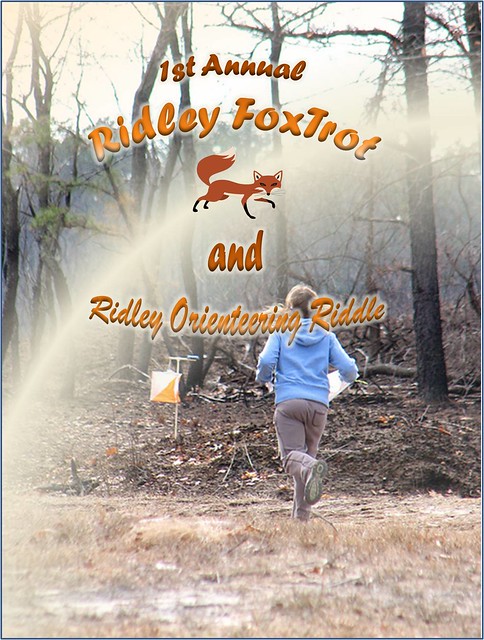
Courses Information:
| Course | Distance | Climb | Ctrls |
|---|---|---|---|
| White | 1.90km | 40.0m | 8 |
| Yellow | 3.10km | 55.0m | 10 |
| Orange | 4.30km | 115.0m | 10 |
| Brown | 3.90km | 95.0m | 9 |
| Green | 5.30km | 135.0m | 11 |
| Red | 7.90km | 200.0m | 15 |
Course Setter: Daniel Barker
Directions: From US30 East (White Horse Pike) in Hammonton take SR-542 (Pleasant Mills Rd.) toward Batsto, follow SR-542 north-east for about 7mi and watch for O'-signs.
ED/CS Notes:
Location: Batsto Village, 4110 Nesco Rd, Hammonton, NJ 08037. Follow Orange and White Orienteering Signs when you get close to the park. The event arena and registraion is at the picnic area ring on the north side of the Batsto Village Visitor Center parking lot. Restrooms are located on the west side of the Batsto Village Visitor Center building proper. Please use the restrooms that have direct egress from the outside. Avoid using the restrooms inside the museum unless you visit the museum, of course.
Hours: Registration is from 10:30 AM until 12:30 PM.
Course closing: Because the land manager requires us to vacate the village at sunset, control pick up will begin at 2:30 PM sharp. Be out of the woods by 2:30PM!
Course Notes: Cyclone Sandy passed through this area recently. There are new unmapped rootstocks with several snapped trees and many downed branches of variuos sizes.
Zac has designed these courses to present route choices around or through the knee to waist high blueberry bushes. A few areas of dark green is green briars which you will want to avoid. The area marshes are normal to dry.
As always be wary of ticks. We have not encountered any chiggers in the last month but if the weather warms they may re-emerge.
There are wood fences that are marked as crossable fences on the map. Please do not climb on these fences. There are two mandatory marked crossing areas on the map for the Green, Red, Blue runners. One of these crossing areas is the entrance to the village and the other crossing point is a closed gate with a narrow openning between the gate and the fence that may be used as a crossing point.
All courses have at least one water stop at a control as designated by a cup symbol on the Clue Sheet.
Fees:
- Map fee $9 (non-member) or $6 (member of DVOA, QOC, SVO, HVO, or other O-USA club, as well as for scout and JROTC groups).
- Electronic punch rental is $1 (non-member) and free to DVOA members.
- Compass rental is $1.
Volunteers: Orienteering is a social sport and a community. Each event takes a village to put on, and an extra pair of hands is always welcome. If you can
help, we will find a job that matches your strengths and schedule--even if for 15-30 min, before or after your course. Please sign up on the DVOA volunteer
page, or contact the meet director.
Note: This event is sandwiched between Shotgun and muzzleloader deer hunting season. We will be setting contols out Sunday morning and all controls must be out of the woods by sunset. Make sure you note the reduced event times (10:30 - 12:30).
Courses Information:
| Course | Distance | Climb | Ctrls |
|---|---|---|---|
| White | 3.30km | 55.0m | 13 |
| Yellow | 4.00km | 55.0m | 12 |
| Orange | 5.20km | 75.0m | 12 |
| Brown | 4.50km | 85.0m | 12 |
| Green | 7.10km | 125.0m | 15 |
| Red | 8.60km | 150.0m | 20 |
| Blue | 11.80km | 175.0m | 27 |
Course Setter:
Notes: Winter meeting. Activities and program details to be determined.
Directions: Take Route 422 W to PA Rt23 West exit. Follow Rt23 west through Phoenixville to Rt724. From Rt23 & Rt724 jct, follow Rt724 west 1.1 miles to Zion Lutheran Church on left. From the Rdg-Pottstown area, take the 724 Exit off 422. Continue E on 724 through 3 lights and look for signs. Large white Church on the right.
Volunteer to help at this event
Course Setter:
Directions: From I-476N use exit 18A to Ridge Pike, go southeast. From I-476S exit at 18B and use the U turn at Allanwood. From I-76 use exit 338 Green Lane, follow N to left turn on Ridge Pike. Look for signs at corner of Ridge Pike and Port Royal Ave.
ED/CS Notes:
This year President's Cup will be held at the Schuylkill Center for Environmental Education (SCEE).
Advanced course will have a mass start at 11:00AM.
Start window for Beginner (White) course will be 11:00AM till 12:00PM.
All courses will be closed at 1:00PM and controls pick up will start.
Please plan your time accordingly.
This map is about 5 years old and was used multiple times for a variety of local club events. It offers quite dense trails network, some open fields, and some wooded areas with two-three creeks. Vegetation varies from open areas to uncrossable patches of green briar. Some fields became overgrown and are no longer crossable. There are some buildings, abandoned buildings, ruins, and fenced enclosures. While field-checking I found several new fences which are uncrossable. Also, one or two trails are no longer in use and are difficult to run on (the one I noticed will be marked accordingly on the map). One area was redone few years ago and it'll be marked as uncrossable - only advanced course will go through that area.
Beginner course is standard point-to-point course.
Advanced course (Orange-Brown level) will have one twist to make it more enjoyable experience. There will be one section on the course with 9 checkpoints (#31 through #39) you’ll have to memorize and navigate to the checkpoints in any order until you reach next available checkpoint on your map. In addition, you might be eligible to skip control(s) in that section. Please refer to the table below, which lists your course you normally run and number of controls you can skip:
- Blue/Red – no skip;
- Green – 1 skip;
- Brown – 2 skips;
- Orange – 3 skips;
Course was set to avoid some dense vegetation as well as to give an option go around on the trail or try your luck going straight. In some cases few controls were set intentionally to get around or away from not so friendly patches of green briar.
There will be no water stops on the course.
The SCEE office will be closed and there will be no bathrooms nor registration inside!
Courses Information:
| Course | Distance | Climb | Ctrls |
|---|---|---|---|
| Beginner | 2.80km | 70.0m | 11 |
| Intermediate | 4.40km | 140.0m | 21 |
Course Setter: Mary Frank
Notes: Beginners program followed by a white course
Directions: From Rt 23 about 1 mile West of Knauertown ( and Warwiick Park) turn right on Trythall Road. In about a mile and at the T intersection make a Left on Harmonyville Road and follow signs to the parking location on Piersol Road. From the North use Rt 345 South from 422 or 724 South through French Creek to the junction with Hopewell Road at Hopewell Furnace. Turn left on Hopewell Road, then in just over a mile turn right on Piersol Road.
Course Setter: Eddie Bergeron
Notes: SVO Event near York PA. Use Rt 30 West to Rt 24 Zion Road exit. Go north up the hill and take a right at the crest of the hill on Deninger Road. Look for the O signs.
Course Setter: Scott Thatcher
Directions: From US Rt. 30 Bypass north of Coatesville, take PA Rt. 82 north. Watch for left turn at top of hill. Follow O'-signs.
ED/CS Notes:
Celebrate St. Paddy's by running the Green course in a Green dress for free! Any Green course runner that shows up is a green dress and runs in the green get to run for free. Wear your green to celebrate St. Paddy's in style!
Courses Information:
| Course | Distance | Climb | Ctrls |
|---|---|---|---|
| White | 2.50km | 52.0m | 11 |
| Yellow | 2.58km | 61.0m | 11 |
| Orange | 4.08km | 88.0m | 15 |
| Brown | 3.18km | 76.0m | 12 |
| Green | 4.74km | 115.0m | 17 |
| Red | 6.05km | 175.0m | 20 |
Course Setter: John Campbell
Directions: The park is approximately 30 miles southwest of Wilmington, DE and 50 miles northeast of Baltimore, MD. Take Exit 100 off I-95, follow Rt. 272 for 11 miles south, through the town of North East and into the park.
ED/CS Notes:
Come out to Elk Neck Sunday March 24th and enjoy the early spring woods! John Campbell has designed a fun set of courses that will provide participants with the trademark bay and wetlands views that make Elk Neck so special.
The event will be run out of the campground area. Parking is limited so carpooling is encouraged. You can park at the Camp Store or the Nature Center lots. If those fill up, we will direct you to overflow areas. Restrooms are available at one of the campground loops past the event center.
The Elk Neck map was last updated in 1998. There are some new unmapped trails (a few in close proximity to controls) and lots of unmapped rootstocks. The courses go near some of the campground loops. Campsites may be occupied. Please do not cut through any occupied campsites.
Red runners: Several legs on the Red course venture near a conference center at the northern part of the map. You may notice new unmapped buildings and other map changes if you stray too far north.
Volunteers are needed for all positions. Please sign up on the website - it will make our jobs much easier!
Courses Information:
| Course | Distance | Climb | Ctrls |
|---|---|---|---|
| White | 2.40km | 50.0m | 13 |
| Yellow | 3.40km | 80.0m | 12 |
| Orange | 4.00km | 120.0m | 12 |
| Brown | 4.50km | 140.0m | 11 |
| Green | 6.00km | 230.0m | 12 |
| Red | 7.80km | 320.0m | 16 |
Course Setter: Wyatt Riley
Notes: This is a special training program for kids ONLY.
W Y O Br G R Special
Volunteer to help at this event
Co-Director: Wyatt Riley
Course Setter: Wyatt Riley Co-Setter: Angelica Riley
Notes: The "Special" course is a trail race using a map with a finish near the Orienteering finish.
Directions: Follow PA Rt23 to Knauertown and watch for O'-signs
ED/CS Notes:
Beautiful fields, pavillion and playground provides a great venue to see the early Spring coming just coming alive.
Fields and trails await the begineer level navigators on the White & Yellow courses. Yellow adds some criss-crossing route choices and some beyond-trail navigation, e.g. to field corners.
Lots of controls on Orange, including some advanced level controls in the forest - very close to easier previous controls you can use as an attack point. This, plus the still reasonably open forest in early Spring make this a great course to use in learning some advanced skills. And at Warwick, you're always close to a trail for a quick recovery, if needed.
Brown and Green stick to the traditional southern 2/3 of the park, with a design intended to provide good navigation, without excessive climb - plus a few cases where you'll want to think carefully about a route choice in the forest, vs. hopping out to one of Warwick's many trails.
Red explores the North side of the park (without tempting you into a sketchy creek crossing - controls right at the bridge), for some rarely used terrain exploration. There's a bit more briar on that side than you might expect given the mapping, so you might want to select less-green route choices, and be careful where you dive into the forest.
Other course notes:
- Yellow & Red courses have some criss-crossing lines between controls - so check the lines and control numbers that you are running to carefully.
- The Green course has some sharp zig-zags, so like Yellow & Red - check those lines and control numbers carefully.
- There's a construction area right where the main parking lot connects to the main trail. It's accurately mapped as of a week before the event - but as it's overprint, you might want to take a look at it beforehand, and look at the map clip at the start, if you want to avoid precious seconds getting stuck on the wrong side of the construction fencing.
Early spring conditions have visibility in the forest still quite good - no green-leaves visible yet as of April 1st, but they may just be popping out by April 7th - still, quite near the best forest visibility of the year.
If it's wet in the days preceeding, you'll find plenty of puddles to splash through on all courses - dry shoes for hanging around afterwards are recommended!
All courses have different first controls, so there should be little or no excess waiting for your starts.
Maps have been professionally printed by a company being considered for our Fall A-event, so you can expect top quality prints.
Finally, we have an unusual combination of this orienteering event being immediately following a 5k Trail Run at Warwick earlier that morning - so if you want to show up around 9:15-9:30am you can watch the trail runners finish (until around 9:45am), and see if you can say hi & talk one of them into trying some orienteering!
Courses Information:
| Course | Distance | Climb | Ctrls |
|---|---|---|---|
| White | 2.58km | 40.0m | 12 |
| Yellow | 2.75km | 60.0m | 12 |
| Orange | 5.03km | 195.0m | 21 |
| Brown | 3.66km | 130.0m | 14 |
| Green | 5.23km | 160.0m | 17 |
| Red | 9.50km | 260.0m | 25 |
Course Setter: Wyatt Riley
Notes: This is a special training program for kids ONLY.
Course Setter: Mary Frank
Notes: Beginner instructional program followed by a white course.
Directions: From King of Prussia follow US 422 west to Oaks Exit. At the bottom of the ramp turn right at the light then make another right at the next light. Follow O-signs to parking. From Pottstown follow US 422 east to the Oaks Exit. Stay right at end of ramp and yield on to Egypt Road. Go under 422 and make a right at the 2nd light (before crossing bridge). Follow O-signs to parking.
Co-Director: John John Gillette
Course Setter: Bob Rycharski Co-Setter: Bob Rycharski
Notes: Rescheduled Hurricane Sandy Quail Hill Invitational DVOA & Scout event, Scout start times are now filled. Late registrations must be refused. No Dogs are allowed registration forms and information
Directions: From N & W: NJ Turnpike Exit 8 to Rt 33 East for 5 mi. Rt 527Alt North/Iron Ore Rd. From E: Garden St Pkwy Exit 100A to Rt 33 W for 16 mi. to Rt 527Alt/Iron Ore Rd. Then North 1/4 mile on 527Alt to Quail Hill sign, turn right onto Le Valley Rd into camp.
ED/CS Notes:
These courses are from the event that was postponed Nov 2012. All courses were rechecked and the Yellow LONG Course was redesigned due to a trail closure. While the Blue Trail in the north of the camp is closed (It is open to "High Hurdles" expert splinters) due to downed trees, it is still visible and usable for navigation. That said, expect 50 to 75 new unmapped trees or rootstocks to be crossed or avoided, mostly in two small areas. A map showing the affected areas will be available at registration. Usually going around the obstructions will be easier than attempting to go over them. While Ranger Adam thankfully has cleared all but two camp trails, trees and rootstocks in the deep forest have not been removed. Only the most dangerous tree and branch snags have been removed from the forest proper. All trails but one are cleared, so beginner courses will not be difficult. There are piles of cut logs which are not mapped and will need to be avoided. Most advanced courses visit mostly runnable forest, but short-cut choices may be more limited. This Orienteering meet will not be one to move up "a new level" as maps were already designed and printed before the "Sandy" windstorm damage in Nov. As more clean-up is completed, notes will be posted here up to the event date of April 13th. Remember, Scouts/Troops must register before April 3, but DVOA members do not. Scouts Registration form is at http://www.scoutorienteering.com/events/2013-04-14a.htm.
After April 3 registration for large units may close without warning.
No Dogs are allowed at the camp.
See the volunteer list, please help out, I especially need two morning flag hanging volunteers to help me get everything in the woods.
Courses Information:
| Course | Distance | Climb | Ctrls |
|---|---|---|---|
| White | 1.90km | 50.0m | 9 |
| Yellow-X | 3.20km | 70.0m | 11 |
| Yellow-Y | 3.60km | 82.0m | 14 |
| Orange | 4.20km | 115.0m | 16 |
| Brown | 3.80km | 100.0m | 9 |
| Green | 5.50km | 110.0m | 18 |
| Red | 7.30km | 150.0m | 19 |
Course Setter:
Directions: Take the PA turnpike to I-81 South. Exit fromI81 onto 233 North and follow it to O-signs and the park. Driving time from the PA turnpike Morgantown exit is about 1:45.
Course Setter: Wyatt Riley
Notes: This is a special training program for kids ONLY.
Course Setter:
Directions: At exit 67 of I78, from east go straight between the Turkey hill and the Wendy's on Silvex road. Go under the bridge and bare right to the park. From west , turn right, go under the interstate, turn left on Silvex road and follow the other directions.
Courses Information:
| Course | Distance | Climb | Ctrls |
|---|---|---|---|
| White | 2.10km | 25.0m | 11 |
| Yellow | 2.30km | 55.0m | 10 |
W Y O Br G R
Volunteer to help at this event
Course Setter: Bob Fink
Directions: From Rt 23 about 1 mile West of Knauertown ( and Warwiick Park) turn right on Trythall Road. In about a mile and at the T intersection make a Left on Harmonyville Road and follow signs to the parking location on Piersol Road. From the North use Rt 345 South from 422 or 724 South through French Creek to the junction with Hopewell Road at Hopewell Furnace. Turn left on Hopewell Road, then in just over a mile turn right on Piersol Road.
ED/CS Notes:
General
This will be the second full DVOA event on a new map. Registration will be in the barnyard outside the Visitor’s Center. The Visitor’s Center will be open for restrooms, no spikes please. Crow’s Nest Trail Guides are available, so you can return to explore the Preserve’s seven miles of trails including a section of the Horseshoe Trail. Look for fox, deer and wood ducks and listen for birds singing. (Check for ticks.) Take the kids to cross the wire bridge.
If you’ve worked up an appetite or feel like socializing, a menu for AJ’s Pizza will be posted near registration. Conveniently located on route 23 on the way to Route 100, AJ’s has picnic tables outside.
Parking
There is limited parking at the visitor’s center lot with more room in the adjacent mowed field. If we have had substantial rain, this mowed area will get very muddy.
Courses – General
The woods are greening up, but most courses will keep you out of the thorns. Many trails have blazes, which might be helpful. Most courses will cross lightly used roads, so be cautious.
White – this course follows some open field borders. These are not mapped as trails; they may be mown and are easy to follow.
Yellow – this is a harder Yellow course. Some controls are well off trails, but are on easily reached following linear features (streams, fence lines, field borders,…).
Orange – this course uses a variety of features with an opportunity to run on the Horseshoe Trail. A few of the Orange controls are in the Southern part of the map with a large number of boulders.
Brown, Green, Red – these courses cross some open fields (fast) and dip down into the Southern part to tangle with the boulders and the emerging green (slow).
Volunteers
We need volunteers! In addition to the Event Director and Course Setter hours worked, it takes about 35 more volunteer hours to put on an event. All volunteers will have an opportunity to run.
Courses Information:
| Course | Distance | Climb | Ctrls |
|---|---|---|---|
| White | 2.70km | 40.0m | 12 |
| Yellow | 3.90km | 70.0m | 11 |
| Orange | 4.10km | 120.0m | 9 |
| Brown | 3.90km | 130.0m | 14 |
| Green | 4.90km | 170.0m | 13 |
| Red | 6.60km | 195.0m | 16 |
Course Setter: Wyatt Riley
Notes: This is a special training program for kids ONLY.
Course Setter: Wyatt Riley
Notes: This is a special training program for kids ONLY.
W Y O Br Score-O
Volunteer to help at this event
Course Setter: Mark Frank
Notes: MASOC 25. Scout event. Preregistration required. Information and registration forms
Directions: Follow PA Rt.23 to Rt.345, take Rt.345 north and watch for O'-signs.
W Y O Br G R
Volunteer to help at this event
Course Setter: Mark Frank
Directions: Follow PA Rt.23 to Rt.345, take Rt.345 north and watch for O'-signs.
ED/CS Notes:
Course data for French Creek Central this Sunday
White 3.2km 40m 9 controls
Yellow 3.3km 70m 11 controls
Orange 3.9km 110m 11 controls 1water stop
Brown 4.km 95m 10 controls 2 water stops
Green 5.9km 145m 12 controls 3 water stops
Red 7.7km 225m 13 controls 2 water stops
The leaves are coming out, but visiblilty in the woods is still good. Other good news is that the brush left by the October storm of 2011 is beginning to decompose. It isn't gone, but visibility is better and it is easier to break through the small stuff.
Course Setter: Wyatt Riley
Notes: This is a special training program for kids ONLY.
Course Setter: Ralph Tolbert Co-Setter: John John Gillette
Directions: West of Newark Delaware on 273 then N on Appleton Road, or go south from PA 896 at Kemblesville on Appleton Road and look for Orienteering signs.
ED/CS Notes:
Come Spend Mothers Day with DVOA at Fair Hill. We are offering a special $3 Event Fee for all Mothers running with us on the 12th. Ralph Tolbert has provided the notes below for a challenging array of courses across the open plains of the park. So bring Mom and join us at Fair Hill
Welcome to Fair Hill Little Egypt. The Little Egypt map was published in February 2007 with field work beginning in 2005. Changes impacting the map include new unmapped trails and, of course, new rootstocks. Generally, the mapped rootstocks will have little or no earth left on them and the trunk will have decayed significantly – no bark. A new wider bridge (not mapped) over the headwaters of the Christina River is ~70 meters upstream from the original narrow one.
The map scale is 1:10,000 with 5-meter contour intervals.
Course - specific notes:
Part of the White course utilizes a natural gas pipe line right-of- way.
None of the courses cross the Elk Creek on the western edge of the map.
Red and Blue course runners have a route choice that could include a surface crossing of Appleton Road, tunnel or bridge crossing; exercise caution if you choose the surface route.
Brown, Green, Red and Blue courses will pass through the University of Delaware Water Shed study area. This was started back in 2007 (shortly after the map was published) and the area has been enlarged. There are numerous rainfall collection points, stream-flow monitoring apparatus, a small shed, and many pipes and streamers covering a large area. NONE of this equipment is mapped! Brown, Green, Red and Blue Course legs will take you through this area – watch your step!
I hope you enjoy your day at Fair Hill as much as I enjoyed designing the courses and field checking.
Ralph Tolbert
Courses Information:
| Course | Distance | Climb | Ctrls |
|---|---|---|---|
| White | 2.85km | 45.0m | 10 |
| Yellow | 3.34km | 55.0m | 9 |
| Orange | 4.89km | 80.0m | 10 |
| Brown | 3.97km | 120.0m | 8 |
| Green | 6.18km | 210.0m | 16 |
| Red | 7.92km | 225.0m | 16 |
| Blue | 12.92km | 325.0m | 22 |
Course Setter: Wyatt Riley
Notes: This is a special training program for kids ONLY.
Course Setter: Bob Burg
Directions: From Junction of NJ70 and NJ72 go SE on NJ72 and look for O signs
ED/CS Notes:
This coming Sunday is DVOA’s first opportunity in several years to return to Brendan Byrne State Forest (aka Lebanon State Forest, aka Pakim Pond). So get out your low vegetation gear and subtle terrain mind-set and prepare to navigate the beautifully unique New Jersey Pinelands.
All of Bob’s courses on the Four Mile Circle map will avoid the typical vertical climb of South Jersey as well as steer you around the extensive boulder fields, leaving you only the most challenging but generous navigation through pine and pin oak, blueberry everywhere, and of course, the legendary network of fire ditches.
We will be assembling near the Fire Tower out along Rt 72, just inside the main entrance to the Park (follow the orange arrows). Our Start location will require a long but absolutely level walk, but then allow ALL courses to utilize the best terrain in the park that usually only longer advanced courses get to visit.
So climb in your car, cross the Delaware, and come enjoy one of our most unique terrains.
Course Stats
White 2.36k 33m 10 ctrls
Yellow 3.35k 55m 10 ctrls
Orange 4.7k 60m 10 ctrls
Brown 3.76k 48m 10 ctrls
Green 5.5k 73m 12 ctrls
Red 7.96k 78m 16 ctrls
Blue 10.14k 103m 22 ctrls
Course Setter: Wyatt Riley
Notes: This is a special training program for kids ONLY.
Course Setter: James McGrath
Notes: DVOA Picnic, Summer Meeting and Relay
Directions: From the north, take Northeast Extension of PA Turnpike to I-80 exit. Turn right at light onto PA Rt. 940 and follow west for 3 miles. Go south on PA Rt. 534 and follow O'-signs. From the south, take Northeast Extension of PA Turnpike to Rt 903 exit. Turn right on PA Rt. 903. Turn left at the light onto PA Rt. 534 and follow O'-signs. The entrance to the Sand Spring Lake parking area is along PA Rt. 534 Between I80 and Rt. 903.
ED/CS Notes:
The Hickory Hop will get started in grand fashion, as we welcome everyone to the relay excitement of the 2013 DVOA Vice President's Cup.
The Point System and Courses
As in previous years, it will be a relay, inspired by the rules for the US Relay Championships. That means that there is a handicapping system, designed to enhance the overall level of competitiveness and excitement.
There are a few small deviations with respect to point values, indicated in bold, below.
Ages 17-20 or 40-49 receives 1 point
Ages 15, 16 or 50-59 receives 2 points
Under 15 years of age or 60 and older receives 3 points
A female orienteer receives 2 points, in addition to any age points.
A team can contain at most 1 person between ages 21 and 39 (inclusive).
Another deviation: there are 3 divisions: 3, 6, and 9 point teams. Each team must have 3 runners (and no one can run more than one leg.)
The total distance converged in the 3 divisions is as follows:
3 point: 12.9K
6 point: 10.4K
9 point: 7.9K
The different divisions will run the following legs:
3 Point
1) Blue
2) Green
3) Orange
6 Point
1) Red
2) Brown
3) Yellow
9 Point
1) Brown
2) Orange
3) Yellow
(The correspondence with color-coded courses is not exact. However, these courses would tend to correspond with longish middle courses of their respective difficulties.)
Event Logistics
Registration will open at 10:30 AM on Saturday at the Sand Spring Lake pavilion. (We’ll have orienteering signs to direct you there.) The total cost is $20 per team. Registration closes at 11:30 AM, allowing enough time to hand out maps.
There will be a mass start for all teams at high noon.
Unlike some relays, there will be no forking, catch-up mass starts, or other complications. This will be a barebones event (albeit one with great map, terrain, and we hope, good courses) that will be a perfect way to ease into the weekend's festivities.
The map is 1:10,000 with 5 meter contours. It features recent updates by Tom Overbaugh. Maps will be laser-printed on 8.5 x 11 paper, with clues on the maps and separate clues available. (Again, no forking.) The map may not have a legend, but some free legends will be available at registration.
Feel free to use this thread to advertise for teammates, and consult the Hickory Hop Rogaine pre-registration list to see other folks who will be there for the weekend.
https://www.orienteeringusa.org/eventregister/c21/reglist/?event_id=47
Night-O Beg Int Adv
Volunteer to help at this event
Course Setter: Tom Overbaugh
Notes: Night O.
Directions: From the north, take Northeast Extension of PA Turnpike to I-80 exit. Turn right at light onto PA Rt. 940 and follow west for 3 miles. Go south on PA Rt. 534 and follow O'-signs. From the south, take Northeast Extension of PA Turnpike to Rt 903 exit. Turn right on PA Rt. 903. Turn left at the light onto PA Rt. 534 and follow O'-signs. The entrance to the Sand Spring Lake parking area is along PA Rt. 534 Between I80 and Rt. 903.
ED/CS Notes:
The Memorial weekend festivities continue on Saturday evening May 25th with a full moon Night O at Sand Spring Lake. The Registration/Start/Finish area for this event is the pavilion at the south end of the Sand Spring Lake parking lot. Courses will be offered for Beginner, Intermediate, and Advanced ability levels.
The Beginner course controls will be on trails and the open area around the lake. There is one trail loop at the start of the Beginner course that will be marked with reflective tape. The Intermediate and Advanced courses feature off-trail controls in the woods and also make use of the open terrain near the lake. Since the vegetation will be out, controls are placed in the more open woods. Controls on all courses will be marked with reflectors. The Sand Spring Lake map has been updated to reflect recent changes around the lake and picnic areas.
Sunset on May 25th is at 8:22 pm and it won't get dark until about 30 minutes later. First start will be around 8:50 pm. Pre-registration is not required. If you would like to reserve a start time in advance, please send me an email (toverbaugh at comcast dot net). Otherwise. start times will be assigned on a first com / first served basis. Registration at the pavilion will open around 7:00 pm. Participants can go out in groups or as individuals. All participants are required to carry both a primary and back-up light source. Map fee will be $6.
Map Scale: Beginners 1:5,000 / Intermediate & Advanced 1:10,000. 5m Contour Interval.
Courses Information:
| Course | Distance | Climb | Ctrls |
|---|---|---|---|
| Beginner | 2.30km | 40.0m | 10 |
| Intermediate | 3.10km | 75.0m | 11 |
| Advanced | 4.70km | 125.0m | 14 |
Course Setter: Sandy Fillebrown
Notes: 3hr and 6 hr rogaine. Pre-Registration recommended; prices go up if you register after May 12 and we may run out of maps. Sign Up Here
Directions: Take Northeast Extension of PA Turnpike to I-80 exit. Turn right at light onto PA Rt. 940 and follow west for 3 miles. Go south on PA Rt. 534 and follow O'-signs.
ED/CS Notes:
On Sunday, DVOA will be hosting a mini-rogaine on the Shades of Death map at Hickory Run State Park.
PRE-REGISTRATION HAS CLOSED. You can show up Sunday morning and you will be able to register and particpate, but you will most likely have to draw your controls on your maps.
Race Format: All competitors - both those doing the 3 hour and those doing the 6 hour event - will receive two copies of the Shades of Death map approximately one hour before the beginning of the event, map A and map B. Each map will show 25 control locations. Each competitor (or team) will need two SI-Cards (your own and/or ones provided by DVOA). One SI-card will be for your A map and one for your B map. When you start, you will take your A SI-card and go to as many controls on your A map as you would like, punching those controls with your A SI-card. You will then come back to the start/finish area, punch the finish with your A SI-card, and then proceed to go to as many controls on your B map as you would like, using your B-SI-card. You then return to the start/finish area and punch finish with your B SI-card. Thus, you are basically doing two loops of the map. However, you can elect to do any number of controls on map A (including 0) before punching the finish and proceeding to collect controls on map B.
Scoring: Controls will be worth the same number of points as the control number. Controls are numbered 31 to 80. Thus, for example, control number 47 is worth 47 points. Controls on map B punched before the finish control is punched by the A SI-card will not count. (If you punch one by mistake you will not be penalized, it just will not count unless you go back and punch it again after you are finished with map A and punch finish with your A SI-card.) There will be a hefty penalty (details to be announced) for coming in late.
Divisions: Competitors may race solo or in teams. There will be a 3-hour division and a 6-hour division. There will be male, female and co-ed divisions in both the solo and team categories. If there are enough entries, there will also be junior, open and masters divisions.
Fees: Pre-registered entry fee is $30 per person, regardless of whether you compete in the 3 or 6 hour event and whether you are solo or part of a team. Members of DVOA or OUSA receive a $5 discount. Members of a single family competing on the same team are free after the first two. Juniors - those age 20 and under - are $20 with a $5 discount if memebers of DVOA or OUSA. Your entry fee gets you the following:
- two maps and map bags per person
- free rental of SI-cards per team if needed
- a finisher's award for every competitor
- food after the event
Registration after Sunday, May 12 will include a $10 per person late fee and be limited by the number of maps that are printed. Pre-registration will close on Sunday, May 19. To enter after this date contact the event director, Sandy Fillebrown.
Schedule: Both the 3 hour and 6 hour events will begin at 10:00 am. Registration will open at 8:00am. Maps will be distributed at 9:00am. There will be a group walk to the start at 9:45am. Food will be available beginning at 1:00pm and going until approximately 5:00pm.
Location: Parking will be at the Sand Spring Lake parking area. Registration and post-race activities will take place in the pavilion at the southern end of the parking area. The start and finish area are a short walk away, on the other side of PA 534.
Additional Items:
- DVOA has rented Camp Shehaqua for the weekend (Friday, Saturday and Sunday nights). This is a group cabin area. Cabins sleep 2-8 with a few lodges that sleep more. Most cabins do not have electricity. There are central bath houses and a dining hall. Janet Porter will be in charge of Camp Shehaqua for the weekend and will be assigning cabins. The fee to stay at Camp Shehaqua is $12 per person for the weekend, regardless of the number of nights.
- Preview maps of Shades of Death are available for $5 each and will be mailed if ordered by May 12.
- SI-cards will be provided if needed as part of the entry fee. However, if you use one of our SI-cards and lose it, there will be a $40 replacement fee.
- There will be NO water on the course except at the start/finish location. Please carry sufficient water with you.
Registration: On-line pre-registration is highly recommended (see above about late registration). List of those currently registered.
Course information given below is approximate based on one set of possible routes going to all controls.
Courses Information:
| Course | Distance | Climb | Ctrls |
|---|---|---|---|
| Rogaine | 30.00km | 560.0m | 50 |
Course Setter: Wyatt Riley
Notes: This is a special training program for kids ONLY.
Course Setter: Mary Frank
Notes: Beginners program
Directions: Pawlings Road:From PA Rt. 422 Exit at Oaks and head East on Egypt Road. Make a right onto Pawlings Rd. Watch for O'-signs. Betzwood Bridge: After the right onto Trooper Road, go left at Audubon Road. Follow O Signs.
Course Setter: Doug Sevon
Directions: South side of Germantown Pike, midway between 202 and 363, just east of the crossing with Whitehall Road.
ED/CS Notes:
Come enjoy the fairly flat terrain with fast courses that explore the woods and streams that are part of the Norristown Farm Park. The fields at the farm have been planted so the fields are strictly out-of-bounds and will be marked as such on the map. Courses have been designed so a route choice across a field is not good route choice.
Orange through Red course participants will have the opportunity to cool their feet multiple times in the streams of the park.
Courses Information:
| Course | Distance | Climb | Ctrls |
|---|---|---|---|
| White | 1.84km | 27.0m | 8 |
| Yellow | 3.54km | 40.0m | 10 |
| Orange | 4.38km | 50.0m | 12 |
| Brown | 4.06km | 45.0m | 11 |
| Green | 5.79km | 80.0m | 13 |
| Red | 8.37km | 115.0m | 23 |
Course Setter: Wyatt Riley
Notes: This is a special training program for kids ONLY.
Course Setter: Karl Ahlswede
Directions: From Exit 26 of the PA Turnpike follow PA Rt. 309 south to Rt. 73. Take a right onto Rt. 73 and follow it north and west and watch for O'-signs.
ED/CS Notes:
DVOA will host an orienteering event at close by and easy to get to Fort Washington State Park on Sunday, June 9th. This small park offers relatively easy orienteering but enough forest to challenge the more advanced orienteers and the event center is nearby a playground, picnic areas and nice, indoor bathroom facilities
Courses Information:
| Course | Distance | Climb | Ctrls |
|---|---|---|---|
| White | 3.20km | 80.0m | 15 |
| Yellow | 2.90km | 80.0m | 10 |
| Orange | 4.10km | 125.0m | 17 |
| Brown | 3.20km | 80.0m | 13 |
| Green | 5.50km | 135.0m | 22 |
| Red | 6.80km | 170.0m | 28 |
W Y O Br G R
Volunteer to help at this event
Pre-Register for this event
Course Setter: Bob Burg
Directions: From Interstate 95 north of Trenton take NJ Rt. 29 north along the Delaware River. Turn right after about 2.5 miles on Rt 546. The park is on the left
ED/CS Notes:
Event Director: Vadim Masalkov
Course Setter: Bob Burg
Note that because of the relatively low DVOA turnout at the Scout/JROTC Championship last October, we will be using the surplus maps from that event. Therefore, none of the storm damage is mapped. But miraculously, the direction and location of downfall, while in some areas impressive, has left courses and route options virtually uneffected.
So come get a first hand look at "Hurricane Meets Woods" half a year later -- especially on display around our Registration/Start/Finish area in Greene Grove.
If you did run a course in October, come and run a different one. The courses use remapped areas of Washington Crossing, offering legs through open woods as well as more technical areas that require careful route choice. And everyone will have use a streamered finishing leg that wends its way through a dozen new rootstocks in the area.
To meet Park safety concerns, we ask that as many of you as possible pre-register for the event on the website. You can still show up the day of the event.
See you in the woods, just across the I-95 bridge into New Jersey. And please be aware that during summer months the Park does charge a per car entrance fee of $5 for Jersey residents, $7 non-residents. Sorry for that, but we did not anticipate it when we were trying to find a slot in our schedule.
Courses Information:
| Course | Distance | Climb | Ctrls |
|---|---|---|---|
| White | 1.95km | 20.0m | 10 |
| Yellow | 2.90km | 23.0m | 10 |
| Orange | 4.25km | 40.0m | 11 |
| Brown | 3.70km | 23.0m | 11 |
| Green | 5.40km | 42.0m | 14 |
| Red | 8.50km | 72.0m | 20 |
Course Setter:
Directions: From King of Prussia follow US 422 west to Oaks Exit. At the bottom of the ramp turn right at the light then make another right at the next light. Follow O-signs to parking. From Pottstown follow US 422 east to the Oaks Exit. Stay right at end of ramp and yield on to Egypt Road. Go under 422 and make a right at the 2nd light (before crossing bridge). Follow O-signs to parking.
Course Setter: Rob Wilkison
Notes: The parking area for this event is the State Game Lands parking lot across the road from the golf course off I80. Clicking on the map name above will send you to a link to a map. It can also be seen at http://www.dvoa.org/info/maps/mapit.php?map_id=26&sked_id=890
Directions: Take Northeast Extension of PA Turnpike to I-80 exit. Turn right at light onto PA Rt. 940 and follow west for 3 miles. Go south on PA Rt. 534 and follow O'-signs.
ED/CS Notes:
We will be at the extreme Western edge of the original Hickory Run 1:15000 map done for the 1988 North American Champs. Only a few copies remain from that printing so this is our last opportunity to run on this classic map. In my experience it has aged well and can be trusted. Any major problems will be highlighted at Registration.
Don't confuse this area with the intricate laurel covered areas around Daddy Allen. The advanced courses here will cross terrain more like the old French Creek West with relatively open woods and large areas of subtile contours. Rob will have more specific course data after the coming weekend, but I suspect Orange and above will have a creek crossing or two. For most people the "attack point" for the registration area will be Rt 534 at Exit 274 of I80. Go South from that point about a half mile. There will be signs.
Courses Information:
| Course | Distance | Climb | Ctrls |
|---|---|---|---|
| White | 1.80km | 55.0m | 8 |
| Yellow | 3.25km | 60.0m | 8 |
| Orange | 4.25km | 95.0m | 9 |
| Brown | 3.90km | 110.0m | 9 |
| Green | 5.25km | 155.0m | 10 |
| Red | 6.75km | 215.0m | 12 |
| Blue | 8.15km | 205.0m | 13 |
W Y O Br G R Bl
Volunteer to help at this event
Co-Director: Frederick Reed
Course Setter: Sam Reed Co-Setter: Frederick Reed
Directions: Follow Rt.23 to PA Rt.345, take Rt.345 north and watch for O'-signs.
ED/CS Notes:
The Reed Family is holding a meet at French Creek State Park East, greatly changed by the 2012 forest fire. Course setter Sam aims to let people tour the now-clear areas of the woods that were previously impassible.
Look for O-signs and come to the usual Baptism Creek parking area. Don't forget to sign up to volunteer if you can!
Registration and snacks at the covered pavilion building about 150 meters from parking. There is a 5 to 15 minute walk to start from there, depending on how fast you go, 1 kilometer with some climb. Streamers will mark the path to start. First start time at 10am. Start will have water, as well as on the course. GO control will be shared with all courses and shoot to finish will be marked. Finish is right next to registration, which will have download. Since it's been rainy these last few weeks, the water features are more pronounced than usual.
Course Notes:
Most of you have probably at least heard about the forest fire, which has drastically changed the vegetation of much of the area. Some areas have been changed into walls of thorns that tower over your head, while others have been completely cleared out of all underbrush. There's really no way to tell from the map which section of woods you would want to travel through. As course setter, I've set courses to avoid the worse areas no matter what route you take. That's really the only way to make fair courses under these conditions. There is also a bit more trail running than usual to get through some of these particularly bad areas. Also, since it's been rainy these last few weeks, the water features are more pronounced than usual.
With the map in the condition it's in, the chances of somebody getting lost or not finishing their course are particularly high. Please remember to always download whether you finished your course or not so we have proof you returned. A 3-hour time limit will be strictly enforced (meaning an OT result, bad/no ranking points). Start closes at 1pm. Controls will begin to be picked up at 3pm, starting with early controls working forward. By 4pm the finish will be taken down. If you don't know if you can finish the course you've chosen in 3 hours, please run the course down.
Course specific notes:
White-- Solid course, gets to see the fire damage without having to walk through it.
Yellow-- A little bit on the hard side for a yellow course. Leg 2 to 3 has a streamered section of about 100 meters that crosses a stream with no bridge. This course also sees the fire damage.
Orange-- Physically very challenging. Be ready to rock hop and cross streams over fallen trees. Visits a section of woods I don't think Orange has ever gone to before.
Brown-- Made to be physically easy as possible. Smart route choices will avoid all rocky ground. About 80 percent white woods and trail running.
Green-- Not to be taken lightly. About 70 percent white woods and trail running.
Red-- Even harder than green. About 60 percent white woods and trail running.
Blue-- I'm so sorry for what I have done to you. Goes pretty much everywhere south of Chestnut Hill. About 50 percent white woods and trail running.
Courses Information:
| Course | Distance | Climb | Ctrls |
|---|---|---|---|
| White | 2.70km | 40.0m | 8 |
| Yellow | 3.50km | 130.0m | 10 |
| Orange | 4.60km | 155.0m | 11 |
| Brown | 3.20km | 95.0m | 9 |
| Green | 5.30km | 180.0m | 14 |
| Red | 7.10km | 205.0m | 18 |
| Blue | 9.60km | 275.0m | 24 |
Course Setter: Nathan Ohrwaschel
Notes: Junior team fundraiser
Directions: From the North take Rt 82 south to Rt 282. Follow 282 south and look for O signs at the junction with Springton Road. From the south take Rt 282 north from Downingtown to the intersection with Springton Road and follow the O signs.
ED/CS Notes:
Courses Information:
| Course | Distance | Climb | Ctrls |
|---|---|---|---|
| White | 2.27km | 0.0m | 15 |
| Yellow | 2.60km | 0.0m | 13 |
| Orange | 4.26km | 0.0m | 14 |
| Brown | 3.30km | 0.0m | 13 |
| Green | 4.77km | 0.0m | 16 |
| Red | 5.97km | 0.0m | 20 |
| SprintO | 2.16km | 0.0m | 16 |
Sprint-O Score-O Special Canoe-O Night-O
Course Setter: Ron Bortz
Notes: DVOA Camping weekend. Pre-Registration at https://orienteeringusa.org/eventregister/
Directions: From I-81 take PA309 west to Carverton Rd, left on 8th St in Carverton and left on Mt Olivet Rd to park
ED/CS Notes:
DVOA's summer mega controls event this year will once again be held at Frances Slocum State Park northeast of Wilkes/Barre, PA on August 10th and 11th.
Everyone from everywhere is invited to this informal format for a weekend of unique orienteering and socializing. Join us for the weekend and camp with us or stay nearby so you can spend some quality time getting to know more of your orienteering family.
Frances Slocum is a great state park with camping,picnicing,a large horseshoe shaped lake,athletic fields and a very large swimming pool with a concession stand.
The orienteering will include a score-o which will be done via a combination of foot,paddle and peddle. There will be no requirement to do all three. The entire score-o may be done on foot, but to score the really big points you will need to paddle. Paddle is the operative word here. The paddling can be done in a canoe, kayak, rowboat, peddleboat (all available for rent or preferably bring your own) or paddleboard. All rules must be followed for state waters. Those so inclined can pick up points on the western potion of the map via mountain bike (your own) or by foot.
The foot and bike-o control sites are the same ones used last year but now you must figure out which ones will get you maximum points (or just get them all). There will be no time limit (except to get out of the woods before the park gates close) so no one has an advantage for highest points total.
There are four catagories (if you want to see how you did compared to others)
1. One day solo 2. One day team 3, Two day solo 4. Two day team
Remember, this entire weekend is very informal, so if you just want to get out, enjoy the woods and find a few controls while you're at it, welcome to it.
Did I say the highest points controls will be on the water ?
There will be a memory/photo-o for those who have done the score-o first.
A photo-o only will be for those who haven't done the score-o.
There will be a paddle-o only for those who don't wish to do the foot/bike-o portions.
Full details will be divulged at the event.
All of the above can be done on either Saturday or Sunday or both days.
The night-o will be Saturday night. There will be 24 controls of which you must choose 15 to spell three words. Each control will have three letters assigned to it of which you must choose one. No control may be visited more than once. Some letters are repeated so you will have to do some planning before running yourself out of options. It will be highly unlikely any two people will choose the same controls, much less in the same order. The same control locations as last year will be used, but as you can decern there will be no significant advantage.
We will also set up some very short sprint course utilizing the training kit which has a printer for immediate split printout, so bring your e-punch finger stick. This same kit may be used to set up a course for children of any age. We will have finger sticks for their use.
All of the other orienteering will not require e-punching or punching of any sort. There will also not be any clue sheets, just numbered or lettered flags in the circles. You will be given control sheets on which, for the score-o, you will record the control value you find at which number; for the night-o the letter you choose at which number.
The map fees will be $6 for your first map. You can use the score-o map for the memory/photo or the photo only or the paddle only Os. Any additional maps will be $2. If doing the night-o only the fee is $6. If you already bought your first map the night-o map will be $2.
Preregister at https://orienteeringusa.org/eventregister/
Being so very informal much of this is subject to alteration.
Stay tuned for updates, clarifications, additions, subtractions or guesses.
If there are any personal questions email me (alliron69@cs.com) or if others might like to know the answer to your query put it on the eboard.
Ron Bortz
Event Organizer (sort of)
8/1/13
For current information go to the e-board under any article referencing "Pocono Dash and Splash"
Sprint-O Score-O Special Canoe-O Night-O
Co-Director: Patty Policelli
Course Setter: Petr Hartman
Notes: Registration and the main parking area will be about 1 mile south of I80 in a gamelands parking lot. From that point it is about a 4 mile drive to a smaller lot. Carpooling from Registration to the start area may be necessary depending on our attendance.
Directions: Part of Hickory Run State Park. West of the office and on the South side of Rt 534.
ED/CS Notes:
We are back to a 10,000 scale map and in an area of Hickory Run that has unique features, topography, and vegetation; differing from the more frequented venues in the park. This will be the first set of courses on this map since it was created for an A event.
Parking may be cramped as we are located at a small lot along 534 about ¾ mile north/west of the ranger’s station. We encourage you to carpool and plan to have a parking volunteer to help maximize space. When you arrive, please look for someone that will help direct you to a parking space. The plan is to get 3 rows of parking - two against the highway, an isle, and one against the berm.
The nearest comfort facility is a port-a-john at the ranger station.
White through Green courses will have a remote start about 10 minutes walk. Red and Blue courses will have some stream crossings.
Courses Information:
| Course | Distance | Climb | Ctrls |
|---|---|---|---|
| White | 2.00km | 55.0m | 7 |
| Yellow | 2.60km | 90.0m | 8 |
| Orange | 4.00km | 155.0m | 9 |
| Brown | 3.70km | 105.0m | 10 |
| Green | 5.50km | 165.0m | 13 |
| Red | 7.80km | 300.0m | 18 |
| Blue | 9.70km | 360.0m | 22 |
Course Setter:
Directions: West of Rt 29 between Green Lane and Red Hill. Look for O signs at the intersection by Marlboro Elementary School.
Course Setter: Roger Hartley Co-Setter: Steve Aronson
Directions: From Rt 422 take Rt 29 north. About 3.5 miles after the junction with Rt 73 look for a left turn onto Deep Creek Road and follow that and O signs to the park. From the North on Rt 29, look for O signs to the right as you approach the town of Green Lane..
Course Setter:
Directions: From the north, take Northeast Extension of PA Turnpike to I-80 exit. Turn right at light onto PA Rt. 940 and follow west for 3 miles. Go south on PA Rt. 534 and follow O'-signs. From the south, take Northeast Extension of PA Turnpike to Rt 903 exit. Turn right on PA Rt. 903. Turn left at the light onto PA Rt. 534 and follow O'-signs. The entrance to the Sand Spring Lake parking area is along PA Rt. 534 Between I80 and Rt. 903.
Course Setter:
Notes: Night O
Directions: From the north, take Northeast Extension of PA Turnpike to I-80 exit. Turn right at light onto PA Rt. 940 and follow west for 3 miles. Go south on PA Rt. 534 and follow O'-signs. From the south, take Northeast Extension of PA Turnpike to Rt 903 exit. Turn right on PA Rt. 903. Turn left at the light onto PA Rt. 534 and follow O'-signs. The entrance to the Sand Spring Lake parking area is along PA Rt. 534 Between I80 and Rt. 903.
Course Setter:
Directions: From the north, take Northeast Extension of PA Turnpike to I-80 exit. Turn right at light onto PA Rt. 940 and follow west for 3 miles. Go south on PA Rt. 534 and follow O'-signs. From the south, take Northeast Extension of PA Turnpike to Rt 903 exit. Turn right on PA Rt. 903. Turn left at the light onto PA Rt. 534 and follow O'-signs. The entrance to the Sand Spring Lake parking area is along PA Rt. 534 Between I80 and Rt. 903.
Course Setter: Ralph Tolbert
Directions: Rt 273 west of Newark Delaware or east on 273 from the crossing of MD Rt 213
Course Setter: Mary Frank
Notes: Beginners program
Directions: From King of Prussia - Rt. 202 take 422 West and exit at the Valley Forge/Rt. 23 West exit and watch for O'-signs
Course Setter:
Notes: Indoor beginner program followed by a white course.
Directions: Rt 625 South of Reading, about 2 miles south of the Jct of 625 and 724
W Y O Br G R
Volunteer to help at this event
Course Setter: Nicholas Reed
Directions: From S on US 1, or exit 9 on the NJTPK , take NJ-18 N to Davidson Road/Metlar's Lane, right on Ave E look for O signs. From N on 287 take Centennial Ave to Hoes Lane, exit at Davidson/Avenue E campus exit, bear left Over Rt-18 and follow O signs.
Course Setter: Bob Gross
Directions: South of Reading PA on route 625. Take Rt 724 West from I 176, or East from 222 and turn south on 625. The park is about 2 miles South of that intersection.
Course Setter: Steve Aronson
Directions: Exit Rt 22 at the Schoenersville/378 south exit. Use the Schoenersville ramp, and then turn left. Pass the Hospital on the right, left on Illicks Mill Rd, or from the south on 378 exit on 8th street North, Left on Schoenersville, Rt on Illicks Mill Road.
Course Setter: Ron Wood
Notes: 2012 Map Revision
Directions: East side: turn west on Eden Road near the Wawa on US 202 about a mile south of 92 and follow O signs. West side park office: take 92 West off of US 202 to park entrance. Follow O signs
Course Setter:
Notes: CANCELED
Directions: North on I 95 to the intersection with I 295. Follow I 295 East and exit at exit 8 and go west on PA 332. Go straight 4.7 miles, and in that stretch 332 becomes Route 413. Where Rt 413 makes a sharp right turn, you will instead be turning left at that light into the main Park entrance. Watch for O-signs.
Course Setter: Mary Frank
Directions: From Rt. 202 take Paoli Pike exit west to West Chester, left onto High St. then three blocks to a right on W. Miner St. W. Miner St. becomes Rt. 842. Follow Rt. 842 west for about 6 miles to Brandywine Valley Association Myrick Center.
Course Setter: Mary Frank
Notes: Program at 11AM, course open at Noon.
Directions: From I-476N use exit 18A to Ridge Pike, go southeast. From I-476S exit at 18B and use the U turn at Allanwood. From I-76 use exit 338 Green Lane, follow N to left turn on Ridge Pike. Look for signs at corner of Ridge Pike and Port Royal Ave.
Course Setter: Thomas H. Mentrak
Directions: From PA, follow US Rt. 1 South into MD. Turn right on Red Pump Rd. Follow for 3/4 mile and turn left on Ridge Road
Course Setter: SVO
Notes: Mid Atlantic Championships. Colonel Denning SP.
Directions: N/A
Course Setter: Sandy Fillebrown
Notes: Fall A Event
Directions: Follow Rt. 23 to PA Rt. 345, take Rt. 345 north and watch for O'-signs
Course Setter: Ed Scott
Notes: DVOA Fall A event
Directions: Kulptown Fire Company: 1082 Chestnut St (Route 345), Douglassville, PA 19518. From Rt 422 to Rt 345 South From Rt 23 to Rt 345 North.
Course Setter: Erik Eddy
Directions: Directions: From the E or S: Business 422 to Mt Penn, Right on Carsonia Ave, Left on Antietam Road, Left on Angora Road, left on Hill Road, right on List road to Rotary Park. From the W or N: Skyline Drive south from Rt 12, left at Bingaman then right to stay on Skyline Drive, left on List Rd., cross Angora and Rotary Park will be the right. Look for O signs.
ED/CS Notes:
Parking will be at Antietam Lake with start at the Nature Center. There is about a 350 meter uphill walk to the start.
The gravel lot off of Antietam Road has limited parking. If the lot is full, additional parking is available in the grass on the west side of Hill Road. Please be mindful that if we have had wet conditions, the grass parking area could be slippery.
Due to early sunset, we will be picking up controls at 2:30pm. Please plan your time.
Volunteers to run the event would be appreciated. I need help for the following Positions:
- Early Start
- Late Start
- Early Epunch
- Control Pick-up
Trails: I added several of the trails that are either more distinct or are most likely to be seen on a course. The fall leaves hide some of the trails. Many of the mountain bike trails SW of the farm are indistinct and have not been added or are marked indistinct. I am not a professional mapper but in my estimation this adds a tremendous amount of value to these courses.
*White and Yellow should not be confused by any previously unmarked trails.
*Shared 1st control: W&Y, Blue&Green, Red&Brown
*Blue has 2 repeat controls 4/15 and 11/14
General Notes: Brown, Green, and Red explore the woods near Antietam Lake, Rotary Park and the Farm while staying away from Skyline Drive. For those who want a challenge, Blue will test your endurance and technical skills with some controls down the North side of Skyline Drive. Be sure to know the symbol for boulder on the clue sheet!
I would love to hear your opinions once you are done running your course!
Courses Information:
| Course | Distance | Climb | Ctrls |
|---|---|---|---|
| White | 1.60km | 45.0m | 11 |
| Yellow | 1.90km | 80.0m | 10 |
| Orange | 3.00km | 100.0m | 11 |
| Brown | 3.30km | 110.0m | 12 |
| Green | 5.10km | 150.0m | 15 |
| Red | 6.60km | 230.0m | 16 |
| Blue | 9.10km | 300.0m | 19 |
Co-Director: Daria Babushok
Course Setter: Hugh III MacMullan
Notes: Ridley Fox Trot
Directions: From Newtown Square follow Rt.3 west approximately 2 miles to main park entrance on south side. Follow O'-signs.
ED/CS Notes:
The Ridley Foxtrot and Riddle is the capstone event of DVOA’s orienteering season. This year we will have a wonderful slate of orienteering courses set by veteran course setter Hugh MacMullan III; as well as the fantastic Riddle set by US Trail-O team member Karl Ahslwede. Stick around for hot refreshments, and the chance to win the Ridley Raffle! And, don’t forget to collect your award - there will be special awards given to the top male and female of each course as well as the top 3 finishers of the Riddle.
Location: (Intersection of Gradyville Rd and Providence Rd in Glen Mills, PA) - follow orange and white O signs once inside the park – Pavilion 17. There are bathroom facilities on site.
Schedule:
- Registration / Courses Start: 10am-1pm
- Ridley Riddle: 12pm to 2:30pm
- Ridley Raffle Drawing: 2:45pm
- Ridley Riddle course solutions: 3pm
- Courses Close: 3pm
- Award Ceremony: 3:05pm
- Riddle Course Review w/Karl: 3:15pm
We still need volunteers! Please send an email to Ann MacMullan (ann@macmullan.org) or Dasha Babushok (dbabusho@gmail.com) if you would like to join the 2013 Ridley FoxTrot Volunteer Team -- the Rousing Ridley Rangers!
Course Setter’s Notes: The Ridley Creek courses enable orienteers to avoid the worst of Ridley’s briars.
Note the greater than usual number of controls on the advanced courses. This is due in large part to clusters of short legs – forcing orienteers to concentrate while “control picking” and avoiding possible thorny route choices. Route choice will largely be on longer legs, with the usual Ridley “which road, which trail, how can I avoid climb” options.
There are numerous controls in some areas, some common to more than one course. They are all on different features, but pay particular attention to the control code. Anyone following someone on a different course will have problems.
Finally, the Red Course (only) crosses Ridley Creek twice, at ankle to mid-calf crossings. Orienteers willing to get wet feet will be rewarded with some of the Park’s nicest woods.
Courses Information:
| Course | Distance | Climb | Ctrls |
|---|---|---|---|
| White | 2.10km | 105.0m | 14 |
| Yellow | 3.50km | 155.0m | 14 |
| Orange | 4.90km | 210.0m | 10 |
| Brown | 3.20km | 140.0m | 16 |
| Green | 5.00km | 265.0m | 19 |
| Red | 6.70km | 305.0m | 28 |
Co-Director: Mary Frank 16103104675
Course Setter:
Notes: Winter meeting. Doors open at 2 pm
Directions: Take Route 422 W to PA Rt23 West exit. Follow Rt23 west through Phoenixville to Rt724. From Rt23 & Rt724 jct, follow Rt724 west 1.1 miles to Zion Lutheran Church on left. From the Rdg-Pottstown area, take the 724 Exit off 422. Continue E on 724 through 3 lights and look for signs. Large white Church on the right.
ED/CS Notes:
Scheduled Activities
Doors open at 2pm ish
Scrapbooks and Library; Bring something to Auction for the DVOA Juniors
3 - 4:30 pm Epunch/Condes Review; Sandy Fillebrown and Vadim Masalkov
4:30 - 5 pm How to design a White/Yellow Course; Tom Overbaugh
5 - 5:30 pm How to teach a beginner (at an event or running an event); M. Frank
5:30 to 6:30 pm Dinner - Bring a Dish to Share; Bring your Silverware, drinks and plates
6:30 pm Juniors - Movie: Despicable Me or bring one to share
6:30 pm Auction Auction Auction
6:30 - 8 pm or so: Adults - Winter Meeting
Course Setter: Vadim Masalkov
Notes: President\'s Cup
Directions: Follow PA Rt23 to Knauertown and watch for O'-signs
ED/CS Notes:
This year President\'s Cup will be held at Warwick County Park.
President\'s Cup course will have a mass start at 11:00AM and then second mass start at 11:45AM or 12:00PM.
Start window for Beginner/Intermediate courses will be 11:00AM (after the mass start) till 12:00PM.
All courses will be closed at 1:00PM or earlier and controls pick up will start.
Please plan your time accordingly.
This map was used on regular basis for local events and was recently updated to reflect changes in the vegetation and trail network. However, brand new office building and surrounding parking lot/paved trails ARE not on the current version of the map, so, please be aware of that. While field checking locations a week ago, I have noticed few more new rootstocks which are not on the map.
This year President\'s Cup theme is \"Charcoal Platform\". It\'ll feature a short \"Charcoal-O\" (Score-O format) course with a maximum of 930 points and time limit of 25-30 minutes. Most of control locations (12 out of 18) will be charcoal platforms with some rootstocks, boulders, and depressions in the mix. Each control will have points value:
- 31 through 39 - 30 points
- 40 through 49 - 40 points
- 50 through 59 - 50 points
- 60 through 69 - 60 points
- 70 through 79 - 70 points
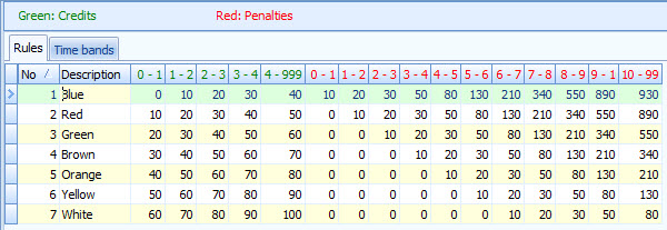
After you finish your \"Charcoal-O\" course, the points will be calculated and start time for the Sprint-O course assigned in such manner that it will be almost another mass start with the leaders going out first and the rest catching them. The first person crossed the finish line will be a winner of 2014 President\'s Cup.
Beginner and Intermediate are standard point-to-point courses derived from control locations used for the \"Charcoal-O\" and Sprint-O courses. For this event maps will be printed at 1:5,000 scale (laser printed at Staples).
There will be no water stops on the course.
Courses Information:
| Course | Distance | Climb | Ctrls |
|---|---|---|---|
| SprintO | 2.20km | 20.0m | 10 |
| Score-O | 3.40km | 110.0m | 18 |
| Beginner | 1.90km | 40.0m | 9 |
| Intermediate | 2.50km | 85.0m | 11 |
Course Setter: Zachary Barker
Directions: From US30 East (White Horse Pike) in Hammonton take SR-542 (Pleasant Mills Rd.) toward Batsto, follow SR-542 north-east for about 7mi and watch for O'-signs.
ED/CS Notes:
The South Jersey area has only had moderate accumulations of snow. Unless we get a large snowfall the week before, the terrain will be snow free. The event site is compact with registration, start and finish just 50 meters north of the packing area. Restrooms will be just south of the packing area at the Batsto Village Ranger Station.
Regular DVOA hours will be effect with starts between 10:00 and 1:00. We ask that all competitors plan to finish their courses by 2:30 so we can remove all controls from the woods by park closing time at 5:00.
The courses are typical Batsto courses with lots of blueberries and some green briar. A rich trail network provides for excellent novice courses. The map features few but very accurate contours. The vegetation features are growing older but are still accurate.
Courses Information:
| Course | Distance | Climb | Ctrls |
|---|---|---|---|
| White | 2.90km | 45.0m | 11 |
| Yellow | 3.30km | 50.0m | 11 |
| Orange | 5.00km | 85.0m | 13 |
| Brown | 5.20km | 95.0m | 15 |
| Green | 7.10km | 110.0m | 14 |
| Red | 8.20km | 110.0m | 17 |
| Blue | 10.50km | 140.0m | 20 |
Course Setter: Mary Frank
Notes: Indoor beginner program at 10, followed by a white course at 11.
Directions: Rt 625 South of Reading, about 2 miles south of the Jct of 625 and 724
Course Setter:
Notes: The results from this event will count in the DVOA club rankings
Directions: From Lancaster follow Rt. 30 West to Rt. 24 North (Mt. Zion Rd.). Take Rt. 24 north to top of hill and make a right onto Deininger Rd. Watch for O'-signs.
ED/CS Notes:
Looks like the area avoided most of the latest big storm. Here is a start on some \\\"course setter notes\\\":
- There is still likely to be snow (ice) on the ground. When I was there Feb 26 it was about 8 inches.
- There are lots of unmapped mountain bike trails, though these might be under the snow and hard to see in many cases.
- There are also large logged areas that are not mapped. The courses in general avoid these areas so they are unlikely to be too big a problem.
Courses Information:
| Course | Distance | Climb | Ctrls |
|---|---|---|---|
| White | 2.40km | 45.0m | 0 |
| Yellow | 2.90km | 60.0m | 0 |
| Orange | 4.40km | 110.0m | 0 |
| Brown | 3.70km | 120.0m | 0 |
| Green | 4.80km | 165.0m | 0 |
| Red | 6.80km | 180.0m | 0 |
Course Setter: Scott Thatcher
Notes: DVOA\\\'s St Paddy\\\'s Day comes a day early this year.
Directions: From US Rt. 30 Bypass north of Coatesville, take PA Rt. 82 north. Watch for left turn at top of hill. Follow O'-signs.
Courses Information:
| Course | Distance | Climb | Ctrls |
|---|---|---|---|
| White | 1.80km | 40.0m | 10 |
| Yellow | 2.50km | 46.0m | 10 |
| Orange | 4.00km | 95.0m | 11 |
| Brown | 3.30km | 67.0m | 12 |
| Green | 4.40km | 153.0m | 15 |
| Red | 6.10km | 171.0m | 21 |
Course Setter: Samuel Kolins
Notes: Rt 117 is closed West of Mt Gretna for bridge construction
Directions: From the PA Turnpike, go South from the Lebanon-Lancaster exit of PA TPK on route 72. Turn West on Cider Press Road then North on Pinch Road. (From Rt 30 in Lancaster go North on Rt 72 through Manheim and another 3+/- miles to Pinch Road.) Follow Pinch Road to the event site. Look for entrance shortly after crossing over the Turnpike.
ED/CS Notes:
The courses will spend most of the time in the northern section of the park. This area is composed mainly of hillsides with only a few large terrain features, but many smaller terrain features and lots of platforms, rocks and other point features. There is a lot of white woods with good visibility this time of year though the travel is slowed in spots by patches of vegetation and moderately rocky ground underfoot (and hopefully not too much snow). The vegetation mapping is still pretty accurate and rootstocks on the map are still clearly visible in the field (though there are also a fair number of new, unmapped downed trees). The trails on the maps are pretty clearly visible and blazed.
All roads and trails along the edges of the maps are in-bounds. However, there are a number of houses on the edges of the map. Please respect these homeowners by not running through their yards. In most cases you would only run into a yard if you were off course. There is one location on some advanced courses where possible route choices take you near houses; in this case the houses are marked as out of bounds on the map.
Registration is on the porch of the environmental center, right next to the parking lot. The start is about a 400-500 meter uphill walk from registration. Water will be provided at the start location (in addition to the usual water on the course).
RED and BLUE: The red and blue courses will also travel to the south-east side of the main ridgeline running through the park. As part the park’s forest management plan, there are a couple areas that you may run into where trees were cut this winter. The affected areas will be outlined in red on your map. These areas are not out of bounds, but most route choices avoid the cut areas, and there are fair number of branches down so travel through these areas would be slow. The boundaries for these areas are a bit rough, but I tried to be fairly accurate in drawing the locations of the boundaries you would be likely to encounter on the course. All trails remain open and unaltered. Red lines crossing trails on the map represent new jeep trails that were created in order to carry out the cutting operations. There are additional new logging areas (small clear cut areas) in the far eastern part of the map that you should not reach unless you are very far off track.
Also note that the southeast side of the park is much rockier than the northwest side, so the standards for what stony ground and boulders get mapped are very different, and travel through rocky areas can be slower.
Courses Information:
| Course | Distance | Climb | Ctrls |
|---|---|---|---|
| White | 2.00km | 50.0m | 10 |
| Yellow | 3.00km | 125.0m | 11 |
| Orange | 4.30km | 150.0m | 10 |
| Brown | 4.00km | 85.0m | 10 |
| Green | 5.60km | 175.0m | 13 |
| Red | 7.00km | 175.0m | 14 |
| Blue | 8.90km | 290.0m | 18 |
Co-Director: Mark Frank
Course Setter: Mark Frank Co-Setter: Mary Frank
Notes: Indoor instructional program followed by a white course
Directions: From the PA Turnpike, go South from the Lebanon-Lancaster exit of PA TPK on route 72. Turn West on Cider Press Road then North on Pinch Road. (From Rt 30 in Lancaster go North on Rt 72 through Manheim and another 3+/- miles to Pinch Road.) Follow Pinch Road to the event site. Look for entrance shortly after crossing over the Turnpike.
ED/CS Notes:
This class will introduce you to the sport of orienteering and answer your questions. You\\\'ll learn what equipment you need and how to use your map and compass correctly. Most importantly you\\\'ll discover how fun orienteering can be!
W Y O Br G R
Volunteer to help at this event
Course Setter: Ed Scott
Directions: Follow Rt.23 to PA Rt.345, take Rt.345 north and watch for O'-signs, or from Rt422 take 82 into Birdsboro and follow 345 to park.
ED/CS Notes:
French Creek West was first used for the 1982 US Championships. The original mapper suggested mapping of the charcoal terraces since much of the terrain was relatively bland, and in some areas point features were nonexistent. Since then, thousands of Orienteers have had varying levels of success in finding these little flat spots in the woods. Sunday is the day to become an expert in finding them. All courses Orange and above will see lots of charcoal terraces. White and Yellow will see many less.
The current 2002 map now has a few problems caused by some extra blackberry briars and some minor trail relocations. The old trail beds are still visible, but not maintained and the new trails are parallel to them, often within sight, but sometimes not. One small trail that is necessary for White, is difficult to see and has been streamered (yellow streamers). It includes two small detours around fallen trees.
Success on the advanced courses will require careful navigation and the willingness/ability to make mid-leg adjustments to the initial game plan.
I have to leave early on Sunday, so if you want to shoot the course setter you will have to start early and run fast.
Here are the course notes that will be posted at Registration.
COURSE SETTERS NOTES FCW 3/30/14
White: Note that control #60 is both White 3 and White 7. Be sure to punch #60 as control 3, then do 4, 5, & 6 in the proper order; then punch #60 again as control #7 before going to #8.
The route from 3 to 4 is streamered with yellow ribbons as the trail is indistinct and has a couple trees down near each end.
Yellow: The clusters of Group Camp cabins each now have a large toilet and shower room. These buildings are not on the map. The original small cabins are marked accurately and the main road connecting them has not been altered.
Orange: Control 3 will have drinking water. It was not in the original plan so is not on the clue sheet.
Orange & Advanced:
The green areas of the map tend to be of the thorny variety. Pick your battles carefully. When I put out the ribbons I did use the compass a lot and did lots of straight line walking to be sure I had the correct feature. It wasn’t much fun. But while hanging the flags I kept the compass in my pack, my head up, and navigated around the briars to the ribbons with little difficulty.
There are a couple trails that have been rerouted to avoid wet or overused areas. They tend to be close to the original trail. The only one near a control is on the approach to BLUE #3, Control #39. The blue blazed trail is following the property line marked on the map while the overgrown trail runs more or less parallel a few meters to the south. As far as accessing the control, this is a good thing.
Courses Information:
| Course | Distance | Climb | Ctrls |
|---|---|---|---|
| White | 2.70km | 85.0m | 9 |
| Yellow | 3.10km | 110.0m | 7 |
| Orange | 4.80km | 135.0m | 7 |
| Brown | 4.70km | 140.0m | 7 |
| Green | 5.60km | 180.0m | 8 |
| Red | 6.60km | 175.0m | 9 |
| Blue | 8.20km | 205.0m | 11 |
Course Setter: Mary Frank
Notes: Beginner program at 10, followed by a white course at 11.
Directions: From King of Prussia follow US 422 west to Oaks Exit. At the bottom of the ramp turn right at the light then make another right at the next light. Follow O-signs to parking. From Pottstown follow US 422 east to the Oaks Exit. Stay right at end of ramp and yield on to Egypt Road. Go under 422 and make a right at the 2nd light (before crossing bridge). Follow O-signs to parking.
Course Setter: Mary Frank
Directions: Follow PA Rt23 to Knauertown and watch for O'-signs
ED/CS Notes:
Courses Information:
| Course | Distance | Climb | Ctrls |
|---|---|---|---|
| White | 2.10km | 30.0m | 10 |
| Yellow | 2.20km | 40.0m | 9 |
| Orange | 4.40km | 90.0m | 17 |
| Brown | 3.60km | 40.0m | 11 |
| Green | 4.50km | 125.0m | 16 |
| Red | 5.80km | 190.0m | 19 |
Course Setter: Steve Aronson
Directions: Exit Rt 22 at the Schoenersville/378 south exit. Use the Schoenersville ramp, and then turn left. Pass the Hospital on the right, left on Illicks Mill Rd, or from the south on 378 exit on 8th street North, Left on Schoenersville, Rt on Illicks Mill Road.
Courses Information:
| Course | Distance | Climb | Ctrls |
|---|---|---|---|
| White | 2.00km | 27.0m | 11 |
| Yellow | 2.70km | 33.0m | 15 |
Course Setter: Mary Frank
Notes: Beginner program at 10, followed by a white course at 11.
Directions: From Rt. 202 take Paoli Pike exit west to West Chester, left onto High St. then three blocks to a right on W. Miner St. W. Miner St. becomes Rt. 842. Follow Rt. 842 west for about 6 miles to Brandywine Valley Association Myrick Center.
W Y O Br G R Bl
Volunteer to help at this event
Course Setter: Bob Burg
Notes: Event center is at the pavilion near the parking area at the Pond.
Directions: From Junction of NJ70 and NJ72 go SE on NJ72 and look for O signs
ED/CS Notes:
Event Director/Course Setter Notes:
New Jersey’s Pinelands terrain is calling you – wonderful pine and oak beauty in complicated but subtle low rolling hills full of just blooming blueberry/huckleberry undergrowth. Along with Batsto, the most unique terrain in DVOA-land. Come run in the woods on Saturday (no steep climb, no stony ground), then enjoy the holiday on Sunday.
Along with superb pineland courses, we will also be featuring an Easter Egg hunt on all courses, White through Blue. Of course, White and Yellow will have the most treasures to scoop up, but all of you can slip an egg into your orienteering suit if you can fit it somewhere (don\'t worry, the eggs are plastic) and have a little one who would love you for it.
Mid-April, we promise wonderful weather (winter a long gone memory), and great courses that will gently (but seriously) challenge your orienteering acumen. We will be staging the event from actual Pakim Pond (not just the title of the map) for the first time in a decade. With thick green vegetation surrounding the pond, courses have dictated a 1k walk to start (all flat terrain), and (yes, I’m sorry) a 750m walk from Finish back to Download, to cool you down (again in all flat terrain).
Come enjoy South Jersey\'s best,
Bob
Here are the course statistics with comments:
White – 2.26k – 15m – 10 controls
A nice easy course along trails that will carry you through the woods, with a few route choice options, and some Easter Egg controls to surprise you along the way. Enjoy the unique beauty of the Pinelands, solo or in groups.
Yellow – 3.03k – 20m – 11 controls
Ranging a bit further out, with a several cross-terrain options and more complicated route choices appropriate for advanced beginners…and of course Easter Eggs!
Orange – 4.30k – 43m – 11 controls
Orange veterans, get ready to run through blueberry/huckleberry…or take the long way around on trails, your choice. This course will test your cross-terrain skills with simple enough control locations, with longer safer options for those new to Orange. Just take care to see all your options...and choose wisely.
Brown – 3.50k – 35m – 11 controls
A short Brown. But with the undergrowth, you’ll be happy with the length. Lots of challenging short and medium advanced legs and terrain, rewarding alert direct navigation in criss-crossing legs. I’m particularly pleased with this course, and would love to hear your feedback when you come in.
Green – 5.47k – 60m – 11 controls
I stretched out the distance a little so that you can share the first half with Red and Blue. This is the course I’m hoping to run myself if all the logistics are going well. A flat-out advanced course that will offer great terrain and smart route choice to match your skills to. With a mix of long and short legs.
Red – 8.10k – 84m – 18 controls
Lots of room to stretch your legs out…with much of the course shared with Blue (and Green) for sharing notes after Finish. With a good variety of short, medium, and long legs, I’m hoping you return with much to talk about (and praise) – ”How many fire ditches did I actually pass before I realized what was happening?....”
Blue – 10.60k – 100m – 23 controls
Lots and lots of room to stretch your legs out, then quick clusters of short turn-around legs….with fire ditches and trails to boggle your mind and cross-terrain options to test your map-reading – all in a narrow area that requires length-wise criss-crossing where you will see the same terrain from every angle. So eidetic memory is a plus. :)
Courses Information:
| Course | Distance | Climb | Ctrls |
|---|---|---|---|
| White | 2.60km | 15.0m | 10 |
| Yellow | 3.03km | 20.0m | 11 |
| Orange | 4.30km | 43.0m | 11 |
| Brown | 3.50km | 35.0m | 11 |
| Green | 5.47km | 60.0m | 11 |
| Red | 8.10km | 84.0m | 18 |
| Blue | 10.60km | 100.0m | 23 |
Course Setter: James McGrath
Notes: OUSA A Event. Relays only today. Pre registration is required. Visit the Event Page for more info and registration
Directions: West of Newark Delaware on 273, or East from the crossing of 272 and 273. Look for O Signs.
Course Setter: Tom Overbaugh
Notes: OUSA A event. Preregistration required for all A event courses. There will be day of event signups for Recreational White and Yellow courses only. Visit the Event Page for more info and registration
Directions: From PA Rt 1 take PA Rt 896 south toward Newark, DE and watch for O'-signs, or from I-95 take DE 896 North to park.
W Y O Br Score-O
Volunteer to help at this event
Course Setter: Mark Frank
Notes: MASOC 26 Scout event. Preregistration required. Download information and entry forms at http://www.scoutorienteering.com/masoc_downloads.htm information and entry forms
Directions: Follow PA Rt.23 to Rt.345, take Rt.345 north and watch for O'-signs.
W Y O Br G R
Volunteer to help at this event
Course Setter: Mark Frank
Directions: Follow PA Rt.23 to Rt.345, take Rt.345 north and watch for O'-signs.
ED/CS Notes:
Courses Information:
| Course | Distance | Climb | Ctrls |
|---|---|---|---|
| White | 2.80km | 40.0m | 10 |
| Yellow | 3.40km | 70.0m | 10 |
| Orange | 4.20km | 110.0m | 9 |
| Brown | 4.10km | 95.0m | 11 |
| Green | 5.50km | 145.0m | 11 |
| Red | 7.60km | 225.0m | 11 |
Course Setter: John Campbell
Directions: South side of Germantown Pike, midway between 202 and 363, just east of the crossing with Whitehall Road.
ED/CS Notes:
This is a golden opportunity to celebrate Mother’s Day with the family in the park.
The park is suddenly turning green after a long winter. That said visibility is still good in the woods so some of the subtlety in vegetation changes is a little vague. There are also a few new trails in places which are not on the map.
The green and red courses will have a stream crossing – The river was down far enough from last week major rainstorm and flooding that I had no problem crossing the river last Saturday while checking control locations.
Areas of Out of Bounds:
There are several areas of Out of Bounds. These are all marked on the map with a vertical pink/purple lines. Some areas the out of bounds is obvious when you get there, the fence around them is a deer fence, i.e. a good 7-8 feet tall – DO NOT ATTEMPT TO CROSS FENCE.
There is an area to the south of the Shannon Mansion / Getty Cottage where there is a crop of Oil seed rape (bright yellow flower) which is noted as Out of Bounds. Please observe this Out of Bounds as you will be disqualified, but more important you put further use of the park in jeopardy.
There are also two old road bridges which cross the railway track. These are unsafe and fenced off and must not be used. Also the railway bridge over the Creek at the NE end of the map is Out of Bounds. These are noted on the map with a pink/purple X.
Courses:
White Course: The white course with the exception of a short distance from the start and a short distance to the final control and finish is all on a paved road, so if anyone wants to bring a stroller etc., the surface is perfect. In order to have the course all on paved road, the length is slightly longer than a typical white course.
Courses - General:
I have planned the courses to make best use of the area as much as possible and provide some route choice. In order to do this some of the course lengths vary a bit from normal. That said the park is very open.
Courses Information:
| Course | Distance | Climb | Ctrls |
|---|---|---|---|
| White | 3.80km | 45.0m | 12 |
| Yellow | 3.70km | 45.0m | 11 |
| Orange | 4.10km | 55.0m | 14 |
| Brown | 4.00km | 60.0m | 11 |
| Green | 5.70km | 95.0m | 16 |
| Red | 7.20km | 105.0m | 18 |
Course Setter: Rick Whiffen Co-Setter: Ron Cook
Directions: North on I 95 to the intersection with I 295. Follow I 295 East and exit at exit 8 and go west on PA 332. Go straight 4.7 miles, and in that stretch 332 becomes Route 413. Where Rt 413 makes a sharp right turn, you will instead be turning left at that light into the main Park entrance. Watch for O-signs.
Course Setter: Steve Aronson
Directions: Use the Bethlehem Rte 412 exit from I78. Take Silvex road (between the Wendy's and the Turkey Hill) to College Ave. Bear left onto College and go to the end. Turn right on South Mountain Drive. Bear left at the next two triangles, South Mountain Park will be on the left.
ED/CS Notes:
By now you are all wondering what the heck Aronson has planned for this weekend. Well you are right, I have gone to great trouble to drive you all nuts.
The first thing you need are driving directions to get here. So...., If you are coming from the south you may choose to use the NE Extension to the Allentown exit, Travel East on Rt.22 for less than half a mile, head south on Pa 309 and merge with I78. Those of you coming from the West will probably already be on I 78. Go to the Bethlehem Exit at Pa 412. Turn right at the base of the ramp, travel under I78 and turn left between the Turkey Hill and the Wendys. BTW The name of the park is South Mountain Park in Bethlehem. That may work better in your GPS
Those of you coming south will be useing Rt33 until you meet I78 west. You will then merge with the eastbound traffic from New Jersey. You will also use the Pa412 Bethlehem exit, but you will go straight at the bottom of the ramp, and join the others between the Turkey Hill and the Wendys.
Silvex Road will weave under the interstate to a triangle. Turn left onto College Avenue and drive to the end. Turn right onto South Mountain Drive and head up the hill. There will be two forks in the road, and you should bear left both times. We will be on the left, across from the abandoned TV studio.
I have to thank Petr Hartman for all of his time and effort. He has added over 400 rootstocks to the map (many with the tree fall), as well as removing a house, adding a half dozen new condos, widening some roads and fire lanes and adding new trails where they have appeared. He has even added the permanant orienteering markers that the ROTC has placed in the woods. This map is absolutley up to date.
Today\\\\\\\\\\\\\\\\\\\\\\\\\\\\\\\'s specialty ala carte
Now that you have made the trek, and climbed all over the hillside, we have a special treat for you. For an additional two dollars, we have a 2.0K course printed on a two color, contour only map. With only 40 meters of climb, you should be able find your way around the top of the hill in a new and challenging way. Since this will not count for the rankings there is no reason for you not to give it a try. There is no better way to improve your skills than to take this unique challenge.
Courses Information:
| Course | Distance | Climb | Ctrls |
|---|---|---|---|
| White | 1.30km | 30.0m | 8 |
| Yellow | 2.60km | 85.0m | 10 |
| Orange | 2.60km | 85.0m | 8 |
| Brown | 3.00km | 95.0m | 8 |
| Green | 5.90km | 200.0m | 12 |
| Red | 8.00km | 270.0m | 15 |
| Blue | 8.90km | 285.0m | 18 |
| Special | 2.00km | 40.0m | 7 |
Course Setter: Wyatt Riley
Directions: From the North take Rt 82 south to Rt 282. Follow 282 south and look for O signs at the junction with Springton Road. From the south take Rt 282 north from Downingtown to the intersection with Springton Road and follow the O signs.
ED/CS Notes:
Come on out! Weather looks solid, and we especially hope you like the course design - a collaboration between Bob Agusta, who\'s recent experience rising up from White through Orange was paired with Wyatt Riley\'s years of experience, incl. just 5-weeks after this event, representing DVOA & the USA at the 2014 World Championships in Italy.
And if that\'s not enough, we have what may be a US (or World?) first: In addition to the regular courses, we have an extra short course available (~Yellow level) - that is only available as a .pdf on your favorite internet-connected device.
Course Notes:
Safety first
- The park entrance to parking lot road is crossed by all courses - often more than once - cross with care.
- There\'s a modest amount of poison ivy scattered about in the deeper grass areas, and some of the forest - almost always below knee height. There are indoor restrooms with running water & soap right next to the finish if you\'re sensitive.
- As usual, there may be ticks out. Spray & check!
Map notes
- There are several out of bounds areas marked on the map with vertical purple overprint - which are farm animal pens, or just-sprouting corn fields. You are required to go around these - yes, through the deep grass, not the short corn. They are easy enough to avoid if you look ahead on the map.
- Some of the vegetation details have changed a bit - as happens rather quickly when it is mapped to 1:5000 detail. It has been updated somewhat in the vicinity of controls, and near several potential route choices, but don\'t expect it to match quite as well as it did in 2011.
- Last weekend’s courses at Star Village - with many controls in depressions - reminded us of the importance of finding the feature, not just looking for a flag. With the leaves finally out, after our late Spring, limited forest visibility will require similar skills here at Springton Manor.
Course notes
- Check your codes - at the 1:5000 scale, controls are often nearby.
- Watch your lines and take controls in order - due to the small scale, some longer courses have criss-crossing lines. Cross-overs: Orange (1), Green (3), Red (11 times!)
- E-map course - Bring your smart-phone or connected tablet - and you can try the (1.3km) pdf course after you finish your regular course - _only_ available electronically, as a .pdf you will get the full URL to, just after you punch start.
THe URL is http://goo.gl/mA19?? (with the last two characters only provided to you, when you start.)
Pinch-zoom-in as much as you like.
(All the regular White-Red courses remain, as usual, on paper only)
Courses Information:
| Course | Distance | Climb | Ctrls |
|---|---|---|---|
| White | 2.00km | 42.0m | 12 |
| Yellow | 3.30km | 104.0m | 13 |
| Orange | 4.90km | 129.0m | 18 |
| Brown | 3.60km | 93.0m | 14 |
| Green | 4.90km | 132.0m | 13 |
| Red | 7.30km | 186.0m | 21 |
| Special | 1.30km | 33.0m | 11 |
Course Setter: Zachary Barker
Notes: Scout leaders must Pre-register their unit using the forms found at www.scoutorienteering.com. No Dogs are allowed on the property. DVOA and USOF members do not need to pre-register
Directions: From N & W: NJ Turnpike Exit 8 to Rt 33 East for 5 mi. Rt 527Alt North/Iron Ore Rd. From E: Garden St Pkwy Exit 100A to Rt 33 W for 16 mi. to Rt 527Alt/Iron Ore Rd. Then North 1/4 mile on 527Alt to Quail Hill sign, turn right onto Le Valley Rd into camp.
ED/CS Notes:
Quail Hill Course 2014 Notes:
Quail Hill adds a $1 surcharge per map above the listed DVOA fees.
- The QH camp entrance to parking lot road is crossed by all courses - often more than once - drive with care & cross with care. Early drivers will park in the middle Quail Lots, later arrivals after 11:30 may park in a further lot (a slightly longer walk to start) Follow the DVOA directional signs to parking.
There is some poison ivy scattered about in the deeper grass areas, and in some of the forest - almost always below knee height. There are indoor restrooms with running water & bring your own soap and clean up right next to the QH finish if you are sensitive. Ticks are out. Spray & check!
This year the power line along the East edge of map is now a potential route choice like it used to be a few years ago.
Map notes: Be sure to Check the map posted at Registration.
There are several out of bounds areas marked on the map with vertical purple or black overprint. These include some private homes, the camp rifle range and other areas the camp has deemed as out of bounds. 12 or more campsites in the early starts may contain campers and tents which must be avoided. Tents are usually struck just before 11 am so and will not be an issue for later runners. There is a Cub Scout Wagon event in the camp, you can use the main road to bypass this activity but please avoid any small groups of Scout Wagon trains - they are learning new Scout life skills in the field near the Rifle and archery range. On the other hand, the Laser Tag area that we haven't been able to use in over 7 years is now in bounds and the course setter may have you visit this "new" wooded hillside terrain. It adds about 10% more runnable area to this camps turf.
Some of the vegetation details have changed a bit - as happens rather quickly on 1:5000 maps. It has been updated somewhat in the vicinity of the Power Line right of way, and near several potential route choices, but don't expect it to match quite as well as it did in 2012. A new foot bridge has been added to the map. New rootstocks have appeared, and older ones are deteriodrated. Most of the damage sustained during Hurricane Sandy has been cleaned up.
Please remember, Dogs are not allowed in this Private camp.
Have fun, come join in the Map Magic & Fun at Quail Hill #13. Volunteers still needed, especially early trainers. Enjoy - ED, Bob R
Courses Information:
| Course | Distance | Climb | Ctrls |
|---|---|---|---|
| White | 2.40km | 65.0m | 13 |
| Yellow-X | 2.70km | 100.0m | 14 |
| Yellow-Y | 3.80km | 115.0m | 19 |
| Orange | 5.40km | 175.0m | 16 |
| Brown | 4.20km | 150.0m | 12 |
| Green | 6.00km | 160.0m | 17 |
| Red | 7.60km | 215.0m | 19 |
| Blue | 9.80km | 305.0m | 25 |
W Y O Br G R
Volunteer to help at this event
Course Setter: Ed Scott
Notes: The almost one kilometer walk to start is a bit of an adventure with two creek crossings. Wire bridges are available for those that are able to reach the wires, or you may cross at a shallow spot for those that choose to stay on the ground. You can bring old shoes to wade across and change into your O shoes before you start. Someone will move them to the finish area while you are out on the course. Use the directions to the Birdsboro Rustic Picnic area where we have reserved a pavilion. Course data will be available soon. They are just a little shorter than normal to make up for the long walk to start, but be ready for a bit of climb. Parking: There are lots of activities here on weekends. We will be sharing the parking area with rock climbers, dog walkers, and other casual hikers. Last weekend there were 4 horse trailers that took up a lot of room. Come early. If the lot is full, there is another parking area on the same street but closer to town at a ball field. It is not reserved for anyone so get there before game time and grab your spot. If you park there go under the RR tracks at the NW end of the lot and walk upstream through the park until you find us. Use the \\\"North Side\\\" directions that appear below. We are NOT at the Kulptown Firehouse this time. Remember that clicking on the map name will give you both a locator map and a set of GPS coordinates for the parking area.
Directions: Kulptown Fire Company: 1082 Chestnut St (Route 345), Douglassville, PA 19518. From Rt 422 to Rt 345 South From Rt 23 to Rt 345 North.
Courses Information:
| Course | Distance | Climb | Ctrls |
|---|---|---|---|
| White | 2.00km | 80.0m | 8 |
| Yellow | 2.90km | 110.0m | 8 |
| Orange | 4.50km | 195.0m | 9 |
| Brown | 4.10km | 180.0m | 9 |
| Green | 4.90km | 215.0m | 10 |
| Red | 6.30km | 235.0m | 14 |
Co-Director: Dave Urban
Course Setter: Dave Urban
Directions: From Exit 26 of the PA Turnpike follow PA Rt. 309 south to Rt. 73. Take a right onto Rt. 73 and follow it north and west and watch for O'-signs.
ED/CS Notes:
General
We will be using the western part of the map and not crossing busy Joshua Road. This map was last updated in 2008 and nature and PA parks have made some changes since then. Start, Finish, and Registration are at the North end of Parking Area #3. There are improved facilities nearby and throughout the park. Enter the park from Joshua Road.
Course Information
Maps are 1:10,000 with 5M contours. Loose control sheets will be available at registration. Course lengths are on the short side – this is a good opportunity to move up and/or run an additional course. There are many controls set in a small area – check the numbers. The mapped green areas are very green. The line in the SE <> NW power line has gone missing. The poles are still there and easy to identify. There is no need to cross any fence. Rootstocks are unreliable and are not used for controls. Using rootstocks for navigation is at your own risk. A new pavilion near the start is not mapped, and at least one old restroom is gone.
White – some of the mapped trails are mowed paths through open fields. These will be streamered where necessary.
Yellow – some route choices and more climb than White. Pay attention to the control numbers. Double check the feature.
Orange – good variety (for the park) of features used. Some subtle route choices and long runs offered.
Brown – check the control numbers.
Green – check the numbers. There are some crossing legs to get distance for this short Green course.
Park Use
There is a Hawk Observation Deck, Disc Golf, and Picnic areas available. There are cooking grills near the Registration/Finish areas. Pets are permitted and must be leashed. We expect a good number of “non Oers” in the park. Respect the areas around the pavilions. We will not make friends running through the middle of someone’s graduation picnic.
Safety
There will be a number posted at the start for Emergency use only. Cell phones are not permitted for navigational use. Do not cross any “non Park road”, railroad track, or stream. Watch out for car traffic on the park roads.
Meet-Up
Feel the need to chill out with a cold one and talk about your route choices? Catch the end of the Phillies game? Ma Gerks, 582 S Bethlehem Pike, will seat us in close proximity. Just mention Orienteering and Ft. Washington park at the door.
Courses Information:
| Course | Distance | Climb | Ctrls |
|---|---|---|---|
| White | 2.20km | 50.0m | 13 |
| Yellow | 2.80km | 75.0m | 12 |
| Orange | 3.10km | 110.0m | 14 |
| Brown | 3.40km | 90.0m | 11 |
| Green | 4.50km | 115.0m | 14 |
W Sprint-O Special
Volunteer to help at this event
Course Setter: Erik Eddy
Notes: Courses open to public: starts for team bike-o and beginner White course between 10-11, and mass start Sprint course at 12:30. Please see course setter notes. Club Summer Picnic and meeting to follow courses. Join us! Pre-registration is not required, but is appreciated due to the uniqueness of the event. No money or commitment is required, just send a note to vicepresident@dvoa.org, including possible teammates for bike-o
Directions: From King of Prussia follow US 422 west to Oaks Exit. At the bottom of the ramp turn right at the light then make another right at the next light. Follow O-signs to parking. From Pottstown follow US 422 east to the Oaks Exit. Stay right at end of ramp and yield on to Egypt Road. Go under 422 and make a right at the 2nd light (before crossing bridge). Follow O-signs to parking.
ED/CS Notes:
2014 VP Cup contested on a new map
------
Pre-register HERE AND
Form BIKE-O HERE! Bike-O_Friend_Finder
-----
Duathlon Orienteering Challenge (Interval starts 9:45-11): The paved trail (~5 miles) that encompasses JJ Audubon and Lower Perkiomen Valley park provides a perfect opportunity to include bikes in orienteering. Competitors will ride in teams of 3 picking up controls along the path. Bikes will be dismounted at 3 stops, where 1 member of the group will pick up several land controls (3 stops will have 3 different difficulty levels). Open, Masters (combined age 165), Non-Competitive, and Family divisions
Mass Start Sprint (12:30PM): Staged in the Perkiomen Valley Park this Sprint will be very spectator friendly. The Sprint will use different combinations of 3 short loops returning to start so that a mass start is possible. The course will be 3.0 km contested in fields and some woods. Pre-registration required by 11:30 AM.
Potluck Lunch: Immediately following the Sprint. We will have the main pavilion with opportunities for other fun at the park (volleyball, tether ball, horseshoe). Summer Meeting will follow the lunch social. Please bring a dish to share.
Courses Information:
| Course | Distance | Climb | Ctrls |
|---|---|---|---|
| White | 1.80km | 10.0m | 10 |
| SprintO | 3.00km | 25.0m | 16 |
| Special | 10.00km | 0.0m | 30 |
W Y O Br G R Bl
Volunteer to help at this event
Course Setter: Robert Meyer
Directions: Follow Rt. 23 to PA Rt. 345, take Rt. 345 north and watch for O'-signs
Courses Information:
| Course | Distance | Climb | Ctrls |
|---|---|---|---|
| White | 2.29km | 65.0m | 7 |
| Yellow | 3.55km | 85.0m | 11 |
| Orange | 4.56km | 95.0m | 10 |
| Brown | 3.99km | 95.0m | 8 |
| Green | 5.46km | 120.0m | 11 |
| Red | 6.60km | 150.0m | 13 |
| Blue | 9.13km | 250.0m | 12 |
Co-Director: Karl Ahlswede
Course Setter: Sandy Fillebrown
Directions: Part of Hickory Run State Park. West of the office and on the South side of Rt 534.
ED/CS Notes:
Start and Finish are close to parking.
White Course:
- Because of the lack of a substantial trail network, the white course doubles back on itself and is a little longer than usual. In addition, some of the trails are narrow and occasionally you will encounter branches and small seedlings that have grown across the trail. They are easy to get past but make the trail a little difficult to see in spots.
Yellow Course:
- The Yellow course also doubles back on itself. There are a few opportunities for going through the woods without a feature to follow, but there is always an alternative: a safer but longer route that goes around. The course makes use of several rough open areas that have a lot of low growing bushes and ferns making for a somewhat physically challenging course. Full leg covering is highly recommended.
Orange and Advanced:
- There are lots and lots and lots of unmapped dot knolls, small depressions and broken ground all over this map. In some cases it’s not clear to me why the mapper mapped some and not others. Where they have been used as control locations, there are other features that should get you to the correct spot and I’ve placed the controls where you should be able to see them from a good distance away.
- The ferns have grown substantially between when I set the courses and now so you will definitely encounter lots of ferns. However, I’ve stayed out of most of the really bad areas so you can usually see the ground through the ferns making it easy to avoid rocks and fallen trees. But, your routes might be different than mine so there are no guarantees.
- Also, the maps and control descriptions were printed before the stakes were put in. On a few controls, the location (which side) might be a little off depending on where I could get the stake into the ground.
- Some of the open areas now have grasses with very sharp seed pods that hook onto and then work their way through socks and shoe fabric. You might want to consider gaiters or duct taping the tops of your shoes.
EVERYONE: Check carefully for ticks when you are done. I have found a few after every outing.
Courses Information:
| Course | Distance | Climb | Ctrls |
|---|---|---|---|
| White | 3.20km | 100.0m | 13 |
| Yellow | 3.50km | 120.0m | 13 |
| Orange | 4.60km | 150.0m | 12 |
| Brown | 4.20km | 105.0m | 10 |
| Green | 5.50km | 125.0m | 12 |
| Red | 7.20km | 160.0m | 15 |
| Blue | 9.10km | 190.0m | 17 |
Course Setter: Roger Hartley
Directions: On Rt313 between Doylestown and Quakertown, go north on 563, look for signs to the right.
ED/CS Notes:
Directions:
After turning off Rt563 at the Park Office, follow the Orienteering signs to Parking Area 12.
Notes:
DVOA has now received permission for the event.
The White and Yellow courses will be a little shorter than usual. As usual, instruction will be available.
As Nockamixon’s woods in summer are unpleasant, Orange will basically be a varied trail run on clearings, trails and the bike path.
Come out and enjoy this excellent Park. After going out on a course, you could:
a. Have some free ice-cream at the Finish.
b. Cycle the bike paths. (Two bikes will be available to borrow.)
c. Go for a swim at the large pool in the Park. ($7)
d. Rent a boat from the Park. (Double canoe or kayak, $25/hour)
e. Try some disc golf on the superb course available at the park. (Discs will be available to borrow.)
See you on the 17th.
Courses Information:
| Course | Distance | Climb | Ctrls |
|---|---|---|---|
| White | 2.40km | 45.0m | 11 |
| Yellow | 3.20km | 55.0m | 9 |
| Orange | 3.90km | 65.0m | 13 |
Course Setter: Rob Wilkison
Notes: Start area is at the West end of the map in the State Game Lands parking lot
Directions: Take Northeast Extension of PA Turnpike to I-80 exit. Turn right at light onto PA Rt. 940 and follow west for 3 miles. Go south on PA Rt. 534 and follow O'-signs.
ED/CS Notes:
This event is in Score Orienteering format, which means that rather than going on a pre-set course from point to point, you will receive a map showing a number of controls, which you can go to in any order. The controls have different point values, and competitor is trying to get as many points as possible in a specified amount of time. You must return to the start/finish area at a designated time or face stiff point penalties.
At this event ther will be 25 controls in the woods, all of orange or advanced level difficulty. Each control will have a value of between 3 and 7 points. The value of each control will be based upon the first numeral of the two digit control number. For example control 31 will have a value of 3 and control 63 will have a value of 6.
One additional twist is that instead of having individual starts spread out over a period of several hours, ther will be two mass starts, an early start at 10:30 am and a late start at noon. If you miss the mass start, you can still go out, but you will be treated as if you started with the mass, so that someone who arrives late and goes out at 12:15 pm will still be expected to finish no later than 2:00 pm. The penalty for each minute overtime is 10 points. Control pickup will begin at 2:01 pm.
At the mass start, everyone will be allowed to look at their map 2 minutes before the official start, so try to be ready to go to the start, which is less than 100 meters from the parking area, a least 5 minutes before the mass start.
The event is using the original 1988 Hickory Run map, which has a scale of 1:15,000. Most of the controls are actually in the State Game Lands west of Hickory Run State Park, but some of the further controls are in the Park itself.
Those who were at the meet held in this same area last summer will know that the map has held up very well for its age, but that the vegetation shown is unreliable in some areas, and is generally thicker than shown on the map, although there are still many areas of white woods. The contours and rock features have not changed, but some of the few trails shown in the map have become overgrown, particularly much of the boundary line trail which marked to border between the park and the game lands.
Because of the sparsity of trails and the nature of the terrain, the score course is not suitable for beginners, unless they are accompanied by someone more experienced. In fact this is a good event for groups to go out together, and the mass start means that people should be finishing around the same time, so there should be no long waits for for someone that you traveled with to finish.
An important tip for novice score orienteers is not to try to do to much. It is far better to finish early than try to get \"one last control\" and end up with severe penalties. None of the controls are that close to the start/finish. Ther are few, if any people who will be able to get all of the controls.
There are some streams crossing the area, but they are as low as they ever get and you should not get your knees wet unless you walk through a pool. Some controls are at small ponds, which are currently dry, but they are distinct from the surrounding ground.
Water jugs have been placed at 5 of the controls, but you might consider carrying water so you do not have to visit the water stop controls if there is a more profitable route. Temperatures are predicted to be in the mid-70s with little chance of rain.
Directons: Parking is just off of Pa Route 534 about 1 km south of the Hickory Run State Park exit of I-80 (exit 274) and about 4 miles from the Northeast Extension interchange with I-80. Coming from the Park, the parking area is approximately 5 miles northwest of the Park office on Route 534.
Night-O Beg Int Adv
Volunteer to help at this event
Co-Director: Dennis Porter
Course Setter: Sandy Fillebrown
Notes: Pre-registration is required. Additional information can be found here on the event page.
Directions: Take Northeast Extension of PA Turnpike to I-80 exit. Turn right at light onto PA Rt. 940 and follow west for 3 miles. Go south on PA Rt. 534 and follow O'-signs.
ED/CS Notes:
Our 2014 Annual Training weekend at Hickory Run will be here before we know it. With Labor Day being September 1 the third weekend of September is earlier than usual, September 13, 14, & 15. Registration is now open for all to register for the weekend. There will be all day training for Beginners, Intermediate and Advance runners, Night O courses on Saturday night offering a beginner course, advance beginner course and an Advance course as well. Closing the weekend out with regular courses on Sunday.
PLEASE NOTE: If you are planning to only run the Sunday courses you still must register for the course on the weekend\'s registration page so that we can make sure that we have enough maps for all planning to come. Once up at Hickory Run we do not have the time or equipment to make additional maps and clue sheets. You do NOT need to pre-pay for your map, you can do that upon arrival on Sunday. IF you do NOT pre-register for your Sunday course you will pay the non-member price of $10 and will run on whatever extra maps we have available.
ALSO: Sundays registration closes at 12pm, Noon! We have the entire camp to clean up as well as control pickup and need to exit the camp as quickly as possible.
Hope to see you all at the training weekend. Any questions please contact me.
Janet Porter
Courses Information:
| Course | Distance | Climb | Ctrls |
|---|---|---|---|
| White | 1.75km | 35.0m | 14 |
| Orange | 2.50km | 80.0m | 15 |
| Green | 4.00km | 100.0m | 17 |
Course Setter:
Notes: Pre-registration is required. Additional information can be found here on the event page.
Directions: From the north, take Northeast Extension of PA Turnpike to I-80 exit. Turn right at light onto PA Rt. 940 and follow west for 3 miles. Go south on PA Rt. 534 and follow O'-signs. From the south, take Northeast Extension of PA Turnpike to Rt 903 exit. Turn right on PA Rt. 903. Turn left at the light onto PA Rt. 534 and follow O'-signs. The entrance to the Sand Spring Lake parking area is along PA Rt. 534 Between I80 and Rt. 903.
Co-Director: Dennis Porter
Course Setter: Petr Hartman
Notes: Registration will be closed at Noon. A blue course is offered but the pre-registration form does not allow you to sign up for blue. If you would like to run a blue course and are pre-registering, sign up for red and include a note that says you would like to run blue.
Directions: From the north, take Northeast Extension of PA Turnpike to I-80 exit. Turn right at light onto PA Rt. 940 and follow west for 3 miles. Go south on PA Rt. 534 and follow O'-signs. From the south, take Northeast Extension of PA Turnpike to Rt 903 exit. Turn right on PA Rt. 903. Turn left at the light onto PA Rt. 534 and follow O'-signs. The entrance to the Sand Spring Lake parking area is along PA Rt. 534 Between I80 and Rt. 903.
Course Setter:
Notes: Susquehanna Stumble by SVO. Event director is Brad Whitmore. Pre-Registration is required. Click here for details.
Directions: Go to the Junction of US 209 and PA 739 and look for O signs
W Y O Br G R
Volunteer to help at this event
Course Setter: Mark Frank
Directions: From Rt 23 about 1 mile West of Knauertown ( and Warwiick Park) turn right on Trythall Road. In about a mile and at the T intersection make a Left on Harmonyville Road and follow signs to the parking location on Piersol Road. From the North use Rt 345 South from 422 or 724 South through French Creek to the junction with Hopewell Road at Hopewell Furnace. Turn left on Hopewell Road, then in just over a mile turn right on Piersol Road.
W
Volunteer to help at this event
Co-Director: Larry Geist
Course Setter:
Notes: DVOA will be offering a beginner instructional program starting at 11AM. The program, just like all our events, happens rain or shine except under extreme emergency conditions.
Directions: From I-476N use exit 18A to Ridge Pike, go southeast. From I-476S exit at 18B and use the U turn at Allanwood. From I-76 use exit 338 Green Lane, follow N to left turn on Ridge Pike. Look for signs at corner of Ridge Pike and Port Royal Ave.
Courses Information:
| Course | Distance | Climb | Ctrls |
|---|---|---|---|
| White | 1.00km | 30.0m | 7 |
Course Setter: Ron Wood Co-Setter: Thomas H. Mentrak
Directions: The camp is approximately 30 miles southwest of Wilmington, DE and 50 miles northeast of Baltimore, MD. Take Exit 100 off I-95, follow Rt. 272 for 10 miles south, through the town of North East and look for signs
ED/CS Notes:
White - 8 controls, 2.8 km length, 35 m climb
Yellow - 10 controls, 2.7 km length, 30 m climb
Orange - 9 controls, 4.1 km length, 90 m climb
Brown - 9 controls, 4.1 km length, 75 m climb
Green - 12 controls, 5.4 km length, 110 m climb
Red - 14 controls, 7.4 km length, 165 m climb
Courses Information:
| Course | Distance | Climb | Ctrls |
|---|---|---|---|
| White | 2.80km | 35.0m | 8 |
| Yellow | 2.70km | 30.0m | 10 |
| Orange | 4.10km | 90.0m | 9 |
| Brown | 4.10km | 75.0m | 9 |
| Green | 5.40km | 110.0m | 12 |
| Red | 7.40km | 165.0m | 14 |
Course Setter: Bob Gross
Directions: Route 345 South from Birdsboro, or North from Rt 23, Look for O signs.
Courses Information:
| Course | Distance | Climb | Ctrls |
|---|---|---|---|
| White | 2.00km | 30.0m | 11 |
| Yellow | 2.20km | 50.0m | 10 |
| Orange | 4.10km | 110.0m | 12 |
| Brown | 3.80km | 110.0m | 14 |
| Green | 5.50km | 175.0m | 16 |
| Red | 7.00km | 220.0m | 20 |
Course Setter: Bob Burg
Notes: NJ Scout Champs starts 10-Noon : Public starts Noon to 2. go to http://www.dvoa.org/pdf/NJscout-reg-info-2014.pdf for more details. PDF with more details.
Directions: From Interstate 95 north of Trenton take NJ Rt. 29 north along the Delaware River. Turn right after about 2.5 miles on Rt 546. The park is on the left
ED/CS Notes:
Beautiful weather, turning leaves, and orienteering through wonderful rolling terrain. What more could you ask for?
We will be keeping Start open until 2pm, and ask the orienteering community that, if you can, to run your course during the later hours…after the initial crush is over. And if possible, to lend us a hand with the scouts and cadets in the morning. We can use any amount of time you can offer, especially in greeting and doing brief introductory instruction for the youth groups. And of course, if you come later we would always appreciate help with picking up flags and standards.
See you in the woods.
Courses Information:
| Course | Distance | Climb | Ctrls |
|---|---|---|---|
| White | 2.18km | 45.0m | 13 |
| Yellow | 2.57km | 95.0m | 13 |
| Orange | 3.93km | 90.0m | 12 |
| Brown | 3.75km | 100.0m | 10 |
| Green | 5.14km | 125.0m | 13 |
| Red | 7.35km | 185.0m | 19 |
| Blue | 9.33km | 240.0m | 22 |
Course Setter: Mike Bertram
Notes: SVO Event: The results from this event will count in the DVOA club rankings
Directions: From US30 go West from Gettysburg to Caledonia. Turn Right (North) on Rt.233 and watch for O'-signs.
Co-Director: Mary Frank 16103104675
Course Setter: Mary Frank
Notes: Night O and Halloween party
Directions: From Rt. 202 take Paoli Pike exit west to West Chester, left onto High St. then three blocks to a right on W. Miner St. W. Miner St. becomes Rt. 842. Follow Rt. 842 west for about 6 miles to Brandywine Valley Association Myrick Center.
ED/CS Notes:
The weather looks great...
Be aware of holes in the fields when running... animals most like edges of the field or crop rows.
There are still some crops at BVA so please do not cross through them.
Please bring flashlights and a watch.
Donations at the end will be taken.
Registration is starting at 6:30; starts will be at dark starting 6:45. 1.5 hour limit for all courses. Last Start at 7:30.
Pumpkins for the winners of each course. You have to be there at the end to receive them.
Old fashioned pin punch is being utilized.
Courses Information:
| Course | Distance | Climb | Ctrls |
|---|---|---|---|
| White | 2.30km | 40.0m | 9 |
| Orange | 3.40km | 65.0m | 8 |
| Green | 4.80km | 110.0m | 13 |
Course Setter: Rich Boehme
Directions: At exit 67 of I78, from east go straight between the Turkey hill and the Wendy's on Silvex road. Go under the bridge and bare right to the park. From west , turn right, go under the interstate, turn left on Silvex road and follow the other directions.
Courses Information:
| Course | Distance | Climb | Ctrls |
|---|---|---|---|
| White | 2.00km | 10.0m | 10 |
| Yellow | 2.90km | 70.0m | 13 |
Course Setter: Ed Scott
Notes: HVO has an A event this weekend. No Blue course
Directions: From Rt 422 take Rt 29 north. About 3.5 miles after the junction with Rt 73 look for a left turn onto Deep Creek Road and follow that and O signs to the park. From the North on Rt 29, look for O signs to the right as you approach the town of Green Lane..
Courses Information:
| Course | Distance | Climb | Ctrls |
|---|---|---|---|
| White | 2.60km | 70.0m | 7 |
| Yellow | 3.10km | 80.0m | 9 |
| Orange | 5.20km | 155.0m | 12 |
| Brown | 4.00km | 120.0m | 10 |
| Green | 5.60km | 175.0m | 10 |
| Red | 6.50km | 200.0m | 15 |
W Y O Br G R Bl
Volunteer to help at this event
Course Setter: Ralph Tolbert
Directions: Rt 273 west of Newark Delaware or east on 273 from the crossing of MD Rt 213
ED/CS Notes:
What better way to spend your extra hour on the first day of Eastern Standard Time than running a course at Fair Hill - Big Elk Chapel. Ralph Tolbert has pulled out all of the stops and has actually added a Blue course to what had originally been advertised. We are looking forward to a nice fall day at the park and hope to see a good showing on all courses. Our registration will be set up at the South Appleton lot and will have signs guiding participants in as usual. The registration area lacks restroom facilities, but there is a convenience store near by at the corner of Telegraph road. Looking forward to a great day in the woods and fields of Fair Hill.
Courses Information:
| Course | Distance | Climb | Ctrls |
|---|---|---|---|
| White | 2.70km | 75.0m | 8 |
| Yellow | 3.30km | 100.0m | 10 |
| Orange | 4.00km | 110.0m | 10 |
| Brown | 3.70km | 110.0m | 6 |
| Green | 5.70km | 170.0m | 11 |
| Red | 7.70km | 200.0m | 12 |
| Blue | 9.90km | 275.0m | 16 |
W Y O Br G R
Volunteer to help at this event
Course Setter: Mary Frank
Notes: Mid Atlantics
Directions: East side: turn west on Eden Road near the Wawa on US 202 about a mile south of 92 and follow O signs. West side park office: take 92 West off of US 202 to park entrance. Follow O signs
ED/CS Notes:
I tried to utilize the best woods for Brandywine. I hope you all come on out and enjoy. This event is not just for competitors, this is for everyone. All are welcome! We will be having visitors from other clubs in the region so it will be quite festive. Come on out and enjoy. We will have DVOA shirts for sale at registration. Feel free to check those Christmas/Holiday lists.
Courses Information:
| Course | Distance | Climb | Ctrls |
|---|---|---|---|
| White | 2.10km | 60.0m | 8 |
| Yellow | 2.40km | 85.0m | 9 |
| Orange | 4.40km | 155.0m | 13 |
| Brown | 3.70km | 120.0m | 12 |
| Green | 5.10km | 160.0m | 15 |
| Red | 6.70km | 190.0m | 20 |
| Relay | 2.70km | 65.0m | 10 |
| Relay | 2.30km | 60.0m | 9 |
| Relay | 1.90km | 55.0m | 9 |
W Y O Br G R Sprint-O
Volunteer to help at this event
Course Setter: Len Policelli
Notes: There is an A event in Rochester NY
Directions: From the Lansdale exit on the Northeast extension of the PA Turnpike, turn right onto Route 63 (West). Follow Route 63 through Mainland and Harleysville. As you near Sumneytown you will go down a large hill. Bear right just beyond the hill onto Geryville
ED/CS Notes:
The woods are opening up and the greens are not as green. If you want to run on a map that is easier to see, this is the weekend. The map scale is 5000. Registration is on the north end of the camp. When you turn into the camp you will be making a left (follow the O-signs) There will be some water stops mid-leg that are in a common area for some of the advanced courses .
White - an easy course with a variety of control features. There is a trail on the second half of the leg to control 7 that has disappeared but there is open field and a road to guide you there.
Yellow - some unique features for conrols and a course on the longer side covering a good portion of the map. There is a flagged route for the middle third of the leg to control 9 and a short flagged section to get around some fallen trees and avergroth on the leg to control 10. There is a trail on the second half of the leg to control 7 that has disappeared but there is open field and a road to guide you there.
Orange - A wide variety of control features. Some easy and some more challenging but at 5000 scale, you will never be too far from a larger feature in case you need to relocate. There is one new root stock used for a control and is marked as new.
Brown - A mix of leg lengths, features and direction will make this a fun course.
Green - Similar to Brown , a mix of leg lengths, features, and change in direction, but more of it. (But definetely not the same course)
Red - More of what is on the Brown and Green courses and a longer Red for those that were hoping for Blue. There is one old root stock used and it is marked as old and appears more like a knoll than a root stock.
Come enjoy the day in the woods, and please, let me know your thoughts of the course you ran.
Courses Information:
| Course | Distance | Climb | Ctrls |
|---|---|---|---|
| White | 2.40km | 40.0m | 10 |
| Yellow | 3.50km | 75.0m | 13 |
| Orange | 4.10km | 115.0m | 14 |
| Brown | 3.90km | 125.0m | 11 |
| Green | 5.70km | 160.0m | 16 |
| Red | 7.40km | 215.0m | 17 |
| SprintO | 2.20km | 60.0m | 11 |
Course Setter: Bob Rycharski
Notes: The annual HVO Dual Event. Details at http://hvo.us.orienteering.org/CPGNuCalendar/view=event/id=523/date=20141123.html
Directions: From S on US 1, or exit 9 on the NJTPK , take NJ-18 N to Davidson Road/Metlar's Lane, right on Ave E look for O signs. From N on 287 take Centennial Ave to Hoes Lane, exit at Davidson/Avenue E campus exit, bear left Over Rt-18 and follow O signs.
Courses Information:
| Course | Distance | Climb | Ctrls |
|---|---|---|---|
| White | 2.46km | 21.0m | 10 |
| Yellow | 2.74km | 24.0m | 12 |
| Orange | 4.04km | 33.0m | 11 |
| Brown | 4.40km | 45.0m | 11 |
| Green | 5.69km | 63.0m | 15 |
| Red | 7.64km | 66.0m | 18 |
Course Setter: Erik Eddy Co-Setter: Diane Reider
Directions: Directions: From the E or S: Business 422 to Mt Penn, Right on Carsonia Ave, Left on Antietam Road, Left on Angora Road, left on Hill Road, right on List road to Rotary Park. From the W or N: Skyline Drive south from Rt 12, left at Bingaman then right to stay on Skyline Drive, left on List Rd., cross Angora and Rotary Park will be the right. Look for O signs.
ED/CS Notes:
The Berks County Parks department has recently purchased the Angora Fruit Farm and is using it as their new Nature Center. Registration will be at the new Nature Center on Angora Road, please check the event schedule for the new location.
The courses will be contained within Antietam Lake Park and the area south of Rotary Park. None of the courses will cross Skyline Drive (where the steep slopes reside).
Be careful driving into the property. Orienteers will be crossing the driveway, may be on the Angora and/or List road, and possibly running through the Fruit Farm for some spectator potential!
The 1:10,000 scale map is the top quality offset print map used for the A-meet in 2002. Some trails have been added by printing on top of the pre-printed map. An example map will be at the registration area with more details.
I hope you will find the advanced courses have a lot of variety- route choice, short technical legs, open woods running, contouring, rock detail, trail running, and navigating/route choice in lower visibility areas. The area is often more physical than other parks (choice your course wisely), but you will be rewarded with great orienteering and the beauty of Mount Penn!
Detailed course notes will be available at registration.
Courses Information:
| Course | Distance | Climb | Ctrls |
|---|---|---|---|
| White | 2.40km | 55.0m | 12 |
| Yellow | 2.70km | 85.0m | 12 |
| Orange | 3.90km | 135.0m | 12 |
| Brown | 3.20km | 115.0m | 11 |
| Green | 4.80km | 185.0m | 16 |
| Red | 7.60km | 300.0m | 19 |
Course Setter: Ralph Tolbert
Notes: White & Yellow for beginners and scouts. All BSA First Class Orienteering requirements will be covered.
Directions: From PA, follow US Rt. 1 South into MD. Turn right on Red Pump Rd. Follow for 3/4 mile and turn left on Ridge Road
ED/CS Notes:
Since we have been unable to secure a Course setter for this event, we will be converting this event at Camp Horseshoe Scout Reservation to a Beginner and Scout event. We will be running two courses (White & Yellow) on the Camp Horseshoe side using past course layouts (2008). For Scouts, we will include a station on distance height estimation and Advancement Requirement. Boy Scouts wishing to volunteer to assist in the running of the event can receive credit for the officiating requirement of the Orienteering Merit Badge. More course setters notes to follow.
Course Setter: James McGrath
Directions: From PA Rt 1 take PA Rt 896 south toward Newark, DE and watch for O'-signs, or from I-95 take DE 896 North to park.
ED/CS Notes:
Don't miss the capstone event of the 2014 DVOA Orienteering Season!
With Ridley FoxTrot taking a one year hiatus due to an embargo for the spring Ridley FoxTrot A-Event, the annual end-of-the year DVOA orienteering extravaganza will take place at White Clay Creek State Park.
Orienteering Courses:
The forest today at White Clay Creek borders on the sublime. With rolling fields, and glades of open forest, today’s courses will take runners on a grand tour of arboreal splendor. From a practical point of view, there is little to note. A smidgeon of out-of-bounds may be encountered on the White, Red, and Blue courses. These small areas are easily negotiated on the trails or open areas that run alongside, and are indicated with a purple overprint on the competitors’ maps. The White, Yellow, Orange, and Blue courses will go through a Frisbee golf area; please be considerate in this multiuse park. There is a mandatory bridge crossing on Blue and Red courses; the same bridge will be crossed twice on each of these courses. Please be careful to take the controls in the right order, and check the control codes after the crossing. Good luck and have fun!Hot Refreshments: an encore performance by no one other than Ann MacMullan!
The Dashing Deer Drawing: Anybody who joins DVOA or renews their membership at the event will be entered into The Dashing Deer Drawing. The winners will be unveiled (and prizes awarded) at 2:45PM. You have to be present to win!
Adopt-A-Meet: Sign up to be an Event Director or a Course Setter for the DVOA 2014 season at this event, and you will be entered into the Adopt-A-Meet Raffle Drawing. The Raffle will take place at 2:45PM.
Award Ceremony: Prizes will be given to the winner of each course (top male and top female) at the conclusion of the event at 3:10PM. You have to be present to win!
Event Schedule
· Registration: 9:45-1pm.
· Courses Start: 10am to 1:15pm
· The Dashing Deer Drawing: 2:45pm
· Courses Close: 3pm
· Control pick-up: 3pm sharp!
- Award Ceremony: 3:15pm
Dasha Babushok (The White Clay Deer Dash Event Director)
Courses Information:
| Course | Distance | Climb | Ctrls |
|---|---|---|---|
| White | 2.20km | 55.0m | 11 |
| Yellow | 2.90km | 90.0m | 12 |
| Orange | 3.80km | 110.0m | 11 |
| Brown | 3.60km | 140.0m | 9 |
| Green | 4.90km | 150.0m | 12 |
| Red | 6.40km | 265.0m | 15 |
| Blue | 8.40km | 280.0m | 21 |
Course Setter:
Directions: Take Route 422 W to PA Rt23 West exit. Follow Rt23 west through Phoenixville to Rt724. From Rt23 & Rt724 jct, follow Rt724 west 1.1 miles to Zion Lutheran Church on left. From the Rdg-Pottstown area, take the 724 Exit off 422. Continue E on 724 through 3 lights and look for signs. Large white Church on the right.
ED/CS Notes:
You do not need to be a member of DVOA to attend; all friends of orienteering in the Delaware Valley are welcome!
Afternoon events include a workshop for past and future event directors and course setters: everything you needed to know to run an event but didn’t know you needed to know! (Does not include how to set a course. We’re planning a separate day of training for that skill later this winter.)
Potluck supper will begin at approximately 5 p.m. Bring a dish to share: appetizer, entrée, side dish, or dessert.
Membership meeting will take place after the potluck dinner. The club leadership will provide some updates on activities of the past year and a look at plans for 2015, including our upcoming A Event in March, which will feature interscholastic, intercollegiate and trail-O championships. And you guessed it: we’ll need lots of help.
We need to elect a new director for a five-year term. To date, we have heard from one person interested in running. If you would like to run, please let me know.
Updated 1/20/15:
Tentative schedule:
Doors open at 2 p.m.
Great opportunity to get to know your fellow DVOAers in a nice, warm, dry environment.
Information sessions - all invited
- 3;00 - 3:30 - How to use Google to create a basic map - Ed Scott
- 3:30 - 4:30 - Orienteering Events 101 - Everything an event director and course setter needs to know to run a quality event (other than how to set a course)
- 5:00 - Potluck dinner: bring a dish to share
- 6:00 - Winter Membership Meeting - all invited to hear information about 2014 in review and plans for 2015
Meeting agenda includes:
- presentation by Eagle Scout who worked on permanent orienteering course at Gov. Dick
- presentation by permanent course coordinators
- update - plans for 2016 A event
- reports from officers
- election of director. Looking for nominees for this 5-year-term
- and more!
Course Setter: Ralph Tolbert
Notes: Special format. Multiple controls in circle, punch ONLY the one that fits the control description.
Directions: From the North take Rt 82 south to Rt 282. Follow 282 south and look for O signs at the junction with Springton Road. From the south take Rt 282 north from Downingtown to the intersection with Springton Road and follow the O signs.
ED/CS Notes:
This special-format event will test your knowledge of the control descriptions on the control sheet and combine features of Trail-O with traditional foot orienteering. As in Trail-O, each control feature will have more than one flag. Participants will be asked to punch the control that matches the control description. Unlike Trail-O, there will definitely be a flag that matches the control description. The event will be timed, but, as always, you can be as competitive or non-competitive time-wise as you prefer.
Two versions will be offered, a short and a long format (long being a relative term; it is at Springton Manor, after all!).
More details to follow.
Update 1/5: Start window for this event is 11 a.m. to 12 noon. Time limit on course is 1.5 hours. We will have access to the Carriage House, with heated registration area and heated rest rooms.
Update 1/22: We used Score-O to identify course type; that's not quite the format, but it's the best we could do from the list available.
Courses Information:
| Course | Distance | Climb | Ctrls |
|---|---|---|---|
| Score-O | 2.40km | 52.0m | 13 |
| Score-O | 3.80km | 110.0m | 15 |
Course Setter: Mary Frank
Notes: Beginner program at 10:AM, Course walk at 11:30. Indoor instruction followed by a walk in the snow.
Directions: South of Reading PA on route 625. Take Rt 724 West from I 176, or East from 222 and turn south on 625. The park is about 2 miles South of that intersection.
Course Setter:
Notes: ### Location change ### Course setter training program. Pre registration by posting to the e-board thread will be greatly appreciated.
Directions: Follow PA Rt23 to Knauertown and watch for O'-signs
W Y O Br G R Bl
Volunteer to help at this event
Co-Director: Bob Burg
Course Setter: Bob Burg Co-Setter: Robert Hesketh
Notes: Ready for a snow adventure in the NJ Pinelands? Nothing like what\\\'s on the ground over in PA, so this should be fun!!! We will post the latest update Saturday evening after hanging flags in the woods.
Directions: NJ Rt 70 East of Medford NJ to Four MIle Circle, the junction of NJ 70 and 72. Follow Orienteering signs from there.
ED/CS Notes:
WE ARE ON This event should prove to be a fitting start to DVOA\\\'s \\\"Spring\\\" schedule, as well as an ode to one of the coldest winters ever in the Delaware Valley. NJ got considerably less snowfall than PA (maybe 4\\\"-6\\\" at 4 Mile Circle), which will be reduced by half by Sunday\\\'s event. We will be hanging flags (bright orange in a totally white landscape!) tomorrow. Tune in for the latest update Saturday night (by now tonight), runnable walkable in the final vestiges of winter\\\'s wonderland 2015, all in mid-40\\\'s sun. Come for the adventure, and bring a change of clothes (especially footware) for after you\\\'ve run your course. We\\\'re thinking this could be historic FUN.
Celebrate the Inaugural Event of the 2015 Orienteering Season!
4 Mile Circle – NJ Pinelands – March 8 updated Feb 17th
We invite you to pack up your cabin fever, shake off the cobwebs, recover your gaiters from storage and stretch out your legs in the special beauty of DVOA’s most unique terrain, the NJ Pinelands. 4 Mile Circle is the map that includes the Headquarters of the Brendan T Byrne State Forest (for decades what we called “Pakim Pond”). We will again meet just inside the park next to the Fire Tower near the park entrance. (Just follow the orange arrows to Registration.)
Come walk and/or run on trails of pine needles, sand, and moss, through blueberry and pin oak that hasn’t yet leafed, all on the first day of daylight savings, no less! That means you can get lost in the woods for hours before it starts getting dark.
In order to get shorter courses out into territory they rarely visit, there will be approx 1k walk to Start. (Note: We apologize beforehand, but the remote Start will require a minus 5m “climb” – yes, climb at 4 Mile Circle is demanding like no other).
We promise to have all the snow and cold weather removed from the park prior to the event, and have special-ordered a wonderful day in the 50\'s. (After the cold of this winter, 50\'s will feel like a beach day.) Whatever the weather, come ready for some fun in the woods.
Course Stats updated Feb 17th - final stats
distance/climb
White 2.34k 30m 10 ctrls Beginner
Yellow 3.06k 35m 9 ctrls Advanced Beginner
Orange 4.34k 25m 11 ctrls Intermediate
Brown 3.88k 30m 10 ctrls Short Advanced
Green 5.51k 28m 13 ctrls Medium Advanced
Red 7.77k 43m 17 ctrls Long Advanced
Blue 10.01k 65m 21 ctrls Elite Advanced
Course Setter: Wyatt Riley
Notes: Chester County series part 1. More data at More data at http://www.dvoa.org/events/Chester-County-Series-2015.php
Directions: From US Rt. 30 Bypass north of Coatesville, take PA Rt. 82 north. Watch for left turn at top of hill. Follow O'-signs.
ED/CS Notes:
*Last minute Update*
We are back in Pavilion 4 Just be careful parking and walking\\\'
Again.....Please do not park on Grassy / Muddy areas - stay n parking lots.
UPDATE....The Park has requested that we use the upper parking lot and Pavillion 5 instead of Pavillion 4. The lower lot by Pavillion 4 may still be muddy/icy on Sunday morning. Both Pavillions are visible from the road so just look for the DVOA signs when you arrive!
Please do not park on the grassy areas.
As open as it gets at Hibernia - even the medium green that is mostly of the short sticks variety, with limited thorns is especially passable at this time of year, so courses can cross into some rarely used terrain.
Map has been updated in dozens of places, esp. near this year\\\\\\\\\\\\\\\\\\\\\\\\\\\\\\\\\\\\\\\\\\\\\\\\\\\\\\\\\\\\\\\\\\\\\\\\\\\\\\\\\\\\\\\\\\\\\\\\\\\\\\\\\\\\\\\\\\\\\\\\\\\\\\\'s course, to ensure better flow and fewer suprises.
In addition to a full slate of White-Blue courses, we are also offering a 5k Long-White Navigation Race - so for those of you with adventure racing or running friends, where White was too short, and Orange+ was too difficult, this is a great chance for them to get a good workout in, without needing any navigational experience. They can even follow others in a mass-start at 11am.
Courses Information:
| Course | Distance | Climb | Ctrls |
|---|---|---|---|
| White | 2.60km | 63.0m | 14 |
| White-X | 5.00km | 102.0m | 21 |
| Yellow | 3.30km | 84.0m | 14 |
| Orange | 4.60km | 111.0m | 19 |
| Brown | 2.80km | 60.0m | 10 |
| Green | 5.00km | 138.0m | 12 |
| Red | 7.60km | 228.0m | 15 |
| Blue | 9.80km | 273.0m | 22 |
W Y O Br G R Bl Trail-O
Volunteer to help at this event
Course Setter: Sam Reed
Notes: DVOA A event Day 1, Fox Chaser II, US Interscholastic Championships, US Intercollegiate Championships, US Trail O Championships
Directions: From Newtown Square follow Rt.3 west approximately 2 miles to main park entrance on south side. Follow O'-signs.
Course Setter: James McGrath
Notes: DVOA A event Day 2, Fox Chaser II, US Interscholastic Championships, US Intercollegiate Championships, US Trail O Championships
Directions: From the intersection of Rt 1 and Rt 352, head north for 2 miles. Right onto E Forge Rd to Painter Road. Follow O-signs.
Course Setter: Bob Burg
Notes: Regular DVOA event plus the New Jersey Scout Orienteering Championships. Scout leaders should contact the event director via email. For all participants there is a $1 access fee above normal DVOA orienteering rates. No dogs allowed.
Directions: From N & W: NJ Turnpike Exit 8 to Rt 33 East for 5 mi. Rt 527Alt North/Iron Ore Rd. From E: Garden St Pkwy Exit 100A to Rt 33 W for 16 mi. to Rt 527Alt/Iron Ore Rd. Then North 1/4 mile on 527Alt to Quail Hill sign, turn right onto Le Valley Rd into camp.
ED/CS Notes:
Set in the rolling hills of central NJ, Quail Hill features all sorts of terrain – wonderful open woods, complicated green areas to navigate through and around, low lying seasonal wet areas, plenty of open lawns, an intricate trail system, at least 100 new rootstocks that Sandy took down in 2012, all surrounding historic Quail Hill on top of which the central camp is located. And being such a compact property, it was mapped at 1:5000 scale with 2.5m contour intervals.
Given all the recent changes, Bob B has done extensive revision of the map in preparation for this event. So we invite you to come out and share the woods with enthusiastic Scouts and JROTC cadets who will be attending. As an added bonus, we promise no snow, maybe even a sunny day in the 40’s if long range forecasts hold up. And this year, we are setting up Registration at (in comparison to our normal staging area) a palatial pavilion right near the archery range. (Do remember that we will be collecting $1 extra to cover the fee the camp charges for each individual competitor.)
Here are the course statistics:
White 2.17k 70m 13 ctrls
Yellow Short 2.32k 75m 11 ctrls
(course between W and Y for Scouts)
Yellow Long 2.82k 80m 12 ctrls
Orange 3.76k 105m 13 ctrls
Brown 3.77k 110m 12 ctrls
Green 5.47k 150m 14 ctrls
Red-Blue 8.41k 230m 19 ctrls
(Red-Blue will use 2 maps back to back in the map bag)
See you all in the woods.
Course Setter: Mary Frank
Notes: Chester County series part 2. More data at http://www.dvoa.org/events/Chester-County-Series-2015.php
Directions: Follow PA Rt23 to Knauertown and watch for O'-signs
ED/CS Notes:
Warwick on Saturday... It will be the warmest event so far this year!
Courses are as follows: White (Beginner) 8 controls, 2 km; Yellow (Advanced Beginner) 11 controls 3.2 km; Orange (Intermediate difficulty) 17 controls 4.5 km, 120m climb; Brown (Difficult) 2.9 m 65 m climb; Green (difficult) 4.5 m, 100 m climb; Red (difficult) 21 controls, 5.7 m, 195 m climb.
Courses available at 10 am...
If you can volunteer to help, please email frankdvoa@aol.com or check the Volunteer section....
See you Saturday....
Course Setter: Mark Frank
Notes: Event will be held at the park office off of route 92 at 10 AM Indoor instruction followed by a white course. 11 AM, do the refurbished Brandywine Permanent Course.
Directions: East side: turn west on Eden Road near the Wawa on US 202 about a mile south of 92 and follow O signs. West side park office: take 92 West off of US 202 to park entrance. Follow O signs
ED/CS Notes:
Beginner Training Event will be at the park office off of Route 92.
W Y O Br G R
Volunteer to help at this event
Course Setter: Tom Overbaugh
Directions: Take Appleton Road North from Maryland 273, or from PA 896 take Appleton Road South. Look for Orienteering signs.
ED/CS Notes:
The April 12th local event will be held on the Fair Hill - Strawbridge Fields map. This area has been used only once previously for the 2014 U.S.Relay Championships. All courses will cross the famed Mason-Dixon line.
Parking and registration for the event will be at the lot off of North Appleton Rd. In order to maximize use of the new terrain, there will be a 1 km (10 minute) walk north to the start. Finish is located a short distance from the parking area.
PARKING NOTE: No need to pay the park\\\'s parking fee; it\\\'s included in your event fee. Be sure to pick up a parking \\\'permit\\\' when you register and place it on your dashboard.
The map is 1:10,000 scale with 5m contours and was produced in 2013 by Marian Cotirta. It is still in very good shape. Only the Red and Blue courses will cross Big Elk Creek (with bridges utilized at both crossing points). Climb figures may appear high - these are measured along the shortest sensible route. It may be possible to reduce climb through judicious route planning.
There is a special symbol used for the first control on the White course - a black open circle. This designates a fence post. For all courses, there is an out-of-bounds area delineated on the map by red slashing. This area is being used for a University of Delaware hydrology study and may not be crossed.
Courses Information:
| Course | Distance | Climb | Ctrls |
|---|---|---|---|
| White | 2.70km | 70.0m | 10 |
| Yellow | 3.40km | 115.0m | 9 |
| Orange | 4.50km | 155.0m | 10 |
| Brown | 3.60km | 120.0m | 10 |
| Green | 5.70km | 205.0m | 14 |
| Red | 8.10km | 305.0m | 18 |
| Blue | 10.20km | 390.0m | 26 |
W Y O Special
Volunteer to help at this event
Course Setter: Wyatt Riley
Notes: Regular start times and a Beginner program at 11AM
Directions: From King of Prussia follow US 422 west to Oaks Exit. At the bottom of the ramp turn right at the light then make another right at the next light. Follow O-signs to parking. From Pottstown follow US 422 east to the Oaks Exit. Stay right at end of ramp and yield on to Egypt Road. Go under 422 and make a right at the 2nd light (before crossing bridge). Follow O-signs to parking.
Courses Information:
| Course | Distance | Climb | Ctrls |
|---|---|---|---|
| White | 1.50km | 20.0m | 11 |
| Yellow | 1.70km | 25.0m | 10 |
| Orange | 5.90km | 175.0m | 16 |
| Green | 6.40km | 210.0m | 16 |
| Special | 5.80km | 170.0m | 14 |
Course Setter: Steve Aronson
Notes: Map is an updated 1:5000 version of the NW part of the Original 1:10000 Star Village Map
Directions: Use the Bethlehem Rte 412 exit from I78. Take Silvex road (between the Wendy's and the Turkey Hill) to College Ave. Bear left onto College and go to the end. Turn right on South Mountain Drive. Bear left at the next two triangles, South Mountain Park will be on the left.
Courses Information:
| Course | Distance | Climb | Ctrls |
|---|---|---|---|
| White | 2.00km | 80.0m | 10 |
| Yellow | 2.40km | 85.0m | 11 |
| Orange | 3.90km | 125.0m | 15 |
Co-Director: James McGrath
Course Setter: James McGrath Co-Setter: Sandy Fillebrown
Notes: Billygoat format Parking is at 41.146846,-74.947962.
Directions: Go North on US 209 from I 80 and look for O signs.
ED/CS Notes:
Update: April 16 pm
Registration for the Billygoat is closed; there are no more maps available.
DVOA is hosting the 37th annual running of the Billygoat. Native to New England, but tired of snow, the frisky goat was lured to the challenging, oft-sublime terrain and the arcadian splendor of the Delaware Water Gap.
The Billygoat has the following format:
- mass start
- competitors may skip any one control
- there will be one forked leg; competitors choose one of two controls to visit
- aid station at about the half-way point; can leave personal stashes of food/drink (we will walk by the aid station on the way to the start)
- official finish time cut-off: 3 hours and 30 minutes
- ~13.5km in length with ~500m of climb
- Choose either a single 1:15,000 map or two 1:10,000 maps back-to-back in a single bag (register early to guarantee a map in the size you want)
In addition to the Billygoat we will offer a shortened version, the Kid at ~8.5km. It will also feature a mass start, but no skip and no forked leg. It will be a 1:10,000 map. It will pass by the aid station fairly early in the course so plan accordingly. We will also have the Baby Goat, an ~3km beginner course with a few more challenging legs.
Pre-registration is required if you want a guaranteed map and official finisher t-shirt, Finisher t-shirts are only awarded to those who complete the Billygoat (not the Kid) in 3 hours and 30 minutes. To view who is registered for the event go to the O U.S.A. registration sitehttps://www.orienteeringusa.org/eventregister/index.php and select the Billygoat. Late fees will be charged for registrations after March 23. Registration will close on April 16.
FEES
(Members are members of any OUSA or IOF affiliated club.)
Billygoat on or before March 23:
Adults $39 (members); $45 (non-members)
Juniors (born 1995 or later) $19 (members); $30 (non-members)
Kid on or before March 23:
Adults $29 (members); $35 (non-members)
Juniors (born 1995 or later) $9 (members); $20 (non-members)
Billygoat March 24 to April 16:
Adults $50 (members); $60 (non-members)
Juniors (born 1995 or later) $25 (members); $40 (non-members)
Kid March 24 to April 16:
Adults $40 (members); $50 (non-members)
Juniors (born 1995 or later) $15 (members); $30 (non-members)
Baby Goat (no late fees; pre-registration not required but suggested if you want a guaranteed map):
Adults $10 per map (members); $15 per map(non-members)
Juniors (born 1995 or later) $5 per map (members); $10 per map (non-members)
E-Punch rental: $4
Compass rental: $4
Parking:
Parking is in the gravel pit on Big Egypt Rd. in the Delaware Water Gap NRA. Parking is somewhat limited and we would like to encourage everyone to carpool if at all possible. Vehicles with at least 2 people and/or vehicles of volunteers will be able to park for free. All others will pay a $10 parking fee.
Schedule:
Check-in for Billygoat and Kid: 9am - 10:40am
Walk to Start: Leave the parking area at 10:40, about a 10 minute walk
Pre-race Briefing and Map Distribution: 10:50am
Start: 11:00am
Registration for Baby Goat: 11:15am - 12:30pm
Awards: 2:30pm
Courses Close: 4:00pm
Course Setter: Samuel Kolins
Notes: Indoor beginner program from 10-11 AM with time to do a course afterward. This is an SVO Event that counts for DVOA rankings. Event Director to be determined by SVO.
Directions: From the PA Turnpike, go South from the Lebanon-Lancaster exit of PA TPK on route 72. Turn West on Cider Press Road then North on Pinch Road. (From Rt 30 in Lancaster go North on Rt 72 through Manheim and another 3+/- miles to Pinch Road.) Follow Pinch Road to the event site. Look for entrance shortly after crossing over the Turnpike.
ED/CS Notes:
Registration is on the porch of the environmental center, right next to the parking lot. The start is in the pavilion also adjacent to the parking lot.
Some courses have route choices that take you back into the environmental center area. For safety reasons, the parking lot itself is marked as out of bounds on the map. However, you are welcome to use the grassy areas around the parking lot and you may cross the driveway between the main road and the parking lot. There is one trail on the map next to the start that is badly overgrown and x’ed out on the map.
Possible route choices use trails that go through the rocky green terrain near the environmental center. Some of these trails can be hard to see on the map due to the surrounding rocks, so a blank map with the trails highlighted will be provided at the registration area if you want to review the trail network before starting your course. As in previous years, due to what I think is an issue with the underlying map the overprint on top of the green is not as crisp as usual - sorry.
The courses will spend most of the time in the northern section of the park. This area is composed mainly of hillsides with only a few large terrain features, but many smaller terrain features and lots of charcoal platforms, rocks, and other point features. There is a lot of white woods with good visibility though the travel is slowed in spots by patches of vegetation and moderately rocky ground underfoot. The trails on the maps are pretty clearly visible and blazed.
The vegetation mapping is still pretty accurate and rootstocks on the map are still clearly visible in the field. Since the map was made there are a fair number of new unmapped downed trees, drainage ditches, and sign-posts, including a new permanent orienteering course. Light green is generally not too bad to travel through, but the medium green in many places is dense, unpleasant, and slow (though not thorny). Green slash generally means significant thorns, but there is thankfully little of that to deal with in the course areas.
All roads and trails along the edges of the maps are in-bounds. However, there are a number of houses on the edges of the map. Please respect these homeowners by not running through their yards. In most cases you would only run into a yard if you were off course.
RED and BLUE: The red and blue courses will also travel to an area on the south side of the park. This area contains some very large boulders, so the standards for what stony ground and boulders get mapped are very different. I have been surprised by some very large but low boulders that do not make it onto the map. There is also a firing range off the map south of the park, so you may hear some gunshots. However, there is a large power line cut between the park and the range, so there shouldn’t be any risk of accidentally walking into the range. Blue has a couple places where the course crosses itself near a control on the map, so please pay attention to the control numbers.
Courses Information:
| Course | Distance | Climb | Ctrls |
|---|---|---|---|
| White | 2.60km | 100.0m | 11 |
| Yellow | 3.00km | 140.0m | 10 |
| Orange | 4.50km | 165.0m | 11 |
| Brown | 4.50km | 130.0m | 8 |
| Green | 5.90km | 170.0m | 12 |
| Red | 7.50km | 240.0m | 16 |
| Blue | 9.30km | 360.0m | 20 |
W Y O Br Score-O
Volunteer to help at this event
Course Setter: Mark Frank
Notes: MASOC 27 - Pre-registered Scouts only. Download forms at www.Scoutorienteering.com There is an A meet by West Point OC in NY this weekend.
Directions: Follow PA Rt.23 to Rt.345, take Rt.345 north and watch for O'-signs.
W Y O Br G R Bl
Volunteer to help at this event
Course Setter: Mark Frank
Notes: West Point weekend
Directions: Follow PA Rt.23 to Rt.345, take Rt.345 north and watch for O'-signs.
Course Setter: Mary Frank
Directions: South side of Germantown Pike, midway between 202 and 363, just east of the crossing with Whitehall Road.
ED/CS Notes:
Enter Norristown Farm Park from Germantown Pike and head to the heart of the park for Beginner and Intermediate Orienteering courses. Put your bikes on the rack and try Bike O too!
Enjoy interesting courses by Mary Frank and (we hope) beautiful May weather.
For more family fun, have a picnic in the park or head to nearby Elmwood Park Zoo. We\\\\\\\'re not crazy about the Mother\\\\\\\'s Day dining rush, but there are many excellent dining options between Norristown Farm Park and the PA Turnpike.
We promise a fun day for orienteers of any skill level especially total beginners and family groups.
Course info available soon!
Course Setter: SVO
Notes: Since DVOA has no event this weekend here is a good alternative on a good SVO map south of Carlisle. More details coming soon
Directions: *From I-81 exit 37 take 233-S 5.9 miles to Ridge Road (on the ridge as you might suspect). Turn left and go north 2.7 miles. *From Pine Grove Furnace State Park. Turn onto Cold Springs Road (opposite Laurel Lake towards the northern end of the Park). After 2.3 miles turn right onto Ridge Road. The meet site is 0.8 miles along the road. Approximate coordinates are 40.0635 x W 077.2783
Course Setter: Ron Bortz
Notes: In conjunction with Berks Co Parks programming
Directions: From the E or S: Business 422 into Reading and look for O signs. From the W or N: Skyline Drive south from Rt 12 and look for O signs
Courses Information:
| Course | Distance | Climb | Ctrls |
|---|---|---|---|
| White | 3.00km | 100.0m | 13 |
| Yellow | 3.70km | 165.0m | 14 |
| Orange | 4.30km | 190.0m | 10 |
| Brown | 3.90km | 150.0m | 10 |
| Green | 5.60km | 225.0m | 11 |
| Red | 7.80km | 325.0m | 18 |
| Blue | 10.80km | 425.0m | 23 |
Course Setter: Mark Frank
Notes: First starts at 10:30 DVOA Picnic & summer meeting Chester County Challenge part 3. More data at http://www.dvoa.org/events/Chester-County-Series-2015.php
Directions: From the North take Rt 82 south to Rt 282. Follow 282 south and look for O signs at the junction with Springton Road. From the south take Rt 282 north from Downingtown to the intersection with Springton Road and follow the O signs.
ED/CS Notes:
The Chester County Series ends at Springton Manor with the potluck summer picnic to follow. All are welcome to enjoy a great day in the fields and woods of the park. Bring a covered dish, stick around after your run to eat, and listen in to the membership meeting (all are welcome).
Schedule:
Starts 10:30-12:30 (Please note change for this event)Picnic 12:00-2:30 (Bring a covered dish, snacks, or drinks. Enjoy after your run!)Membership Meeting @ 1:30
Earn points in the Chester County series by bringing a friend new to orienteering or volunteering at the event. To volunteer email Erik at erikreddy@gmail.com or sign up here.
Courses Information:
| Course | Distance | Climb | Ctrls |
|---|---|---|---|
| White | 1.90km | 60.0m | 9 |
| Yellow | 2.80km | 70.0m | 12 |
| Orange | 4.00km | 105.0m | 14 |
| Brown | 3.60km | 70.0m | 13 |
| Green | 4.50km | 120.0m | 14 |
| Red | 6.20km | 150.0m | 20 |
W Y O Br G R
Volunteer to help at this event
Course Setter: Robert Meyer
Notes: Parking and event center at Kulptown firehouse on Rt345.
Directions: Kulptown Fire Company: 1082 Chestnut St (Route 345), Douglassville, PA 19518. From Rt 422 to Rt 345 South From Rt 23 to Rt 345 North.
Courses Information:
| Course | Distance | Climb | Ctrls |
|---|---|---|---|
| White | 2.10km | 73.0m | 8 |
| Yellow | 3.11km | 115.0m | 9 |
| Orange | 4.70km | 105.0m | 10 |
| Brown | 3.74km | 85.0m | 8 |
| Green | 5.10km | 135.0m | 10 |
| Red | 6.36km | 265.0m | 12 |
Course Setter: Nathan Ohrwaschel
Notes: Ultra long O with a mass start.
Directions: Follow Rt. 23 to PA Rt. 345, take Rt. 345 north and watch for O'-signs
ED/CS Notes:
Course Notes:
Mass Start for all courses will begin at 10:30AM. Registration for mass start will end at 10:15 so please arrive promptly to ensure you are registered in time to enjoy the fun.
The mass start is not mandatory but those wishing to start individually can do so anytime before 1:00. Control pick up will begin at 3:00PM.
White through Red has a standard course time limit of 3 hours. While blue being an ultra long course has a course time limit of 4 hours.
Green, Red, and Blue have 2 mandatory crossing points along PA 345. There will water at the second mandatory crossing. These crossings are unmanned but will have streamers indicating where to cross. Please use caution when going through the mandatory crossing sections.
White – Great for beginners and takes advantage of the day use area.
Yellow – Fun advanced beginner course that goes around the lake and has some interesting route choices.
Orange – A little bit longer than usual but takes advantage of open trails and fun route choice options.
Brown – Uses the complex trail network around the lake along with advanced control location to provide an adequate challenge for all advanced orienteers
Green – It will be longer than most green courses and takes you to the more challenging section in the French Creek East area. It provides a great physical for those who are looking to get out in the woods and stretch their legs
Red – Uses much of the same course as the blue course until it splits off and follows its own path and challenges.
Courses Information:
| Course | Distance | Climb | Ctrls |
|---|---|---|---|
| White | 3.20km | 0.0m | 11 |
| Yellow | 3.80km | 0.0m | 13 |
| Orange | 5.50km | 0.0m | 13 |
| Brown | 4.80km | 0.0m | 9 |
| Green | 7.40km | 0.0m | 13 |
| Red | 9.50km | 0.0m | 14 |
| Blue | 13.20km | 0.0m | 22 |
W Y O Br G R Bl
Volunteer to help at this event
Co-Director: Ralph Tolbert
Course Setter: Thomas H. Mentrak
Directions: Rt 273 west of Newark Delaware or east on 273 from the crossing of MD Rt 213
ED/CS Notes:
The Cecil County Fair will be in its opening weekend, so we will be working out of the South Appleton Road parking area. This lot is reached by turning south from 273 onto Appleton Road. The parking area is about a mile down on the right. This is a small lot and will probably be shared with some equestrians. Please give the horses right of way. Activities from the fair will only potentially impact the red and blue courses, with an antique tractor parade moving from the racetrack area to the Gallagher Road area between 11:00 and 1:00. In walking and investigating the area, I noticed that the vegetation boundarys had thickened, the vegetation is about a ? step harder, and some smaller areas seemed to have grown together, making my early thoughts for some control placements unuseable. Climb was hard to avoid, courses are trending toward the short end as a result.
Courses Information:
| Course | Distance | Climb | Ctrls |
|---|---|---|---|
| White | 2.01km | 110.0m | 0 |
| Yellow | 3.34km | 135.0m | 0 |
| Orange | 4.53km | 180.0m | 0 |
| Brown | 3.89km | 170.0m | 0 |
| Green | 5.01km | 225.0m | 0 |
| Red | 6.91km | 310.0m | 0 |
| Blue | 9.91km | 365.0m | 0 |
Co-Director: Mark Frank
Course Setter: Bob Fink
Directions: On Rt313 between Doylestown and Quakertown, go north on 563, look for signs to the right.
ED/CS Notes:
It is difficult to provide a full set of normal courses in this park because of the heavy vegetation encountered when straying too far off trail. So we have decided to offer a Score-O format to give all levels of orienteers a chance to see some of the best areas of the park.
A normal White Course will be available for beginners. This course will have 12 controls with a course length of 2.6 km, and 30 meters of climb.
The Score-O Course will have 26 controls spread out across the park. Each control will have a specific point value and you will have 90 minutes to get as many points as possible. There will be penalties for going over 90 minutes, so be sure to bring a watch. You can start at any time during our normal start window of 10:00 AM to 1:00 PM.
Advanced Beginner and Intermediate level orienteers will have plenty of choices for visiting control locations that are of normal Yellow or Orange difficulty.
Advanced level orienteers will be able to visit some very nice forest and stream terrain where there are a few more advanced control locations and they will have the challenge of picking a good route choice to maximize their points. There is minimal elevation change, so you will probably be able to cover a little more distance than you would on your normal course. It is expected that some of our faster runners may be able to get to all controls.
Nockamixon State Park is a multi-use park with lots of opportunities for enjoying other activities after you run your course. Disc Golf, Boat Rentals, Biking Paths, Swimming and Picnicking are all available. You can get more details on the park website.
As always, we could use some helpers to make everything go smoothly during the event. Please use the volunteer sign-up link to indicate if you are able to spend part of the day helping out.
Courses Information:
| Course | Distance | Climb | Ctrls |
|---|---|---|---|
| White | 2.60km | 30.0m | 12 |
| Score-O | 0.00km | 0.0m | 26 |
W Y O Br Bl
Volunteer to help at this event
Course Setter: Samuel Kolins
Directions: Rt 625 South of Reading, about 2 miles south of the Jct of 625 and 724
ED/CS Notes:
Parking and registration will be at the C.H. McConnell Environmental Education Hall near the mansion.
With Nolde’s dense trail network and summertime vegetation, the courses for this event were always going to focus on route choice. So for something different this event will double-down on route choice. At many points in the intermediate and advanced courses there will be a fork and you will have two choices of which control to visit (so there may be two different control 1’s on your map but you only need to go to one of the two). Since there will be so many different route choice options and people going different directions there will also be a mass-start option added to the mix. There will be standard white and yellow courses, an intermediate level forked course (listed as orange-Y below), and two advanced level forked courses (brown-Y and blue-Y below), with the blue course following the brown course route and then adding an extra loop.
The mass start will be at 11AM, though you can also start at any time in the standard 10-1 window. Please register by 10:30 if you want to take part in the mass start. Control pick-up will begin at 3PM.
Detailed course notes are available on the e-board post about event (under the members tab above).
Hope to see you there!
Courses Information:
| Course | Distance | Climb | Ctrls |
|---|---|---|---|
| White | 2.20km | 95.0m | 10 |
| Yellow | 3.10km | 120.0m | 11 |
| Orange-Y | 4.80km | 175.0m | 9 |
| Brown-Y | 4.80km | 140.0m | 9 |
| Blue-Y | 9.30km | 260.0m | 18 |
Co-Director: Ed Scott
Course Setter: Ed Scott
Notes: In conjunction with Berks Co Parks programming
Directions: Directions: From the E or S: Business 422 to Mt Penn, Right on Carsonia Ave, Left on Antietam Road, Left on Angora Road, left on Hill Road, right on List road to Rotary Park. From the W or N: Skyline Drive south from Rt 12, left at Bingaman then right to stay on Skyline Drive, left on List Rd., cross Angora and Rotary Park will be the right. Look for O signs.
Courses Information:
| Course | Distance | Climb | Ctrls |
|---|---|---|---|
| White | 2.31km | 60.0m | 8 |
| Yellow | 3.30km | 125.0m | 10 |
| Orange | 3.70km | 150.0m | 9 |
| Brown | 3.61km | 140.0m | 8 |
| Green | 4.62km | 175.0m | 9 |
| Red | 6.30km | 245.0m | 12 |
Course Setter:
Directions: Take Northeast Extension of PA Turnpike to I-80 exit. Turn right at light onto PA Rt. 940 and follow west for 3 miles. Go south on PA Rt. 534 and follow O'-signs.
ED/CS Notes:
Registration is closed for the training and cabins. There might be a few spots still available, contact Fred Kruesi for more information.
Course Setter: Petr Hartman Co-Setter: Ed Scott
Notes: Advanced Night course uses the Sand Spring map
Directions: Take Northeast Extension of PA Turnpike to I-80 exit. Turn right at light onto PA Rt. 940 and follow west for 3 miles. Go south on PA Rt. 534 and follow O'-signs.
Course Setter: Rob Wilkison
Directions: From the north, take Northeast Extension of PA Turnpike to I-80 exit. Turn right at light onto PA Rt. 940 and follow west for 3 miles. Go south on PA Rt. 534 and follow O'-signs. From the south, take Northeast Extension of PA Turnpike to Rt 903 exit. Turn right on PA Rt. 903. Turn left at the light onto PA Rt. 534 and follow O'-signs. The entrance to the Sand Spring Lake parking area is along PA Rt. 534 Between I80 and Rt. 903.
ED/CS Notes:
Our Hickory Run Training weekend is almost here.
We need volunteers to help with the starts. Advance starts will have a remote start but will finish back at the camp.
I am greatly in need of \\\"control pickers\\\" for the afternoon. A small group would be helpful to allow clean-up to go well. Please use the event volunteer site on the schedule to sign-up.
If you have questions please contact me directly at orienteer7 at aol.com or call 610.792.0502
Please Note for those traveling to the event on Sunday the Last start times will be 12:00 NOON instead of 1pm
and
Control removal will begin at 2pm for beginner courses.
Advance control removal will bewgin at 2:30pm
Courses Information:
| Course | Distance | Climb | Ctrls |
|---|---|---|---|
| White | 2.30km | 50.0m | 12 |
| Yellow | 2.90km | 75.0m | 13 |
| Orange | 4.25km | 140.0m | 11 |
| Brown | 4.00km | 125.0m | 10 |
| Green | 4.90km | 160.0m | 12 |
| Red | 6.60km | 195.0m | 12 |
| Blue | 7.50km | 210.0m | 13 |
Course Setter: Mary Frank
Notes: Beginner program and white course 10AM - 2PM
Directions: Follow PA Rt23 to Knauertown and watch for O'-signs
ED/CS Notes:
Community Day from 10 to 2. Hay rides, face painting, pony rides and orienteering
Course Setter:
Notes: SVO Beginners event at Kings Gap Environmental Center, 10 milers SW of Carlisle
Course Setter: Len Policelli
Directions: Go North on US 209 from I 80 and look for O signs.
ED/CS Notes:
Using the map developed for the 2012 NAOC and used for this spring’s Billygoat, these courses were designed to put you into the less used areas. Some areas of the map have less detail than others. The woods are mostly open and light green can be navigated easily.
WHITE – sticks to trails and is streamered in spots.
YELLOW - leaves the trails at the end to provide a few short controls along well defined features.
ORANGE – controls are within 30m of a defined lineal feature or a very prominent feature.
BROWN – short and sweet.
GREEN – combination of short and long legs with some interesting route choice options
RED & BLUE – venture out to areas not seen by the other courses. Red only shares one common leg with Green and Blue only shares two common legs with Red.
SPRINT – all but one leg is under 300m with many around 100m. Set in a unique and mostly open forest this map has been expanded to 5000 scale from the original 10,000.
If there are not enough options, for an extra $3 you can upgrade your fun to a second course. Let us know when you register or as you download your initial course if you would like to go again. There are 51 controls in the woods. Most course legs are unique to that course.
Courses Information:
| Course | Distance | Climb | Ctrls |
|---|---|---|---|
| White | 2.90km | 70.0m | 10 |
| Yellow | 3.20km | 85.0m | 12 |
| Orange | 4.00km | 160.0m | 9 |
| Brown | 3.70km | 120.0m | 8 |
| Green | 6.00km | 230.0m | 11 |
| Red | 7.50km | 295.0m | 14 |
| Blue | 9.40km | 385.0m | 20 |
| SprintO | 2.50km | 100.0m | 13 |
Co-Director: Mary Frank 16103104675
Course Setter: Bob Agosta
Notes: There is an A Meet this weekend by EMPO (NY)
Directions: From US Rt. 30 Bypass north of Coatesville, take PA Rt. 82 north. Watch for left turn at top of hill. Follow O'-signs.
ED/CS Notes:
CS Notes:
Early October will still show the very green topography of Hibernia Park. Beginner courses will be confined mainly to trails and open areas. Advanced courses will have some visually dense routes with controls located in pockets of more open woods. Green and Red courses will explore some of the nicer areas of the southern end of the park.
The Chambers Lake dam is an out-of-bounds restricted area that is fenced and signed, limiting the crossing points between the northern and southern areas of the park.
Control #67 on the Red and Green courses shows water (refreshment), however the water is located about 50 meters northeast of the control along a trail.
The last control on all courses does not have streamers to the finish, so remember to punch at the finish before proceeding to the download area.
Enjoy!
Courses Information:
| Course | Distance | Climb | Ctrls |
|---|---|---|---|
| White | 2.50km | 75.0m | 11 |
| Yellow | 3.60km | 110.0m | 11 |
| Orange | 4.50km | 150.0m | 11 |
| Brown | 3.80km | 90.0m | 12 |
| Green | 5.10km | 190.0m | 11 |
| Red | 7.00km | 230.0m | 16 |
Course Setter:
Notes: THIS EVENT HAS BEEN CANCELLED
Directions: The camp is approximately 30 miles southwest of Wilmington, DE and 50 miles northeast of Baltimore, MD. Take Exit 100 off I-95, follow Rt. 272 for 10 miles south, through the town of North East and look for signs
ED/CS Notes:
Due to some last minute scheduling conflicts the Camp Rodney event has been cancelled.
W Y O Br G R Volunteer to help at this event
Course Setter: Bob Burg
Notes: Regular DVOA event + the ROTC & NJ Scout-O Champs Specific data for Scouts and JROTC units can be found at http://www.scoutorienteering.com/events/2015-10-17a.pdf
Directions: From Interstate 95 north of Trenton take NJ Rt. 29 north along the Delaware River. Turn right after about 2.5 miles on Rt 546. The park is on the left
ED/CS Notes:
Washington Crossing Event – October 17
SCOUT/JROTC 19th Annual New Jersey Championships – Saturday, October 17th
Orienteering Community and General Public Are More than Welcome
We invite you to the “wilds” of Washington Crossing State Park for this Autumn event to run wonderful courses in a beautiful NJ treasure – rolling hills wrapping around several converging creek re-entrants leading down to the Delaware River, full of runnable white woods, open fields, and intricate trail systems through a variety of vegetation, which while growing thicker in places still leaves us plenty of room to roam. Note that we will be offering an early afternoon Score-O this year for Scouts and JROTC.
For Scouts, Venture Crews, and JROTC: If you haven’t already registered yet, submit your entry form to our Registrar as soon as possible – deadline is Friday (Oct 9th) postmark. If you have any further questions, please contact Event Director and Course Setter Bob Burg at bburg[at]comcast[dot]net or (856) 258-2859.
For DVOA Members and the Orienteering Public: Come join us for a full set of courses (note that we are offering courses White through Red) on Saturday. To avoid the rush of Scouts and JROTC, we suggest that you to start your course between Noon and 1:30pm. You may, of course run at any time, from 10am on. We would greatly appreciate your help during the early hours when we are managing hundreds of scouts and jrotc, or at completion of the day to collect everything for departure.
As ever (with autumn colors just beginning to change) see you in the woods….
Courses Information:
| Course | Distance | Climb | Ctrls |
|---|---|---|---|
| White | 2.44km | 45.0m | 13 |
| Yellow | 2.48km | 60.0m | 10 |
| Yellow-X | 3.18km | 60.0m | 11 |
| Orange | 4.06km | 70.0m | 11 |
| Brown | 3.88km | 85.0m | 11 |
| Green | 5.20km | 120.0m | 13 |
| Red | 7.67km | 170.0m | 20 |
Course Setter:
Notes: SVO Event
Directions: Turnpike to Carlisle Exit: N. on Rt 11 for less than a mile: Middlesex Road North to 944: 944 West to 233: 233 N to Col Denning.
Course Setter: Mary Frank
Directions: From Rt. 202 take Paoli Pike exit west to West Chester, left onto High St. then three blocks to a right on W. Miner St. W. Miner St. becomes Rt. 842. Follow Rt. 842 west for about 6 miles to Brandywine Valley Association Myrick Center.
ED/CS Notes:
IT´S ZOMBIE NIGHT AT MYRICK CENTER
Everyone is Welcome for our annual Night O at the Myrick Center...
Registration begins at 5:30 to 6:45 pm. Start at dark. Courses close at 8:45 pm
Zombies are 50 percent off.
A Zombie is not just someone who is low on caffeine, one must dress the part... AKA costume ;). See you ghouls there....
Please make sure you have a dependable flash light and watch.
INSTRUCTIONS ARE ALWAYS AVAILABLE. Group room available.
Merit Badge Counselor is available
Courses:
Beginner is a score with 15 points. One hour time limit....so we can get all the little zombies back.
Intermediate/Orange. Pin Punch, regular course (taking the controls in order) 3.125 km, 70 m climb, 10 controls.
Advanced: epunch (we are utilizing the teaching controls), 4.2 km, 100 m climb, 10 controls.
All dogs must be on a short leash so they don\\\'t get spooked by the Zombies...
Food afterwards in the barn for donation.
Groups please email you are coming so we can try to have enough food for everyone.
Spooky music is free
You will want to be there... because all great minds think or... taste alike.
Course Setter:
Directions: From Rt. 320 and Rt. 30 intersection at Villanova follow Rt. 320 south to first light. Right at light then bear left at road fork (Newtown Rd). Follow O'-signs.
ED/CS Notes:
The Willows is a perfect park for people who want to improve their orienteering skills. It is a great place to master associating what you see on the map with what you see on the ground. You may not even need a compass.
The weather forecast looks great. See you there!
Courses Information:
| Course | Distance | Climb | Ctrls |
|---|---|---|---|
| White | 2.10km | 45.0m | 12 |
| Yellow | 2.80km | 85.0m | 12 |
| Score-O | 0.00km | 0.0m | 24 |
Course Setter:
Notes: Last minute permission issues have forced us to cancel this event.
ED/CS Notes:
Course Setter: Steve Aronson
Directions: Exit Rt 22 at the Schoenersville/378 south exit. Use the Schoenersville ramp, and then turn left. Pass the Hospital on the right, left on Illicks Mill Rd, or from the south on 378 exit on 8th street North, Left on Schoenersville, Rt on Illicks Mill Road.
W Y O Br G R Bl
Volunteer to help at this event
Course Setter: Ron Barron
Directions: East side: turn west on Eden Road near the Wawa on US 202 about a mile south of 92 and follow O signs. West side park office: take 92 West off of US 202 to park entrance. Follow O signs
ED/CS Notes:
Welcome to Brandywine Creek State Park.
We will be starting from the JCC parking area off of Eden Rd.
You should appreciate that we avoided placing a lot of controls on the steep cliff ridden areas in the southern part of the park. Instead you’ll become more familiar with the braided, rocky lowlands along Rocky Run. There are a lot of controls placed down there, so please check the CP numbers to make sure you have the correct control.
There are improvements/renovations currently going on in the park. Please respect any sign/closure you may encounter. Orange through Red courses all will be down near the western end of Rocky Run, near the Brandywine Creek. The bridge there on the main creekside trail is being reconstructed. There is a small temporary bridge you can use to cross Rocky Run. It is just downstream, or west, of the bridge being repaired. It is visible and signed so we’ve chosen not to remap it.
Red course runners may encounter a trail closure on the west side of the creek. It is marked on the map. Please respect it. There are route option you can utilize that will not make your lives miserable. ALSO red runners please note that there is a water drop near the east side of Thompson’s Bridge. You will pass it twice. It is marked on your maps also. Please note it.
Courses Information:
| Course | Distance | Climb | Ctrls |
|---|---|---|---|
| White | 2.60km | 35.0m | 12 |
| Yellow | 3.50km | 40.0m | 13 |
| Orange | 4.20km | 105.0m | 13 |
| Brown | 4.20km | 90.0m | 11 |
| Green | 5.50km | 150.0m | 17 |
| Red | 7.60km | 215.0m | 20 |
Course Setter: Craig Snyder
Notes: This event is for Scout groups only and requires Pre-registration. Call 717-295-5919 or e-Mail mschlegel@co.lancaster.pa.us
Course Setter: Mary Frank
Notes: 11 AM Beginner program at the Deep Creek pavilion, followed by a White course.
Directions: From Rt 422 take Rt 29 north. About 3.5 miles after the junction with Rt 73 look for a left turn onto Deep Creek Road and follow that and O signs to the park. From the North on Rt 29, look for O signs to the right as you approach the town of Green Lane..
W Y O Br G R Bl
Volunteer to help at this event
Course Setter: Bob Burg
Notes: HVO Dual event. New map. Parking in lot 101.
Directions: From S on US 1, or exit 9 on the NJTPK , take NJ-18 N to Davidson Road/Metlar's Lane, right on Ave E look for O signs. From N on 287 take Centennial Ave to Hoes Lane, exit at Davidson/Avenue E campus exit, bear left Over Rt-18 and follow O signs.
ED/CS Notes:
UPDATE 2 Nov 15
Welcome to the Brave New World of Rutgers Ecological Preserve
_
Sunday, Nov 8th – Annual DVOA/HVO Dual Meet Starts from 10am-1pm. Pick-Up starts at 3pm
Our annual dual meet is once again returning to Rutgers Ecological Preserve this year….but not really. This is not your father’s old Rutgers Preserve map anymore. All of the courses will use the most renovated mapping of the park. So you may not recognize long sort-of familiar areas.
Thanks to our LiDAR basemap and Sandy’s extensive remake of the Preserve 3 years ago, the map will debut areas of the park where no orienteer has dared to go. Courses have sometimes sent them there anyway, but never with much certainty or lack of frustration. Please note that since the mapping has been far more complex and labor intensive than ever imagined (at times analogous to mapping a large boulder field where only rootstocks 1.5m and up have made the cut), not all of the map will be completed by Nov 8th. But no worry, mapping has focused on the best woods, and course design uses only what will be ready for the event.
Note -- We originally posted a Blue course, but it looked like a game of “pick up sticks.” So we are now offering both longish Green and RedBlue courses to satisfy those who come to stretch out their legs.
So come out for our annual competition in full force (to be joined, I’m sure, by plenty of scouts and cadets) to run over hill, over dale, through the Preserve’s leaf-covered rolling hills and reentrants (punctuated with hundreds of unmistakable rootstocks and comfortingly modest climb), all in autumnal splendor. I must admit, this is becoming my new “favorite DVOA map.”
Updated Course Stats (with brief descriptions):
White 2.00k 27m 11ctrls
Classic White course using trails and creeks through mostly downhill terrain (go figure), following a creek into the streamered Finish.
Yellow 2.94k 60m 13ctrls
Definitely an Advanced Beginner Yellow, always with linear feature route choices, but with lots of safe beautiful cross-terrain options for the more adventurous.
Orange 4.00k 65m 12ctrls
Everything from long intricate yellow legs to truly advanced legs, it will challenge you to make smart route choices in the best terrain.
Brown 3.82k 50m 9ctrls
A nice mix of short, medium and long legs through some of the prettiest terrain….and who can complain about the climb?
Green 5.41k 85m 12ctrls
I would love to run this course. Long legs, medium legs, and cherry picking in quick progression, through a great variety of terrain and route choice, featuring the best areas of the Preserve.
RedBlue 7.95k 120m 15ctrls
Thanks to e-punch, you may recognize many of the same areas during your course, but from totally different directions. I’ve had many of these legs on my mind during mapping. So come out and enjoy the all-new, always-surprising (beautiful to sublime to Sandy dramatic) Rutgers Ecological Preserve.
P.S. Please remember that Nov 8th will be our 2nd Sunday of Eastern Standard Time. Pick-Up will begin at 3pm. So if you anticipate the possibility of taking the scenic version on your course, please plan to go out on your course by noon. J
P.P.S. Any groups planning to attend, please contact me with your numbers so that we print enough maps.
Course Setter:
Notes: Mid Atlantics at QOC. Go to (N38.7825, W076.7970) and look for directional signs to the park. Pre-registration required.
Directions: Entrance on right just South of US 301 and Osborne Road. (N38.7825, W076.7970) For most of DVOA land get to I-95, then take I-695 around the East side of Baltimore, then I-97 South, to US-301 South. Be alert after you pass Upper Marlboro.
W Y O Br G R
Volunteer to help at this event
Course Setter: Mark Frank
Directions: Follow Rt. 23 to PA Rt. 345, take Rt. 345 north and watch for O'-signs
ED/CS Notes:
Come out and have some fun at French Creek on Sunday November 22, 2015. The woods at French Creek are spectacular with visibility is about as good as it gets. The courses focus on using the best open woods. We will have registration, start and finish located on top of the hill near the French Creek Camping loops. Lots of room for parking. Bathrooms will be available at the park. We guarantee if you come and have some fun and adventure ... when you get home you will have a little more room for your favorite turkey!
Registration and Start times are between 10am and 1pm. Start shuts down at 1:30. Courses close at 3pm.
We can still use help for the event especially with control removal.Control removal for early parts of the courses will begin around 2:30. All controls will be removed at 3pm.
If you wish to have a copy of the control descriptions sent to you in advance please email me at orienteer7 at aol dot com. You can sign up to help using the volunteer link for the event found on the schedule or you can contact me directly at orienteer7 at aol dot com. If your bringing a group and need more than a couple of maps please contact Mary Frank at frankdvoa at aol dot com to guarantee we have enough course maps available.
Courses Information:
| Course | Distance | Climb | Ctrls |
|---|---|---|---|
| White | 2.10km | 45.0m | 8 |
| Yellow | 3.10km | 50.0m | 11 |
| Orange | 4.20km | 145.0m | 9 |
| Brown | 3.80km | 105.0m | 9 |
| Green | 5.00km | 130.0m | 11 |
| Red | 6.70km | 195.0m | 14 |
Course Setter: Mike Bertrtam
Directions: Get to Rt. 30 on the northeast side of York PA. Take Rt. 24 (Mt. Zion Rd.) north to top of hill and make a right onto Deininger Rd. Watch for O'-signs.
ED/CS Notes:
Susquehanna Valley Orienteering
Announces THE SEVENTEENTH ANNUAL SUSQUEHANNA STUMBLE
The Susquehanna Stumble is a Billygoat-inspired event with a couple of
twists. The competitors run between most controls in normal sequential
order, but occasionally enter a “window” where there are several
controls which can be visited in ANY order.
Mass start at 11:00
WHAT: The Long-Stumble event will be ~15 km in length, with
commemorative towel for the first 25 (or more if available) finishers.
The Short-Stumble will be ~8 km with commemorative towels for the
first 20 (or more if available) finishers.
There will also be white, yellow, and orange recreational courses.
COST: $ 22 for the Long-Stumble, $ 15 for the Short-Stumble, 5 $ for
recreational courses.
REGISTRATION: Send E-MAIL TO whitmore@stsci.edu AND TELL HIM WHETHER
YOU ARE DOING THE SHORT OR LONG COURSE by NOVEMBER 27. You can then
pay at the event. Morning-of-event registration is also ok but an
additional $ 5 will be added to the fee (and there is a small chance
that we might run out of maps and would have to draw one for you).
Course Setter: Bob Burg
Directions: From US30 East (White Horse Pike) in Hammonton take SR-542 (Pleasant Mills Rd.) toward Batsto, follow SR-542 north-east for about 7mi and watch for O'-signs.
ED/CS Notes:
BATSTO – Sunday, 6 Dec 15
The Finale of the 2015 NJ Autumn Tripleheader
Welcome to the “wilds” of the South Jersey Pinelands. Along with 4 Mile Circle in the snow last March, Batsto provides the alpha and omega of DVOA’s 2015 schedule. We have ordered weather that avoids the snows of March, perfect low 50’s day in non-stop sun, but who knows for sure…… J
We are offering a full set of courses, White through Blue, to take you through blueberry understory (but without all that green stuff attached to their branches), parallel trails and fire ditches, gently rolling hills everywhere, and magical white woods strewn with pine needles featuring dramatic man-made contours and knolls nearing Finish…..everything you have come to love about Batsto State Park.
We could certainly use help at the event. We have our core group, but many hands (and relief shifts throughout the day) make light enjoyable work for all. Please contact me at bburg@comcast.net if you can help. (Oh! and bathrooms are a short walk across the parking lot to the Visitors Center.) Starts are the normal 10 to 1 window, but we will start Pick-Up at 3pm due to dwindling daylight.
And for all of you who might like to check out historic Batsto Village, consider Batsto’s special Winter Celebration at Historic Batsto Village from 1 to 4PM after you’ve run your courses. Winter at Batsto.
Any groups who plan to attend, please contact Bob Burg at bburg@comcast.net so that we can estimate how many course maps we need to print.
Come join us in this uniquely beautiful terrain to stretch out your legs in the next to last O-event of the season (as well as a chance burn off all that Thanksgiving self-indulgence) before Winter hibernation.
Course Stats:
White 2.3k – 35m – 12ctrls
Yellow 3.1k – 40m – 13ctrls
Orange 4.4k – 75m – 11ctrls
Brown 3.9k – 40m – 10ctrls
Green 5.6k – 85m – 13ctrls
Red 7.3k – 105m – 17ctrls
Blue 9.6k – 135m – 23ctrls
Course Setter Notes:
I have never designed courses at Batsto before…..and am I amazed! After years of course-setting Pakim Pond/4 Mile Circle’s narrow corridors of dramatic hillsides, Batsto offers wonderful rolling terrain (sometimes dramatic) in every direction, which allows courses to go anywhere that works. Be ready to read subtle, but clear contours on a superbly accurate map. (Thank you, Vladimir and Eric.) I’ve worked to set controls in the most feature-full and beautiful terrain. Hope you have a good time.
Near Start and Finish (both near Registration) there are some areas of white woods that now feature expanding areas of dense pine saplings which we couldn’t overprint on the maps. But the trails still confidently get you through those areas. And on all advanced courses (while Vadim back in 2009 and I in more recent years have done our best at mapping new trails), out at your courses’ farthest reaches you may encounter some unmapped, but established bike trails. So please be ready to navigate terrain rather than trails.
Hope you enjoy the courses. I’ve thoroughly enjoyed designing them. All feedback is welcomed.
Course Setter: Vadim Masalkov Co-Setter: Olga Baranova
Notes: Parking Lot #3, restroom is available at Lot #5 (all others are closed for the season).
Directions: From Exit 26 of the PA Turnpike follow PA Rt. 309 south to Rt. 73. Take a right onto Rt. 73 and follow it north and west and watch for O'-signs.
ED/CS Notes:
LAST EVENT of the season for you to enjoy on looks like another beautiful Sunday!
This time we\'ll be using parking Lot #3 (http://www.dcnr.state.pa.us/cs/groups/public/documents/document/dcnr_004722.pdf) as our staging area:
Course setter notes.
Fort Washington map is showing some aging and while fieldchecking, I\'ve noticed changes, specifically vegitation and trails. Generally vegitation got worse where it wasn\'t great to begin with and the rule of thumb is to avoid dark green areas. However, there are couple of areas cleared by the park stuff. Most of the trails are there with few changes/additions here and there. Advanced courses, Brown through Red, will encounter new trail on the west side of Joshua Road which is not mapped. Several indistinct trail don\'t exist anymore and with the leaves on the ground some of them are difficult to see.
This time of the year the woods are pretty much open with great visibility and offer high speeds throughout most of the forested areas.
White and Yellow courses are staying within main park area and cross only park road, still, be caeful and use caution while crossing road.
Orange course offers high speed running with easy to medium navigation with few twists here and there.
Brown course is more or less middle distance like with a lot of short legs.
Green and Red courses are using higher than normal amount of checkpoints due to the road crossing, so, please be careful and avoid double punching - some of the older chips can hold only 30 timed punches (+6 checkpoint numbers only). Both courses have a lot of controls, change the flaw from short legs to some longer, from high speed on the trails/roads to slower in the woods. Again, please be careful crossing roads and make sure you punch in order.
Road crossing.
All advanced courses, Orange through Red, are crossing Joshua Road twice in two different crossing points. We\'ll have checkpoints on each side of the road and you\'ll have 1 min. to cross the road safely. The time spent will be deducted (voided) from your final time, so, please use caution while crossing the road.
Water stops.
There will be only 2 water stops, one will be at the checkpoint after the second Joshua Road crossing and another one near the place where all the courses go through.
Bathrooms.
All bathrooms but one at parking Lot #5 are closed for the season.
Registration.
Registration and Start times are between 10am and 1pm. Start shuts down at 1:30pm and courses close at 3pm. Controls pickup for early parts of courses will begin around 2:30pm and the rest will be removed at 3:00pm.
As usual, we look for VOLUNTEERS to help with this event! Each volunteer will get a Holiday Gift!
See you in the woods.
Courses Information:
| Course | Distance | Climb | Ctrls |
|---|---|---|---|
| White | 2.50km | 50.0m | 10 |
| Yellow | 3.20km | 55.0m | 11 |
| Orange | 4.70km | 105.0m | 19 |
| Brown | 4.40km | 110.0m | 18 |
| Green | 6.60km | 165.0m | 25 |
| Red | 8.20km | 210.0m | 29 |
Course Setter:
Directions: Take Route 422 W to PA Rt23 West exit. Follow Rt23 west through Phoenixville to Rt724. From Rt23 & Rt724 jct, follow Rt724 west 1.1 miles to Zion Lutheran Church on left. From the Rdg-Pottstown area, take the 724 Exit off 422. Continue E on 724 through 3 lights and look for signs. Large white Church on the right.
ED/CS Notes:
All welcome!
Come and chat with your fellow DVOAers for more than the few minutes we normally spend before and after an event.
Tentative schedule (to be updated as information is confirmed):
2:30 to 4:30 - The Art of Course Setting - with Bob Burg and Erik Eddy - click for more info
3:45 to 4:45 - information presentation #2
5 to 6: covered dish: bring a dish or drink to share: snacks, salads, entrees, desserts. Also remember to bring utensils and dishes
6 to 8 - meeting, election, discussion
- meeting: update on club activities in past year
- election: election of club officers and one director for 5-year term
- discussion: activities for coming year and planning for 50th anniversary in 2017
Course Setter: Ralph Tolbert
Notes: The Presidents cup at Springton Manor.
Directions: From the North take Rt 82 south to Rt 282. Follow 282 south and look for O signs at the junction with Springton Road. From the south take Rt 282 north from Downingtown to the intersection with Springton Road and follow the O signs.
ED/CS Notes:
Note 1/29/16: due to the amount of snow still on the ground, the President\\\'s Cup Event will NOT take place on Sunday, Jan. 31. We\\\'re contemplating rescheduling for a date in February. Waiting for Punxatawny Phil\\\'s weather prediction.
An extra-special format: Seek the Feature, Not the Flag, otherwise known as No-Flag Score-O.
Because weather conditions can be uncertain this time of year and sunset still comes earlier then we would like, we are shortening the windows for this event. Start window: 11 am to 12 noon. Completion window: 1 hour from start time.
Format: e-punch controls will be put on the control feature; however, the familiar white-and-orange orieenteering flags will not be flown. This will be a good opportunity to demonstrate (or practice) your skill in finding the feature without relying on looking for a flag.
We are tentatively planning a white/yellow course for those participants who may desire a little more structure to their orienteering.
Course Setter: Mary Frank
Notes: Indoor beginner program followed by a white course.
Directions: South of Reading PA on route 625. Take Rt 724 West from I 176, or East from 222 and turn south on 625. The park is about 2 miles South of that intersection.
Course Setter: Samuel Kolins
Notes: This Event is on!!! Regular schedule of courses White to Red
Directions: From the PA Turnpike, go South from the Lebanon-Lancaster exit of PA TPK on route 72. Turn West on Cider Press Road then North on Pinch Road. (From Rt 30 in Lancaster go North on Rt 72 through Manheim and another 3+/- miles to Pinch Road.) Follow Pinch Road to the event site. Look for entrance shortly after crossing over the Turnpike.
ED/CS Notes:
Governor Dick is on the schedule a bit earlier this year so that we can use the area west of Pinch road (which gets a bit green during the summer). This area is much flatter and less rocky than the eastern part of the park and contains a number of small streams, giving some very good terrain for the orange and brown courses as well as the first half of the other advanced courses. The second half of the green, red, and blue courses will use the big boulder area south of the environmental center - this is some nice, technically challenging terrain (good practice for West Point). Especially for Green, I did my best to limit the amount of time going over rocks rather than moving around them (depending on route choice of course). The white and yellow courses will use the trail network on the eastern side of the park with the yellow course containing some optional cut-throughs of the white, not-too rocky woods in this area.
Detailed course notes are now posted on the DVOA e-board.
Hope to see you there!
Courses Information:
| Course | Distance | Climb | Ctrls |
|---|---|---|---|
| White | 2.60km | 105.0m | 12 |
| Yellow | 3.20km | 135.0m | 12 |
| Orange | 4.30km | 90.0m | 11 |
| Brown | 4.40km | 95.0m | 10 |
| Green | 5.70km | 190.0m | 15 |
| Red | 7.50km | 205.0m | 18 |
| Blue | 9.30km | 270.0m | 25 |
W Y O Br G R Bike-O
Volunteer to help at this event
Course Setter: Erik Eddy
Notes: We are using the Kulptown Fire Company lot and pavilion as our event center, so use the directions for the Rt 345 side of the map
Directions: Kulptown Fire Company: 1082 Chestnut St (Route 345), Douglassville, PA 19518. From Rt 422 to Rt 345 South From Rt 23 to Rt 345 North.
ED/CS Notes:
The day before Easter, come experience a truly special event. The beginner orienteer will discover a wilderness experience all on trails in this rustic park, discovering a beautiful resourvoir along the way. The elite orienteer will be pushed to physical and navigational limits in this 2013 National Event terrain. The older advanced orienteer will spend nearly all of the course off-trail on a 3 km Brown.
The event is staged out of Kulptown Firehouse (be careful with the generic directions printed on this schedule page). Birdsboro Preserve is a local gem in the Hopewell Big Woods but lacks much infrastructure. For that reason, there is a remote start (about 1/2 mile).
Foot-O: The map is generally in good shape and the woods have been very pleasant throughout the winter (much different than June!). The area is generally hilly so advanced courses may be slightly more physical than normal: use your judgement on course choice.
Mountain Bike-O: The map is derived from the foot-o map to a simplified map where trail ridability is the main feature. All controls are on the trail (must stay on trails) and are not on a \"feature\". The challenge will be quickness in reading the map and route choice. You must have experience with riding on rough trails. Many of the trails are double track and are considered easier technical mountain biking for this region, but there are many long ascents and descents. The long course will take you by all three of the resourvoirs, get you a glimpse of the recent logging, challenge your route choice and have a very scenic navigational challenge on bike.
Start/Finish: The start/finish area is about 1/3 of a mile from the registration area. To accomodate, we plan to have a clothing drop and water jugs/food at the finish, which you will pass before going to the start. Those who would like to do both foot-o and bike-o course have the option to sign up for both courses at registration and begin their 2nd course immediately after finishing with walking/biking back to registration. Please come early if this is your plan!
Helping out: Please contact Bob Gross or use the volunteer sign up sheet if you would like to help. An easy way to help out for early starters would be carrying some items to the remote finishing area.
Carpool: If the turnout is large, the parking area could be an issue. Consider carpooling or perhaps leaving a car down the road at Daniel Boone High School.
Courses Information:
| Course | Distance | Climb | Ctrls |
|---|---|---|---|
| White | 2.90km | 95.0m | 12 |
| Yellow | 3.10km | 110.0m | 11 |
| Orange | 4.10km | 165.0m | 14 |
| Brown | 3.10km | 110.0m | 10 |
| Green | 4.90km | 195.0m | 13 |
| Red | 7.00km | 270.0m | 18 |
| Blue | 8.80km | 325.0m | 23 |
| Special | 7.25km | 200.0m | 13 |
| Special | 11.50km | 330.0m | 19 |
Course Setter: Mary Frank
Directions: Follow PA Rt23 to Knauertown and watch for O'-signs
Courses Information:
| Course | Distance | Climb | Ctrls |
|---|---|---|---|
| White | 2.10km | 50.0m | 11 |
| Yellow | 2.50km | 80.0m | 14 |
| Orange | 4.40km | 140.0m | 21 |
| Brown | 3.50km | 65.0m | 17 |
| Green | 4.50km | 145.0m | 17 |
| Red | 6.30km | 175.0m | 17 |
Course Setter:
Notes: 10 AM Beginner program followed by a white course
Directions: From King of Prussia follow US 422 west to Oaks Exit. At the bottom of the ramp turn right at the light then make another right at the next light. Follow O-signs to parking. From Pottstown follow US 422 east to the Oaks Exit. Stay right at end of ramp and yield on to Egypt Road. Go under 422 and make a right at the 2nd light (before crossing bridge). Follow O-signs to parking.
Course Setter: Anthony Riley
Directions: South side of Germantown Pike, midway between 202 and 363, just east of the crossing with Whitehall Road.
ED/CS Notes:
On April 10th join us for a FUN DAY OF ORIENTEERING!
Come join us for a day of orienteering adventure at beautiful Norristown Farm Park! Walk, run, hike alone or as a group at your own pace, all ages are welcome! No experience necessary! Instruction and starts available from 10 am to 1 pm! Bring your families to a fun day OUTDOORS!
GROUP PICNIC 2 PM! SHARE FOOD AND STORIES with people you know and meet! Hot Dogs will be cooked by Local Juniors for a donation (suggested donation $1 per Hot Dog)!
All proceeds of this event benefit the US Junior Team!
Start your course of choice from 10:00 AM-1:00 PM.
Courses Information:
| Course | Distance | Climb | Ctrls |
|---|---|---|---|
| White | 1.76km | 35.0m | 8 |
| Yellow | 3.56km | 50.0m | 13 |
| Orange | 4.72km | 85.0m | 13 |
| Brown | 4.16km | 75.0m | 14 |
| Green | 6.63km | 150.0m | 17 |
| Red | 8.58km | 200.0m | 22 |
Course Setter: Bob Burg
Notes: Regular DVOA event and the NJ spring scout O. No dogs are allowed in the camp
Directions: From N & W: NJ Turnpike Exit 8 to Rt 33 East for 5 mi. Rt 527Alt North/Iron Ore Rd. From E: Garden St Pkwy Exit 100A to Rt 33 W for 16 mi. to Rt 527Alt/Iron Ore Rd. Then North 1/4 mile on 527Alt to Quail Hill sign, turn right onto Le Valley Rd into camp.
ED/CS Notes:
Quail Hill Boy Scout Camp – Sunday April 17th
_
Annual NJ Scout/JROTC Spring Event Since 1999
Course Setter – Bob Burg
Event Director – Bob Rycharski
Note Any Scouts or JROTC planning to attend who haven’t pre-registered, please read information at www.scoutorienteering.com and contact Bob Rycharski at rrycharski345@optimum.net or (973) 513-5146 – immediately! Late registration after April 10.
Course Setter Notes
Welcome to the rolling hills of central New Jersey, with broad campsite fields, intricate trail system, seasonal marsh and stream beds, featuring plenty of Sandy’s rootstocks, especially in advanced course areas. Being an annual event for scouts and cadets, we do invite DVOA members to help us with managing the morning crush, then go out on a course a little later. The general public is as always warmly welcomed.
And for those Red and Blue runners who are staying home this weekend rather than go Trolling, we have a special Red/Blue course of 8.5k (printed on 2 back-to-back maps) that will give you plenty of distance to stretch out your legs and get your cardio in. Note that the fee for this event will include $1 extra to cover the per head fee the camp charges us.
Remember Quail Hill is 1:5000 scale, 2.5m intervals.
The map was newly updated in 2015 with additional revision this year.
From Event Director Bob Rycharski
We hope you come out to the Quail Hill local event in mid April. This event gets young scouts and cadets into the woods to experience and learn about the great sport of orienteering. The cost to attend this event is $1 per person above the regular DVOA prices to help defray Camp access fees. Scout and JROTC leaders MUST contact the Registrar Bob Rycharski - see the instructions at www.scoutorienteering.com, before 10 April. New this year is a request for parents\' signature on a DVOA Scout/Cadet permission slip for OUSA insurance reasons. Please see that form posted at www.Scoutorienteering.com. Leaders, please bring the permission forms with you to the event. Contact ED Bob Rycharski if you have questions or can\'t download the permission slip.
Please check the DVOA Volunteers page on this website to help us staff this local NJ event.
No Dogs allowed in camp. Due to somewhat limited parking, please car pool.
Courses Information:
| Course | Distance | Climb | Ctrls |
|---|---|---|---|
| White | 2.10km | 58.0m | 12 |
| Yellow-X | 2.20km | 60.0m | 11 |
| Yellow-Y | 2.80km | 75.0m | 13 |
| Orange | 4.00km | 100.0m | 14 |
| Brown | 3.80km | 90.0m | 12 |
| Green | 5.30km | 138.0m | 16 |
| Red | 8.50km | 217.0m | 20 |
Course Setter: Brad Whitmore
Course Setter: Mary Frank
Notes: Beginner program and white course. Session#1 11AM-Noon, Session #2 Noon-2PM
Directions: From Rt. 202 take Paoli Pike exit west to West Chester, left onto High St. then three blocks to a right on W. Miner St. W. Miner St. becomes Rt. 842. Follow Rt. 842 west for about 6 miles to Brandywine Valley Association Myrick Center.
Course Setter:
Notes: Free beginners event. Instruction at 10AM followed by beginner and intermediate level permanent courses.
Course Setter:
Notes: 30 minute Indoor beginners program at 11AM. After the program participants will be able to go out on a course.
Directions: From the PA Turnpike, go South from the Lebanon-Lancaster exit of PA TPK on route 72. Turn West on Cider Press Road then North on Pinch Road. (From Rt 30 in Lancaster go North on Rt 72 through Manheim and another 3+/- miles to Pinch Road.) Follow Pinch Road to the event site. Look for entrance shortly after crossing over the Turnpike.
Course Setter:
Notes: SVO Scout Event. Also open to the general public
Course Setter: Thomas H. Mentrak
Directions: The camp is approximately 30 miles southwest of Wilmington, DE and 50 miles northeast of Baltimore, MD. Take Exit 100 off I-95, follow Rt. 272 for 10 miles south, through the town of North East and look for signs
ED/CS Notes:
Rodney is greening up quickly and what looked to be wide open space has started to close in. The map is aging and trails have changed, some disappearing, some routing around downed trees, and some new networks have been created. Some trails and traces have deteriorated into not much more than erosion gullies, filled with leaves. Please exercise caution in these areas.
Please remember, we are the guests of the Del-Mar-Va council, BSA, and respect any occupied campsites.
Courses Information:
| Course | Distance | Climb | Ctrls |
|---|---|---|---|
| White | 2.20km | 15.0m | 10 |
| Yellow | 3.10km | 105.0m | 10 |
| Orange | 4.00km | 155.0m | 13 |
| Brown | 3.30km | 125.0m | 8 |
| Green | 4.30km | 170.0m | 14 |
| Red | 5.90km | 200.0m | 12 |
| Blue | 6.80km | 230.0m | 18 |
W Y O Br Score-O
Volunteer to help at this event
Co-Director: Ed Scott
Course Setter: Mark Frank
Notes: MASOC#28, 2016 More information
Directions: Follow PA Rt.23 to Rt.345, take Rt.345 north and watch for O'-signs.
W Y O Br G R Bl
Volunteer to help at this event
Course Setter: Mark Frank
Directions: Follow PA Rt.23 to Rt.345, take Rt.345 north and watch for O'-signs.
ED/CS Notes:
All the A-Events over for the Spring? Why not travel to DVOA land for an opportunity for great competition courses for minimal expense. The Sunday event will offer a Blue Course for the first time in some years with some great opportunities for route choice. The current 10 day weather forecast shows low to mid 70s and sunny. There will be courses for all abilities and free instructions for beginners. Registration and Starts any time between 10am and 1pm. Bring a picnic lunch and enjoy the view from south of the lake. Come Run, Jog, Hike or Walk through the park known as the Orienteering Capital of the U.S. See you there!
Courses Information:
| Course | Distance | Climb | Ctrls |
|---|---|---|---|
| White | 2.84km | 55.0m | 10 |
| Yellow | 3.70km | 70.0m | 12 |
| Orange | 4.44km | 110.0m | 15 |
| Brown | 4.00km | 105.0m | 10 |
| Green | 5.40km | 140.0m | 13 |
| Red | 6.84km | 190.0m | 17 |
| Blue | 10.20km | 310.0m | 14 |
W Y O Br G
Volunteer to help at this event
Co-Director: Larry Geist
Course Setter: Wyatt Riley
Directions: From I-476N use exit 18A to Ridge Pike, go southeast. From I-476S exit at 18B and use the U turn at Allanwood. From I-76 use exit 338 Green Lane, follow N to left turn on Ridge Pike. Look for signs at corner of Ridge Pike and Port Royal Ave.
ED/CS Notes:
Course Setters Notes:
Courses Information:
| Course | Distance | Climb | Ctrls |
|---|---|---|---|
| White | 1.80km | 55.0m | 9 |
| Yellow | 2.80km | 110.0m | 8 |
| Orange | 3.70km | 170.0m | 12 |
| Brown | 3.00km | 135.0m | 10 |
| Green | 5.30km | 235.0m | 17 |
W Y O Br G R
Volunteer to help at this event
Course Setter: Bob Burg
Directions: From Junction of NJ70 and NJ72 go SE on NJ72 and look for O signs
ED/CS Notes:
The blueberry is just beginning to bud and the pinelands austere summer beauty is about to burst. So is all the course prep -- courses to challenge your inner fire-ditch calculators and lure you cross country, with a closing circuit around picturesque Pakim Pond and its surrounding marshes. And of course all the sandy moss-lined pine needle trails and Pakim\'s extreme climbs come free of charge. Bring your cameras for after your run and plan to picnic \"like it\'s 1999.\"
Start will be a nice level 850m walk to loosen you up, with Finish right at our pond-side staging area. Here are the almost-final course stats to whet your appetite:
Courses Information:
| Course | Distance | Climb | Ctrls |
|---|---|---|---|
| White | 2.51km | 10.0m | 14 |
| Yellow | 3.14km | 20.0m | 12 |
| Orange | 4.33km | 30.0m | 12 |
| Brown | 3.72km | 25.0m | 13 |
| Green | 5.39km | 45.0m | 15 |
| Red | 7.77km | 60.0m | 18 |
| Blue | 10.37km | 95.0m | 23 |
Course Setter: Sandy Fillebrown
Notes: 2 sprints. #1 at 3:00PM, #2 at 6:30 PM. Can do one or both. Preregistration required at https://www.orienteeringusa.org/eventregister/a40/register/start/water-gap-ar To see who has registered go to https://www.orienteeringusa.org/eventregister/a40/reglist/home/water-gap-ar
Directions: Go north on US 209 from I 80, or South from I 84. Look for O signs.
ED/CS Notes:
Pre Registration required
For more info download the event flyer here.
<To register:
https://www.orienteeringusa.org/eventregister/a40/register/start/water-gap-ar
To see who is registered:
https://www.orienteeringusa.org/eventregister/a40/reglist/home/water-gap-ar
Course Setter: Petr Hartman
Notes: Part of the Step Outdoors Lehigh Valley event at Steel Stacks
Rogaine
Volunteer to help at this event
Course Setter: Sandy Fillebrown
Notes: 6 hour Rogaine. Spackman Creek & Stucky Pond. Parking at PEEC. Pre-Registratioj required. Register at https://www.orienteeringusa.org/eventregister/a40/register/start/water-gap-ar To see who has registered to go https://www.orienteeringusa.org/eventregister/a40/reglist/home/water-gap-ar
Directions: Go north on US 209 from I 80, or South from I 84. Look for O signs.
ED/CS Notes:
DVOA is hosting a 6-hour rogaine in the Delaware Water Gap National Recreation Area on Sunday, June 5. Competitors will have 6 hours to find as many checkpoints as they can, pre-marked on the Spackman Creek and Stuckey Pond offset-printed 1:15,000 orienteering maps...
For more info download the event flyer here.
Pre Registration is required
<To register:
https://www.orienteeringusa.org/eventregister/a40/register/start/water-gap-ar
To see who is registered:
https://www.orienteeringusa.org/eventregister/a40/reglist/home/water-gap-ar
Course Setter: Petr Hartman
Notes: Part of the Step Outdoors Lehigh Valley at Steel Stacks in Bethlehem, PA
W Relay Summer Meeting, Picnic
Volunteer to help at this event
Course Setter: Erik Eddy
Notes: Summer Meeting and Picnic. White course will be available 9:30-10:45 AM for beginners not quite ready for the relay. Registration and Relay Team Formation 9:30-10:45. 11 AM Mass Start for the Relay. 3 legs (white, orange, brown) that can be run by 1-3 people. The orange and brown will include forking so following is to be taken catiously. Time modifiers based on your age/gender of the people on your team. Bring a covered dish for picnic. Summer meeting to follow.
Directions: From Rt 23 about 1 mile West of Knauertown ( and Warwiick Park) turn right on Trythall Road. In about a mile and at the T intersection make a Left on Harmonyville Road and follow signs to the parking location on Piersol Road. From the North use Rt 345 South from 422 or 724 South through French Creek to the junction with Hopewell Road at Hopewell Furnace. Turn left on Hopewell Road, then in just over a mile turn right on Piersol Road.
ED/CS Notes:
Join DVOA for a fun relay event and stick around for the summer meeting and pot-luck picnic. Learn more about DVOA and meet some of your navigation peers! Enjoy a relaxing afternoon at Crow\'s Nest Preserve.
Bring a covered dish for picnic. Summer meeting after picnic.
Registration and Team Formation is 9:30-10:45AM. Mass start at 11AM.
Relay- Beginner, Intermediate, Advanced
White course will be available 9:30-10:45 AM for beginners not quite ready for the relay
The relay event will have three legs, run according to the US Relay Champs points system to determine time “bonuses” for runners.
Those rules are:
1. Ages 17-20 or 35-49 receives 1 point
2. Ages 15, 16 or 50-59 receives 2 points
3. Under 15 years of age or 60 and older receives 3 points
4. A female orienteer receives 2 points, in addition to any age points.
5. [ex. 15-year old female = 4 points; 47 year old male = 1 point; 23 year old male = 0 points]
Each point is worth a 4 minute deduction from the time taken on a leg.
So, a team of a M18, an M21, and a F65 would have (1 x 4) + (0 x 4) + (5 x 4) = 24 minutes subtracted from their total time. And so forth.
You are welcome to run the relay as an individual or a team of two, but the same point system applies.
There are three courses: Beginner, Intermediate, and Advanced, as follows:
• Beginner: 2.6K, 11 controls (White)
• Intermediate: 3.2K, 9 controls (Orange)
• Advanced: 4.3K, 12 controls (Brown/Green)
Some of the courses may have “forking” where throughout the 3 courses everyone will run the same legs, but may differ between the courses. So, following is OK—but pay attention!
Registration is 10-10:45AM. The event will be a mass start, at 11 AM. Teams will do the legs in random order. In other words, at \"go\" some runners will be on Beginner, some Intermediate, and some Advanced. The teams will be given their packet of maps before the start, in the order they will run.
Summer picnic to follow. Bring a covered dish and enjoy a great day at the Crow\'s Nest Preserve!
Courses Information:
| Course | Distance | Climb | Ctrls |
|---|---|---|---|
| Beginner | 2.60km | 0.0m | 11 |
| Intermediate | 3.20km | 0.0m | 9 |
| Advanced | 4.30km | 0.0m | 12 |
Course Setter: Rob Wilkison
Notes: SVO Event
Courses Information:
| Course | Distance | Climb | Ctrls |
|---|---|---|---|
| White | 2.10km | 40.0m | 7 |
| Yellow | 3.00km | 115.0m | 8 |
| Orange | 3.90km | 155.0m | 11 |
| Brown | 3.80km | 175.0m | 10 |
| Green | 5.10km | 220.0m | 11 |
| Red | 6.80km | 325.0m | 14 |
Course Setter: Steve Aronson
Directions: Use the Bethlehem Rte 412 exit from I78. Take Silvex road (between the Wendy's and the Turkey Hill) to College Ave. Bear left onto College and go to the end. Turn right on South Mountain Drive. Bear left at the next two triangles, South Mountain Park will be on the left.
ED/CS Notes:
The event is a Score O with our normal 10 am to 1 pm start window. Runners will have 90 minutes to gather score points with score penalties for runners coming in overtime. Beginner\'s score course will be available.
Courses Information:
| Course | Distance | Climb | Ctrls |
|---|---|---|---|
| Score-O | 11.70km | 0.0m | 30 |
W Y O Br G R Bl Volunteer to help at this event
Course Setter: Samuel Kolins
Notes: Ron Bortz
Directions: Follow Rt. 23 to PA Rt. 345, take Rt. 345 north and watch for O'-signs
ED/CS Notes:
Parking and registration will be at Scott’s Run Lake. We will be using the northern parking lot (so keep driving past the first two lots in the Scott’s Run loop to reach us). Start is a flat 400 meter road walk from registration and finish is within 150 meters of registration.
Like the event at Nolde last summer, these courses will focus on route choice. At many points in the intermediate and advanced courses there will be a fork and you will have two choices of which control to visit (so there may be two different control 3’s on your map but you only need to go to one of the two). Since there will be so many different route choice options and people going different directions there will also be a mass-start option added to the mix. There will be standard white and yellow courses, an intermediate level forked course (listed as orange-Y below), and four advanced level forked courses (brown-Y, green-Y, red-Y, and blue-Y below). The blue course follows the brown course route and then adds an extra loop, while the green and red courses mostly follow the first part of the first blue loop and the second part of the second blue loop.
The mass start will be at 11AM, though you can also start at any time in the standard 10-1 window. Please register by 10:30 if you want to take part in the mass start. Control pick-up will begin at 3PM.
Detailed course notes are now available on the e-board (under the members tab above).
Hope to see you there!
Courses Information:
| Course | Distance | Climb | Ctrls |
|---|---|---|---|
| White | 2.70km | 85.0m | 10 |
| Yellow | 3.50km | 85.0m | 10 |
| Orange-Y | 4.60km | 130.0m | 11 |
| Brown-Y | 3.90km | 95.0m | 9 |
| Green-Y | 5.20km | 145.0m | 11 |
| Red-Y | 6.30km | 175.0m | 13 |
| Blue-Y | 10.00km | 275.0m | 20 |
Course Setter: Nathan Ohrwaschel
Notes: Annual Hickory Run Training weekend.
Directions: From the north, take Northeast Extension of PA Turnpike to I-80 exit. Turn right at light onto PA Rt. 940 and follow west for 3 miles. Go south on PA Rt. 534 and follow O'-signs. From the south, take Northeast Extension of PA Turnpike to Rt 903 exit. Turn right on PA Rt. 903. Turn left at the light onto PA Rt. 534 and follow O'-signs. The entrance to the Sand Spring Lake parking area is along PA Rt. 534 Between I80 and Rt. 903.
Courses Information:
| Course | Distance | Climb | Ctrls |
|---|---|---|---|
| Beginner | 1.70km | 0.0m | 12 |
| Intermediate | 2.60km | 0.0m | 14 |
| Advanced | 4.70km | 0.0m | 12 |
Course Setter: Nathan Ohrwaschel
Directions: From the north, take Northeast Extension of PA Turnpike to I-80 exit. Turn right at light onto PA Rt. 940 and follow west for 3 miles. Go south on PA Rt. 534 and follow O'-signs. From the south, take Northeast Extension of PA Turnpike to Rt 903 exit. Turn right on PA Rt. 903. Turn left at the light onto PA Rt. 534 and follow O'-signs. The entrance to the Sand Spring Lake parking area is along PA Rt. 534 Between I80 and Rt. 903.
Courses Information:
| Course | Distance | Climb | Ctrls |
|---|---|---|---|
| White | 2.40km | 0.0m | 11 |
| Yellow | 2.70km | 0.0m | 14 |
| Orange | 4.70km | 0.0m | 11 |
| Brown | 3.80km | 0.0m | 12 |
| Green | 4.30km | 0.0m | 13 |
| Red | 6.40km | 0.0m | 15 |
| Blue | 7.90km | 0.0m | 18 |
Course Setter:
Notes: US Classic Champs day1
Course Setter:
Notes: US Classic Champs day2
Course Setter:
Notes: North American Champs Day 1 - New Hampshire
Course Setter:
Notes: North American Champs Day 2 - New Hampshire
Course Setter:
Notes: North American Champs Day 3 - New Hampshire
Course Setter: Brad Whitmore
Notes: Training session at 10AM with FREE WYO Courses.
Course Setter: Erik Eddy
Directions: Directions: From the E or S: Business 422 to Mt Penn, Right on Carsonia Ave, Left on Antietam Road, Left on Angora Road, left on Hill Road, right on List road to Rotary Park. From the W or N: Skyline Drive south from Rt 12, left at Bingaman then right to stay on Skyline Drive, left on List Rd., cross Angora and Rotary Park will be the right. Look for O signs.
ED/CS Notes:
Event Director Notes:
Parking is limited, as of 10-1-16 I need a couple of volunteers to help park cars efficiently. Please consider signing up on the volunteer list. The lot at Antietam Lake/Hill Road is under construction, there is no over flow if we fill up the available area at the Fruit Farm.
Erik has designed some fun courses. Come out and enjoy one of Berks County\'s wonderful parks.
Course Setter Notes:
Courses Information:
| Course | Distance | Climb | Ctrls |
|---|---|---|---|
| White | 2.30km | 75.0m | 11 |
| Yellow | 3.30km | 140.0m | 12 |
| Orange | 3.70km | 140.0m | 13 |
| Brown | 3.10km | 125.0m | 13 |
| Green | 4.50km | 165.0m | 17 |
| Red | 6.20km | 230.0m | 21 |
Course Setter:
Notes: Mid Atlantic Champs hosted by SVO
Directions: From Lancaster follow Rt. 30 West to Rt. 24 North (Mt. Zion Rd.). Take Rt. 24 north to top of hill and make a right onto Deininger Rd. Watch for O'-signs.
ED/CS Notes:
WELCOME TO THE 2016 MID-ATLANTIC REGIONAL ORIENTEERING MEET
Courses Information:
| Course | Distance | Climb | Ctrls |
|---|---|---|---|
| White | 2.40km | 40.0m | 0 |
| Yellow | 3.20km | 55.0m | 0 |
| Orange | 4.80km | 175.0m | 0 |
| Brown | 3.20km | 75.0m | 0 |
| Green | 4.80km | 100.0m | 0 |
| Red | 6.40km | 280.0m | 0 |
| Blue | 8.00km | 340.0m | 0 |
| Relay | 2.50km | 60.0m | 0 |
| Relay | 2.20km | 50.0m | 0 |
| Relay | 2.70km | 80.0m | 0 |
Course Setter: Bob Burg
Notes:
!!! PLEASE NOTE LOCATION CHANGE !!!
20th Annual NJ Scout and JROTC ChampionshipDirections: North on I 95 to the intersection with I 295. Follow I 295 East and exit at exit 8 and go west on PA 332. Go straight 4.7 miles, and in that stretch 332 becomes Route 413. Where Rt 413 makes a sharp right turn, you will instead be turning left at that light into the main Park entrance. Watch for O-signs.
ED/CS Notes:
Big Welcome to Scouts and JROTC and Everyone Who Loves Orienteering
20th Annual NJ Scout and JROTC Championships
Due to a last-minute complication (which arose just today), we have needed to switch this Saturday’s NJ Championships to (ironically) Pennsylvania’s Tyler State Park in Newtown PA. The orienteering technique for doing this is called “Relocation.” Tyler is the closest venue to Washington Crossing among DVOA’s maps, Tyler’s facility and security staffs are very cooperative (took about 2 hours to get approval for this change), parking is more than ample, and we invite you all to change your GPS coordinates and join us in our new digs.
Check out this link to see Google map and directions to Tyler
We are contacting all the Scout and JROTC leaders tonight to announce the change. Here is DVOA’s website link to Tyler directions. Mary Frank and Bob Burg will be designing the courses in the next 2 days, and our event will be up and running for Starts to begin by 10am
We welcome scouts, cadets, and orienteers of all types to come enjoy our courses. (We will post course stats as soon as possible.) Just an example of how Orienteering is the “thinking sport,” making course corrections on the fly.
See you in the woods this Saturday with big smiles and welcomes for all.
If you haven’t heard, this is a BIG event. Last year’s total attendance approached 700 participants, so it is definitely an O-Celebration to enjoy in the park’s Autumnal beauty. And given our recent climate, it will surely be Indian Summer with just a tinge of Fall colors.
For Scouts, Venture Crews, and JROTC: If you haven’t already received our Registration Packet, please download the accompanying documents (links below), share it with other troop and unit leaders you know, and submit it to our Registrars as soon as possible. If you have any further questions, please contact Event Director and Course Setter Bob Burg – bburgATcomcast.net – (856) 258-2859.
Registration Info Packet
Early Bird - Intention to Attend
Registration Entry Form
For DVOA Members and the Orienteering Public: Come join us for a full set of courses (White through Red) on Saturday. To avoid the rush of Scouts and JROTC, we suggest that you to start your course between Noon and 1:30pm. You may, of course run at any time, from 10am on. We would greatly appreciate your help during the early hours when we are managing hundreds of scouts and cadets, or at completion of the day to collect everything for departure. As ever, see you in the woods.
Course Setter: Mary Frank
Notes: Annual Halloween NightO, zombies welcome.
Directions: From Rt. 202 take Paoli Pike exit west to West Chester, left onto High St. then three blocks to a right on W. Miner St. W. Miner St. becomes Rt. 842. Follow Rt. 842 west for about 6 miles to Brandywine Valley Association Myrick Center.
ED/CS Notes:
Start is around 6 pm. Registration opens at 5:30.
Offering white, orange and advanced night courses with epunch.
Snacks by Jack available afterward.
Parking is across the street from registration. Be careful crossing.
Costumes are fun.
Course Setter:
Notes: HVO Dual Event at SILAS CONDICT PARK HVO Event Page with directions
Courses Information:
| Course | Distance | Climb | Ctrls |
|---|---|---|---|
| White | 1.70km | 66.0m | 11 |
| Yellow | 2.30km | 96.0m | 10 |
| Orange | 3.00km | 129.0m | 11 |
| Brown | 2.90km | 90.0m | 9 |
| Green | 4.70km | 252.0m | 16 |
| Red | 5.60km | 312.0m | 16 |
Course Setter: Bob Gross Co-Setter: Mark Kern
Directions: South of Reading PA on route 625. Take Rt 724 West from I 176, or East from 222 and turn south on 625. The park is about 2 miles South of that intersection.
Courses Information:
| Course | Distance | Climb | Ctrls |
|---|---|---|---|
| White | 2.80km | 90.0m | 10 |
| Yellow | 3.40km | 150.0m | 11 |
| Orange | 4.10km | 150.0m | 11 |
| Brown | 4.00km | 85.0m | 13 |
| Green | 5.50km | 135.0m | 17 |
| Red | 7.60km | 250.0m | 20 |
W Y O Br G R Bl
Volunteer to help at this event
Course Setter: Mary Frank
Directions: Follow Rt. 23 to PA Rt. 345, take Rt. 345 north and watch for O'-signs
Courses Information:
| Course | Distance | Climb | Ctrls |
|---|---|---|---|
| White | 2.00km | 45.0m | 9 |
| Yellow | 3.50km | 88.0m | 10 |
| Orange | 3.90km | 110.0m | 13 |
| Brown | 4.10km | 85.0m | 14 |
| Green | 5.10km | 140.0m | 14 |
| Red | 7.10km | 200.0m | 16 |
Course Setter: James McGrath
Directions: From the intersection of Rt 1 and Rt 352, head north for 2 miles. Right onto E Forge Rd to Painter Road. Follow O-signs.
ED/CS Notes:
DVOA is excited to return to Tyler Arboretum on Sunday, November 20, 2016! Tyler is a 650 acre sylvan wonderland and the site of many horticultural splendors. We are thrilled to be able to orienteer here once again.
Parking is in the main Tyler Arboretum parking lots, with overflow parking available in the grass. There will be signs to registration from parking. Registration, download, results, and refreshments are on the patio of the Barn.
Start and finish are both remote. There are two different start locations. There will be signs or streamers from registration to the start(s). There will signs or streamers from the finish back to the Barn.
Please note, because Tyler is a private arboretum, we have to charge extra for admission to the facility. They have generously agreed to greatly discounted fees of $5 for adults and $3 for children of 20 years or younger. We will collect these fees at registration.
Walk to start(s)
1) 750 meters to red and blue start
2) 1,050 meters to all other courses stars.
Both follow the same trail; red and blue runners will arrive at their start first.
Red and blue start is on the west side of Painter Road. Please use caution when crossing the road.
Courses Information:
| Course | Distance | Climb | Ctrls |
|---|---|---|---|
| White | 2.50km | 55.0m | 11 |
| Yellow | 3.00km | 65.0m | 12 |
| Orange | 3.80km | 100.0m | 14 |
| Brown | 3.90km | 100.0m | 17 |
| Green | 5.40km | 140.0m | 20 |
| Red | 7.60km | 210.0m | 28 |
| Blue | 10.10km | 305.0m | 29 |
Course Setter: Brad Whitmore
Notes: Course Lengths White 2.1 km 50 m 8 c Yellow 2.9 km 75 m 9 c Orange 4.7 km 130 m 9 c Green 5.9 km 200 m 16 c
Directions: Exact coordinates to registration/start/finish parking lot: 40.027661, -76.296645 Directions from Route 30: Take 501 (Lititz Pike) south. Continue straight as 501 ends and becomes 222 south. You will cross a bridge over the railroad tracks into the city. Continue straight onto Duke St. for 1.3 miles at which point you will come to a traffic light at a 5 way intersection. Bear slightly left to continue on S Duke St. In another 6/10 mile, turn right on Chesapeake St. Pass a row of houses on the left, then take the first left onto E. Strawberry St. and cross the bridge into the park. Turn left at the Welcome to Central Park sign and parking is immediately on the left. If that parking fills, there are also several lots if you go straight at the Welcome sign and then take the first right. To return to Route 30: (different due to one way streets) Cross the E. Strawberry St bridge out of the park and turn left on Chesapeake St. When Chesapeake ends, turn right on S. Queen St. Continue straight all the way through the city for 1.8 miles. Turn right onto McGovern Ave, then left onto Duke St which will take you over the bridge and out of the city. Continue straight until reaching Rt 30 again.
W Y O Br G R
Volunteer to help at this event
Course Setter: Bob Burg
Directions: From S on US 1, or exit 9 on the NJTPK , take NJ-18 N to Davidson Road/Metlar's Lane, right on Ave E look for O signs. From N on 287 take Centennial Ave to Hoes Lane, exit at Davidson/Avenue E campus exit, bear left Over Rt-18 and follow O signs.
ED/CS Notes:
As DVOA’s Autumn season draws to a close, you are warmly invited to orienteer the “wilds” of New Jersey the first Sunday in December on the northern-most map in DVOA NJ captivity. Since last year large additional revised sections have been added to include some of the most intriguing terrain in the Preserve. Certainly I had never seen it before!
And this year we will be using a new staging area (just follow the orange arrows) that offers courses for White, Yellow, Orange, and Brown runners that visit parts of the park you’ve never experienced before. And for Green and Red runners, you could be visiting re-mapped areas that you will not recognize!
Sure, there are lots and lots (and lots) of large new rootstocks (circa Sandy 2012) with their extensive canopies that dot both gently rolling white woods as well as the Preserve’s always dramatic deeply-cut stream-bed terrain – but they only add to the challenge of navigating throughout the park, especially when on cross-terrain legs.
Note that being only 2 weeks from the shortest day of the year, we will close courses and start gathering controls by 2:30pm, so we encourage you to arrive and start your courses just a smidge earlier than usual. I only wish you could have seen the autumnal yellows, oranges, and reds of the Preserve that I’ve witnessed in recent weeks.
In the leaves’ wake, lots of great terrain remain.
So please come join all your DVOA (and HVO, scout and cadet) friends as we move deeper into the holiday season. We promise to spread a lot of orienteering thanksgiving and joy.
Courses Information:
| Course | Distance | Climb | Ctrls |
|---|---|---|---|
| White | 2.60km | 70.0m | 13 |
| Yellow | 3.10km | 97.0m | 13 |
| Orange | 4.20km | 112.0m | 13 |
| Brown | 3.70km | 108.0m | 12 |
| Green | 5.50km | 150.0m | 14 |
| Red | 7.60km | 180.0m | 20 |
Course Setter: Wyatt Riley Co-Setter: Angelica Riley
ED/CS Notes:
Come to the First regular Orienteering Event in Wilson Farm Park! This event is perfect for beginners or for anyone who wants to explore a *New Map* - 1:4,000, 2m contours!
3 Different courses with 14-16 points each - do just one or do them all!
FREE Instruction available 10 am to 12 noon
Registration - No advance registration required. Just show up and have fun!
Start Times - You can start anytime between 10 am - 12 noon (NOTE earlier last start than most events)
Price - $12, or $7 for DVOA Members
Start/Finish/Registration
Is at the ‘tot lot’/’racing’ Pavilion at the North edge of the park, right near the new townhouses.
Heated indoor bathrooms, drinking fountains, and covered registration tables available.
Courses Information:
| Course | Distance | Climb | Ctrls |
|---|---|---|---|
| White | 1.90km | 22.0m | 14 |
| Yellow | 2.40km | 30.0m | 15 |
| SprintO-1 | 2.40km | 30.0m | 15 |
| SprintO-2 | 2.50km | 36.0m | 16 |
Course Setter:
Directions: Take Route 422 W to PA Rt23 West exit. Follow Rt23 west through Phoenixville to Rt724. From Rt23 & Rt724 jct, follow Rt724 west 1.1 miles to Zion Lutheran Church on left. From the Rdg-Pottstown area, take the 724 Exit off 422. Continue E on 724 through 3 lights and look for signs. Large white Church on the right.
ED/CS Notes:
Tentative schedule for the winter meeting this Saturday:
Course Setter: Ralph Tolbert
Notes: President\\\'s Cup - starts 11:00 - 12:00
Directions: From Rt. 202 take Paoli Pike exit west to West Chester, left onto High St. then three blocks to a right on W. Miner St. W. Miner St. becomes Rt. 842. Follow Rt. 842 west for about 6 miles to Brandywine Valley Association Myrick Center.
ED/CS Notes:
The format is a score-0: find as many controls as you can within the time limit. In this case, the first event of the 50th anniversary year for DVOA, the challenge is to find 50 controls in 50 minutes. Start window for this event is between 11 a.m. and noon. Control pick-up will start at 1 p.m. or shortly thereafter.
Course Setter: Mary Frank
Notes: Beginner introductory program with a short white course. Program begins at 10am
Directions: South of Reading PA on route 625. Take Rt 724 West from I 176, or East from 222 and turn south on 625. The park is about 2 miles South of that intersection.
Course Setter: Erik Eddy
Notes: Mass start at Noon.
Directions: From PA Rt. 422, 8 miles west of Pottstown, go north at Baumstown on Daniel Boone Road. Follow O'-signs from Rt. 422.
ED/CS Notes:
Come out for some winter fun in the orienteering off-season! The purpose of this event is to have some map fun in February where we typically do not get out.
Schedule:
Registration 11AM-11:45AM.
Pre-race briefing at 11:45
Mass start at Noon.
Course Closes at 2 PM.
General format:
The event will be a 2 hour time limit with a few physical and mental challenges to complete before (or after) getting on the main orienteering course. Might be a fun event to compete as a team. The bulk of the course will be score (choose as may points as you like in any order) orienteering with 20 controls, though a little more old school with pin punch. The course setter says the course is open to any skill level as you can choose how many points you would like to find.
Please come early as the 11:45AM briefing will be very important.
Encouraged to grab some pizza with the course setter after cleanup is finished.
Courses Information:
| Course | Distance | Climb | Ctrls |
|---|---|---|---|
| Score-O | 0.00km | 0.0m | 20 |
Course Setter: Scott Thatcher
Notes: The OHare St Patricks Day Run.
Directions: From US Rt. 30 Bypass north of Coatesville, take PA Rt. 82 north. Watch for left turn at top of hill. Follow O'-signs.
ED/CS Notes:
March Snow! I assessed the park Saturday. Hibernia area recieved about 4.5 inches of snow. Melting is occurring today, but temperatures are falling to the low teens Friday, and Saturday nights. Trails for the most part are ok some may become Ice paths. High temperatures will not be above freezing Saturday thru late Sunday afternoon.
Courses are set.... Hope to see everyone tomorrow! Park roads and parking is clear!
While there is still snow most major paths are clear and features are recognizable.
Some notes:
Many Large trees have fallen over the years and covered some features - Notably one boulder that is on the red course. The Hibernia map is outdated but usable...some features are no longer recognizable or covered with undergrowth.
Thank you!
Courses Information:
| Course | Distance | Climb | Ctrls |
|---|---|---|---|
| White | 2.10km | 46.0m | 9 |
| Yellow | 2.40km | 43.0m | 9 |
| Orange | 3.90km | 88.0m | 10 |
| Brown | 3.30km | 67.0m | 9 |
| Green | 5.10km | 153.0m | 10 |
| Red | 7.80km | 216.0m | 16 |
Course Setter:
Notes: Annual NJ Scout Spring Championship
Directions: From N & W: NJ Turnpike Exit 8 to Rt 33 East for 5 mi. Rt 527Alt North/Iron Ore Rd. From E: Garden St Pkwy Exit 100A to Rt 33 W for 16 mi. to Rt 527Alt/Iron Ore Rd. Then North 1/4 mile on 527Alt to Quail Hill sign, turn right onto Le Valley Rd into camp.
ED/CS Notes:
*EVENT IS STILL ON*
Despite the snow on Tuesday we will still have this event. Recommend participants bring sturdy shoes, extra socks and clothing to change into after running! Forcast is for rain and snow Saturday, ending at 0900 Sunday. See you at Camp.
*
Join DVOA for the Annual Scout Orienteering Event at Quail Hill Scout Camp. Courses available for Scouts will include:
- White: Course For beginners and younger scouts with little or no orienteering experience. [Acceptable for First Class Advancement Requirement]
- Yellow Short: For scouts who have successfully completed a few White courses.
- Yellow Long: For scouts who have prior repeated success navigating courses on a map.
- Orange: Only for senior scouts and leaders with lots of orienteering experience.
Instruction from veteran DVOA orienteers will be available throughout the day, and will focus primarily on reading map features, handling the map, and developing smart navigational skills.
Advanced Courses (not designed for Scouts) will also be available to the general public, the best of whom fly through the woods. And remember, our DVOA members are friendly and approachable.
Starts: Anytime between 10:00am to 1:00 pm. All courses close at 3:00 pm.
Map details: Color map completely revised for this event. 1:5000 scale with 2.5 meter contours.
Cost: Scouts pay the DVOA member fee of $7 per map (i.e. per team) which includes a $1
e-chip rental, then also a $1 camp fee for each participant not camping at Quail Hill.
DVOA uses an e-System to record your arrival at each flag from Start to Finish, providing an immediate print-out of your results at Download. And you take the map home with you.
Pre-Registration Required Groups (BSA/GSA/Venture Crews – including any non-scout group)
So that we can organize ahead of time and make registration as smooth and enjoyable for all of us. Contact Event Director, John Gillette (listed above). We strongly encourage 2 (or at most) 3-member teams for Scouts to maximize everyone’s experience of reading and navigating on the map.
Make a Weekend of It – Camp out, pack up everything Sunday morning, then compete on a course before driving home. Contact Monmouth BSA Council to Reserve a Campsite.
Further Directions and Information can be found on DVOA’s website Schedule, along with Scout-friendly links for newcomers to read additional information about orienteering skills and practices.
Sorry, no dogs allowed in camp.
Courses Information:
| Course | Distance | Climb | Ctrls |
|---|---|---|---|
| White | 2.07km | 48.0m | 13 |
| Yellow-X | 2.37km | 78.0m | 11 |
| Yellow-Y | 3.19km | 75.0m | 11 |
| Orange | 4.26km | 85.0m | 14 |
| Brown | 3.58km | 95.0m | 11 |
| Green | 5.08km | 156.0m | 15 |
| Red | 8.46km | 246.0m | 24 |
Course Setter: Erik Eddy
Notes: Mountain Bike Orienteering only. Pre-register for lowest price: online or mail in. Flyer and Mail In Form
Directions: Kulptown Fire Company: 1082 Chestnut St (Route 345), Douglassville, PA 19518. From Rt 422 to Rt 345 South From Rt 23 to Rt 345 North.
ED/CS Notes:
The Gear Grinder is a mountain bike orienteering event. Simply, MTBO is navigational racing on mountain bikes, in which each participant is give a map showing a series of checkpoints to be found in a designated order in the shorter possible time, with the choice of route between checkpoints is up to the racer. Success depends on raw speed but also ability to read the map, make good route choices and execute them efficiently.
Pre-registration is encouraged to get the best rate! DVOA (and other OUSA clubs) members gets $5 off the rates below
Half (7-8 miles) and Full Gear Grinder (12+ miles):
By 2/26: $15, By 3/19: $20, By 3/23 $25 and Race day: $30
Start and finish are at Rustic Park. Price includes food (probably pizza), awards, specially designed mtb-o map. A mountain bike is required as there are a variety of trail conditions and lots of climbing.
The event will also have a Mini Gear Grinder/Intro to MTB-O. The course will be about 4.5 miles with easier trails to navigate. In order for this to work participants will have an alternate start/finish which is either a 10 min drive or a warm up bike ride requiring passing 2 cable bridges. $15 for pre-registrants and $20 for race day, with $5 off for Orienteering club members. There are no awards for this event.
I have especially designed the Mini Gear Grinder such that a hybrid bike could get around the course and would be fun for a novice mountain biker that enjoys maps!
Schedule: Registration opens at 7:30 AM. Pre-race briefing for Gear Grinder at 8:45AM for first starts at 9AM. The mini gear grinder and half gear grinder will follow with details to be announced closer to race day.
Courses Information:
| Course | Distance | Climb | Ctrls |
|---|---|---|---|
| Bike-O | 11.60km | 0.0m | 14 |
| Bike-O Short | 6.10km | 0.0m | 10 |
| Bike-O Long | 21.30km | 0.0m | 22 |
W Y O Br G R Bl
Volunteer to help at this event
Course Setter: Sandy Fillebrown
Directions: Follow Rt. 23 to PA Rt. 345, take Rt. 345 north and watch for O'-signs
ED/CS Notes:
Start/Finish/Registration will all be at the end of the road that goes to the campground loops. Park in the parking spots along the road and then make your way to the bottom of the hill that leads up to the Water Tower.
We were asked to stay completely out of the campground loops so Orange, Brown, Green, Red and Blue all have the same first control up the hill and then disperse from there. That same control is also the last control for all courses. So all courses except White and Yellow will punch at that control first and also last. White and Yellow will punch there last.
Advanced courses all cross over themselves, sometimes more than once, so make sure you are headed to the correct next control.
Courses Information:
| Course | Distance | Climb | Ctrls |
|---|---|---|---|
| White | 2.40km | 35.0m | 8 |
| Yellow | 3.10km | 45.0m | 10 |
| Orange | 4.50km | 135.0m | 8 |
| Brown | 4.10km | 95.0m | 12 |
| Green | 5.40km | 165.0m | 14 |
| Red | 7.40km | 210.0m | 17 |
| Blue | 9.70km | 260.0m | 21 |
Course Setter: Mary Frank
Directions: Follow PA Rt23 to Knauertown and watch for O'-signs
Course Setter:
Notes: Instructions in basic orienteering will be from 10:00 am to 11:00 am, participants can then try a white course designed for people new to the sport. All ages welcome; suggested donation $2.00 per person; pre-registration is preferred; participants should meet at the Main Pavilion; Rain or shine!
Directions: From King of Prussia follow US 422 west to Oaks Exit. At the bottom of the ramp turn right at the light then make another right at the next light. Follow O-signs to parking. From Pottstown follow US 422 east to the Oaks Exit. Stay right at end of ramp and yield on to Egypt Road. Go under 422 and make a right at the 2nd light (before crossing bridge). Follow O-signs to parking.
Course Setter: Samuel Kolins
Notes: There will be a full range of courses from beginner to advanced. Details on the eboard and schedule page.
Directions: From the PA Turnpike, go South from the Lebanon-Lancaster exit of PA TPK on route 72. Turn West on Cider Press Road then North on Pinch Road. (From Rt 30 in Lancaster go North on Rt 72 through Manheim and another 3+/- miles to Pinch Road.) Follow Pinch Road to the event site. Look for entrance shortly after crossing over the Turnpike.
ED/CS Notes:
This year’s courses at Governor Dick will be on the northern side of the park. Especially with the good early season visibility, these are the most open and fastest woods in the park. The red and blue courses will also have a section in the southeast part of the park with a bit more boulder-reading.
Registration is on the porch of the environmental center, right next to the parking lot. The start is about a 500 meter walk from registration, with 30m of climb. Water will be provided at the start location (in addition to the usual water on the course). Finish is at the registration area.
Control pickup will begin at 3:00.
Detailed course notes are now posted on the DVOA e-board. Hope to see you there!
Courses Information:
| Course | Distance | Climb | Ctrls |
|---|---|---|---|
| White | 2.10km | 70.0m | 10 |
| Yellow | 2.50km | 120.0m | 12 |
| Orange | 4.50km | 175.0m | 10 |
| Brown | 4.00km | 105.0m | 10 |
| Green | 5.30km | 115.0m | 12 |
| Red | 7.30km | 230.0m | 15 |
| Blue | 9.50km | 325.0m | 22 |
Course Setter: Mary Frank
Notes: Instructions in basic orienteering will be from 10:00 am to 11:00 am, participants can then try a white course designed for people new to the sport. All ages welcome; suggested donation $2.00 per person; pre-registration is preferred (email Mary Frank at frankdvoa@aol.com or call above); Rain or shine!
Directions: South side of Germantown Pike, midway between 202 and 363, just east of the crossing with Whitehall Road.
Course Setter:
Notes: The Pine Barrens Are Calling... Easter Flag Hunt
Directions: From US30 East (White Horse Pike) in Hammonton take SR-542 (Pleasant Mills Rd.) toward Batsto, follow SR-542 north-east for about 7mi and watch for O'-signs.
ED/CS Notes:
What an incredible terrain Batsto offers. And with recent map revisions, we will be highlighting areas (especially near Start and Finish) that we have had to avoid at recent events. Most of the park changes slowly, but some areas have made dramatic changes since the map was born.
So come navigate perhaps the most unique terrain in DVOA captivity and enjoy the intricately rolling terrain just before all the undergrowth starts budding. We promise a glorious Spring day!
Courses Information:
| Course | Distance | Climb | Ctrls |
|---|---|---|---|
| White | 2.40km | 38.0m | 12 |
| Yellow | 3.20km | 75.0m | 12 |
| Orange | 4.20km | 75.0m | 11 |
| Brown | 3.80km | 55.0m | 10 |
| Green | 5.20km | 85.0m | 13 |
| Red | 7.80km | 118.0m | 15 |
| Blue | 10.10km | 142.0m | 22 |
Course Setter: Ron Barron
Directions: From Rt. 422 take Rt. 29, North to Collegeville, East on Germantown Pike and watch for O'-signs.
ED/CS Notes:
For those of you that are not going to the A Event in New York we will be presenting an event with a full slate of courses. It’s been a while since we held an event here at Evansburg, so It’s possible some of you have never been here. We have a pavilion adjoining a parking area.
Access to the park must be from the south or west. Germantown Pike is signed into the park at Skippack Creek Road. Lesher Rd and Thompson Rd are closed to vehicle traffic coming into the park. Evansburg Rd to Mill Rd can also get you to the main park entrance.
All of the courses go through the lower elevations of the park, along the creek, where there is a most obvious series of ditches, gullies and depressions. These are some of the remnants of the Mennonite settlers that inhabited the area for years before the State of PA took it over to turn it into a reservoir to cool the Limerick Nuclear Power Plant. Luckily for us the reservoir never got built and the already condemned land was turned into the park.
Many features marked on the map, either topographic or vegetative, are subtle. Features such as: visible low linear rises; a series of depressions all lined up in a row; plantings of trees, all of the same species lined up in perfect rows; conifer plantations... are marked on the maps. These features are visible in the park and can be used to navigate with, but they will take some getting used to focusing in on them because many are not large scale features like you may be used to.
There are "out of bounds" and "forbidden routes" marked on the maps. Please respect them, especially those areas on the south/west part of the map.
Water is at TWO stations. They are not at CP's. They are marked on the maps, NOT on the clue sheets
There are some areas that are dense with control points. Please make sure you are at the correct CP.
Look for the spring bloom of ephemerals that is just getting underway, especially near the wet areas/vernal ponds or the south-ish facing hills. The Virginia Blue Bells (Mertensia) is spectacular in places. There is also an immature bald eagle trolling around over the creek. If you see it, you'll know what it is.
Please be careful of the hairy stemmed vines on some of the trees as this is poison ivy that hasn’t leafed out yet.
There will be no mandatory water crossings. Bridge crossings are a reasonable route choice for those courses crossing the Skippack Creek.
Courses Information:
| Course | Distance | Climb | Ctrls |
|---|---|---|---|
| White | 2.60km | 50.0m | 9 |
| Yellow | 3.50km | 70.0m | 11 |
| Orange | 4.70km | 100.0m | 11 |
| Brown | 4.30km | 110.0m | 10 |
| Green | 6.30km | 160.0m | 12 |
| Red | 8.00km | 200.0m | 16 |
Course Setter: Rob Wilkison
Notes: Course Length climb controls red 7.1 km. 270 m. 14 green 5.0 km. 170 m. 11 brown 3.9 km. 140 m. 9 Orange 4.1 km 150 m 10 Yellow 3.3 km 85 m 10 White 2.6 km 50 m 9 information
Directions: On US Rt 30 just East of York PA, take Rt 24 North about 1 mile to the top of the first ridge. Turn East and continue about a mile to the park.
Course Setter: Mark Frank
Notes: MASOC 29 Epunch for all "on time" entries. Patches for first 600 entries. More MASOC information
Directions: Follow PA Rt.23 to Rt.345, take Rt.345 north and watch for O'-signs.
W Y O Br G R
Volunteer to help at this event
Course Setter: Mark Frank Co-Setter: Ed Scott
Directions: Follow PA Rt.23 to Rt.345, take Rt.345 north and watch for O'-signs.
ED/CS Notes:
This event uses the courses for MASOC 29 (Saturday's 5/6/17 event) along with additional advance courses. Registration will be at the pool area with plenty of parking and bathrooms. Start and finsh are short less than 100 meters from registration. There are plenty of tables and metal grills in the area of registration to allow for after event picnics with family and friends.
Courses Information:
| Course | Distance | Climb | Ctrls |
|---|---|---|---|
| White | 3.20km | 65.0m | 13 |
| Yellow | 4.10km | 80.0m | 11 |
| Orange | 4.40km | 100.0m | 12 |
| Brown | 4.20km | 85.0m | 13 |
| Green | 5.10km | 145.0m | 14 |
| Red | 6.50km | 170.0m | 16 |
| Blue | 8.40km | 270.0m | 16 |
Course Setter: Mary Frank
Notes: More data at Www.montcoseniorgames.com
Directions: South side of Germantown Pike, midway between 202 and 363, just east of the crossing with Whitehall Road.
Course Setter:
Notes: SVO/DVOA Event with Epunch, Directed and courses set by Brad Whitmore. Course data: red 7.6 km. 265 m. 16 green 5.3 km. 225 m. 11 brown 4.2 km. 140 m. 10 Orange 4.3 km 120 m 8 controls Yellow 3.0 km 70 mm 8 White 2.2 km 35 m 9 The Colonel Denning meet is coming up this weekend. This is a joint event between SVO and DVOA so we will have e-punching which is an added incentive for SVO members. If you have never seen the open woods of Colonel Denning State Park do yourself a favor and put this on your calendar. We have permission to use the Doubling Gap Center Youth Camp next to the park so this will be a chance to see their grounds also.
Directions: On PA Rt 233 about 8 miles SW of Landisburg PA, or 20 miles NW of Carlisle.
Short
Volunteer to help at this event
Course Setter: Sandy Fillebrown
Notes: Wednesday Evening Series #1
Courses and Registration Open: 6:00 pm
Courses Close and Clean-up Begins: 7:30 pm
Two courses, each ~2.0 - 2.5 km and suitable for beginners
$10 for one course, $15 for two; all proceeds benefit the US Orienteering Team
Directions: From I-476N use exit 18A to Ridge Pike, go southeast. From I-476S exit at 18B and use the U turn at Allanwood. From I-76 use exit 338 Green Lane, follow N to left turn on Ridge Pike. Look for signs at corner of Ridge Pike and Port Royal Ave.
ED/CS Notes:
Come help kick off this summer's Wednesday Evening Series! Two courses suitable for everyone. Enjoy a leisurely walk around the Schukyll Center's trail network finding controls as you go or run hard and see if you can pick the fastest routes on the fly.
Special pricing as all proceeds go to benefit the US Team. $10 for one course, $15 for both and $2 per extra map in a group. Have fun while supporting the athletes competing in Estonia later this summer including long-time DVOA members Greg Ahlswede and Alison Campbell!
Courses Information:
| Course | Distance | Climb | Ctrls |
|---|---|---|---|
| SprintO-1 | 2.20km | 40.0m | 12 |
| SprintO-2 | 2.40km | 65.0m | 12 |
W Y O Br G
Volunteer to help at this event
Course Setter: Wyatt Riley
Directions: From I-476N use exit 18A to Ridge Pike, go southeast. From I-476S exit at 18B and use the U turn at Allanwood. From I-76 use exit 338 Green Lane, follow N to left turn on Ridge Pike. Look for signs at corner of Ridge Pike and Port Royal Ave.
Courses Information:
| Course | Distance | Climb | Ctrls |
|---|---|---|---|
| White | 1.80km | 45.0m | 8 |
| Yellow | 2.70km | 100.0m | 9 |
| Orange | 4.70km | 170.0m | 12 |
| Brown | 2.90km | 135.0m | 10 |
| Green | 6.80km | 235.0m | 16 |
Course Setter: Nathan Ohrwaschel
Notes: Wednesday Evening Series #4
Courses and Registration Open: 6:00 pm
Courses Close and Clean-up Begins: 7:30 pm
Two courses, each ~2.0 - 2.5 km and suitable for beginners
$10 for one course, $15 for two; all proceeds benefit the US Orienteering Team
Directions: Follow PA Rt23 to Knauertown and watch for O'-signs
Courses Information:
| Course | Distance | Climb | Ctrls |
|---|---|---|---|
| SprintO-1 | 1.80km | 30.0m | 12 |
| SprintO-2 | 2.50km | 45.0m | 18 |
Course Setter: Sandy Fillebrown
Notes: Wednesday Evening Series #3
Courses and Registration Open: 6:00 pm
Courses Close and Clean-up Begins: 7:30 pm
Two courses, each ~2.0 - 2.5 km and suitable for beginners
$10 for one course, $15 for two; all proceeds benefit the US Orienteering Team
Directions: 202 N from K of P (not taking DeKalb St), across Dannehower bridge into Norristown, continuing straight on Markley St for many blocks, about 1/2 mile past Main St, passing a Septa Station on left, then turning L on Harding, L on Sterigere to map.
ED/CS Notes:
Don't miss this long awaited return to Norristown State Hospital!
Note that this is NOT Norristown Farm Park and the entrance to the hospital grounds are in a completely different place. Here are the GPS coordinates of the parking lot we will be using: N:40.133888 W:-75.345105
There will be orienteering signs (the wooden orange and white arrows) from the corner of Sterigere St. and Stanbridge St., the main entrance to the Hospital. To avoid driving through the middle of the courses, however, the arrows will take you northeat on Stanbridge St. outside the hospital grounds to the gate at Locust St. Then you will turn left onto Locust St. and go straight ahead to the parking lot by building 57. Please obey the stop signs and drive slowly as there are often people walking about.
THERE ARE NO FACILITIES AVAILABLE so plan accordingly.
You could choose to warm-up by jogging about 600m and into the woods of the Farm Park and there will be a map available showing you how to get there (go back down Locust St., turn left on Stanbrigde St. and go to the end of the road, across the foot bridge and into the Farm Park.
The map is old; it was made in 2004. I've made a lot of updates - buildings are gone and many trees have been cut down and new ones planted in different places - but I'm sure I've missed things. Although the map was made specifically for sprint courses, it uses an old mapping standard for sprint courses. In particular, buildings are black and not gray, underpasses are not shown, stairs are not shown except in a few places where I added them thinking it might affect route choice and impassable stone walls are shown by using the stone wall symbol from a regular orienteering map (line with solid black circles).
We have been asked to stay away from several buildings. These, and the grounds immediately surrounding them, have been marked as out-of-bounds. Please respect this as we want to be able to come back! A blank map with the out-of-bounds area shown will be available at registration.
Courses Information:
| Course | Distance | Climb | Ctrls |
|---|---|---|---|
| SprintO-1 | 2.20km | 10.0m | 13 |
| SprintO-2 | 2.50km | 20.0m | 13 |
Score-O Summer Meeting, Picnic
Volunteer to help at this event
Course Setter: Bob Gross
Notes: Creek Crossing required via cable wire bridge or wading! Bring extra socks. Summer Picnic ~ 12:30. Bring a covered dish; meeting to follow. Also, as this is a 'score' event, plan to carry some drinking water. 11:00 AM Mass Start #1 11:30 AM Mass Start #2 60 minute time limit - score course with a special twist. Control pick-up starts at 12:45PM. Start at 11 if you'd like to stay out longer.
Directions: Kulptown Fire Company: 1082 Chestnut St (Route 345), Douglassville, PA 19518. From Rt 422 to Rt 345 South From Rt 23 to Rt 345 North.
Courses Information:
| Course | Distance | Climb | Ctrls |
|---|---|---|---|
| Score-O | 0.00km | 0.0m | 25 |
Course Setter: Nathan Ohrwaschel
Notes: Wednesday Evening Series #2
Courses and Registration Open: 6:00 pm
Courses Close and Clean-up Begins: 7:30 pm
Two courses, each ~2.0 - 2.5 km and suitable for beginners
$10 for one course, $15 for two; all proceeds benefit the US Orienteering Team
Directions: From US Rt. 30 Bypass north of Coatesville, take PA Rt. 82 north. Watch for left turn at top of hill. Follow O'-signs.
Courses Information:
| Course | Distance | Climb | Ctrls |
|---|---|---|---|
| SprintO-1 | 2.30km | 50.0m | 13 |
| SprintO-2 | 2.80km | 60.0m | 17 |
Course Setter: Hugh III MacMullan
Notes: Wednesday Evening Series #5
Courses and Registration Open: 6:00 pm
Courses Close and Clean-up Begins: 7:30 pm
Two courses, each ~2.0 - 2.5 km and suitable for beginners
$10 for one course, $15 for two; all proceeds benefit the US Orienteering Team
Directions: From Newtown Square follow Rt.3 west approximately 2 miles to main park entrance on south side. Follow O'-signs.
Courses Information:
| Course | Distance | Climb | Ctrls |
|---|---|---|---|
| SprintO-1 | 2.20km | 60.0m | 12 |
| SprintO-2 | 2.60km | 90.0m | 12 |
Course Setter: Nathan Ohrwaschel
Notes: Wednesday Evening Series #6
Courses and Registration Open: 6:00 pm
Courses Close and Clean-up Begins: 7:30 pm
Two courses, each ~2.0 - 2.5 km and suitable for beginners
$10 for one course, $15 for two; all proceeds benefit the US Orienteering Team
Directions: From the North take Rt 82 south to Rt 282. Follow 282 south and look for O signs at the junction with Springton Road. From the south take Rt 282 north from Downingtown to the intersection with Springton Road and follow the O signs.
Courses Information:
| Course | Distance | Climb | Ctrls |
|---|---|---|---|
| SprintO-1 | 2.00km | 45.0m | 11 |
| SprintO-2 | 2.60km | 50.0m | 17 |
Course Setter: Steve Aronson
Notes: The Event Center is on the French Creek North map. The event will cover all of French Creek and some adjoining properties. Details and link to registration
Directions: Follow Rt. 23 to PA Rt. 345, take Rt. 345 north and watch for O'-signs
Course Setter: Sandy Fillebrown
Notes: Wednesday Evening Series #7
Courses and Registration Open: 6:00 pm
Courses Close and Clean-up Begins: 7:30 pm
Two courses, each ~2.0 - 2.5 km and suitable for beginners
$10 for one course, $15 for two; all proceeds benefit the US Orienteering Team
Directions: From Exit 26 of the PA Turnpike follow PA Rt. 309 south to Rt. 73. Take a right onto Rt. 73 and follow it north and west and watch for O'-signs.
ED/CS Notes:
This week's Wednesday event is at Ft. Washington State Park. We'll be using the big new pavilion for registration with start and finish close by. There are restrooms next to the parking area.
Courses this week were designed by DVOA's Greg Ahlswede as a small thank you for the series supporting the US Team. Greg is currently living and training in Europe - which is why we haven't seen much of him recently at DVOA events. It paid off for him with a great result just recently at the World Championships in the long distance event. He says that knowing people in the US are cheering for him and supporting the team makes a big difference.
Both courses cross the park road and parking lots at least twice so please use caution when driving into the park and in the parking lots and also while running your courses. They do cross along straight sections at angles and you should have good visibility (whether driving or running) but please be careful.
The park just installed a 9-hole frisbee golf course - making a new trail maze that Greg exploited when designing the courses. He also used loops in his course design so you'll be visiting the same control more than once on a course. Pay close attention to which way you go around these loops and, as always, be sure to check control codes!
Courses Information:
| Course | Distance | Climb | Ctrls |
|---|---|---|---|
| SprintO-1 | 2.10km | 75.0m | 16 |
| SprintO-2 | 2.30km | 55.0m | 13 |
Course Setter: Nathan Ohrwaschel
Notes: Wednesday Evening Series #8
Courses and Registration Open: 6:00 pm
Courses Close and Clean-up Begins: 7:30 pm
Two courses, each ~2.0 - 2.5 km and suitable for beginners
$10 for one course, $15 for two; all proceeds benefit the US Orienteering Team
Directions: Follow PA Rt.23 to Rt.345, take Rt.345 north and watch for O'-signs.
Courses Information:
| Course | Distance | Climb | Ctrls |
|---|---|---|---|
| SprintO-1 | 2.10km | 25.0m | 11 |
| SprintO-2 | 2.60km | 50.0m | 15 |
Course Setter: Steve Aronson
Notes: Night orienteering with 8PM start. Annual training weekend and Night-O. Click here for more details and to register.
Directions: Take Northeast Extension of PA Turnpike to I-80 exit. Turn right at light onto PA Rt. 940 and follow west for 3 miles. Go south on PA Rt. 534 and follow O'-signs.
Course Setter: Steve Aronson
Directions: From the north, take Northeast Extension of PA Turnpike to I-80 exit. Turn right at light onto PA Rt. 940 and follow west for 3 miles. Go south on PA Rt. 534 and follow O'-signs. From the south, take Northeast Extension of PA Turnpike to Rt 903 exit. Turn right on PA Rt. 903. Turn left at the light onto PA Rt. 534 and follow O'-signs. The entrance to the Sand Spring Lake parking area is along PA Rt. 534 Between I80 and Rt. 903.
W Y O Br G R
Volunteer to help at this event
Course Setter: Ed Scott
Notes: Parking & Registration at Rustic Picnic area on south side of Birdsboro.
Directions: Kulptown Fire Company: 1082 Chestnut St (Route 345), Douglassville, PA 19518. From Rt 422 to Rt 345 South From Rt 23 to Rt 345 North.
Courses Information:
| Course | Distance | Climb | Ctrls |
|---|---|---|---|
| White | 2.10km | 100.0m | 6 |
| Yellow | 2.80km | 100.0m | 7 |
| Orange | 3.50km | 140.0m | 9 |
| Brown | 3.50km | 190.0m | 7 |
| Green | 4.00km | 190.0m | 8 |
| Red | 5.00km | 245.0m | 10 |
Course Setter: Tom Overbaugh
Notes: There is a separate entrance fee for White Clay Creek State Park. It is $4/car with Delaware plates and $8 per car with out of state plates. Car pooling, or meeting somewhere close by and carpooling the last mile or two is recommended.
Directions: From PA Rt 1 take PA Rt 896 south toward Newark, DE and watch for O'-signs, or from I-95 take DE 896 North to park.
Courses Information:
| Course | Distance | Climb | Ctrls |
|---|---|---|---|
| White | 2.50km | 85.0m | 9 |
| Yellow | 3.70km | 125.0m | 11 |
| Orange | 4.00km | 165.0m | 13 |
| Brown | 3.90km | 125.0m | 9 |
| Green | 5.50km | 140.0m | 14 |
| Red | 7.10km | 260.0m | 16 |
| Blue | 8.40km | 315.0m | 21 |
W Y O Special
Volunteer to help at this event
Course Setter: Frederick Reed
Notes: Susquehanna Stumble
Directions: Take Appleton Road North from Maryland 273, or from PA 896 take Appleton Road South. Look for Orienteering signs.
ED/CS Notes:
Courses Information:
| Course | Distance | Climb | Ctrls |
|---|---|---|---|
| White | 2.17km | 45.0m | 0 |
| Yellow | 4.08km | 130.0m | 0 |
| Orange | 5.79km | 145.0m | 0 |
| Special | 14.47km | 420.0m | 0 |
| Special | 7.82km | 260.0m | 0 |
Course Setter: Len Policelli
Directions: Go North on US 209 from I 80 and look for O signs.
ED/CS Notes:
Everything is in place for next week's event in the Delaware River National Recreation Area. We have some great terrain, open woods, and minimal briars. The hardest part of the day may be getting there. The NE extention will be closed North of the Lehigh Valley. This means ALL traffic will be exiting at Lehigh Valley. Additionally, Milford Road is under major construction and the turn off to the park is difficult to spot.
SO here are my clues - From 209 in the DRNRA turn left on Bushkill Falls Rd (a traffic light) then Right on Milford Rd. Drive untill you see a big red crane, then slow down. You will be making a right in a few hundred meters. Look for an O-sign and a construction barrel (this is the entrance to Big Egypt Rd)
COURSE NOTES:
Overall, be careful for wire fences. There are many and they usually run with stone rows, but not always.
All Routes will pass by two stratigic locations on the main park road where water stops will be located. Red will have one additional water stop.
White: There are some downed trees between 3 and 4. A streamered route will get you around them.
Yellow: There is a streamered section that gives the beginner a glimpse into some of the unique features at Egypt Mills. There are also a few route choices that can be made.
Orange: Control features near other big and defined features. A shorter course that will hopfully have some times under an hour.
Brown: Pay attention to the crossover of the course. It doesn't look pretty on paper, but the course uses some of the best spots.
Green & Red: Two challenging courses with a good variety of legs and terrain. Keep alert for wire fences.
Courses Information:
| Course | Distance | Climb | Ctrls |
|---|---|---|---|
| White | 1.60km | 40.0m | 10 |
| Yellow | 2.70km | 90.0m | 12 |
| Orange | 3.40km | 125.0m | 9 |
| Brown | 3.90km | 145.0m | 10 |
| Green | 5.30km | 240.0m | 13 |
| Red | 6.80km | 295.0m | 15 |
Course Setter:
Notes: Scout/JROTC 21st annual NJ championships
>>> Download Registration/Information Packet PDF file
>>> Download Entry Form Word doc
Directions: North on I 95 to the intersection with I 295. Follow I 295 East and exit at exit 8 and go west on PA 332. Go straight 4.7 miles, and in that stretch 332 becomes Route 413. Where Rt 413 makes a sharp right turn, you will instead be turning left at that light into the main Park entrance. Watch for O-signs.
Course Setter: Jacob Moore
Directions: From the junction of US 30 and PA 24, East of York, go North on Rt24 to the top of the ridge and turn Right. Follow the signs to parking.
Course Setter: Mary Frank
Notes: White 2 K Orange 3K Green 4.6K Registration 5:30 pm at the barn. First starts around 6:00PM Download and snacks are in the barn.. donation for hotdog (as long as they last) to help the Junior Team. Wear a Costume and you are free....
Directions: From Rt. 202 take Paoli Pike exit west to West Chester, left onto High St. then three blocks to a right on W. Miner St. W. Miner St. becomes Rt. 842. Follow Rt. 842 west for about 6 miles to Brandywine Valley Association Myrick Center.
Course Setter: Bob Agosta
Directions: From Newtown Square follow Rt.3 west approximately 2 miles to main park entrance on south side. Follow O'-signs.
ED/CS Notes:
C’mon out and enjoy a beautiful mid-autumn day of orienteering at Ridley Creek State Park! Foliage colors are just beginning to show. A good warm up for our national event the following week – many legs will provide an opportunity to practice your sprint technique. Courses follow the rich network of trails and patches of open woods through the southern section of the park. You will also visit some of the area’s historic structures! With the warm weather leading up to this event, vegetation is still in full bloom so be prepared to navigate the ubiquitous Ridley brambles. White and Yellow courses will start at the registration pavilion. Start for Orange, Brown, Green, Red and Blue is about a 600 meter walk from the pavilion.
Courses Information:
| Course | Distance | Climb | Ctrls |
|---|---|---|---|
| White | 3.30km | 45.0m | 9 |
| Yellow | 3.50km | 105.0m | 9 |
| Orange | 5.00km | 140.0m | 15 |
| Brown | 4.50km | 115.0m | 11 |
| Green | 5.40km | 190.0m | 14 |
| Red | 6.40km | 200.0m | 18 |
| Blue | 9.00km | 260.0m | 23 |
Sprint-O
Volunteer to help at this event
Course Setter: Nathan Ohrwaschel
Notes: DVOA National Event Sprint #2
Directions: From Harrisburg, PA and Points West: Take the Pennsylvania Turnpike East to Exit 286 (Reading/Denver). Exit to 222 North. Follow the signs for 222 North/Allentown. Exit at Broadcasting Road. Make a right at the traffic signal onto Broadcasting Road. Make the first right onto Harper Road (campus entrance). From Philadelphia, PA and Southern New Jersey: I-76 West to exit 328A for 422 West. 422 West to Reading (about 45 minutes). Merge to the left lane after passing the Penn Street, Penn Avenue, and North Wyomissing Blvd. exits in Reading. Follow the signs for 222 North/Allentown. Exit at Broadcasting Road. Make a right at the traffic signal onto Broadcasting Road. Make the first right onto Harper Road (campus entrance).
Course Setter: Erik Eddy
Notes: DVOA National Event Day 2 - Long Courses
Course Setter:
Notes: QOC national meet QOC Quinquagenary a Quantico National Meet near Triangle VA
Directions: QOC Quinquagenary @ Quantico National Meet, Triangle VA
Course Setter:
Notes: QOC national meet
Course Setter:
Directions: From S on US 1, or exit 9 on the NJTPK , take NJ-18 N to Davidson Road/Metlar's Lane, right on Ave E look for O signs. From N on 287 take Centennial Ave to Hoes Lane, exit at Davidson/Avenue E campus exit, bear left Over Rt-18 and follow O signs.
ED/CS Notes:
We invite you all -- club members, scouts, cadets, and general public -- to explore the diverse terrain of Rutgers Ecological Preserve this Sunday, featuring Hurricane Sandy's handiwork, 675 1.5m to 4m mapped rootstocks (and counting), making for a dramatic landscape.
The preserve offers great variety, from expanses of gently sloping open woods to stream beds that have cut dramatic valleys through the park, areas of vegetation that challenge your route choices to an intricate trail system in some areas while no trails to be found in others. It offers a wonderful range of forest and occasional fields for course setting -- no exhausting climb (just check out the stats listed below), no boulder fields, no marshes.
So come enjoy the definitely autumn weather, no rain, lots of sun.  Normal Start times anytime from 10am to 1pm. But get back to Finish by 3pm. We'll start picking up controls by then to accommodate early dusk.
COURSE STATS
White 2.10k 25m 13 ctrls
Yellow 3.04k 50m 14 ctrls
Orange 4.35k 60m 12 ctrls
Brown 3.85k 60m 10 ctrls
Green 5.05k 68m 15 ctrls
Red 7.07k 105m 20 ctrls
See you all in the woods for an always great day of orienteering.
Courses Information:
| Course | Distance | Climb | Ctrls |
|---|---|---|---|
| White | 2.10km | 25.0m | 13 |
| Yellow | 3.04km | 50.0m | 14 |
| Orange | 4.35km | 60.0m | 12 |
| Brown | 3.85km | 60.0m | 10 |
| Green | 5.05km | 68.0m | 15 |
| Red | 7.07km | 105.0m | 20 |
Course Setter: Mary Frank
Directions: Follow PA Rt23 to Knauertown and watch for O'-signs
ED/CS Notes:
Registration will open at 8:30am. We will be starting participants at 9am instead of the normal 10am so you can get there an hour early. Starts are from 9am until 1pm. Controls will begin to be removed around 2:30. Course information is posted below.
Courses Information:
| Course | Distance | Climb | Ctrls |
|---|---|---|---|
| White | 2.00km | 40.0m | 11 |
| Yellow | 2.50km | 70.0m | 10 |
| Orange | 4.50km | 100.0m | 15 |
| Brown | 3.70km | 75.0m | 15 |
| Green | 5.20km | 145.0m | 14 |
| Red | 5.90km | 175.0m | 18 |
W G Score-O Night-O
Volunteer to help at this event
Course Setter: Christopher Hand
Notes: Event Center is at Roberts Elementary School 889 Croton Road, Wayne, PA. Starts from 5PM to 7 PM. Control pick up at 8 PM. Map is non-ISOM enhanced trail map by Chris Hand at 1:5000.
Directions: From King of Prussia mall, take S. Gulph Rd about a mile to Brooks Rd (turn right). Merge on Croton Rd. Roberts School (parking) is on left in 3/4 mile.
ED/CS Notes:
Night-O in an unfamiliar place in the early evening! Plenty of time afterwards to shop and/or eat in King of Prussia.
McKaig is a hilly 93 acres with well-maintained trails, gentle flowing creeks and lots of white woods.
The (amateur) map uses USGS contours and is non-ISOM but very readable for a night-O at 1:5000.
Beginner course features a treasure hunt and marshmallow roasting for the kiddies along the way. The advanced course is set using strong features with lots of route choice for off trail navigation and climbs that will warm you up in a hurry.
There is a score-O featuring all the controls of both courses.
Starts from 5 - 7 PM, control pickup at 8 PM. Score-O has no time limit other than the 8 PM cutoff.
Courses Information:
| Course | Distance | Climb | Ctrls |
|---|---|---|---|
| White | 1.90km | 25.0m | 12 |
| Green | 3.90km | 158.0m | 15 |
| Score-O | 4.10km | 120.0m | 23 |
W Y O Br G R Bl Relay
Volunteer to help at this event
Course Setter: Ralph Tolbert
Notes: Mid Atlantic Champs
Directions: Take Appleton Road North from Maryland 273, or from PA 896 take Appleton Road South. Look for Orienteering signs.
ED/CS Notes:
THIS IS AN OPEN EVENT. PLEASE JOIN US EVEN IF YOU ARE NOT COMPETING
Come join us at the rolling hills of Fair Hill for the Mid-Atlantic Championships. This year's event will consist of individual Orienteering with starts between 9:30 and Noon and a Relay Mass Start at 2:00 pm (14:00). Arena Center will be at Parking field#2 near the Covered Bridge with access from Appleton Road and Telegraph Road.
We will use the Fair Hill Strawbridge Fields Map (1:10,000) For the event
Start for Classic Orienteering will be remote near the Mason Dixon Line. Transportation will be provided between Registration and Start. Finish and Relay Start will be in the vicinity of Registration
Preliminary Points System for the Broken Compass Award
Club championship (the Broken Compass award to the winning club) scored by
o number of club participants/number of members (%=# points) > total = 100 points
o top 8 on Br,G,R,B courses (Top 3 per club) 10,8,6,5,4,3,2,1 > total = 156
o top 6 on W,Y,O courses (Top 3 per club) 8,6,4,3,2,1 > total = 72
o top 4 in Open, 4pt, 8pt relays 3 x (20,15,10,5) > total = 150
sum = 478
We will use a points framework similar to the US Relay to handicap
the relay (e.g., a 25 year old male is worth 0 points while a 50
year old female is worth 4 points - see below).
There are three categories for scoring :
Open (any number of points)
4 Point (4 or more points)
8 Point (8 or more points)
Points handicapping system for relay:
• Ages 21-39 count as 0 points
• Ages 17-20 or 40-49 count as 1 point
• Ages 15, 16 or 50-59 count as 2 points
• Under 15 years of age or 60 and older count as 3 points
A female orienteer adds 2 more points, in addition to any age points.
Fair Hill 2017 MidAtlantics Course setter’s notes
Welcome to the 2017 MidAtlantic Championships. Here are a few things of interest regarding today’s event. First the basics…
Map: Fair Hill Strawbridge Fields (original field work done in 2004; updated in 2013)
Scale: 1:10,000
Contours: 5 meters
Safety bearing: East to the Big Elk Creek and follow it downstream or south to the event area.
Water stops: Water stops are located at the CUP symbol on the map. They are located at common crossing points along gravel roads. There will be water at the start triangle as well.
General course notes:
There is a 6-minute ride by passenger van to the start. Van will run approximately every 15 minutes!
All controls are on the west side of the Big Elk Creek.
Yellow, Orange, Brown, Green, Red and Blue courses will take you into Pennsylvania.
Most controls are in the wooded areas of the park and you will need to traverse open fields between controls. The fields were recently mowed. I found the transition area between open field and woods accurately mapped. In other words, if the map shows a break in the green along the edge of wooded area, you can get in. The area has an extensive trail network and is accurately mapped.
Regarding rootstocks: The mapper for the 2013 update used the dot knoll and green stick for newer rootstocks. The brown X was used by the original mappers and these represent old decaying root stocks with little or no dirt on the roots.
Fair Hill is an active equine center. If you encounter horses on the trail, please alert the rider to your presence and YIELD to the horses. They are bigger than you!
Hope you enjoy the courses.
Courses Information:
| Course | Distance | Climb | Ctrls |
|---|---|---|---|
| White | 2.40km | 40.0m | 9 |
| Yellow | 3.40km | 75.0m | 10 |
| Orange | 4.60km | 125.0m | 9 |
| Brown | 4.20km | 75.0m | 7 |
| Green | 5.40km | 135.0m | 10 |
| Red | 8.00km | 185.0m | 11 |
| Blue | 9.20km | 300.0m | 15 |
| Relay | 1.30km | 35.0m | 6 |
| Relay | 1.80km | 60.0m | 7 |
| Relay | 2.00km | 60.0m | 8 |
Course Setter:
Notes: Winter meeting followed by potluck dinner.
Directions: Take Route 422 W to PA Rt23 West exit. Follow Rt23 west through Phoenixville to Rt724. From Rt23 & Rt724 jct, follow Rt724 west 1.1 miles to Zion Lutheran Church on left. From the Rdg-Pottstown area, take the 724 Exit off 422. Continue E on 724 through 3 lights and look for signs. Large white Church on the right.
ED/CS Notes:
Tentative agenda as of 12/19/17:
2-5:30 p.m.: Information/discussions. Topics TBD (see member discussion board for your opportunity to weigh in on the topics)
5:30-6:30 p.m.: Pot-luck dinner. Bring a dish to share.
6:30-8 p.m.: Membership meeting
- Election of officers: President, Vice-President, Secretary, and one Director
- Report on activities of club in 2017
- Looking forward: plans for 2018
Course Setter:
Notes: Presidents cup: starts from 11AM until noon
Directions: From the North take Rt 82 south to Rt 282. Follow 282 south and look for O signs at the junction with Springton Road. From the south take Rt 282 north from Downingtown to the intersection with Springton Road and follow the O signs.
ED/CS Notes:
This year's President Cup will be a Poker-O. Participants will have the opportunity to make their best poker hand by selecting from controls equivalent to playing cards. Twenty controls will provide at least one of each of the major poker hands, from a royal flush to two pair.
I will have available papers showing the hierarchy of poker hands.
Participants will be given a clue sheet with the playing-card equivalents when they receive their map.
The person with the best hand in the least amount of time will win.
Alternative O-version: if you want a better workout, try for all 20 controls in the time limit. We might call this the REALLY full house version.
Time limit for both versions: 1 hour.
Course Setter: Scott Thatcher Co-Setter: Frederick Reed
Directions: From US Rt. 30 Bypass north of Coatesville, take PA Rt. 82 north. Watch for left turn at top of hill. Follow O'-signs.
ED/CS Notes:
Those running in leprechan costumes or kilts run for free. Weather looking great for Sunday. First start 10;00 am.
Courses Information:
| Course | Distance | Climb | Ctrls |
|---|---|---|---|
| White | 2.30km | 0.0m | 0 |
| Yellow | 2.44km | 0.0m | 0 |
| Orange | 3.88km | 0.0m | 0 |
| Brown | 3.27km | 0.0m | 0 |
| Green | 4.18km | 0.0m | 0 |
| Red | 6.79km | 0.0m | 0 |
Co-Director: Mark Frank
Course Setter: Samuel Kolins
Notes: Regular start times beginning at 10AM. Free Beginner classroom program at 11AM with courses available after the program
Directions: From the PA Turnpike, go South from the Lebanon-Lancaster exit of PA TPK on route 72. Turn West on Cider Press Road then North on Pinch Road. (From Rt 30 in Lancaster go North on Rt 72 through Manheim and another 3+/- miles to Pinch Road.) Follow Pinch Road to the event site. Look for entrance shortly after crossing over the Turnpike.
ED/CS Notes:
Registration is on the porch of the environmental center, right next to the parking lot. The start is about a 300 meter walk from registration, with 15m of climb. Finish is at the registration area.
One of the challenges with setting courses at Governor Dick is that the area near the environmental center is a bit green, leading to some trail run legs coming into the finish. In order to change things up a bit this year, instead of just a trail run, the intermediate and advanced courses will have a downhill section containing a number of quick legs on controls all within 30m of the trail. However, the controls will be on the back side of large rock features and thus not be visible from the direction of approach on the trail (or in some cases from the trail at all). The challenge will be keeping map contact and leaving the trail at the correct time. This section of the map has a lot of rock detail. In order to see this section of controls clearly, in your map bag (on the back side of the main, 1:10,000 scale map) you will have a special 1:2500 scale insert of just this part of the course. Detailed course notes are now posted on the DVOA e-board. Hope to see you there!
Courses Information:
| Course | Distance | Climb | Ctrls |
|---|---|---|---|
| White | 2.10km | 90.0m | 10 |
| Yellow | 2.50km | 100.0m | 11 |
| Orange | 4.20km | 160.0m | 14 |
| Brown | 3.80km | 115.0m | 16 |
| Green | 5.10km | 165.0m | 18 |
| Red | 6.90km | 280.0m | 23 |
| Blue | 8.70km | 360.0m | 26 |
Course Setter: Nathan Ohrwaschel Co-Setter: Steve Ohrwaschel
Directions: Follow PA Rt23 to Knauertown and watch for O'-signs
W Sprint-O
Volunteer to help at this event
Course Setter: Mary Frank
Directions: From King of Prussia follow US 422 west to Oaks Exit. At the bottom of the ramp turn right at the light then make another right at the next light. Follow O-signs to parking. From Pottstown follow US 422 east to the Oaks Exit. Stay right at end of ramp and yield on to Egypt Road. Go under 422 and make a right at the 2nd light (before crossing bridge). Follow O-signs to parking.
Courses Information:
| Course | Distance | Climb | Ctrls |
|---|---|---|---|
| White | 2.10km | 20.0m | 11 |
Course Setter: Samuel Kolins
Notes: Scout training weekend based on Merit Badge requirements.
Scout registration and information at the scout calendar page
Merit badge requirements
Course Setter:
Directions: South side of Germantown Pike, midway between 202 and 363, just east of the crossing with Whitehall Road.
W Y O Br G R Bl
Volunteer to help at this event
Course Setter: Samuel Kolins
Notes: No pre registration is required. Full public DVOA event and a requirement for Scouts completing the the Orienteering Merit Badge.
Scout registration and information at the scout calendar page
Merit Badge RequirementsED/CS Notes:
Two years ago the entire Hawk Mountain Boy Scout camp was remapped. For the national event last fall we used just the main part of the camp, but the map is actually significantly larger and also covers a few less developed parts of the property. This event will debut the larger map for the intermediate and advanced courses, containing some legs though the complex geometry of the campsites and other legs though the new parts of the terrain. Registration, start, and finish are all at the pavilion attached to the camp office in the main parking lot.
Full course notes are now posted on e-board.
Dogs (whether on a leash or not) are prohibited at all times because of hygiene concerns.
Courses Information:
| Course | Distance | Climb | Ctrls |
|---|---|---|---|
| White | 1.90km | 40.0m | 12 |
| Yellow | 2.60km | 70.0m | 13 |
| Orange | 3.90km | 120.0m | 15 |
| Brown | 3.60km | 95.0m | 12 |
| Green | 5.40km | 175.0m | 15 |
| Red | 7.10km | 255.0m | 20 |
| Blue | 8.60km | 333.0m | 20 |
Course Setter:
Course Setter:
Course Setter:
W Y O Br G R Bl
Volunteer to help at this event
Course Setter: Bob Burg
Directions: NJ Rt 70 East of Medford NJ to Four MIle Circle, the junction of NJ 70 and 72. Follow Orienteering signs from there.
ED/CS Notes:
We welcome all of you to ideal weather forecast for this Sunday, sunny and mid 60's, perfect to shake off your cabin fever and come join us in the unique beauty of the NJ Pinelands. "Pakim Pond" is one of DVOA's most storied (and earliest) maps. And we will be using the Four Mile Circle portion near the Fire Tower at the Main Entrance -- rustic accommodations among pine needles and gently rolling terrain.
The undergrowth is only budding, some Mt Laurel may have its first Spring blossoms, and for added adventure, the areas we're using for courses are NEWLY REVISED On your course, you will visit terrain you've never seen before, often finding features never mapped before. The mapper/course setter can't wait to hear your adventures when you come in. And we promise to keep your climb to double figures, mostly low double figures.
So come renew (or jump start) your love for this wonderful venue. We welcome any assistance, 1 or 2 hours. Arrive early to help with start of day, then go run your course. Or come run/walk a course, then relieve the morning crew. No experience needed, only a warm smile and helping hands. And as a bonus, volunteers get to run their course for free. Please contact Bob at bburg at comcast dot net to join our group.
The course stats are still tentative. With last minute revision updates, the courses will only get more interesting, but basically the same lengths and climb.
See y'all in the woods this Sunday in the "wilds" of South Jersey.
Courses Information:
| Course | Distance | Climb | Ctrls |
|---|---|---|---|
| White | 2.90km | 20.0m | 13 |
| Yellow | 3.40km | 33.0m | 13 |
| Orange | 4.20km | 30.0m | 13 |
| Brown | 3.70km | 33.0m | 12 |
| Green | 5.30km | 35.0m | 13 |
| Red | 7.20km | 60.0m | 18 |
Course Setter:
Course Setter:
Notes: MASOC 30
Directions: Follow PA Rt.23 to Rt.345, take Rt.345 north and watch for O'-signs.
W Y O Br G R Bl
Volunteer to help at this event
Course Setter:
Directions: Follow PA Rt.23 to Rt.345, take Rt.345 north and watch for O'-signs.
Courses Information:
| Course | Distance | Climb | Ctrls |
|---|---|---|---|
| White | 2.90km | 45.0m | 10 |
| Yellow | 3.30km | 60.0m | 11 |
| Orange | 4.80km | 105.0m | 13 |
| Brown | 3.90km | 80.0m | 11 |
| Green | 5.20km | 150.0m | 10 |
| Red | 6.50km | 235.0m | 14 |
| Blue | 9.00km | 315.0m | 16 |
Course Setter: Mark Frank
Notes: OPEN TO THE PUBLIC and the Patriots Orienteering Challenge, the Mid-Atlantic JR ROTC & Military High School Championships for units from NY, NJ, PA, DE, MD, VA, and DC.
Directions: Follow PA Rt.23 to Rt.345, take Rt.345 north and watch for O'-signs.
Course Setter: Mary Frank
Directions: East side: turn west on Eden Road near the Wawa on US 202 about a mile south of 92 and follow O signs. West side park office: take 92 West off of US 202 to park entrance. Follow O signs
Course Setter: Erik Eddy
Notes: Mountain bike orienteering with three courses available. Pre-register - through FRIDAY 12PM, 5/18. Race day also available (+$5). Post-race party and awards!Register here: Register Here! Event Center is at the Kulptown Fire Co. ***********Update (Runners Only) - runners are now welcome for the courses recreationally (but try biking if you can!). Stay on the trails to compare splits against bikers! **MUST email Erik Eddy at erikreddy@gmail.com to get a map**, but no commitment. $20 ($15 for under 19) which includes post race party (soda,beer, pizza/lunch) and mid-course aid station, pay at the event.********** All Details Here
Directions: Kulptown Fire Company: 1082 Chestnut St (Route 345), Douglassville, PA 19518. From Rt 422 to Rt 345 South From Rt 23 to Rt 345 North.
ED/CS Notes:
Erik has 3 courses designed to challenge the mountain bike novice to the mountain bike pro. We’ll be starting from Kulptown Fire Company pavilion on Saturday 5/19/18.
12pm-3pm post race party. Oakbrook Brewing Company will be providing craft beer to those over 21. Pizza at 12:30, sodas & snacks
Registration for Intro: 10am-12pm
Half Gear Grinder – last registration @ 10:15 – starts begin @ 10:30 (3 hour limit)
Full Gear Grinder – last registration @ 9:15 – starts begin @ 9:30 (4 hour limit)
Courses close at 2pm
Awards at 1:30pm
All courses are welcome to foot orienteers - but MUST email Erik Eddy before 9PM Friday to get a map and details: erikreddy@gmail.com (do not need to prepay). We ask that you stay on trails to make the head-to-head with bikes more interesting + nasty vegetation is not marked, though you are free to do as you like.
The courses (expected actual length):
Intro: 6.7K, 155M Climb, 11 Controls - $20 day of race
Half Gear Grinder: 12.2K, 275M Climb, 11 Controls - $35 day of race (+$5 for non-member), under 19 years $25
Full Gear Grinder: 21.5K, 585M Climb, 18 Controls - $35 day of race (+$5 for non-member), under 19 years $25
Courses Information:
| Course | Distance | Climb | Ctrls |
|---|---|---|---|
| Bike-O | 12.20km | 275.0m | 11 |
| Bike-O Short | 6.70km | 155.0m | 11 |
| Bike-O Long | 21.50km | 585.0m | 18 |
W Y O Br G R Bl Instruct
Volunteer to help at this event
Course Setter: Glen Tryson
Notes: Berks County Parks hosted event, including 11AM instructional event.
Directions: Directions: From the E or S: Business 422 to Mt Penn, Right on Carsonia Ave, Left on Antietam Road, Left on Angora Road, left on Hill Road, right on List road to Rotary Park. From the W or N: Skyline Drive south from Rt 12, left at Bingaman then right to stay on Skyline Drive, left on List Rd., cross Angora and Rotary Park will be the right. Look for O signs.
ED/CS Notes:
Welcome to Mt. Penn. We will be using the Antietam Lake Park map but starting from Rotary Park which is located off of List Road, close to the center of the map. This is the same terrain used for the A-meet last November, so some areas may look familiar but hopefully you’ll see some new areas too.
A few things will be different than last Fall’s event:
• Leaves are out on the vegetation, so visibility will be reduced in those areas mapped with any shade of green.
• There is a network of mountain bike trails in the park and depending on their usage may be more or less prominent than depicted by the map. Where trails affecting route choice have become less distinct (due to non-use or vegetation overgrowth) I have changed them to indistinct on the map. I did not re-map trails which have become more distinct nor have I added any new trails. Blue and Red runners in particular should be aware that there are new or more prominent trails in the western part of the area which are not shown on the map.
But there a few things that haven’t changed:
• All the rocks are still out there, as are the hills.
• There are several areas marked as Out of Bounds. These are mostly private residences, so please give them a wide berth if your routes take you near them. Boundaries of the OOB areas are not marked in the terrain.
And a word of caution:
All courses cross active roads, although none are particularly busy. Please cross carefully since drivers may not be expecting a runner to pop out of the woods.
Courses Information:
| Course | Distance | Climb | Ctrls |
|---|---|---|---|
| White | 2.00km | 85.0m | 11 |
| Yellow | 2.40km | 100.0m | 9 |
| Orange | 4.70km | 200.0m | 11 |
| Brown | 3.30km | 100.0m | 11 |
| Green | 5.30km | 170.0m | 16 |
| Red | 7.00km | 190.0m | 19 |
| Blue | 8.20km | 235.0m | 20 |
Sprint-O
Volunteer to help at this event
Course Setter: Sandy Fillebrown
Notes: World Orienteering Day
Directions: From I-476N use exit 18A to Ridge Pike, go southeast. From I-476S exit at 18B and use the U turn at Allanwood. From I-76 use exit 338 Green Lane, follow N to left turn on Ridge Pike. Look for signs at corner of Ridge Pike and Port Royal Ave.
ED/CS Notes:
DVOA will be hosting a series of Wednesday evening events starting with this one and going through the beginning of August. Each event will have two short courses - each around 2 or 2.5 km. Registration and starts begin at 6:00pm (earlier if we're ready) and close at 7:00. Control pickup begins promptly at 7:30 so we can be out of the park by dusk.
These events are being run as a Fundraiser for the US National Team. Special pricing is in effect: $10 for one course, $15 for two, $2 for each additional map in a group.
Courses Information:
| Course | Distance | Climb | Ctrls |
|---|---|---|---|
| SprintO-1 | 2.30km | 50.0m | 14 |
| SprintO-2 | 2.00km | 75.0m | 11 |
Course Setter: Andis Vitolins
Notes: Westchester County Challenge - Middle distance
Visit the event page for full info and registration
ED/CS Notes:
Schedule of events
10:00 - 16:00 - Shuttle busses operate between Fox Lane High/Middle School and Westmoreland Sanctuary (~ 15 min. ride)
10:00 – 14:00 - Registration packet pick-up at the Westmoreland Sanctuary.
11:00 - 11:40 - US Team Trials starts.
12:00 – 14:00 General public competitive starts.
The Start is 500 m away, trail walk from the Registration packet pick-up.
White, Yellow and Orange Recreational courses available at Westmoreland Sanctuary, starting 12:30
14:30 - 16:00 Live results award ceremonies for competitive classes.
16:00 - All courses closed
Courses Information:
| Course | Distance | Climb | Ctrls |
|---|---|---|---|
| White | 2.10km | 115.0m | 14 |
| Yellow | 2.85km | 140.0m | 14 |
| Orange | 3.40km | 210.0m | 13 |
| Brown | 3.00km | 160.0m | 15 |
| Green | 3.60km | 210.0m | 16 |
| Red | 4.50km | 220.0m | 16 |
| Blue | 5.50km | 280.0m | 21 |
Course Setter: Gregory Balter
Notes: Westchester County Challenge - Continental Relay Championships
Visit the event page for full info and registration
ED/CS Notes:
Courses Information:
| Course | Distance | Climb | Ctrls |
|---|---|---|---|
| Relay | 2.90km | 120.0m | 13 |
| Relay | 4.50km | 180.0m | 14 |
Course Setter: Niels Lyng Olsen
Notes: Westchester County Challenge - Long
Visit the event page for full info and registration
ED/CS Notes:
Schedule of Events
7:30 Parking Open (same area as on Sunday), walk 600 meters marked route to Event Arena. Parking at event arena is reserved for EMT and event workers.
8:00 - 11:00 - Registration at Event Arena is open.
8:30 - 9:30 - US Team Trial Starts
9:30 - 11:30 - General public competitive starts.
The Start is 200 m away from arena.
White, Yellow and Orange Recreational courses available at Mountain Lakes, starting 9:30
11:30 - 13:00 - Live results award ceremonies for competitive classes.
14:59 - All courses closed.
Courses Information:
| Course | Distance | Climb | Ctrls |
|---|---|---|---|
| White | 1.60km | 60.0m | 9 |
| Yellow | 2.40km | 80.0m | 15 |
| Orange | 5.90km | 235.0m | 16 |
| Brown | 4.40km | 135.0m | 13 |
| Green | 6.50km | 225.0m | 17 |
| Red | 9.30km | 345.0m | 19 |
| Blue | 11.90km | 480.0m | 26 |
Course Setter: Nathan Ohrwaschel
Notes: Registration opens 6PM. 2 beginner friendly sprint courses available. Both courses close 7:30.
Directions: From US Rt. 30 Bypass north of Coatesville, take PA Rt. 82 north. Watch for left turn at top of hill. Follow O'-signs.
Courses Information:
| Course | Distance | Climb | Ctrls |
|---|---|---|---|
| SprintO-1 | 2.00km | 0.0m | 0 |
| SprintO-2 | 2.50km | 0.0m | 0 |
Relay Summer Meeting, Picnic
Volunteer to help at this event
Course Setter: Tom Overbaugh
Notes: Summer picnic and meeting
Directions: From Exit 26 of the PA Turnpike follow PA Rt. 309 south to Rt. 73. Take a right onto Rt. 73 and follow it north and west and watch for O'-signs.
ED/CS Notes:
The 2018 DVOA Summer Picnic and Vice President’s Cup will be held Sunday June 10th at Fort Washington State Park. The event center will be Pavilion #1 which is located adjacent to Parking Lot #1 in the Militia Hill section of the park - follow O-signs from the park entrance off Militia Hill Rd. Registration will open at 10:00 am with a mass start fun relay beginning at 11:00 am.
A regular White Course (2.1 km) will also be offered from 10:00-12:00 for those not participating in the relay. In an effort to balance teams for the relay, a point system will be used. Official relay teams must have a minimum of 3 points. Points are assigned as follows:
1 point: Junior (20 and younger)
1 point: Veteran (40 and older)
1 point: Female
A single person can count for 2 points if they satisfy two of the criteria above. If you know your relay team in advance, please send the information (names, point info) to toverbaugh at comcast dot net. If you don’t have a relay team and would like us to assign you to a team, you can either email me your info ahead of time or let us know at registration the day of the event.
After the conclusion of the relay, we will have lunch in the pavilion. Please bring a dish to share. The club will provide grilled burgers, veggie burgers, and hot dogs. After lunch, we will hold the annual summer meeting.
Courses Information:
| Course | Distance | Climb | Ctrls |
|---|---|---|---|
| White | 2.10km | 55.0m | 10 |
| Relay | 1.70km | 30.0m | 7 |
| Relay | 1.80km | 55.0m | 8 |
| Relay | 2.70km | 80.0m | 9 |
Course Setter: Karl Ahlswede
Notes: Registration opens 6PM. 2 beginner friendly sprint courses available. Both courses close 7:30.
Directions: From Exit 26 of the PA Turnpike follow PA Rt. 309 south to Rt. 73. Take a right onto Rt. 73 and follow it north and west and watch for O'-signs.
Course Setter: Rob Wilkison / Jacob Moore
Notes: SVO event with help from DVOA.
Courses Information:
| Course | Distance | Climb | Ctrls |
|---|---|---|---|
| White | 1.50km | 45.0m | 7 |
| Yellow | 2.20km | 90.0m | 8 |
| Orange | 3.40km | 125.0m | 10 |
| Brown | 4.20km | 165.0m | 10 |
| Green | 5.30km | 220.0m | 11 |
| Red | 6.20km | 270.0m | 14 |
| Blue | 7.70km | 335.0m | 17 |
Course Setter:
Notes: Registration opens 6PM. 2 beginner friendly sprint courses available. Both courses close 7:30.
Directions: Follow PA Rt23 to Knauertown and watch for O'-signs
Courses Information:
| Course | Distance | Climb | Ctrls |
|---|---|---|---|
| SprintO-1 | 2.00km | 0.0m | 0 |
| SprintO-2 | 2.50km | 0.0m | 0 |
Course Setter: Christopher Hand
Notes: NOTE !! Starts are from 6PM until 8PM
Directions: From King of Prussia mall, take S. Gulph Rd about a mile to Brooks Rd (turn right). Merge on Croton Rd. Roberts School (parking) is on left in 3/4 mile.
ED/CS Notes:
One of the latest sunsets of the year. Starts from 6 PM to 8 PM. Control pickup when it gets dark around 9:15 PM.
Two orange courses and one yellow course. The courses will be a little on the short side, but very hilly. McKaig has an excellent trail system you'll be crossing often while running through very clean woods.
Newly redrawn amateur map at 1x5000 scale.
Courses Information:
| Course | Distance | Climb | Ctrls |
|---|---|---|---|
| Yellow | 2.60km | 80.0m | 9 |
| Orange-X | 3.90km | 130.0m | 16 |
| Orange-Y | 3.90km | 140.0m | 8 |
Course Setter: Nathan Ohrwaschel
Notes: Registration opens 6PM. 2 beginner friendly sprint courses available. Both courses close 7:30.
Directions: From the North take Rt 82 south to Rt 282. Follow 282 south and look for O signs at the junction with Springton Road. From the south take Rt 282 north from Downingtown to the intersection with Springton Road and follow the O signs.
Courses Information:
| Course | Distance | Climb | Ctrls |
|---|---|---|---|
| SprintO-1 | 2.00km | 0.0m | 0 |
| SprintO-2 | 2.50km | 0.0m | 0 |
Course Setter: Mark Frank
Notes: Start window is 11 AM - 2 PM.
Directions: Take Philadelphia Ave West from Downtown Indiana PA to College Lodge Road (across from the Kenbrook Home). Follow College Lodge Road about 0.5 miles to the IUP Co-Op Recreational Park, College Lodge entrance
Courses Information:
| Course | Distance | Climb | Ctrls |
|---|---|---|---|
| White | 1.70km | 55.0m | 7 |
| Yellow | 2.20km | 80.0m | 13 |
| Orange | 4.60km | 155.0m | 14 |
| Brown | 4.30km | 145.0m | 17 |
| Green | 5.60km | 175.0m | 17 |
Course Setter: Greg Ahlswede
Notes: Registration opens 6PM. 2 beginner friendly sprint courses available. Both courses close 7:30.
Directions: 202 N from K of P (not taking DeKalb St), across Dannehower bridge into Norristown, continuing straight on Markley St for many blocks, about 1/2 mile past Main St, passing a Septa Station on left, then turning L on Harding, L on Sterigere to map.
ED/CS Notes:
Two great courses have been designed by US Team member Greg Ahlswede who is currently traveling and training in Europe in preparation for the World Championships to be held later this summer. Both courses have significant route choice legs with the second course somewhat more challenging. Don't let the short distance of the second course fool you - it is measured along the straight line but many legs have buildings in the way that you will need to go around making the actual distance traveled a good bit longer. Come see if you can keep track of where you are and where you are going amongst all the nooks and crannies of Norristown State Hospital.
Please note that there are NO restroom facilities on the property that we are allowed to use. There are several nearby gas stations/convenience stores with public restrooms; I also noticed that Elmwood Park had a few portable toilets the last time I drove by. Please plan accordingly!
Courses Information:
| Course | Distance | Climb | Ctrls |
|---|---|---|---|
| SprintO-1 | 2.30km | 30.0m | 12 |
| SprintO-2 | 2.00km | 20.0m | 16 |
Course Setter: Anthony Riley
Notes: Registration opens 6PM. 2 beginner friendly sprint courses available. Both courses close 7:30.
Courses Information:
| Course | Distance | Climb | Ctrls |
|---|---|---|---|
| SprintO-1 | 1.80km | 25.0m | 11 |
| SprintO-2 | 2.10km | 30.0m | 13 |
Course Setter:
Notes: Hickory Run Training Weekend. Training for Beginner, Intermediate and Advanced Orienteers
Directions: From the north, take Northeast Extension of PA Turnpike to I-80 exit. Turn right at light onto PA Rt. 940 and follow west for 3 miles. Go south on PA Rt. 534 and follow O'-signs. From the south, take Northeast Extension of PA Turnpike to Rt 903 exit. Turn right on PA Rt. 903. Turn left at the light onto PA Rt. 534 and follow O'-signs. The entrance to the Sand Spring Lake parking area is along PA Rt. 534 Between I80 and Rt. 903.
Course Setter: Greg Ahlswede
Directions: Take Northeast Extension of PA Turnpike to I-80 exit. Turn right at light onto PA Rt. 940 and follow west for 3 miles. Go south on PA Rt. 534 and follow O'-signs.
Course Setter: Greg Ahlswede
Notes: Starts are 10-Noon. No starts after 12:00 PM
Directions: From the north, take Northeast Extension of PA Turnpike to I-80 exit. Turn right at light onto PA Rt. 940 and follow west for 3 miles. Go south on PA Rt. 534 and follow O'-signs. From the south, take Northeast Extension of PA Turnpike to Rt 903 exit. Turn right on PA Rt. 903. Turn left at the light onto PA Rt. 534 and follow O'-signs. The entrance to the Sand Spring Lake parking area is along PA Rt. 534 Between I80 and Rt. 903.
ED/CS Notes:
IMPORTANT: Limited start window: 10 am - 12 noon. No starts after 12 noon!
Note: registration will take place in Camp Daddy Allen. Parking is limited, so if you're coming for the day, please consider carpooling. At the event site, be careful where you park so as not to damage vegetation or block other cars.
Tentative course information:
White: 2 km, 50 m climb, 8 controls
Yellow: 2.4 km, 60 m climb, 10 controls
Orange: 4.3 km, 120 m climb, 11 controls
Brown: 3.9 km, 100 m climb, 10 controls
Green: 5.1 km, 140 m climb, 13 controls
Red: 7.6 km, 150 m climb, 21 controls
Blue: 9 km, 210 m climb, 26 controls.
- White and yellow are traditional beginner courses that will help any newcomers to get out and have a fun day outdoors while still having a mental challenge. From orange to blue, the courses are a mixture of long and middle. Several sections are set as a middle distance race with short, fast legs and many changes in direction, meaning that quick decision making and exiting controls in the correct direction are key factors to success. Between these "middle" sections are long legs that can provide a number of interesting route choices.
- Red and blue will also have a "spectator passage" passing by the dining hall before going out for a final loop that is 1-1.5km in distance. This passage will be marked with streamer tape (a purple dashed line on the map. Competitors are required to follow these streamers. (Honor system here, folks. It's just for fun anyway!)
- These courses will be the perfect chance to apply what you've learned at the camp.
Course Setter: Ron Barron
Directions: From Rt 422 take Rt 29 north. About 3.5 miles after the junction with Rt 73 look for a left turn onto Deep Creek Road and follow that and O signs to the park. From the North on Rt 29, look for O signs to the right as you approach the town of Green Lane..
ED/CS Notes:
Welcome to Green Lane:.
We will be using the area around the “Stone Pavilion”, opposite the parking lot of the park office. It is very close to the south park entrance, of Gravel Pike. There are restrooms there as well as picnic facilities.
It’s been very wet this summer:) It’s been very wet in the woods, so far, also. The vegetation denotations on the map, however, are pretty good. Generally, the woods aren’t much greener than mapped. The biggest thing to watch for is dead fall. The entire park has LOTS of it, so it creates a patchy network of areas that you simply have to go around the downed tree(s) and then, be on your way. Some areas marked as white have a grassy weed growing in them. Large swaths of thigh high weeds. Generally, there is nothing under them, but you can’t see it to know. Please use caution if you find yourself in one of those patches.
Montgomery county has been doing a lot of renovations to the park. What were once mowed grassy areas are now rough open land that hasn’t been mowed this year. Rough open land may mean rough, slow going.
The area in the middle of our map that had a trail running over a pipeline, that we always used is also now closed. It too is signed at it's ends. Please don’t enter into a signed closed area, even though a trail remnant may be visible. There are MANY other trails in the woods that have been closed, especially in the southern part of the park. There are signs to keep park users off of these closed trails. The net result is a more defined trail network and less of a rats maze. There is no reason to use the area in the middle of the map as we’ve hung the course to avoid it. In some cases you may find yourself at another trail remnant that is marked as an indistinct trail. We left those trails marked on the maps as they are indeed a navagatable feature. Just don’t enter closed areas at the signs.
The trail updates have been made to the maps. The vegetation changes have been made to the grassy areas on our maps also. I think all the new buildings have been added. Rootstocks have NOT been updated.
Please be aware that all the roads in the park are open to vehicular traffic. All courses cross open roads. We will sign as many expected crossing areas as we can. Some advanced course participants will also cross Hill Road at the top of the hill. Again, use caution
Please look at the distances of the courses before you choose what you are going to do. Because of the off limits section in the middle of the map, the advanced courses that use the north part of the map are on the long side. But then again you all have a lot of pent up energy since there hasn’t been a lot of orienteering around here lately.
Courses Information:
| Course | Distance | Climb | Ctrls |
|---|---|---|---|
| White | 2.50km | 40.0m | 10 |
| Yellow | 3.60km | 90.0m | 13 |
| Orange | 4.80km | 120.0m | 14 |
| Brown | 3.80km | 85.0m | 12 |
| Green | 5.20km | 105.0m | 17 |
| Red | 7.60km | 155.0m | 21 |
| Blue | 8.70km | 140.0m | 23 |
Course Setter: Christopher Hand
Notes: 264 Canal Street Port Providence, PA 19460 N 40.1281 x W 075.4935
Directions: 264 Canal Street, Port Providence PA N 40 07.68407 W 075 29.63636.
ED/CS Notes:
Canoe the "Fitz" loop with a twist!
Suitable for all ages/skills in the Schuylkill river and canal.
Starts from 10:00 AM to 12:00 PM (noon), and expect to be canoeing/kaying for about three hours or so. The cost is $5 per team, plus any boat rentals you may need.
Start and finish is at the Fitzwater Station (264 Canal Street
Port Providence, PA 19460), a great pub with indoor and outdoor dining right next to the canal. You can rent a canoe or kayak there from "Port Providence Paddle" http://canoeandkayak.biz, or bring your own boat(s). Call 610-933-1421 ahead of time to reserve your boat(s). Mention you're doing the orienteering event when reserving for a 10% discount off your rental.
As you paddle the "loop" (which is the Schuylkill canal and river with two portages), a provided map will direct you to visit certain locations ("controls") - specific channels, tributaries, sides of islands, historical features, etc. All controls are optional. Some controls will be on land and will require you to exit your boat.
Course is Score-O format - all controls are optional.
Teams using a canoe are allowed to split up briefly during the race. For instance, one member could portage the boat while another hikes down a side trail for a control location.
The "Fitz" will be open as normal for food and drink.
Courses Information:
| Course | Distance | Climb | Ctrls |
|---|---|---|---|
| Canoe-O | 8.00km | 5.0m | 15 |
Course Setter: Paul Bennett
Notes: HVO Dual on a New Wanaque Ridge Map. Leashed dogs are permitted. Park is busy so carpooling is much appreciated. HVO Data
Directions: From I-287 take 511 North to 4th street. Go right (East) on 4th East which makes a right angle turn North toward the parking lot. GPS N 41.03496 - W 074.28577
Course Setter: Mary Frank
Notes: Starts from 6:30 - 7:30
Directions: From Rt. 202 take Paoli Pike exit west to West Chester, left onto High St. then three blocks to a right on W. Miner St. W. Miner St. becomes Rt. 842. Follow Rt. 842 west for about 6 miles to Brandywine Valley Association Myrick Center.
ED/CS Notes:
Courses Information:
| Course | Distance | Climb | Ctrls |
|---|---|---|---|
| White | 2.10km | 50.0m | 0 |
| Orange | 3.00km | 60.0m | 0 |
| Green | 4.20km | 90.0m | 0 |
Course Setter: Bob Burg
Notes: NJ Scout O Championships and courses open to all.
Directions: From N & W: NJ Turnpike Exit 8 to Rt 33 East for 5 mi. Rt 527Alt North/Iron Ore Rd. From E: Garden St Pkwy Exit 100A to Rt 33 W for 16 mi. to Rt 527Alt/Iron Ore Rd. Then North 1/4 mile on 527Alt to Quail Hill sign, turn right onto Le Valley Rd into camp.
ED/CS Notes:
Course Stats
Length Climb Ctrls
White 2.00k 72m 11
Yellow S 2.46k 70m 11
Yellow L 3.11k 92m 13
Orange 4.14k 104m 15
Brown 3.66k 114m 12
Green 5.04k 168m 16
Red 7.67k 248m 23
Courses Information:
| Course | Distance | Climb | Ctrls |
|---|---|---|---|
| White | 2.00km | 72.0m | 11 |
| Yellow | 3.00km | 92.0m | 13 |
| Yellow-X | 2.46km | 70.0m | 11 |
| Orange | 4.14km | 104.0m | 15 |
| Brown | 3.66km | 114.0m | 12 |
| Green | 5.04km | 168.0m | 16 |
Course Setter: Bob Burg
Notes: Area 4 Naval JROTC Championship and courses open to all.
Directions: North on I 95 to the intersection with I 295. Follow I 295 East and exit at exit 8 and go west on PA 332. Go straight 4.7 miles, and in that stretch 332 becomes Route 413. Where Rt 413 makes a sharp right turn, you will instead be turning left at that light into the main Park entrance. Watch for O-signs.
ED/CS Notes:
Preregistration required for JROTC units competing in the championships.
Course Setter:
Notes: The Susquehanna Stumble hosted by SVO offering Beginner through Intermedaite regular courses and the Susquehanna stumble with a Short 7 K, and a Long 14 K course.
Directions: From US30 go West from Gettysburg to Caledonia. Turn Right (North) on Rt.233 and watch for O'-signs.
ED/CS Notes:
The Susquehanna Stumble is a Billygoat-inspired event with a couple of twists. The competitors run between most controls in normal sequential order, but occasionally enter a "window" where there are several controls which can be visited in ANY order.
WHERE: Pine Grove Furnace State Park, Cooke, PA
WHEN: Mass start at 11:00, Sunday, October 28, 2018
WHAT: The Long-Stumble event will be ~14 km in length, with commemorative towel for the first 25 (or more if available) finishers.
The Short-Stumble will be ~7 km with commemorative towels for the first 20 (or more if available) finishers.
The course setter is Mike Bertram; the meet director is Brad Whitmore.
There will also be white, yellow, and orange recreational courses with Jacob Moore as the course setter.
COST: $ 25 for the Long-Stumble, $ 18 for the Short-Stumble, 5 $ for recreational courses.
REGISTRATION: Send E-MAIL to whitmore@stsci.edu AND TELL HIM WHETHER YOU ARE DOING THE SHORT OR LONG COURSE by OCTOBER 25. PLEASE INCLUDE YOUR E-PUNCH NUMBER IN THE EMAIL so we can get these entered ahead of time. You can then pay at the event. Morning-of-event registration is also ok but an additional $ 5 will be added to the fee.
DIRECTIONS: From the WEST and NORTH: Take I-81 south to Rt 233. Follow 233 to the park. Follow O-signs to the top of the mountain (Piney Mountain parking area) .
From the SOUTH: Take Rt 30 west from Gettysburg to Caledonia. Turn right (north) on Rt 233 and follow to the park. Follow O-signs to the top of the mountain (Piney Mountain parking area).
From the EAST find one of several ways on to Bendersville road (e.g., west out of Bendersville itself), and look for the parking lot at the top of the mountain.
Course Setter: Frederick Reed
Notes: Long score O - Mass Start at 11AM with a 2 hour time limit
Directions: Follow Rt. 23 to PA Rt. 345, take Rt. 345 north and watch for O'-signs
Courses Information:
| Course | Distance | Climb | Ctrls |
|---|---|---|---|
| Score-O | 0.00km | 0.0m | 31 |
W Y O Br G R Bl
Volunteer to help at this event
Course Setter: Tom Overbaugh
Directions: Rt 273 west of Newark Delaware or east on 273 from the crossing of MD Rt 213
ED/CS Notes:
This event is being staged out of the fairgrounds. Parking is in the grassy area just south of Rt. 273. Registration will be in the Stafford Pavilion in the fairgrounds. There is a short walk to the Start from the pavilion – follow streamers. The map fee covers the park entrance fee – no additional fees will be collected at Registration.
It’s been a few years since we’ve held an event on the Big Elk Chapel map. Since then, there have been a significant number of new and modified trails. The map has been revised to update trails in the areas covered by the courses. Unless used for a control site, rootstocks on the map are very unreliable. Many of the old mapped rootstocks are no longer visible and there are a large number of new ones. The map has not been updated to reflect changes to rootstocks. Some of the horse jumps in the open fields have been moved and are no longer in locations shown on the map.
As always at Fair Hill, you may encounter horses on trails. Always announce your presence well in advance and give them plenty of space if you pass them.
Advanced courses are a bit longer than normal due to moderate climb and some “dead running” on trails or though fields.
Sunset is at 4:50 pm. Control pick-up will begin no later than 3:00 pm. If you expect to take several hours to complete your course, please start by noon. Otherwise, the controls may be collected before you finish.
IMPORTANT NOTE FOR GREEN, RED, BLUE: There is a long leg on these courses where the straight line traverses an area currently under construction for a stream stabilization project. The construction area has been marked with red slashing on the map and is OUT OF BOUNDS. You must take routes to the left or right to avoid this area. Any runners caught crossing the out of bounds area will be disqualified.
Courses Information:
| Course | Distance | Climb | Ctrls |
|---|---|---|---|
| White | 2.40km | 55.0m | 10 |
| Yellow | 3.60km | 70.0m | 11 |
| Orange | 4.40km | 90.0m | 12 |
| Brown | 4.20km | 80.0m | 11 |
| Green | 6.30km | 105.0m | 13 |
| Red | 8.00km | 155.0m | 17 |
| Blue | 10.60km | 235.0m | 24 |
W Y O Br G R Bl Volunteer to help at this event
Course Setter: Samuel Kolins
Notes: SVO Event. Counts for DVOA rankings.
Directions: From Lancaster follow Rt. 30 West to Rt. 24 North (Mt. Zion Rd.). Take Rt. 24 north to top of hill and make a right onto Deininger Rd. Watch for O'-signs.
ED/CS Notes:
Registration, start, and finish are all at the pavilion on your right just after you enter the park; restrooms are across the street. The entire park was re-mapped by Marian Cotirta in 2015 with some slight updates since then, so the map is in pretty good shape overall.
Due to the early sunset this time of year, control pickup will begin around 2:30. So if you want a full three hours to complete your course, please arrive in the earlier part of the start window.
Hope to see you there!
Courses Information:
| Course | Distance | Climb | Ctrls |
|---|---|---|---|
| White | 1.80km | 75.0m | 9 |
| Yellow | 2.50km | 100.0m | 11 |
| Orange | 4.20km | 160.0m | 12 |
| Brown | 3.80km | 110.0m | 11 |
| Green | 5.30km | 175.0m | 13 |
| Red | 6.90km | 280.0m | 15 |
| Blue | 9.10km | 333.0m | 19 |
Course Setter: Bob Burg
Directions: From S on US 1, or exit 9 on the NJTPK , take NJ-18 N to Davidson Road/Metlar's Lane, right on Ave E look for O signs. From N on 287 take Centennial Ave to Hoes Lane, exit at Davidson/Avenue E campus exit, bear left Over Rt-18 and follow O signs.
ED/CS Notes:
While Sunday may feature diminishing rain into the morning, even better the temperatures appear to be heading into the 60's! So a great day to enjoy a late Indian Summer day. Just bring waterproof O-clothes as well as a change of clothes. We'll provide great courses in a wide variety of terrain....without any pesky climb or rock features.
Orange, Brown, and especially Green and Red will all navigate terrain just newly mapped. And we'll have plenty of enthuiastic scouts and cadets running through the woods with you.
We're gathering at our normal parking lot along Ave E, with Start and Finish very close to our Staging Area, with port-o-potty conveniently near parking.
The Rutgers Preserve features deep stream valleys, while also providing subtle rolling white woods (as well as a wide variety of vegetation, trail systems, and scattered fields), and of course in some areas a maze of over 800 large rootstocks left from Sandy's 2012 pass through the park. Careful map reading, route choice, and navigation will be richly rewarded....while beginner courses will visit a very safe and intersting variety of terrain.
Come join the fun in the northeast reaches of DVOAland located conveniently near the NJ Turnpike just across the Raritan from the New Brunswick Rutgers campus. Below are the courses we'll be offering...
Courses Information:
| Course | Distance | Climb | Ctrls |
|---|---|---|---|
| White | 2.40km | 30.0m | 13 |
| Yellow | 2.80km | 40.0m | 11 |
| Orange | 4.30km | 60.0m | 11 |
| Brown | 3.80km | 55.0m | 11 |
| Green | 5.10km | 85.0m | 15 |
| Red | 7.10km | 108.0m | 21 |
Course Setter: Christopher Hand
Notes: THIS IS A RESCHEDULED EVENT FROM LAST WEEK
Directions: From King of Prussia mall, take S. Gulph Rd about a mile to Brooks Rd (turn right). Merge on Croton Rd. Roberts School (parking) is on left in 3/4 mile.
ED/CS Notes:
Beautiful clean woods
Indoor registration/download
Normal prices
Six courses - all skill levels
Starts from 5 PM to 7 PM
Campfire at the start
Hot chocolate indoors, pizza $1 / slice and smores by the campfire (donation requested).
Courses Information:
| Course | Distance | Climb | Ctrls |
|---|---|---|---|
| White | 2.20km | 54.0m | 11 |
| Yellow | 3.00km | 102.0m | 14 |
| Orange | 3.30km | 105.0m | 17 |
| Brown | 3.00km | 81.0m | 12 |
| Green | 3.80km | 135.0m | 16 |
| Red | 4.70km | 183.0m | 16 |
Course Setter: Namid Amhed
Notes: Mid Atlantic Championships
Directions: From the North on I-270 (driving South): Take exit 15A-15B to merge onto Maryland 118 south (Germantown Rd.) toward Germantown. Continue on Maryland 118 for 5.3 miles. Turn left onto Riffle Ford Rd. Continue for 2.3 miles. Smokey Glen Farm is on the left. Coordinates are (N39.1261 W77.2687)
Course Setter:
Notes: Doors open at 2PM. Afternoon programs to be announced, then a pot luck dinner followed by the annual winter meeting.
Directions: Take Route 422 W to PA Rt23 West exit. Follow Rt23 west through Phoenixville to Rt724. From Rt23 & Rt724 jct, follow Rt724 west 1.1 miles to Zion Lutheran Church on left. From the Rdg-Pottstown area, take the 724 Exit off 422. Continue E on 724 through 3 lights and look for signs. Large white Church on the right.
Course Setter: Mark Frank
Notes: Indoor instruction followed by a beginner level course. Rain, snow, or shine!!!!
Directions: South of Reading PA on route 625. Take Rt 724 West from I 176, or East from 222 and turn south on 625. The park is about 2 miles South of that intersection.
Course Setter:
Notes: Beginner Program: 10 AM is full, 12:30 Still has some room. Maximum of 50 attendees. Contact Mary Frank for reservations. 1183 Harmony Hill Road, Downingtown PA
Directions: 1200 Skelp Level Road, Downingtown PA, 19335. Entrance is discreet- marked by a wooden post with 1200 and a narrow driveway.
Course Setter: Mark Frank
Directions: South side of Germantown Pike, midway between 202 and 363, just east of the crossing with Whitehall Road.
Course Setter: Christopher Hand
Notes: Indoor instruction followed by a beginner course
Directions: From King of Prussia mall, take S. Gulph Rd about a mile to Brooks Rd (turn right). Merge on Croton Rd. Roberts School (parking) is on left in 3/4 mile.
ED/CS Notes:
Two sessions:
10 AM and 1 PM
Both sessions start at the "Old Roberts" schoolhouse with some indoor instruction. Afterwards, we'll walk into the nature center together and start people on beginners courses. There will at least three beginner courses available to help spread people out a bit.
The 10 AM class has lots of pre-registrants through the McKaig center. The 1 PM class will have more room available.
FREE
Donations to the Nature Center will be accepted if you'd like to contribute.
Course Setter: Scott Thatcher
Notes: Annual Hibernia St Patricks O.
Directions: From US Rt. 30 Bypass north of Coatesville, take PA Rt. 82 north. Watch for left turn at top of hill. Follow O'-signs.
ED/CS Notes:
A fund raiser for the junior team will be set-up. Hot dogs will be served and all donations will be given to the junior team fund.
Courses Information:
| Course | Distance | Climb | Ctrls |
|---|---|---|---|
| White | 2.39km | 0.0m | 10 |
| Yellow | 2.67km | 0.0m | 10 |
| Orange | 4.28km | 0.0m | 10 |
| Brown | 3.37km | 0.0m | 12 |
| Green | 4.41km | 0.0m | 11 |
| Red | 7.34km | 0.0m | 18 |
Course Setter:
Notes: RUTGERS 24 March 2019 - Event Notes Come Run the Rootstock Strewn Rolling Hills of Rutgers Ecological Preserve
Preface: Permit complications required that we switch Batsto to April 20 and Rutgers to March 24. We will be featuring newly mapped terrain in and be using the entire map to offer the best courses Rutgers provides. Stretch out your hibernated bodies.
We will greatly appreciate any help you can offer, early or late. And for those who can help, you're invited to run your course for free. We also invite all of you to go up to someone you don't know and make a new friend.
The following courses are preliminary, which I'll do final vetting on this coming week.
See you in the woods.
Directions: From S on US 1, or exit 9 on the NJTPK , take NJ-18 N to Davidson Road/Metlar's Lane, right on Ave E look for O signs. From N on 287 take Centennial Ave to Hoes Lane, exit at Davidson/Avenue E campus exit, bear left Over Rt-18 and follow O signs.
Courses Information:
| Course | Distance | Climb | Ctrls |
|---|---|---|---|
| White | 2.30km | 33.0m | 14 |
| Yellow | 3.20km | 48.0m | 13 |
| Orange | 4.20km | 54.0m | 12 |
| Brown | 3.80km | 50.0m | 13 |
| Green | 5.30km | 63.0m | 13 |
| Red | 7.20km | 86.0m | 21 |
Course Setter: Samuel Kolins
Notes: White, Yellow and a fun Score course. Beginners instructional class will be offered at 11AM by Mary Frank.
Directions: From the PA Turnpike, go South from the Lebanon-Lancaster exit of PA TPK on route 72. Turn West on Cider Press Road then North on Pinch Road. (From Rt 30 in Lancaster go North on Rt 72 through Manheim and another 3+/- miles to Pinch Road.) Follow Pinch Road to the event site. Look for entrance shortly after crossing over the Turnpike.
ED/CS Notes:
Score-o map handout will be at 10:50AM (please register by 10:45), mass start at 11AM, and course close at 2PM.
Free Introduction to Orienteering Class at 11AM.
White and Yellow courses can start at any time from 10AM to 1PM.
Governor Dick is one of our largest maps, and this year we will be using all of that space by having a score-o/mini Rogaine. The park has a great variety of terrain, with a fairly flat, less rocky, but greener western part, lots of white woods in the steeper northern part, and loads of big boulders in the south and far east. With the score-o format, pick your favorite type of terrain and enjoy. The score-o format will also allow you to visit some neat areas that are hard to reach with standard courses.
Full course notes are posted on the eBoard (under the members link above).
Summary of Courses:
White and Yellow: Standard courses.
Orange: The score-o course has been designed to contain about 14 orange level controls in the same general area. Orange level controls will be denoted by having last number 1, 2, or 3. Of course even if you are an “orange” orienteer you are welcome to also try and find other controls as well - a score-o can be a nice time to try a few harder controls with no mis-punch if you don’t find them!
Advanced: The rest of the 37 score-o controls will be at the advanced level.
Courses Information:
| Course | Distance | Climb | Ctrls |
|---|---|---|---|
| White | 1.90km | 90.0m | 10 |
| Yellow | 2.80km | 125.0m | 11 |
| Score-O | 17.00km | 0.0m | 37 |
Course Setter: Mark Frank
Notes: Regular club event plus a free Intermediate Orienteering Class. Class is offered at two times, starting at 10:00 and 11:15. Lasts around 1 hour. Class will cover skills useful for finding controls that are not near trails. Topics will include planning and attackpoints, keeping map contact, rough compass and aiming off, and reading contours. The class is aimed at people who have completed an orienteering course before and are looking to transition to (or improve their performance on) courses that involve more off-trail navigation. After the class you can try out your new skills on one of the full courses being offered that day ($7 for DVOA members, $12 for non-members)
Directions: Follow PA Rt23 to Knauertown and watch for O'-signs
Courses Information:
| Course | Distance | Climb | Ctrls |
|---|---|---|---|
| White | 2.00km | 40.0m | 10 |
| Yellow | 3.10km | 75.0m | 12 |
| Orange | 4.40km | 125.0m | 16 |
| Brown | 4.30km | 75.0m | 16 |
| Green | 5.30km | 135.0m | 18 |
| Red | 6.50km | 150.0m | 19 |
Course Setter:
Notes: http://qoc.us.orienteering.org/events/2019/4/13/junior-nationals
Course Setter: Bob Burg
Directions: From US30 East (White Horse Pike) in Hammonton take SR-542 (Pleasant Mills Rd.) toward Batsto, follow SR-542 north-east for about 7mi and watch for O'-signs.
ED/CS Notes:
A Once-in-a-Liftime NJ Pinelands Event
Last year Batsto experienced a wildfire that engulfed about half of our map. Happily, Batsto staff decided to take full advantage of their fortune (Pineland woods depend on periodic fires to maintain robust health), and turned it into the largest controlled burn I've ever seen. Mother Nature provided the circumstance and fuel, and Batsto crew just let it run its course, serendipitously using natural firebreak features to keep it contained - the major dirt road (Goodwater Rd) that runs N/S the length of our map which was uphill and west from the fire, with the backstop of extensive marsh areas downhill to the east. Happy coincidence.
When I first saw the area in December as I started my next stage of Batsto revisions, I was astonished and absolutely thrilled. The fire transformed large swaths of unbroken slash green vegetation -- groundcover that exhausts us all when we try running cross terrain -- turning massive sections of the map into white woods full of intricate and inviting rolling hills and reentrants. A little charred around the edges, but totally runnable. It also allowed me to see the ground for the first time in DVOA captivity which enabled me to add some contour refinements and details virtually impossible to see before.
I've included two examples of one small section to whet your appetite, (PLEASE INSERT THE TWO JPGs HERE, BOB) comparing our original 2006 map with the new 2019 version. It's an area that was virtually unusable before -- even to run orienteers through -- since the groundcover was consistently waist high, growing higher and progressively denser over the years.
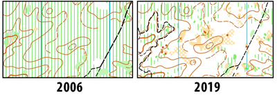
Undoubtedly, over the next few growing seasons, I will need to gradually add slash green back onto the map. But for this year, we have such a unique opportunity to enjoy the best of the pineland terrain without having to bail out to the nearest trail. Yellow will get a taste of it, Orange through Blue courses will get a full dose.
So please forgive my unbridled enthusiasm. The Pinelands were part of my childhood, my family's tap water directly from its legendary aquifer, drives through it on daytrips to the shore, swimming several times each summer in Pakim Pond and other cedar water lakes. I am so at home in its unique beauty. This is icing on my O-cake.
ED/CS Notes
Of course I'm hoping for a great turnout for this rare opportunity. So please consider helping out for an hour or two - with morning set-up, first shift before you run/walk a course, relief shift after you run/walk a course, or help us gather up everything at end of day. Only welcoming good spirits is necessary. Prior experience is a bonus.
Given the conditions in the woods, courses will challenge your map reading and ingenuity, but not your legs, patience, or determination. And as a bonus, only Red and Blue have any chance of topping 100m climb. Here are the course stats to date, though as I complete map revisions, I'm sure the advanced courses will change, only a little on distance and climb, perhaps a lot on route choice and control locations as I take full advantage of the white wood options. I promise, you won't just be counting fire ditches and looking for the nearest trail to bail out to.
Courses Information:
| Course | Distance | Climb | Ctrls |
|---|---|---|---|
| White | 2.20km | 32.0m | 13 |
| Yellow | 3.20km | 52.0m | 12 |
| Orange | 4.30km | 60.0m | 12 |
| Brown | 3.90km | 65.0m | 11 |
| Green | 5.20km | 75.0m | 13 |
| Red | 7.20km | 125.0m | 16 |
| Blue | 9.40km | 145.0m | 22 |
Course Setter:
Notes: West Point "A" event day 2
Course Setter: Mary Frank
Notes: 10AM Beginners Program and white course
Directions: From King of Prussia follow US 422 west to Oaks Exit. At the bottom of the ramp turn right at the light then make another right at the next light. Follow O-signs to parking. From Pottstown follow US 422 east to the Oaks Exit. Stay right at end of ramp and yield on to Egypt Road. Go under 422 and make a right at the 2nd light (before crossing bridge). Follow O-signs to parking.
Course Setter:
Course Setter: Mark Frank
Notes: MASOC 32 - Scout Championship event, this event is NOT open to the general public. Public Event will be held on Sunday.
Directions: Follow PA Rt.23 to Rt.345, take Rt.345 north and watch for O'-signs.
ED/CS Notes:
Scout Registration Closed Midnight Friday April 19, 2019 Questions: Contact Ed Scott
Volunteers make this event happen. Click here to see this year's volunteer list.
Courses Information:
| Course | Distance | Climb | Ctrls |
|---|---|---|---|
| White | 3.00km | 45.0m | 10 |
| Yellow | 3.50km | 60.0m | 11 |
| Orange | 4.80km | 110.0m | 12 |
| Brown | 4.00km | 75.0m | 11 |
| Green | 5.30km | 110.0m | 10 |
| Red | 7.30km | 200.0m | 13 |
| Blue | 8.80km | 300.0m | 16 |
W Y O Br G R Bl
Volunteer to help at this event
Course Setter: Mark Frank
Directions: Follow PA Rt.23 to Rt.345, take Rt.345 north and watch for O'-signs.
Courses Information:
| Course | Distance | Climb | Ctrls |
|---|---|---|---|
| White | 3.00km | 45.0m | 10 |
| Yellow | 3.50km | 60.0m | 11 |
| Orange | 4.80km | 110.0m | 12 |
| Brown | 4.00km | 75.0m | 11 |
| Green | 5.30km | 110.0m | 10 |
| Red | 7.30km | 200.0m | 13 |
| Blue | 8.80km | 300.0m | 16 |
Course Setter: Steve Aronson
Notes: 10AM until 2PM. Free Instructional program and a Beginners course.
Directions: Exit Rt 22 at the Schoenersville/378 south exit. Use the Schoenersville ramp, and then turn left. Pass the Hospital on the right, left on Illicks Mill Rd, or from the south on 378 exit on 8th street North, Left on Schoenersville, Rt on Illicks Mill Road.
Course Setter:
Notes: SVO/DVOA joint event: Brad Whitmore Event Director/Course setter. Includes a class on contour reading at 10 and 11:15. Class will include a group walk to observe contour features on the ground and how they are drawn on the map. Then we'll talk about techniques for using contours to help with navigation and we'll practice these strategies on some short off-trail routes. Register for the class at samcol19 at yahoo dot com. More data at http://www.dvoa.org/people/eboard2/readtopic.php?topic_id=1878
Directions: Rt 273 west of Newark Delaware or east on 273 from the crossing of MD Rt 213
Courses Information:
| Course | Distance | Climb | Ctrls |
|---|---|---|---|
| White | 2.90km | 60.0m | 0 |
| Yellow | 3.10km | 65.0m | 0 |
| Orange | 3.50km | 70.0m | 0 |
| Brown | 3.90km | 85.0m | 0 |
| Green | 5.60km | 100.0m | 0 |
| Red | 8.90km | 230.0m | 0 |
| Blue | 10.50km | 295.0m | 0 |
Course Setter: Sandy Fillebrown
Notes: Start window is 4:30-7PM
ED/CS Notes:
The 2019 summer sprint series starts with this event on the brand new map of FDR Park. The American Swedish Historical Museum currently has an exhibit on the history of navigation and orienteering and is sponsoring this event. Make time to come early and visit the exhibit if you can - it's fascinating! It's also World Orienteering Day so come celebrate orienteering.
The event will start earlier than usual at 4:30pm. Controls will be picked up starting no later than 7:30pm.
This event is suitable for beginners and instruction will be available.
Parking is in the lots in front of the museum. Registration will be in front of the museum or just inside in case of inclement weather. We have permission to use the restroom facilities in the museum.
This is an urban park so lots of grassy areas and sidewalks with some (very limited) wooded areas. I do not recommend spiked shoes and they are NOT permitted inside the museum. There will most likely be many sporting events going on - baseball, softball, soccer, tennis - and lots of spectators or others just enjoying the park. Courses have been designed so that you shouldn't want to go through the playing fields so keep that in mind. Please stay alert and be considerate of all the park users.
There is a road that circles the park and the courses cross this road a number of times - use caution. It is a one-way road and cars are generally going slow, but please be careful and cross in a safe manner.
There are two courses, one slightly longer than the other. They utilize some of the same controls for part of the course. Check codes since there are some places where there are a lot of controls and the courses criss-cross over themselves.
Note that the Wednesday evening events are a fundraiser for the US Orienteering Team. As such, there is special pricing. The cost is $10 for one course, $15 for two and an optional additional $5 to rent an SI-Air card for those events where touchless punching is offered. (Touchless punching just means you have to get your SI-Card close to the control and not actually insert the card into the control. Regular punching with a regular SI-card can also be used at these events.)
Courses Information:
| Course | Distance | Climb | Ctrls |
|---|---|---|---|
| SprintO-1 | 2.20km | 10.0m | 12 |
| SprintO-2 | 2.40km | 10.0m | 12 |
Course Setter: Mark Frank
Notes: Special event. Pre-registration required. Patriot's Orienteering Challenge is open to all JR-ROTC and Military High Schools. Not open to the general public. DVOA Event Volunteers can run courses (no charge) after all ROTC starts.
Directions: Follow PA Rt23 to Knauertown and watch for O'-signs
Course Setter: Sandy Fillebrown
ED/CS Notes:
This is a repeat of the May 15 event for those that couldn't make it on Wednesday. The American Swedish Historical Museum currently has an exhibit on the history of navigation and orienteering and is sponsoring this event. We have a brand new map of FDR Park that is featured in the exhibit. This event is targeted for scouts and other beginners but DVOA members who come and help can also run the courses.
PLEASE NOTE UPDATED TIME: The event will start at 1pm. Controls will be picked up starting no later than 3pm.
This event is suitable for beginners and instruction will be available.
Parking is in the lots in front of the museum. Registration will be in front of the museum or just inside in case of inclement weather.
This is an urban park so lots of grassy areas and sidewalks with some (very limited) wooded areas. I do not recommend spiked shoes and they are NOT permitted inside the museum. There will most likely be many sporting events going on - baseball, softball, soccer, tennis - and lots of spectators or others just enjoying the park. Courses have been designed so that you shouldn't want to go through the playing fields so keep that in mind. Please stay alert and be considerate of all the park users.
There is a road that circles the park and the courses cross this road a number of times - use caution. It is a one-way road and cars are generally going slow, but please be careful and cross in a safe manner.
There are two courses, one slight longer than the other. They utilize some of the same controls for part of the course. Check codes since there are some places where there are a lot of controls and the courses criss-cross over themselves.
Courses Information:
| Course | Distance | Climb | Ctrls |
|---|---|---|---|
| SprintO-1 | 2.20km | 10.0m | 12 |
| SprintO-2 | 2.40km | 10.0m | 12 |
Course Setter: Sandy Fillebrown
Notes: Start window is 6-7PM
ED/CS Notes:
The second event in the Weednesday Sprint Series is on another new map. Bob Burg recently completed the work on mapping Germantown Academy, a 1:4000 map perfect for short summer courses. The courses are suitable for beginners.
We will be parking and working out of the athletic complex behind the main campus of Germantown Academy. Take Morris Rd. and look for O signs.
Both courses are somewhat longer than the "straight-line" distance measured as one course crosses back and forth around playing fields that are out of bounds while the other crosses back and forth around buildings.
There are a few controls in wooded sections of the campus but I don't recommend spikes - most of both courses are on hard-packed trails and paved walkways.
The campus has been busy the times I've visited so please be considerate of all the people you may encounter.
Controls will be picked up starting no later than 7:30pm. We should be ready and open for starts by 5:30 or even a little earlier. If you can help out with registration, epunch or instruction having one or two people would be appreciated. And if you can stick around and help pick up controls that would be great.
Courses Information:
| Course | Distance | Climb | Ctrls |
|---|---|---|---|
| SprintO-1 | 2.20km | 35.0m | 14 |
| SprintO-2 | 2.20km | 50.0m | 14 |
Course Setter: Mark Frank
Notes: Instructions at Hollidaysburg YMCA starting at 10am. Beginner event starts are from 11:15 to 1PM Please contact Mark Frank at orienteer7@aol.com for more information and to register
Course Setter: Anthony Riley
Notes: Start window is 6-7PM
ED/CS Notes:
Explore a beautiful Chester County park, O-Style! Come join us at our Wilson Farm Park sprint series event and swerve around baseball fields, volley-ball pits, a beautiful lake and a frisbee golf course. The courses are set by Junior National Team member and 2019 Billy Goat Champion AJ Riley, that swing even this seemingly simple park into an interesting race! If you’re not already convinced, the Riley’s will be providing pizza for all who go out on a course!
Courses Information:
| Course | Distance | Climb | Ctrls |
|---|---|---|---|
| SprintO-1 | 1.80km | 25.0m | 12 |
| SprintO-2 | 3.10km | 45.0m | 17 |
Course Setter: Nathan Ohrwaschel
Notes: Start window is 6-7PM
Directions: From Newtown Square follow Rt.3 west approximately 2 miles to main park entrance on south side. Follow O'-signs.
Courses Information:
| Course | Distance | Climb | Ctrls |
|---|---|---|---|
| SprintO-1 | 2.00km | 0.0m | 0 |
| SprintO-2 | 2.50km | 0.0m | 0 |
W Y O Br G R Bl Sprint-O
Volunteer to help at this event
Course Setter: Samuel Kolins
Notes: SVO Event. Counts for DVOA rankings.
Directions: On PA Rt 233 about 8 miles SW of Landisburg PA, or 20 miles NW of Carlisle.
ED/CS Notes:
Full set of White through Blue courses plus a Sprint, all on one of our least-green maps, perfect for June. Come out, run a course, relax a bit while you grab some food and water, and then try out the Sprint course.
Start Times:
Standard White through Blue courses: Start any time from 10AM-1PM. Courses close at 3PM.
Sprint Course: Start any time from 10AM to 3PM. Course closes at 4PM.
Cost:
First course is usual SVO rate - $5 for SVO, QOC, and DVOA members, $10 for non-members.
Additional courses (including the sprint) are $3 for members, $5 for non-members.
Full Course Notes: On the e-board here.
Courses Information:
| Course | Distance | Climb | Ctrls |
|---|---|---|---|
| White | 1.80km | 65.0m | 11 |
| Yellow | 2.30km | 85.0m | 12 |
| Orange | 4.00km | 125.0m | 14 |
| Brown | 3.70km | 115.0m | 12 |
| Green | 5.20km | 165.0m | 13 |
| Red | 6.90km | 210.0m | 15 |
| Blue | 9.30km | 310.0m | 21 |
| SprintO | 2.30km | 65.0m | 10 |
Course Setter: Karl Ahlswede
Notes: Start window is 4-7PM
Directions: From Exit 26 of the PA Turnpike follow PA Rt. 309 south to Rt. 73. Take a right onto Rt. 73 and follow it north and west and watch for O'-signs.
ED/CS Notes:
Please join us for an afternoon and evening of sprint orienteering at Fort Washington State Park. We will have the courses up by 4:00pm and taken down starting at 7:00pm.
We will be using updated maps but please be aware that this park is undergoing vegetation changes very often due to the heavy use of disc golfing. There are many new open areas. We have tried to map these as accurately as possible. Some of the cages used for disc golfing are mapped but there are a great deal that are not mapped.
There are trail options for all route choices and leg coverings are not mandatory. There are some areas of green that may offer a route choice advantage where leg coverings would be needed.
Sprint One is a beginner friendly course that offers route choice challenges. Map scale will be 1:5000.
Sprint Two has a section of the course that is partially a Micro Sprint format. Orienteers will start on a course on a map with 1:5000 scale and after the 4th control will use the micro sprint map on the back for the next 16 controls. The micro sprint has a map scale of 1:750 and the SI control boxes will be on the ground with an orange flag attached. The standard orienteering flag will not be used. After finishing the micro sprint section the orienteers will return to using the 1:5000 map for the remainder of the course. The micro sprint section will require orienteers to switch techniques in orienteering where accurate map reading and compass reading will be useful.
Sprint Three will be primarily a Micro Sprint that uses the same format as Sprint Two.
Courses Information:
| Course | Distance | Climb | Ctrls |
|---|---|---|---|
| SprintO-1 | 2.40km | 40.0m | 9 |
| SprintO-2 | 1.80km | 43.0m | 24 |
| SprintO-3 | 1.00km | 17.0m | 19 |
Course Setter: Nathan Ohrwaschel
Directions: From US Rt. 30 Bypass north of Coatesville, take PA Rt. 82 north. Watch for left turn at top of hill. Follow O'-signs.
Course Setter: Tom Overbaugh
Directions: From the North take Rt 82 south to Rt 282. Follow 282 south and look for O signs at the junction with Springton Road. From the south take Rt 282 north from Downingtown to the intersection with Springton Road and follow the O signs.
ED/CS Notes:
The 2019 DVOA Summer Picnic will be held Sunday, June 23rd at Springton Manor Farm. Registration will open at 10:00 am with a mass start relay beginning at 11:00 am.
Map print scale is 1:5,000 with 10 ft contours. The relay consists of three legs (run in the following order):
White 1.9 km
Yellow 2.4 km
Brown 2.8 km
In an effort to balance teams for the relay, a point system will be used. Official relay teams must have a minimum of 3 points. Points are assigned as follows:
1 point: Junior (20 and younger)
1 point: Veteran (40 and older)
1 point: Female
A single person can count for 2 points if they satisfy two of the criteria above. If you don’t have a relay team and would like us to assign you to a team, record your name on the “Individuals Needing a Relay Team” clipboard at registration.
A regular White Course (1.9 km) will also be offered from 10:00-12:00 for those not participating in the relay. If you would like to go out on Yellow or Brown as an individual (not as part of a relay team), we will allow it but only after ensuring there are enough maps for relay participants (meaning no individual starts on Yellow or Brown until after the relay mass start).
Some minor map updates were made for this event.
After the conclusion of the relay, we will have the club picnic lunch. Please bring a covered dish to share and your own plates/cups/utensils. The club will provide drinks. After lunch, we will hold the annual summer meeting. We anticipate starting the meeting around 2:00 pm.
Courses Information:
| Course | Distance | Climb | Ctrls |
|---|---|---|---|
| White | 1.90km | 50.0m | 9 |
| Yellow | 2.40km | 65.0m | 10 |
| Brown | 2.80km | 80.0m | 12 |
Course Setter: Bob Fink
Notes: Start window is 5-7PM
Directions: From Rt 422 take Rt 29 north. About 3.5 miles after the junction with Rt 73 look for a left turn onto Deep Creek Road and follow that and O signs to the park. From the North on Rt 29, look for O signs to the right as you approach the town of Green Lane..
Courses Information:
| Course | Distance | Climb | Ctrls |
|---|---|---|---|
| SprintO-1 | 2.30km | 40.0m | 11 |
| SprintO-2 | 2.30km | 60.0m | 14 |
Course Setter: Bob Gross
Notes: This event has been changed to Beginner instruction followed by short and long white, courses. Instructions will begin at 10:30 followed by beginner courses.
Directions: From Rt 23 about 1 mile West of Knauertown ( and Warwiick Park) turn right on Trythall Road. In about a mile and at the T intersection make a Left on Harmonyville Road and follow signs to the parking location on Piersol Road. From the North use Rt 345 South from 422 or 724 South through French Creek to the junction with Hopewell Road at Hopewell Furnace. Turn left on Hopewell Road, then in just over a mile turn right on Piersol Road.
ED/CS Notes:
PLEASE NOTE: There will be two beginner level white courses. Anyone wanting to get out and hike or run the trails are welcome to join us.
White Course - 4.0 km with 13 controls.
Long White Trail Run - 6.0 km with 15 controls, with mud and a stream crossing.
Co-Director: Samuel Kolins
Course Setter: Samuel Kolins
Notes: Start window is 5-7PM
Directions: From I-476N use exit 18A to Ridge Pike, go southeast. From I-476S exit at 18B and use the U turn at Allanwood. From I-76 use exit 338 Green Lane, follow N to left turn on Ridge Pike. Look for signs at corner of Ridge Pike and Port Royal Ave.
ED/CS Notes:
Join us for two sprint courses. The courses only overlap at the first control, with one course exploring the northeast part of the park and the second the southern section.
Starts will be 5-7PM with control pickup at 7:30.
Full course notes are available on the e-board
Courses Information:
| Course | Distance | Climb | Ctrls |
|---|---|---|---|
| SprintO-1 | 2.30km | 60.0m | 13 |
| SprintO-2 | 2.30km | 90.0m | 16 |
Course Setter: Ed Scott
Notes: Instructional program at 10 followed by a white course based at the Nature Center on Hill Road.
Directions: Directions: From the E or S: Business 422 to Mt Penn, Right on Carsonia Ave, Left on Antietam Road, Left on Angora Road, left on Hill Road, right on List road to Rotary Park. From the W or N: Skyline Drive south from Rt 12, left at Bingaman then right to stay on Skyline Drive, left on List Rd., cross Angora and Rotary Park will be the right. Look for O signs.
Course Setter: Bob Gross
Notes: Parking and event center is at Rotary Park
Directions: Directions: From the E or S: Business 422 to Mt Penn, Right on Carsonia Ave, Left on Antietam Road, Left on Angora Road, left on Hill Road, right on List road to Rotary Park. From the W or N: Skyline Drive south from Rt 12, left at Bingaman then right to stay on Skyline Drive, left on List Rd., cross Angora and Rotary Park will be the right. Look for O signs.
Courses Information:
| Course | Distance | Climb | Ctrls |
|---|---|---|---|
| White | 3.10km | 130.0m | 11 |
| Yellow | 2.60km | 140.0m | 7 |
| Orange | 4.30km | 155.0m | 11 |
| Brown | 3.60km | 80.0m | 9 |
| Green | 4.30km | 155.0m | 10 |
| Red | 5.60km | 180.0m | 9 |
Course Setter: Glen Tryson
Notes: Start window is 6-7PM
Directions: From Harrisburg, PA and Points West: Take the Pennsylvania Turnpike East to Exit 286 (Reading/Denver). Exit to 222 North. Follow the signs for 222 North/Allentown. Exit at Broadcasting Road. Make a right at the traffic signal onto Broadcasting Road. Make the first right onto Harper Road (campus entrance). From Philadelphia, PA and Southern New Jersey: I-76 West to exit 328A for 422 West. 422 West to Reading (about 45 minutes). Merge to the left lane after passing the Penn Street, Penn Avenue, and North Wyomissing Blvd. exits in Reading. Follow the signs for 222 North/Allentown. Exit at Broadcasting Road. Make a right at the traffic signal onto Broadcasting Road. Make the first right onto Harper Road (campus entrance).
ED/CS Notes:
This week's edition of the Summer Sprint Series will be on the Penn State - Berks campus near Reading. The terrain is what you'd expect to find on a college campus: an array of buildings with many connecting walkways and roads, open space between the buildings and many parking lots. The campus also has some wooded and natural areas, which along with the lawns right now are lush green. This venue has not been used since the A-meet in November of 2017.
Courses Information:
| Course | Distance | Climb | Ctrls |
|---|---|---|---|
| SprintO-1 | 2.40km | 55.0m | 10 |
| SprintO-2 | 2.60km | 60.0m | 12 |
Course Setter: Tom Overbaugh
Notes: Start window is 6-7PM
Directions: 202 N from K of P (not taking DeKalb St), across Dannehower bridge into Norristown, continuing straight on Markley St for many blocks, about 1/2 mile past Main St, passing a Septa Station on left, then turning L on Harding, L on Sterigere to map.
ED/CS Notes:
Come out to Norristown State Hospital on Wednesday 7/24 for the final Sprint event of the 2019 Summer season!
Use the NSH entrance off of Stanbridge St. and watch for signs to direct you to the parking which is just a short ways ahead on the left after entering the grounds. Two courses will be offered. Cost is $10 for one course, $15 total for two courses. We will have a limited number of SI Air e-punch sticks available on a first come/first served basis for an additional $5. All proceeds benefit the US Team. Start window is 5:30 - 7:00 pm.
Important Course Notes:
There is a cluster of buildings in the area covered by the courses which is strictly out-of-bounds. This area is marked with red slashing on the maps. Courses have been designed to use this as a route choice obstacle. Runners can go around either side of the area but sidewalks between buildings that are covered with the red slashing may not be used. There is a roadway that runs between the out-of-bounds areas that is not covered with red slashing and may be used. Any runner caught violating the out-of-bounds areas will be disqualified. As long as everyone avoids the red slashed areas, there should be no issue.
Use caution when running or crossing roads. Traffic is generally very light.
Map scale is 1:5000 with 3 meter contours.
Courses Information:
| Course | Distance | Climb | Ctrls |
|---|---|---|---|
| SprintO-1 | 2.60km | 15.0m | 11 |
| SprintO-2 | 2.50km | 24.0m | 12 |
Course Setter: Samuel Kolins
Notes: Starts from 9:30am - 1:00pm
Directions: South of Reading PA on route 625. Take Rt 724 West from I 176, or East from 222 and turn south on 625. The park is about 2 miles South of that intersection.
ED/CS Notes:
A Set of Summer-Style Courses on a Newly Revised Map!
Course Formats:
The courses are designed to avoid nasty areas of summer vegetation and to provide an opportunity to beat the heat by doing a few shorter courses rather than one long course.
- A standard beginner (white) course, designed to have easier navigation and route choices for people new to orienteering. Free instruction will also be available for new orienteers.
- A standard sprint course, in the style of the Wednesday night series.
- A Middle/Sprint style hybrid, with sets of quick legs in a couple of areas of nice woods connected by some sprint legs and longer route choice legs on the trails. Shorter (2.5km) or Longer (4.5km) versions are available.
- A Choose-o. Like a trail-o but where you visit the controls. In the area of each control location there will 1-4 flags, each with a punch. You must select the control that matches the location on the map and the control description, or decide that no flag is correctly placed.
- A Head-to-head sprint. A sprint course with forking, a butterfly loop, and a spectator control, designed so that you can start at the same time as somebody else (or multiple other people) and have a head-to-head race. Challenge your friends or people with similar sprint rankings. The course can also be done individually.
More detailed course notes can be found on the e-board here.
Updated Map!
The central part of the Nolde map was updated by Vladmir Zherdev in 2017. We have only had a couple of beginner courses at Nolde since then, so for most club members this will be the first opportunity to run on the revised map. Except for a bit of the longer middle/sprint course, all of the courses will be on the revised section of the map.
Other Important Notes:
- Starts from 9:30-1:00, so you can come early, beat the heat, and do multiple courses.
- Courses close at 2:00, and the gates to the park close at 4:00.
- We will have SI Air for this event; an SI card can be rented for $5 with proceeds going to the national team. If you have not used SI Air before try it out; it is really fun!
- Cost for members is $5 per course. For $20 do as many courses as you want with SI Air. For non-members the cost is $10 for the first course and $5 per additional course, with a max of $25.
- Please consider volunteering. We could use help with registration and control pickup. We are using lots of controls for this event but they are not very spread out, so even just a few minutes helping with pickup would be very useful.
Standard Sprint: Length: 2.4km Climb: 100m Controls: 12 Map Scale: 1:5000
Head-to-Head Sprint: Length: 2.6km Climb: 75m Controls: 17 Map Scale: 1:5000
Choose-O: Length: 1.7km Climb: 60m Controls: 12 Map Scale: 1:4000
Middle/Sprint Hybrid:
Short: Length: 2.5km Climb: 100m Controls: 12 Map Scale: 1:5000
Long: Length: 4.5km Climb: 210m Controls: 18 Map Scale: 1:7500
Course Setter: Glen Tryson
Directions: From Rt 422 take Rt 29 north. About 3.5 miles after the junction with Rt 73 look for a left turn onto Deep Creek Road and follow that and O signs to the park. From the North on Rt 29, look for O signs to the right as you approach the town of Green Lane..
ED/CS Notes:
Welcome to Green Lane in the Summer! The woods are green and it is often rocky underfoot. Visibility is reduced and it will be slow-going, so the courses are shorter than usual. Running the course you normally run should give you plenty of time in the woods - especially if it is a hot day. Only the Orange and Red courses venture to the north of Deep Creek Lake, so those are your choice you want some additional distance (and possibly some faster running).
The good news is that there is not much thorny stuff. My advice is to stay in areas mapped white or light green or on trails as much as possible. Be careful even with that approach since there are a few areas which are much thicker than the map indicates (thickness of vegetation was likely mapped in late fall/winter/early spring and certain types of vegetation thicken up much more than others during the growing season). If it looks thick and nasty, don't go that way!
There are many recent blowdowns of large trees, creating unmapped rootstocks which may be 2-3 meters high. Rootstocks which were on the original map are still shown, but keep in mind that in the terrain they will likely be well-weathered. The trunks and crowns of the new blowdowns may impede travel. The map has only been modified in one place where a possibly useful trail junction has been obliterated by a blowdown.
Certain section of the Green Lane map have rock, lots of rock. In the densest areas, not all rock is mapped, so think like the mapper and figure out what he chose to map (keeping in mind that the mapping was probably done when there were no leaves on the vegetation which may make it hard to see some of the rock).
The Green Lane map is about fifteen years old, so some things have changed. Sandy Fillebrown and Bob Fink did some updates this Spring in the area around Deep Creek Lake and I have made some changes further out where courses might be affected, but be aware that not everything is up to date.
There are several areas marked out of bounds on the map. Of particular note is the campground area to the south of the parking lot. Since it is Summer, the campground is in use and we need to avoid passing through it. It is possible to get around the campground in the surrounding woods. Most of the rest of the OOB areas are private property located outside the park boundaries.
All courses cross roads in the park which will have traffic on them, so please cross carefully. I have seen cars on Deep Creek Road well in excess of the speed limit. Also, the Perkiomen Trail winds through the park and may have some speedy bicycle traffic. Stay aware when you are on or crossing a wide gravel or paved path.
For registration/download, we will be using the “Stone Pavilion”, the stone building on the left, just before you reach the parking lot of the park office. It is very close to the south park entrance, of Gravel Pike. There are restrooms there as well as picnic facilities.
Courses Information:
| Course | Distance | Climb | Ctrls |
|---|---|---|---|
| White | 2.00km | 25.0m | 10 |
| Yellow | 2.80km | 65.0m | 12 |
| Orange | 4.40km | 140.0m | 13 |
| Brown | 2.80km | 80.0m | 11 |
| Green | 4.10km | 120.0m | 12 |
| Red | 5.70km | 165.0m | 17 |
Night-O Training
Volunteer to help at this event
Course Setter: Vadim Masalkov
Notes: 27th Annual Hickory Run training weekend. Preregistration for Training, cabins, meals and night O is required. For more information click the link below to the training weekend page.
Directions: From the north, take Northeast Extension of PA Turnpike to I-80 exit. Turn right at light onto PA Rt. 940 and follow west for 3 miles. Go south on PA Rt. 534 and follow O'-signs. From the south, take Northeast Extension of PA Turnpike to Rt 903 exit. Turn right on PA Rt. 903. Turn left at the light onto PA Rt. 534 and follow O'-signs. The entrance to the Sand Spring Lake parking area is along PA Rt. 534 Between I80 and Rt. 903.
ED/CS Notes:
Click Here for more information and to register online.
Hickory Run Training Weekend 20019 – Night-O
September 7th, 2019
1. Introduction
The Delaware Valley Orienteering Association (DVOA) is pleased to invite you to participate in the 2019 Training Weekend at Hickory Run State Park and test your navigational skills at night.
2. Courses
For the Night-O, we are offering 3 courses: Beginner, Intermediate, and “forked” Advanced course with 2 subsets. The Beginner and Intermediate courses are using Camp Daddy Allen, Advanced – Sand Spring Lake map.
- Beginner course, 1.7km / 35m / 10c
Participant on the Beginner (White/Yellow difficulty) course will stay within group campground boundaries; course utilizes prominent features, but still tests your ability to navigate at night and choose which way to go. - Intermediate course, 2.4km / 75m / 12c
Participant on the Intermediate (Orange difficulty) course will test their navigational skills, where you would have to go off the trails and make route choice decisions. - Advanced forked course
Short, 3.1km / 90m / 12c
Long, 4.7km / 145m / 16c
Participants on Advanced (Brown-Blue difficulty) course will start and finish at group campground, but most of the course you’ll have to navigate off the trails utilizing your map reading, pace counting, terrain interpretation, and compass skills at night.
Please be aware, Sunday advanced courses use same areas and you may encounter controls, which are not on your Night-O course. Please check control descriptions and numbers before punching. All Night-O controls will have reflectors, so, it would be easier to identify them and use different numbers, which means there will be no control on east (or west) side of Hickory Run creek with the same number.
Advanced course will have a fork at control #8, where competitors can choose either short 3.1km/90m course (Brown/Green) OR long 4.7km/145m (Red/Blue).
Either short or long advanced course are not designed to cross Hickory Run creek. Instead, use park road to get on the other side of the creek.
It’s NOT advisable to run neither of Advanced courses if you hadn’t complete yet any advanced, Brown trough Blue, orienteering courses.
Fair warning! This terrain is technical ranging from difficult to very difficult levels.
3. Schedule
- Start window 8:00 – 9:30 PM
- Courses close at 11:30 PM.
- Please make sure you are back by 11:30PM from the woods and accounted by start/finish personnel, even if you did not complete your course, to ensure we are not conducting a search party.
4. Start/Finish
- Start intervals – 2 min.
- Start and Finish will be in front of Dining Hall.
5. Control Description
- Control descriptions are printed on front of all maps for all courses. For Beginner and Intermediate courses control descriptions are text; for Advanced – symbolic.
6. Terrain/Maps
- Sand Spring Lake, scale 1:7,500 with 5m contours - Advanced
The Sand Spring Lake map covers range of terrain from the grassy and flat with shallow features to the cliff faces along the Hickory Run creek. White woods abound, but there is also plenty of mountain laurel and rhododendron, impassable in places, as well as deciduous forest. Stands of rhododendron are mapped according to runnability. Thus, some rhododendron groves are mapped as light green, some as medium green and some as dark green. Small stands of rhododendron are still generally mapped as dark green dots (bush symbol, ISOM #420) or green blobs. The unique features of the terrain – large numbers of small knolls and depressions. Only the largest ones are mapped, and they appear on the map as dot knolls, u-depressions, broken ground and micro-contours. While field-checking I’ve noticed some vegetation changes, which may affect navigation and runnability – in general, visibility this time of the year is lower due to leafy trees coverage.
PLEASE NOTE map scale: it’s printed at 1:7,500 (10mm=1cm on the map is equal 75m on terrain). The things may come up sooner than you expected. - Camp Daddy Allen, scale 1:5,000 with 5m contours – Beginner/Intermediate
The Camp Daddy Allen map is a subset of Sand Spring Lake map, adapted for the Sprint discipline and covers (generally) are of the group campground. There are no forbidden to cross areas on Beginner/Intermediate courses.
7. Safety
- Advanced
North-West side of Hickory Creek: go East until you reach park road South-East side of Hickory Creek: go West until you reach park road. Proceed North-East until right turn to the group campground. - Beginner/Intermediate
Proceed on the campground road, which loops around campground toward Dining Hall.
8. Weather
- Check local forecast for New Haven, PA.
- Expected day temperature in the low 73F (~23C) and night in high 39F (9C), clouds and sun.
9. What equipment do I need?
Having the right equipment can make a big difference to your enjoyable and safe participation at Night-O race. If you are already an active participant at other night races such as Rogaining, then you probably have much, if not all of the gear you will need to get started.
- Clothing
Although you intend to keep moving to keep warm, ensure you comfortable and durable active wear for the expected temperature range. - Footwear
Trail-running or orienteering shoes with studs (rubber or metal) are highly recommended. - Navigation
Orienteering map and compass are the only navigation aids on the course. Technological aides such as GPS, altimeters, and smart watches with these instruments will not give you much of the benefits and can slow you down and distract while on the course. But GPS-tracking is a great post-racing analysis tool and you are welcome to use your smart watch or GPS tracker. - Water
There will be no water stops on the courses. - Torch (headlamp)
A torch is essential for night-O navigation. Head torches are the outstanding choice for racing at night time as they allow both hands to be free for map and compass work, follow the eyes wherever they move, and are now light and strong.
A good head torch will have a strong central beam to pick up controls at distance, as well as lower power settings for map reading. Battery life is an important consideration, so, please don’t forget fully charge them at home and make sure they can last for at least 2 hours.
As will all equipment, torches can fail, unexpectedly. A spare (smaller) torch might be a great companion for night adventure along with spare set of batteries.
Have fun and be safe in the woods !
Courses Information:
| Course | Distance | Climb | Ctrls |
|---|---|---|---|
| Beginner | 1.70km | 35.0m | 10 |
| Intermediate | 2.40km | 75.0m | 12 |
| Advanced | 4.70km | 145.0m | 16 |
| Advanced | 3.10km | 90.0m | 12 |
Course Setter: Rob Wilkison
Directions: From the north, take Northeast Extension of PA Turnpike to I-80 exit. Turn right at light onto PA Rt. 940 and follow west for 3 miles. Go south on PA Rt. 534 and follow O'-signs. From the south, take Northeast Extension of PA Turnpike to Rt 903 exit. Turn right on PA Rt. 903. Turn left at the light onto PA Rt. 534 and follow O'-signs. The entrance to the Sand Spring Lake parking area is along PA Rt. 534 Between I80 and Rt. 903.
ED/CS Notes:
Courses Information:
| Course | Distance | Climb | Ctrls |
|---|---|---|---|
| White | 2.00km | 55.0m | 9 |
| Yellow | 2.90km | 80.0m | 12 |
| Orange | 4.40km | 140.0m | 11 |
| Brown | 3.90km | 135.0m | 10 |
| Green | 5.20km | 205.0m | 10 |
| Red | 6.80km | 220.0m | 12 |
| Blue | 8.40km | 255.0m | 13 |
Co-Director: Angelica Riley
Course Setter: Angelica Riley Co-Setter: Wyatt Riley
Directions: From Exit 26 of the PA Turnpike follow PA Rt. 309 south to Rt. 73. Take a right onto Rt. 73 and follow it north and west and watch for O'-signs.
ED/CS Notes:
Maps are bagged and ready, sites are streamered, controls are layed out to sync, getting ready to set.
Forecast looks spectator & picnic friendly.
I look forward to seeing you all at this centrally located event as the fall season gets underway!
Courses Information:
| Course | Distance | Climb | Ctrls |
|---|---|---|---|
| White | 2.50km | 50.0m | 8 |
| Yellow | 3.50km | 80.0m | 13 |
| Orange | 4.80km | 150.0m | 16 |
| Brown | 3.50km | 130.0m | 11 |
| Green | 6.10km | 210.0m | 19 |
| Red | 8.10km | 265.0m | 26 |
Course Setter: Mary Frank
Notes: Part of the "Warwick Community Days" program
Directions: Follow PA Rt23 to Knauertown and watch for O'-signs
W Y O Br G R Sprint-O
Volunteer to help at this event
Course Setter: Lena Kushleyeva
Directions: Follow PA Rt23 to Knauertown and watch for O'-signs
ED/CS Notes:
Directions: Follow PA Rt23 to Knauertown and watch for O-signs by County Park Road.
Come out for a wonderful day of Fall orienteering! We will have full-length courses, White through Red, plus a meadow Sprint! SI Air rentals will be available if you would like to try them out. Start any time from 10AM-1PM; Control pick up will begin at 3pm.
Read the course notes here!
Courses Information:
| Course | Distance | Climb | Ctrls |
|---|---|---|---|
| White | 1.90km | 45.0m | 11 |
| Yellow | 3.30km | 135.0m | 12 |
| Orange | 4.30km | 150.0m | 15 |
| Brown | 3.30km | 80.0m | 14 |
| Green | 5.10km | 175.0m | 19 |
| Red | 6.70km | 200.0m | 23 |
| SprintO | 2.00km | 20.0m | 12 |
Course Setter: Erik Eddy
Notes: Mountain Bike Orienteering - The Gear Grinder. Event center at Kulptown fire Company. Two length courses with after party and awards to follow. Pre-registration strongly encouraged. Please see the event notes link for more details and schedule. Full Details and Registration
Directions: Kulptown Fire Company: 1082 Chestnut St (Route 345), Douglassville, PA 19518. From Rt 422 to Rt 345 South From Rt 23 to Rt 345 North.
Course Setter: Mary Frank
Notes: Registration opens at 6:00. Starts are from 6:30 to 7:15.
Directions: From Rt. 202 take Paoli Pike exit west to West Chester, left onto High St. then three blocks to a right on W. Miner St. W. Miner St. becomes Rt. 842. Follow Rt. 842 west for about 6 miles to Brandywine Valley Association Myrick Center.
ED/CS Notes:
Don't forget your flashlights/headlamps.
Parking is on the south side of Route 842, we will ask you to register and download in the barn. Tomato pie and apples will be available after you run.
We are hosting our annual Night O and the weather is perfect, the moon will be full, and we expect a good turnout.
Courses being offered are White (Beginner) 2 km, 11 Controls, Orange(Intermediate) 3 km, 9 Controls, Advanced 4.4 km, 13 controls.
Water: We will station water at a spot out on the course at the pavilion in case you would like some.
Map: We are utilizing an older map so note there is a few minor man made objects added but nothing to deter from your course. The green in the woods actually is not as dark as the map appears. We will be starting and finishing on the parking side of 842..Also IMPORTANT: part of the challenge is not going through planted crops. You are to stay out of cutting through any planted areas.
Costumes are welcome Don't forget, bring flashlights... See you there.
Co-Director: Steve Aronson 610.814.0580
Course Setter: Steve Aronson Co-Setter: Petr Hartman
Directions: Use the Bethlehem Rte 412 exit from I78. Take Silvex road (between the Wendy's and the Turkey Hill) to College Ave. Bear left onto College and go to the end. Turn right on South Mountain Drive. Bear left at the next two triangles, South Mountain Park will be on the left.
Co-Director: Bob Burg
Course Setter:
Notes: NJ Scout Orienteering Championships
Directions: From N & W: NJ Turnpike Exit 8 to Rt 33 East for 5 mi. Rt 527Alt North/Iron Ore Rd. From E: Garden St Pkwy Exit 100A to Rt 33 W for 16 mi. to Rt 527Alt/Iron Ore Rd. Then North 1/4 mile on 527Alt to Quail Hill sign, turn right onto Le Valley Rd into camp.
ED/CS Notes:
Scout Start Times from 10am to Noon – General Public Starts 10am until 1pm
Visit the event page for Registration Forms and Info Packets
DVOA again offers our Annual NJ Scout Orienteering Championship right in the middle of New Jersey at Monmouth Council’s Quail Hill Scout Reservation. Please pass along word among NJ scouting friends of yours who may not be aware of the event.
We welcome ALL Scouts – Girl Scouts and Brownies and Venture Crews as well as all Boy Scouts and Cub Scouts, including those who are members of a NJ Council even though their troop may be located in PA.
And all orienteers are welcomed to run a course. White through Red courses are open to everyone, club members and geeral public,
JROTC Unit planning to attend: To make morning Registration as easy and streamlined as possible, please fill in the Entry Form in the link below and email it to our Registrars. But don’t include fees: Your fees will be per entry, not per cadet, the same as usual, to be paid that morning.
Course Setter: Brad Whitmore
Notes: SVO Event. Courses by Brad Whitmore contact: whitmore@stsci.edu for more details
Course Setter:
Notes: NJ Navy Jr ROTC Championships
Directions: North on I 95 to the intersection with I 295. Follow I 295 East and exit at exit 8 and go west on PA 332. Go straight 4.7 miles, and in that stretch 332 becomes Route 413. Where Rt 413 makes a sharp right turn, you will instead be turning left at that light into the main Park entrance. Watch for O-signs.
ED/CS Notes:
Looking for a few more helpers for Saturday's event at Tyler State Park for JROTC Area 4's annual event. No experience is necessary. You can run after you work... no problem. Feel free to email me should you find you have the time... maryf@covenv.com....
Thank you and enjoy this gorgeous weather...
Course Setter: Bob Burg
Notes: HVO Dual event
Directions: North on I 95 to the intersection with I 295. Follow I 295 East and exit at exit 8 and go west on PA 332. Go straight 4.7 miles, and in that stretch 332 becomes Route 413. Where Rt 413 makes a sharp right turn, you will instead be turning left at that light into the main Park entrance. Watch for O-signs.
Course Setter: Sandy Fillebrown
Directions: Follow PA Rt.23 to Rt.345, take Rt.345 north and watch for O'-signs.
ED/CS Notes:
This event will be a score-O format meaning you will get a map with all the controls marked on it and you can go to as many as you like in the time available. The time limit will be 90 minutes and it will be a mass start at 12 noon.
There will be a set of controls suitable for beginners, some more at an intermediate skill level and the rest at an advanced level.
You can go by yourself or in a group, go leisurely to a few or try to get to as many as you can. The only constraint is that you are back by 1:30pm.
Registration will open at 10:45am and close at 11:45. Maps will be handed out and final instructions given at that time. Late arrivals will be allowed to participate, but your start time will still be recorded as 12 noon and you must still return to the finish by 1:30pm.
There will be NO water on the course so please be sure to bring your own if you think you will need it.
Scoring:
- Controls 31-39 are each worth 1 point
- Controls 41-49 are each worth 3 points
- Controls 51-59 are each worth 5 points
- Penalties: Lose 2 points for every minute (or part of a minute) overtime.
Courses Information:
| Course | Distance | Climb | Ctrls |
|---|---|---|---|
| Score-O | 0.00km | 0.0m | 27 |
Course Setter: Mike Bertram
Notes: Mid Atlantic Championships at SVO
Directions: From US30 go West from Gettysburg to Caledonia. Turn Right (North) on Rt.233 and watch for O'-signs.
ED/CS Notes:
Visit the event page for much more information and registration
In the morning there will be a set of classic-length courses; this will be a National Ranking event.
In the early afternoon there will be a three-person realy.
Both events are open to all orienteers and also determine the Mid-Atlantic Club Championships.
All club members are encouraged to attend. Attendence is one of the factors that determines the club championship!
Pre-registration will be strongly encouraged to speed up the process and so that we have the correct number of maps. Pre-Register here.
Courses Information:
| Course | Distance | Climb | Ctrls |
|---|---|---|---|
| White | 1.80km | 25.0m | 7 |
| Yellow | 2.50km | 30.0m | 9 |
| Orange | 4.40km | 70.0m | 8 |
| Brown | 3.80km | 85.0m | 7 |
| Green | 5.90km | 110.0m | 10 |
| Red | 7.30km | 170.0m | 10 |
| Blue | 9.30km | 205.0m | 14 |
| Relay | 2.60km | 30.0m | 7 |
| Relay | 2.00km | 25.0m | 7 |
| Relay | 2.90km | 95.0m | 7 |
W Y O Br G R
Volunteer to help at this event
Course Setter: Tom Overbaugh
Directions: Take Appleton Road North from Maryland 273, or from PA 896 take Appleton Road South. Look for Orienteering signs.
ED/CS Notes:
Join us on November 10th at Fair Hill, McCloskey Pavilion for our Veterans Day Event. Tom Overbaugh has designed a challenging set of courses for a Fall day in the woods of Cecil County, Maryland. Start and finish will be at McCloskey Pavilion, a short drive on the trail from the North Appleton Road lot. Signs will guide you to the parking field from the lot.
IMPORTANT NOTE: Control pick-up will begin no later than 3:00 pm due to limited daylight (sunset is at 4:52 pm). If you expect to take up to 3 hours to complete your course, please start by 12:00 noon so that you will be finished by 3:00 pm.
All courses cover terrain east of Big Elk Creek. The map was produced in 2013. Some updates have been made for this event to reflect changes to trails and vegetation. Most of the rough open fields have been mowed but there are some where higher grass is still present. You may notice stacks of hay bales in the fields - these are not shown on the map. Leg protection is recommended as there are sporadic thorns and undergrowth in some areas. When transitioning from woods to field or vice versa, pay careful attention to vegetation and trail mapping when selecting your route. Dark green areas and areas of green slash are generally thorny and impenetrable.
If you can spare some time for control pick-up, please let us know!
Courses Information:
| Course | Distance | Climb | Ctrls |
|---|---|---|---|
| White | 2.30km | 100.0m | 11 |
| Yellow | 3.50km | 130.0m | 13 |
| Orange | 4.00km | 155.0m | 13 |
| Brown | 3.50km | 140.0m | 11 |
| Green | 5.60km | 195.0m | 17 |
| Red | 7.00km | 275.0m | 20 |
Course Setter:
Notes: Stumble
Course Setter: Christopher Hand
Notes: From 11 AM to 2 PM Free instruction and beginners course on a professionally produced map.
Directions: From King of Prussia mall, take S. Gulph Rd about a mile to Brooks Rd (turn right). Merge on Croton Rd. Roberts School (parking) is on left in 3/4 mile.
ED/CS Notes:
Pause from your shopping and eating at the KoP Mall on Black Friday and stop on by for a beginner course in the beautiful McKaig Nature Center, just a few minutes away.
The courses Friday (day) and Saturday (night) feature the same brand new 1:5000 map by Vladimir Zherdev.
Start location for this day event will be in the Nature Center itself. Park at Roberts Elementary and follow the signs along the main trail to the start, about 500 meters.
Courses Information:
| Course | Distance | Climb | Ctrls |
|---|---|---|---|
| White | 1.20km | 60.0m | 8 |
| White-X | 1.20km | 68.0m | 8 |
| Yellow | 1.50km | 65.0m | 10 |
Course Setter:
Notes: Starts from 5-7PM. Control pickup at 8
Directions: From King of Prussia mall, take S. Gulph Rd about a mile to Brooks Rd (turn right). Merge on Croton Rd. Roberts School (parking) is on left in 3/4 mile.
ED/CS Notes:
Join us for a fun Night Orienteering event only a mile or two from the King of Prussia mall!
This is a great place to try out your night skills. As long as you don't cross a road, if you get lost you only need to follow the nearest creek downwards back towards the park entrance until you re-orient yourself.
This year features a new professional map by Vladimir Zherdev. I updated it for one trail that the park altered this spring.
The park and adjacent areas are not large, but there is lots of climb. There will be more than one advanced course - come right at 5 PM and run multiple courses if you'd like!
The woods are quite clean and runable. There will be two courses suitable for beginners.
First starts at 5 PM.
Courses Information:
| Course | Distance | Climb | Ctrls |
|---|---|---|---|
| Night-O | 2.30km | 69.0m | 13 |
| Night-O | 2.80km | 104.0m | 13 |
| Night-O | 3.70km | 122.0m | 19 |
| Night-O | 4.10km | 185.0m | 20 |
| Night-O | 4.40km | 198.0m | 20 |
Course Setter:
Directions: NJ Rt 70 East of Medford NJ to Four MIle Circle, the junction of NJ 70 and 72. Follow Orienteering signs from there.
ED/CS Notes:
For DVOA’s final event of the year we offer a holiday treat of unique SJ pineland terrain, to experience the brand new map of Four Mile Circle, extensively revised Winter 2018 and May / Nov 2019 which covers the most useful orienteering half of the map. Our courses will use only the areas that have been updated, most recently reclaiming the previously inaccessible NW corner of 4 Mile including the longest most inviting reentrant in the park whose vegetation has changed dramatically since mapped mostly white woods in 2005.
Come join more than 50 JROTC cadets from 2 units who attended our recent Area 4 Championship as well as 35 SJ Outdoor Club members (who the Burtons have been inviting for years) who are showing up this year in unprecedented numbers which Pat and Bob will be guiding around the White and Yellow courses.
Long range weather forecasts have stayed unusually consistent for the past 4 or 5 days – 30’s on set-up day Saturday, an inviting mid-40’s day on Sunday, both rainless – so here’s hoping we can count on that.
Onto Course Descriptions
All courses require arduous climb in this pineland state forest, starting with 20m on the 2.9k White, capping off with an overwhelming 100m climb on the 9.7k Blue. Cross terrain (advanced) navigation offers a lot more white woods than previously available, and richly rewards careful map-reading and route choice through more complicated vegetation and trail-rich areas.
Needless to say, 4 Mile has none of those pesky boulder fields and stony ground of 8-10-12 5m contour hillsides, not even marshes. Just gently rolling hills (of 2.5m contours) with lots of trails and fire ditches monopolizing many areas, totally devoid in others. Plus lots of picturesque areas featuring pine-needle and moss-covered open woods, clusters of Mt Laurel, then of course plenty of blueberry groundcover.
We’ll be meeting just inside the park’s main entrance (first road to your left when entering the park), just behind the fire tower on the left side of Rt 72 just before you reach the entrance when driving east from the actual 4 Mile Circle (the intersection of Rts 70 and 72). Our normal staging area for 4 Mile events.
Drive over to Jersey for our last event of the season. You will enjoy these woods, the map and courses.
Here are the course stats……
Courses Information:
| Course | Distance | Climb | Ctrls |
|---|---|---|---|
| White | 2.94km | 20.0m | 12 |
| Yellow | 3.23km | 22.0m | 11 |
| Orange | 4.20km | 44.0m | 11 |
| Brown | 4.12km | 45.0m | 13 |
| Green | 5.43km | 48.0m | 14 |
| Red | 7.29km | 65.0m | 18 |
| Blue | 9.68km | 100.0m | 22 |
Course Setter:
Notes: Annual winter meeting. Details will be posted soon.
Directions: Take Route 422 W to PA Rt23 West exit. Follow Rt23 west through Phoenixville to Rt724. From Rt23 & Rt724 jct, follow Rt724 west 1.1 miles to Zion Lutheran Church on left. From the Rdg-Pottstown area, take the 724 Exit off 422. Continue E on 724 through 3 lights and look for signs. Large white Church on the right.
Course Setter: Samuel Kolins
Notes: Beginner Class 10AM, White course 11 to Noon. Noon mass start score O.
Directions: From the North take Rt 82 south to Rt 282. Follow 282 south and look for O signs at the junction with Springton Road. From the south take Rt 282 north from Downingtown to the intersection with Springton Road and follow the O signs.
ED/CS Notes:
For this year's President's Cup we will have a standard white-course and a Choose-O Score-O.
Location: Springton Manor Farm Park, Manor house area.
Note that the only vehicle entrance to the park is from the west off of Springton Rd (Google maps may try to route you through the closed northeast entrance).
There will be an indoor, heated area for registration, bathrooms, and post-event chatting.
Start and Finish are both within a few steps of the registration building.
Timing: There will be a beginner class at 10AM and white course starts from 11AM-noon.
Starts for the Choose-O Score-O will be at any time from 12:00 noon until 12:30PM, with a mass start at 12:00 for those who want to take part. You will have one minute to study your map and then you will punch start and begin your adventure!
Control Pickup will begin at 2PM (please consider staying around to help - you won't have to wait long for pickup to begin, and while the park is small we will have a lot of controls in the woods, so many people each covering a small area will be helpful).
Pre-Registration: To save time on Sunday, there will be optional pre-registration and payment on Saturday at the Winter Meeting.
What in the world is a Score-O Choose-O?: For details about the event format and the full course notes, check out the e-board post at:
http://www.dvoa.org/people/eboard2/readtopic.php?topic_id=2053
Courses Information:
| Course | Distance | Climb | Ctrls |
|---|---|---|---|
| White | 1.80km | 50.0m | 14 |
| Score-O | 5.80km | 140.0m | 30 |
| Score-O | 8.50km | 195.0m | 30 |
Course Setter: Mary Frank
Notes: 10 AM Instructional program followed by a beginner level course. Great for Scouts! Total time is about 2 hours.
Directions: Rt 625 South of Reading, about 2 miles south of the Jct of 625 and 724
Course Setter: Ron Wood
Directions: From PA Rt 1 take PA Rt 896 south toward Newark, DE and watch for O'-signs, or from I-95 take DE 896 North to park.
Course Setter: Bob Burg
Notes: The Batsto Event has been postponed. Stay healthy.
Directions: From US30 East (White Horse Pike) in Hammonton take SR-542 (Pleasant Mills Rd.) toward Batsto, follow SR-542 north-east for about 7mi and watch for O'-signs.
ED/CS Notes:
The Batsto Event has been postponed.
Courses Information:
| Course | Distance | Climb | Ctrls |
|---|---|---|---|
| White | 2.19km | 42.0m | 12 |
| Yellow | 3.24km | 48.0m | 12 |
| Orange | 4.41km | 80.0m | 11 |
| Brown | 4.18km | 65.0m | 11 |
| Green | 5.52km | 80.0m | 14 |
| Red | 7.42km | 130.0m | 17 |
| Blue | 10.31km | 170.0m | 24 |
Course Setter: Petr Hartman
Notes: The Big Woods Event has been postponed. All registered participants will be contacted with further information.
Directions: From rt. 100 take Rt 724 west for 3 miles. Turn left on Unionville Rd. for 3 miles. Turn right on St. Peter's Rd. for a half mile. Park is on the left.
Course Setter: Mike Bertram
Notes: This event has been cancelled
Directions: From Lancaster follow Rt. 30 West to Rt. 24 North (Mt. Zion Rd.). Take Rt. 24 north to top of hill and make a right onto Deininger Rd. Watch for O'-signs.
Course Setter: Samuel Kolins
Notes: This Event has been cancelled
Directions: Take Northeast Extension of PA Turnpike to I-80 exit. Turn right at light onto PA Rt. 940 and follow west for 3 miles. Go south on PA Rt. 534 and follow O'-signs.
ED/CS Notes:
With the virus situation, not sure if this event will have to be cancelled, postponed, or run in a modified format. Just have to wait and see how things play out. Stay safe!
The Exact Change Rogaine at Hickory Run
Check out all the event details here: https://drive.google.com/open?id=1HSkkMlZMox6jaPMUqpY31qGGjd7PII9W
Pre-Registration required on Event Register: https://eventreg.orienteeringusa.org/eventregister/a40/register/start/exact-change-rogaine
Normal Registration ends on May 10th. Late Registration Ends May 27th.
Join us for 10, 7, or 4 hours of navigation in excellent Poconos terrain. We will be using all four of our fully-contiguous Hickory Run orienteering maps (these have been used for national level orienteering and adventure racing events). Food will be provided after the event, with a chance to hang out with orienteering friends, new and old, to share your adventures.
Tasty Prizes for the most controls found! Special coins will be placed at each control, and an additional prize will go the person who can collect just the right coins on the course, so that their coin value most closely matches their final orienteering score.
The timing options for the different duration courses are:
10 hour: Map handout 7AM, event 8AM-6PM.
7 hour: Map handout 10AM, event 11AM-6PM.
4 hour: There are two different options:
Map handout 10AM, event 11AM-3PM.
Map handout 1PM, event 2PM-6PM.
Plan on joining us for a day of navigational fun in some of our best terrain. Despite the fact that DVOA goes up to Hickory Run for training each year, there are a ton of awesome areas of the park that most orienteers have not visited in years, if ever. Check out the compiled map on the last page of the event details link above to get a look at just how cool the entire mapped area is when viewed as once. Look forward to seeing you in the woods!
Course Setter: Nathan Ohrwaschel
Notes: This Event has been cancelled
Course Setter: Wyatt Riley
Notes: This event will be preregistration. We are asking all participants to realize MASKING and DISTANCING is required.
Directions: Follow PA Rt.23 to Rt.345, take Rt.345 north and watch for O'-signs.
ED/CS Notes:
Courses Information:
| Course | Distance | Climb | Ctrls |
|---|---|---|---|
| White | 2.40km | 40.0m | 8 |
| Yellow | 4.20km | 155.0m | 10 |
| Orange | 4.30km | 105.0m | 11 |
| Brown | 3.20km | 100.0m | 9 |
| Green | 5.50km | 210.0m | 9 |
| Red | 7.80km | 275.0m | 14 |
Course Setter: Mary Frank
Notes:
Pre-register for this event here
Directions: Follow PA Rt23 to Knauertown and watch for O'-signs
ED/CS Notes:
REMEMBER to bring your own course water to carry on your course and food and drink for after the course. Bathrooms are expected to be available at the park office.
Courses Information:
| Course | Distance | Climb | Ctrls |
|---|---|---|---|
| White | 1.80km | 55.0m | 8 |
| Yellow | 2.80km | 75.0m | 12 |
| Orange | 4.20km | 120.0m | 14 |
| Brown | 3.80km | 105.0m | 14 |
| Green | 5.30km | 155.0m | 17 |
| Red | 6.60km | 230.0m | 22 |
Course Setter:
Notes: THIS IS A VIRTUAL WARWICK EVENT from 9/7 through 9/18
There will be Streamered courses left in the woods from 9/7 through 9/18.
$7 for members and juniors, and $12 for non-members Register Here
After registration is complete the Event Director will send your printable PDF map with further instructions to follow once you are at the park.
Enjoy and stay safe.Directions: Follow PA Rt23 to Knauertown and watch for O'-signs
Course Setter: Mary Frank
Notes: Special COVID restrictions: Program at 10AM for the first 25 participants. Overflow program at noon if necessary. Masks are required. Cancelled if it rains and new date will be established.
Directions: From King of Prussia follow US 422 west to Oaks Exit. At the bottom of the ramp turn right at the light then make another right at the next light. Follow O-signs to parking. From Pottstown follow US 422 east to the Oaks Exit. Stay right at end of ramp and yield on to Egypt Road. Go under 422 and make a right at the 2nd light (before crossing bridge). Follow O-signs to parking.
Course Setter: Ron Barron
Notes:
Pre-register for this event here
Directions: From the North take Rt 82 south to Rt 282. Follow 282 south and look for O signs at the junction with Springton Road. From the south take Rt 282 north from Downingtown to the intersection with Springton Road and follow the O signs.
ED/CS Notes:
Updated Information, 9/18/20
Springton Manor; Event Notes
We will have courses for all abilities, White through Red. The park is a great place to learn how to orienteer with good visibility, large, obvious features and a strong trail network. The White and Yellow course are perfect for beginners, and novices as well as families.
*Registration is on-line only.
*Please try to register before Saturday for this event.
*If you registered and your name isn’t on the registered participants list, please contact me. Better to fix it before Sunday.
*We’ll stage next to the Carriage House/park office. The usual parking lot.
*We are hopeful that the restroom right in the Carriage House should be open for us. The restrooms are open down the hill in the Great Barn.
*Please take a few minutes to look around the park. The gardens and fields near the mansion look wonderful right now.
*Cluesheets and course notes will be available a short time before the event. Print out your cluesheets at home please! They will be available at:
https://drive.google.com/drive/folders/1hZp1w3Pfq1kX12IbJc4xc0f5jEahx-0M?usp=sharing
Course Notes
*The controls should be programmed for SI Air for this event. If you are starting early, please check with the start person and make sure the Air feature on the controls is turned on.
*There are fields that are still being actively cultivated. Stay out of them. There are plenty of route choices to avoid them. Goats and sheep are unpredictable, Stay out of their pastures.
*Please honor the out of bounds areas marked on your maps. You can do better than Warwick.
*Springton is a small park, so there is a high density of controls out there. Make sure you are at the correct control before punching.
*There are some flags to help mark trails on the White and Yellow courses. Those folks are more than welcome to follow them, otherwise, it’s a LONG way around.
*The map was updated recently and generally holds up well. Thank you Wyatt. Vegetation is still summery, somewhat greener in some areas. Areas marked as rough open land are quite variable. Some runnable, some not. The green hashed areas are nose high right now and very slow.
*I’ve been trying to keep up with the park’s seasonal mowings. There may be some areas that have been mowed differently as depicted on the map. Seasonal mowing patterns do not effect anything in the woods.
Remember, we are still to follow mandated rules concerning group activities.
*Please do not come if you are, or have been ill with any of the CV19 symptoms or have been around others that have symptoms.
*Bring a mask and wear it when you are around people at the start, registration, or otherwise around people. You may remove it once you are away from the start, by yourself, or with your group.
Move away from the registration area when you are through there. This has been a problem.
*Please bring your own water to take out on the course. There will not be any at controls. or at registration.
*Maintain 2 meters distance between you and others especially near registration or the start.
Courses Information:
| Course | Distance | Climb | Ctrls |
|---|---|---|---|
| White | 2.00km | 50.0m | 11 |
| Yellow | 3.30km | 92.0m | 14 |
| Orange | 4.70km | 100.0m | 16 |
| Brown | 4.20km | 100.0m | 16 |
| Green | 4.95km | 110.0m | 19 |
| Red | 6.40km | 150.0m | 22 |
Course Setter: Bob Burg
Notes:
We will just run a regular event this year due to the pandemic. Masks are required, preregistration as well.
Click here to pre-registerDirections: From N & W: NJ Turnpike Exit 8 to Rt 33 East for 5 mi. Rt 527Alt North/Iron Ore Rd. From E: Garden St Pkwy Exit 100A to Rt 33 W for 16 mi. to Rt 527Alt/Iron Ore Rd. Then North 1/4 mile on 527Alt to Quail Hill sign, turn right onto Le Valley Rd into camp.
ED/CS Notes:
After months of quarantine, come out and enjoy the woods at Quail Hill. Rather than our annual Scout Championship, we will be hosting a simpler, more relaxed version at this event. To keep everyone safe, we will be practicing careful commonsense standards and utilizing online pre-registration. Enjoy a safe and inviting day of orienteering in the healthiest in the country, the great outdoors.
click here for online pre-registration
In order to remain as "paperless" as possible, clue sheets will not be provided at the event. Control descriptions are on the maps, but if you would like a separate clue sheet, here are the links so you may print your own at home:
click here for white and yellow clue sheets
click here for orange, brown, green, and red clue sheets
Reminder: For the safety of our participants, DVOA will not be supplying water or snacks at the event. Water will not be available to runners out on the courses, so plan to carry any water you may need.
Courses Information:
| Course | Distance | Climb | Ctrls |
|---|---|---|---|
| White | 2.00km | 63.0m | 14 |
| Yellow | 3.10km | 75.0m | 13 |
| Orange | 4.10km | 88.0m | 13 |
| Brown | 3.80km | 105.0m | 11 |
| Green | 5.00km | 113.0m | 16 |
| Red | 7.30km | 144.0m | 23 |
Course Setter: Nathan Ohrwaschel
Notes:
Pre-registration required. Click here to register for this event.
Directions: From US Rt. 30 Bypass north of Coatesville, take PA Rt. 82 north. Watch for left turn at top of hill. Follow O'-signs.
ED/CS Notes:
10:30am - 1:30pm for people who feel they are at average or lower risk.
Courses Information:
| Course | Distance | Climb | Ctrls |
|---|---|---|---|
| White | 2.10km | 0.0m | 0 |
| Yellow | 2.90km | 0.0m | 0 |
| Orange | 4.00km | 0.0m | 0 |
| Brown | 3.20km | 0.0m | 0 |
| Green | 5.30km | 0.0m | 0 |
| Red | 6.80km | 0.0m | 0 |
W Y O Br G R
Volunteer to help at this event
Course Setter: Anthony Riley
Notes: Course setters: AJ Riley & Bridget Hall.
Masks are required, preregistration as well.
Click here to pre-registerDirections: Follow Rt.23 to PA Rt.345, take Rt.345 north and watch for O'-signs, or from Rt422 take 82 into Birdsboro and follow 345 to park.
ED/CS Notes:
Classic Orienteering at French Creek
Pre-registration required. Click HERE to register.
See who is registered
Controls descriptions can be printed ahead of time.
DAYLIGHT SAVINGS TONIGHT.........FALL BACK ONE HOUR*
Please register by 6:00 pm EDT on Oct 31st to ensure that your information is in the computer for the event
Early Start 9:30 to 10:30 am
Regular Start 10:30 am to 1:00 pm
Control pickup begins at 2:30 sharp to beat sundown.
OUSA and DVOA COVID-19 safety measures in effect including:
- Mask at Registration check-in and download
- 6 foot social distancing at Registration and Download
- No water on course or snacks at finish. Please carry your own water to hydrate.
DAYLIGHT SAVINGS TONIGHT.........FALL BACK ONE HOUR*
Course Setters notes:
Advanced courses are harder than usual, technical controls combined with physically demanding terrain may be grounds to reconsider which courses to go on.
Vegetation mapping is out of date.
The undergrowth is very thick and thorny in places so definitely protect your legs!
There may be some extra and/or missing trails in the south east part of the map.
Courses Information:
| Course | Distance | Climb | Ctrls |
|---|---|---|---|
| White | 3.20km | 70.0m | 13 |
| Yellow | 3.30km | 75.0m | 11 |
| Orange | 4.30km | 110.0m | 13 |
| Brown | 4.00km | 95.0m | 11 |
| Green | 5.20km | 145.0m | 12 |
| Red | 6.80km | 205.0m | 17 |
Course Setter: Samuel Kolins
Directions: From the PA Turnpike, go South from the Lebanon-Lancaster exit of PA TPK on route 72. Turn West on Cider Press Road then North on Pinch Road. (From Rt 30 in Lancaster go North on Rt 72 through Manheim and another 3+/- miles to Pinch Road.) Follow Pinch Road to the event site. Look for entrance shortly after crossing over the Turnpike.
ED/CS Notes:
Pre-registration is required, see here.
For helpful instructions to register groups, see here.
For Course notes, see here.
For Clue Sheets to print, see here.
There will be a Free Introduction to Orienteering Class at 11AM (after the class you can try out a course!).
Check-in is under the pavilion at the north end of the parking lot (note that this is different from other years). You must wear a mask in the check-in area - thank you for protecting our volunteers and other participants! See the link above for required pre-registration. We really appreciate it if you register earlier rather than later.
Note: For COVID reasons there will be no water on the course or in the registration or finish areas. Please bring your own water out on the course. Stay safe.
While archery hunting is allowed in PA on Sunday Nov 15 this year, no hunting is allowed at any time at Gov. Dick. Still, not a bad idea to wear some orange in case of illegal archers.
The White, Yellow, Orange, Brown, and Green courses all stay on the northern part of the map, which is flatter, less rocky, and more open.
The GreenY, Red, and Blue courses go on the southern part of the map, which provides some of the club’s more technically and physically challenging terrain (one of my favorite and most frustrating areas for working on my skills).
The Special Course is a Yes-or-No-O, where for each control you must decide if the flag was placed in the correct spot or not.
Special start window for those with high COVID risk from 9:30-10:30. General starts any time from 10:30AM to 1PM (Yes-or-No-O starts until 2PM). Control pickup will begin promptly at 2:45PM so we can finish before dark!
Courses Information:
| Course | Distance | Climb | Ctrls |
|---|---|---|---|
| White | 2.20km | 75.0m | 10 |
| Yellow | 2.50km | 110.0m | 12 |
| Orange | 4.20km | 155.0m | 12 |
| Brown | 4.10km | 120.0m | 10 |
| Green | 5.30km | 150.0m | 12 |
| Green-Y | 5.20km | 235.0m | 15 |
| Red | 7.00km | 290.0m | 18 |
| Blue | 8.50km | 350.0m | 23 |
| Special | 1.20km | 55.0m | 13 |
Course Setter: Christopher Hand
Notes: Free beginners program. 11AM to 2PM. notes
Directions: From King of Prussia mall, take S. Gulph Rd about a mile to Brooks Rd (turn right). Merge on Croton Rd. Roberts School (parking) is on left in 3/4 mile.
ED/CS Notes:
This is mostly a beginners event - it's free. Instructions given as preregistrants arrive plus we snag a few randoms who happen to be walking through for "Get outside on Black Friday" - a funny event in a town that sports the biggest shopping mall in the country.
This year's course is a score-O with six easy controls and six harder ones. The easy ones (usually) serve as attackpoints for the harder ones.
Maps and loaner epunches will be available at the start but if you want your own map and want to stay away from people at the start - here's a link to the course map you can download and print ahead of time: https://hats4toads.com/public/mckaig20201127.pdf
Note: start is remote. Park at Roberts Elementary and follow the main "cadet" trail to the start.
Courses Information:
| Course | Distance | Climb | Ctrls |
|---|---|---|---|
| Score-O | 2.00km | 100.0m | 12 |
Course Setter:
Notes: Winter Meeting, virtual meeting login info will be posted. Meeting to start at 2 pm and should be done by dinner
Directions: You choose the location. Just connect and relax.
ED/CS Notes:
Greetings DVOA Members
It has been a wild year and we will be taking some time on Sunday, February 28th to review where we've been and to chart our course for the future. While we normally host this meeting in person at the end of January with a delicious pot-luck, work and COVID environment challenges have driven us to a virtual format in February. That said, I think we have put together a meeting that will provide a wealth of information and a fair amount of interaction to allow participants to learn and help grow the club.
Our format for the meeting will be Google Meets. This will allow us to see each other and project slides to support our discussions. I will send voting and video links to all registered members. The event will be free. We will begin the day with a few training/breakout sessions on various topics and conclude with a plenary session to report the state of the club and provide feedback on select areas wihtin the club. We will also use this opportunity to present service awards including the return of Course Directors and Course Setters of the year and the Ringo Award. I am excited to announce that we will allow virtual voting for the Course Directors and Course Setters and will have a virtual vote for the one Board position that we must fill. As this is a virtual event, participants can come and go as they please to sample the training and information sessions that they want. Here is the agenda for the event:
DVOA Winter Meeting
28 February 2021 2:00 PM (14:00)
Breakout Classes:
2:00 PM- How to teach Orienteering [Mark Frank]
2:30 PM- How to set up equipment for an event
3:00 PM- Tutorial on Route Gadget [John G]
3:30 PM- Youth Protection and Safe Sport [John G]
4:00 PM - General Session:
- State of the Club
- High level financial report (Where we spend our money)
- Membership report
- Equipment status and report
- Mapping Committee Report and Priorities
- Permanent Courses Report
- Education Report
- A-Event Status and Discussion
4:45 PM-Elections (voting online)
5:00 PM - Awards (voting online and Ringo Award Committee)
- Ringo Awards
- Course Setter of the Year (experienced and new)
- Event Director of the Year (experienced and new)
Course Setter: Christopher Hand
Notes: Come for instruction anytime between 11AM and 12:30 PM. White course will be available until 2PM. We have a rain date for March 13 if necessary.
Directions: From King of Prussia mall, take S. Gulph Rd about a mile to Brooks Rd (turn right). Merge on Croton Rd. Roberts School (parking) is on left in 3/4 mile.
ED/CS Notes:
Free beginners courses (with some instructions) - point to point or Score-O
Note: Count on it being muddy in some places. Courses are designed to keep away from most of the mud.
Please preregister at: https://www.enjoymckaig.org/content.aspx?page_id=4002&club_id=383980&item_id=1385311
Course Setter: Lena Kushleyeva
Notes: Registration Is Now Closed
Directions: North on I 95 to the intersection with I 295. Follow I 295 East and exit at exit 8 and go west on PA 332. Go straight 4.7 miles, and in that stretch 332 becomes Route 413. Where Rt 413 makes a sharp right turn, you will instead be turning left at that light into the main Park entrance. Watch for O-signs.
ED/CS Notes:
The event is sold out and registration is closed!
Parking:
This year we will be starting from a different parking from what we used in the previous years.
We’ll start from the Boardwalk lot
If this lot fills up, the overflow lot is the Maze lot (just across the field from the start location)
If the parking is particularly tough, the second overflow is farther away, here: Second overflow
Course notes:
Green, Red, Blue and Pink will venture in the disc golf area. Two notes there:
- the "man-made object" circles in the disc golf area are used to mark locations of golf baskets. Each disc golf hole at Tyler has 2 or 3 locations that the basket rotates between. So each basket may mot be may not be mapped correctly at any point in time.
- Thin dark green lines are used to mark the locations of log walls that are constructed to give more structure to the golf course.
Green, Red and Blue will run near a swampy area southeast of the start. The swamp mapping has been updated this spring to reflect the current wet and swampy conditions.
Pink and Blue will have route choices going through cultivated land. There are no active plantings happening right now, and all cultivated land is ok to run through.
Other courses will have a cornfield (mapped as cultivated land) on the edge of their courses. I don’t think any good route choices go through it, but you can go through it if you like. It will likely be very muddy.
Rootstalks have not been remapped in the recent year, and a lot of trees fell during last year’s storms. So there will be unmapped rootstalks in the woods, some quite large, and possibly near mapped ones.
Courses Information:
| Course | Distance | Climb | Ctrls |
|---|---|---|---|
| White | 2.10km | 40.0m | 13 |
| Yellow | 2.70km | 55.0m | 12 |
| Orange | 4.00km | 111.0m | 18 |
| Brown | 3.70km | 90.0m | 16 |
| Green | 5.20km | 140.0m | 18 |
| Red | 6.60km | 190.0m | 20 |
| Blue | 9.50km | 235.0m | 24 |
| Special | 7.70km | 180.0m | 20 |
Training
Volunteer to help at this event
Co-Director: Richard Howett
Course Setter:
Notes: This is a Scout Only Training Day. Preregistration only. https://hmc-bsa.org/tentaroo-login/
W Y O Br G R
Volunteer to help at this event
Course Setter: Eric Silva
Notes: >>> Rregister Here <<< Registration closes 1 pm 3/20/2021
ED/CS Notes:
https://eventreg.orienteeringusa.org/eventregister/a40/register/start/-dvoa-march-21-2021
Registration will close Saturday at 1 pm.
We've posted the lengths/Climb last night.
Just a note on the woods. The green on the map is mostly Mountain Laurel in the woods and some dense sapplings. There is some stony ground but a lot of nice open woods. Very fun. Some of you may find some patches of snow still on the hillside. We hope you enjoy the show.
Courses Information:
| Course | Distance | Climb | Ctrls |
|---|---|---|---|
| White | 1.90km | 50.0m | 0 |
| Yellow | 2.80km | 80.0m | 0 |
| Orange | 3.60km | 115.0m | 0 |
| Brown | 3.50km | 105.0m | 0 |
| Green | 5.00km | 165.0m | 0 |
| Red | 6.80km | 285.0m | 0 |
Course Setter: Wyatt Riley
Notes: Registration is now closed for this event.
Directions: From Newtown Square follow Rt.3 west approximately 2 miles to main park entrance on south side. Follow O'-signs.
ED/CS Notes:
Spring is finally here! Now is the time to run in the Ridley Creek woods before the vegetation gets too thick. Covid protocols are still required. Please bring your own water and snacks. Masks are required in the check-in and finish area. You must pre-register.
Registration for this event has closed.
Courses Information:
| Course | Distance | Climb | Ctrls |
|---|---|---|---|
| White | 2.30km | 70.0m | 9 |
| Yellow | 3.00km | 70.0m | 8 |
| Orange | 4.60km | 150.0m | 10 |
| Brown | 3.10km | 135.0m | 11 |
| Green | 5.80km | 230.0m | 18 |
| Red | 7.90km | 300.0m | 23 |
Course Setter: Mary Frank
Notes: Introduction to Orienteering Class to begin at 10 am. After 30 minutes of introductions, you get to go on a beginner course. CLASS IS FULL
Directions: From King of Prussia follow US 422 west to Oaks Exit. At the bottom of the ramp turn right at the light then make another right at the next light. Follow O-signs to parking. From Pottstown follow US 422 east to the Oaks Exit. Stay right at end of ramp and yield on to Egypt Road. Go under 422 and make a right at the 2nd light (before crossing bridge). Follow O-signs to parking.
Courses Information:
| Course | Distance | Climb | Ctrls |
|---|---|---|---|
| White | 1.90km | 15.0m | 10 |
Course Setter: Mary Frank
Notes: Covid Protocols are in place at this event. We will be near the Park Office so lets show everyone that we are being respectful of their safety at Warwick (Park Management, Vistors, Event Staff and Event Participants). If you have No mask, you will not start. In order to download, you must have a mask.
> Register Here <<
Directions: Follow PA Rt23 to Knauertown and watch for O'-signs
Courses Information:
| Course | Distance | Climb | Ctrls |
|---|---|---|---|
| White | 2.55km | 0.0m | 14 |
| Yellow | 3.90km | 0.0m | 13 |
| Orange | 4.40km | 0.0m | 14 |
| Brown | 4.20km | 0.0m | 13 |
| Green | 5.30km | 0.0m | 15 |
| Red | 7.05km | 0.0m | 19 |
Course Setter:
Notes: www.radnorrecreation.com This is where beginners can register for this program DVOA is doing this for Radnor Township
Directions: From Rt. 320 and Rt. 30 intersection at Villanova follow Rt. 320 south to first light. Right at light then bear left at road fork (Newtown Rd). Follow O'-signs.
ED/CS Notes:
The Willows event is being offered in conjunction with the Radnor Recreation & Community Programming department.
Pre-registration is required. Pre-register at www.radnorrecreation.com
COVID restrictions are in affect. Please wear a mask at check-in and results. Please provide your own water and snacks.
Courses Information:
| Course | Distance | Climb | Ctrls |
|---|---|---|---|
| Yellow | 2.80km | 85.0m | 12 |
Course Setter: Mark Frank Co-Setter: Mark Frank
Notes: MASOC 32 Day 1 Scouts only event Preregistration Required
Directions: Follow PA Rt.23 to Rt.345, take Rt.345 north and watch for O'-signs.
ED/CS Notes:
Scouts only event Preregistration Required
EVENT REGISTRATION IS CLOSED
Downloads
Course Setter: Mark Frank
Notes: MASOC 32 Day 2 Scouts only event Preregistration Required
Directions: Follow PA Rt.23 to Rt.345, take Rt.345 north and watch for O'-signs.
ED/CS Notes:
Scouts only event Preregistration Required
EVENT REGISTRATION IS CLOSED
Course Setter: Mary Frank
Notes: This is for Senior Games of Montgomery County. 30 people restriction.
Directions: From King of Prussia follow US 422 west to Oaks Exit. At the bottom of the ramp turn right at the light then make another right at the next light. Follow O-signs to parking. From Pottstown follow US 422 east to the Oaks Exit. Stay right at end of ramp and yield on to Egypt Road. Go under 422 and make a right at the 2nd light (before crossing bridge). Follow O-signs to parking.
Course Setter: Margaret Hammond
Notes: No dogs allowed at Quail Hill.... Protocols for COVID in Place
Directions: From N & W: NJ Turnpike Exit 8 to Rt 33 East for 5 mi. Rt 527Alt North/Iron Ore Rd. From E: Garden St Pkwy Exit 100A to Rt 33 W for 16 mi. to Rt 527Alt/Iron Ore Rd. Then North 1/4 mile on 527Alt to Quail Hill sign, turn right onto Le Valley Rd into camp.
ED/CS Notes:
Preregistration is required - use the link below to register.
https://eventreg.orienteeringusa.org/eventregister/a40/register/start/dvoa-may-16-2021
Course Setter: Mary Frank
Notes: Bucks County Senior Games which is allowing husband/wife or Senior with family member teams
Directions: From Langhorne, PA follow PA Rt. 413 North toward Newtown and watch for O'-signs.
Course Setter: Samuel Kolins
Directions: From Langhorne, PA follow PA Rt. 413 North toward Newtown and watch for O'-signs.
ED/CS Notes:
Pre-registration required by Friday June 11th at 11PM: Register online here
Course notes available here
We will be using the north parking lot near Tollgate road. Look for a pop-up tent in the picnic area.
To make the best use of the time of year and the park, the courses will have more of a sprint feel with lots of route choice. The terrain is mostly in the developed part of the park with a mix of fields, mown wooded areas, and pockets of thick woods that create route choices. Green and Red will visit the southern part of the park which is more wooded, but will still focus mostly on trails and route choice with a few ventures into pockets of open woods. Overall the courses should be fast and hopefully leave you without any embedded thorns (unless you get creative with some route choices).
Given the nature of the park and courses, anybody comfortable doing an intermediate (Orange) course who wants a longer distance option would be fine doing green or red.
Courses Information:
| Course | Distance | Climb | Ctrls |
|---|---|---|---|
| White | 1.70km | 25.0m | 11 |
| Yellow | 3.10km | 45.0m | 16 |
| Orange | 3.70km | 55.0m | 18 |
| Brown | 3.70km | 55.0m | 18 |
| Green | 5.60km | 100.0m | 23 |
| Red | 7.20km | 135.0m | 29 |
Course Setter: Samuel Kolins
Directions: From the north, take Northeast Extension of PA Turnpike to I-80 exit. Turn right at light onto PA Rt. 940 and follow west for 3 miles. Go south on PA Rt. 534 and follow O'-signs. From the south, take Northeast Extension of PA Turnpike to Rt 903 exit. Turn right on PA Rt. 903. Turn left at the light onto PA Rt. 534 and follow O'-signs. The entrance to the Sand Spring Lake parking area is along PA Rt. 534 Between I80 and Rt. 903.
Courses Information:
| Course | Distance | Climb | Ctrls |
|---|---|---|---|
| Score-O | 0.00km | 0.0m | 63 |
Course Setter: Julie Keim Co-Setter: Mike Bertram
Notes: Click to Register See who's Registered
Directions: On PA Rt 233 about 8 miles SW of Landisburg PA, or 20 miles NW of Carlisle.
Courses Information:
| Course | Distance | Climb | Ctrls |
|---|---|---|---|
| White | 2.60km | 0.0m | 9 |
| Yellow | 3.20km | 0.0m | 9 |
| Orange | 4.30km | 0.0m | 9 |
| Brown | 3.70km | 0.0m | 9 |
| Green | 4.50km | 0.0m | 9 |
| Red | 8.00km | 0.0m | 15 |
Course Setter: Wyatt Riley
Notes: Beginner class at 10 am limit 20 people,
Beginner class at 11 am limit 20 people.
Click to Register See who's Registered
Directions: From the PA Turnpike, go South from the Lebanon-Lancaster exit of PA TPK on route 72. Turn West on Cider Press Road then North on Pinch Road. (From Rt 30 in Lancaster go North on Rt 72 through Manheim and another 3+/- miles to Pinch Road.) Follow Pinch Road to the event site. Look for entrance shortly after crossing over the Turnpike.
Courses Information:
| Course | Distance | Climb | Ctrls |
|---|---|---|---|
| White | 2.30km | 95.0m | 10 |
| Yellow | 2.50km | 110.0m | 10 |
| Orange | 3.90km | 175.0m | 10 |
| Brown | 3.20km | 90.0m | 8 |
| Green | 6.50km | 215.0m | 11 |
| Red | 7.70km | 265.0m | 15 |
Course Setter:
Notes: Introduction Class. Preregistration for this class for 10 am or 11 am - limiting 25 to each session at this time. If these classes fill up we may offer it at Noon as well. Link to preregistration page. This is a FREE program. We have been offering these classes since the 80's.
Directions: South of Reading PA on route 625. Take Rt 724 West from I 176, or East from 222 and turn south on 625. The park is about 2 miles South of that intersection.
Course Setter: Sandy Fillebrown
Notes: Register Here
Directions: From the north, take Northeast Extension of PA Turnpike to I-80 exit. Turn right at light onto PA Rt. 940 and follow west for 3 miles. Go south on PA Rt. 534 and follow O'-signs. From the south, take Northeast Extension of PA Turnpike to Rt 903 exit. Turn right on PA Rt. 903. Turn left at the light onto PA Rt. 534 and follow O'-signs. The entrance to the Sand Spring Lake parking area is along PA Rt. 534 Between I80 and Rt. 903.
ED/CS Notes:
Please be careful when driving in to Camp Daddy Allen. Starts are along the entrance road and there will be runners and walkers on or crossing the road. I designed the courses thinking it would be part of the annual training weekend with most people already at the Camp and I didn't think to redesign things when it turned into just a Sunday event. Also, parking will be at the various cabin parking areas. Hopefully we will have some volunteers to direct traffic but if not, just keep going along the camp road until you find a place to park. Again, please drive carefully as the courses crisscross the camp area.
We've had a lot of rain recently and all water features are full, especially for this time of year. Even some things - like depressions - that are not normally water features are full! Hickory Run (the stream on the west side of Daddy Allen) is running high and fast. All courses except White and Yellow cross the stream; I would urge runners to use the road bridges that cross it. The road is currently closed to car traffic so running along it should be fine.
Red and Blue also cross the park road near the entrance to the Sand Spring Lake area; please use caution.
Courses Information:
| Course | Distance | Climb | Ctrls |
|---|---|---|---|
| White | 1.60km | 40.0m | 9 |
| Yellow | 2.30km | 70.0m | 11 |
| Orange | 4.20km | 110.0m | 13 |
| Brown | 4.00km | 120.0m | 13 |
| Green | 5.10km | 145.0m | 14 |
| Red | 6.80km | 190.0m | 15 |
| Blue | 8.50km | 245.0m | 19 |
| SprintO | 2.60km | 80.0m | 10 |
Course Setter: Mary Frank
Notes: Beginner program starting at 10 AM. Register Here
Directions: 1200 Skelp Level Road, Downingtown PA, 19335. Entrance is discreet- marked by a wooden post with 1200 and a narrow driveway.
Course Setter:
Notes: Limit on participants.Click here to Register
Directions: From King of Prussia follow US 422 west to Oaks Exit. At the bottom of the ramp turn right at the light then make another right at the next light. Follow O-signs to parking. From Pottstown follow US 422 east to the Oaks Exit. Stay right at end of ramp and yield on to Egypt Road. Go under 422 and make a right at the 2nd light (before crossing bridge). Follow O-signs to parking.
Course Setter: Sandy Fillebrown
Notes: This is a mass start event which is a combination of regular orienteering plus a "window" where you have to figure what order you want to take the controls in. There is a short Stumble (around 8 K) and a long Stumble (around 15 K). All finishers get a special Stumble towel as a souvenir. There are also normal recreational courses (generally white, yellow, orange) for people not ready for the Stumble courses.
Directions: Take Northeast Extension of PA Turnpike to I-80 exit. Turn right at light onto PA Rt. 940 and follow west for 3 miles. Go south on PA Rt. 534 and follow O'-signs.
ED/CS Notes:
Register now on EventReg website!
Event Director Notes
The Susquehanna Stumble is a Billygoat-inspired mass start event with a couple of twists. While much of the course is normal point-to-point cross-country orienteering, there are also several windows where you can take the controls in any order.
Participants are welcome to compete individually or as a team, but everyone must register for the Stumble individually.
Standard White, Yellow and Orange (WYO) courses will also be offered, and group registrations will be accepted for these.
Schedule: 10:00am - check-in opens for Short and Long Stumble
10:45am - check-in closes for Short and Long Stumble
11:00am - mass start of Long
11:15am - mass start of Short
11:30am - check-in opens for WYO
11:45am - starts begin for WYO
1:00pm - check-in closes for WYO
1:15pm - starts close for WYO
2:15pm - end of Short (3 hour time limit)
4:00pm - end of Long (5 hour time limit), WYO courses close.
Prices:
Long Stumble: $25 ($15 for juniors)
Short Stumble: $18 ($10 for juniors)
WYO: $7 for orienteering club members and juniors; $12 everyone else.
Awards: Commemorative hand towels (designed by Josie Whitmore) for the first 25 finishers and the first 5 female finishers of the Long Stumble, and first 30 finishers and first 10 female finishers of the Short Stumble.
Note:
There will be no water on the course, or at the start/finish, so please carry your own water with you. The Long Stumble will loop back though the start/finish area about half way through, so feel free to stash extra water near the start!
Course Setter Notes
We've had a lot of rain recently, so water features are generally full and obvious. That said, there are also now extra water features such as depressions that may look like small marshes or random washes that look like dried stream beds. Hickory Run Creek itself has been running high and fast in recent weeks. The courses have been designed so that, while not required, crossing at one of the road bridges is always a reasonable route choice. If you're not familiar with the park, there will be a map at check-in highlighting these crossing points (they are not highlighted on the competition maps).
Courses Information:
| Course | Distance | Climb | Ctrls |
|---|---|---|---|
| White | 2.00km | 35.0m | 9 |
| Yellow | 2.20km | 40.0m | 11 |
| Orange | 3.60km | 85.0m | 10 |
| Special | 8.00km | 220.0m | 18 |
| Special | 15.00km | 390.0m | 29 |
Course Setter: Nathan Ohrwaschel
Notes: Register Here
Directions: From US Rt. 30 Bypass north of Coatesville, take PA Rt. 82 north. Watch for left turn at top of hill. Follow O'-signs.
Courses Information:
| Course | Distance | Climb | Ctrls |
|---|---|---|---|
| White | 2.10km | 36.0m | 9 |
| Yellow | 2.60km | 54.0m | 10 |
| Orange | 4.40km | 93.0m | 11 |
| Brown | 3.50km | 72.0m | 13 |
| Green | 4.90km | 117.0m | 16 |
| Red | 5.70km | 132.0m | 20 |
Co-Director: Samuel Kolins
Course Setter: Samuel Kolins Co-Setter: Lena Kushleyeva
Directions: From Rt. 202 take Paoli Pike exit west to West Chester, left onto High St. then three blocks to a right on W. Miner St. W. Miner St. becomes Rt. 842. Follow Rt. 842 west for about 6 miles to Brandywine Valley Association Myrick Center.
ED/CS Notes:
Pre-Registration is required at:
https://eventreg.orienteeringusa.org/eventregister/a40/register/start/dvoa-myrick-center-2021
This event will feature standard beginner, intermediate, and advanced courses up to Green length (5km).
Additionally we will have a sprint course for you to try after you do your standard course - just $3 extra!
Starts from 10AM-1PM, with sprint starts until 2PM. All courses close at 3PM.
The Myrick map was just revised by Ron Barron, so come out an enjoy the map at its best!
Course Notes now available:
http://www.dvoa.org/people/eboard2/readtopic.php?topic_id=2328
Courses Information:
| Course | Distance | Climb | Ctrls |
|---|---|---|---|
| White | 1.90km | 40.0m | 16 |
| Yellow | 2.80km | 100.0m | 17 |
| Orange | 3.70km | 120.0m | 19 |
| Brown | 3.70km | 100.0m | 18 |
| Green | 5.00km | 150.0m | 22 |
| SprintO | 2.30km | 80.0m | 14 |
Course Setter:
Notes: look at HVO website for registration
Course Setter:
Notes: Course setter Brad Whitmore Due to Covid precautions there will be no water on the course. BYOB This is not a preregistered event @ SVO.
Directions: From Lancaster follow Rt. 30 West to Rt. 24 North (Mt. Zion Rd.). Take Rt. 24 north to top of hill and make a right onto Deininger Rd. Watch for O'-signs.
Course Setter:
Notes: Reserved for the JROTC Competition. Tentative
Directions: Follow PA Rt.23 to Rt.345, take Rt.345 north and watch for O'-signs.
Courses Information:
| Course | Distance | Climb | Ctrls |
|---|---|---|---|
| White | 3.10km | 35.0m | 9 |
| Yellow | 4.40km | 55.0m | 14 |
| Orange | 5.30km | 120.0m | 14 |
| Brown | 4.80km | 75.0m | 12 |
| Green | 6.20km | 130.0m | 14 |
W Y O Br G R
Volunteer to help at this event
Course Setter: Vadim Masalkov
Notes: Click Here to Register
Directions: Follow PA Rt.23 to Rt.345, take Rt.345 north and watch for O'-signs.
Courses Information:
| Course | Distance | Climb | Ctrls |
|---|---|---|---|
| White | 3.10km | 35.0m | 9 |
| Yellow | 3.50km | 55.0m | 10 |
| Orange | 5.30km | 120.0m | 14 |
| Brown | 4.80km | 75.0m | 12 |
| Green | 6.20km | 130.0m | 14 |
| Red | 7.10km | 175.0m | 17 |
Course Setter: Tom Overbaugh
Notes: This is a National Event. All are Welcome!! Part of the Back to the Woods event.
See Webpage for registration information.
Directions: Exit I-95 at Marsh Rd. Go south on Marsh Rd. then turn left on Carr Rd. Park entrance is to the right off of Carr Rd.
Courses Information:
| Course | Distance | Climb | Ctrls |
|---|---|---|---|
| White | 1.40km | 15.0m | 9 |
| Yellow | 1.70km | 15.0m | 12 |
| Orange | 1.90km | 20.0m | 12 |
| Brown-X | 1.80km | 15.0m | 12 |
| Brown-Y | 1.60km | 13.0m | 11 |
| Green-X | 2.20km | 18.0m | 14 |
| Green-Y | 1.90km | 13.0m | 14 |
| Red | 2.50km | 18.0m | 16 |
| Blue | 3.10km | 18.0m | 18 |
Course Setter: Tom Overbaugh
Notes: This is a National Event. All are Welcome. Part of the Back to the Woods event.
See webpage for more information on start times and registration.
Directions: From I-95 take DE Rt.896 South. Go to Old Baltimore Pike and take a Right, West on Baltimore Pike. The park entrance and then the church parking will be on your right. Follow the O'-signs.
Courses Information:
| Course | Distance | Climb | Ctrls |
|---|---|---|---|
| White | 2.40km | 35.0m | 10 |
| Yellow | 2.40km | 55.0m | 9 |
| Orange | 2.90km | 70.0m | 11 |
| Brown-X | 2.50km | 65.0m | 12 |
| Brown-Y | 2.20km | 45.0m | 8 |
| Green-X | 3.40km | 75.0m | 12 |
| Green-Y | 3.10km | 85.0m | 13 |
| Red | 3.60km | 85.0m | 15 |
| Blue | 4.10km | 105.0m | 17 |
Course Setter: Wyatt Riley
Notes: This is a National Event. All are Welcome! Part of the Back to the Woods event.
See webpage for more information on start times and registration.
Directions: The camp is approximately 30 miles southwest of Wilmington, DE and 50 miles northeast of Baltimore, MD. Take Exit 100 off I-95, follow Rt. 272 for 10 miles south, through the town of North East and look for signs
Courses Information:
| Course | Distance | Climb | Ctrls |
|---|---|---|---|
| White | 2.20km | 50.0m | 10 |
| Yellow | 2.70km | 115.0m | 11 |
| Orange | 4.30km | 175.0m | 11 |
| Brown-X | 3.90km | 140.0m | 12 |
| Brown-Y | 3.60km | 150.0m | 11 |
| Green-X | 6.80km | 255.0m | 14 |
| Green-Y | 5.80km | 225.0m | 13 |
| Red | 8.10km | 295.0m | 17 |
| Blue | 10.90km | 430.0m | 20 |
W Y O Br G R
Volunteer to help at this event
Co-Director: Ava Suhocki
Course Setter: Patrick Shannon Co-Setter: Margaret Hammond
Notes: Click Here to Register
Directions: From S on US 1, or exit 9 on the NJTPK , take NJ-18 N to Davidson Road/Metlar's Lane, right on Ave E look for O signs. From N on 287 take Centennial Ave to Hoes Lane, exit at Davidson/Avenue E campus exit, bear left Over Rt-18 and follow O signs.
ED/CS Notes:
*Due to limited daylight this time of year, control pickup will begin promptly at 2:30PM to ensure that we can collect everything before dark. Please plan to be out of the woods by this time.
*As a reminder, no water is provided on the courses. If you would like to have water while out in the woods, please bring your own.
*Course Setter Notes will be posted at the event.
*Scale for all courses is 1:7500.
Courses Information:
| Course | Distance | Climb | Ctrls |
|---|---|---|---|
| White | 2.30km | 30.0m | 9 |
| Yellow | 2.80km | 55.0m | 10 |
| Orange | 4.60km | 90.0m | 11 |
| Brown | 4.00km | 50.0m | 12 |
| Green | 5.60km | 95.0m | 12 |
| Red | 7.10km | 110.0m | 16 |
W Y O Br G R Bl Relay
Volunteer to help at this event
Course Setter: Tom Overbaugh
Notes:
Mid-Atlantic Championships - Click Here to Register
Directions: West of Newark Delaware on 273, or East from the crossing of 272 and 273. Look for O Signs.
ED/CS Notes:
2021 Mid-Atlantic Orienteering Championships
Fair Hill Mason-Dixon
11/21/2021
Download Printable Parking Pass
Overview
DVOA welcomes you to the Mid-Atlantic Championships at Fair Hill!
Everybody is welcome to participate in this event including members of Mid-Atlantic clubs, members of other clubs, and people new to orienteering. You can be competitively vying for the titles of Mid-Atlantic Individual and Relay champion or just out for a fun time in the woods; there are options here for everybody so don’t be intimidated by some of the “competitive” aspects.
The event will consist of two races. In the morning there will be individual classic-length courses. In the afternoon there will be a three-leg relay.
As part of the event, there will be a competition between QOC, SVO, DVOA, and other clubs from the Mid-Atlantic region for the coveted Broken Compass Award. Clubs will earn points based on attendance as well as performance in the classic race and the relay. Everyone is encouraged to participate - you can only help, not hurt, your club by running in races and earning points for your attendance and finish. More details on scoring are below.
In addition to the Broken Compass competition, the times and format will be a little different than you are used to from other DVOA events, so please read the following carefully.
Pre-registration is now open. Pre-registration is required for all courses.
Courses will open at 9:00 AM with the last starts going off at noon. Everyone needs to be out of the woods by 3:00 PM so we can collect all of the controls before it gets dark. But you will want to plan to run on the early side, because in addition to the individual race, the Mid-Atlantic Championships feature team relays, which will begin at 1:30 PM. The relays are a lot of fun and a great chance to build camaraderie with your fellow club members.
You don’t need a relay team yet; clubs will help organize and register teams the day of the event, so don't hesitate to join the fun. If you want to find a relay team in advance, contact the following person who is coordinating relay teams for these clubs:
DVOA - QOC - SVO
So plan on arriving early, staying late, and enjoying a great day of orienteering with your friends from all the Mid-Atlantic clubs at the 2021 Mid-Atlantic Championships!
Directions
Fair Hill is located off of Rt. 273 six miles west of Newark, DE. Enter the park at the fairgrounds entrance on Rt. 273 then proceed east on Ranger Skinner Dr. to the tee with Training Center Dr./Kennel Rd. Take a left and cross over Rt. 273. Follow Training Center Dr. north to the intersection with Tawes Dr. Make a right on Tawes Dr. and follow it downhill to the parking area. Orange and White Orienteering signs will be posted from Rt. 273 to the parking area off of Tawes Dr.
Logistics
The covered bridge area will be the staging area for this event. The park has constructed a large new parking lot there which will accommodate both cars and buses. The pavilion near the covered bridge will be used for Check-in and Results. Start for the regular courses is a short 5 minute walk from the pavilion. Finish for the regular courses is also about a 5 minute walk from the pavilion (don’t forget to download after completing your course!).
When you arrive you will just need to check in to let us know you are here. Volunteers at the start will assign start times on a first-come first-serve basis, ensuring at least 2 minutes between start times on the same course. Maps will be distributed at the start. You will not be able to study the map until after punching start. Participants will have 3 hours to complete their course. The map scale will be 1:10,000 for all regular courses.
Relay Start/Finish are in the field adjacent to the pavilion. The map scale is 1:7500 for the Relay courses.
Schedule
9:00 am – First start, regular courses
12:00 noon – Last start, regular courses
1:30 pm – Mass start, relay (see notes below in Relay section regarding chase start)
3:00 pm – All courses close (regular & Relay), control pick-up begins
4:43 pm – Sunset
Costs
Cost for the classic is $10 for members of any orienteering club or juniors and $12 for all others.
The relay is free for anybody doing a classic course or $5 otherwise.
Courses
To score points on your individual course for any club in the Broken Compass competition, you must choose either the course corresponding to your gender and age or a more difficult course.
However, this is only a consideration if you think you're likely to be one of the faster finishers, male or female, on a course. If that isn't you, simply sign up for the course you prefer for its length/difficulty - you'll still be contributing to your club's score just by taking part, as attendance figures into the Broken Compass scoring, not just the individual course and relay results.
The 'official' courses for each age and gender are listed below:
White: F 12 and under, M 12 and under
Yellow: F 14 and under, M 14 and under
Orange: F 16 and under, M 16 and under
Brown: F 18 and under or 55 and over, M 65 and over
Green: F 20 and under or 35 and over, M 18 and under or 50 and over
Red: F any age, M 20 and under or 35 and over
Blue: M or F any age
As mentioned above, you can run a shorter course than your age+gender is assigned, though you will not be eligible for points for placing highly on the course. To do this, when registering sign up for the "rec" version of the desired course.
In the chart F = female and M = male. The number denotes age on Dec 31, 2021.
The Fair Hill Mason-Dixon Map
The Fair Hill Mason-Dixon map was first produced in 2004. It has undergone updates since then including the latest revision completed in spring of 2021. The latest revision focused on trail changes, deletion of old rootstocks, addition of new rootstocks, and vegetation updates where substantial changes had occurred. One of the keys to orienteering successfully at Fair Hill is choosing entry/exit points between the woods and the fields carefully. Trails should be reliable. Transition vegetation may vary somewhat from what is shown on the map (and has generally thickened).
Course Notes
Terrain is steep in areas. Footwear with good traction is recommended, particularly if the weather is wet.
Fair Hill is a multi-use park. You may encounter other users (particularly equestrians and mountain bikers) while on your course. Horses always have the right of way. If you encounter them, announce your presence well in advance and give them wide berth.
Brown Course participants: The first leg on the Brown course is very short to avoid steeper terrain. Read the map carefully and do not go directly from Start to control #2, bypassing control #1.
IMPORTANT NOTE: Due to COVID, there will be no water available at the Start, on the courses or at the Finish. Participants must bring their own water.
Relay Details
The relay will have three legs so forming a relay team requires THREE (3) orienteers. Anyone can form a team and a club can enter as many teams as it likes. There will be three classes of relay teams: 3-point, 6-point, and 9-point, according to the total points of the three team members. A team with 3-5 points counts as a 3-point team; 6-8 points counts as a 6-point team, and 9 or more points counts as a 9-point team.
Below are the rules for calculating team member points according to age and gender.
- Ages 17-20 or 35-49 receives 1 point
- Ages 15-16 or 50-59 receives 2 points
- Under 15 years of age or 60 and older receives 3 points
- a female orienteer receives 2 points in addition to any age points
Only teams with members all belonging to the same Mid-Atlantic club and whose team members total at least 3 points can affect the scoring for the Broken Compass. Other teams are more than welcome to participate (please join the fun!) Such teams will have their times posted in the results for placing but will not be factored into the Broken Compass scoring system.
There will be a “chasing” start. 9 point teams will take part in the initial mass start, 6 point teams will start 7 minutes later, 3 point another 7 minutes after that. There will be mass starts for 2nd, and 3rd leg orienteers who haven't already been tagged ~15 minutes after the lead runner on the leg in question starts. We will count each runner’s full time in the result. All classes of team are part of the same competition, i.e. the first 10 club teams whose third leg runners finish, with no one on the team mispunching, are the ones that earn points for their clubs.
All relay maps will be 1:7500 scale, and there will be three courses/legs, with the following stats:
Leg 1: 1.9 km, 80 m, 6 controls - Beginner/Advanced Beginner (White/Yellow) difficulty
Leg 2: 2.3 km, 85 m, 7 controls - Intermediate (Orange) difficulty
Leg 3; 2.9 km, 95 m, 8 controls - Advanced difficulty
Team Scoring for Broken Compass Award
The coveted Broken Compass Award will be awarded to the Mid-Atlantic eligible club with the highest number of points. To keep the burden of computing the scores manageable, it is each competitor's responsibility to make sure the results list them as competing for the correct club and in the correct competitive class.
Points are awarded as follows:
Attendance: 200 x (club members participating/total club membership) - maximum 200 points possible for each club.
Individual Courses: Separate points for top eligible male and female finishers on each course as shown below, for a total of 341 points at stake. To be eligible you must be a current member of a Mid-Atlantic club and must be running the appropriate course according to the table above, or running up in a harder course (so those signed up for a "rec" course are not eligible). Non-eligible members earn attendance points for their club, but will be ignored for purposes of individual course scoring (so they can’t prevent others from earning points). If anyone runs more than one course, only the first course they run counts for attendance and scoring.
While first place for each course and gender is worth 10 points, we have adjusted the number of places for which points are earned to reflect the number of different age groups running that course. For example, the only female ages running the orange course is 15-16, while the green course is run by ages 19-20 and 35-49; thus there are more places that earn points for green course women than for orange course women.
White: F/M: 1st through 3rd - 10/5/2 pts - 17+17=34 points at stake
Yellow: F/M: 1st through 3th - 10/5/2 pts - 17+17=34 points at stake
Orange: F/M 1st through 3rd - 10/5/2 pts - 17+17=34 points at stake
Brown: F 1st through 7th- 10/8/6/5/4/3/2 pts - 38 total points at stake
M 1st through 5th- 10/8/6/4/2 pts - 30 points at stake
Green: F 1st through 7th- 10/8/6/5/4/3/2 pts - 38 total points at stake
M 1st through 6th- 10/8/6/4/3/2 pts - 33 points at stake
Red: F 1st through 6th - 10/8/6/4/3/2 pts - 33 points at stake
M 1st through 6th- 10/8/6/4/3/2 pts - 33 points at stake
There will be no separate male and female points for the blue course, points will be awarded to top finishers' clubs as follows:
Blue - 1st through 7th - 10/8/6/4/3/2/1 pts - 34 total points at stake
Relay: As noted above, the handicapping for the relay will be done by giving higher point teams a head start. Thus all relay teams will be scored together, regardless of how many points the team has.
Relay points: 1st through 10th- 60/50/41/33/26/20/15/11/8/6pts - 270 points at stake
All teams beyond tenth will earn 2 points for their club.
Courses Information:
| Course | Distance | Climb | Ctrls |
|---|---|---|---|
| White | 2.70km | 80.0m | 11 |
| Yellow | 3.20km | 95.0m | 10 |
| Orange | 4.10km | 165.0m | 11 |
| Brown | 3.70km | 135.0m | 11 |
| Green | 5.50km | 170.0m | 15 |
| Red | 7.30km | 240.0m | 19 |
| Blue | 8.80km | 255.0m | 21 |
| Relay | 1.90km | 80.0m | 6 |
| Relay | 2.30km | 85.0m | 7 |
| Relay | 2.90km | 95.0m | 8 |
Course Setter: Steve Aronson
Notes: Reservoir parking lot. All courses are shorter than standard guidelines.
Directions: From Rt 422 take Rt 29 north. About 3.5 miles after the junction with Rt 73 look for a left turn onto Deep Creek Road and follow that and O signs to the park. From the North on Rt 29, look for O signs to the right as you approach the town of Green Lane..
ED/CS Notes:
This is a Short Course event. Course lengths and times will be shorter than usual.
Courses are on the North section of the map. Meet at the Boat House Rental parking lot.
Since this section of the map is rather small, and large areas are too green, Green and Red will have a map exchange.
Pre-registration online is required. The registration form covers both Saturday and Sunday. The idea is to save you from repeating name, club, etc. if you are doing both days.
You must wear a mask in the check-in area. Please observe social distancing.
Note: For COVID reasons there will be no water on the course or in the registration or finish areas. Please bring your own water out on the course.
Special start window for those with high COVID risk from 9:30-10:00. General starts any time from 10:00 AM to 1 PM. Control pick-up will begin at 3:00 PM.
Courses Information:
| Course | Distance | Climb | Ctrls |
|---|---|---|---|
| White | 1.80km | 55.0m | 7 |
| Yellow | 2.10km | 65.0m | 7 |
| Orange | 3.60km | 130.0m | 12 |
| Brown | 3.30km | 90.0m | 12 |
| Green | 4.30km | 110.0m | 14 |
| Red | 5.70km | 125.0m | 18 |
Course Setter: Steve Aronson
Notes: Main parking lot across from camping area. All courses are shorter than standard guidelines.
Directions: From Rt 422 take Rt 29 north. About 3.5 miles after the junction with Rt 73 look for a left turn onto Deep Creek Road and follow that and O signs to the park. From the North on Rt 29, look for O signs to the right as you approach the town of Green Lane..
ED/CS Notes:
This is a Short Course event. Course lengths and times will be shorter than usual.
Courses are on the South section of the map. Meet at the main parking lot across from camping area.
Pre-registration online is required. The registration form covers both Saturday and Sunday. The idea is to save you from repeating name, club, etc. if you are doing both days.
You must wear a mask in the check-in area. Please observe social distancing.
Note: For COVID reasons there will be no water on the course or in the registration or finish areas. Please bring your own water out on the course.
Indoor plumbing is available!
Special start window for those with high COVID risk from 9:30-10:00. General starts any time from 10:00 AM to 1 PM. Control pick-up will begin at 3:00 PM.
Courses Information:
| Course | Distance | Climb | Ctrls |
|---|---|---|---|
| White | 2.60km | 60.0m | 11 |
| Yellow | 2.80km | 70.0m | 8 |
| Orange | 2.60km | 50.0m | 11 |
| Brown | 3.30km | 75.0m | 11 |
| Green | 4.20km | 105.0m | 16 |
| Red | 4.60km | 125.0m | 17 |
Course Setter: Bob Burg
Notes: Registration Closes 12/3/2021.. Click Here to Register
Directions: From US30 East (White Horse Pike) in Hammonton take SR-542 (Pleasant Mills Rd.) toward Batsto, follow SR-542 north-east for about 7mi and watch for O'-signs.
ED/CS Notes:
Registration is online Register Here Now.
Batsto was scheduled for 15 March 2020, course maps printed and ready to go, then we went into covid lockdown, Batsto being the very first event we canceled. Frown While NJ State Parks re-opened to the public, they were not entertaining special group events so we re-scheduled Batsto again, and then again. And finally, just this Monday, we got official approval to orienteer on Dec 5th. Hallelujah
Some of you may remember that a large wildfire occurred at Batsto in 2018, which rangers in a stroke of genius turned into a massive controlled burn, opening up large eastern swaths of our map for the first time since the map debuted in 2006. Everyone who attended our event in 2019 got to enjoy wonderfully open woods where tall (3-4-5 feet high) dense groundcover had always existed. As the Batsto mapper, I was likely the first orienteer to ever see the ground in many of those areas.
And luckily pineland vegetation grows slowly, so Dec 5 we will once again enjoy extensive white woods while they last. In the 3 years since the fire, groundcover is definitely re-establishing itself, but it still grows slowly enough that by pineland standards virtually all of the burn area is still quite runnable white woods. So we heartily invite everyone to come out to the unique and beautiful gently rolling terrain of the pinelands at Batsto’s runnable best.
Advanced courses will definitely favor those who discern subtle contour and vegetation features and choose routes accordingly. While the option lasts, advanced runners won’t need to run to the closest trail like we did in the past. Abundant cross-country route choices in the pinelands?! What a concept!
We will really appreciate anyone who shows up to help before going out on a course, or runs their course first and helps out after finishing. It takes a village to run an event, especially one approved less than 2 weeks before the event. Cool
We will not have water out on the courses, so plan accordingly.
And ANY GROUP (e.g. JROTC Units), please contact Bob as soon as possible with estimated numbers on which courses (even before registering) so that we’ll have sufficient lead time next week to print additional maps as they may be needed. We welcome you with open arms….or at least very friendly fist bumps. Laughing
Courses Information:
| Course | Distance | Climb | Ctrls |
|---|---|---|---|
| White | 2.20km | 42.0m | 12 |
| Yellow | 3.20km | 48.0m | 12 |
| Orange | 4.40km | 80.0m | 11 |
| Brown | 4.20km | 65.0m | 11 |
| Green | 5.50km | 80.0m | 14 |
| Red | 7.40km | 130.0m | 17 |
| Blue | 10.30km | 170.0m | 24 |
Course Setter:
Notes: NJ Scout Program DUAL EVENT with HVO
Click here to register
Directions: From N & W: NJ Turnpike Exit 8 to Rt 33 East for 5 mi. Rt 527Alt North/Iron Ore Rd. From E: Garden St Pkwy Exit 100A to Rt 33 W for 16 mi. to Rt 527Alt/Iron Ore Rd. Then North 1/4 mile on 527Alt to Quail Hill sign, turn right onto Le Valley Rd into camp.
Courses Information:
| Course | Distance | Climb | Ctrls |
|---|---|---|---|
| White | 2.30km | 65.0m | 12 |
| Yellow | 3.10km | 75.0m | 14 |
| Orange | 4.00km | 90.0m | 15 |
| Brown | 3.70km | 100.0m | 12 |
| Green | 4.80km | 150.0m | 17 |
| Red | 7.00km | 158.0m | 23 |
W Y O Br Sprint-O
Volunteer to help at this event
Course Setter: Samuel Kolins
Directions: Park entrance is from PA 232 (Second Street Pike). Within the park, take the second right to reach the parking lot.
ED/CS Notes:
Variety of courses on a new map. Do a sprint as a second course for just $3 extra!
Note the Saturday date. Starts from 10AM to 1PM, extended to 2PM for the sprint. Courses close at 2:45PM.
Pre-registration required by Thursday Dec 16th here.
Course notes are available here.
Courses Information:
| Course | Distance | Climb | Ctrls |
|---|---|---|---|
| White | 1.40km | 20.0m | 15 |
| Yellow | 2.40km | 40.0m | 20 |
| Orange | 4.10km | 65.0m | 20 |
| Brown | 4.10km | 60.0m | 21 |
| SprintO-1 | 2.20km | 25.0m | 15 |
| SprintO-2 | 3.60km | 50.0m | 23 |
Course Setter:
Notes: Please disregard Potluck note.
Directions: You choose the location. Just connect and relax.
ED/CS Notes:
The annual DVOA Winter Meeting will be held Saturday January 22nd from 3:00 - 5:30 pm. Due to COVID, we will again use a virtual Zoom platform rather than an in-person meeting. Because we are using a private Zoom account, we will not post the log-in details here. Instead, an email will be sent to all members probably no later than Monday 1/10 with the log-in information. If you would like to participate in the meeting and do not receive an email by end of the day Monday 1/10, please send me an email (toverbaugh@comcast.net). We will then send you a separate email with the log-in details.
The agenda for the meeting is as follows:
| Start | End | Topic | Presenter |
| 3:00 PM | 3:05 PM | Welcome | Tom Overbaugh |
| 3:05 PM | 3:10 PM | Accept 2021 Winter Meeting Minutes | Mary Frank |
| 3:10 PM | 3:20 PM | Treasurer's Report | John Ort |
| 3:20 PM | 3:25 PM | Membership Report | Mary Frank |
| 3:25 PM | 3:35 PM | Educational Update | Mark & Mary Frank |
| 3:35 PM | 3:40 PM | Equipment Report | Ron Bortz |
| 3:40 PM | 3:50 PM | Mapping Update | Vadim Masalkov |
| 3:50 PM | 3:55 PM | Map Database Report | Fred Kruesi |
| 3:55 PM | 4:00 PM | Permanent Course Report | Bob Agosta |
| 4:00 PM | 4:10 PM | Website Update Status Report | Bob Gross |
| 4:10 PM | 4:15 PM | Regional Permission Coordinators | Tom Overbaugh |
| 4:15 PM | 4:25 PM | Spring/Fall Schedule | Mark Frank |
| 4:25 PM | 4:30 PM | Election of Officers | Mary Frank |
| 4:30 PM | 4:40 PM | Break | |
| 4:40 PM | 4:45 PM | Course Setter / Event Director Awards | Bob Agosta |
| 4:45 PM | 4:50 PM | Ringo Award | Tim Walsh |
| 4:50 PM | 4:55 PM | Club Ranking Awards | Vadim Masalkov |
| 4:55 PM | 5:00 PM | Special Award | Mark Frank |
| 5:00 PM | 5:05 PM | O'Hare Awards | Tom Overbaugh |
| 5:05 PM | 5:10 PM | President's Cup Preview | Tom Overbaugh |
| 5:10 PM | 5:25 PM | Open Floor / Discussion | All |
| 5:25 PM | 5:30 PM | Meeting Close | Tom Overbaugh |
We will try to make the meeting slides available several days prior to the meeting.
Course Setter: Tom Overbaugh
Notes: 2022 President's Cup. Registration closes at 11:00 PM Thursday January 20th. Click here to Register
Directions: Exit I-95 at Marsh Rd. Go south on Marsh Rd. then turn left on Carr Rd. Park entrance is to the right off of Carr Rd.
ED/CS Notes:
This year’s President’s Cup will be held on the new (once-used) Bellevue State Park map in Wilmington, DE. It will follow a Score-O format with Jeopardy! Theme. See details below.
![]()
Map Scale: 1:5000
Contour Interval: 2.5m
Map Specification: ISSprOM (Sprint Standards)
Event Format: Score-O
Start Time: 12:00 noon sharp. Gather at pavilion at 11:45 am for map distribution & instructions
Time Limit: 60 minutes
Number of Controls: 48
Control Difficulty: Mix of Easy, Intermediate, Advanced
Control Points: Same as Control # (e.g. control 31 is worth 31 points)
Maximum Points: 2616 (excluding potential Jeopardy Daily Double Bonus)
Event Registration: > Click Here to Register <
Registration closes at 11:00 PM Thursday January 20th.
Electronic Punch: E-punch will be used for Finish timing only. Pin punches will be used at controls to record the responses to the Jeopardy questions on a special control card.
NOTE: If you are concerned about touch points due to COVID, you may bring your own permanent marker on the course and use that to mark the control card instead of the pin punch.
Overtime Point Penalties:
0 to 1 minute: -50
1 minute to 2 minutes: -100
2 minutes to 3 minutes: -200
3 minutes to 4 minutes: -400
4 minutes to 5 minutes: -800
5 minutes to 6 minutes: -1600
6 minutes to 7 minutes: -3200
> 7 minutes -3200
Jeopardy Theme: The map has been divided into 6 different sectors, each of which corresponds to a Jeopardy category. The category topics and questions are orienteering-related. The total points available in each category are the same: 436 points. Within each category on the map are 8 controls. At each control flag, you will find a laminated card on top of the flag showing the control number and the Jeopardy question along with 4 possible responses: A, B, C, D. You must pick the response you believe is correct and then use the pin punch (or your permanent marker) to mark your response in the corresponding A, B, C, or D box on the control card. You will only receive points for a control if you answer the Jeopardy question correctly. The difficulty of the questions generally increases with the control number (e.g. question at control 78 will be much more difficult than that at control 31). You might want to keep this in mind when formulating your strategy for which controls to visit. Also, two of the controls have been randomly designated as “Daily Doubles.” These will be marked as such on the question card. If you answer a Daily Double question correctly, you will receive double the point value for that control. There are no electronic punch stations at the controls. To record your Finish time, you must punch the electronic punch Finish box on the sawhorse on the east side of the pavilion. Then proceed to Download at the pavilion. At Download, you must download your finish time and turn in your control punch card so that your Jeopardy responses can be recorded in an Excel spreadsheet for the official scoring. Note that overtime penalties are rather severe so you should plan on finishing within the 1 hour time limit. Control pick-up will begin as soon as the course is cleared.
Several cautions: There is a stable area on the southwest side of the map. Controls have been placed to avoid stables and corrals but it is still possible you could encounter a horse and rider on a trail. If you do, the horse and rider have the right of way. Announce your presence well in advance and give the horse a wide berth when passing. There is a popular disc golf course on the map and controls are placed in or near the disc golf area. Please be respectful of other park users and do not interfere with their enjoyment of the park. A road crossing(s) may be required depending on which controls you elect to visit. Be mindful of traffic when crossing the road. The Bellevue Mansion area and associated formal gardens are out-of-bounds and marked with red cross-hatch on the maps. Participants are not permitted to enter this area.
Directions: From north, take I-95 south to Marsh Rd. exit. Go south on Marsh Rd. to intersection with Carr Rd. Take a left on Carr Rd. Park entrance is ahead on right.
From south: participants are urged to use I-495 rather than I-95 due to major road construction in Wilmington. Take I-495 north to Exit 4 US-13/DE-3/Edgemoor Rd. Turn right onto Edgemoor Rd. and follow for 0.8 mile. At light, turn slight right onto Marsh Rd. Follow Marsh Rd. 1.3 miles to intersection with Carr Rd. Take a right on Carr Rd. - park entrance is ahead on right.
At this time of year, there is no park entrance fee in effect. Follow signs to the main parking lot. Porta-johns are available next to the parking lot. To get to the pavilion from the parking lot, proceed northwest to cross the gravel track and then take the footbridge across the pond. Pavilion #1 which will serve as the event center is on the left. There are no porta johns at the pavilion.
Courses Information:
| Course | Distance | Climb | Ctrls |
|---|---|---|---|
| Score-O | 0.00km | 0.0m | 48 |
Course Setter: Mark Frank
Notes: Introductory Class for Beginners... Registration Closes 2/25/2022 @ 1 pm. Register Here
Directions: From the PA Turnpike, go South from the Lebanon-Lancaster exit of PA TPK on route 72. Turn West on Cider Press Road then North on Pinch Road. (From Rt 30 in Lancaster go North on Rt 72 through Manheim and another 3+/- miles to Pinch Road.) Follow Pinch Road to the event site. Look for entrance shortly after crossing over the Turnpike.
Course Setter: Mary Frank
Notes: Free introductory program. Lesson at 10 am, course at 11 am. Preregistration only Register Here
Directions: Rt 625 South of Reading, about 2 miles south of the Jct of 625 and 724
Course Setter: Bob Burg
Notes: Pre-Registration is required. Register Here
Directions: From Langhorne, PA follow PA Rt. 413 North toward Newtown and watch for O'-signs.
ED/CS Notes:
To start off our DVOA Spring Schedule this Sunday, we are delighted to debut the now completely revised Core Creek map. Courses are designed to get everyone out into Bucks County terrain when it offers its most open navigation conditions of the year. So the longer courses visit all corners of this small park through the most runnable areas. Because of the density and variety of detail in virtually every part of the park, we will be using a 1:7500 scale version of the map for this event.
An extensive trail system full of a variety of greens as well as large (and small) clearings and wide open fields will challenge (and reward) all orienteers to carefully choose the best route from control to control. Then every once in a while you'll find yourselves in a patch of wide open woods which courses use to their fullest. And for the runners among us, advanced courses provide plenty of opportunity to stretch out your legs - but only if you do it smartly.
We will be staging the event from Duchess Lane parking lot which is conveniently located close to the center of the park which wraps from northwest to south to northeast around Lake Luxembourg. We have a heated bathroom and playground apparatus just feet from our pavilion, complete with grill. Remember we do not provide water on our courses or snacks at the staging area, so plan accordingly. And let's hope for minimal rain this coming week since the park can get rather soggy.
The posted course stats are now official.
Pre-Registration is required -- deadline is Friday March 4 midnight. Please use the following link to go to the registration page.
Courses Information:
| Course | Distance | Climb | Ctrls |
|---|---|---|---|
| White | 2.10km | 60.0m | 12 |
| Yellow | 3.00km | 80.0m | 13 |
| Orange | 4.30km | 95.0m | 13 |
| Brown | 3.90km | 100.0m | 12 |
| Green | 5.00km | 120.0m | 16 |
| Red | 7.40km | 150.0m | 21 |
| Blue | 9.40km | 185.0m | 30 |
Course Setter: Glen Tryson
Notes: National Event - Pre-registration is required for all courses (competitive and recreational). No day of event registrations will be accepted. Click for More Details and Registration
Directions: Follow Rt. 23 to PA Rt. 345, take Rt. 345 north and watch for O'-signs
Course Setter: Petr Hartman
Notes: National Event - Pre-registration is required for all courses (competitive and recreational). No day of event registrations will be accepted. Click for More Details and Registration
Directions: From rt. 100 take Rt 724 west for 3 miles. Turn left on Unionville Rd. for 3 miles. Turn right on St. Peter's Rd. for a half mile. Park is on the left.
Course Setter: Mark Frank
Pre-register Here or Check Who's Registered
Notes: We are opening up to club members after 11:00 am. Come and support the JROTC and cheer them on!! We will be having a fun relay for them at around 12:30 pm. Please consider helping if you can! Open field courses: Brown 4.5k 12 controls 80m; Orange 4.0k 10 controls 50m Yellow and White simple courses with no more than 40m climb
Directions: North on I 95 to the intersection with I 295. Follow I 295 East and exit at exit 8 and go west on PA 332. Go straight 4.7 miles, and in that stretch 332 becomes Route 413. Where Rt 413 makes a sharp right turn, you will instead be turning left at that light into the main Park entrance. Watch for O-signs.
Course Setter: Wyatt Riley
Pre-register Here or Check Who's Registered
Notes: Registration closes 4/2/22 9 am
Courses Information:
| Course | Distance | Climb | Ctrls |
|---|---|---|---|
| White | 2.90km | 110.0m | 11 |
| Yellow | 2.90km | 110.0m | 10 |
| Orange | 4.30km | 135.0m | 12 |
| Brown | 3.10km | 150.0m | 8 |
| Green | 5.80km | 255.0m | 12 |
| Red | 7.50km | 295.0m | 14 |
Course Setter: David Morgan
Pre-register Here or Check Who's Registered
Notes: Register up to 9 am 4/9/22. Please try not to wait until then to ensure you have a map.
Directions: Follow PA Rt23 to Knauertown and watch for O'-signs
ED/CS Notes:
Courses lengths, climb and controls shown are now final.
There will be no drinking water on the course, at the start or finish. Please bring and carry what you require on the course, before and after the event.
The park office nearby registration has heated flush bathrooms.
Course notes:
Some courses will visit the same contol more than once.
There are many controls nearby other controls (but not similar feature controls) so check carefully your control number before punching-in and moving on.
Please be aware that semi-open areas have been mowed so there is presently (early spring) little variation in "open" versus "semi-open" areas shown on the map.
Some slight map changes have been made due to changes at the park. Rootstocks along course legs have been generally updated as of 4/2/22. To be added the rootstock must be 1.5 meters or higher. Some older rootstocks previously on the map have not been removed although they may now be smaller than 1.5m in height.
The woods although rocky in places are wide-open with high visibility.
Control descriptions will be on the bottom front of each map and separate control descriptions will be available near registration for those who need them.
Courses Information:
| Course | Distance | Climb | Ctrls |
|---|---|---|---|
| White | 2.80km | 65.0m | 10 |
| Yellow | 3.80km | 80.0m | 14 |
| Orange | 4.80km | 110.0m | 15 |
| Brown | 3.90km | 120.0m | 14 |
| Green | 5.00km | 165.0m | 17 |
| Red | 7.10km | 210.0m | 20 |
W Y O Br G R Bl
Volunteer to help at this event
Course Setter: Bob Burg
Pre-register Here or Check Who's Registered
Notes: Registration Closes 9 am 4/15/22
Directions: NJ Rt 70 East of Medford NJ to Four MIle Circle, the junction of NJ 70 and 72. Follow Orienteering signs from there.
ED/CS Notes:
Invitation to Four Mile Circle Easter Saturday – 16 April
In honor of our mascot, anyone have a bunny outfit or rabbit ears they can wear?
We’ll deduct 10 minutes off your time….well, not really.
We are planning to makeEaster Saturday special for everyone, especially families bringing children with them. For the younger, youngest, and young at heart, ashort 790m Easter Treasure Hunt through the beautiful open woodsencircling our Staging Area. Then a full set of regular courses for everyonethat use terrain most orienteers never get to visit which will challenge allof you.
The map we’ll be using isextensively revised (updated in the 2½ years since we last visited Four Mile Circle, some of it mapped 6 or 7 years ago) that incorporatesmultiple controlled burnsdone in many areassince our last visit in 2019 which offerroute choices (and features) never before inviting. E.g. far less blueberry groundcover to thrash through which will richly reward careful map reading.
One apology….to get to these new areas, there will be a 1.2k walk to Start so that all coursescan startin thesemostrecentlyupdated areas (which only the longest advanced course ever get to visit) beforethey turn back home towards Finish. Hint, hint…getting to that remote Start, some of you could drive family andfriends to Start and return to park atthe Staging Area, then use the walk/jog back to Start as a good warm up. We are also exploring having some masked “taxi service” for those who could really use that option.
Here are preliminary course stats for you to choose from. We’ll post final vetted stats within the next week, but they will be very close to these. Iapologize for the death-defying climbs (topping out at 100m for the 10.1k Blue)which were inevitable in suchsteep and dramatic pineland terrain. ?While the undulating terrain can be subtle, mapped contours decisively show the park’s topography….once you surrender to seeing it.
Please register online as soon as possible. Course files will go to the printer several days before event Registration officially closes. So if you want a map of your own, help that process by registering as soon as you know you are coming so that we can make as accurate a guesstimate as possible. And please consider volunteering an hour or sobefore or after you run your course to help our core staff go out on their own courses.
We promise ideal mid-April weather….and lots of orienteering esprit de corps in this wonderfully unique terrain among DVOA venues, currently and conveniently so inviting before groundcover leafs out. Courses will take full advantage of theseideal conditions.
Courses Information:
| Course | Distance | Climb | Ctrls |
|---|---|---|---|
| White | 2.53km | 25.0m | 10 |
| Yellow | 3.21km | 36.0m | 12 |
| Orange | 4.23km | 48.0m | 12 |
| Brown | 3.88km | 52.0m | 11 |
| Green | 5.14km | 65.0m | 14 |
| Red | 7.56km | 75.0m | 22 |
| Blue | 10.10km | 100.0m | 26 |
Course Setter: Mary Frank
Pre-register Here
Notes: Introduction at 10 am. Registration is through the Park's event page.
Directions: From King of Prussia follow US 422 west to Oaks Exit. At the bottom of the ramp turn right at the light then make another right at the next light. Follow O-signs to parking. From Pottstown follow US 422 east to the Oaks Exit. Stay right at end of ramp and yield on to Egypt Road. Go under 422 and make a right at the 2nd light (before crossing bridge). Follow O-signs to parking.
W Y O Br G Special
Volunteer to help at this event
Course Setter: Joey McGarvey
Pre-register Here or Check Who's Registered
Notes: This event is to be a memorial event - in memory of John Edwards.
Directions: From Rt. 320 and Rt. 30 intersection at Villanova follow Rt. 320 south to first light. Right at light then bear left at road fork (Newtown Rd). Follow O'-signs.
ED/CS Notes:
Looks like we should have a warm, pleasant day at Willows & Skunk Hollow this Sunday, as we use this completely redone map for the first time (thanks, Wyatt!). Scale is 5000m and contours are 5m. The vegetation can be pretty dense, but recent visits by Tim and Wyatt suggest that everyone should be able to get into and out of the controls without getting too scratched up. Please note in advance a few off-limits areas: there will be a general wellness event happening at the park on Sunday, so give the mansion a wide berth; the large eastern field and Darby-Paoli Road are also off-limits (and should not be tempting in terms of route selection--both of these will be marked on your map). Orange, Brown, and Green will all have potential fallen log/water crossings, but the courses have been designed to make these optional, so please be safe and use your best judgment. Also pay attention to crossed lines and control placement on the Green map--the out-of-bounds field and smallish area of the park means we've had to use the map in creative ways.
Courses Information:
| Course | Distance | Climb | Ctrls |
|---|---|---|---|
| White-X | 1.90km | 65.0m | 11 |
| White-Y | 1.50km | 35.0m | 8 |
| Yellow | 2.90km | 80.0m | 15 |
| Orange | 4.40km | 130.0m | 21 |
| Brown | 4.00km | 125.0m | 18 |
| Green | 5.60km | 175.0m | 25 |
Course Setter: Mark Frank
Notes: 33rd annual Scott - Mid-Atlantic Scout Orienteering Championships
>> Download Event Info and Registration (pdf)<<
>> Download Registration Form <<
Directions: Follow PA Rt.23 to Rt.345, take Rt.345 north and watch for O'-signs.
W Y O Br G R Bl
Volunteer to help at this event
Course Setter: Mark Frank
Pre-register Here or Check Who's Registered
Notes: REGISTRATION IS CLOSED for this event. PLEASE NOTE: Registration Cut-off for this event will be Monday May 2, 2022. These maps are being printed professionally for this event. A 9km Blue Course has been added. Registration to open 4/15/22
Directions: Follow PA Rt.23 to Rt.345, take Rt.345 north and watch for O'-signs.
Courses Information:
| Course | Distance | Climb | Ctrls |
|---|---|---|---|
| White | 3.10km | 40.0m | 12 |
| Yellow | 3.60km | 65.0m | 12 |
| Orange | 4.70km | 130.0m | 17 |
| Brown | 4.20km | 120.0m | 15 |
| Green | 5.30km | 140.0m | 15 |
| Red | 7.40km | 210.0m | 17 |
| Blue | 9.00km | 285.0m | 18 |
Course Setter: Mary Frank
Pre-register Here
Notes: 2022 Montgomery County Senior Games
For more information and to register, click the above registration link.
You do not have to live in Montgomery County to join in the fun!!!
Directions: From Rt 422 take Rt 29 north. About 3.5 miles after the junction with Rt 73 look for a left turn onto Deep Creek Road and follow that and O signs to the park. From the North on Rt 29, look for O signs to the right as you approach the town of Green Lane..
Course Setter: David Morgan
Pre-register Here or Check Who's Registered
Notes: Changed Date due to Weather, moved from March 10 am introduction followed by a course.
Directions: 1200 Skelp Level Road, Downingtown PA, 19335. Entrance is discreet- marked by a wooden post with 1200 and a narrow driveway.
Course Setter: Brad Whitmore
Notes: SVO Event - NEW MAP (largely unfinished) Halifax, PA
Course Setter: Mary Frank
Notes: Coventry Woods Festival Sunday May 22nd from 1 pm to 5 pm. We will be having a beginner course and instructions through the day. Various Vendors will be onsite at their Annual Festival.
Directions: From rt. 100 take Rt 724 west for 3 miles. Turn left on Unionville Rd. for 3 miles. Turn right on St. Peter's Rd. for a half mile. Park is on the left.
Co-Director: Victor Frolenko
Course Setter: Svetlana Frolenko Co-Setter: Victor Frolenko
Notes: Summer Series - Special time: Short Course/Sprint 10 to 11 am Registration Link
Directions: Park entrance is from PA 232 (Second Street Pike). Within the park, take the second right to reach the parking lot.
Co-Director: Anthony Riley
Course Setter: Oriana Riley Co-Setter: Anthony Riley
Notes: Summer Series - Special time: Short/ Sprint course 10 am to 11 am Registration Link
Course Setter: Mary Frank
Notes: 2022 Bucks County Senior Games Registration will be through Bucks County Senior Games
Directions: North on I 95 to the intersection with I 295. Follow I 295 East and exit at exit 8 and go west on PA 332. Go straight 4.7 miles, and in that stretch 332 becomes Route 413. Where Rt 413 makes a sharp right turn, you will instead be turning left at that light into the main Park entrance. Watch for O-signs.
Course Setter: Mark Frank
Pre-register Here or Check Who's Registered
Notes: French Creek State Park - Public Program. Follow the signs in the park to check in.
Directions: Follow PA Rt.23 to Rt.345, take Rt.345 north and watch for O'-signs.
Course Setter: Nathan Ohrwaschel
Pre-register Here
Notes: Summer Series - Short Course/Sprint Picnic to follow with Meeting. Registration closes 9 am 6/25/2022 10 am to 11:30 Start Times
Directions: Follow PA Rt23 to Knauertown and watch for O'-signs
Courses Information:
| Course | Distance | Climb | Ctrls |
|---|---|---|---|
| SprintO-1 | 1.90km | 30.0m | 14 |
| SprintO-2 | 2.50km | 60.0m | 20 |
Course Setter: Ron Barron
Pre-register Here or Check Who's Registered
Notes: 6 pm to 7 pm starts Four Dogs is a great restaurant close. Maybe we can eat there afterwards?
Directions: From Rt. 202 take Paoli Pike exit west to West Chester, left onto High St. then three blocks to a right on W. Miner St. W. Miner St. becomes Rt. 842. Follow Rt. 842 west for about 6 miles to Brandywine Valley Association Myrick Center.
Courses Information:
| Course | Distance | Climb | Ctrls |
|---|---|---|---|
| SprintO-1 | 2.30km | 105.0m | 14 |
| SprintO-2 | 2.10km | 70.0m | 12 |
Course Setter: Samuel Kolins
Pre-register Here or Check Who's Registered
ED/CS Notes:
Starts are 10:00-11:30.
We will have two very different sprints at this event, plus a white course that is an easier version of sprint 1 for those who would like a bit less route choice.
White: Course is all on trails and in mown fields on the north part of campus.
Sprint 1: Course is a mix of mown fields, trails, and some small open wooded areas on the north part of the campus (but never too far from a trail).
Sprint 2: Runs around the buildings on the southern part of campus, on paved or mown grass surfaces pretty much the entire time.
Note that both sprints have a straight line distance of 1.9km. The distances quoted below are the shortest legal routes, finding ways to run around all of the buildings and fences.
To register, use the link in red above. Registration closes at the end of the day Thursday July 14th.
Full course notes are available here.
Courses Information:
| Course | Distance | Climb | Ctrls |
|---|---|---|---|
| White | 1.70km | 20.0m | 14 |
| SprintO-1 | 2.20km | 25.0m | 15 |
| SprintO-2 | 2.90km | 40.0m | 16 |
Course Setter:
Pre-register Here or Check Who's Registered
Notes: Chester County Series 6 pm starts Intro course offered with Sprints Maybe we go to dinner afterwards?
Directions: From US Rt. 30 Bypass north of Coatesville, take PA Rt. 82 north. Watch for left turn at top of hill. Follow O'-signs.
ED/CS Notes:
Yes it is going to be a hot one.
Course lengths by Dave are Sprint 1 - 2.8 KM with 80 M climb; Sprint 2 - 2.2 KM 70 M climb Please note the contour interval for Hibernia is 10 FT.
Course Setter:
Notes: Chester County Series Cancelled due to storm 6 pm starts for introductory course
Directions: Follow PA Rt23 to Knauertown and watch for O'-signs
Course Setter: Ron Barron
Pre-register Here or Check Who's Registered
Notes: Chester County Series 6 pm start Introductory and Sprint Course available Maybe we go to dinner afterwards?
Directions: From the North take Rt 82 south to Rt 282. Follow 282 south and look for O signs at the junction with Springton Road. From the south take Rt 282 north from Downingtown to the intersection with Springton Road and follow the O signs.
ED/CS Notes:
We'll be based out of the lot that is furthest to the north, in the park, or all the way around, on the road. Not the lot near the park office.
There will be the two sprint courses as well as a beginner course as ths is a Chester County event. We won't have to climb most of the hill. You'll get to see/enjoy the main/farm part of the park. ????
Courses Information:
| Course | Distance | Climb | Ctrls |
|---|---|---|---|
| White | 1.80km | 52.0m | 12 |
| SprintO-1 | 2.20km | 47.0m | 16 |
| SprintO-2 | 2.00km | 50.0m | 14 |
Course Setter: Sergei Ryzhkov
Pre-register Here or Check Who's Registered
Notes: Starts from 10am to 11:30am. Tyler is an urban park with a lot of activity going on especially through the summer. The Frisbee Golf course is under constant upgrades and occasionally platforms and paths are moved. Do not rely on the frisbee ‘baskets’ as players are constantly changing the locations of those. In summer the park feels ‘greener’ and some of the boundaries are out of date. Courses are on the shorter side to avoid ‘the fight’ areas.
Directions: North on I 95 to the intersection with I 295. Follow I 295 East and exit at exit 8 and go west on PA 332. Go straight 4.7 miles, and in that stretch 332 becomes Route 413. Where Rt 413 makes a sharp right turn, you will instead be turning left at that light into the main Park entrance. Watch for O-signs.
ED/CS Notes:
Tyler is an urban park with a lot of activity going on especially through the summer. The Frisbee Golf course is under constant upgrades and occasionally platforms and paths are moved. Do not rely on the frisbee ‘baskets’ as players constantly changing the locations of those. In summer the park feels ‘greener’ and some of the boundaries are out of date. Courses are on the shorter side to avoid ‘the fight’ areas.
Courses Information:
| Course | Distance | Climb | Ctrls |
|---|---|---|---|
| SprintO-1 | 2.10km | 25.0m | 10 |
| SprintO-2 | 2.30km | 30.0m | 8 |
Course Setter: Mary Frank
Notes: Moving Event to later in the month to avoid heat
Course Setter: Samuel Kolins
Pre-register Here or Check Who's Registered
Notes: Bucks County Community College - Adjacent to Tyler State Park Special time: 10am-11am; New map 1:2,500
ED/CS Notes:
Come get you debut edition of our new Bucks County Community College sprint map! With a very interesting layout of buildings, walls, and canopies, I think that this will be one of our most fun urban sprint maps and a great finale for the summer sprint series.
Note that both courses have a straight line distance of 1.7km. The distances quoted below are the shortest legal routes, finding ways to run around all of the walls and buildings.
To register, use the link in red above. Registration closes at the end of the day Thursday August 11th.
We may not have bathroom access on site! Public restrooms are available at adjacent Tyler state park, a couple of minute drive away.
Full course notes available here.
Courses Information:
| Course | Distance | Climb | Ctrls |
|---|---|---|---|
| SprintO-1 | 2.40km | 40.0m | 17 |
| SprintO-2 | 2.80km | 45.0m | 19 |
Course Setter:
Pre-register Here or Check Who's Registered
Notes: Training Weekend.
Directions: From the north, take Northeast Extension of PA Turnpike to I-80 exit. Turn right at light onto PA Rt. 940 and follow west for 3 miles. Go south on PA Rt. 534 and follow O'-signs. From the south, take Northeast Extension of PA Turnpike to Rt 903 exit. Turn right on PA Rt. 903. Turn left at the light onto PA Rt. 534 and follow O'-signs. The entrance to the Sand Spring Lake parking area is along PA Rt. 534 Between I80 and Rt. 903.
ED/CS Notes:
Training Weekend Schedule
August 19 – 21st 2022
Check in between August 19th at 6 pm to August 20th 9:30 am for Cabins. Check anything that was broken at check in time.
August 20th
9:30 am Training for all levels begin to 12 Noon
11:30 to 12:30 – Lunch
13:00 to 14:00 Training Continues
14:00 to 16:00 Short Courses Available
17:30 to 19:00 Dinner
(all staff are volunteers so please assist with meals or clean up)
August 21st
9:00 am to 12 Noon Orienteering Event (any helpers to pick up controls always appreciated)
Cabin Check out by 2 pm – swept and report anything that was broken during stay.
Course Setter: Greg Ahlswede
Pre-register Here or Check Who's Registered
Notes: Registration was reopened 8/18/22. We do have a few maps for walk ons. If you would like to email us at maryf@covenv.com if you missed registration, that would be fine and we will try to accommodate walk ons.
Directions: From the north, take Northeast Extension of PA Turnpike to I-80 exit. Turn right at light onto PA Rt. 940 and follow west for 3 miles. Go south on PA Rt. 534 and follow O'-signs. From the south, take Northeast Extension of PA Turnpike to Rt 903 exit. Turn right on PA Rt. 903. Turn left at the light onto PA Rt. 534 and follow O'-signs. The entrance to the Sand Spring Lake parking area is along PA Rt. 534 Between I80 and Rt. 903.
Course Setter: Kirsten Mayland
Pre-register Here or Check Who's Registered
Directions: From Rt. 422 take Rt. 29, North to Collegeville, East on Germantown Pike and watch for O'-signs.
ED/CS Notes:
10am start time. This is the final sprint event for the Summer Sprint Series for this year. Potluck picnic and awards for the Summer Sprint Series to follow at the park!
Courses Information:
| Course | Distance | Climb | Ctrls |
|---|---|---|---|
| White | 1.50km | 0.0m | 10 |
| SprintO-1 | 1.80km | 0.0m | 10 |
| SprintO-2 | 2.10km | 0.0m | 13 |
Course Setter: Mary Frank
Pre-register Here or Check Who's Registered
Notes: 10 am start time, instructions offered from 10 to 10:30 indoors with a White Course opportunity afterwards. Program completed by 12 Noon.
Directions: South of Reading PA on route 625. Take Rt 724 West from I 176, or East from 222 and turn south on 625. The park is about 2 miles South of that intersection.
Course Setter: Mary Frank
Pre-register Here
Notes: Beginner Program starts at 10am followed by beginner course.
Directions: From King of Prussia follow US 422 west to Oaks Exit. At the bottom of the ramp turn right at the light then make another right at the next light. Follow O-signs to parking. From Pottstown follow US 422 east to the Oaks Exit. Stay right at end of ramp and yield on to Egypt Road. Go under 422 and make a right at the 2nd light (before crossing bridge). Follow O-signs to parking.
Course Setter: Bob Agosta
Pre-register Here or Check Who's Registered
Notes: Join us on Sunday, September 18th at Iron Hill Park for a return to the A-Event venue from 2021. We will be offering White through Red Courses set by Bob Agosta. WIth easy access to I-95 and numerous eating establishments in nearby Newark, this event is the perfect opportunity for an end of summer outing. Online registration is available at the link below: https://eventreg.orienteeringusa.org/eventregister/a40/register/start/dvoa-iron-hill---sep-18-2022 Online registration for the event will close on September 16th at 9:00 AM. Cost is $7.00 for Members, Scouts and Juniors; $12.00 for Non-members. Extra map fee is $2.00. Late registration fee for members and non-members is $20.00. Starts commence at 10:00 am. Start closes at 1:00 pm (13:00) and control pickup begins promptly at 2:30 pm (14:30)
Directions: From I-95 take DE Rt.896 South. Go to Old Baltimore Pike and take a Right, West on Baltimore Pike. The park entrance and then the church parking will be on your right. Follow the O'-signs.
ED/CS Notes:
Join us on Sunday, September 18th at Iron Hill Park for a return to the A-Event venue from 2021. We will be offering White through Red Courses set by Bob Agosta. WIth easy access to I-95 and numerous eating establishments in nearby Newark, this event is the perfect opportunity for an end of summer outing. Online registration is available at the link below:
https://eventreg.orienteeringusa.org/eventregister/a40/register/start/dvoa-iron-hill---sep-18-2022
Online registration for the event will close on September 16th at 9:00 AM. Cost is $7.00 for Members, Scouts and Juniors; $12.00 for Non-members. Extra map fee is $2.00. Late registration fee for members and non-members is $20.00. Starts commence at 10:00 am. Start closes at 1:00 pm (13:00) and control pickup begins promptly at 2:30 pm (14:30)
Courses Information:
| Course | Distance | Climb | Ctrls |
|---|---|---|---|
| White | 1.80km | 45.0m | 8 |
| Yellow | 2.60km | 70.0m | 10 |
| Orange | 4.20km | 110.0m | 15 |
| Brown | 3.20km | 80.0m | 14 |
| Green | 4.80km | 155.0m | 15 |
| Red | 6.00km | 175.0m | 18 |
Course Setter: Mark Frank
Notes: 4th Annual Flashlight Night (Night Orienteering) using map made by Jim Wolfe, WPOC. Simple map and easy courses.
Directions: Contact Mark Frank orienteer7 at aol dot com for directions
Course Setter: Samuel Kolins
Pre-register Here or Check Who's Registered
Notes: New Sprint map - there will be a White plus 2 sprints. Starts 10am to noon.
ED/CS Notes:
Join us for the debut of the club’s new sprint map of Charlestown Township Park!
We will have a beginner (white) course plus two sprints. To spice things up a bit, for the second sprint only the control boxes will be placed on each feature - no bright orange flags. You will have to navigate to the correct feature and read your clues!
Full course notes at: https://docs.google.com/document/d/1eawrruSV0PrbtyUcAb8sKUnf6cC5_ZP-PB1fvyqaZmo/edit
Courses Information:
| Course | Distance | Climb | Ctrls |
|---|---|---|---|
| White | 1.30km | 30.0m | 14 |
| SprintO-1 | 2.60km | 50.0m | 20 |
| SprintO-2 | 1.60km | 35.0m | 18 |
Course Setter: TBD
Notes: SVO Event
Directions: From Interstate 81, take Exit 37. Travel south on PA 233 for about 2.3 miles. Turn left onto Pine Road and continue 2.2 miles. Turn right onto Kings Gap Road. The Cameron-Masland Mansion is 3.5 miles from the center’s entrance. Follow the winding, paved road to the top of the mountain. In the Mansion Area, bear left to follow the one-way directional signs. Parking is available in several lots adjacent to the education building and mansion. GPS DD: Lat. 40.09321 Long. -77.2683
Course Setter: Nathan Ohrwaschel
Pre-register Here or Check Who's Registered
Directions: From US Rt. 30 Bypass north of Coatesville, take PA Rt. 82 north. Watch for left turn at top of hill. Follow O'-signs.
Course Setter:
Pre-register Here or Check Who's Registered
Notes: Scout Only event 10 am instruction followed by a course.
Course Setter: Lena Kushleyeva
Pre-register Here or Check Who's Registered
Notes: New Map - Bucks County, PA
ED/CS Notes:
Middle-distance courses on a brand new map! Plus a sprint through the scout camp.
All advanced courses and Orange will be on a 1:7500 map; White and Yellow will be on 1:5000.
The terrain is rocky, so please be careful. Areas that are mapped as rocky will definitely be rocky, and trails going through rocky areas are rocky as well. So take that into consideration when planning your route.
The park is very hilly, so the courses have a lot of climb and will be quite physical for their length, especially Red and Orange.
The sprint is on 1:3000, it's a fun run through the busy scout camp. Note that there are lots of various structures in the camp, and those with a roof are mapped as buildings. Roofless things (e.g. tent platforms) are unmapped.
The park has some huge cliffs (and technical rock climbing), so please stay away from them. There will be no controls on big cliffs or route choices through them. if your control is on a cliff, it's a small tame and friendly cliff. Stay away from the big cliffs, or come back for them another day with your climbing gear.
Starts for regular courses are the usual 10am-1pm.
Sprints: Noon-2pm starts.
Control pickup will begin at 3PM.
Courses Information:
| Course | Distance | Climb | Ctrls |
|---|---|---|---|
| White | 1.30km | 50.0m | 15 |
| Yellow | 2.10km | 110.0m | 15 |
| Orange | 3.90km | 165.0m | 16 |
| Brown | 3.30km | 135.0m | 15 |
| Green | 4.20km | 135.0m | 17 |
| Red | 5.20km | 210.0m | 19 |
| SprintO | 2.10km | 35.0m | 14 |
Course Setter: Mark Frank
Pre-register Here or Check Who's Registered
Notes: Navy JR ROTC Area 4 competition - Host school -Boyertown HS. Request the registration form at maryf@covenv.com. Registration ends 10/17/22. Map 1:5,000 5m Course are newly revised For event volunteers courses: W,Y,O,Br,G Looking for workers to assist with Starts for the JROTC cadets. 9 - 11 am email maryf@covenv.com. Workers participate for free. 12 - 1 pm will be for public starts. Preregistration mandatory by 10/18/22.
Directions: From Rt 422 take Rt 29 north. About 3.5 miles after the junction with Rt 73 look for a left turn onto Deep Creek Road and follow that and O signs to the park. From the North on Rt 29, look for O signs to the right as you approach the town of Green Lane..
Course Setter: Brad Whitmore
Notes: This event is on for this Sunday. This is an SVO event.
Directions: From US30 go West from Gettysburg to Caledonia. Turn Right (North) on Rt.233 and watch for O'-signs.
Course Setter: Wyatt Riley
Pre-register Here or Check Who's Registered
Notes: Halloween Night-O, start window 6:30-7:30pm, controls pickup 8:30pm.
Directions: From King of Prussia mall, take S. Gulph Rd about a mile to Brooks Rd (turn right). Merge on Croton Rd. Roberts School (parking) is on left in 3/4 mile.
ED/CS Notes:
Please join us for a special Halloween Night-O event at McKaig Nature Center.
Bring your headlamp/flashlight and enjoy McKaig Nature Center trails at night.
Registration, check-in, start, and finish will be at the old Roberts Schoolhouse next to the Roberts Elementary School.
Start time 6:30-8:00pm. Please make sure you are back, even if you didn't find all controls, before the pickup begins at 8:30pm.
There will be hot tea / hot chocolate and candies offered after the race at no charge.
There are no restroom facilities, please plan accordingly.
Courses Information:
| Course | Distance | Climb | Ctrls |
|---|---|---|---|
| Beginner | 2.18km | 75.0m | 12 |
| Intermediate | 3.19km | 130.0m | 11 |
| Advanced | 3.66km | 175.0m | 11 |
Course Setter: zzzzz zzzzzzzz
Pre-register Here or Check Who's Registered
Notes: Dual Event - HVO sponsored A tradition with DVOA is to alternate from HVO to DVOA to have a fun competition between the 2 clubs - if you can, please join us at this Dual Event to support DVOA in this decades long rivalry. See HVO's event page: https://www.hvorienteering.com/2022-silas-map-adventure
Directions: From the interchange of I-78 and I-287, take I-287 North, about 32 miles, to exit 52B for Rte 23 North. Follow Rte 23 North for about 3.5 miles and take the ramp on the right to Kinnelon Rd / Kiel Ave (it is about 0.5 mi past the pedestrian overpass, just before the next signal). At end of ramp (signal) turn left onto Kiel Ave. Go straight across Rte 23 onto Kinnelon Road, and continue about 1.1 mi to the park entrance on the right at William Lewis Arthur Drive. Follow park road about 0.8 mi to parking at the (far) end.
Course Setter: Brad Whitmore
Pre-register Here or Check Who's Registered
Notes: SVO Short and Long Stumble - mass start at 11:00, plus WYO recreational courses. The Short Stumble will be around 7 km long, the long course will be about 13 km long. The format is rather unique with a combination of normal cross country orienteering taking the controls in order, and the addition of a few windows where you can take the controls in whatever order you think is best. There will also be normal W/Y/O recreational courses.
Directions: From Lancaster follow Rt. 30 West to Rt. 24 North (Mt. Zion Rd.). Take Rt. 24 north to top of hill and make a right onto Deininger Rd. Watch for O'-signs.
Course Setter: Wyatt Riley Co-Setter: Petr Hartman
Pre-register Here or Check Who's Registered
Notes: Registration Closes Friday 7 am November 11th.
Directions: Follow Rt. 23 to PA Rt. 345, take Rt. 345 north and watch for O'-signs
Courses Information:
| Course | Distance | Climb | Ctrls |
|---|---|---|---|
| White | 2.95km | 100.0m | 8 |
| Yellow | 3.26km | 110.0m | 11 |
| Orange | 3.85km | 155.0m | 13 |
| Brown | 3.25km | 95.0m | 12 |
| Green | 5.02km | 130.0m | 14 |
| Red | 7.60km | 215.0m | 17 |
Course Setter: Mary Frank
Pre-register Here or Check Who's Registered
Notes: 10 am Introductory program for the Park! Registration Closes 9 am on Friday, November 18th
Directions: South side of Germantown Pike, midway between 202 and 363, just east of the crossing with Whitehall Road.
Co-Director: Mary Frank 16103104675
Course Setter: Ron Wood
Pre-register Here or Check Who's Registered
Directions: From PA Rt 1 take PA Rt 896 south toward Newark, DE and watch for O'-signs, or from I-95 take DE 896 North to park.
ED/CS Notes:
Speaking of White Clay Creek itself, the green and red courses cross the creek to the east side of the park by two bridges. Please cross the creek only at the bridges; do not attempt to cross anywhere else.
We have field checked the park, and trails for likely route selections should be open. There are some other trails that may no longer exist or which may overgrown with vegetation blocking entrances or exits. We tried to avoid those trails.
Some trails may be difficult to see due to leaf litter. In particular, there is one trail that is useful on the White course whose intersection with a main trail may be difficult to spot. That intersection should be marked with streamers.
WCC is known for being "green," and some areas on the intermediate and advanced courses may be "greener" than they appear on the map. We have tried to avoid sending people through nasty green stuff. However, this is WCC, so please be careful.
There will be no water on the courses. I am keeping my fingers crossed about the weather. As I am typing this (Monday), the forecast is for cool but sunny weather.
WCC is a Delaware State Park, so there is an entrance fee at the front gate. There was not much we could do about that. WCC is an excellent venue for orienteering, so we hope you find it worth it. And, of course, we hope you enjoy the courses.
Courses Information:
| Course | Distance | Climb | Ctrls |
|---|---|---|---|
| White | 2.80km | 60.0m | 13 |
| Yellow | 3.40km | 90.0m | 13 |
| Orange | 3.80km | 110.0m | 11 |
| Brown | 3.10km | 115.0m | 9 |
| Green | 5.60km | 215.0m | 14 |
| Red | 7.00km | 225.0m | 16 |
Course Setter: Wyatt Riley
Pre-register Here or Check Who's Registered
Notes: Course Setter's Notes
Directions: From Newtown Square follow Rt.3 west approximately 2 miles to main park entrance on south side. Follow O'-signs.
Courses Information:
| Course | Distance | Climb | Ctrls |
|---|---|---|---|
| White | 2.62km | 120.0m | 9 |
| Yellow | 2.81km | 140.0m | 9 |
| Orange | 4.05km | 175.0m | 15 |
| Brown | 2.93km | 155.0m | 12 |
| Green | 6.12km | 215.0m | 18 |
| Red | 8.18km | 320.0m | 22 |
Course Setter: Ted Good
Pre-register Here
Directions: QOC hosts the Mid-Atlantics in Catonsville, MD
Course Setter: Ron Bortz
Pre-register Here or Check Who's Registered
Directions: From rt. 100 take Rt 724 west for 3 miles. Turn left on Unionville Rd. for 3 miles. Turn right on St. Peter's Rd. for a half mile. Park is on the left.
ED/CS Notes:
Come orienteer on our new map at Coventry Woods! If you missed the national event this spring, here is your opportunity to orienteer at this great new location.
Registration will close at 11 pm on Thursday, December 8th.
10am-1pm starts. Control pickup will begin at 2:30PM
No Compass Challenge:
In addition to our regular courses, our course setter is offering a No Compass Challenge for experienced orienteerers (Orange, Green, Brown, and Red Courses). Test your map reading skills without the use of a compass! Details available on the day of the event.
Courses Information:
| Course | Distance | Climb | Ctrls |
|---|---|---|---|
| White | 2.10km | 65.0m | 10 |
| Yellow | 3.30km | 95.0m | 11 |
| Orange | 4.60km | 110.0m | 13 |
| Brown | 4.10km | 120.0m | 12 |
| Green | 5.20km | 120.0m | 14 |
| Red | 7.40km | 270.0m | 17 |
W Y O Br G R
Volunteer to help at this event
Co-Director: Mary Frank 16103104675
Course Setter: Patrick Shannon
Pre-register Here or Check Who's Registered
Directions: From S on US 1, or exit 9 on the NJTPK , take NJ-18 N to Davidson Road/Metlar's Lane, right on Ave E look for O signs. From N on 287 take Centennial Ave to Hoes Lane, exit at Davidson/Avenue E campus exit, bear left Over Rt-18 and follow O signs.
ED/CS Notes:
Rutgers Ecological Preserve has an extensive trail network to challenge beginners and create some interesting route choices for those on the intermediate/advanced courses. The map also has the full spectrum of vegetation from large sections of impenetrable briar to pockets of beautiful wide-open woods and everything else in between. Though some map updates were made particularly in the immediate areas around controls the vegetation has generally gotten thicker since mapped. With winter nearly upon us the woods have opened up some but medium green, dark green, and green slash are still often impassible, so it is generally best to take trails around these areas. To take advantage of the best this map has to offer intermediate/advanced runners can expect a mix of short legs in the pockets of white woods and long route choice legs mainly on trails in between. Green and Red courses in particular loop over themselves multiple times so make sure you are paying attention and don't hit the controls out of order!
Control Pick up will begin at 2:30 pm.
Courses Information:
| Course | Distance | Climb | Ctrls |
|---|---|---|---|
| White | 2.20km | 35.0m | 9 |
| Yellow | 2.30km | 40.0m | 10 |
| Orange | 4.50km | 85.0m | 11 |
| Brown | 3.70km | 50.0m | 9 |
| Green | 5.50km | 75.0m | 16 |
| Red | 7.20km | 145.0m | 21 |
Course Setter:
Notes: Come and enjoy the Educational workshops. Bring your Laptop from 2 to 5, then enjoy the social and potluck and then the Annual Meeting. Email frankdvoa@aol.com for any questions. All are welcome!!!
Directions: Take Route 422 W to PA Rt23 West exit. Follow Rt23 west through Phoenixville to Rt724. From Rt23 & Rt724 jct, follow Rt724 west 1.1 miles to Zion Lutheran Church on left. From the Rdg-Pottstown area, take the 724 Exit off 422. Continue E on 724 through 3 lights and look for signs. Large white Church on the right.
Course Setter: Wyatt Riley
Pre-register Here or Check Who's Registered
Notes: President's Cup, Fun event - Mass Start, Peg Race. Event Details
Courses Information:
| Course | Distance | Climb | Ctrls |
|---|---|---|---|
| Special | 2.10km | 40.0m | 12 |
| Special | 3.80km | 60.0m | 23 |
Course Setter: Mary Frank
Pre-register Here
Notes: The Park is coordinating the registration. Please see the link. If you are a Merit Badge College Scout, you need to email maryf@covenv.com that you are coming at Noon. Park Office Lot
Directions: East side: turn west on Eden Road near the Wawa on US 202 about a mile south of 92 and follow O signs. West side park office: take 92 West off of US 202 to park entrance. Follow O signs
Course Setter:
Notes: 11:30 Scout Program
Directions: The camp is approximately 30 miles southwest of Wilmington, DE and 50 miles northeast of Baltimore, MD. Take Exit 100 off I-95, follow Rt. 272 for 10 miles south, through the town of North East and look for signs
Course Setter:
Pre-register Here or Check Who's Registered
Notes: Registration will close at noon on 3/3/2023 https://eventreg.orienteeringusa.org/eventregister/a40/register/start/dvoa-warwick-intro
Directions: Follow PA Rt23 to Knauertown and watch for O'-signs
Course Setter:
Notes: National Ranking Event hosted by the Quantico Orienteering Club at Prince William Forest. Pre-registration is required a few weeks in advance See: orienteering use.org\events\calendar
Course Setter: Margaret Hammond
Pre-register Here or Check Who's Registered
Directions: From N & W: NJ Turnpike Exit 8 to Rt 33 East for 5 mi. Rt 527Alt North/Iron Ore Rd. From E: Garden St Pkwy Exit 100A to Rt 33 W for 16 mi. to Rt 527Alt/Iron Ore Rd. Then North 1/4 mile on 527Alt to Quail Hill sign, turn right onto Le Valley Rd into camp.
ED/CS Notes:
Quail Hill Scout Reservation – Sunday, March 12th, 2023 Hosted by Delaware Valley Orienteering Association Start times from 10am to 1pm
Register here at https://eventreg.orienteeringusa.org/eventregister/a40/register/start/dvoa-quail-hill---march-12-2
Registration Closes on Thursday, March 9th at 11:59 pm.
The Delaware Valley Orienteering Association will return to the Quail Hill Scout Reservation to host an orienteering event for Scouts, Scouters, and the General Public. Scout units can reserve campsites with the local council to stay over the entire weekend.
Quail Hill Reservation is perfect for orienteering with a wide variety of terrain. The reservation offers intricate trail systems, wide open fields, rolling hills with valleys carved into their sides, and stream beds flowing down into marshes and a lake. There are plenty of features to make for interesting and challenging courses.
The DVOA volunteers will be offering training for novices on Sunday before participants run their courses. Registered Merit Badge counselors will be on hand at the event to assist in signing off on Orienteering Merit Badge requirements and First Class Land Navigation requirements.
Scouts that are interested in helping assist at the event (Requirement 9) can coordinate with the Event Director John Gillette, gillettejw@gmail.com , to schedule a time and activity.
We hope that you will join us on Sunday, March 12th for the most adventurous orienteering in New Jersey Scouting. We promise it will be a fun-packed day for all Scouts and Leaders, experts and novices alike.
Courses Information:
| Course | Distance | Climb | Ctrls |
|---|---|---|---|
| White | 2.10km | 52.0m | 10 |
| Yellow | 2.60km | 85.0m | 14 |
| Orange | 3.60km | 110.0m | 16 |
| Brown | 3.40km | 120.0m | 15 |
| Green | 4.80km | 135.0m | 16 |
| Red | 6.70km | 222.0m | 21 |
Course Setter:
Notes: See information for March 11 Day 1 event
Course Setter: Mary Frank
Pre-register Here or Check Who's Registered
Notes: 10 am program
Directions: From King of Prussia mall, take S. Gulph Rd about a mile to Brooks Rd (turn right). Merge on Croton Rd. Roberts School (parking) is on left in 3/4 mile.
Course Setter:
Notes: Flying Pig XXV and Orienteering USA Nationals See: orienteeringusa.org/events/calendar for registration deadlines and registration.
Course Setter: Mary Frank
Pre-register Here or Check Who's Registered
Notes: Instructional Program 10 am...to noon.
Directions: South side of Germantown Pike, midway between 202 and 363, just east of the crossing with Whitehall Road.
Course Setter:
Notes: See: Day 1 3/24/23 for registration link
Course Setter:
Pre-register Here or Check Who's Registered
Notes: 10 am indoor class. Please try and preregister so we have an idea of how many people will be there at 10. Event is 10am to Noon
Directions: From the PA Turnpike, go South from the Lebanon-Lancaster exit of PA TPK on route 72. Turn West on Cider Press Road then North on Pinch Road. (From Rt 30 in Lancaster go North on Rt 72 through Manheim and another 3+/- miles to Pinch Road.) Follow Pinch Road to the event site. Look for entrance shortly after crossing over the Turnpike.
Course Setter:
Notes: See Day 1 3/24/23 for registration link
Course Setter: Robert Meyer
Notes: THIS EVENT HAS BEEN CANCELED DUE TO WEATHER. It will be reschedlued for a later date.
Directions: From King of Prussia follow US 422 west to Oaks Exit. At the bottom of the ramp turn right at the light then make another right at the next light. Follow O-signs to parking. From Pottstown follow US 422 east to the Oaks Exit. Stay right at end of ramp and yield on to Egypt Road. Go under 422 and make a right at the 2nd light (before crossing bridge). Follow O-signs to parking.
ED/CS Notes:
This instructional event has been canceled by the park due to weather. We'll reschedule at a later date. Sorry for any inconvenience.
Course Setter:
Notes: See OrienteeringUSA.org/events/calendar for link to event registration deadlines and registration.
Course Setter:
Notes: See information for Day 1 4/15/23
Course Setter: Robert Meyer
Pre-register Here or Check Who's Registered
Directions: From Rt. 320 and Rt. 30 intersection at Villanova follow Rt. 320 south to first light. Right at light then bear left at road fork (Newtown Rd). Follow O'-signs.
Course Setter: Bob Burg
Pre-register Here or Check Who's Registered
Directions: From Exit 26 of the PA Turnpike follow PA Rt. 309 south to Rt. 73. Take a right onto Rt. 73 and follow it north and west and watch for O'-signs.
ED/CS Notes:
Welcome to the new extensively revised Fort Washington map of the area north of Park Road along both north and south slopes of the ridge – all of it covering the best advanced orienteering terrain in the park. Only thing, you might not recognize large portions of that terrain. A high-wind storm (including some tornado damage) ripped through the woods in Fall of 2021, leaving lots of new rootstocks, some snapped off tree stumps, and plenty of resulting rough open with scattered trees.
There are still easy ways to navigate through the damage, but careful map reading and route choice will definitely be rewarded. Revisions also incorporated LiDAR data, so we enthusiastically invite you to explore what may feel like a brand new map.
We will have two Joshua Rd crossings – integrated into White and Yellow courses, optional on all other courses if you find them convenient enough to use or wish the safety. Simply punch the first and wait till traffic is clear, then punch the second on the other side of the road. That elapsed time (no more than 2 minutes allowed) will be deleted on your results at Download.
We are seriously crossing our fingers that Spring greening will arrive only gradually, since the woods are in great condition for ideal runs, jogs, and walks. Especially Green and Red may feel like they’re on an advanced Sprint Course in the woods – lots of short quick-decision legs with some nice longer legs in between. But all cross-terrain courses will have lots of open woods to enjoy.
So put Fort Washington on your calendar and enjoy this new map right in the heart of DVOA land. As always, we happily welcome anyone who can offer and hour or two early before your course, or an hour or two after your course.
See Course Stats below…..
Courses Information:
| Course | Distance | Climb | Ctrls |
|---|---|---|---|
| White | 2.70km | 50.0m | 14 |
| Yellow | 3.00km | 95.0m | 16 |
| Orange | 4.00km | 125.0m | 17 |
| Brown | 3.60km | 85.0m | 14 |
| Green | 4.80km | 150.0m | 19 |
| Red | 6.10km | 195.0m | 23 |
Course Setter:
Notes: Instruction begins at 10 AM. It will be followed by the option to go out on the White or Yellow permanent courses. This event is free.
Directions: From Interstate 81, take Exit 37. At the exit, travel south on Route 233 about 2.5 miles. Turn left onto Pine Road and continue 2.5 miles. The entrance to the center is on the right. Follow O-signs.
Course Setter:
Notes: The Western Pennsylvania Orienteering Club hosts the 2nd Babcock Bog & Boulder Challenge (3BC). Information and registration at www.wpoc.org/3bc-ad.htm
Directions: Babcock Division of Gallitzin State Forest (4 miles east of Windber, PA on Route 56) 3-hour and 6-hour Score Orienteering (mini-rogaine)
W Y O Br G R Bl Score-O
Volunteer to help at this event
Course Setter: Samuel Kolins
Pre-register Here or Check Who's Registered
Directions: East of New Egypt on route 528 (New Egypt Township, West of the Town of Lakehurst), look for signs
ED/CS Notes:
Public Event & 2023 Delaware Valley JROTC Championships
In addition to a regular event for the general public, we will have a special event with JRTOC units. More information for JROTC units available here.
Starts any time from 10AM to 1PM. Control pickup will begin at 3PM.
Full course notes available here.
Courses Information:
| Course | Distance | Climb | Ctrls |
|---|---|---|---|
| White | 2.50km | 15.0m | 14 |
| Yellow | 2.90km | 20.0m | 14 |
| Orange | 4.20km | 30.0m | 15 |
| Brown | 4.30km | 30.0m | 11 |
| Green | 5.50km | 40.0m | 16 |
| Red | 7.40km | 55.0m | 20 |
| Blue | 10.60km | 85.0m | 27 |
| Score-O | 7.60km | 75.0m | 29 |
Course Setter:
Pre-register Here
Notes: Montgomery County Senior Games
Directions: From Rt 422 take Rt 29 north. About 3.5 miles after the junction with Rt 73 look for a left turn onto Deep Creek Road and follow that and O signs to the park. From the North on Rt 29, look for O signs to the right as you approach the town of Green Lane..
Co-Director: Mary Frank 16103104675
Course Setter: Mark Frank
Notes: S-MASOC 34 - Scout Event Only. Volunteers can also go out on a course.
Directions: Follow PA Rt.23 to Rt.345, take Rt.345 north and watch for O'-signs.
ED/CS Notes:
Download the event announcement and registration now.
Course Setter:
Pre-register Here or Check Who's Registered
Notes: National Ranking Event (NRE) hosted by Up North Orienteers (UNO) see: orienteeringusa.org/events/calendar for registration deadlines and registration
Co-Director: Mary Frank 16103104675
Course Setter: Mark Frank
Pre-register Here or Check Who's Registered
Directions: Follow PA Rt.23 to Rt.345, take Rt.345 north and watch for O'-signs.
Courses Information:
| Course | Distance | Climb | Ctrls |
|---|---|---|---|
| White | 3.40km | 55.0m | 12 |
| Yellow | 3.70km | 55.0m | 12 |
| Orange | 4.70km | 125.0m | 14 |
| Brown | 4.50km | 105.0m | 12 |
| Green | 5.60km | 135.0m | 12 |
| Red | 7.80km | 210.0m | 16 |
Course Setter:
Notes: See Day 1 5/6/23 Day 1 for registration deadlines and registration.
Course Setter: Rob Wilkison
Pre-register Here or Check Who's Registered
Notes: White, Yellow and Brown courses will be printed 1:7,500 and Orange, Green and Red at 1:10,000. Control descriptions are on the map but also available at registration. Course Setter’s Notes Colonel Denning State Park is nestled within Doubling Gap, which is formed by a ridgeline doubling back on itself. A stream (Doubling Gap Creek) runs through the Park, and it has been damed up at one point to create a small lake, which has a sandy beach and swimming area. Because of the rather narrow valley, advanced courses will have a bit more climb than usual for DVOA events, but nothing over 5%. On the other hand, the woods on the hillsides are, for the most part, as open as can be found in summertime Mid-Atlantic orienteering. There are 3 footbridges over Doubling Gap Creek upstream of the lake and the dam, a park road and another footbridge downstream of the lake. The creek is not much more then ankle depth upstream of the lake and maybe up to mid-calf below the dam. All courses will cross a park road, which has a 15 mph speed limit and little traffic beyond the main parking area. Red and Green courses will cross PA Route 233 twice. There is not a lot of traffic on this road, but what there is will often exceed the 35 mph speed limit when going up or down a fairly steep hill. Registration, start and finish are located at a pavilion near the main parking lot, less than a quarter mile from the park entrance off Pa Route 233. The parking lot does contain two charging stations for electric vehicles. Come join us for the first DVOA event in the former SVO territory
Directions: On PA Rt 233 about 8 miles SW of Landisburg PA, or 20 miles NW of Carlisle.
Courses Information:
| Course | Distance | Climb | Ctrls |
|---|---|---|---|
| White | 2.10km | 45.0m | 8 |
| Yellow | 2.50km | 90.0m | 10 |
| Orange | 3.90km | 140.0m | 10 |
| Brown | 3.70km | 180.0m | 8 |
| Green | 5.30km | 240.0m | 12 |
| Red | 7.00km | 305.0m | 15 |
Course Setter: Wyatt Riley
Pre-register Here or Check Who's Registered
Notes: Starts 10am - 11:30am. Control pickup starts at 12:30pm. Discounted registration online until Thursday evening, 11:59pm.
Directions: From King of Prussia mall, take S. Gulph Rd about a mile to Brooks Rd (turn right). Merge on Croton Rd. Roberts School (parking) is on left in 3/4 mile.
Courses Information:
| Course | Distance | Climb | Ctrls |
|---|---|---|---|
| White | 2.03km | 70.0m | 14 |
| SprintO-1 | 2.09km | 80.0m | 11 |
| SprintO-2 | 2.42km | 85.0m | 14 |
Course Setter:
Notes: Senior Games Bucks County. Pavilion 5 Onsite Registration Available.
Directions: From Langhorne, PA follow PA Rt. 413 North toward Newtown and watch for O'-signs.
Course Setter: Sandy Fillebrown
Pre-register Here or Check Who's Registered
Notes: 3 hour Score-O with a mass start at 3pm. Parking at Sand Spring Lake parking area. You can do Saturday 6/10 or Sunday 6/11 or both days'v for a combined 2 day total. Maps were sent to the printer on 6/1. You can still register but you will receive overlapping laser printed maps of the course instead of the single offset printed map of each area.
Directions: From the north, take Northeast Extension of PA Turnpike to I-80 exit. Turn right at light onto PA Rt. 940 and follow west for 3 miles. Go south on PA Rt. 534 and follow O'-signs. From the south, take Northeast Extension of PA Turnpike to Rt 903 exit. Turn right on PA Rt. 903. Turn left at the light onto PA Rt. 534 and follow O'-signs. The entrance to the Sand Spring Lake parking area is along PA Rt. 534 Between I80 and Rt. 903.
ED/CS Notes:
Register here. See who is registered here.
Hickory Run Score-O Double
Saturday, June 10: 3-hour score-O on the Shades of Death and Sand Spring Lake maps starting at 3pm
Sunday, June 11: 3-hour score-O on the Gould Run and Sand Spring Lake maps starting at 10am
On each day there will be 30 unique controls scattered across the two maps. Visit as many as you can (or want) in the 3-hour time limit. Each is worth 1 point. Highest point total wins: ties are broken by shortest time. For each minute or part of a minute over the time limit, 1 point will be deducted. There will be a mass start each day (at 3pm on Saturday and 10am on Sunday). There will be no pre-start planning period; maps will be distributed just before the start.
Do just Saturday or just Sunday or go for a combined total for both days. We’ll report the results for each day separately and for the 2-day total.
Note that the Sunday controls will be out in the woods during the Saturday event and similarly many of the Saturday controls will probably still be out in the woods during the Sunday event. So be aware that, depending on your route choices, you may see controls that are not on your course and if you punch any of them, they will not count. And in case you have an older SI card, note that it will only hold times for 30 punches, so you don’t want to just punch anything you see without checking codes.
Each participant will receive 3 maps each day: a 1:10,000 map of either Shades of Death (Saturday) or Gould Run (Sunday), a 1:10,000 map of Sand Spring Lake and a map showing the allowed crossings between the two maps. Sand Spring Lake is on the north side of Rt. 534 while Shades of Death and Gould Run are on the south. There is a section of Rt. 534 between the Gould Run and Sand Spring Lake maps that is very dangerous to walk along and it will be marked as out of bounds. There is also a section between those two maps that is only covered by the original 1:15,000 Hickory Run map. There are no controls on this section of the map, but the third map will show this area and you are allowed to cross through the part that is not marked out of bounds to get from one map to the other if you want. (See the 2021 Shades of Death Rogaine on the DVOA’s RouteGadget site for a preview of the maps.)
There are several areas marked out of bounds. These include all the campground areas, the park maintenance area, the Youth Forestry Camp, the ranger’s house, and a section of Shades of Death that has been deemed environmentally sensitive. Please stay out of all places marked as out-of-bounds; our ability to continue using these maps depends on it.
Pricing: $15 per participant per day for members of DVOA or other OUSA, COF or IOF affiliated clubs; $20 per participant per day for non-members. If doing both days, there is a $5 discount; the total is $25 per participant for members and $35 per participant for non-members. You can go out as a team if you want, but pricing is per individual and each participant must be registered.
Registration: Registration will be done through EventReg and pre-registration is required. You must register by midnight Tuesday, May 30 to guarantee getting maps. UPDATE 6/1: Registration is still open. However, if you register between now and the event you will receive laser printed, overlapping maps of each section of the course as opposed to the offset printed maps. Each participant should register separately even if you intend to do the course as a group. There will be a place to let us know you are part of a team during the registration process, or you can just let us know when you finish.
Epunch: There will be SI e-punching; the units will be in beacon mode. If you do not have your own SI card, you may either borrow a non-SI Air e-punch for no charge or you may rent an SI Air e-punch for $5 (per day). SI Air allows for contactless e-punching, so you just need to hold the SI Air e-punch in the vicinity of the control and not insert it into the control. There are only a small number of SI Air e-punches for rent; first come, first served.
Water and Food: There will be no water stops on the course. Please carry water, especially if it is a hot day. There are several streams scattered across the maps, but I would strongly recommend bringing and using a water treatment method if you suspect you will want to use these. There will be water and some snacks at the finish. The Hickory Run concession stands will be open on Sunday afternoon and possibly Saturday evening.
Course Setter Notes: The maps are still very good, but they are getting old and although there have been updates over the years, some of the vegetation mapping is showing its age. However, for the most part (except for rootstocks), the vegetation hasn’t changed too much. There are a few places where the mountain laurel has grown in a bit and places where it has died off. There are places where some thorny bushes have expanded and taken over. And there is at least one place where several trees have come down making it tough to traverse. I’ve tried to update the map in the few places where I noticed large changes that might impact route choices.
Both the Sand Spring Lake and Shades of Death maps have large sections of dense mountain laurel mapped as medium green. Pushing through short sections (less than 5m say) is generally not a problem, especially where a corridor of light green exists on the map or where you can see white woods ahead, but trying to traverse longer sections will not be pleasant and is not recommended.
There was very little snow in NE PA this winter and so many water features are dry or very low. That said, the controls were selected so that using the various bridges over the larger streams makes sense (at least to me).
Sandy
Courses Information:
| Course | Distance | Climb | Ctrls |
|---|---|---|---|
| Score-O | 0.00km | 0.0m | 30 |
Course Setter: Sandy Fillebrown
Notes: 3 hour Score-O with a mass start at 10am. Parking at Sand Spring Lake parking area. You can do Saturday 6/10 or Sunday 6/11 or both days for a combined 2 day total. Register by 11:59pm 5/30.
Directions: From the north, take Northeast Extension of PA Turnpike to I-80 exit. Turn right at light onto PA Rt. 940 and follow west for 3 miles. Go south on PA Rt. 534 and follow O'-signs. From the south, take Northeast Extension of PA Turnpike to Rt 903 exit. Turn right on PA Rt. 903. Turn left at the light onto PA Rt. 534 and follow O'-signs. The entrance to the Sand Spring Lake parking area is along PA Rt. 534 Between I80 and Rt. 903.
ED/CS Notes:
Register here. See who is registered here.
See the information for Saturday, June 10 for more details.
Courses Information:
| Course | Distance | Climb | Ctrls |
|---|---|---|---|
| Score-O | 0.00km | 0.0m | 30 |
Course Setter: SergeiOld Fedorov
Pre-register Here or Check Who's Registered
Notes: 2 short courses offered. Starts from 10am to Noon "From the Course Setter: We’re in Pennsylvania woods in summer so don’t expect it to be fast and open. Generally the trail routes are going to be faster. Luckily for this park it shouldn’t be an issue with plenty of trails. The sprint courses are intermediate level and will require some technical skills. I tried to design to have more route choices and butterfly twists to make it more interesting. White is easy on trails."
Directions: Park entrance is from PA 232 (Second Street Pike). Within the park, take the second right to reach the parking lot.
ED/CS Notes:
We’re in Pennsylvania woods in summer so don’t expect it to be fast and open. Generally the trail routes are going to be faster. Luckily for this park it shouldn’t be an issue with plenty of trails. The short courses are intermediate level and will require some technical skills. I tried to design to have more route choices and butterfly twists to make it more interesting. White is easy on trails.
Courses Information:
| Course | Distance | Climb | Ctrls |
|---|---|---|---|
| White | 1.10km | 15.0m | 8 |
| SprintO-1 | 2.60km | 40.0m | 13 |
| SprintO-2 | 2.50km | 35.0m | 13 |
Course Setter: Lena Kushleyeva
Pre-register Here or Check Who's Registered
Notes: 2 short courses offered. Starts from 10am to Noon.
Courses Information:
| Course | Distance | Climb | Ctrls |
|---|---|---|---|
| White | 1.00km | 0.0m | 18 |
| SprintO-1 | 1.80km | 0.0m | 17 |
| SprintO-2 | 2.20km | 0.0m | 16 |
Course Setter: Rob Wilkison
Pre-register Here or Check Who's Registered
Notes: DVOA Summer Picnic and Open Public Beginner Event. There are two short courses being offered along with a beginner (white) course. The park is generally open so even a beginner can enjoy the short courses. Starts are from 10am to Noon.
Courses Information:
| Course | Distance | Climb | Ctrls |
|---|---|---|---|
| Special | 2.10km | 35.0m | 9 |
| Special | 2.50km | 40.0m | 14 |
| Beginner | 1.10km | 30.0m | 8 |
Course Setter: Samuel Kolins
Pre-register Here or Check Who's Registered
Notes: Summer Short Course event
Note new start location:
From the Route 213 Exit off of US1 in Langhorne Take N Flowers Mill Road headed north. Slight right onto Langhorne-Yardley Rd.
Left onto Woodbourne Rd.
Park entrance will be on your left.
Look for O-signs.
Directions: From Langhorne, PA follow PA Rt. 413 North toward Newtown and watch for O'-signs.
ED/CS Notes:
We will have four courses available:
White: Beginner on-trail.
Yellow: Beginner with some off-trail.
Sprint 1: More of a short course than a true sprint - mostly off-trail through some of the most open woods of the park.
Sprint 2: Mostly on trails with lots of route choices.
Full course notes available here.
Courses Information:
| Course | Distance | Climb | Ctrls |
|---|---|---|---|
| White | 1.40km | 25.0m | 12 |
| Yellow | 2.50km | 50.0m | 17 |
| SprintO-1 | 2.20km | 40.0m | 12 |
| SprintO-2 | 2.30km | 35.0m | 14 |
Course Setter: Mark Frank
Pre-register Here or Check Who's Registered
Notes: 2 short courses to be offered. Start will be located at the playground area near the park office.
Directions: Follow PA Rt.23 to Rt.345, take Rt.345 north and watch for O'-signs.
Courses Information:
| Course | Distance | Climb | Ctrls |
|---|---|---|---|
| White | 1.30km | 20.0m | 7 |
| SprintO-1 | 2.90km | 65.0m | 8 |
| SprintO-2 | 3.20km | 70.0m | 15 |
Course Setter:
Pre-register Here or Check Who's Registered
Notes: A beginner instructional event at French Creek State Park starts promptly at 1pm at the playground near the park office. Follow orienteering event signs.
Directions: Follow PA Rt.23 to Rt.345, take Rt.345 north and watch for O'-signs.
Courses Information:
| Course | Distance | Climb | Ctrls |
|---|---|---|---|
| Beginner | 1.30km | 20.0m | 7 |
Course Setter:
Pre-register Here or Check Who's Registered
Notes: Instruction Program begins at 10am. Beginner course afterwards. Beginner course last starts 11:30am
Directions: On PA Rt 233 about 8 miles SW of Landisburg PA, or 20 miles NW of Carlisle.
Courses Information:
| Course | Distance | Climb | Ctrls |
|---|---|---|---|
| Beginner | 1.10km | 40.0m | 6 |
Co-Director: Steve Aronson 610.814.0580
Course Setter: Rich Boehme
Pre-register Here or Check Who's Registered
Notes: Note Special Start Time 6:30 to 7:30 pm. Out of woods by 8pm Directions for Saucon Creek: At exit 67 of I78, from east go straight between the Turkey hill and the Wendy's on Silvex road. Go under the bridge and bare right to the park. From west , turn right, go under the interstate, turn left on Silvex road and follow the other directions.
Directions: At exit 67 of I78, from east go straight between the Turkey hill and the Wendy's on Silvex road. Go under the bridge and bare right to the park. From west , turn right, go under the interstate, turn left on Silvex road and follow the other directions.
ED/CS Notes:
Join us for some sprint courses after the heat on a Saturday afternoon. Part of the Summer Sprint Series you can earn points just for starting a course, and more for finishing. Do two courses and twice the points. Afterwards we will visit a local establishmnet for a drink and some dinner (not included).
Courses Information:
| Course | Distance | Climb | Ctrls |
|---|---|---|---|
| SprintO-1 | 1.60km | 7.0m | 10 |
| SprintO-2 | 2.00km | 45.0m | 11 |
Course Setter:
Notes: Multi-Day National Event attracting competitors from around the world. See: orienteering usa.org/events/calendar for link to registration deadlines and registration.
Co-Director: Sharon Siegler
Course Setter: Glen Tryson
Pre-register Here or Check Who's Registered
Notes: Note: Special Start time 6:30pm-7:30pm. Out of woods by 8:30pm From I78 and PA 412 (exit 67) head left (south) on 412 for three traffic lights. Turn right on Water Street for 1/4 mile, Water Street Park is on the right. We will park at the north end of the lot. Thomas Ironsite is to the north.
Directions: From I78E and PA-412 (exit 67) head left/south on 412 for three traffic lights (from I78W, south four traffic lights). Turn right on Water Street for 1/4 mile; Water Street Park is on the right. If Park lot is full, parallel park on Front Street (one block east of the Park). Thomas Iron Site is to the north of the Park lot.
ED/CS Notes:
Two courses are available. Sprintt 2 (1.8k, 20m climb) is a straightforward advanced beginner course (a Yellow course) with only a few tricky spots. Sprintt 1 (2.5k, 45m climb) is set as an advanced level Sprint course, offering lots of route choice and some more challenging control placements. There is very little paved area on the map and there are some steep areas with loose rock/gravel - orienteering shoes or aggressive trail shoes would be appropriate.
Thomas Iron Site offers some interesting terrain for orienteering, with a complex trail network, a wide range of vegetation, and ruins from the historic use of the site for iron production. There is some nice contour detail, also a result of the site's previous use, due to dumping of slag (waste from the ironmaking process). Petr Hartman has made an excellent map of the area.
Since it's summer the vegetation is thick, obscuring some contour detail, making some trails less obvious and discouraging off-trail route choices. For judging runnability, the green is probably one shade darker than mapped. There are some thorny areas, occasional poison ivy, and stinging nettles (mostly in white woods near the creek bordering the map to the west). Courses are designed so that you should be on a trail if you need to pass through any areas where nettles may be.
Glen Tryson
Courses Information:
| Course | Distance | Climb | Ctrls |
|---|---|---|---|
| SprintO-1 | 1.80km | 20.0m | 10 |
| SprintO-2 | 2.50km | 45.0m | 13 |
Co-Director: Sharon Siegler
Course Setter: Petr Hartman
Pre-register Here or Check Who's Registered
Notes: Special Start time: 6pm to 7pm. Out of woods by 8pm
Directions: From the US22 and PA191 intersection, turn right and head north to the first traffic light. Turn left on to Broadhead Road and procede to Christians Spring Road on the left. Park is on right just after the stone bridge underpass.
ED/CS Notes:
This is the last of the Lehigh Valley Saturday evening Sprints. Join us at 6:00PM for some wide open field running on a new map. Join us afterwards for dinner at a pizza shop (BYOB if you like)
Courses Information:
| Course | Distance | Climb | Ctrls |
|---|---|---|---|
| White | 1.60km | 25.0m | 10 |
| SprintO-1 | 1.50km | 25.0m | 15 |
| SprintO-2 | 1.70km | 45.0m | 16 |
Course Setter: Victor Frolenko
Pre-register Here or Check Who's Registered
Notes: Starts from 10am to Noon
ED/CS Notes:
Courses Information:
| Course | Distance | Climb | Ctrls |
|---|---|---|---|
| White | 1.00km | 0.0m | 9 |
| SprintO-1 | 2.00km | 0.0m | 21 |
| SprintO-2 | 2.00km | 0.0m | 12 |
Co-Director: Lena Kushleyeva
Course Setter: David Radspinner
Pre-register Here or Check Who's Registered
Notes: White, and 2 Short Courses, 10 am to 12 noon Open Starts
Directions: From Newtown Square follow Rt.3 west approximately 2 miles to main park entrance on south side. Follow O'-signs.
ED/CS Notes:
We are using wooded areas with runnable terrain tucked within denser summer vegetation. Some legs will provide a bit of trail running mixed in with some clever features just off the trails. I would strongly recommend shoes with good traction (spikes if you have them) and leg covering as the trails can be muddy depending upon recent rains and the undergrowth is full of vines and thorns. Thanks to Sam's support, we have updated the map to best represent the conditions of the terrain. Green is green and not runnable, whereas white should be reasonably runnable. Routes through green will not be passable and the courses have been designed to go around these areas.
We are using Picnic Area 16 of the State Park. The White and West starts and finishes will be across the access road to avoid anyone trying to cross for time. The East course will start and finish on the same side as the parking area.
The West map will be 1:4000 and the East map will be 1:5000
I hope you enjoy the day and the courses. See you at Ridley Creek SP.
Courses Information:
| Course | Distance | Climb | Ctrls |
|---|---|---|---|
| White | 2.00km | 90.0m | 9 |
| SprintO-1 | 2.10km | 115.0m | 11 |
| SprintO-2 | 2.50km | 80.0m | 10 |
Course Setter:
Pre-register Here
Notes: World Ranking Event (WRE) Trail-O Championships hosted by the Capital Region Nordic Alliance (CRNA) in Philadelphia. See registration link for more information.
Course Setter: Wyatt Riley Co-Setter: Oriana Riley
Pre-register Here or Check Who's Registered
Notes: 2 short courses offered. Starts from 10am to Noon Course Notes
ED/CS Notes:
2 short courses offered. Starts from 10am to Noon
Please see course setter's notes here.
Courses Information:
| Course | Distance | Climb | Ctrls |
|---|---|---|---|
| SprintO-1 | 3.20km | 100.0m | 10 |
| SprintO-2 | 2.50km | 80.0m | 9 |
Course Setter:
Notes: See Day1 on August 18th
Course Setter:
Notes: See Day 1 on August 18th
Course Setter: Bob Burg
Pre-register Here or Check Who's Registered
Notes: Starts between 10am and 11:30am. This is our last event of the Summer Short Series 2023! Plan to stay for lunch - bring a picnic blanket and grab food from the Asian market located next to our event. 12 PM AWARDS: Top Male and Female based on the overall series scoring table will receive awards! Series Scoring
ED/CS Notes:
The FDR map has undergone thorough revision in preparation for the WRE TrailO Championships in the Navy Yard the weekend prior with its final course scheduled for FDR Sunday afternoon. So on the 26th come enjoy the map's DVOA debut and navigate the unique circumstances of this busy summertime urban park.
Because the very popular and iconic Asian Market recently relocated to the southern shore of Edgewood Lake (right where our reserved picnic site was), we will be setting up just south of there next to the ballfields. And after everyone finishes their courses, we invite you to join us for a season-ending picnic. Sampe the variety that Asian Market vendors vender offer or bring food of your own.
All courses are designed to avoid the heaviest pedestrian and auto traffic, but there will be plenty of gatherings throughout the park to invite creative route choices. And since the park does not lack for control features, there will be plenty of open space for runners to stretch out their legs. And as a special treat in such a developed park both short courses will visit a small section of woods with intricate trail choices.
See you all August 26.
Courses Information:
| Course | Distance | Climb | Ctrls |
|---|---|---|---|
| SprintO-1 | 2.00km | 10.0m | 14 |
| SprintO-2 | 2.40km | 15.0m | 12 |
| Beginner | 2.00km | 8.0m | 16 |
Course Setter: John John Gillette
Pre-register Here or Check Who's Registered
Notes: 11:00 am program
Directions: South of Reading PA on route 625. Take Rt 724 West from I 176, or East from 222 and turn south on 625. The park is about 2 miles South of that intersection.
Course Setter: Mark Frank
Notes: Annual Flashlight Night Will we get over 326 this year???
Course Setter:
Notes: Girl Scout Day program from 11 am to 12:30 pm.
Directions: From Newtown Square follow Rt.3 west approximately 2 miles to main park entrance on south side. Follow O'-signs.
Course Setter: Ron Barron
Pre-register Here or Check Who's Registered
Notes: Marsh Creek H2"O" Event
ED/CS Notes:
Come out and have fun at our late summer orienteering event on the water at Marsh Creek State Park – the DVOA Marsh Creek Lake H2”O” canoe/kayak orienteering event, Sunday, September 10, 2023! Start times are between 10:00am and 11:30am. Event Director: Bob Agosta; Course Setter: Ron Barron.
Teams of 2 as well as soloists will hunt down upwards to 25 control locations that will be located along the shoreline of 550-acre Marsh Creek Lake and the immediate surrounding woods. This will be a Rogaine style event, meaning controls will have different values depending on how close to the start/finish they are or how difficult they will be to get to.
We will be offering two different timed event durations: 2-hour and 3-hour. Marsh Creek Watersports will be outfitting us with boats, PFD’s and paddles, for those that need to rent a boat. They have mostly tandem and solo kayaks, but a handful of canoes will also be available. You may also provide your own kayak or canoe. (Sorry, no row boats or paddle boards).
The navigation will not be difficult for the most part but strategy will be critical to attain a high score. There should be only a little bush-whacking through the woods. All controls are optional. There will not be any set course. Teams will be allowed to split up if they choose (land and water), which should make for some interesting strategies. Teams must finish together in their boat. While solo participants are allowed, should you want to compete on a team but need help finding a team-mate, please reach out to Bob Agosta or Ron Barron.
Everyone MUST have a map. We are also encouraging the use of SI “Air” chips to make it easier to punch from the boat at water controls. The Club has a limited supply of “Air” chips available to rent. You will have an option to select this during the registration process.
We will be set up beyond the parking lots and boat rental building, on the left. Next to a big lake:) There is plenty of room to picnic after the event.
The map is 1:15,000 with 2-meter contours, and was last used for a GOALS Savage Adventure Race in 2021. While we expect to be able to waterproof the maps, you will want some means of having it available to you during the race, while paddling. Many people use a case with straps that hang from their neck, but invention is always appropriate.
We recommend wearing shoes that are captive to your feet. Flip-flops could be a problem. Longer pants are also recommended as they provide excellent sun protection while in a kayak or canoe. Both will be helpful should you hike to a control.
Registration cost is $18 for a 2-person team, including an “Air” chip ($13 if you use your own “Air” chip); $15 for solo competitors, including an “Air” chip ($10 if you use your own “Air” chip).
Boats will be available to rent directly from Marsh Creek Watersports on the day of the event at a discounted rate to our club, for those registered for the event.
$70 for a 3-hour tandem kayak or canoe; $55 for a 2-hour tandem kayak or canoe; $60 for a 3-hour solo kayak; and $50 for a 2-hour solo kayak.
See you on the lake!
Bob and Ron
Course Setter: Glen Tryson
Pre-register Here or Check Who's Registered
Notes: Saturday evening event Details:
Directions: Take Northeast Extension of PA Turnpike to I-80 exit. Turn right at light onto PA Rt. 940 and follow west for 3 miles. Go south on PA Rt. 534 and follow O'-signs.
Course Setter: Julie Keim
Pre-register Here or Check Who's Registered
Notes: Morning and afternoon training for beginner, intermediate and advance orienteers Details
Directions: Take Northeast Extension of PA Turnpike to I-80 exit. Turn right at light onto PA Rt. 940 and follow west for 3 miles. Go south on PA Rt. 534 and follow O'-signs.
Co-Director: Mary Frank 16103104675
Course Setter: Glen Tryson
Pre-register Here or Check Who's Registered
Notes: Online registration deadline earlier than usual. Details
Directions: From the north, take Northeast Extension of PA Turnpike to I-80 exit. Turn right at light onto PA Rt. 940 and follow west for 3 miles. Go south on PA Rt. 534 and follow O'-signs. From the south, take Northeast Extension of PA Turnpike to Rt 903 exit. Turn right on PA Rt. 903. Turn left at the light onto PA Rt. 534 and follow O'-signs. The entrance to the Sand Spring Lake parking area is along PA Rt. 534 Between I80 and Rt. 903.
Course Setter:
Notes: See: orienteeringusa.org/events/calendar for registration deadlines and registration
Course Setter: Robert Meyer
Pre-register Here or Check Who's Registered
Notes: This Event is Cancelled due to Excessive Rain Forecasted.
Directions: From King of Prussia follow US 422 west to Oaks Exit. At the bottom of the ramp turn right at the light then make another right at the next light. Follow O-signs to parking. From Pottstown follow US 422 east to the Oaks Exit. Stay right at end of ramp and yield on to Egypt Road. Go under 422 and make a right at the 2nd light (before crossing bridge). Follow O-signs to parking.
Course Setter: David Morgan
Pre-register Here or Check Who's Registered
Notes: Registration closes Septemmber 23 @ 7 am
Directions: Follow PA Rt23 to Knauertown and watch for O'-signs
Courses Information:
| Course | Distance | Climb | Ctrls |
|---|---|---|---|
| White | 2.80km | 70.0m | 10 |
| Yellow | 3.40km | 95.0m | 10 |
| Orange | 4.00km | 155.0m | 14 |
| Brown | 3.80km | 90.0m | 13 |
| Green | 5.40km | 165.0m | 15 |
| Red | 6.90km | 200.0m | 19 |
Course Setter:
Notes: see Day 1 9/23/23 for registration link.
Course Setter: Mark Frank
Pre-register Here or Check Who's Registered
Notes: This is a city park so there is little to no woods...mostly open areas with scattered trees, ball fields, trails and small point features. Scale is 1:4,000 and contour interval 2m. Map was made by OUSA in 2022 and this will be its "First Day of Issue" for public use. The Linden Navy Junior ROTC will be the host for the event. The Orange and Brown courses will have controls which are basically of White/Yellow course difficulty with a few more route choices, more controls and longer lengths than the White and Yellow courses. Yes, you are reading the climb right. 2m contours. Walkers will also enjoy the route decisions on Orange and Brown. Runners should expect some very fast times per km as long as they stay focused. There will be flush bathrooms a short walk from registration/start/finish. Only Orange and Brown courses cross the circular one-way road within the park. Orienteers should be careful when crossing this road as drivers do not always follow the posted speed limit signs. Follow the link above to register. Pre-registration is required. Directions: From Westfield Avenue take Linden Road south 3 blocks to East 3rd Avenue. Turn left on East 3rd Avenue and follow it east for 2 blocks. Turn right on Warinanco Park road and follow the orienteering signs. Wariance Park road is one-way so if you miss the turn you will need to make a loop inside the park.
Courses Information:
| Course | Distance | Climb | Ctrls |
|---|---|---|---|
| White | 1.80km | 22.0m | 10 |
| Yellow | 3.00km | 24.0m | 12 |
| Orange | 4.50km | 38.0m | 18 |
| Brown | 5.70km | 44.0m | 17 |
Course Setter:
Notes: Columbia River Orienteering Club hosting events at Dutchman Flat and Lava Butt near Bend, Oregon. See: orienteeringusa.org/events/calendar for registration deadlines and registration.
Course Setter:
Notes: See Day 1 9/30/23 for link to registration and deadlines
Course Setter:
Pre-register Here or Check Who's Registered
Notes: Beginner Instructions at 10 am followed by your going on White Course.
Course Setter:
Notes: This is a National Event. Pre-registration is required. See Orienteering USA website for link to event registration.
Course Setter: Kyle Sullivan
Pre-register Here or Check Who's Registered
ED/CS Notes:
In addition to standard white through red courses, there will be training exercises available to do as a second course. The training exercises are free to anybody doing a standard course. Beginner, intermediate, and advanced options will be available. The beginner and intermediate training will focus on navigating using features other than just trails. The advanced training will also have a memory-o component. Lengths are around 2 km.
Course Setter Notes:
This is a hilly area, and is somewhat small to use for regular course lengths, so some climb is somewhat unavoidable for all courses. Efforts were made to reduce climb for beginner/intermediate (White, Yellow, Orange) and advanced short (Brown) courses. For Green and Red courses: prepare to climb.
Courses Information:
| Course | Distance | Climb | Ctrls |
|---|---|---|---|
| White | 2.19km | 100.0m | 12 |
| Yellow | 2.00km | 80.0m | 10 |
| Orange | 3.80km | 160.0m | 13 |
| Brown | 4.13km | 130.0m | 11 |
| Green | 5.04km | 205.0m | 12 |
| Red | 6.05km | 220.0m | 11 |
Course Setter:
Notes: See October Day 1 event for registration information.
Course Setter:
Pre-register Here or Check Who's Registered
Notes: Event is cancelled.
Directions: Due to chill, rain and limited pre-registration, this event has been cancelled. See scheduled for the next Night O' on Oct. 28th!
Course Setter: Ernie Schubert
Pre-register Here or Check Who's Registered
Directions: Follow Rt. 23 to PA Rt. 345, take Rt. 345 north and watch for O'-signs
Courses Information:
| Course | Distance | Climb | Ctrls |
|---|---|---|---|
| White | 2.40km | 35.0m | 9 |
| Yellow | 3.90km | 90.0m | 12 |
| Orange | 4.60km | 110.0m | 13 |
| Brown | 4.10km | 110.0m | 10 |
| Green | 5.20km | 155.0m | 12 |
| Red | 7.50km | 235.0m | 14 |
Course Setter: Mark Frank
Pre-register Here or Check Who's Registered
Notes: Area 4 Championship DVOA Volunteers may go out on a course after JR ROTC participants have started. General public may register online and go out on a course from 11:30am until 1pm. Expect course controls to be removed starting at 2:30pm
Directions: From Rt 422 take Rt 29 north. About 3.5 miles after the junction with Rt 73 look for a left turn onto Deep Creek Road and follow that and O signs to the park. From the North on Rt 29, look for O signs to the right as you approach the town of Green Lane..
Courses Information:
| Course | Distance | Climb | Ctrls |
|---|---|---|---|
| White | 2.70km | 35.0m | 10 |
| Yellow | 3.30km | 40.0m | 13 |
| Orange | 4.70km | 85.0m | 17 |
| Brown | 4.30km | 105.0m | 14 |
| Green | 5.60km | 110.0m | 20 |
| Red | 6.50km | 135.0m | 22 |
Course Setter:
Notes: Scout Merit Badge Day Please register for your campsite for Scouts at Hawk Mountain and email frankdvoa@aol.com
Co-Director: Ian Whitehead
Course Setter: Wyatt Riley
Pre-register Here or Check Who's Registered
Notes: Halloween Night-O from the Old School House! Start window 6:30-7:30pm, controls pickup begins 8:30pm. Bring your headlamp/flashlight and enjoy McKaig Nature Center trails at night. Registration, check-in, start, finish (and, new this year, a portajohn) will be at the old Roberts Schoolhouse next to the Roberts Elementary School. Start time 6:30-7:30pm. Please make sure you are back, even if you didn't find all controls, before the pickup begins at 8:30pm. There will be hot tea / hot chocolate and candies offered after the race at no charge.
Directions: From King of Prussia mall, take S. Gulph Rd about a mile to Brooks Rd (turn right). Merge on Croton Rd. Roberts School (parking) is on left in 3/4 mile.
Courses Information:
| Course | Distance | Climb | Ctrls |
|---|---|---|---|
| Beginner | 1.60km | 45.0m | 10 |
| Intermediate | 2.30km | 90.0m | 12 |
| Advanced | 3.20km | 145.0m | 11 |
W Y O Br G R Bl
Volunteer to help at this event
Co-Director: Bradley Hall
Course Setter: Brennen Hall
Pre-register Here or Check Who's Registered
Courses Information:
| Course | Distance | Climb | Ctrls |
|---|---|---|---|
| White | 2.50km | 70.0m | 10 |
| Yellow | 3.30km | 95.0m | 12 |
| Orange | 4.40km | 160.0m | 12 |
| Brown | 3.20km | 100.0m | 9 |
| Green | 5.20km | 230.0m | 13 |
| Red | 6.80km | 285.0m | 17 |
Course Setter: Sergei Ryzhkov
Pre-register Here or Check Who's Registered
Notes: DVOA's Queen of the Hills National Ranking Event Day 1. Pre-registration closed on Oct. 22. Event Details
Directions: From I-95 take DE Rt.896 South. Go to Old Baltimore Pike and take a Right, West on Baltimore Pike. The park entrance and then the church parking will be on your right. Follow the O'-signs.
Course Setter: Bob Agosta
Pre-register Here or Check Who's Registered
Notes: DVOA's Queen of the Hills National Ranking Event Day 2. Event Details
Directions: Rt 273 west of Newark Delaware or east on 273 from the crossing of MD Rt 213
Course Setter:
Pre-register Here or Check Who's Registered
Directions: 1200 Skelp Level Road, Downingtown PA, 19335. Entrance is discreet- marked by a wooden post with 1200 and a narrow driveway.
Course Setter:
Pre-register Here or Check Who's Registered
Notes: Instructional program beginning at 10 am. Indoor class instructions followed by a course on the property. Participant will learn to use epunch. Expect to be done around 12:30.
Directions: From Interstate 81, take Exit 37. At the exit, travel south on Route 233 about 2.5 miles. Turn left onto Pine Road and continue 2.5 miles. The entrance to the center is on the right. Follow O-signs.
Course Setter: Samuel Kolins
Pre-register Here or Check Who's Registered
Directions: From rt. 100 take Rt 724 west for 3 miles. Turn left on Unionville Rd. for 3 miles. Turn right on St. Peter's Rd. for a half mile. Park is on the left.
ED/CS Notes:
Full course notes are available here.
In addition to standard White through Blue courses, we will have a training exercise on a contour only map. There will be intermediate, short advanced, and long advanced versions of the training (see stats below).
Due to the earlier sunset, control pickup will start at 2:30 for the regular courses and 3:00 for the training. Be sure to start earlier enough to complete your course(s)!
Courses Information:
| Course | Distance | Climb | Ctrls |
|---|---|---|---|
| White | 1.90km | 65.0m | 13 |
| Yellow | 2.90km | 125.0m | 17 |
| Orange | 4.10km | 130.0m | 16 |
| Brown | 3.70km | 115.0m | 10 |
| Green | 5.40km | 170.0m | 13 |
| Red | 7.00km | 245.0m | 15 |
| Blue | 9.70km | 355.0m | 21 |
| Training | 1.40km | 25.0m | 9 |
| Training | 1.80km | 40.0m | 9 |
| Training | 3.20km | 95.0m | 12 |
Co-Director: Mary Frank 16103104675
Course Setter: Mark Frank
Pre-register Here or Check Who's Registered
Notes: Patriots Challenge - Open to all branches of High School Junior ROTC programs. Event JR ROTC Registration for this Event is closed. ALL Course maps will be printed at 1:7,500 Public Registration is open until midnight 11/16 Public Starts est. to begin at 11 am.
Directions: Follow PA Rt23 to Knauertown and watch for O'-signs
Courses Information:
| Course | Distance | Climb | Ctrls |
|---|---|---|---|
| White | 2.40km | 55.0m | 10 |
| Yellow | 3.20km | 90.0m | 12 |
| Orange | 4.70km | 120.0m | 15 |
| Brown | 3.90km | 110.0m | 14 |
| Green | 5.40km | 145.0m | 18 |
| Red | 6.80km | 190.0m | 23 |
Co-Director: Ian Whitehead
Course Setter: Wyatt Riley Co-Setter: Ralph Tolbert
Pre-register Here or Check Who's Registered
Notes: Mid-Atlantic Championships - Individual Courses, Relay & Club Scoring for Broken Compass Award. Event Details
Directions: The camp is approximately 30 miles southwest of Wilmington, DE and 50 miles northeast of Baltimore, MD. Take Exit 100 off I-95, follow Rt. 272 for 10 miles south, through the town of North East and look for signs
Courses Information:
| Course | Distance | Climb | Ctrls |
|---|---|---|---|
| White | 2.25km | 55.0m | 11 |
| Yellow | 2.79km | 85.0m | 11 |
| Orange | 4.13km | 155.0m | 13 |
| Brown | 2.76km | 90.0m | 12 |
| Green | 4.51km | 170.0m | 14 |
| Red | 6.82km | 215.0m | 15 |
| Blue | 9.28km | 320.0m | 16 |
| Relay | 1.41km | 35.0m | 8 |
| Relay | 2.25km | 60.0m | 10 |
| Relay | 2.52km | 95.0m | 10 |
Course Setter: Bob Burg
Pre-register Here or Check Who's Registered
Directions: From Langhorne, PA follow PA Rt. 413 North toward Newtown and watch for O'-signs.
ED/CS Notes:
We will be staging this event at the only pavilion in the northeastern area of Core Creek (just west of the tennis courts) so that ALL courses navigate through the nicest open woods in the entire park...and for the three advanced courses, the new far NE corner, which debuted at our 2022 event. While the bathroom next door is closed during cooler months there is a portable just 100m away.
On all coures, while official lengths are computed "as the crow flies", your actual routes will definitely twist and turn around lake inlets and intricate trail choices through varieties of green, all with minimal climb. Orange-Brown-Green-Red will visit updated portions of the park rarely (if ever) used before, while the longish Red (short Blue) course visits most of the park - stretching from the far NE to far SW corners of the map, and we chose this time of year (after all invasive grasses have wilted away), making many more clearings accessible for courses and route choice.
So we invite you to come navigate new areas of the park (as one of our attendees March 2022 described to me) "I never knew existed". See you in the woods.
And a Special Assurance for Those Who Competed in 2022:
Concerning the scale snafu I sprung on all of us last year, the map scale for this year's event will truly be 1:7500 (and printed as such on a larger page) to make map reading easier while navigating this feature-full map.
Courses Information:
| Course | Distance | Climb | Ctrls |
|---|---|---|---|
| White | 2.20km | 45.0m | 12 |
| Yellow | 2.60km | 45.0m | 12 |
| Orange | 4.20km | 75.0m | 15 |
| Brown | 3.60km | 75.0m | 14 |
| Green | 5.40km | 100.0m | 18 |
| Red | 8.00km | 115.0m | 24 |
Course Setter: Patrick Shannon
Pre-register Here or Check Who's Registered
Notes: HVO / DVOA Dual Event Dual-Meet Information
Directions: From S on US 1, or exit 9 on the NJTPK , take NJ-18 N to Davidson Road/Metlar's Lane, right on Ave E look for O signs. From N on 287 take Centennial Ave to Hoes Lane, exit at Davidson/Avenue E campus exit, bear left Over Rt-18 and follow O signs.
ED/CS Notes:
DVOA will close out its 2023 season with a full array of standard courses (White through Red) at Rutgers Ecological Preserve. This event is not only the annual HVO/DVOA Dual Meet but it will also feature a map simplification training exercise and even a fashion contest for those that are interested so there are plenty of reasons to come out and spend some quality time in the woods before winter! PLEASE NOTE, PRE-REGISTRATION (AND THE DISCOUNTED FEES ASSOCIATED) CLOSES AT 8AM FRIDAY MORNING! (Day of registration available, at DVOA standard rates.) See event notes for details.
Courses Information:
| Course | Distance | Climb | Ctrls |
|---|---|---|---|
| White | 2.20km | 30.0m | 10 |
| Yellow | 2.30km | 40.0m | 10 |
| Orange | 4.30km | 75.0m | 14 |
| Brown | 3.70km | 45.0m | 12 |
| Green | 5.80km | 75.0m | 16 |
| Red | 7.50km | 135.0m | 20 |
| Training | 1.40km | 0.0m | 4 |
| Training | 2.60km | 0.0m | 5 |
Course Setter:
Notes: Event runs from 1/12/24 to 1/15/24 Pre-registration is required. See OUSA event listing for deadlines and fees.
Course Setter:
Notes: Event runs from 1/13/24 to 1/15/24. Pre-registration is required. See OUSA event schedule for link to entry fee information and entry deadlines.
Course Setter:
Notes: DVOA's Winter Meeting 2pm to 8pm. Trainings start at 2:30pm, Pot Luck Dinner at 5:30pm Schedule & Details of Training, Meeting & Potluck Dinner
Directions: Take Route 422 W to PA Rt23 West exit. Follow Rt23 west through Phoenixville to Rt724. From Rt23 & Rt724 jct, follow Rt724 west 1.1 miles to Zion Lutheran Church on left. From the Rdg-Pottstown area, take the 724 Exit off 422. Continue E on 724 through 3 lights and look for signs. Large white Church on the right.
Course Setter:
Pre-register Here or Check Who's Registered
Notes: DUE to the weather, the Park has asked us to reschedule the event. Date pending President's Cup - New Map - Get 'em All O' ... Event Details
Course Setter: Ian Whitehead
Pre-register Here or Check Who's Registered
Notes: Join us for Mailbox Madness, an urban sprint orienteering training series in Philadelphia. Events follow a Score-O format, with mailboxes instead of control flags. Tag as many mailboxes as you can in 60 minutes--pace and route choice are up to you. Scoring is unofficial, on the honor system. Note that urban running involves risk--please cross streets safely and carefully. Please arrive at 10:45 to enter and collect your map. Mass Start at 11 am. Start location to be announced. More Info on Urban Orienteering
Directions: The start will be in Pastorius Park, next to the pond. There is plenty of free street parking adjacent to Pastorius Park, in addition to paid lots along Germantown Avenue. We will have an after-event "Mappy Hour" at Chestnut Hill Brewing Company beginning at 12:00 pm. Mappy Hour is open to everyone, even if you are not participating in the Score-O. Google Map
Course Setter:
Notes: Want to get involved with orienteering? Start of 3 night Main Line School Night (MLSN) "Intro to Orienteering" class for beginners. Thursday Feb 22nd, 29th and March 7th. See link to register. Limited space available. Link to MLSN program registration
Course Setter:
Pre-register Here or Check Who's Registered
Notes: 10 am instructional program starting in the classroom for 45 minutes and then trying a course in the woods. Expect to be there until at least noon.
Directions: From Interstate 81, take Exit 37. At the exit, travel south on Route 233 about 2.5 miles. Turn left onto Pine Road and continue 2.5 miles. The entrance to the center is on the right. Follow O-signs.
Course Setter:
Notes: Event runs from 3/2/24 to 3/10/24. Pre-registration is required. See OUSA event schedule for link to entry fee information and entry deadlines. OUSA Event info and registration
Course Setter:
Pre-register Here or Check Who's Registered
Notes: Start at Pavilion 10 am to Noon
Directions: South side of Germantown Pike, midway between 202 and 363, just east of the crossing with Whitehall Road.
Course Setter: Ian Whitehead
Pre-register Here or Check Who's Registered
Notes: Join us for Mailbox Madness, an urban sprint orienteering training series in Philadelphia. Events follow a Score-O format, with mailboxes instead of control flags. Tag as many mailboxes as you can in 60 minutes--pace and route choice are up to you. Scoring is unofficial, on the honor system. Note that urban running involves risk--please cross streets safely and carefully. Please arrive at 10:45 to enter and collect your map. Mass Start at 11 am. More Info on Urban Orienteering
Directions: Google Map The start will be at Clark Park Bowl, south of Chester Avenue in Clark Park. There is a small public parking lot in Clark Park, but it may be full because of the Farmers Market on Saturday morning. There is plenty of free street parking available, especially west of the park. We will have an after-even "Mappy Hour" at Carbon Copy beginning at 12:15pm. Mappy Hour is open to everyone, even if you are not participating in the Score-O.
Course Setter:
Pre-register Here or Check Who's Registered
Notes: Class begins at 10 am. We should be done by Noon.
Directions: South of Reading PA on route 625. Take Rt 724 West from I 176, or East from 222 and turn south on 625. The park is about 2 miles South of that intersection.
Course Setter: Bob Agosta
Pre-register Here or Check Who's Registered
Directions: From US Rt. 30 Bypass north of Coatesville, take PA Rt. 82 north. Watch for left turn at top of hill. Follow O'-signs.
Courses Information:
| Course | Distance | Climb | Ctrls |
|---|---|---|---|
| White | 2.00km | 45.0m | 10 |
| Yellow | 2.80km | 55.0m | 10 |
| Orange | 4.70km | 95.0m | 13 |
| Brown | 3.70km | 70.0m | 12 |
| Green | 5.20km | 150.0m | 16 |
| Red | 6.30km | 190.0m | 16 |
Course Setter: Samuel Kolins
Pre-register Here or Check Who's Registered
Directions: From Exit 26 of the PA Turnpike follow PA Rt. 309 south to Rt. 73. Take a right onto Rt. 73 and follow it north and west and watch for O'-signs.
ED/CS Notes:
This event will feature a full set of orienteering courses at Fort Washington, with an added twist for the advanced courses of removing the trails from part of the map. There will also be an opportunity to discuss navigation strategies with the mapper and course setter either before or after your course. Full details here.
Note that this time of year there is only one bathroom open in the park and it is about 1km from the registration area (see the map at the link above), so you may want to stop by the restroom as you are entering the park.
After the event, consider joining the Mappy Hour (where you can get lunch, drink-of-choice, and discuss your day's adventure) - at Tannery Run Brew Works, just 7 minutes from the park - meeting at 1pm. Details. Directions to the Brew Works.
Courses Information:
| Course | Distance | Climb | Ctrls |
|---|---|---|---|
| White | 2.20km | 70.0m | 15 |
| Yellow | 2.40km | 85.0m | 15 |
| Orange | 4.40km | 105.0m | 17 |
| Brown | 3.80km | 90.0m | 15 |
| Green | 5.50km | 125.0m | 21 |
| Red | 7.20km | 210.0m | 29 |
| Blue | 9.20km | 270.0m | 36 |
Course Setter:
Notes: Event runs from 3/22/24 to 3/24/24. Pre-registration is required. See OUSA event schedule for link to entry fee information and entry deadlines. OUSA Event info and registration
Co-Director: Mary Frank 16103104675
Course Setter: Brennen Hall
Pre-register Here or Check Who's Registered
Notes: THIS EVENT WAS MOVED FROM 3/23/2024 TO 3/30/2024 DUE TO THE EXTREME RAIN FORECASTED AND SINCE GOV DICK WE DIDN'T WANT ANY ISSUES. THERE IS A LOVELY BREW PUB THAT PEOPLE MAY WANT TO VISIT..https://www.lvcraftbrew.com/brewpub
Directions: From the PA Turnpike, go South from the Lebanon-Lancaster exit of PA TPK on route 72. Turn West on Cider Press Road then North on Pinch Road. (From Rt 30 in Lancaster go North on Rt 72 through Manheim and another 3+/- miles to Pinch Road.) Follow Pinch Road to the event site. Look for entrance shortly after crossing over the Turnpike.
ED/CS Notes:
Course Setter Notes:
There are three new uncrossable fences (including one that was just put up a couple weeks ago) that I added to the map. None of these should interfere with courses but you will notice at least one.
Private property is marked as out of bounds. Advanced courses might see houses but shouldn’t have trouble avoiding these areas. There is one path that passes in between two areas marked OB. This one can be used if you wish, just stay out of people’s yards.
As a safety precaution, Route 117 is marked as a forbidden route with red X’s. This mostly applies to the Red course as this road might be a tempting route choice otherwise.
Courses Information:
| Course | Distance | Climb | Ctrls |
|---|---|---|---|
| White | 2.80km | 115.0m | 12 |
| Yellow | 3.10km | 115.0m | 13 |
| Orange | 3.40km | 150.0m | 12 |
| Brown | 3.90km | 120.0m | 11 |
| Green | 5.20km | 195.0m | 15 |
| Red | 6.80km | 265.0m | 18 |
Course Setter:
Notes: 10 beginner instructional program. Come at 10 am get an instruction and then go on a course.. Preregistration preferred. Free. Link for Registration will be active 2/1/2024 - 4/5/2024
Directions: From King of Prussia follow US 422 west to Oaks Exit. At the bottom of the ramp turn right at the light then make another right at the next light. Follow O-signs to parking. From Pottstown follow US 422 east to the Oaks Exit. Stay right at end of ramp and yield on to Egypt Road. Go under 422 and make a right at the 2nd light (before crossing bridge). Follow O-signs to parking.
Course Setter:
Directions: Event runs from 4/5/24 to 4/7/24. Pre-registration is required. See OUSA event schedule for link to entry fee information and entry deadlines.
Course Setter: Dmitry Lavrov
Pre-register Here or Check Who's Registered
Directions: From N & W: NJ Turnpike Exit 8 to Rt 33 East for 5 mi. Rt 527Alt North/Iron Ore Rd. From E: Garden St Pkwy Exit 100A to Rt 33 W for 16 mi. to Rt 527Alt/Iron Ore Rd. Then North 1/4 mile on 527Alt to Quail Hill sign, turn right onto Le Valley Rd into camp.
Courses Information:
| Course | Distance | Climb | Ctrls |
|---|---|---|---|
| White | 2.30km | 65.0m | 11 |
| Yellow | 3.10km | 80.0m | 14 |
| Orange | 3.90km | 120.0m | 21 |
| Brown | 4.20km | 120.0m | 17 |
| Green | 5.70km | 180.0m | 24 |
| Red | 6.60km | 160.0m | 29 |
Course Setter:
Notes: Event runs from 4/13/24 to 4/14/24. Pre-registration is required. See OUSA event schedule for link to entry fee information and entry deadlines. Direct link not currently available Event info
Course Setter:
Notes: Event runs from 4/13/24 to 4/14/24. Pre-registration is required. See OUSA event schedule for link to entry fee information and entry deadlines.
Course Setter: Wyatt Riley
Pre-register Here or Check Who's Registered
Directions: From Rt. 320 and Rt. 30 intersection at Villanova follow Rt. 320 south to first light. Right at light then bear left at road fork (Newtown Rd). Follow O'-signs.
ED/CS Notes:
Brown is Green, Orange is Blue? This means, specifically - Brown will have some more controls off trail, in the forest, which is getting thicker and greener in the Spring - and Orange will have some route choices where splashing across a wide but shallow stream is best. Pick your favorite option.
Courses Information:
| Course | Distance | Climb | Ctrls |
|---|---|---|---|
| White | 2.11km | 55.0m | 12 |
| Yellow | 2.66km | 75.0m | 11 |
| Orange | 3.16km | 95.0m | 18 |
| Brown | 4.10km | 110.0m | 16 |
Course Setter:
Notes: This is a one day National organized jointly by the Long Island OC and HVO. Pre-registration is required for all competitive courses. Registration is open. Early deadline is Friday April 12th 2024. Late deadline is Thursday April 18th. Link to event and registration
Course Setter:
Pre-register Here or Check Who's Registered
Notes: 10 am Start Time, expect to be done by 12 noon.
Directions: From PA Rt 1 take PA Rt 896 south toward Newark, DE and watch for O'-signs, or from I-95 take DE 896 North to park.
Course Setter: Sam Listwak
Notes: Annual Susquehanna Stumble hosted by the Quantico Orienteering Club. Pre-registration is required by no later than Noon on Aril 27, 2024 Stumble Info here
Course Setter: Mark Frank
Pre-register Here
Notes: S-MASOC 2024. Our 35th Scout Orienteering Championships. For information on this Scout Only event, please email frankdvoa@aol.com.
Directions: Follow PA Rt.23 to Rt.345, take Rt.345 north and watch for O'-signs.
W Y O Br G R
Volunteer to help at this event
Course Setter: Mark Frank
Pre-register Here or Check Who's Registered
Notes: Registration for the public Sunday event is open - please register early so we can make sure we have a map for you. We will be hosting the Scout Event the day before so if you can help too, that would be amazing!!
Mappy Hour - Join other finishers 12:30-2:30pm at Hidden River Brewing company for food & drink of your choice.
Directions: Follow PA Rt.23 to Rt.345, take Rt.345 north and watch for O'-signs.
Courses Information:
| Course | Distance | Climb | Ctrls |
|---|---|---|---|
| White | 3.30km | 55.0m | 12 |
| Yellow | 3.90km | 85.0m | 14 |
| Orange | 4.60km | 100.0m | 15 |
| Brown | 4.50km | 95.0m | 16 |
| Green | 5.70km | 130.0m | 17 |
| Red | 7.00km | 160.0m | 22 |
Course Setter:
Notes: Senior Games Montgomery County 2024
Directions: From Rt 422 take Rt 29 north. About 3.5 miles after the junction with Rt 73 look for a left turn onto Deep Creek Road and follow that and O signs to the park. From the North on Rt 29, look for O signs to the right as you approach the town of Green Lane..
Course Setter:
Pre-register Here or Check Who's Registered
Notes: Long Trail orienteering Run/walk starts at 11 am. prior to the Coventry Woods Festival that starts at 1 pm. (Food Trucks, Goat Races and vendors) No off Trail running. Preregistration will begin Monday evening 5/13/24. This event is a registered DVOA World Orienteering Week event.
Directions: From rt. 100 take Rt 724 west for 3 miles. Turn left on Unionville Rd. for 3 miles. Turn right on St. Peter's Rd. for a half mile. Park is on the left.
ED/CS Notes:
As a part of the Coventry Woods Festival DVOA will have 3 courses to choose from with starts from 11 am to 1pm for the two Trail Run/Walk options
and 1 beginner course from 11am through 3:30pm.
Parking will be at the Fernbrook main access off of St. Peters Road. Parking will be part of the Festival parking. Follow signs to the start which will be at the pavilion east of the Main building. There will be food vendors and other types of vendors and organizatons starting around 1pm. The festival ends around 4:30pm
During this time of the season we are not permitted to go off trail so all courses will be required to use trails from one control to another.
There will be a beginner (white course) for those wanting to try orienteering or just looking for a long walk. It is 1.6 km 75m climb and 10 controls
The "Trail Run 1" (YELLOW-X) is 2.2 km as the crow flies but 3.8 km using trails with 125m of climb and 7 controls.
The "Trail Run2" (YELLOW-Y) is 5.2km as the crow flies but 8.2 km using trails with 260m of climb and 11 controls.
Trail Run course distances may vary depending on the trail route you choose between some controls.
Registration should open Monday evening 5/13/24 and will close at 11pm Friday 5/17/24. Questions should be directed to Mary Frank at frankdvoa@aol.com
Courses Information:
| Course | Distance | Climb | Ctrls |
|---|---|---|---|
| White | 1.60km | 75.0m | 10 |
| Yellow-X | 3.80km | 125.0m | 7 |
| Yellow-Y | 8.20km | 260.0m | 11 |
Course Setter: Lena Kushleyeva
Pre-register Here or Check Who's Registered
Notes: Starts 10am to Noon.
Directions: Park entrance is from PA 232 (Second Street Pike). Within the park, take the second right to reach the parking lot.
ED/CS Notes:
Join us for the kickoff of the summer short course series.
There will be two short courses plus a white course for beginners and kids.
Starts will be 10AM-Noon.
Course notes: The sprint courses are for the most part on trails, but you might find it advantageous to cross through white or light-green woods in a few places. But stay away from dark green and double slash, as they are very unpleasent. There's some poison ivy in the woods, and it's also tick season, so it's best to wear long pants.
Courses Information:
| Course | Distance | Climb | Ctrls |
|---|---|---|---|
| White | 1.40km | 0.0m | 19 |
| SprintO-1 | 2.80km | 0.0m | 14 |
| SprintO-2 | 2.60km | 0.0m | 12 |
Course Setter: Julie Keim
Pre-register Here or Check Who's Registered
Notes: Starts 10am to Noon
Directions: From Harrisburg, PA and Points West: Take the Pennsylvania Turnpike East to Exit 286 (Reading/Denver). Exit to 222 North. Follow the signs for 222 North/Allentown. Exit at Broadcasting Road. Make a right at the traffic signal onto Broadcasting Road. Make the first right onto Harper Road (campus entrance). From Philadelphia, PA and Southern New Jersey: I-76 West to exit 328A for 422 West. 422 West to Reading (about 45 minutes). Merge to the left lane after passing the Penn Street, Penn Avenue, and North Wyomissing Blvd. exits in Reading. Follow the signs for 222 North/Allentown. Exit at Broadcasting Road. Make a right at the traffic signal onto Broadcasting Road. Make the first right onto Harper Road (campus entrance).
ED/CS Notes:
Starts 10 AM - Noon. We plan to start control pickup around 1:30 PM (or earlier if all have finished.)
No food/water will be provided. Please bring your own water and snacks as needed.
Bathrooms should be available in the Perkins Building near the start. NO SPIKES inside the building. There is also a Wawa about 1/2 mile south on Broadcasting Rd.
Spikes are not advised anyway as most of the course will be on pavement or grass lawn. There are a few legs where some people may choose to cut through forest. While the woods can be thick and have a lot of junk underfoot I don't think they are particularly nasty.
See more detailed map/course notes here
After event Mappy Hour: Sly Fox Taphouse - 820 Knitting Mills Way #100, Wyomissing, PA 19610. They don't take reservations for smaller groups so I can't guarantee we'll be seated immediately, but we will be there at a less busy time of the day.
Courses Information:
| Course | Distance | Climb | Ctrls |
|---|---|---|---|
| SprintO-1 | 2.20km | 55.0m | 10 |
| SprintO-2 | 2.40km | 70.0m | 11 |
Course Setter: Samuel Kolins
Pre-register Here or Check Who's Registered
Notes: 1 or 2 Hour Score-O with Pizza Social
Directions: North on I 95 to the intersection with I 295. Follow I 295 East and exit at exit 8 and go west on PA 332. Go straight 4.7 miles, and in that stretch 332 becomes Route 413. Where Rt 413 makes a sharp right turn, you will instead be turning left at that light into the main Park entrance. Watch for O-signs.
ED/CS Notes:
Join us for a one or two hour score-o covering all of Tyler State park, including many areas that have not been used for any recent events! The course is designed to be appropriate for all experience levels, with a mix of controls from first-time beginner to advanced.
2 hour event: Check-in 9:30-10:30, Maps distributed at 10:00AM. Mass start at 10:30M. Finish time 12:30PM.
1 hour event: Check-in 10:30-11:30, Maps distributed at 11:00AM. Mass start at 11:30M. Finish time 12:30PM.
At the end of the event (12:30) join us at the finish pavilion for some pizza and sharing of stories from the course. You will be able to sign up for the pizza as part of the registration process.
Similar to our other summer events, costs are $15 for members and $20 for non-members. Pizza cost is $5/person.
Full course notes are available here.
Courses Information:
| Course | Distance | Climb | Ctrls |
|---|---|---|---|
| Score-O | 17.00km | 0.0m | 50 |
Co-Director: Sergei Fedorov
Course Setter: Sergei Fedorov
Pre-register Here or Check Who's Registered
Notes: Starts from 10am to Noon
ED/CS Notes:
This year’s BCCC courses will feature a slightly different format and I believe will create a good warm up for upcoming international and local events. BCCC is awesome spirit terrain and the recently revised by Sam Kolins map reflects it all! Courses are measured at straight line. The actual distance traveled will be at least 30 to 50% higher due to running around the buildings and other obstacles. Loose clue sheets will be available at the start and you will want to pay attention to those! No spikes allowed for these courses. Portable toilet is available at the visitors parking lot 100m from the start-finish area.
Both sprints will feature multiple route choices and a lot of controls are close to each other and on the same features so check your control codes carefully! We’re placing additional controls in some areas to create additional challenge. Very important to read the description including the exact control placement to avoid surprises as some of the controls are placed in the tricky fenced sections of the campus. Be extremely careful crossing the main campus road as this may have some traffic - both courses will cross it.
As an additional challenge - one course will feature artificial fences which are forbidden to cross. In the field they will be set using the caution tape and sticks and on campus tape will be placed on the ground. Both will be marked on the map. A portion of the second course will feature an area with ‘white map’ where all features have been removed from the map and you will only be able to use compass bearing to navigate to the controls. This will require competitors to switch from one technique to another while maintaining the same fast speed.
For beginners trying to choose one course, we recommend Sprint 1. The course has a similar length to a white course with slightly more advanced difficulty but many buildings, fields, and linear features to help with navigation, so it’s doable for any level at slower speeds - give it a try!
Courses Information:
| Course | Distance | Climb | Ctrls |
|---|---|---|---|
| SprintO-1 | 1.90km | 25.0m | 14 |
| SprintO-2 | 2.10km | 35.0m | 16 |
Course Setter: Ian Whitehead
Pre-register Here or Check Who's Registered
Notes: Join us for Mailbox Madness, an urban sprint orienteering training series in Philadelphia. Events follow a Score-O format, with mailboxes instead of control flags. Tag as many mailboxes as you can in 60 minutes--pace and route choice are up to you. Scoring is unofficial, on the honor system. Note that urban running involves risk--please cross streets safely and carefully. Please arrive at 5:45 pm to enter and collect your map. Mass Start at 6 pm. We will meet at Pretzel Park. Mappy hour to follow (7:15 pm) at Manayunk Brewing Company. More Info on Urban Orienteering
Directions: Start is at Pretzel Park in Manayunk.
Course Setter:
Notes: The event runs from June 22nd to June 30th, 2024 Friday, June 21 – Warmup event, Fishtrap Lake WA Marmot O’ Cup (incl. Western States Championships*) Saturday, June 22 – Forest Sprints NRE, Round 1 (am) and Round 2 (pm), Fisk State Park, Spokane WA Sunday, June 23 – Middle NRE, Fisk State Park, Spokane WA Monday, June 24 – Riverside State Park, Spokane WA Tuesday, June 25 – Holmberg Park and Conservation Area, Spokane WA Wednesday, June 26 – Rest/travel day Thursday, June 27 – Classic NRE, Larry Creek Rec Area, Florence MT Friday, June 28 – Middle NRE, Soft Rock Rec Area, Ravalli County MT Saturday, June 29 – Long NRE, Lubrecht Experimental Forest, Greenough MT Sunday, June 30 – Sprint NRE, University of Montana, Missoula MT OUSA Event info and registration
Co-Director: Angelica Riley
Course Setter: Wyatt Riley Co-Setter: Rob Wilkison
Pre-register Here or Check Who's Registered
Notes: Mass Start 11am. (Vice+)President's Cup & meeting to follow. Small/relatively simple - but *new* map. Non-standard courses (Score-orienteering like) - see more information link. More info.
Course Setter: Anthony Riley
Pre-register Here or Check Who's Registered
Notes: NOTE Special Start time 10 am to Noon, changed due to heat. There will be short event - no crossing planted fields so plan your route choices wisely.
Directions: South side of Germantown Pike, midway between 202 and 363, just east of the crossing with Whitehall Road.
Course Setter: Ian Whitehead
Pre-register Here or Check Who's Registered
Notes:
ED/CS Notes:
Starts 10 am to noon.
Important: the Schuyllkill Center has asked us to stay on trails for this event. You will be able to complete both courses almost entirely via trails, open fields, and clearings. Most controls are located within a few meters of a trail. Please do not take shortcuts through the woods. There is heavy summer vegetation throughout the park, so you probably won't be tempted.
Some areas of the course are fenced off and gated. You can go through the gates--just be sure to shut them behind you.
The Sprint 1 course is set up as a Memory-O. At each control, a part of the map will be displayed. You can look at that part, and then try to navigate to the next control by memory. This adds an extra challenge and helps build route planning and map reading skills. If you're participating in the Memory-O, you can go out on the course without your own map. There will also be maps available if you want one.
The courses are similar in their level of difficulty. Sprint 2 is a bit longer. For beginners, we'd recommend doing Sprint 1 without the Memory-O option.
Directions: From I-476N use exit 18A to Ridge Pike, go southeast. From I-476S exit at 18B and use the U turn at Allanwood. From I-76 use exit 338 Green Lane, follow N to left turn on Ridge Pike. Look for signs at corner of Ridge Pike and Port Royal Ave.
Courses Information:
| Course | Distance | Climb | Ctrls |
|---|---|---|---|
| SprintO-1 | 2.50km | 130.0m | 11 |
| SprintO-2 | 2.90km | 70.0m | 12 |
Course Setter: Steve Aronson
Pre-register Here or Check Who's Registered
Notes: NOTE special start times: 4:30pm to 6:30pm
Directions: Follow PA Rt.23 to Rt.345, take Rt.345 north and watch for O'-signs.
Course Setter:
Pre-register Here or Check Who's Registered
Notes: 10 am beginner instructions with the Park. Parking near the Playground
Directions: Follow PA Rt.23 to Rt.345, take Rt.345 north and watch for O'-signs.
Course Setter: Steve Aronson
Pre-register Here or Check Who's Registered
Notes: Check-in begins at 7pm near the park office. This is a Score-O event. Mass Start at 8pm.
Directions: Follow PA Rt.23 to Rt.345, take Rt.345 north and watch for O'-signs.
Course Setter: Joey McGarvey
Pre-register Here or Check Who's Registered
Notes: Join us for Mailbox Madness, an urban sprint orienteering training series in Philadelphia. Events follow a Score-O format, with mailboxes instead of control flags. Tag as many mailboxes as you can in 60 minutes--pace and route choice are up to you. Scoring is unofficial, on the honor system. Note that urban running involves risk--please cross streets safely and carefully. Please arrive at 5:45 pm to enter and collect your map. Mass start at 6 pm. We will meet in front of the Swarthmore United Methodist Church, next to the public library. There is abundant parking (meters end at 5 pm).
Mappy hour to follow at Ship Bottom Brewery, a two-minute walk away from the finish.
More Info on Mailbox Madness
Directions: Meet in front of the Swarthmore United Methodist Church.
Course Setter: Steve Aronson
Pre-register Here or Check Who's Registered
Notes: NOTE Special start time: 5pm to 7pm.
Directions: On Rt313 between Doylestown and Quakertown, go north on 563, look for signs to the right.
ED/CS Notes:
Take a trip down memory lane. This map has not been used for several years, and you can tell. A pavilion has been added, and some trails are gone, but the courses are set to avoid any discrepencies. Revisit an old friend or go where you have not gone before. Nockamixon is an enjoyable "walk in the park"
Courses Information:
| Course | Distance | Climb | Ctrls |
|---|---|---|---|
| SprintO-1 | 2.20km | 45.0m | 9 |
| SprintO-2 | 2.00km | 45.0m | 9 |
Course Setter: Karen Graffman
Pre-register Here or Check Who's Registered
Notes: Note special Start time: 5pm to 7pm.
ED/CS Notes:
A first time map drawn by Petr Hartman, and courses by a first time designer, Karen Graffman.
Franko Farms is a small nature preserve with many mown grass rides and waist high sanctuaries. Wear long pants and sneakers, the ticks are everywhere. Gentle rolling hills with a subtle trail system to challenge your decision making at every leg.
Courses Information:
| Course | Distance | Climb | Ctrls |
|---|---|---|---|
| SprintO-1 | 2.10km | 30.0m | 11 |
| SprintO-2 | 2.20km | 40.0m | 12 |
Course Setter:
Notes: This event runs from August 3rd to August 10th. COC and NAOC info and registration
Course Setter: Bob Burg
Pre-register Here or Check Who's Registered
Notes: Starts 10am to Noon
ED/CS Notes:
FDR might be the most unique venue in our catalogue of maps – especially during summer weekends. And given FDR’s ambitious re-design of the entire property, I’ve just recently completed revising the park in preparation for our event. So come enjoy our 2 Short Courses and Brown course in Philadelphia’s urban heartland.
As you run courses you’ll pass by music of all sorts (though no classical chamber music) as well as Asian and Latino Markets, so after the event you can please whichever your ethnic palette prefers. Also I invite everyone to visit the new state-of-the-art playground – mapped as out-of-bounds on courses, right across from our Staging Area, in the far SW corner of the Swedish Museum’s large parking lot – where I routinely see adults enjoying it as much as their kids. [Note: I do suggest driving into the park at the western-most entrance on Pattison.]
On your courses you’ll need to navigate a number of unmapped features, i.e. summertime picnics and traffic. But I’ve designed the courses to avoid the busiest areas so you might even find your course(s) reasonably bucolic. Both short courses are a combination of White and Yellow navigation, while the Brown (visitng all corners of the map including all four of the smallish wooded areas) will require some advanced navigation, but no elite athleticism.
See you all on the 17th.
Special Notes Because of the detail of this urban park, the Short Courses will be printed at 1:3000 scale, the Brown course at 1:4000 scale. So everyone will need to use a separate clue sheet which you can get at sign in (and if needed, a legend).
Also since FDR has added lots of small patches as well as large areas of garden, the map will use a non-standard garden symbol rather than simply dark olive.
And because a couple wanting to attend their first orienteering event contacted us, we will be offering a truly White course for them. So if you know anyone who might be overwhelmed with an Adanced Beginner course (i.e. the standard Short Course), we're printing several White maps. Just have them Pre-Reg for a Short Course, and we will sort it out at the event.
Courses Information:
| Course | Distance | Climb | Ctrls |
|---|---|---|---|
| White | 1.72km | 8.0m | 13 |
| Brown | 3.64km | 32.0m | 20 |
| SprintO-1 | 2.13km | 10.0m | 14 |
| SprintO-2 | 2.11km | 10.0m | 13 |
Course Setter: Angelica Riley
Pre-register Here or Check Who's Registered
Notes: starts 10am to Noon Followed by picnic and awards for summer short course series
ED/CS Notes:
Welcome to the LAST SUMMER Short Courses at Wilson Farm Park!
A Pizza Picnic and AWARDS for the OVERALL Series Top Male and Female participants will follow the courses! (Current series standings.)
Please add $5 for Pizza to when registering for Pizza from our local HG Coal Fired Pizza (on the map!) - we're aiming for Pizza delivered around 12:30pm - so plan your arrival and start times accordingly.
The park is easy to navigate but offers some route choices - open fields, sports fields, many paths—some legs have optimal routes across tall grass fields or through light green forest, but you can opt to go around without losing much time, if you prefer to run in shorts.
Looking forward to seeing many of you!
Courses Information:
| Course | Distance | Climb | Ctrls |
|---|---|---|---|
| SprintO-1 | 2.03km | 36.0m | 11 |
| SprintO-2 | 2.05km | 32.0m | 10 |
Course Setter:
Notes: https://paparksandforests.org/event/women-in-the-big-woods/ Women in the Big Woods
Directions: Follow PA Rt.23 to Rt.345, take Rt.345 north and watch for O'-signs.
Course Setter: Mary Frank
Notes: https://paparksandforests.org/event/women-in-the-big-woods/ Women in the Big Woods Event, DVOA assisting with a program. Registration is limited so register early
Directions: Follow PA Rt.23 to Rt.345, take Rt.345 north and watch for O'-signs.
Course Setter: Julie Keim
Pre-register Here or Check Who's Registered
Notes: Hickory Run Training Weekend Details
Directions: From the north, take Northeast Extension of PA Turnpike to I-80 exit. Turn right at light onto PA Rt. 940 and follow west for 3 miles. Go south on PA Rt. 534 and follow O'-signs. From the south, take Northeast Extension of PA Turnpike to Rt 903 exit. Turn right on PA Rt. 903. Turn left at the light onto PA Rt. 534 and follow O'-signs. The entrance to the Sand Spring Lake parking area is along PA Rt. 534 Between I80 and Rt. 903.
Course Setter: Samuel Kolins Co-Setter: Rob Wilkison
Pre-register Here or Check Who's Registered
Directions: From the north, take Northeast Extension of PA Turnpike to I-80 exit. Turn right at light onto PA Rt. 940 and follow west for 3 miles. Go south on PA Rt. 534 and follow O'-signs. From the south, take Northeast Extension of PA Turnpike to Rt 903 exit. Turn right on PA Rt. 903. Turn left at the light onto PA Rt. 534 and follow O'-signs. The entrance to the Sand Spring Lake parking area is along PA Rt. 534 Between I80 and Rt. 903.
ED/CS Notes:
Registration for this event is through the Hickory Run Training Weekend Page. Even if you are not coming to training or staying the night at Hickory Run you can still participate and should register using the training weekend page.
Starts 7:30-8:30PM. Two hour course time limit.
We will have three courses: beginner, intermediate, and advanced. The advanced course will also have shorter and longer versions with the ability to choose what version you are doing while out on the course.
For more details, including advice about what course would be the best fit for you, see the full course notes here:
Courses Information:
| Course | Distance | Climb | Ctrls |
|---|---|---|---|
| Beginner | 1.70km | 60.0m | 13 |
| Intermediate | 2.20km | 75.0m | 14 |
| Advanced | 5.00km | 160.0m | 14 |
| Advanced | 3.50km | 135.0m | 10 |
Course Setter: Rob Wilkison Co-Setter: Samuel Kolins
Pre-register Here or Check Who's Registered
Notes: Last Start is at Noon. Controls to be picked up starting 2 pm. Details
Directions: From the north, take Northeast Extension of PA Turnpike to I-80 exit. Turn right at light onto PA Rt. 940 and follow west for 3 miles. Go south on PA Rt. 534 and follow O'-signs. From the south, take Northeast Extension of PA Turnpike to Rt 903 exit. Turn right on PA Rt. 903. Turn left at the light onto PA Rt. 534 and follow O'-signs. The entrance to the Sand Spring Lake parking area is along PA Rt. 534 Between I80 and Rt. 903.
ED/CS Notes:
All starts will be about 100 m. from the campground dining hall and all finishes will be at the front of the dining hall.
Dark green on the map is usually rhododendron and the medium green is usually mountain laurel. Getting through dark green may require some crawling. There are sometimes deer trails through the laurel. The green vegetation boundaries have expanded a bit in places but can still be used as rough navigational aids.
As of one week before the event, most water features (ponds and marshes) had some water but they can dry up quickly. Even without water they are distinguishable from the surrounding terrain.
WHITE course: A couple of trails have become somewhat overgrown and there will be orange streamers marking them. The course does require a 100 m. walk along the edge of a park road. Most of the traffic on the road will be people coming to the event. Take care.
The blue course is the only one crossing (and recrossing) a major park road. All courses, except white and yellow, will cross a narrow park road that parallels Hickory Run. There is a pedestrian bridge crossing Hickory Run at a location where a water stop will be located. Advanced courses will have one or two other water stops at control locations. There are no water stops on the white and yellow courses as they remain in the campground area.
Courses Information:
| Course | Distance | Climb | Ctrls |
|---|---|---|---|
| White | 2.10km | 70.0m | 13 |
| Yellow | 2.40km | 65.0m | 11 |
| Orange | 4.50km | 135.0m | 13 |
| Brown | 4.10km | 125.0m | 11 |
| Green | 5.50km | 180.0m | 13 |
| Red | 6.80km | 205.0m | 13 |
| Blue | 8.40km | 230.0m | 15 |
Course Setter: Mark Frank
Notes: FLASHLIGHT NIGHT ANNUAL EVENT...
Co-Director: Wyatt Riley
Course Setter: Yury Tambasov
Pre-register Here or Check Who's Registered
Directions: From I-95 take DE Rt.896 South. Go to Old Baltimore Pike and take a Right, West on Baltimore Pike. The park entrance and then the church parking will be on your right. Follow the O'-signs.
ED/CS Notes:
All courses cross a disc golf course. Please be careful when running in this area.
Courses Information:
| Course | Distance | Climb | Ctrls |
|---|---|---|---|
| White | 3.00km | 60.0m | 11 |
| Yellow | 3.20km | 90.0m | 13 |
| Orange | 4.10km | 100.0m | 14 |
| Brown | 4.30km | 120.0m | 15 |
| Green | 5.10km | 125.0m | 17 |
| Red | 6.60km | 180.0m | 22 |
Course Setter:
Notes: This is Day 1 of a 2 day classic orienteering event September 28th and 29th. No link currently available. by Empire Orienteering club Information & Registration
Course Setter:
Notes: Day 2 of the "O" on the PLAT-O by the Empire Orienteering club Information & Registration
Course Setter: Mark Frank
Pre-register Here or Check Who's Registered
Notes: This event is being organized by Linden NJROTC. Any volunteers able to assist please email maryf@covenv.com. There is typically over 100 cadets for this event. Starts for public after 11:30 am. Warinanco is city park with mowed fields and open areas with scattered trees. Paved trails and worn cross-country tracks through the open fields. Although there is an Orange and Brown Course offered the technical levels for these course are "Yellow" in nature based on the park's openess. For advanced runners this is an opportunity to run on the compass and work on sprint your speed.
Courses Information:
| Course | Distance | Climb | Ctrls |
|---|---|---|---|
| White | 1.60km | 12.0m | 10 |
| Yellow | 3.10km | 20.0m | 14 |
| Orange | 4.40km | 36.0m | 16 |
| Brown | 5.60km | 38.0m | 17 |
Course Setter: Robert Meyer
Notes: Training at 10, then you go out on a course. Please leave a donation to the Park for this program. Email: LowerPerkiomenValley@MontgomeryCountyPA.gov
Directions: From King of Prussia follow US 422 west to Oaks Exit. At the bottom of the ramp turn right at the light then make another right at the next light. Follow O-signs to parking. From Pottstown follow US 422 east to the Oaks Exit. Stay right at end of ramp and yield on to Egypt Road. Go under 422 and make a right at the 2nd light (before crossing bridge). Follow O-signs to parking.
Course Setter: Karl Ahlswede
Notes: DVOA hosts U.S. Orienteering Championships - Sprint Link to event website
Course Setter: Greg Ahlswede
Notes: DVOA hosts the U.S. Orienteering Championships - Middle Link to event website
Course Setter: Glen Tryson
Notes: DVOA hosts the U.S. Orienteering Championships - Long Link to event website
Course Setter: Ian Whitehead Co-Setter: Joey McGarvey
Pre-register Here or Check Who's Registered
Directions: South side of Germantown Pike, midway between 202 and 363, just east of the crossing with Whitehall Road.
ED/CS Notes:
Courses Information:
| Course | Distance | Climb | Ctrls |
|---|---|---|---|
| Beginner | 2.40km | 39.0m | 9 |
| Intermediate | 3.80km | 54.0m | 10 |
| Advanced | 4.50km | 66.0m | 13 |
W Y O Br G
Volunteer to help at this event
Co-Director: Mary Frank 16103104675
Course Setter: Mark Frank
Pre-register Here or Check Who's Registered
Notes: NJROTC AREA 3 CHAMPIONSHIPS Open to the Public at 11 am. Control Pick up to begins at 2 pm.
Directions: Follow PA Rt.23 to Rt.345, take Rt.345 north and watch for O'-signs.
Courses Information:
| Course | Distance | Climb | Ctrls |
|---|---|---|---|
| White | 3.40km | 40.0m | 12 |
| Yellow | 4.00km | 75.0m | 14 |
| Orange | 4.70km | 115.0m | 15 |
| Brown | 4.60km | 95.0m | 14 |
| Green | 5.80km | 140.0m | 17 |
Co-Director: Michele Fisher
Course Setter: Wyatt Riley Co-Setter: Andrew Fisher
Pre-register Here or Check Who's Registered
Directions: From King of Prussia mall, take S. Gulph Rd about a mile to Brooks Rd (turn right). Merge on Croton Rd. Roberts School (parking) is on left in 3/4 mile.
ED/CS Notes:
Starts from 6-7 pm. Bring a headlamp and/or flashlight. Meet at the Old Robert's Schoolhouse in front of Robert's Elementary School.
Courses Information:
| Course | Distance | Climb | Ctrls |
|---|---|---|---|
| Beginner | 2.00km | 45.0m | 12 |
| Intermediate | 1.90km | 65.0m | 13 |
| Advanced | 2.80km | 115.0m | 13 |
Co-Director: Mary Frank 16103104675
Course Setter: Wyatt Riley Co-Setter: Ernie Schubert
Pre-register Here or Check Who's Registered
Directions: Follow Rt. 23 to PA Rt. 345, take Rt. 345 north and watch for O'-signs
ED/CS Notes:
- First time use of the merged French Creek Map - so there's a bit of North, West & Central on the map.
- The merged map does not have a legend - so we will be putting loose legends in the back of White/Yellow map cases (and optionally in Orange+.)
- Brown is 1:7,500 - all other maps are 1:10,000
- Green has an optional map-flip, and Red has a required map-flip. In both cases, these are simply the same course and numbering (there's no re-start-at-a-triangle) - but they are framed differently.
- On Green you can complete the course on one side of the page only, but you'll get pretty close to the edge of the paper. If you get close to the edge and want to see more of the map, flip over your map case.
- On Red, you'll see the line just going off the first page - just flip the paper over and continue.
- In both Red & Green cases there will be two one-sided sheets in one map case. And you may want to flip it back over to the original side, as you approach the start/finish area.
Courses Information:
| Course | Distance | Climb | Ctrls |
|---|---|---|---|
| White | 2.90km | 85.0m | 8 |
| Yellow | 3.00km | 100.0m | 8 |
| Orange | 4.20km | 145.0m | 10 |
| Brown | 3.20km | 100.0m | 8 |
| Green | 5.20km | 135.0m | 10 |
| Red | 7.70km | 230.0m | 13 |
Course Setter: David Morgan Co-Setter: Mark Frank
Pre-register Here or Check Who's Registered
Notes: PUBLIC STARTS AT 11 AM TO 1 PM. Annual Patriot's Challenge. Open to all High School Junior ROTC programs. Courses white through green. JROTC starts begin at 10am. Starts open to club volunteers and general public 11am to 1pm. Courses White through Red ************************************** JR ROTC Relay information: For every 10 cadets entered in the morning event a school can enter 1 four person team in the relay. Teams can be all male, all female or mixed with at least 2 females on the mixed team. No cadet can run more than 1 leg and no cadet can be on more than one team. ********There will be a mass start at ~2pm. There will be 2 levels of team relays. Level 1 will consist of a white, a yellow, a white and a yellow course. The level 2 will consist of a yellow, an orange, a yellow and an orange course. All Level 1 Relay teams will run legs R1,R3,R2,R4 All Level 2 Relay teams will run Legs R3,R5,R4,R6 >>>>>>>>>>>>>Courses: [ R1 leg = 1.1.km 30m climb 5 controls]; [ R2 leg = 1.0 km 15m climb 5 controls]; [ R3 leg = 1.1 km 35m climb 5 controls]; [ R4 leg = 1.3 km 35m climb 5 controls]; [ R5 leg = 1.8 km 55m climb 6 controls]; [ R6 leg = 1.7 km 35m climb 6 controls]
Directions: Follow PA Rt23 to Knauertown and watch for O'-signs
Courses Information:
| Course | Distance | Climb | Ctrls |
|---|---|---|---|
| White | 2.90km | 80.0m | 12 |
| Yellow | 3.90km | 80.0m | 11 |
| Orange | 4.70km | 140.0m | 13 |
| Brown | 3.90km | 100.0m | 11 |
| Green | 5.50km | 150.0m | 16 |
| Red | 6.53km | 195.0m | 21 |
Course Setter:
Pre-register Here
Notes: HVO hosting. Dual Event with DVOA. Traditional Event! All fun! Event Directors: Liz Merritt and Ching-Hua Chen; Course Setter: Kseniya Popova White (~1.5 km) - beginner Yellow (~ 2.0 km) - beginner Orange (~ 3.0 km) - intermediate Brown (~ 4.0 km) - advanced Green (~ 5.5 km) - advanced Red (~ 6.5 km) - advanced HVO Event info
Directions: From the interchange of I-78 and I-287, take I-287 North, about 32 miles, to exit 52B for Rte 23 North. Follow Rte 23 North for about 3.5 miles and take the ramp on the right to Kinnelon Rd / Kiel Ave (it is about 0.5 mi past the pedestrian overpass, just before the next signal). At end of ramp (signal) turn left onto Kiel Ave. Go straight across Rte 23 onto Kinnelon Road, and continue about 1.1 mi to the park entrance on the right at William Lewis Arthur Drive. Follow park road about 0.8 mi to parking at the (far) end.
Course Setter: Samuel Kolins
Pre-register Here or Check Who's Registered
Notes: Area 2 NJROTC Championships followed by open public starts 11:30am-1PM. Control Pick up to begins at 2:30 pm.
Directions: From Langhorne, PA follow PA Rt. 413 North toward Newtown and watch for O'-signs.
ED/CS Notes:
We will have a full set of courses, white through blue, available to the general public starting at 11:30. We also have a special short white course for very young children whose legs might not be up for the 2.5km white course.
Course notes are available here.
Courses Information:
| Course | Distance | Climb | Ctrls |
|---|---|---|---|
| White | 2.50km | 45.0m | 21 |
| White-X | 0.90km | 15.0m | 9 |
| Yellow | 3.40km | 50.0m | 21 |
| Orange | 4.20km | 80.0m | 20 |
| Brown | 3.90km | 65.0m | 15 |
| Green | 5.20km | 90.0m | 20 |
| Red | 6.80km | 115.0m | 28 |
| Blue | 9.60km | 155.0m | 37 |
Co-Director: Bradley Hall
Course Setter: Ron Bortz
Pre-register Here or Check Who's Registered
Notes: At present we expect to transport Blue, Red and Green runners to a remote start to utilize more of the better section of the map. White & Yellow courses to be finalized by Monday 11/18 and will then be posted.
Directions: From Rt 422 take Rt 29 north. About 3.5 miles after the junction with Rt 73 look for a left turn onto Deep Creek Road and follow that and O signs to the park. From the North on Rt 29, look for O signs to the right as you approach the town of Green Lane..
Courses Information:
| Course | Distance | Climb | Ctrls |
|---|---|---|---|
| White | 0.00km | 0.0m | 0 |
| Yellow | 0.00km | 0.0m | 0 |
| Orange | 5.10km | 95.0m | 14 |
| Brown | 3.80km | 105.0m | 11 |
| Green | 6.10km | 130.0m | 17 |
| Red | 8.20km | 210.0m | 20 |
| Blue | 9.40km | 225.0m | 24 |
Course Setter: Ian Whitehead
Pre-register Here or Check Who's Registered
Notes: Expect a mix of trail orienteering in the northern part of the map with more off-trail excursions in the south. Dense undergrowth and thorns are prevalent at Ridley, but our December date means that the woods will be more runnable than usual. Fallen leaves make some marginal trails shown on the map invisible.
To take full advantage of the most open woods in the park, the green, red, and blue courses will cross a busy road to reach the southeastern area. These courses will feature two short untimed legs so that runners can safely cross the road. Water will also be available along these legs.
Directions: From Newtown Square follow Rt.3 west approximately 2 miles to main park entrance on south side. Follow O'-signs.
Courses Information:
| Course | Distance | Climb | Ctrls |
|---|---|---|---|
| White | 2.60km | 60.0m | 11 |
| Yellow | 3.00km | 70.0m | 10 |
| Orange | 4.70km | 145.0m | 12 |
| Brown | 4.10km | 145.0m | 12 |
| Green | 5.00km | 185.0m | 15 |
| Red | 7.20km | 265.0m | 25 |
| Blue | 9.00km | 310.0m | 27 |
Course Setter: Patrick Shannon
Pre-register Here or Check Who's Registered
Notes: Parking is in Lot 103...
Directions: From S on US 1, or exit 9 on the NJTPK , take NJ-18 N to Davidson Road/Metlar's Lane, right on Ave E look for O signs. From N on 287 take Centennial Ave to Hoes Lane, exit at Davidson/Avenue E campus exit, bear left Over Rt-18 and follow O signs.
Courses Information:
| Course | Distance | Climb | Ctrls |
|---|---|---|---|
| White | 2.80km | 60.0m | 13 |
| Yellow | 3.10km | 85.0m | 14 |
| Orange | 5.00km | 130.0m | 13 |
| Brown | 4.30km | 60.0m | 16 |
| Green | 6.30km | 90.0m | 20 |
| Red | 8.30km | 185.0m | 29 |
Course Setter: Glenn Pastel
Notes: Mid-Atlantic Championships. QOC Registration will open at 6pm the Monday before the event. Add your name to this sheet so we can plan relay teams. Link to QOC Event and Registration
Course Setter:
Course Setter: Samuel Kolins
Pre-register Here or Check Who's Registered
Notes: Join us for the second winter series of Mailbox Madness, an urban sprint orienteering training series in Philadelphia. The Bustleton edition will begin in the late morning, with lunch/Mappy Hour to follow, for those interested, at the Georgian Bread restaurant.
Events follow a Score-O format, with mailboxes instead of control flags. Tag as many mailboxes as you can in 60 minutes—pace and route choice are up to you. Scoring is unofficial, on the honor system. Note that urban running involves risk. Please cross streets safely and carefully.
There will be a mass start at 11 am; arrive fifteen minutes early (10:45 am) to collect your map and plan your route. More Info on Mailbox Madness
Directions: Meet at Gifford Playground. Look for us near the playground equipment. Free street parking is available adjacent to the playground. The park can be accessed either from Tomlinson Rd or Burgess St. Sometimes parking on Tomlinson gets a little bit tight but there is usually ample free space on Burgess St and Selma St.
Course Setter:
Notes: Jan 17 -19th
Course Setter:
Course Setter:
Course Setter:
Notes: Meetings in the afternoon starting at 2 pm. Course Design - how to set the best courses of different levels, Registration/Results Systems Dinner - bring a dish to share. 5 pm to 5:45 pm Annual Winter Meeting at 6 pm
Directions: Take Route 422 W to PA Rt23 West exit. Follow Rt23 west through Phoenixville to Rt724. From Rt23 & Rt724 jct, follow Rt724 west 1.1 miles to Zion Lutheran Church on left. From the Rdg-Pottstown area, take the 724 Exit off 422. Continue E on 724 through 3 lights and look for signs. Large white Church on the right.
ED/CS Notes:
Winter Meeting! https://www.dvoa.org/dvoa-meetings/
2:30 to 3:30 pm - Course Setting Clinic – discuss ideas for how to set the best courses of different levels
4:00 to 5:15 pm Registration/Results (Computer work bring your laptop) Event Reg, MEOS
5:30 to 6:30 pm Pot Luck Dinner – bring a dish to share
6:30 to 7:30 pm Winter Meeting (including awards, reports, and board member elections)
Course Setter: Wyatt Riley
Pre-register Here or Check Who's Registered
Notes: President's Cup - Probably a 'Peg Race'
Directions: From King of Prussia mall, take S. Gulph Rd about a mile to Brooks Rd (turn right). Merge on Croton Rd. Roberts School (parking) is on left in 3/4 mile.
ED/CS Notes:
Actual who's registered link. (One above doesn't work yet for the new JotForm registration system we are testing.)
This is the President's Cup - there will be a 'Peg Race' - basically a Yellow/Orange level course, plus some advanced legs optional for those who are fast. See course notes for details.
Note we are trying out some new tools - Jotform for registration and MEOS for results - let us know if you see any issues!
Courses Information:
| Course | Distance | Climb | Ctrls |
|---|---|---|---|
| Special | 2.40km | 85.0m | 11 |
| Advanced | 4.00km | 130.0m | 18 |
Course Setter: Joey McGarvey
Pre-register Here or Check Who's Registered
Notes: Join us for the second winter series of Mailbox Madness, an urban sprint orienteering training series in Philadelphia. The Rittenhouse edition will begin in the late morning, with Mappy Hour/lunch to follow, for those interested, at Human Robot Schuylkill Banks/Spread Bagelry.
Events follow a Score-O format, with mailboxes instead of control flags. Tag as many mailboxes as you can in 60 minutes—pace and route choice are up to you. Scoring is unofficial, on the honor system. Note that urban running involves risk. Please cross streets safely and carefully.
There will be a mass start at 11 am; arrive fifteen minutes early (10:45 am) to collect your map and plan your route.
More Info on Mailbox Madness
Directions: Start will be in Schuylkill River Park, at the Spruce Street entrance. Street parking can be tough to find in this neighborhood. If you wish to take public transit, it’s a short 10-15 minute walk from 30th St. Station to our start location. If you’re driving, there are parking lots near our start location and Mappy Hour location: a Parkway lot at 24th and Walnut ($12 for four hours), Walnut Bridge Parking and Storage ($8-$12 for two to three hours), and, we’re sure, others.
Course Setter: Joey McGarvey
Pre-register Here or Check Who's Registered
Notes: Join us for the second winter series of Mailbox Madness, an urban sprint orienteering training series in Philadelphia. The Media edition will begin in the late morning, with lunch/Mappy Hour to follow, for those interested, at Sterling Pig Brewery.
Events follow a Score-O format, with mailboxes instead of control flags. Tag as many mailboxes as you can in 60 minutes—pace and route choice are up to you. Scoring is unofficial, on the honor system. Note that urban running involves risk. Please cross streets safely and carefully.
There will be a mass start at 11 am; arrive fifteen minutes early (10:45 am) to collect your map and plan your route.
More Info on Mailbox Madness
Directions: The start is near the east entrance of Glen Providence Park, just north of West Baker Street—just go down the steps to the picnic tables on the lawn. There is some parking available right at the entrance of the park, plus additional street parking throughout Media.
Course Setter: Ian Whitehead
Pre-register Here or Check Who's Registered
Notes: Join us for the second winter series of Mailbox Madness, an urban sprint orienteering training series in Philadelphia. The South Philly edition will begin in the late morning.
Events follow a Score-O format, with mailboxes instead of control flags. Tag as many mailboxes as you can in 60 minutes—pace and route choice are up to you. Scoring is unofficial, on the honor system. Note that urban running involves risk. Please cross streets safely and carefully.
There will be a mass start at 11 am; arrive fifteen minutes early (10:15 am) to collect your map and plan your route. More Info on Mailbox Madness
Directions: We will meet on the east side of Columbus Square Park, on S. 12th Street between Wharton and Reed Streets. If you're driving, please give yourself some extra time, as finding parking in South Philly can be challenging. There should be a municipal lot at 1339 S. 12th St., directly opposite our meeting spot. If you're taking SEPTA, the closest stop is Ellsworth-Federal on the Broad Street line.
Course Setter: Alex Azarov
Pre-register Here
Directions: From King of Prussia mall, take S. Gulph Rd about a mile to Brooks Rd (turn right). Merge on Croton Rd. Roberts School (parking) is on left in 3/4 mile.
ED/CS Notes:
Training is free, no participation fee. Pre-registration is required. This training is aimed at orienteers of all levels, ages, and experience. You can participate in part 1 or part 2, depending on how busy you are. But it would be best to participate in full.
Schedule:
-
-
9am - Introduction. Theory part 1. “Map – Terrain – Directions”
-
10am - Orienteering training part 1. Practical
-
12pm - Lunch (bring your own food and drink)
-
1pm - Theory part 2. "Why do I need compass?"
-
2pm - Orienteering training part 2. Practical
-
Theory part 3. “Summary”
-
Training will be organized by Alex Azarov and Yury Tambasov. Feel free to contact if you have any questions!
alex.docs@outlook.com
tambasau@gmail.com
Course Setter: Ron Bortz
Pre-register Here or Check Who's Registered
Notes: Permit received officially! See you Sunday
Directions: From the E or S: Business 422 into Reading and look for O signs. From the W or N: Skyline Drive south from Rt 12 and look for O signs
Courses Information:
| Course | Distance | Climb | Ctrls |
|---|---|---|---|
| White | 1.90km | 60.0m | 10 |
| Yellow | 3.90km | 130.0m | 11 |
| Orange | 5.10km | 175.0m | 13 |
| Brown | 4.00km | 125.0m | 12 |
| Green | 5.20km | 185.0m | 15 |
| Red | 8.00km | 285.0m | 19 |
| Blue | 9.80km | 385.0m | 24 |
Course Setter: Mark Frank
Pre-register Here or Check Who's Registered
Notes: 10am in classroom introduction followed by a beginner course at 11am.
Directions: From Interstate 81, take Exit 37. At the exit, travel south on Route 233 about 2.5 miles. Turn left onto Pine Road and continue 2.5 miles. The entrance to the center is on the right. Follow O-signs.
Course Setter:
Co-Director: Angelica Riley
Course Setter: Yury Tambasov
Pre-register Here or Check Who's Registered
Notes: Known as Brendan Byrne State Forest
Directions: NJ Rt 70 East of Medford NJ to Four MIle Circle, the junction of NJ 70 and 72. Follow Orienteering signs from there.
ED/CS Notes:
Some information from CS Yury Tambasov.
There is Atlantic coastal plain type of forest with mainly oak-pine trees highly covered with bushes and undervegetation of various types. This time of the year runabillity is mostly good but may be reduced in some areas. There are almost no open land areas. Terrain is dry with sandy soil. Highly developed road and path network gives lots of options for routechoices.
Start and finish area is about 200 meters away from the parking field. Each course crosses minor roads with little traffic, but you should pay extra attention getting close and crossing.
There is map flip for Blue course.
(Discounted $7-$15) pre-registration closes 11:59pm Thursday before the event. (On-site registration will be available (until we run out of extra maps) - at day-of prices - $10 beginner, $20 other.)
Courses Information:
| Course | Distance | Climb | Ctrls |
|---|---|---|---|
| White | 3.50km | 0.0m | 10 |
| Yellow | 4.30km | 0.0m | 12 |
| Orange | 4.90km | 0.0m | 14 |
| Brown | 6.20km | 0.0m | 18 |
| Green | 7.20km | 0.0m | 21 |
| Red | 8.80km | 0.0m | 24 |
| Blue | 11.70km | 0.0m | 30 |
Course Setter:
Course Setter:
Course Setter:
Course Setter: Dmitry Lavrov
Pre-register Here or Check Who's Registered
Directions: From N & W: NJ Turnpike Exit 8 to Rt 33 East for 5 mi. Rt 527Alt North/Iron Ore Rd. From E: Garden St Pkwy Exit 100A to Rt 33 W for 16 mi. to Rt 527Alt/Iron Ore Rd. Then North 1/4 mile on 527Alt to Quail Hill sign, turn right onto Le Valley Rd into camp.
Courses Information:
| Course | Distance | Climb | Ctrls |
|---|---|---|---|
| White | 2.60km | 65.0m | 13 |
| Yellow | 3.10km | 95.0m | 18 |
| Orange | 4.20km | 105.0m | 20 |
| Brown | 4.10km | 100.0m | 18 |
| Green | 5.30km | 165.0m | 25 |
| Red | 7.50km | 245.0m | 26 |
Course Setter:
Course Setter: Bob Agosta
Pre-register Here or Check Who's Registered
Directions: From US Rt. 30 Bypass north of Coatesville, take PA Rt. 82 north. Watch for left turn at top of hill. Follow O'-signs.
ED/CS Notes:
The Volunteer Sign up list for HIBERNIA is up and running. We are looking forward to a great event this year.
Course Setter Notes
The woods are showing early spring bloom with wet areas activated by recent rain, especially this past week. This will affect all green and slash mapped areas. Light and Medium Green areas are still quite runnable at this time of the year.
Rootstocks are generally not shown on this map however, some 2 meter + rootstocks have been added near control locations.
The Yellow course has one 180-meter leg through open woods between controls 8 and 9. The route is marked every 20 meters with streamers.
Courses Information:
| Course | Distance | Climb | Ctrls |
|---|---|---|---|
| White | 2.40km | 50.0m | 10 |
| Yellow | 3.70km | 95.0m | 12 |
| Orange | 5.00km | 110.0m | 13 |
| Brown | 4.00km | 120.0m | 12 |
| Green | 6.10km | 150.0m | 15 |
| Red | 7.00km | 180.0m | 19 |
Course Setter:
Course Setter:
W Y O Br G R
Volunteer to help at this event
Course Setter: Lena Kushleyeva
Pre-register Here or Check Who's Registered
Directions: East of New Egypt on route 528 (New Egypt Township, West of the Town of Lakehurst), look for signs
Courses Information:
| Course | Distance | Climb | Ctrls |
|---|---|---|---|
| White | 2.40km | 0.0m | 14 |
| Yellow | 2.60km | 0.0m | 12 |
| Orange | 4.10km | 0.0m | 13 |
| Brown | 4.30km | 0.0m | 12 |
| Green | 5.90km | 0.0m | 15 |
| Red | 7.40km | 0.0m | 18 |
| Blue | 10.00km | 0.0m | 21 |
Course Setter:
Course Setter:
Course Setter:
Course Setter: Bob Burg
Pre-register Here or Check Who's Registered
Notes: Bob Burg changed the date 1/25/2025
Directions: From Exit 26 of the PA Turnpike follow PA Rt. 309 south to Rt. 73. Take a right onto Rt. 73 and follow it north and west and watch for O'-signs.
ED/CS Notes:
Fort Washington Debut of New Revised Map – Easter Saturday April 19 Note the early Start and Finish times of 9am and 11:30am
We are delighted to invite you to run/walk your course (on the new revised FW map) that visits places we have not used for a number of years. Given the amount of detail in the far more developed eastern half of the park, the map will be printed at 1:7500 scale to make everything more legible for all those attending, and especially on more advanced courses will also have a few more legs per course than normal. The Red course is the only course that crosses Joshua Rd, and are designed to use the 2 most common trail crossings (going out and coming back) to make Red navigation the safest.
If long-range forecasts hold, April 19 should be a warmish day (hallelujah!) with perhaps some light showers in the afternoon after we have packed up and left the park. Fort Washington park has started its Spring time greening, but all courses are designed to avoid the worst patches of brambles…though you might find solitary renegades shooting up here and there.
Our Staging Area will be in one of the northern-most picnic areas in the largest parking lot. Just follow the orange arrows and look for our Sign and Blade welcoming you.
Courses Information:
| Course | Distance | Climb | Ctrls |
|---|---|---|---|
| White | 2.20km | 45.0m | 15 |
| Yellow | 2.70km | 85.0m | 14 |
| Orange | 4.60km | 125.0m | 17 |
| Brown | 3.60km | 120.0m | 17 |
| Green | 5.40km | 170.0m | 23 |
| Red | 7.00km | 220.0m | 30 |
Course Setter:
Pre-register Here or Check Who's Registered
Notes: 10 am start for the program Finish by Noon.
Directions: South side of Germantown Pike, midway between 202 and 363, just east of the crossing with Whitehall Road.
Course Setter: Mark Frank Co-Setter: Robert Frank
Pre-register Here or Check Who's Registered
Notes: Beginner Course, Instructions will be available between 10 am to Noon. Course Closes at 1 pm.
Directions: Follow PA Rt23 to Knauertown and watch for O'-signs
Course Setter:
Course Setter: Kseniya Popova
Pre-register Here
Notes: Classroom Training Event as well as Forest training - see https://westmorelandsanctuary.org/general-programs/orienteering/ for more information. (Similar to McKaig classroom training - world-championships competitor Yury T. & Alex A. leading.) Orienteering Training
Directions: See link. https://www.google.com/maps/dir/?api=1&destination=260%20Chestnut%20Ridge%20Rd,%20Mt%20Kisco,%20NY%2010549,%20USA
W Y O Br G R
Volunteer to help at this event
Course Setter: Ron Barron
Pre-register Here or Check Who's Registered
Notes: Hawk Watch Pavilion Fee for Delaware Parks in place per car
Directions: East side: turn west on Eden Road near the Wawa on US 202 about a mile south of 92 and follow O signs. West side park office: take 92 West off of US 202 to park entrance. Follow O signs
ED/CS Notes:
We'll have a full slate of regular courses. The wonderful stone walls in the park will be on full display, there will be big views, tall trees, large fields and a few hills to climb.
This event is being staged from the Hawk Hill area. This is the west side of the creek. Delaware Parks parking fees in effect.
Courses Information:
| Course | Distance | Climb | Ctrls |
|---|---|---|---|
| White | 2.26km | 35.0m | 9 |
| Yellow | 2.71km | 73.0m | 12 |
| Orange | 4.30km | 120.0m | 11 |
| Brown | 4.00km | 140.0m | 15 |
| Green | 6.20km | 230.0m | 16 |
| Red | 7.30km | 245.0m | 20 |
| Blue | 9.10km | 275.0m | 24 |
Course Setter:
Course Setter: Mark Frank
Notes: MASOC 2025 36 Annual Mid-Atlantic Scout Orienteering Championship open to all boy and girls scouts and adventurers. Contact Mark Frank at orienteer7 at aol dot com. Information packets with registration forms to be released by email early in January 2025.
Directions: Follow PA Rt.23 to Rt.345, take Rt.345 north and watch for O'-signs.
ED/CS Notes:
There are over 400 registered scouts for this event!
Should you have some time and would like to help out, email maryf@covenv.com. You can run your course after you help!
Have a lovely rest of your day.
Courses Information:
| Course | Distance | Climb | Ctrls |
|---|---|---|---|
| White | 3.10km | 55.0m | 12 |
| Yellow | 3.70km | 80.0m | 13 |
| Orange | 4.43km | 95.0m | 14 |
| Brown | 3.98km | 80.0m | 11 |
| Green | 5.61km | 155.0m | 16 |
| Red | 7.84km | 215.0m | 18 |
W Y O Br G R
Volunteer to help at this event
Course Setter: Mark Frank
Pre-register Here or Check Who's Registered
Directions: Follow PA Rt.23 to Rt.345, take Rt.345 north and watch for O'-signs.
Courses Information:
| Course | Distance | Climb | Ctrls |
|---|---|---|---|
| White | 3.10km | 55.0m | 12 |
| Yellow | 3.70km | 80.0m | 13 |
| Orange | 4.43km | 95.0m | 14 |
| Brown | 3.98km | 80.0m | 11 |
| Green | 5.61km | 155.0m | 16 |
| Red | 7.84km | 215.0m | 18 |
Course Setter:
Notes: Senior Games... 10:00 am to 11 am checkin Walk ups welcome!!!
Directions: From Rt 422 take Rt 29 north. About 3.5 miles after the junction with Rt 73 look for a left turn onto Deep Creek Road and follow that and O signs to the park. From the North on Rt 29, look for O signs to the right as you approach the town of Green Lane..
Course Setter: Samuel Kolins
Pre-register Here or Check Who's Registered
ED/CS Notes:
Free training from 11-1PM by Alex Azarov and Yury Tambasov! See here for details and registration.
Middle distance courses, orange through red.
New permanent course available for beginners.
These courses will mostly use an interesting corner of the map that will not be covered in the Billygoat courses, and was only visited by the Elite courses during nationals last year.
Starts 2PM-4PM.
Visit this link for our dedicated web page for the full details of the Saturday and Sunday events, including course setter notes: 2025 BILLYGOAT RUN website
Courses:
- Beginner (Permanent Course): ~2.5km, ~60m climb
- Orange (Intermediate): 2.3km, 65m climb, 11 controls
- Brown (Short Advanced): 2.3km, 70m climb, 8 controls
- Green (Medium Advanced): 2.9km, 115m climb, 10 controls
- Red (Long Advanced): 4.2km, 150m climb, 15 controls
Course Setter: Robert Meyer
Pre-register Here or Check Who's Registered
Notes: Beginners Instruction at 10 am followed by a course. Donations accepted at the Park for the Park. You should be done your course at around Noon. Preregistration link will be up a month ahead.
Directions: From King of Prussia follow US 422 west to Oaks Exit. At the bottom of the ramp turn right at the light then make another right at the next light. Follow O-signs to parking. From Pottstown follow US 422 east to the Oaks Exit. Stay right at end of ramp and yield on to Egypt Road. Go under 422 and make a right at the 2nd light (before crossing bridge). Follow O-signs to parking.
Course Setter: Samuel Kolins
Pre-register Here or Check Who's Registered
Notes: 2025 Billygoat
ED/CS Notes:
Join us for the 45th Annual Billygoat run.
A mass-start event with a long tradition of fun.
We will also have a variety of shorter and easier options plus middle distance courses Saturday afternoon so there will be something for everybody.
Mass start for the Billygoat and Kid will be at 11AM.
Starts for other courses from 11:15-1:00.
Visit this link for our dedicated web page for the full details of the events, including course setter notes and registration links: 2025 BILLYGOAT RUN website
Courses:
- Billygoat: 11.4 km, 475m climb, 27 controls (one skipped)
- The Kid: 6.5 km, 270m climb, 16 controls (one skipped)
- Baby Goat (~Green Advanced Course): 4.4 km, 180m climb, 12 controls
- Infant Goat (~Brown Advanced Course): 3.1 km, 100m climb, 13 controls
- Score-O: 32 controls, ~5.5km to reach them all, 90 minute time limit. Designed to be appropriate for first-timers, beginners, and intermediate orienteers.
Course Setter: Samuel Kolins
Pre-register Here or Check Who's Registered
Directions: From Newtown Square follow Rt.3 west approximately 2 miles to main park entrance on south side. Follow O'-signs.
ED/CS Notes:
Score-O/Mini Rogaine covering our entire Ridley Creek Map.
Find as many controls as you can in either 1.5 or 3 hours.
We will have controls for all levels from first-timers to advanced, so everybody is welcome.
We will have a pizza lunch at the finish where you can share routes and stories with the other orienteers.
- 3 hour course: Check-in 9:30-10:30AM, Maps distributed at 10:00AM. Mass start at 10:30AM. Finish time 1:30PM.
- 1.5 hour course: Check-in 11:00-12:00, Maps distributed at 11:30AM. Mass start at 12:00. Finish time 1:30PM.
- You can also start the 1.5-hour course any time from 10:30-Noon, but you will be back to finish before the pizza arrives!
Cost is $15 for members, $20 for non-members, and $10 for all juniors. Pizza cost is $5/person.
More details here.
Courses Information:
| Course | Distance | Climb | Ctrls |
|---|---|---|---|
| Score-O | 20.50km | 0.0m | 56 |
Course Setter: Joey McGarvey
Pre-register Here or Check Who's Registered
Notes: Join us for the first sprint of the summer series! These courses take you into Myrick's woods, so studded shoes might be appreciated. The woods were mostly in decent shape, vegetation-wise, as of a couple weeks ago.
Note that fields on the southern end of the park are largely cultivated and are marked as out of bounds on the map. Do not cut through them.
Starts between 10 am and 12 pm. Control pickup starts at 1 pm, sooner if we're able.
Directions: From Rt. 202 take Paoli Pike exit west to West Chester, left onto High St. then three blocks to a right on W. Miner St. W. Miner St. becomes Rt. 842. Follow Rt. 842 west for about 6 miles to Brandywine Valley Association Myrick Center.
Courses Information:
| Course | Distance | Climb | Ctrls |
|---|---|---|---|
| White | 2.20km | 30.0m | 12 |
| SprintO-1 | 2.40km | 50.0m | 9 |
| SprintO-2 | 2.70km | 55.0m | 11 |
Course Setter: Mark Frank
Pre-register Here or Check Who's Registered
Notes: This is a beginner event with an intro program at 10am and beginner course from 11am to 1pm. More info to follow.
Directions: Canoe Creek State Park is located ~10 miles east of Hollidaysburg, PA off of PA Route 22. Signs will be posted from Route 22.
Course Setter: Yury Tambasov
Pre-register Here or Check Who's Registered
Directions: From Exit 26 of the PA Turnpike follow PA Rt. 309 south to Rt. 73. Take a right onto Rt. 73 and follow it north and west and watch for O'-signs.
ED/CS Notes:
2 Short aka "Sprint" courses - in a newly updated map - of the detailed Disc Golf area!
Courses will be open from 10AM till 12PM.
After the main event we invite orienteers of all level and experience to participate in technical orienteering training on Saturday, June 7th at Fort Washington!
Training will happen right after orienteering courses, so feel free to join us and explore two crucial lessons:
1. Direction and how to use the compass - 12:30 - 1:30PM
2. Contours and shapes - 1:30 - 3PM
Training will be organized by Alex Azarov and Yury Tambasov and mostly will be theoretical with some short very low intensity exercises (walking).
Training is free, no participation fee. Pre-registration is required. Training will be at the same pavilion as the registration for Saturday's course.
If you have any questions feel free to ask:
alex.docs@outlook.com
tambasau@gmail.com
And here is the link for registration:
https://form.jotform.com/250508077109051
Courses Information:
| Course | Distance | Climb | Ctrls |
|---|---|---|---|
| White | 1.30km | 50.0m | 6 |
| SprintO-1 | 2.70km | 75.0m | 12 |
| SprintO-2 | 3.00km | 90.0m | 16 |
Course Setter:
Pre-register Here or Check Who's Registered
Notes: 10 to Noon Introductory Class starting at the McConnells Education Center. No one signed up to course set the short courses, so that will not be available at this time.
Directions: South of Reading PA on route 625. Take Rt 724 West from I 176, or East from 222 and turn south on 625. The park is about 2 miles South of that intersection.
Co-Director: Wyatt Riley
Course Setter: Yury Tambasov
Pre-register Here or Check Who's Registered
Directions: North on I 95 to the intersection with I 295. Follow I 295 East and exit at exit 8 and go west on PA 332. Go straight 4.7 miles, and in that stretch 332 becomes Route 413. Where Rt 413 makes a sharp right turn, you will instead be turning left at that light into the main Park entrance. Watch for O-signs.
ED/CS Notes:
2 Short aka "Sprint" courses in the woods of Tyler State Park. Courses will cover most runnable and enjoyable parts of well known park of Bucks county!
Courses will be open from 10AM till 12PM.
After the main event we invite orienteers of all level and experience to participate in technical orienteering training, so feel free to join us and explore two crucial lessons:
1. Direction and how to use the compass - 12:30 - 1:30PM
2. Contours and shapes - 1:30 - 3PM
Training will be organized by Alex Azarov and Yury Tambasov and mostly will be theoretical with some short very low intensity exercises (walking).
Training is free, no participation fee. Pre-registration is required. Training will be at the same pavilion as the registration for Saturday's course.
If you have any questions feel free to ask:
alex.docs@outlook.com
tambasau@gmail.com
And here is the link for registration:
https://form.jotform.com/250508077109051
Courses Information:
| Course | Distance | Climb | Ctrls |
|---|---|---|---|
| White | 1.50km | 0.0m | 8 |
| SprintO-1 | 2.80km | 0.0m | 13 |
| SprintO-2 | 2.30km | 0.0m | 12 |
Course Setter: Mark Frank
Notes: Instructional Program starting at 6 pm, ending at 7:30 pm. Starting at the Ampitheater near the campgrounds. Great for beginners!! and families!!
Directions: Follow Rt. 23 to PA Rt. 345, take Rt. 345 north and watch for O'-signs
Course Setter: Rob Wilkison Co-Setter: David Morgan
Pre-register Here or Check Who's Registered
Notes: Pavilion 4 Reserved. Courses to begin at 10 am. Picnic and Summer Membership Meeting to follow after the courses are closed - around 1 pm. Bring a dish to share!! Club will provide a hot grill and hot-dogs (feel free to bring your own other-grill-items too.)
Courses Information:
| Course | Distance | Climb | Ctrls |
|---|---|---|---|
| White | 1.30km | 30.0m | 9 |
| SprintO-1 | 2.40km | 50.0m | 12 |
| SprintO-2 | 1.90km | 50.0m | 11 |
Co-Director: Angelica Riley
Course Setter: Wyatt Riley Co-Setter: Victor Frolenko
Pre-register Here or Check Who's Registered
Notes: (Start & Registration are to the right of the building, down the stairs.) Course Notes
Courses Information:
| Course | Distance | Climb | Ctrls |
|---|---|---|---|
| SprintO-1 | 3.00km | 95.0m | 8 |
| SprintO-2 | 2.60km | 110.0m | 8 |
Course Setter:
Pre-register Here or Check Who's Registered
Notes: Instructional program starting at the Ampitheater at 6 pm to 7:30 pm. Great for beginners!
Directions: Follow Rt. 23 to PA Rt. 345, take Rt. 345 north and watch for O'-signs
Course Setter: Ron Barron
Pre-register Here or Check Who's Registered
Notes: 5 - 6:15 pm starts.. New map Lets go to The Stables for a bite afterwards!!
Courses Information:
| Course | Distance | Climb | Ctrls |
|---|---|---|---|
| White | 0.00km | 0.0m | 0 |
| SprintO-1 | 0.00km | 0.0m | 0 |
| SprintO-2 | 0.00km | 0.0m | 0 |
Course Setter: Mark Frank
Pre-register Here or Check Who's Registered
Notes: NOTE: DVOA event has changed from Saturday 7/19 to Sunday 7/20 with approval from Temple Ambler. New Map 1:2,500 with 2.5m contours. Please note that no metal spiked shoes will be allowed on campus. The campus terrain is flat and regular running shoes or shoes with rubber cleats are appropriate. Temple has let some of the mowed fields grow-up with knee high grass. We have encountered large ticks while working there recently. Bring spray and check after event. Parking will be at Lot 2 next to the learning center. The Learning Center will be open for rest rooms. There is a church group also using the building for their Sunday service. Remember NO METAL CLEATS.
Courses Information:
| Course | Distance | Climb | Ctrls |
|---|---|---|---|
| SprintO-1 | 2.10km | 25.0m | 12 |
| SprintO-2 | 2.40km | 30.0m | 13 |
Course Setter: Ron Bortz
Pre-register Here or Check Who's Registered
Notes: DUE TO THE HEAT PREDICTED WE WILL HAVE STARTS OPEN AT 9 am for those that want to participate. Bring Water!
Directions: From Rt 422 take Rt 29 north. About 3.5 miles after the junction with Rt 73 look for a left turn onto Deep Creek Road and follow that and O signs to the park. From the North on Rt 29, look for O signs to the right as you approach the town of Green Lane..
ED/CS Notes:
Here is some info to help you with your decision on which course to do or in which order to do both.
Start and registration is on the North side of the lake.
Course 1 is around the lake with not much noticable climb. All controls are boulder features. All controls are yellow to orange hybrid with a couple that could be white.
Course 2 is the shorter but goes up the hill to the north then right back down with controls again yellow to orange with a couple which could be white level in difficulty.
These should be straight forward quick courses for any weather.
This is on the new and improved map which some of you saw last fall.
Hope to see many of you on the 26th
C.S Ron Bortz
Courses Information:
| Course | Distance | Climb | Ctrls |
|---|---|---|---|
| White | 0.00km | 0.0m | 0 |
| SprintO-1 | 3.10km | 50.0m | 12 |
| SprintO-2 | 2.15km | 60.0m | 10 |
Course Setter: Samuel Kolins
Pre-register Here or Check Who's Registered
Notes: Starts 10AM to Noon
Directions: From King of Prussia mall, take S. Gulph Rd about a mile to Brooks Rd (turn right). Merge on Croton Rd. Roberts School (parking) is on left in 3/4 mile.
ED/CS Notes:
Join us for short courses in one of our most beautiful summertime parks. To take advantage of the open terrain, the two short courses will feature mostly off-trail navigation, so will feel more like short versions of standard courses rather than ‘true’ sprints. We will also have white (beginner on-trail) and yellow (beginner with some off-trail) options.
Starts 10AM to noon. Full details available here.
Courses Information:
| Course | Distance | Climb | Ctrls |
|---|---|---|---|
| White | 1.80km | 70.0m | 17 |
| Yellow | 2.30km | 90.0m | 20 |
| SprintO-1 | 2.20km | 100.0m | 13 |
| SprintO-2 | 2.20km | 70.0m | 12 |
W Sprint-O
Volunteer to help at this event
Co-Director: Victor Frolenko
Course Setter: Victor Frolenko Co-Setter: Samuel Kolins
Pre-register Here or Check Who's Registered
Notes: Starts 10AM to Noon
ED/CS Notes:
Join us for some true urban sprint courses on a beautiful campus.
We will have a white course (geared towards kids) and two sprint courses.
For adults or tennagers doing their first course who are comfortable reading a map I would recommend Sprint 2.
As a special treat, Sprint 1 will feature some artifical barriers to create new route choice decisions.
Full course notes here.
Courses Information:
| Course | Distance | Climb | Ctrls |
|---|---|---|---|
| White | 1.30km | 20.0m | 17 |
| SprintO-1 | 2.60km | 40.0m | 21 |
| SprintO-2 | 2.30km | 35.0m | 16 |
Course Setter: Lena Kushleyeva
Pre-register Here or Check Who's Registered
Directions: Park entrance is from PA 232 (Second Street Pike). Within the park, take the second right to reach the parking lot.
Course Setter:
Pre-register Here or Check Who's Registered
Notes: Instructional program beginning at 6 to 7:30 pm.
Directions: Follow Rt. 23 to PA Rt. 345, take Rt. 345 north and watch for O'-signs
Course Setter: Wyatt Riley
Pre-register Here or Check Who's Registered
Notes: Please join us at Wilson Farm Park for the final Summer Short Series of 2025 from 10:00 AM to noon! After the sprints, we’ll celebrate with awards and a potluck lunch starting at 12:30 PM. Pizza will be provided for all participants, and we kindly ask everyone to bring a side dish to share. Prizes will be awarded to the top female and top male runners. Let’s wrap up the season with a good company, food, and fun for all
Courses Information:
| Course | Distance | Climb | Ctrls |
|---|---|---|---|
| SprintO-1 | 2.35km | 30.0m | 15 |
| SprintO-2 | 3.29km | 48.0m | 21 |
Course Setter:
Notes: WOMEN IN THE BIG WOODS EVENT BEING OFFERED Orienteering on Saturday September 6th.
Directions: Follow PA Rt.23 to Rt.345, take Rt.345 north and watch for O'-signs.
Course Setter:
Pre-register Here or Check Who's Registered
Notes: Training weekend, Camping at Daddy Allen for the weekend.
Directions: From the north, take Northeast Extension of PA Turnpike to I-80 exit. Turn right at light onto PA Rt. 940 and follow west for 3 miles. Go south on PA Rt. 534 and follow O'-signs. From the south, take Northeast Extension of PA Turnpike to Rt 903 exit. Turn right on PA Rt. 903. Turn left at the light onto PA Rt. 534 and follow O'-signs. The entrance to the Sand Spring Lake parking area is along PA Rt. 534 Between I80 and Rt. 903.
Co-Director: Kyle Sullivan
Course Setter:
Notes: Training Day
Directions: Take Northeast Extension of PA Turnpike to I-80 exit. Turn right at light onto PA Rt. 940 and follow west for 3 miles. Go south on PA Rt. 534 and follow O'-signs.
Courses Information:
| Course | Distance | Climb | Ctrls |
|---|---|---|---|
| SprintO | 2.40km | 70.0m | 25 |
Course Setter: Sandy Fillebrown
Directions: Take Northeast Extension of PA Turnpike to I-80 exit. Turn right at light onto PA Rt. 940 and follow west for 3 miles. Go south on PA Rt. 534 and follow O'-signs.
Courses Information:
| Course | Distance | Climb | Ctrls |
|---|---|---|---|
| Beginner | 1.70km | 40.0m | 13 |
| Intermediate | 2.50km | 75.0m | 13 |
| Advanced | 3.40km | 100.0m | 11 |
| Advanced | 5.10km | 140.0m | 16 |
Course Setter: Sandy Fillebrown
Pre-register Here or Check Who's Registered
Notes: Please email frankdvoa@aol.com if you have any questions on the training weekend.
Directions: From the north, take Northeast Extension of PA Turnpike to I-80 exit. Turn right at light onto PA Rt. 940 and follow west for 3 miles. Go south on PA Rt. 534 and follow O'-signs. From the south, take Northeast Extension of PA Turnpike to Rt 903 exit. Turn right on PA Rt. 903. Turn left at the light onto PA Rt. 534 and follow O'-signs. The entrance to the Sand Spring Lake parking area is along PA Rt. 534 Between I80 and Rt. 903.
Courses Information:
| Course | Distance | Climb | Ctrls |
|---|---|---|---|
| White | 1.90km | 45.0m | 14 |
| Yellow | 2.40km | 65.0m | 14 |
| Orange | 4.00km | 110.0m | 12 |
| Brown | 3.60km | 120.0m | 11 |
| Green | 5.30km | 160.0m | 16 |
| Red | 7.10km | 235.0m | 15 |
| Blue | 10.10km | 310.0m | 22 |
Course Setter: Ian Whitehead
Pre-register Here or Check Who's Registered
Notes: The park is still overgrown at this time of year—respect the green. Care has been taken to make use of the open woods on the map. Vegetation is mapped mostly accurately, but vegetation boundaries may not be useful for navigation, and some trails are hard to see.
Also respect out-of-bounds areas.
A reminder that as a Delaware state park, White Clay Creek charges an entry fee of $4 for in-state vehicles and $8 for out-of-state. When we've gone, they've accepted credit cards.
The event will be followed by an ice cream Mappy Hour, from 1:15 pm to 2:30 pm, at Woodside Farm Creamery, an eleven-minute drive from White Clay Creek.
ADDITIONALLY, Kathy Moss will be selling her very own honey, from her very own bees, from her very own organic garden, at the event. She'll be bringing this local, raw honey in 1 lb bottles ($10) and 2 lb bottles ($20) and plans to have light amber, amber, and dark options available.
Directions: From PA Rt 1 take PA Rt 896 south toward Newark, DE and watch for O'-signs, or from I-95 take DE 896 North to park.
Courses Information:
| Course | Distance | Climb | Ctrls |
|---|---|---|---|
| White | 2.40km | 45.0m | 14 |
| Yellow | 3.20km | 100.0m | 14 |
| Orange | 5.00km | 125.0m | 16 |
| Brown | 4.30km | 145.0m | 9 |
| Green | 6.00km | 215.0m | 12 |
| Red | 7.80km | 255.0m | 15 |
Course Setter: Mark Frank
Notes: ANNUAL FLASHLIGHT NIGHT FOR HOLLIDAYSBURG SCHOOL DISTRICT. Registration 5-7pm. Starts from 5:30 to 7:30 pm Courses removed at 9pm Three courses offered (short, medium and long - all controls at beginner to adv beginner levels)
Courses Information:
| Course | Distance | Climb | Ctrls |
|---|---|---|---|
| Beginner | 1.70km | 15.0m | 10 |
| Intermediate | 2.50km | 20.0m | 15 |
| Advanced | 4.00km | 35.0m | 20 |
Course Setter: Mark Frank
Pre-register Here or Check Who's Registered
Notes: This is an open Park. Public should come between 11:30 am and 12:30 pm.
Course Setter: Mark Frank
Pre-register Here or Check Who's Registered
Notes: Indoor Beginner program at 10am and beginner level course starts from 11am to Noon.
Directions: From Interstate 81, take Exit 37. At the exit, travel south on Route 233 about 2.5 miles. Turn left onto Pine Road and continue 2.5 miles. The entrance to the center is on the right. Follow O-signs.
W Y O Br G R Bl Sprint-O Relay
Volunteer to help at this event
Course Setter: Samuel Kolins
Pre-register Here or Check Who's Registered
Notes: Area 2 Competition NJROTC, with general public starts 11AM-1PM.
Directions: Follow PA Rt23 to Knauertown and watch for O'-signs
ED/CS Notes:
In addition to an orienteering event open to the general public, Warwick is hosting the 2025 NJROTC Area 2 Championships.
NJROTC units should contact Mary Frank for more information about the Area Championships and registration
For everybody else, starts will be available from 11AM to 1PM, and you can register at the link above.
Also consider arriving early to help with the Area Champs! Reach out to Mary Frank to volunteer.
Full course notes are available here.
Courses Information:
| Course | Distance | Climb | Ctrls |
|---|---|---|---|
| White | 2.10km | 50.0m | 15 |
| White-X | 2.50km | 65.0m | 18 |
| Yellow | 3.20km | 110.0m | 16 |
| Orange | 4.20km | 135.0m | 18 |
| Brown | 3.90km | 110.0m | 14 |
| Green | 5.70km | 175.0m | 23 |
| Red | 7.20km | 200.0m | 24 |
| Blue | 9.80km | 270.0m | 35 |
| SprintO | 1.50km | 35.0m | 11 |
Course Setter:
Notes: Requires pre=registration. See OUSA website
Course Setter: Robert Meyer
Pre-register Here or Check Who's Registered
Notes: Beginner Training at 10 am. Then try your course afterwards. White Course is available.
Directions: From King of Prussia follow US 422 west to Oaks Exit. At the bottom of the ramp turn right at the light then make another right at the next light. Follow O-signs to parking. From Pottstown follow US 422 east to the Oaks Exit. Stay right at end of ramp and yield on to Egypt Road. Go under 422 and make a right at the 2nd light (before crossing bridge). Follow O-signs to parking.
Course Setter:
Notes: Requires Pre-registration. See OUSA website
Co-Director: Mary Frank 16103104675
Course Setter: Andrew Fisher Co-Setter: Wyatt Riley
Pre-register Here or Check Who's Registered
Notes: 6-7:30pm starts (full darkness after 7)
Directions: From King of Prussia mall, take S. Gulph Rd about a mile to Brooks Rd (turn right). Merge on Croton Rd. Roberts School (parking) is on left in 3/4 mile.
Course Setter: Glen Tryson
Pre-register Here or Check Who's Registered
Notes: Additional street parking is available on Front Street if the Water Street Park lot is full.
Directions: From I78E and PA-412 (exit 67) head left/south on 412 for three traffic lights (from I78W, south four traffic lights). Turn right on Water Street for 1/4 mile; Water Street Park is on the right. If Park lot is full, parallel park on Front Street (one block east of the Park). Thomas Iron Site is to the north of the Park lot.
ED/CS Notes:
Control Pickup will begin at 2:45.
For those who want a second course there is a 2.1km sprint available. It can be done mostly on trails with lots of route choice options, including some through the woods. If you are registered for a standard course, there is no charge or pre-registration needed for the sprint.
Terrain and Course Notes
Iron was last produced here by the Thomas Iron Company circa 1920, so time and nature have reclaimed all but the most durable artifacts: concrete and stone foundations, and piles of slag (the waste products from iron production). Subsequent human use has resulted in a significant trail network.
Courses Information:
| Course | Distance | Climb | Ctrls |
|---|---|---|---|
| White | 1.70km | 20.0m | 11 |
| Yellow | 2.00km | 30.0m | 13 |
| Orange | 3.60km | 60.0m | 18 |
| Brown | 3.00km | 50.0m | 19 |
| Green | 4.50km | 90.0m | 27 |
| SprintO | 2.10km | 30.0m | 14 |
Course Setter:
Notes: Join us for a Mappy Hour after Thomas Iron Site on Saturday, November 8th. We'll hang out from roughly 2 to 4 pm at Lost Tavern Brewing in Hellertown. The Grubnight Food Truck will be set up there. If you're planning to join, please let Joey McGarvey know at the event, if possible.
Directions: Lost Tavern Brewing is located at 782 Main Street, Hellertown, PA, just a seven-minute walk from Thomas Iron Site.
Co-Director: Wyatt Riley
Course Setter: Brennen Hall
Pre-register Here or Check Who's Registered
Notes: A Event Middle Event Weekend Info
** WYO-Recreational ONLY Register at this link
Directions: From Lancaster follow Rt. 30 West to Rt. 24 North (Mt. Zion Rd.). Take Rt. 24 north to top of hill and make a right onto Deininger Rd. Watch for O'-signs.
Course Setter:
Pre-register Here or Check Who's Registered
Notes: This event listing is for local / recreational courses only. If you'd like to enter the National Ranking Event - use the other event listing for this date.
Course Setter: Bradley Whitmore
Pre-register Here or Check Who's Registered
Notes: THE STUMBLE Event Weekend Info
** WYO Recreational ONLY Register at this link
Directions: From Lancaster follow Rt. 30 West to Rt. 24 North (Mt. Zion Rd.). Take Rt. 24 north to top of hill and make a right onto Deininger Rd. Watch for O'-signs.
Course Setter:
Pre-register Here or Check Who's Registered
Notes: This event listing is for Sunday's local / recreational courses only. If you'd like to enter the Susquehanna Stumble, use the other event listing for this date. Stumble Weekend information
W Y O Br G R Bl
Volunteer to help at this event
Course Setter: Petr Hartman
Pre-register Here or Check Who's Registered
Notes: Start at Scotts Run Please consider wearing bright orange or a Safety Vest since it is small game season.
Directions: Follow Rt. 23 to PA Rt. 345, take Rt. 345 north and watch for O'-signs
ED/CS Notes:
The start and parking for this event will be at Scott's Run Lake. Watch for O-Signs from both entrances off PA Route 345. Please be aware that the road into Scott's Run is a one-way road and newly re-paved. Bathroom (non-flush) should be open near registration. There are flush toilets at the park office and at the boat launch area on the western end of Hopewell Lake.
Please register online by Thursday November 20th if possible. All maps will be at 1:10,000 except the Brown Course which will be printed at 1:7,500. We will be using a printer for the maps and will course over-print with some extra Thursday 11/20.
NOTE: There will be no water stops on the courses so plan appropriately
Sunday November 23rd is a PA hunting day for small game and also bow hunting for deer. We recommend that if you plan to go out on Brown, Green, Red or Blue that you wear some type of blaze orange.
PA is moving towards opening Sunday hunting for more than just November so a blaze orange vest may be a good investment.
Questions? Contact Mary Frank at: frankdvoa at aol dot com
Mark Frank
Courses Information:
| Course | Distance | Climb | Ctrls |
|---|---|---|---|
| White | 2.60km | 60.0m | 10 |
| Yellow | 3.60km | 125.0m | 13 |
| Orange | 4.50km | 140.0m | 13 |
| Brown | 3.80km | 100.0m | 11 |
| Green | 5.10km | 150.0m | 9 |
| Red | 7.20km | 225.0m | 12 |
| Blue | 9.30km | 300.0m | 13 |
Course Setter:
Notes: Join us for a Mappy Hour after French Creek North on Sunday, November 23rd. We'll hang out from roughly 2 to 4 pm at Hidden River Brewing Company in Douglassville. Their kitchen will be open, serving sandwiches, paninis, and other snacks. If you're planning to join, please let Joey McGarvey or Ian Whitehead know at the event, if possible.
Directions: Hidden River Brewing Company is located at 1808 Schuylkill Road/PA-724, Douglassville, PA, a fourteen-minute drive from Scotts Run Lake.
Course Setter: Bob Agosta Co-Setter: Mark Frank
Notes: Intro at 10am at the park amphitheater near family campground. Signs on Park Road to amphitheater. Courses from 11am to 1pm. Will use the new permanent course(s) on French Creek North as control placement but will have real controls and epunch at control sites.
Directions: Follow Rt. 23 to PA Rt. 345, take Rt. 345 north and watch for O'-signs
Course Setter: Patrick Shannon
Pre-register Here or Check Who's Registered
Notes: DUAL EVENT WITH HVO Follow the Orienteering Signs to allowed Parking. Groups will need the waivers, email registrar ahead of time. Rutgers also requires a Waiver. Sign when you get to Registration.
Directions: From S on US 1, or exit 9 on the NJTPK , take NJ-18 N to Davidson Road/Metlar's Lane, right on Ave E look for O signs. From N on 287 take Centennial Ave to Hoes Lane, exit at Davidson/Avenue E campus exit, bear left Over Rt-18 and follow O signs.
ED/CS Notes:
Welcome to the DVOA/HVO Dual Meet at
Rutgers Ecological Preserve!
COURSE NOTES: Starts are from 9:30am to 1pm but courses will close promptly at 2:30pm to give us enough time to pickup controls before dark.
Rutgers Ecological Preserve has an extensive trail network to challenge beginners and create some interesting route choices for those on the intermediate/advanced courses. This is an older map and the vegetation is generally thicker than it appears. Avoid medium green, dark green, and green slash (vertical green lines) whenever possible.
To take advantage of the best this map has to offer courses loop over themselves and there are a lot of controls in close proximity in the more open areas. Check your clues! The Red course has a map flip part way through.
DVOA/HVO DUAL EVENT: This will also serve as the 2025 DVOA/HVO Dual Event so come out and support your club! On each course points will be awarded to the top three male and top three female finishers from each club running in their age category or a more difficult course:
White: F 12 and under, M 12 and under
Yellow: F 14 and under, M 14 and under
Orange: F 16 and under, M 16 and under
Brown: F 18 and under or 55 and over, M 65 and over
Green: F 20 and under or 35 and over, M 18 and under or 50 and over
Red: M/F any age
1st through 6th place for each gender (excluding any runners not associated with either club or not finishing in the top three for their club) will earn 6/5/4/3/2/1 points respectively.
Courses Information:
| Course | Distance | Climb | Ctrls |
|---|---|---|---|
| White | 2.50km | 25.0m | 10 |
| Yellow | 2.70km | 40.0m | 13 |
| Orange | 4.70km | 85.0m | 16 |
| Brown | 3.50km | 55.0m | 13 |
| Green | 5.80km | 90.0m | 19 |
| Red | 8.60km | 175.0m | 27 |
Course Setter:
Notes: Requires pre-registration. See OUSA website
Course Setter:
Notes: SNOWED OUT Mid-Atlantic Champs Dual Event with QOC!! Event Information on QOC website
Course Setter: Ian Whitehead
Pre-register Here or Check Who's Registered
Notes: Join us for the third winter series of Mailbox Madness, offering urban sprint orienteering training in Philadelphia (and environs). The Old City edition will begin in the late morning, with a start in the center of Washington Square Park. Mappy Hour to follow at National Mechanics Bar & Restaurant for those who are interested.
Events follow a Score-O format, with (mostly) mailboxes instead of control flags. Tag as many mailboxes as you can in 60 minutes—pace and route choice are up to you. Scoring is unofficial, on the honor system, though the map will be on the Usynligo app. Note that urban running involves risk. Please cross streets safely and carefully.
There will be a mass start at 11 am; arrive fifteen minutes early (10:45 am) to collect your map and plan your route.
Advance registration is $5. Day-of is $10. More Info on Mailbox Madness
Directions: Start is in the center of Washington Square Park (between 6th and 7th Streets just south of Walnut). Street parking can be challenging to find in Old City, so please give yourself some extra time if you’re driving. There are multiple parking garages, but these can be pricey; we believe you’ll have the most luck finding more affordable street parking east of start, between Washington Square Park and the Delaware.
Course Setter:
Notes: This event is from 1/16 through 1/19. Requires pre-registration. See OUSA website GNC 2026 website
Course Setter:
Notes: 2 pm opening 2:30-5pm - hands on volunteer computer training 5:30 pm Potluck 6:30 pm Winter Meeting More details on the day's schedule
Directions: Take Route 422 W to PA Rt23 West exit. Follow Rt23 west through Phoenixville to Rt724. From Rt23 & Rt724 jct, follow Rt724 west 1.1 miles to Zion Lutheran Church on left. From the Rdg-Pottstown area, take the 724 Exit off 422. Continue E on 724 through 3 lights and look for signs. Large white Church on the right.
Course Setter: Ian Whitehead
Pre-register Here or Check Who's Registered
Notes: President's Cup
Directions: Park entrance is from PA 232 (Second Street Pike). Within the park, take the second right to reach the parking lot.
ED/CS Notes:
As usual, the President's Cup is a non-standard event. This year there will be a few different courses to choose from (2km to 6km), and up to 60 controls to find - though if you do things right, you'll have to find far fewer.
Briefing at 10:45am. Mass Start at 11am. (Individual starts available, 11:05am-11:30am.) Controls pickup starts at 1pm.
More info here - in the theme of Carmen Sandieg-O.
Thanks to Course Setter Ian Whitehead for the novel format idea and implementation!
Course Setter: Joey McGarvey
Pre-register Here or Check Who's Registered
Notes: Join us for the third winter series of Mailbox Madness, offering urban sprint orienteering training in Philadelphia (and environs). The Phoenixville edition will begin in the late morning, with the start in the plaza directly in front of the Schuylkill River Heritage Center, a semicircle surrounded by “Phoenix Steel” columns. There is abundant parking available in downtown Phoenixville, including three lots on all sides of the Heritage Center. Lunch/Mappy Hour to follow at Root Down Brewing Company.
Events follow a Score-O format, with mailboxes (and other landmarks) instead of control flags. Tag as many as you can in 60 minutes—pace and route choice are up to you. Scoring is unofficial, on the honor system, though the map will be on the Usynligo app. Note that urban running involves risk. Please cross streets safely and carefully.
There will be a mass start at 11 am; arrive fifteen minutes early (10:45 am) to collect your map and plan your route.
Advance registration is $5. Day-of is $10. More Info on Mailbox Madness
Directions: The start is in the plaza directly in front of the Schuylkill River Heritage Center, a semicircle surrounded by “Phoenix Steel” columns. There is abundant parking available in downtown Phoenixville, including three lots on all sides of the Heritage Center.
Course Setter: Joey McGarvey
Pre-register Here or Check Who's Registered
Notes: What better way to spend Valentine's Day morning than with a run through the City of Brotherly Love—specifically the neighborhoods of Fishtown and Northern Liberties? The run will begin in the late morning, with a start in the center of Palmer Park. Lunch/Mappy Hour to follow at the North American Street location of the Wissahickon Brewing Company.
Events follow a Score-O format, with (mostly) mailboxes instead of control flags. Tag as many mailboxes as you can in 60 minutes—pace and route choice are up to you. Scoring is unofficial, on the honor system, though the map will be on the Usynligo app. Note that urban running involves risk. Please cross streets safely and carefully.
There will be a mass start at 11 am; arrive fifteen minutes early (10:45 am) to collect your map and plan your route.
Advance registration is $5. Day-of is $10. More Info on Mailbox Madness
Directions: The start is in the center of Palmer Park in the Fishtown neighborhood of Philadelphia.
Co-Director: Wyatt Riley
Course Setter: Yury Tambasov
Pre-register Here or Check Who's Registered
Directions: From Exit 26 of the PA Turnpike follow PA Rt. 309 south to Rt. 73. Take a right onto Rt. 73 and follow it north and west and watch for O'-signs.
ED/CS Notes:
There will be mandatory passage crossing Joshua Road for Brown, Green and Red courses. On the map it will be marked as a Crossing point symbol and on the terrain it's located at the north-west park entrance and will be streamered and visible during the race. It's not allowed to cross Joshua Road in any other places than the Crossing point. Each participiant should stop before crossing and make sure that there is no car approaching.
Also there will be some activity on a golf course same time with orienteering event. So you are not allowed to enter the golf area for your safety.
Courses Information:
| Course | Distance | Climb | Ctrls |
|---|---|---|---|
| White | 2.10km | 0.0m | 11 |
| Yellow | 2.50km | 0.0m | 15 |
| Orange | 2.60km | 0.0m | 12 |
| Brown | 3.00km | 0.0m | 14 |
| Green | 5.10km | 0.0m | 22 |
| Red | 6.50km | 0.0m | 27 |
| Special | 0.00km | 0.0m | 39 |
Course Setter:
Pre-register Here or Check Who's Registered
Notes: BEGINNER PROGRAM, MEET AT EDUCATIONAL BARN CLASSROOM @ 10 AM
Directions: South side of Germantown Pike, midway between 202 and 363, just east of the crossing with Whitehall Road.
Course Setter: Mary Frank
Pre-register Here or Check Who's Registered
Notes: Beginners event. Program starts at 10am in classroom at education center. Beginner course follows from 11am to Noon. Fee is $5/map. Online registration will be available approimately 1 month prior to event.
Directions: From Interstate 81, take Exit 37. At the exit, travel south on Route 233 about 2.5 miles. Turn left onto Pine Road and continue 2.5 miles. The entrance to the center is on the right. Follow O-signs.
Course Setter: Glen Lewis
Pre-register Here or Check Who's Registered
Directions: From PA Rt 1 take PA Rt 896 south toward Newark, DE and watch for O'-signs, or from I-95 take DE 896 North to park.
ED/CS Notes:
Course setter Glen Lewis has designed three courses for mountain bike orienteering at White Clay Creek State Park in Delaware. There will be short, medium, and long courses to provide bike orienteers of all skill and endurance levels with appropriate challenges. The course specifications are listed below.
Start and finish will be near the park’s main parking lot located off Route 896, just north of Newark, Delaware. All courses will be on trails, tracks, and/or roads. All controls should be accessible while still on bikes. There will be no controls in the woods. The medium and long courses will include both sides of White Clay Creek via available bridges. We are hoping for (but cannot guarantee) warmer weather and arrival of early Spring. Course conditions and any further information will be updated closer to the event.
Starts open at 9:00 a.m.
Bike-O participants are strongly encouraged to ensure that they, or their bikes, are equipped with rear-facing blinking lights for safety. The portions of the courses on roads will have motor vehicle traffic with which to contend. We will have a few Autopilot Map Boards available for loan on a first-come, first-serve basis, but having your own would ensure you will have a solid place for your map.
Please note that State of Delaware park entry fees will be in effect for both in-state and out-of-state residents.
--Steve Mones, Event Director
Courses Information:
| Course | Distance | Climb | Ctrls |
|---|---|---|---|
| Bike-O | 18.20km | 0.0m | 10 |
| Bike-O Short | 4.80km | 0.0m | 9 |
| Bike-O Long | 30.00km | 0.0m | 17 |
Course Setter: Dmitry Lavrov
Pre-register Here or Check Who's Registered
Directions: From N & W: NJ Turnpike Exit 8 to Rt 33 East for 5 mi. Rt 527Alt North/Iron Ore Rd. From E: Garden St Pkwy Exit 100A to Rt 33 W for 16 mi. to Rt 527Alt/Iron Ore Rd. Then North 1/4 mile on 527Alt to Quail Hill sign, turn right onto Le Valley Rd into camp.
Courses Information:
| Course | Distance | Climb | Ctrls |
|---|---|---|---|
| White | 2.50km | 60.0m | 11 |
| Yellow | 3.30km | 90.0m | 15 |
| Orange | 4.60km | 125.0m | 19 |
| Brown | 3.70km | 95.0m | 14 |
| Green | 5.60km | 160.0m | 15 |
| Red | 8.10km | 225.0m | 19 |
Course Setter:
Pre-register Here
Notes: Event is from Friday 3/20/26 through Sunday 3/22/26. See OUSA website for registration information. You do not need to qualify to attend. **2026 US Nationals website**
Course Setter:
Notes: 3 & 6 hour Mini-rogaine hosted by the Western PA Orienteering Club
Course Setter: David Morgan
Pre-register Here or Check Who's Registered
Notes: Woods visibility as good as it gets.
Directions: Follow PA Rt23 to Knauertown and watch for O'-signs
Courses Information:
| Course | Distance | Climb | Ctrls |
|---|---|---|---|
| White | 2.00km | 40.0m | 10 |
| Yellow | 3.00km | 90.0m | 12 |
| Orange | 5.00km | 140.0m | 17 |
| Brown | 3.70km | 85.0m | 15 |
| Green | 5.30km | 125.0m | 18 |
| Red | 6.70km | 175.0m | 20 |
W Y O Br G R Bl Sprint-O
Volunteer to help at this event
Course Setter: Samuel Kolins
Pre-register Here or Check Who's Registered
Directions: From US Rt 22, take PA 145 north (MacArthur Rd) for about 4.5 km. Turn left on S. Church St. After about 1.5 km, see parking on right.
ED/CS Notes:
We are debuting a super-cool new map by Petr Hartman!
Event will have a middle + sprint format to best take advantage of this unique terrain.
Full course notes and distances here.
Please note, that while there will be water available at the finish of the middle and start of the sprint, there will not be water available on any of the courses. Please carry your own if you think you will need it.
The property was previously a quarry and cement plant and the map contains many remnants of human activity that make for fascinating and unique orienteering. There are many cliffs of various sizes created by the quarries and a substantial number of ruins related to the cement operations. Many of the ruins are factory-sized buildings that we are able to run through, making for terrific sprint terrain. The lakes filling the old quarries give the site a special beauty. Overall a very cool place to experience!
Course Setter:
Notes: This event is from Friday April 10th through Sunday April 12th. Pre-registration is required. See OUSA website for information.
ED/CS Notes:
Course Setter: Petr Hartman
Pre-register Here or Check Who's Registered
Notes: NEW MAP: First Day of Issue
ED/CS Notes:
Courses Information:
| Course | Distance | Climb | Ctrls |
|---|---|---|---|
| White | 2.10km | 75.0m | 9 |
| Yellow | 3.60km | 120.0m | 11 |
| Orange | 4.60km | 155.0m | 12 |
| Brown | 3.80km | 95.0m | 9 |
| Green | 5.60km | 180.0m | 13 |
| Red | 7.50km | 200.0m | 14 |
| Blue | 9.50km | 280.0m | 21 |
Course Setter:
Notes: Pre-registration required. See OUSA website
Course Setter: Ian Whitehead
Pre-register Here or Check Who's Registered
Notes: Brendan Byrne State Forest has the distinctive terrain of the New Jersey pine barrens, with sandy soil, pine and oak forest, and subtle topography. You will need to read the map closely, using gullies, mounds, and low hills for navigation. Vertical slash on the map indicates low blueberry and other undergrowth, which is still crossable at a fast pace. There are not many thorns. The mapping is very accurate. Be warned that sometimes dry gullies look like trails and vice versa. Also many features mapped as mounds might look like rootstocks, and vice versa. The Jersey Devil is known to roam these parts, so be on the lookout!
Additionally, note the inclusion of a Non-Competitive 60-Minute Score-O option, based on feedback received over the fall that some beginners prefer the Score-O format to a more competitive standard course. This will be on the all-controls map; it does not count toward rankings and is intended only for those who don't wish to do a standard course.
Directions: NJ Rt 70 East of Medford NJ to Four MIle Circle, the junction of NJ 70 and 72. Follow Orienteering signs from there.
ED/CS Notes:
Just a reminder that the event is Saturday, not Sunday, in a bit of a departure from the typical DVOA schedule.
Also, control pickup will begin at 2 pm SHARP. If you're doing a longer course, give yourself the time you need to finish, otherwise you might find your controls have already been picked up.
Courses Information:
| Course | Distance | Climb | Ctrls |
|---|---|---|---|
| White | 2.70km | 15.0m | 12 |
| Yellow | 3.50km | 20.0m | 13 |
| Orange | 4.90km | 30.0m | 17 |
| Brown | 3.90km | 20.0m | 13 |
| Green | 5.10km | 30.0m | 14 |
| Red | 7.50km | 45.0m | 22 |
| Blue | 10.50km | 65.0m | 31 |
| Score-O | 0.00km | 0.0m | 0 |
Course Setter:
Notes: Pre-registration required. See OUSA website.
Course Setter: Sandy Fillebrown
Pre-register Here or Check Who's Registered
Notes: Beginner-only event SEE THE FLYER!
Course Setter: Len Policelli
Pre-register Here or Check Who's Registered
ED/CS Notes:
General Notes for Merli-Sarnoski:
- There is NO drinkable water at the park. We will have water at the start and finish but it will be helpful if you also bring your own. The bathrroms will be open, but please do not drink the water.
- There are NO water stops on the courses. Please carry water if you think you will need it. Merli-Sarnoski can be a tough park so please be sure to hydrate before hand and take water if you think there's even a small chance you might want some while out.
- There are many winding mountain bike trails throughout the park. They are generally well maintained; however, they can be difficult to see on the ground especially if you are just crossing them.
- All courses cross the park roads. Traffic is generally light and most vehicles go slowly, but please use caution when crossing.
- Map scales:
- White: 1:5,000
- Yellow, Orange and Brown: 1:7,500
- Green, Red and Blue: 1:10,000
Courses Information:
| Course | Distance | Climb | Ctrls |
|---|---|---|---|
| White | 2.50km | 65.0m | 14 |
| Yellow | 3.30km | 65.0m | 11 |
| Orange | 4.20km | 125.0m | 11 |
| Brown | 3.80km | 110.0m | 9 |
| Green | 5.50km | 190.0m | 13 |
| Red | 7.00km | 230.0m | 17 |
| Blue | 10.80km | 380.0m | 21 |
Course Setter: Mark Frank
Notes: S-MASOC 2026 Announcement and registration form
Directions: Follow PA Rt.23 to Rt.345, take Rt.345 north and watch for O'-signs.
Course Setter: Mark Frank
Pre-register Here or Check Who's Registered
Directions: Follow PA Rt.23 to Rt.345, take Rt.345 north and watch for O'-signs.
Courses Information:
| Course | Distance | Climb | Ctrls |
|---|---|---|---|
| White | 3.30km | 45.0m | 11 |
| Yellow | 4.00km | 80.0m | 15 |
| Orange | 4.50km | 85.0m | 14 |
| Brown | 4.10km | 85.0m | 14 |
| Green | 5.70km | 145.0m | 17 |
| Red | 7.10km | 210.0m | 21 |
Course Setter:
Notes: For more information: https://www.wcocorienteering.org/current-schedule
Course Setter: Samuel Kolins
Pre-register Here or Check Who's Registered
Directions: From Langhorne, PA follow PA Rt. 413 North toward Newtown and watch for O'-signs.
ED/CS Notes:
Score-O/Mini Rogaine covering the entire Core Creek Map.
Find as many controls as you can in either 1.5 or 2.5 hours.
We will have controls for all levels from first-timers to advanced, so everybody is welcome.
We will have a pizza lunch at the finish where you can share routes and stories with the other orienteers.
- 2.5 hour course: Check-in 9:30-10:30AM, Maps distributed at 10:00AM. Mass start at 10:30AM. Finish time 1:00PM.
- 1.5 hour course: Check-in 10:30-11:00, Maps distributed at 11:00AM. Mass start at 11:30. Finish time 1:00PM.
- You can also start the 1.5-hour course any time from 10:30-11:30, but you will be back to finish before the pizza arrives!
Cost is $15 for members, $20 for non-members, and $10 for all juniors. Pizza cost is $5/person.
For more details, see the course notes here.
Courses Information:
| Course | Distance | Climb | Ctrls |
|---|---|---|---|
| Score-O | 13.30km | 0.0m | 53 |
| Score-O | 19.10km | 0.0m | 53 |
Course Setter: Yury Tambasov Co-Setter: Alex Azarov
Pre-register Here or Check Who's Registered
Notes: US WOC Team Trials sprints plus public courses on a new map of Rutgers-Cook/Douglass campus. Red & Blue courses as a sanctioned National Ranking Event. See Event Website for special pricing. Event Website
Course Setter: Yury Tambasov Co-Setter: Alex Azarov
Pre-register Here or Check Who's Registered
Notes: US Team Trials Knockout sprints including a public Sprint. See Event Website for special pricing. Event Website
Course Setter: Joey McGarvey
Pre-register Here or Check Who's Registered
Notes: Starts between 10 am and noon, with control pickup beginning at 1 pm. We will be set up at picnic area A, near the American Swedish Historical Museum. You should navigate to the museum and park in the lot just south of it.
Be careful crossing roads and please be considerate of picnickers, pedestrians, and other people enjoying the park. This especially applies in the southeast corner of the park, where one of the sprint courses runs close to the Southeast Asian Market—the market area is not marked out of bounds, but it will be visible as you approach. Slow down in (or avoid) concentrations of shoppers and stands.
Also consider returning to the market after the event for iced Vietnamese coffee, grilled skewers, lemongrass cheesesteaks, or whatever your heart desires!
Courses Information:
| Course | Distance | Climb | Ctrls |
|---|---|---|---|
| White | 1.60km | 7.5m | 15 |
| SprintO-1 | 2.20km | 10.0m | 13 |
| SprintO-2 | 2.60km | 5.0m | 12 |
Course Setter:
Pre-register Here or Check Who's Registered
Notes: Beginner Clinic
ED/CS Notes:
There will be a Beginner's Clinic at Merli-Sarnoski Park on Sunday, May 31 from 10am to noon.
Meet at 10am in the main parking lot. If the pavilion is not reserved we will be there. Otherwise, look for a small pop-up tent with the DVOA logo somewhere around the parking lot.
There will be some basic instruction followed by the opportunity to do some orienteering.
Course Setter: Ian Whitehead
Pre-register Here or Check Who's Registered
Notes: The Schuylkill Center requested that we stay on trails for this event. All controls are placed on or near trails or in open fields. You should not take back routes through the woods. The undergrowth is dense, so going through the woods is not advisable, anyway.
There are several fenced areas with gates. You can go through these gates, but be sure to close them behind you.
Be respectful of other visitors, especially in busy areas.
A beginner-friendly white course will be offered. Sprint 1 is a typical sprint course, visiting some of the ponds, creeks, and steep valleys of the Schuylkill center. Sprint 2 is longer, covering less-visited terrain and some unique man-made features. Sprint 2 is designed in the style of a knockout sprint course, with loops and forking. There are multiple versions of the map, which cover the same legs in different orders. There will be an optional mass start for Sprint 2 at 11:30 am. If you don't want to participate in the mass start, you can still run Sprint 2 on your own. Starts go from 10 am to noon.
We will have a pizza lunch for all participants starting at 12:30!
Directions: From I-476N use exit 18A to Ridge Pike, go southeast. From I-476S exit at 18B and use the U turn at Allanwood. From I-76 use exit 338 Green Lane, follow N to left turn on Ridge Pike. Look for signs at corner of Ridge Pike and Port Royal Ave.
Courses Information:
| Course | Distance | Climb | Ctrls |
|---|---|---|---|
| White | 1.60km | 65.0m | 14 |
| SprintO-1 | 2.40km | 115.0m | 12 |
| SprintO-2 | 3.50km | 100.0m | 19 |
Course Setter: Robert Meyer
Pre-register Here or Check Who's Registered
Directions: From King of Prussia follow US 422 west to Oaks Exit. At the bottom of the ramp turn right at the light then make another right at the next light. Follow O-signs to parking. From Pottstown follow US 422 east to the Oaks Exit. Stay right at end of ramp and yield on to Egypt Road. Go under 422 and make a right at the 2nd light (before crossing bridge). Follow O-signs to parking.
Course Setter:
Notes: Events in Oregon and Washington state. Requires Pre-registration
Course Setter: Mark Frank
Pre-register Here or Check Who's Registered
Notes: Indoor instruction for beginners program starts at 10am followed by a simple beginner course afterwards.
Directions: From Interstate 81, take Exit 37. At the exit, travel south on Route 233 about 2.5 miles. Turn left onto Pine Road and continue 2.5 miles. The entrance to the center is on the right. Follow O-signs.
Course Setter: Steven Mones
Pre-register Here or Check Who's Registered
Notes: Adding to the Summer Series, we will also have our Summer Picnic/Meeting afterwards. Please bring a salad/dish to share. We will grill hotdogs and burgers!
Course Setter:
Notes: Beginner program 6 pm to 7:30 pm
Directions: Follow Rt. 23 to PA Rt. 345, take Rt. 345 north and watch for O'-signs
Course Setter: Steve Aronson
Notes: Starts 4:30pm to 6:30pm
Directions: From the US22 and PA191 intersection, turn right and head north to the first traffic light. Turn left on to Broadhead Road and procede to Christians Spring Road on the left. Park is on right just after the stone bridge underpass.
Course Setter:
Pre-register Here or Check Who's Registered
Notes: Beginner Program 6 to 7:30 pm
Directions: Follow Rt. 23 to PA Rt. 345, take Rt. 345 north and watch for O'-signs
Course Setter: Steve Aronson
Notes: Starts 4:30pm to 6:30pm
Directions: From I78E and PA-412 (exit 67) head left/south on 412 for three traffic lights (from I78W, south four traffic lights). Turn right on Water Street for 1/4 mile; Water Street Park is on the right. If Park lot is full, parallel park on Front Street (one block east of the Park). Thomas Iron Site is to the north of the Park lot.
Course Setter:
Pre-register Here
Notes: From July 25th to August 3, 2025 Preregistration is required. Includes 6 days of competition and fundraiser event.
W Sprint-O
Volunteer to help at this event
Course Setter: Bob Agosta
Notes: Starts 10 am to Noon
Directions: From Newtown Square follow Rt.3 west approximately 2 miles to main park entrance on south side. Follow O'-signs.
W Sprint-O Volunteer to help at this event
Course Setter: Lena Kushleyeva
Directions: Park entrance is from PA 232 (Second Street Pike). Within the park, take the second right to reach the parking lot.
Course Setter: Mark Frank
Notes: Instructional program starts at 10am. Beginner course follows after indoor program.
Directions: From Interstate 81, take Exit 37. At the exit, travel south on Route 233 about 2.5 miles. Turn left onto Pine Road and continue 2.5 miles. The entrance to the center is on the right. Follow O-signs.
Course Setter:
Directions: From the north, take Northeast Extension of PA Turnpike to I-80 exit. Turn right at light onto PA Rt. 940 and follow west for 3 miles. Go south on PA Rt. 534 and follow O'-signs. From the south, take Northeast Extension of PA Turnpike to Rt 903 exit. Turn right on PA Rt. 903. Turn left at the light onto PA Rt. 534 and follow O'-signs. The entrance to the Sand Spring Lake parking area is along PA Rt. 534 Between I80 and Rt. 903.
Course Setter: Samuel Kolins
Directions: From the north, take Northeast Extension of PA Turnpike to I-80 exit. Turn right at light onto PA Rt. 940 and follow west for 3 miles. Go south on PA Rt. 534 and follow O'-signs. From the south, take Northeast Extension of PA Turnpike to Rt 903 exit. Turn right on PA Rt. 903. Turn left at the light onto PA Rt. 534 and follow O'-signs. The entrance to the Sand Spring Lake parking area is along PA Rt. 534 Between I80 and Rt. 903.
Course Setter: Mark Frank
Notes: Annual Flashlight Night for Hollidaysburg!! Great Fun!
Course Setter:
Notes: Pre-registration required. See OUSA National Event site for link.
Course Setter:
Directions: From rt. 100 take Rt 724 west for 3 miles. Turn left on Unionville Rd. for 3 miles. Turn right on St. Peter's Rd. for a half mile. Park is on the left.
Course Setter:
Notes: FOR NJROTC AREA 2 CHAMPIONSHIPS
Directions: From Rt 422 take Rt 29 north. About 3.5 miles after the junction with Rt 73 look for a left turn onto Deep Creek Road and follow that and O signs to the park. From the North on Rt 29, look for O signs to the right as you approach the town of Green Lane..
Course Setter:
Notes: Sunday Local event
Directions: From Rt 422 take Rt 29 north. About 3.5 miles after the junction with Rt 73 look for a left turn onto Deep Creek Road and follow that and O signs to the park. From the North on Rt 29, look for O signs to the right as you approach the town of Green Lane..
Course Setter: Brennen Hall
Directions: From Lancaster follow Rt. 30 West to Rt. 24 North (Mt. Zion Rd.). Take Rt. 24 north to top of hill and make a right onto Deininger Rd. Watch for O'-signs.
Course Setter: Bob Agosta
Notes: Updated map by JJ Cote
Directions: From US Rt. 30 Bypass north of Coatesville, take PA Rt. 82 north. Watch for left turn at top of hill. Follow O'-signs.
Course Setter: Patrick Shannon
Directions: From S on US 1, or exit 9 on the NJTPK , take NJ-18 N to Davidson Road/Metlar's Lane, right on Ave E look for O signs. From N on 287 take Centennial Ave to Hoes Lane, exit at Davidson/Avenue E campus exit, bear left Over Rt-18 and follow O signs.
Co-Director: Victor Frolenko
Course Setter: Francis Hogle
Notes: TBD date, likely leaves off Fall 2026 - perhaps early December. Perhaps even a Mid-Atlantics scoring day...
Directions: From I-95 take DE Rt.896 South. Go to Old Baltimore Pike and take a Right, West on Baltimore Pike. The park entrance and then the church parking will be on your right. Follow the O'-signs.
Courses Information:
| Course | Distance | Climb | Ctrls |
|---|---|---|---|
| White | 2.00km | 105.0m | 12 |
| Yellow | 3.10km | 205.0m | 10 |
| Orange | 3.00km | 145.0m | 9 |
| Brown | 3.50km | 145.0m | 9 |
| Green | 4.70km | 230.0m | 14 |
| Red | 7.50km | 320.0m | 18 |
Course Setter:
Notes: Pre-registration required. See OUSA National event schedule for link.
A Message to our Membership and Orienteering Friends:
- Outdoor activies, including Orienteering have some inherent risks, and we ask that you assume those risks when you are out and about. These risks include both physical hazards, such as the rocks, stick and logs in our parks, as well as a risk of catching something from another person outside, including Covid-19.
- For a more isolated orienteering experience - our Permanent Courses await you any time*. (*Check with the specific park for their opening hours.)
- We also will continue to respect local COVID regulations - see specific event information for anything uncommon or changed vs. the new-normal expectations.
- Mask usage: Please continue to respect other Orienteers & Volunteers who have different COVID strategies than you do. At our registration, check-in and download areas in particular, please be respectful and keep your distance and/or wear your mask if they are masked.
- Starts: When you register for a specific start window, please aim to arrive in that timeframe. It helps spread out starters, and ensures participants don't have to wait very long to get out on their course.
- Online-pre-registration: watch for the deadlines a day or two before the event. Pre-registration ensures there will be a map available for you, and costs less than registering on the day of the event.
- If you miss the pre-registration, onsite registration is generally available at day-of pricing (see the DVOA pricing sheet), and you can check with the Event Director to confirm.
- Should you have any questions regarding a specific event, please feel free to click on the event director to clarify any specific needs you have.